
Home
Preamble
Index
Areas
Dales
Hills
Lakes
Places
Reserves
Rivers
Structures
Villages
References
Me
Saunterings: Walking in North-West England
Saunterings is a set of reflections based upon walks around the counties of Cumbria, Lancashire and
North Yorkshire in North-West England
(as defined in the Preamble).
Here is a list of all Saunterings so far.
If you'd like to give a comment, correction or update (all are very welcome) or to
be notified by email when a new item is posted - please send an email to johnselfdrakkar@gmail.com.
52. Morecambe Bay - from Cark to Grange-over-Sands
Words are like people. Some I know well; some I think I know but don’t really; some I recognise but never interact with; some I have never met. In the last set until recently was the word ‘liminal’. ‘Subliminal’ I know but the word from which it is derived had escaped me. ‘Liminal’ is there in the dictionary (to be precise, it is in one of my three dictionaries) so I have to accept that it is a bona fide word. Perhaps I am now seeing the word because I have begun reading the literature where it tends to be used, that is, rather lyrical, perhaps pretentious, nature writing.
What does ‘liminal’ mean? According to the dictionary, liminal is an adjective derived from the
noun ‘limen’, meaning “the limit below which a stimulus is not perceived”. So it’s to do with this
perceptual threshold, but how exactly? Normally with an unfamiliar word I can make a stab at its
meaning from the context. What does it mean in the following context? “The Museum of Scotland offers a
lexicon of spatial types to suit the collection's variety of objects, artificially locating them within a
recognizable domain. Circulation occupies a liminal zone, offering a contrapuntal journey beyond the
taxonomy of collections or chronology” (Benson, The Architectural Review, 2003). Authors seem happy to use the word – frequently – without feeling the need to clarify for dim readers. I am afraid that for me the meaning of ‘liminal’ remains below my perceptual threshold. I wouldn’t dare use it myself.
Nonetheless, I expect that it is an excellent word to describe Morecambe Bay. It is a region of perceptual thresholds – from sand to mud, from mud to water, from water to sky. And these thresholds are perpetually changing, hour by hour and day by day. The tides, the sunsets and the seasons generate an evolving palette to delight any lyricist. Yes, I am sure that Morecambe Bay is liminal.
I resolved to investigate the liminality of Morecambe Bay from a new angle (for me), from its
northern coast between Cark and Grange-over-Sands.
I walked from Cark, which lies on the River Eea, heading first to Lenibrick Point on the estuary
of the River Leven. I could barely see the Leven, for it flows far over on the other side. The tide was out and the whole inlet seemed to be of sand. Beyond was Ulverston, with its incongruous lighthouse. Inland I could see only the Coniston group of hills but the haze had rendered them a featureless grey.
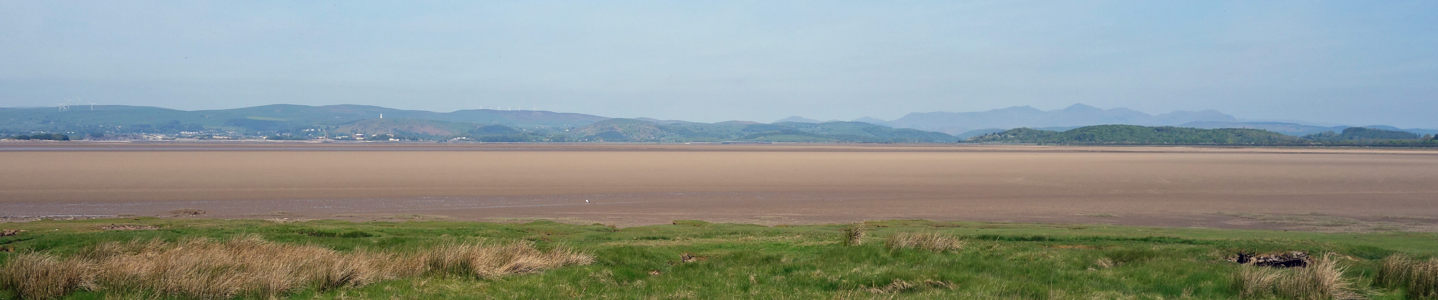
Cartmel Sands, Ulverston and the Coniston hills from Lenibrick Point
As I continued to Cowpren Point, Heysham Power Station – or at least the rectangular
shape of it – came into view some eight miles away across the bay. Beyond that,
however, the Fylde coast and Fleetwood could not be seen. The bay itself seemed to
be mainly sand or mud all the way to Heysham, with just a few streaks of water glittering
in the sun. The heat haze made it difficult to distinguish sea from sky. Walney Island
(if that's what it was) appeared to be a mirage floating in the air.
Turning east, I strode out on what’s called the Old Embankment. Sheep dotted the marsh-land on the bay-side and inland the fields seemed over-populated with cows but the only sound to be heard was that of skylarks. The fields inland were resplendent with the white blossom of hawthorn. Are we allowed to call hawthorn ‘may’ in other months of the year? At West Plain Farm I thought about trying the New Embankment to find a short-cut to Wyke Farm but it is not shown as a public footpath and it might well end at an unfordable ditch, causing an extra three miles to be walked.
So I turned inland to walk around what’s marked on the map as Cark Airfield, although I could see no sign of airfield activities. A somewhat depressing walk along the road passed a motley collection of activities – car services, Bay Search and Rescue headquarters, Flookburgh Fishermen, Cartmel Sticky Toffee Pudding Company, and so on – and brought me, after almost walking in a circle, to within half a mile from where I had started!
I headed east along the quiet, long and dull lane towards the promontory
of Humphrey Head. If I had thought that the view would justify the effort I would
have walked up to its top (it’s only 53 metres high). But it wouldn’t, so I didn’t.
I regretted my laziness later. Humphrey Head could have been the highlight of this
walk, even without the clearest views, but my energy and enthusiasm had wilted during
hot trudge from West Plain Farm.
However, I perked up as I emerged on the other side of Humphrey Head to be faced with a fine view across the marsh, the sand, and the river of the Kent Channel to Arnside Knott. It was a challenge to identify the grey shapes of the Dales hills beyond. To the south, I could make out the Bowland hills but I could see no detail, such as the Caton windmills. The bay itself was quiet and inactive. There seemed too little water for any action.
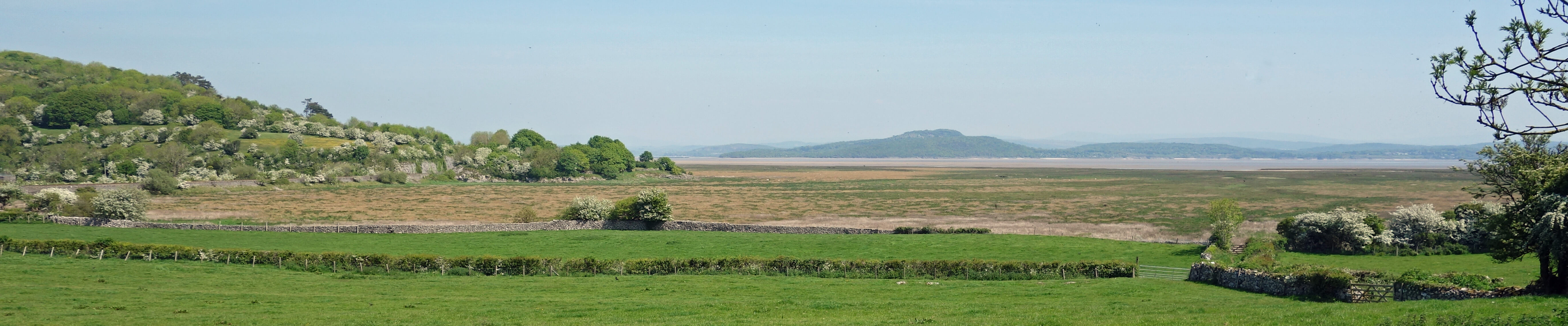
Arnside Knott and the Kent Channel from north of Humphrey Head
A tempting path curved east, where Wainwright (1974) encouraged what looks like a trespass across the railway
line at Kents Bank but I had no guarantee that it was still possible or safe. So I detoured away from the bay
again to get around Kirkhead. Its tower is a prominent feature on this walk and its caves were found to
contain the oldest human remains in northern Britain (Lloyd, 2016). However, it is all out of bounds, as
many ‘private’ signs told me. After dropping down to the railway line, it was now a simple matter to follow
its adjacent promenade all the way to Grange-over-Sands.
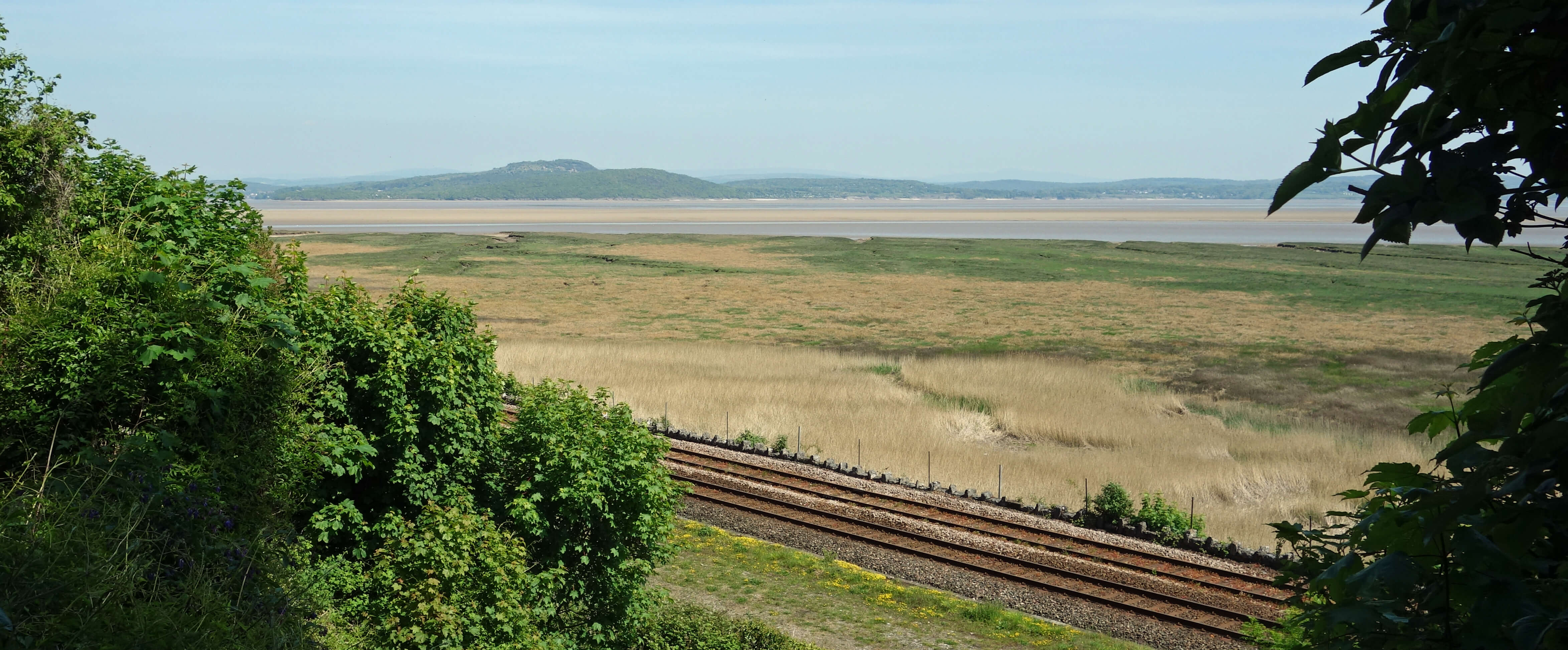
Towards Arnside Knott from near Kents Bank
Here I became increasingly intermingled with
holiday-making strollers. I paused to peek at the old Lido, which recently featured in the TV programme The Bay and
which the Save Grange Lido
campaign is trying to resuscitate. It’s something of a miracle that its remains are still there to be resuscitated.
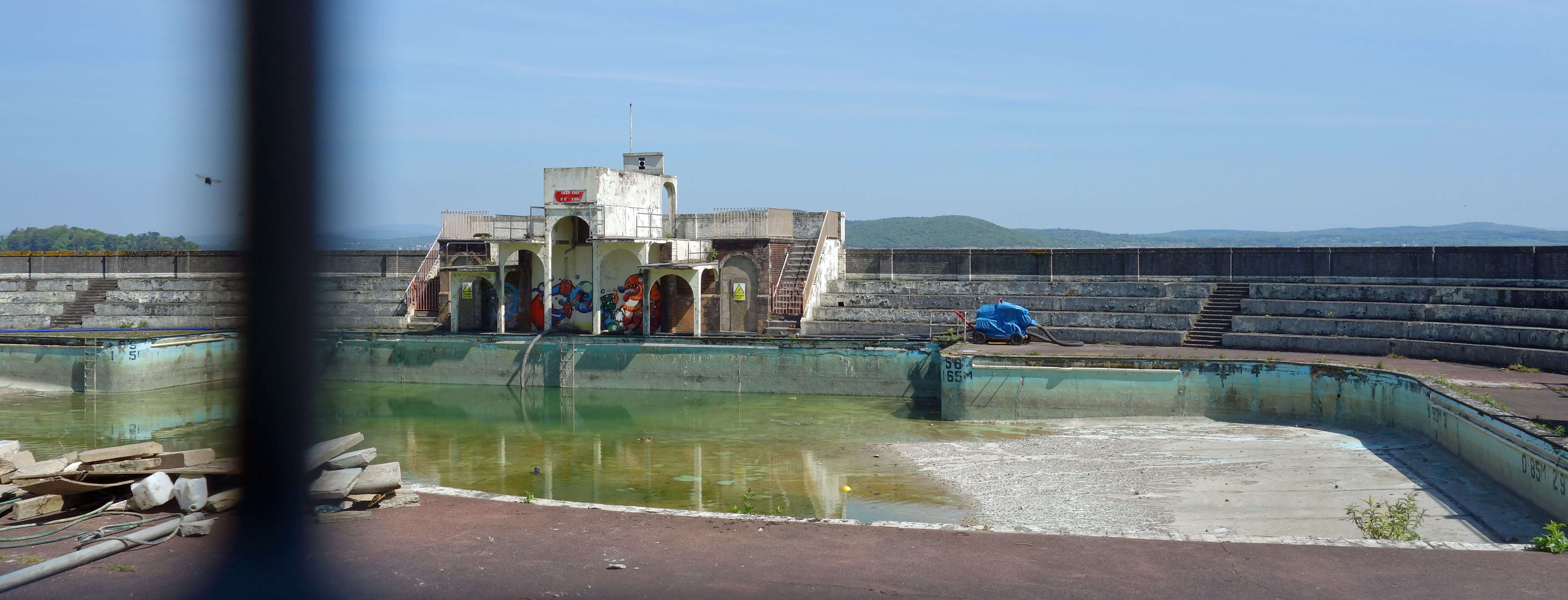
Grange Lido
I had time before my train for an ice-cream and to mull over the name, Grange-over-Sands. I can imagine someone at, say, Morecambe, pointing and saying “that’s Grange, over the sands” but to the people in Grange-over-Sands it is not ‘over the sands’. Why do Grange residents accept a name bestowed on it by non-residents? Why don’t they insist on a name that suits the place from their point of view? Are there any other places that have names that are appropriate only to people who don’t live there?
Date: May 14th 2019
Start: SD365763, Cark railway station (Map: OL7)
Route: (linear) NW on road, SW over railway line – Sand Gate, Lenibrick Point – S –
Cowpren Point – E on Old Embankment –
West Plain Farm – N, E – Holme – E, S, E, N – Wyke Farm – N, E, SE – Kents Bank railway station – NE – Grange-over-Sands
railway station
Distance: 10 miles; Ascent: 50 metres
Home
Preamble
Index
Areas
Dales
Hills
Lakes
Places
Reserves
Rivers
Structures
Villages
References
Me
© John Self, 2018-

Top photo: The western Howgills from Dillicar;
Bottom photo: Blencathra from Great Mell Fell