
Home
Preamble
Index
Areas
References
Me
Saunterings: Walking in North-West England
Saunterings is a set of reflections based upon walks around the counties of Cumbria, Lancashire and
North Yorkshire in North-West England
(as defined in the Preamble).
Here is a list of all Saunterings so far.
If you'd like to give a comment, correction or update (all are very welcome) or to
be notified by email when a new item is posted - please send an email to johnselfdrakkar@gmail.com.
59. The 1 in 5,000 Hen Harriers of Bowland
 The logo for the Forest of Bowland Area of Outstanding Natural Beauty represents a hen harrier. It was a wise decision to adopt the hen harrier because the fortunes of this bird in Bowland have focussed our attention on the difficulties of managing such a wild, remote region.
When the hen harrier logo was designed the Forest of Bowland was ìthe stronghold of the hen harrier on English moorland. Between 2002 and 2008 two-thirds of all the nesting attempts in the English uplands (83 out of 125)î were in Bowland (Avery, 2015, p188). The word ëstrongholdí was an exaggeration, as the number of nesting attempts in England each year was still very low compared to what it could and should be. And it became even lower. In 2017 not one hen harrier nested in Bowland. Since then there has been a slight improvement, to three successful nests in 2018 and five in 2019.
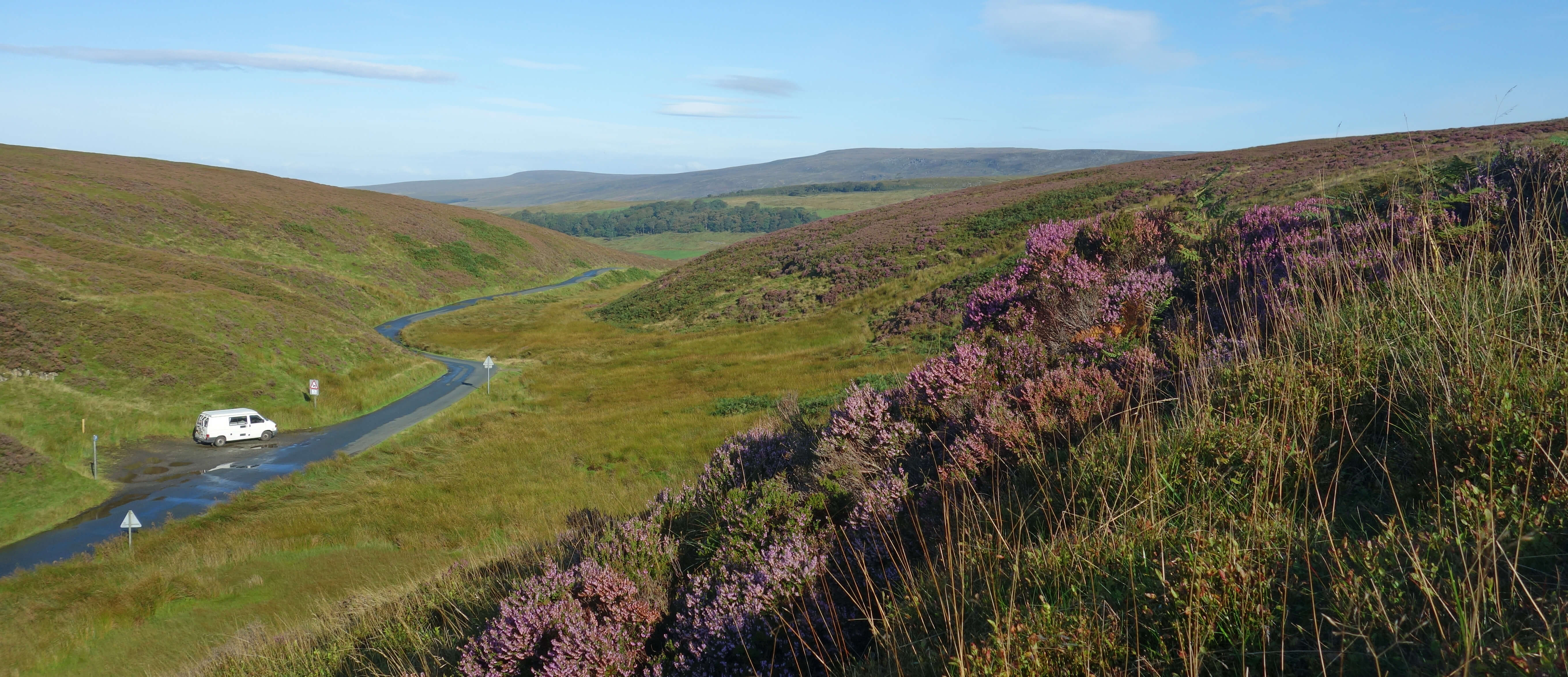
I set off from the Grey Stone of Trough, which feels like the central point of Bowland, since it
marks the line of the old county boundary between Lancashire and Yorkshire and stands at the head of the
Trough of Bowland at the highest point of the only road that passes through central Bowland. From there,
I walked to Whins Brow, an unassuming top of modest height (476 metres), which nonetheless is arguably Bowlandís central peak since it provides the most comprehensive panorama: of the tops of the Dales Three Peaks over Croasdale to the north-east;
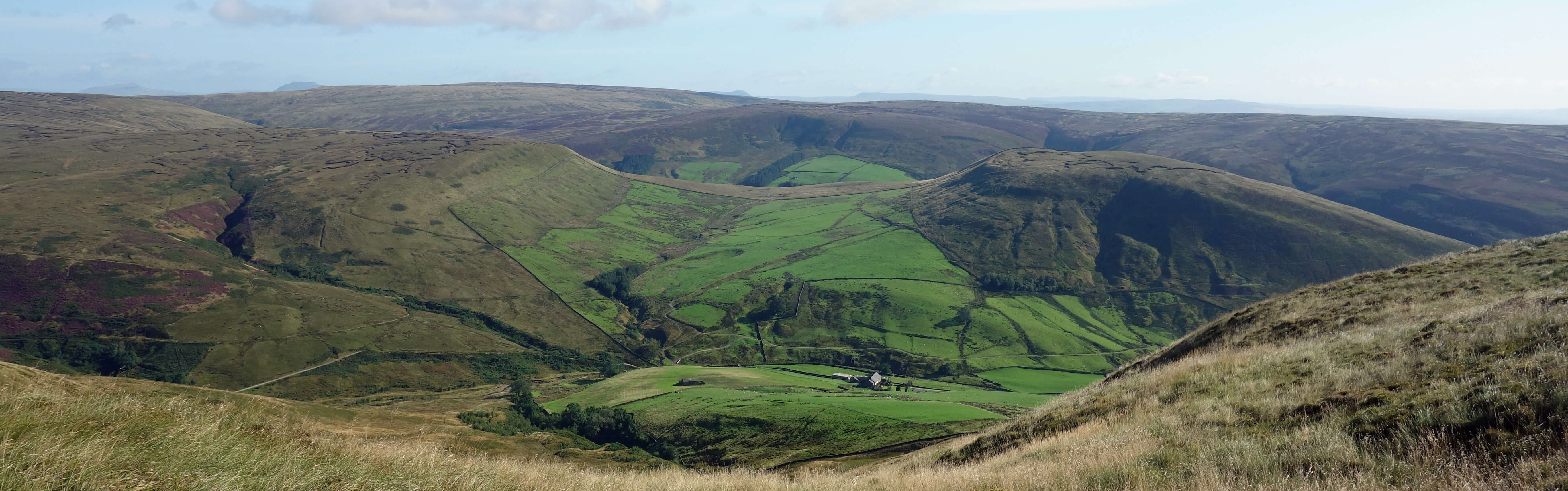
From Whins Brow looking across Brennand with the tops of the Dales Three Peaks just visible
of Pendle and other Pennine hills to the south-east; of the southern Bowland hills of Totridge, Hareden Fell and Hawthornthwaite Fell to the south;
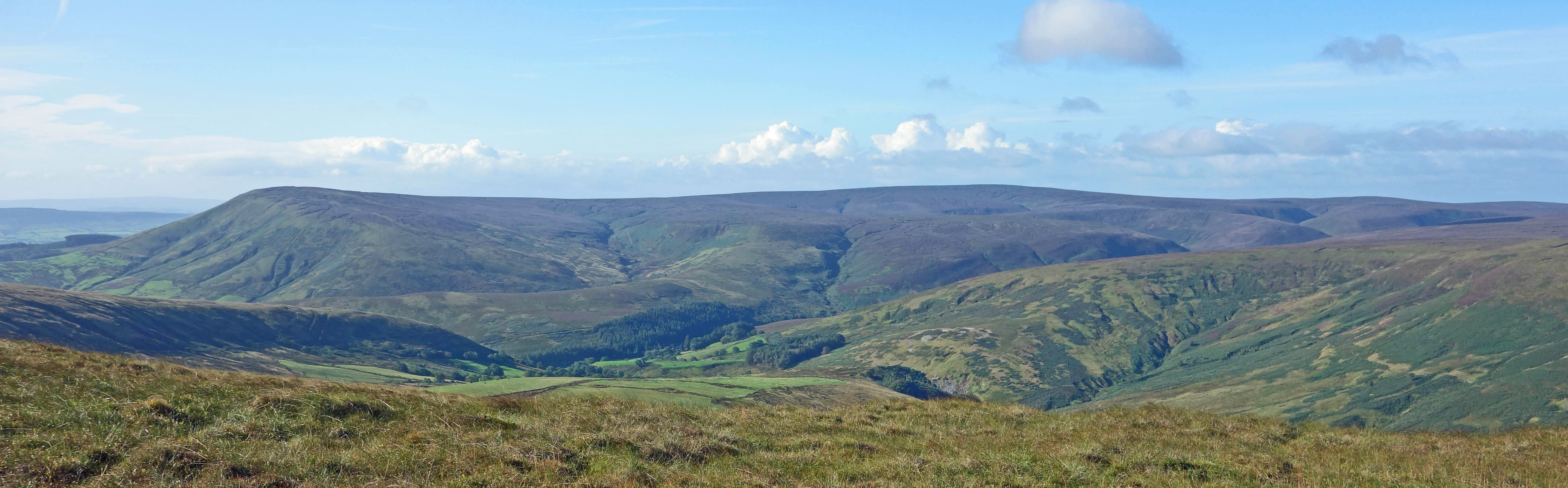
From Whins Brow looking south to Totridge and Hareden Fell
of Morecambe Bay (and sometimes, but not on this occasion, the Lake District hills) to the
north-west; and of Bowlandís highest tops of Wardís Stone (561 metres), Wolfhole Crag (527 metres) and
White Hill (544 metres) to the north-west and north.
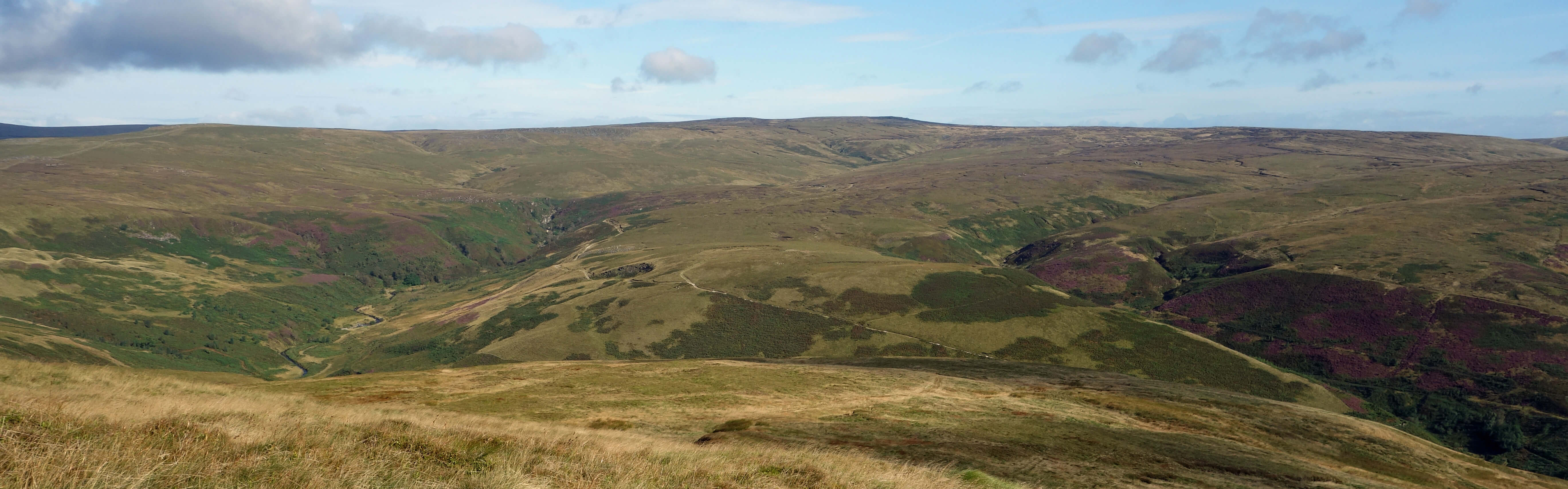
From Whins Brow looking north to Wolfhole Crag
Plus, after walking north a little from Whins Brow, a birdís eye view of the valleys of Brennand and Whitendale,
which seem to me to be at the heart of Bowland, as the farms here are the only ones that are tucked into an
inner valley. Between the two valleys stands the appropriately-named Middle Knoll and, in addition to being the
centre of Bowland, the region claims the
central point of Britain,
at Whitendale Hanging Stones.
I continued north over purple heather, bilberry and long tufted grass, and around a few pools the colour of coffee without milk.
As I headed towards Brennand River, which gathers all the water that falls in the large basin south of Wolfhole Crag, I became aware that a United Utilities van was moving slowly along the track that leads eventually to a shooting cabin. In fact, as I moved along, so did the van. I felt under surveillance, a feeling confirmed when two men got out of the van to observe me with binoculars. It was a little unnerving, but perhaps it is reassuring to know that they want nobody to misbehave on their moors. It also became a little embarrassing when I found that the river was too high for me to cross. At least, not in my boots: I warily paddled over barefoot. By the time I reached the track the van had moved away, which was a pity as I would have liked to know what they were concerned about.
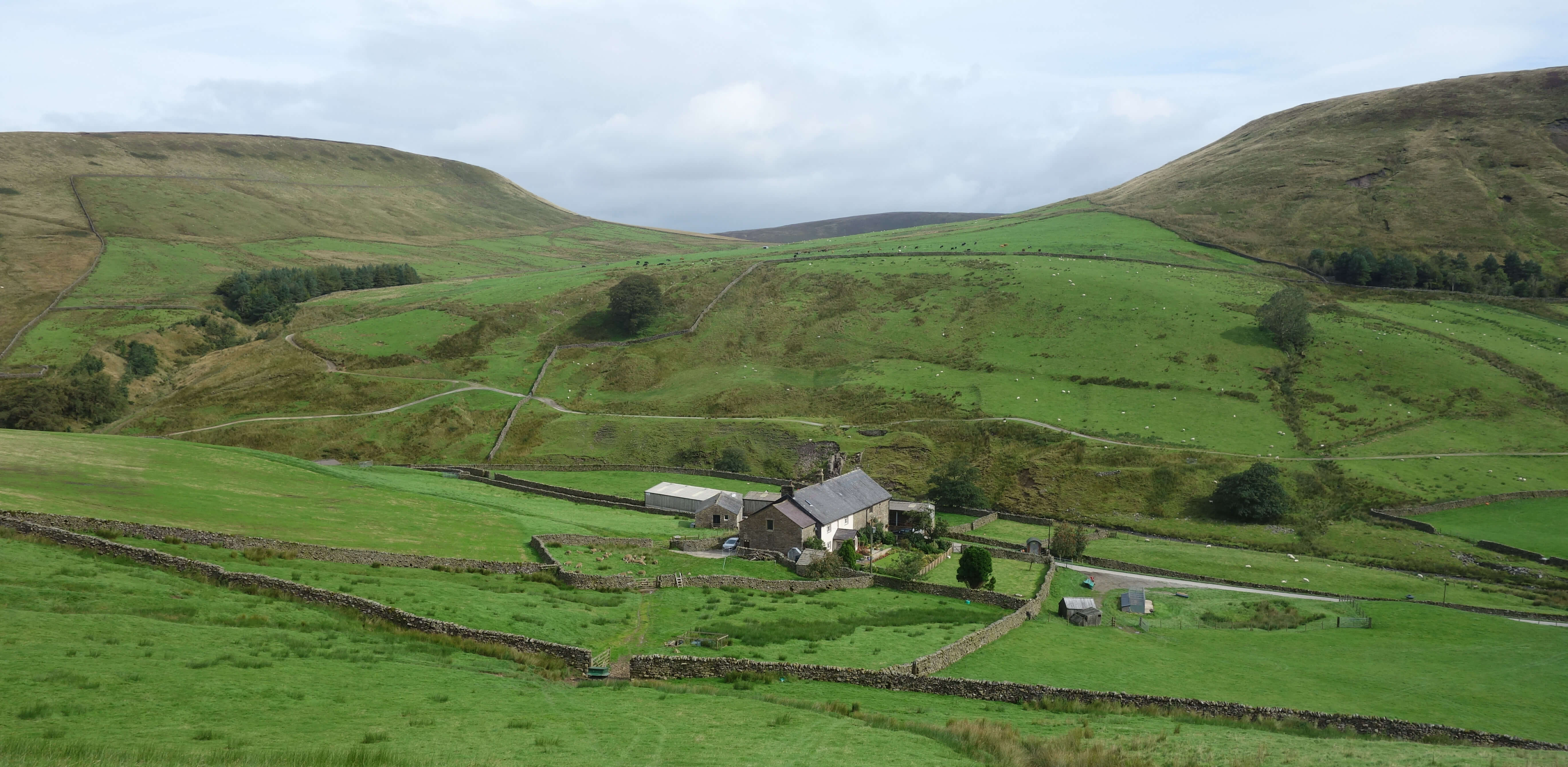
Right: Brennand Farm.
I walked through the two Brennand farms to where United Utilities has a building and information boards. A van was parked but there seemed to be nobody about for me to interrogate. The information boards were mainly about its work in extracting our drinking water from these fells but I noticed that I was advised to ìlook out for birds like merlin and peregrine falconî. Merlin perhaps, peregrine doubtful ñ there used to be a score or so of peregrine nests in Bowland but now there are usually none.
The information boards did not mention hen harriers, which is somewhat coy of United
Utilities because it has been working hard with the RSPB to help hen harriers return to nest
in Bowland. No doubt they donít want the public interfering ñ and probably that was why I was
being monitored. All eight of the hen harrier nests in 2018 and 2019 were on United Utilities land.
What are the chances of that?
United Utilities owns 34% of the Bowland Fells Special Protection Area, a designation intended to protect rare upland birds such as the merlin and hen harrier. Other things being equal, the probability that a hen harrier nest in Bowland will be on United Utilities land is 0.34. The probability that all eight nests will be there would seem to be 0.34 x 0.34 x 0.34 x 0.34 x 0.34 x 0.34 x 0.34 x 0.34, that is slightly less than 0.0002, or 1 in 5,000.
Are other things equal? Hen harriers do not nest communally like rooks. Once one hen harrier has
begun to nest, the second will not establish its nesting territory right next to it.
Therefore, the probably of the second (and so on) hen harrier nest being on United Utilities land would be less than 0.34 and the probability of all eight being there considerably less than 1 in 5,000.
The areas of Bowland that are not United Utilities land are owned by the Abbeystead Estate (47%),
the Bleasdale Estate (10%) and others (8%). The two estates manage the moors for driven grouse shooting
and employ gamekeepers to help ensure that grouse thrive. In the opening remarks of a
parliamentary debate on driven grouse shooting
in 2016 it was stated that ìthe evidence is clear that birds of prey, including hen harriers, are better off on managed heather moorlandî. A later speaker explained that ìwithout gamekeepers to control them, predators multiply and hen harriers pay the priceî. So, it seems, a hen harrier that attempts to nest on gamekeeper-managed land is likely to be more successful than one that attempts to nest on United Utilities land. Therefore, the probability that all eight successful nests were on United Utilities land is even further lowered from 1 in 5,000.
Is it a remarkable fluke? Or is there an explanation? When the speaker mentioned above referred to predators, he meant animals such as foxes, stoats and weasels. The elimination of these would clearly benefit ground-nesting birds such as grouse and hen harriers. However, to gamekeepers a hen harrier is not just another ground-nesting bird. It is a predator too, since it is rather fond of young grouse. It is illegal to kill or disturb a hen harrier. They wouldnít, would they?
Date: September 5th 2019
Start: SD622531, The Grey Stone of Trough (Map: OL41)
Route: E ñ Whins Brow ñ N ñ Brennand River ñ across river, E, SE ñ
United Utilities information boards ñ NW ñ Brennand Farm ñ S on Ouster Rake ñ fence ñ W ñ Whins Brow, Grey Stone of
Trough
Distance: 6 miles; Ascent: 305 metres
Home
Preamble
Index
Areas
References
Me
© John Self, 2018-

Top photo: The western Howgills from Dillicar;
Bottom photo: Blencathra from Great Mell Fell