
Home
Preamble
Index
Areas
References
Me
Saunterings: Walking in North-West England
Saunterings is a set of reflections based upon walks around the counties of Cumbria, Lancashire and
North Yorkshire in North-West England
(as defined in the Preamble).
Here is a list of all Saunterings so far.
If you'd like to give a comment, correction or update (all are very welcome) or to
be notified by email when a new item is posted - please send an email to johnselfdrakkar@gmail.com.
57. Around a Windswept Sandscale Haws
As several times recently, Northern Rail failed to deliver me to the Cumbrian west coast in a timely fashion
but this time I had a plan B. I got off the train at Dalton-in-Furness and walked to the west coast – specifically, to the sand dunes of Sandscale Haws in the Duddon estuary. Sandscale Haws has accumulated an impressive set of acronyms: LGS (Local Geological Site), NNR (National Nature Reserve), SAC (Special Area of Conservation), SPA (Special Protection Area), SSSI (Site of Special Scientific Interest) and Ramsar (which isn’t an acronym). But never mind all that: it was a windy day and I looked forward to a blow-out on the dunes.
Sand dunes have become a rare habitat in England. There are only fragments left on the Lancashire coast north of the Ribble but west Cumbria still has several sizable areas of dune, at Drigg, Eskmeals, Haverigg and Walney Island, in addition to Sandscale Haws. Apart from being a habitat for niche species, sand dunes can provide, it is now belatedly realised, more effective flood defence than the concrete barricades that have often replaced them.
I strode from Dalton, past the Castle, over the railway line, across the A590, over farmland, to reach the inlet of Scarth Bight, with the large area of grassed-over dunes of Sandscale Haws to the north. A herd of native cattle browsed the marshland. Beyond them I could see, to my surprise, a dozen or so shacks on the exposed, low-lying promontory of Lowsy Point. I went to have a look, of course. They were weather-beaten, as you’d expect, and some were built on supports, presumably in the hope that they wouldn’t be washed away by high waters. There was nobody about. The owners of these ramshackle retreats must return to them wondering how much has been blown or washed away.
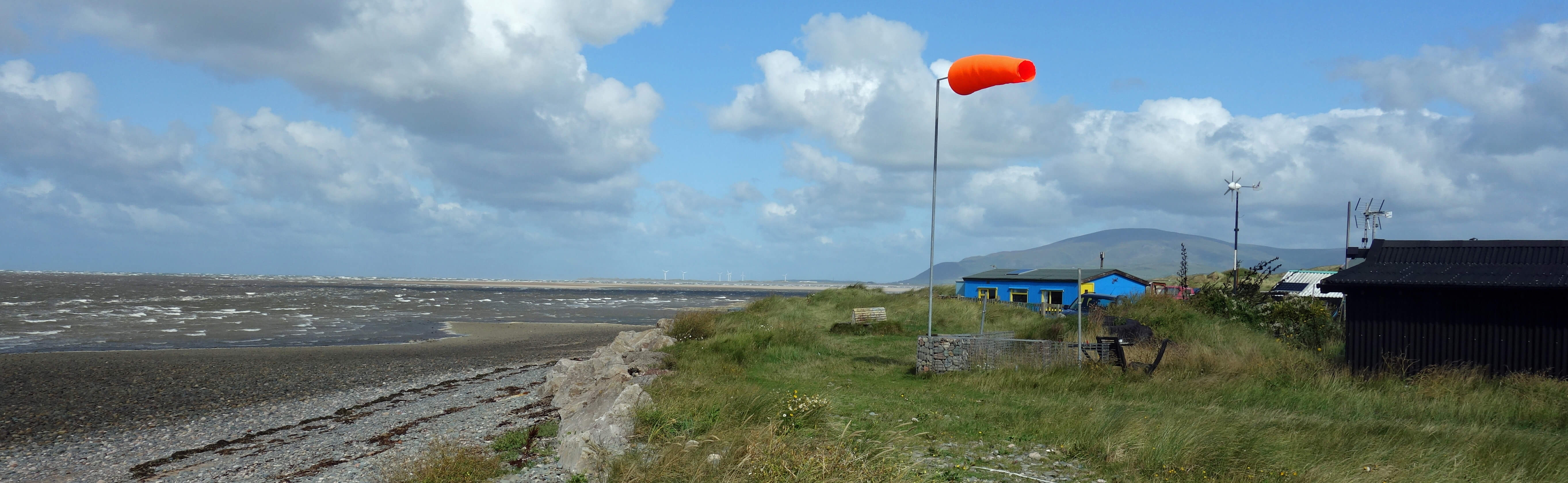
Black Combe from Lowsy Point
Lowsy Point was separated by the narrow Scarth Channel from the north end of Walney Island. Beyond the last shack I dropped down to a long, sandy beach, deserted apart from two men who were trying to fish. The tide was coming in, blown along by the strong wind that created a series of white-topped wavelets from far out to sea. The beach is clearly flat and, when the tide is out, stretches miles into the bay.
What kind of fish comes in at the forefront of a few inches of water? Whatever they were, they had nothing to fear from the fishermen because they could hardly cast their lines into the sea against the wind.
I walked up to the crest of the sand dunes to survey inland. There was an expanse of hummocky dunes, with low vegetation and a few ponds within which breed the rare natterjack toad, Europe’s noisiest amphibian but not in August. It was a battle along the sand dunes, up and down marram-grassed humps, wind-blown and sand-blasted – but invigorating and yet exhausting. So I retreated to the beach. I was still wind-blown and sand-blasted but at least I was on the level. As I had been made well aware, the sand dunes are still active, as they must be to remain dunes.
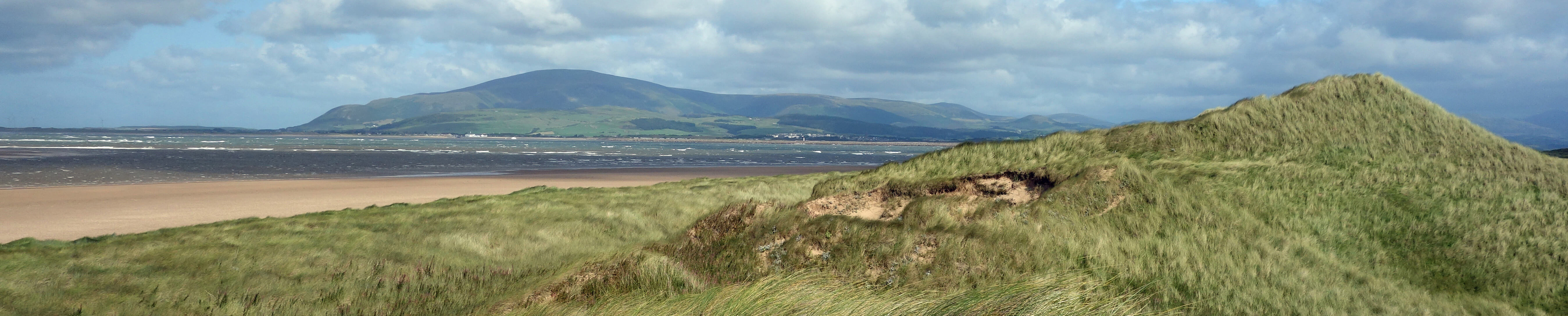
Black Combe from Sandscale Haws
Ahead, Black Combe arose behind Millom and Hodbarrow, just a couple of miles away across the Duddon Channel. Piles of foam
were being moved, inch-by-inch, up the beach by the tide. Occasionally, a cloud of it was whipped up and over the dunes. As I turned
east, more of the central Lake District hills came into view. It was a challenge to identify familiar tops from an unfamiliar-to-me angle.
Scafell? Bowfell? The Old Man of Coniston? The answers were given at the Roanhead car park, where a display identifies them.
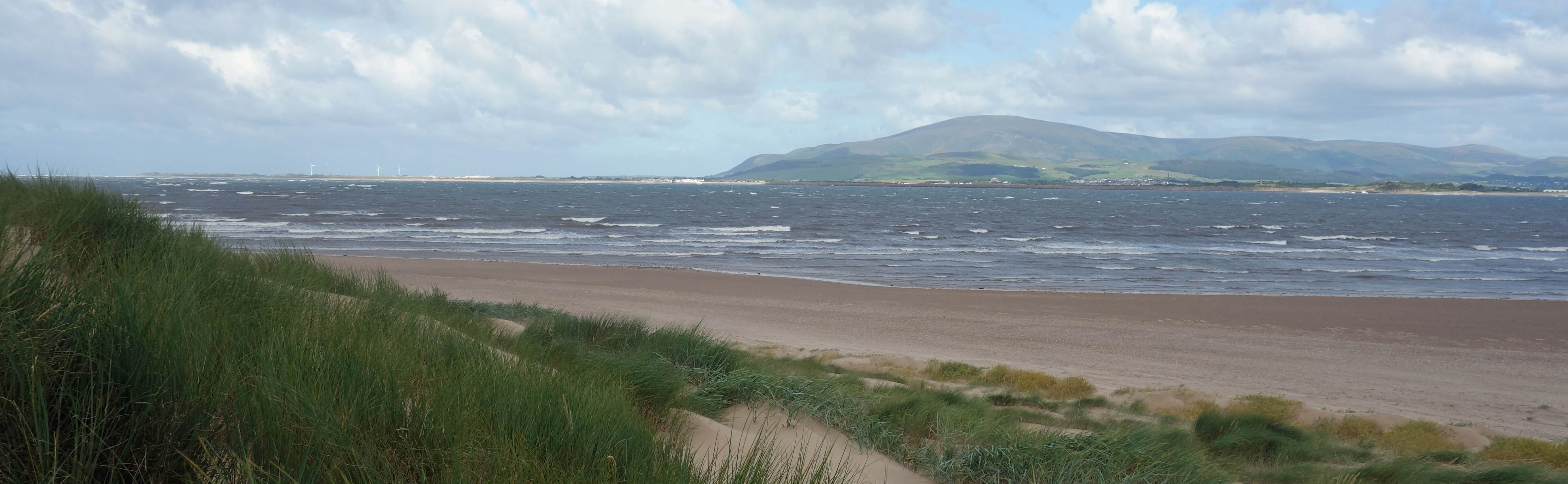
Black Combe from Roanhead beach
From the car park I had no choice but to walk back across the A590 and over the railway line. I was back in plenty of time for the train and picked up a leaflet about a Dalton Heritage Walk. This informed me that “since the closure of the last mine in the 1920s, Dalton has not seen any significant changes”. They said it. It was easy to imagine the main street in the 1920s.
There wasn’t much mentioned in the Heritage Walk that I hadn’t already seen on my walk out of and back into Dalton.
The 14th century Dalton Castle – really a pele tower – stood strong and square but it was closed. From the outside only
the four figures at the top corners intrigued. I had already noticed the blue plaques for Dalton’s two illustrious sons:
George Romney (1734-1802) and
Dr William Close (1775-1813).
The former is described by Bragg (1983) as “undoubtedly the greatest Cumbrian painter”. That is not to say that
he was the greatest painter of Cumbria because he moved to London to make his name and his money, mainly by
painting portraits. I have not studied Romney’s body of work but I see that he painted sixty portraits of
Lady Hamilton. I deduce that either he was infatuated with Lady Hamilton (as others were) or he was a
perfectionist, thinking that the first fifty-nine didn’t quite get her right.
The latter blue plaquee, Dr Close, was actually born in Yorkshire but began his medical practice in
Dalton in 1797. His plaque describes him as “surgeon, apothecary, musician, writer, historian and inventor”.
Ah, but if that allowed him any spare time did he ever walk to Sandscale Haws?
Date: August 15th 2019
Start: SD231738, Dalton railway station (Map: OL6)
Route: NW, W past Castle, N, W over A590 – Thwaite House – W, NW, SW, W on
track by Scarth Bight – Lowsy Point – N, E – car park at Roanhead – S, SE and same way back
Distance: 8 miles; Ascent: 70 metres
Home
Preamble
Index
Areas
References
Me
© John Self, 2018-

Top photo: The western Howgills from Dillicar;
Bottom photo: Blencathra from Great Mell Fell