
Home Preamble Index Areas References Me
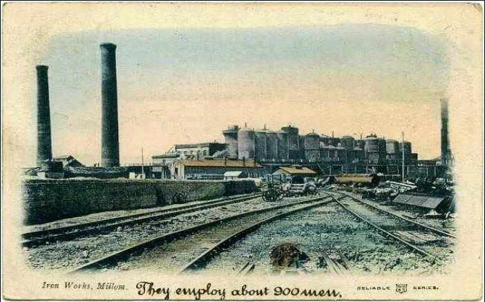
Millom Iron Works
I walked to the estuary, passing what the poet Norman Nicholson, who lived in Millom all his life, described as ôa parallelogram of straight-ruled, tight-packed, slate-built terrace housesö of a ôtypical northern industrial townö (Nicholson, 1969). However, Millom was not itself a typical northern industrial town. It was hardly part of the industrial north, being isolated at the south-west corner of (what is now) Cumbria. I have seen no similar terraces elsewhere in Cumbria. Today, the terraces seem incongruous without the industrial context. Millom is, in principle, a fine place to live, deserving of suitable housing, basking under Black Combe (600 metres) and on the bracing Duddon estuary.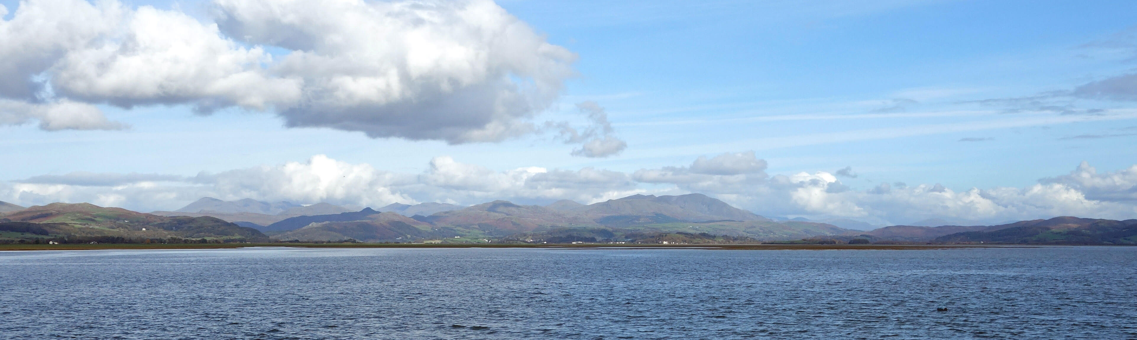
The Cumbrian fells from the Duddon estuary at Millom
At the estuary I could see what Nicholson meant when he said that despite living in this Millom outpost he always felt part of the Lake District because he could look towards the ôsaw-edge sky-line of the fellsö. Yes, indeed it is a marvellous prospect up the Duddon valley towards the Scafells and the Old Man. The tide was in, filling all the creeks, and, unlike in NicholsonÆs day, it was utterly silent apart from the occasional bird-sound. The path that I walked on was once a railway line running to the various mines on the peninsular. On the landward side was the site of the Millom Ironworks, now a Nature Reserve, although it seemed to be fenced off from this path. The flat æislandÆ on the bay-side is marked on the 1968 map as also part of æMillom Ironworks (disused)Æ with æmineral railwayÆ lines and slag heap. The estuary bank had the remains of an old port although I would think that the estuary is too shallow to allow significant vessels to reach it even when the tide was in.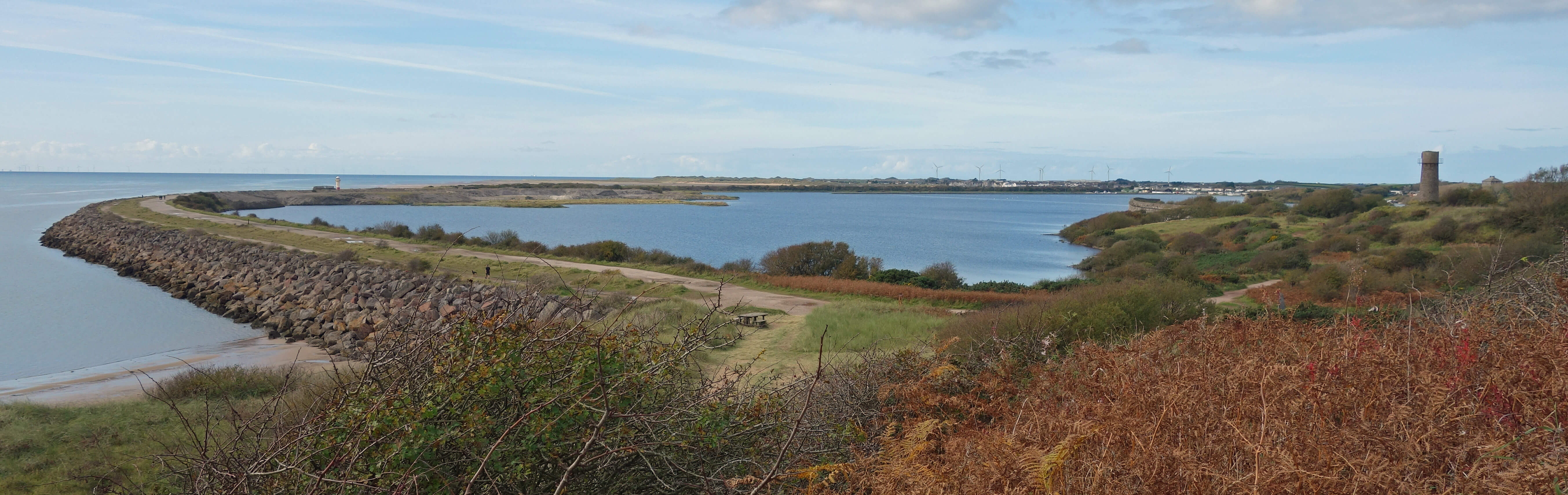
The outer barrier from Hodbarrow Point
Near the end of the barrier are the chalets of the Port Haverigg Holiday Village. They do raise the tone from the appearance, typical of isolated coastal villages, of the salty, rusty, weather-beaten houses of Haverigg but I think IÆd feel frustrated not to have a clear view of the sea and not to have a way to sail out from the enclosed lake. Beyond Haverigg I anticipated having about four miles of beach walking. However, to begin with I was surprised to find myself walking between high dunes on the landward side and a gravel bank and lower dunes on the seaward side that prevented any view of the sea.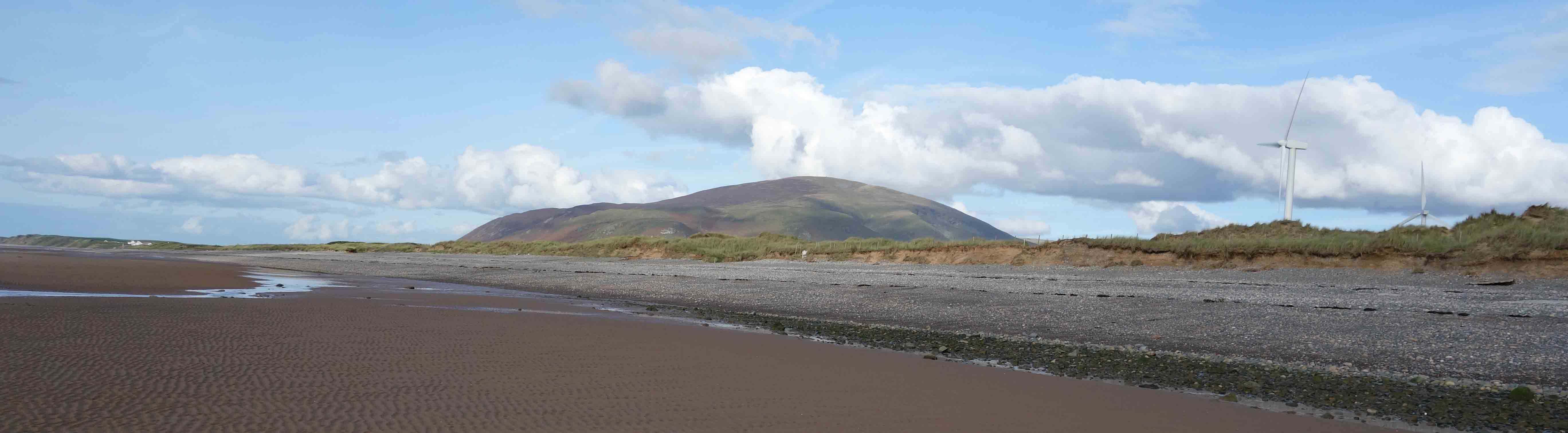
Black Combe
Needless to say, it was peaceful, soothing walking, alone (apart from one or two distant dog walkers) far out on the sand, making my way around the occasional lagoon left by the tide. It was quite easy walking on the firm sand and I reached Silecroft earlier than expected. At one point I met a group of five riders galloping across the sands. Imagine being able to do that every day, weather and tides permitting! I ended my invigorating beach stroll by walking inland to the village of Silecroft.
The sands at Silecroft
You may be assuming that since I started at Millom railway station I would get the train from Silecroft back û but no. We have not used public transport since March. Like everybody, we havenÆt done a lot of things since March. We havenÆt: seen children or grandchildren (except on Skype/Zoom); seen any other relatives (apart from a few at a funeral); had anybody in our house (apart from a plumber and a chimney-sweep); been in any pubs or restaurants; been to any events; slept anywhere other than home. Who knows when this might change?
Home Preamble Index Areas References Me
® John Self, 2018-

Top photo: The western Howgills from Dillicar; Bottom photo: Blencathra from Great Mell Fell