
Home
Preamble
Index
Areas
Dales
Hills
Lakes
Places
Reserves
Rivers
Structures
Villages
References
Me
Saunterings: Walking in North-West England
Saunterings is a set of reflections based upon walks around the counties of Cumbria, Lancashire and
North Yorkshire in North-West England
(as defined in the Preamble).
Here is a list of all Saunterings so far.
If you'd like to give a comment, correction or update (all are very welcome) or to
be notified by email when a new item is posted - please send an email to johnselfdrakkar@gmail.com.
106. Twelve Ponds and a Power Station
I am stumped. I always try to include in the title an indication of where we’ll be sauntering but this time the
map is no help at all. It marks nothing that anyone will have heard of apart from those who live there, which
is hardly anybody. It shows no villages, no significant buildings (castles, halls, churches,
pubs, and the like), no natural or
unnatural features of any renown, and nothing of interest to a tourist. As far as I am aware, the geology is of
no special interest, no incidents of historical importance have occurred here, and no famous people have been born or lived here.
I walked for about thirteen miles in what was not quite a no man’s land because I passed all of seven buildings
that on the map are given could-be-anywhere names: Hill Farm, Crosslands, Sill Field, West View, Warth, Barkin House
and High Fell House. I did walk around a wind farm as well but few will have heard of that either: Armistead Wind Farm.
Perhaps the wind farm is here because there are so few locals to object and so few features to spoil.
The walk was in fact along lanes and tracks around fields of pasture about six miles north of Kirkby
Lonsdale, just east of the M6. I think I set foot within five parishes: Killington, Old Hutton and Holmescales,
Preston Patrick, Lupton and Mansergh. Two hundred years ago I would have walked over Commons of those names.
Today there are no Commons marked on the map. The land has all, or almost all, been converted to farmland, for
cattle and sheep. That process of conversion seems to have created many bodies of water that weren’t on the
map two hundred years ago. Nobody will have heard of these either but they do, at least, provide a slender
thread by which to hang this narrative.
I walked first to Tarneybank Tarn. I have struggled to decide what to call these various bodies of
water. A ‘lake’ suggests something substantial to me, no doubt influenced by the real lakes to the west. A ‘pond’ I
see as rather small and probably artificial, as with the prototypical village pond. A ‘pool’ emphasises,
I think, the depth of water – and as all these bodies of water lie in hollows in the undulating land I expected
them to be shallow. A ‘tarn’ is, to me, a small mountain lake. I pondered the matter deeply
and opted for ‘pond’. This particular pond I didn't consider to be a tarn,
despite the two 'tarn's in its name, as there are no mountains here.
I couldn’t see it
anyway, since it was well tucked into the folds of the hillocks and hidden by woodland, although I suppose
it must be there as the Westmorland Wildfowlers' Association has recently bought it.
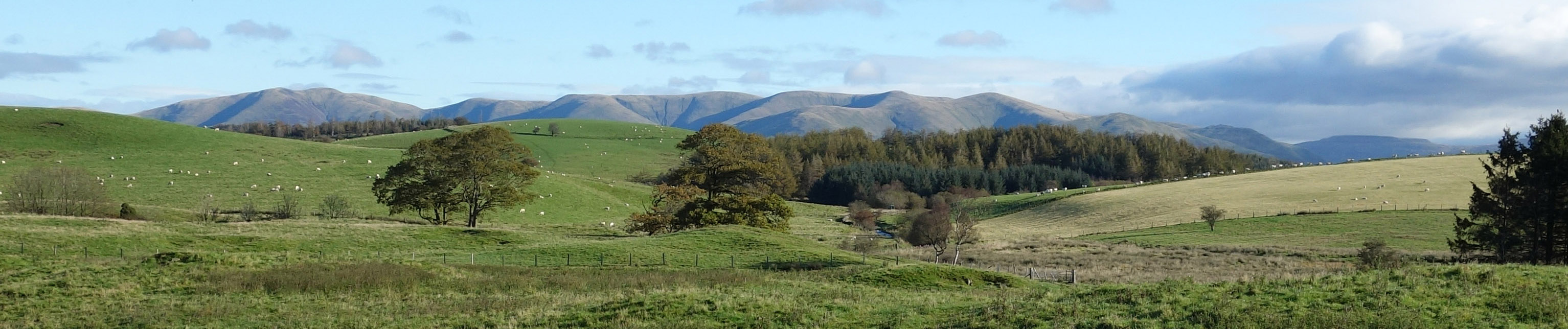
The Howgills from near Tarneybank Tarn
I walked on. A buzzard drifted from its branch. The shadows from the low sun made the Howgills look splendidly
smooth. Then, over a rise, there was a view of the Coniston hills straight ahead, widening out later to the Langdales and
beyond. The terrain throughout this walk was unusual: nowhere flat but nowhere hilly. The land undulated, twisting and
turning, as the lanes and tracks did, revealing views in different directions. There were occasional small conifer
plantations but they did not obscure the open aspect of the landscape. The land itself forms a wide, moderately high ridge, ranging from about 160 metres to 270 metres.
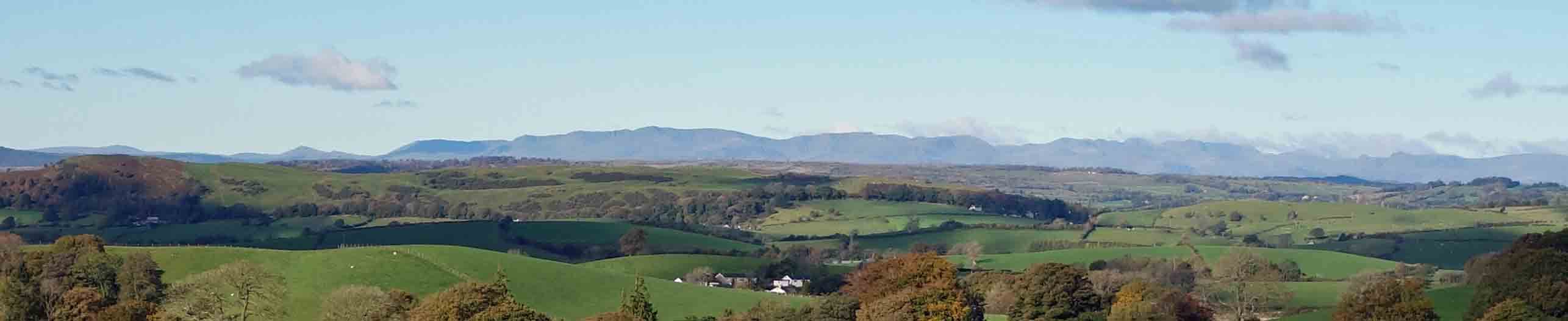
The Lake District hills
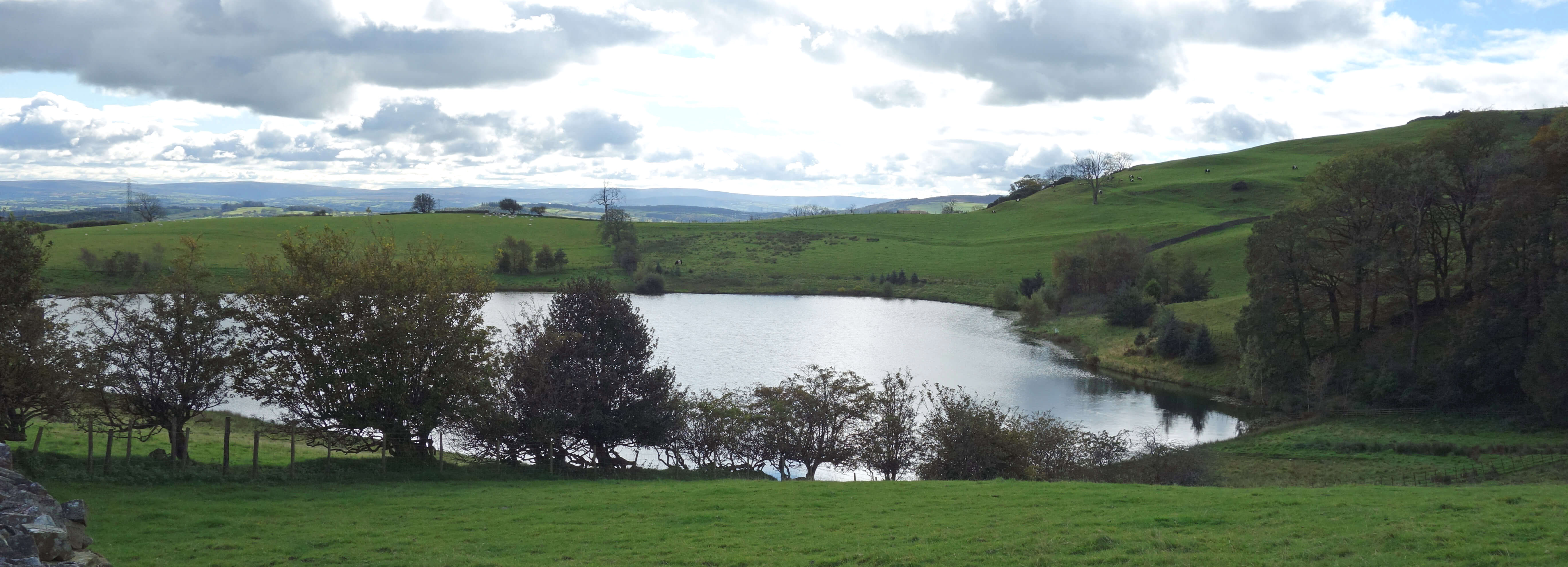
 Crossing and re-crossing the M6, I passed Hood Tarn, which I could at least see, just. It was enclosed by
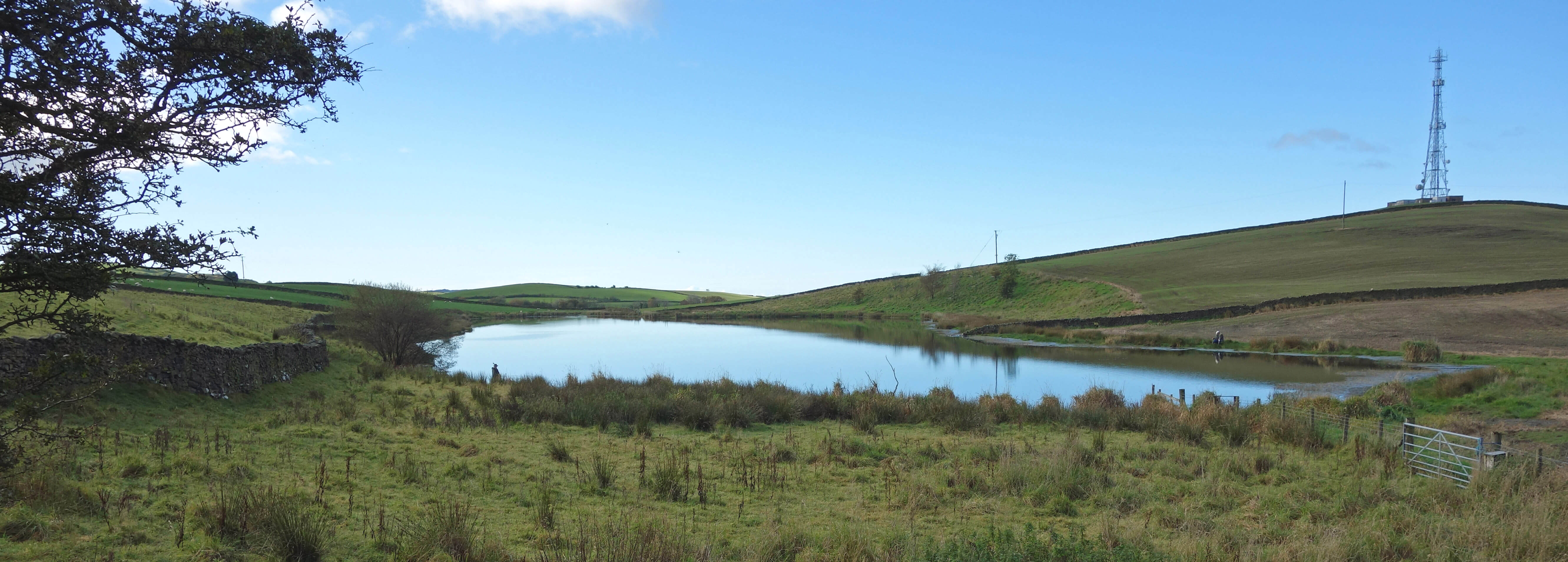
conifers. I then passed a much larger body of water (shown left), unnamed on the map. Since it’s below Bleasegale Hill,
I’ll call it Bleasegale Water. I was puzzled by it. It didn’t seem to have natural banks. It was like a giant puddle that had crept up the fields. A couple of anglers sat around it. Bleasegale Water is not, I think, under the control of Kendal and District Angling Club, unlike Banks Pond, signposted off to the north nearby.
Crossing and re-crossing the M6, I passed Hood Tarn, which I could at least see, just. It was enclosed by
conifers. I then passed a much larger body of water (shown left), unnamed on the map. Since it’s below Bleasegale Hill,
I’ll call it Bleasegale Water. I was puzzled by it. It didn’t seem to have natural banks. It was like a giant puddle that had crept up the fields. A couple of anglers sat around it. Bleasegale Water is not, I think, under the control of Kendal and District Angling Club, unlike Banks Pond, signposted off to the north nearby.
As Crosslands a small pond was becoming less of a pond. Further on, Fall Beck runs in a deep, wooded
gully that has been dammed for some reason to form Gatebeck Reservoir, small, overgrown and of no use to anybody.
The land continued in the form of undulating grassy fields, most with moor grass, indicating that they remain quite
boggy, and also with patches of gorse and bracken. The views swung round towards Arnside Knott and Morecambe Bay
and at West View (with a good view to the west, naturally) there was the only facility that I encountered, in the
form of a small caravan park, that recognised the existence of holiday-makers.
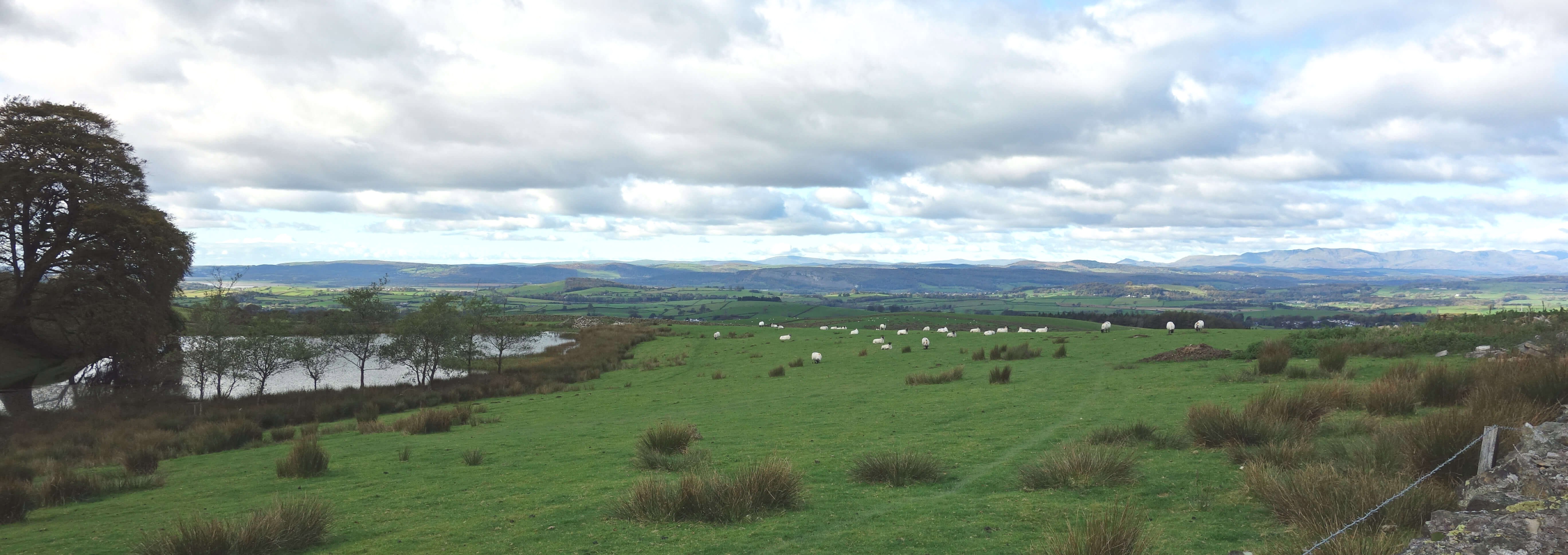 There was also a presentable
little lake (shown right) for them to paddle about in.
There was also a presentable
little lake (shown right) for them to paddle about in.
Next I passed Warth Fish Pond, according to the map. It could not be seen through thick woodland and
was protected by high fences with ‘trespassers will be prosecuted’ signs. They must have some special fish in
there. I continued along narrow lanes most of which had grass in the middle. On some they hadn’t even tried
to tarmac the middle bit. Apart from two short sections on the B6254, I saw very little traffic, unsurprisingly, since the lanes go nowhere in particular. I saw more bicycles than cars.
 The next body of water (shown left) also thinks it’s a tarn – Tarnhouse Tarn. It is in fact a reservoir, with the long dam
clearly seen beside the road. It is nevertheless a pretty setting, although again reserved for private fishing.
I turned north on Green Lane to pass Lupton Reservoir. This, from what I could see of it, is rather smaller than shown
on the map. It is shrouded in trees, with ‘keep out’ signs on the fences.
The next body of water (shown left) also thinks it’s a tarn – Tarnhouse Tarn. It is in fact a reservoir, with the long dam
clearly seen beside the road. It is nevertheless a pretty setting, although again reserved for private fishing.
I turned north on Green Lane to pass Lupton Reservoir. This, from what I could see of it, is rather smaller than shown
on the map. It is shrouded in trees, with ‘keep out’ signs on the fences.
From Barkin House it was a pleasant walk (off-road for a change), with views to the east across to Middleton Fell and the
Howgills. I reached Wyndhammere, which, I think, deserves to be considered a lake and not just because it sounds
like one. It's about half a kilometre long and is the largest of the ponds visited. It lies in a charming setting below
Middle and High Fell House, but there is no access to its banks. The lake sparkled in the sunlight, a buzzard mewed contentedly somewhere, and a roe deer hopped through the woods.
I assume that it is a reservoir created by a dam across Blea Beck to the south but I couldn't see it.
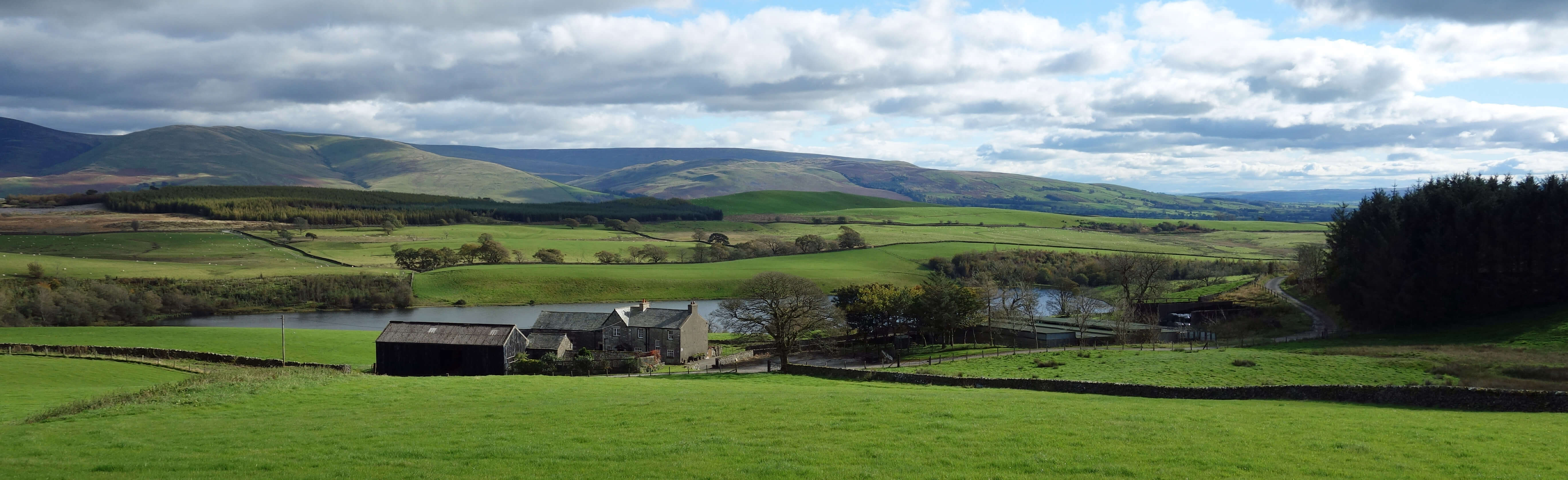
Wyndhammere and Middle Fell House
I then walked east to the Old Scotch Road, a drove road along which cattle from Scotland were driven south. It now
forms the western border of the Yorkshire Dales National Park. I don’t know what so appealed to the Park authorities
that they wanted to extend the boundary quite so far west.
I walked up Talebrigg Hill to gain a view of Kitmere. I
knew from previous experience that it is a challenge to seek a closer view of Kitmere: it is surrounded by dense
rhododendron. It must have seemed a good idea to plant a couple of rhododendron to enhance the boating lake when
Kitmere was created in the 1880s to provide power for Rigmaden Park to the east. Now the rhododendron seems uncontrollable,
although they are trying.
Kitmere and Wyndhammere are named after Christopher Wyndham Wilson (1844-1918), known as
Kit, owner of Rigmaden Park. North of Talebrigg Hill is Egholme Peat Moss, an area of rough heathery bog with a few
scrubby trees that seems to have been ignored by man. It is perhaps what most of this region once looked like.
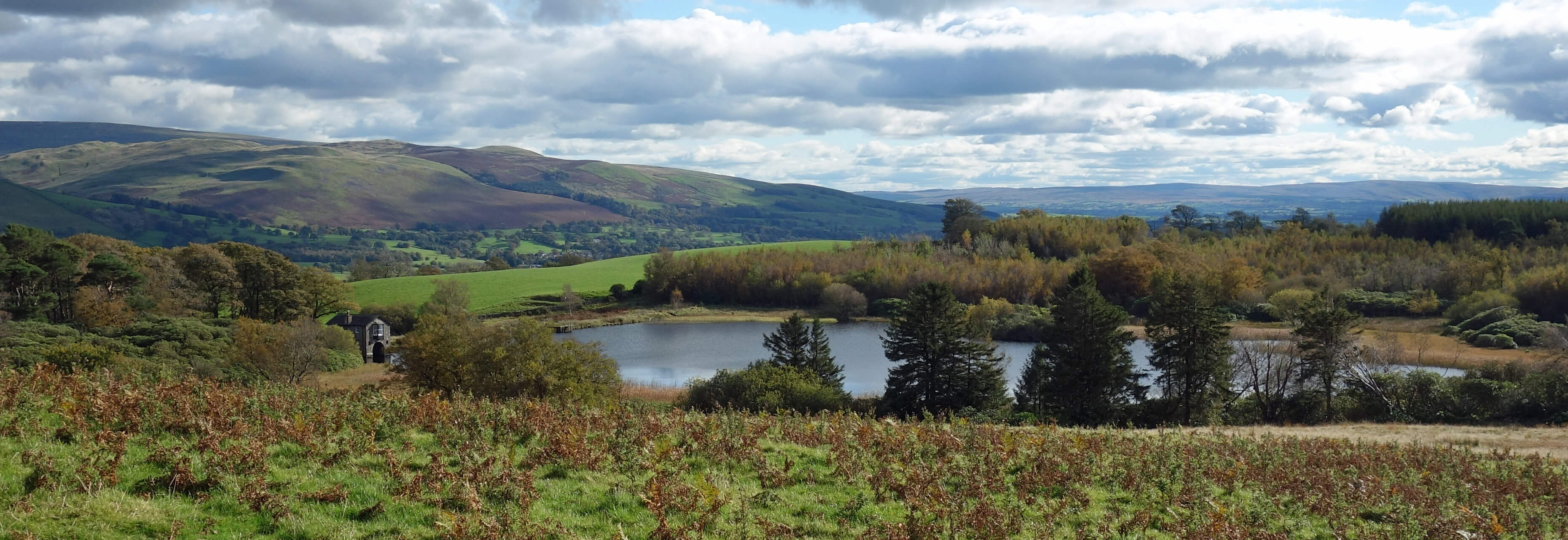
Kitmere from Talebrigg Hill
Walking north, accompanied by a few goldfinch, I came the closest that I had been to the six turbines of the
Armistead Wind Farm. I use ‘wind farm’ because that is its name and it has anyway become the conventional term
for these structures, in a triumph for wind industry PR. The industry can now inherit our goodwill towards farmers,
those ruddy-faced yeopeople of the soil who toil in all weathers to feed us. We might feel less fond of an
Armistead Wind-Power Station. I see that the local parishes receive Ł12,000 a year from this wind farm.
Well why not? The parish villagers' lives are already blighted by the M6 and few of them can see or hear the wind-power station where they live.
Date: October 11th 2020
Start: SD596880, Hills Quarry (Maps: OL2, OL7)
Route: N, W past Tarneybank Tarn, W over M6, S under M6 – Crosslands – SW, W – Gatebeck
Reservoir – SW – Sill Field – SE – West View – W, SW – Warth – E past Warth Fish Pond, SE – Tarnhouse Tarn – NE
past Lupton Reservoir – NW – Barkin House – E, NE – High Fell House – E, SE past Wyndhammere, E, N, E, NE – Talebrigg
Hill – N, W, NW, N – Hills Quarry
Distance: 13 miles; Ascent: 120 metres
Home
Preamble
Index
Areas
Dales
Hills
Lakes
Places
Reserves
Rivers
Structures
Villages
References
Me
© John Self, 2018-

Top photo: The western Howgills from Dillicar;
Bottom photo: Blencathra from Great Mell Fell