
Home
Preamble
Index
Areas
Dales
Hills
Lakes
Places
Reserves
Rivers
Structures
Villages
References
Me
Saunterings: Walking in North-West England
Saunterings is a set of reflections based upon walks around the counties of Cumbria, Lancashire and
North Yorkshire in North-West England
(as defined in the Preamble).
Here is a list of all Saunterings so far.
If you'd like to give a comment, correction or update (all are very welcome) or to
be notified by email when a new item is posted - please send an email to johnselfdrakkar@gmail.com.
102. Upper Ribblesdale: Drumlins, Three Peaks and a Cave
Cars were jam-packed along the road in Chapel-le-Dale and also at Ribblehead but elsewhere
parking spaces were virtually
empty. We parked alone near Ribble Head House, and set off south over the Thorns Gill packhorse bridge
(shown in [14])
and past the ruins
of the once-substantial Thorns Farm, once a grange for Furness Abbey, according to Hartley and Ingilby (1956). We had come to
see, firstly, the Ribblesdale drumlin field which Waltham (1987) described as “Britain’s finest”. Waltham had been rather
over-the-top about the Hutton Roof Crags karren as well [98]
but he is not alone in enthusing about the drumlins. Many writers
remark on this aspect of the Yorkshire Dales geology and landscape, often likening the appearance of the
drumlins to (rather large) eggs in a basket.
According to Stephens (1990), “of all the features deposited by the last ice sheets, arguably the drumlin would rank
as the most evocative of the former passage of an ice sheet” since drumlins are “unmistakably the work of the ice”. In the case
of the Ribblesdale drumlins, ice sheets moved west from Langstrothdale into Ribblesdale and then swung south-west and south.
These changes of direction are indicated by the orientations of the long axes of the drumlins. The ‘eggs in a basket’ effect
is, I'm sure, best appreciated from the air – from a hot-air balloon perhaps – with a low sun casting shadows to show the shapes of the
drumlins. On the ground one is aware only of walking up, down and around various smooth humps that are quite unlike the
limestone crags on the valley sides.
After a pleasant hour or so navigating ourselves around the humps, we reached Nether Lodge, where we met a stream of walkers
from the opposite direction. These were Three Peakers, taking the Bank Holiday Saturday opportunity to tackle the classic 24-mile
walk over Pen-y-ghent (694 metres), Whernside (736 metres) and Ingleborough (723 metres). That’s why all the parked cars were there. Many of the walkers were clearly
part of a sponsored group. It is the convention nowadays to do the walk anti-clockwise, starting in Horton-in-Ribblesdale.
So these walkers had completed one of the three peaks (Pen-y-ghent) and had about 18 miles still to go. One of them asked us – since we
were being a nuisance walking the wrong way but clearly
looked exceedingly fit – whether we had already conquered two peaks, which would have meant having walked 18 miles clockwise from
Horton since breakfast.
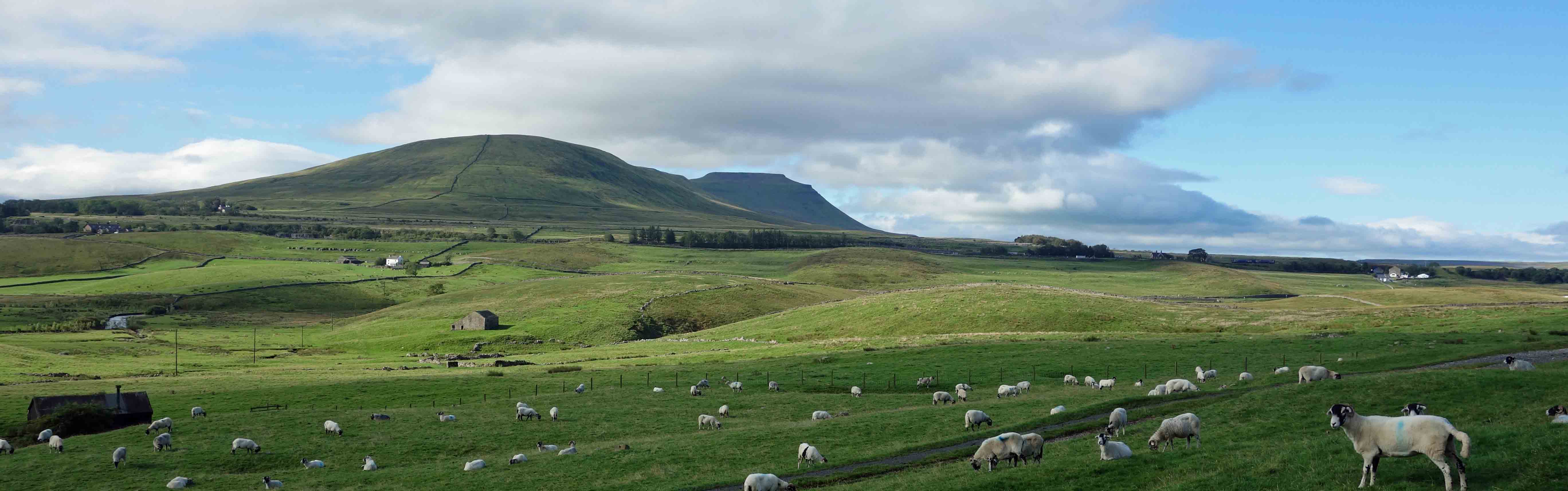
Ingleborough, from near Ribble Head House
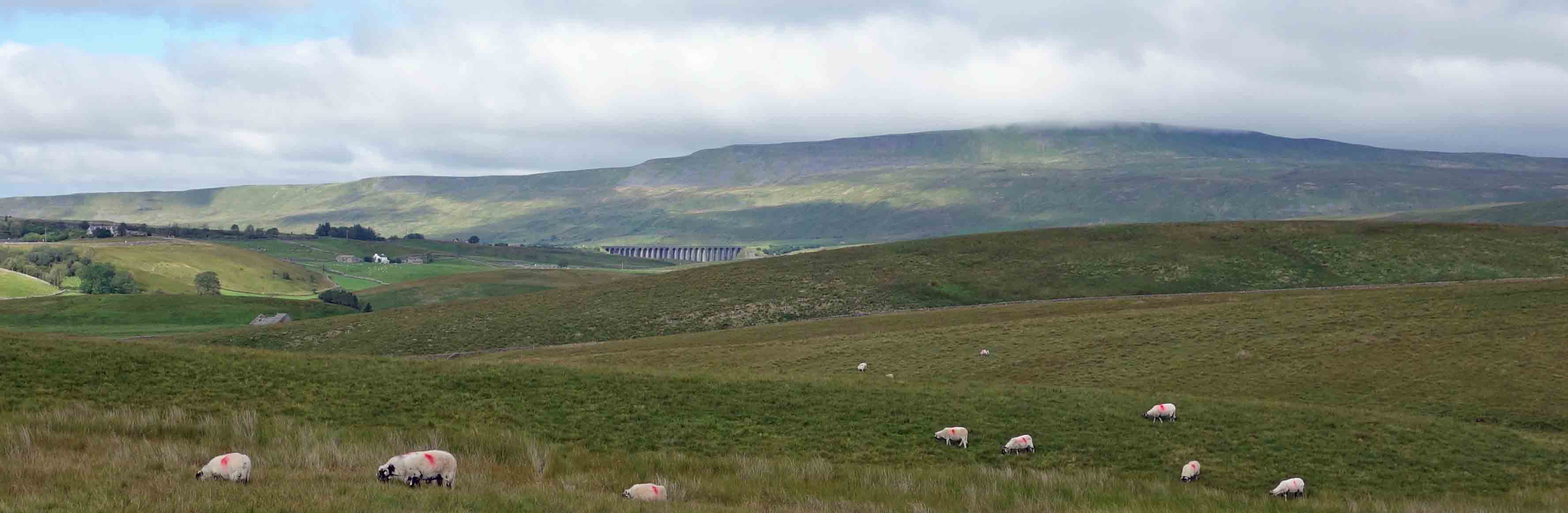
Whernside, from near Nether Lodge, with the Ribblehead Viaduct in the middle
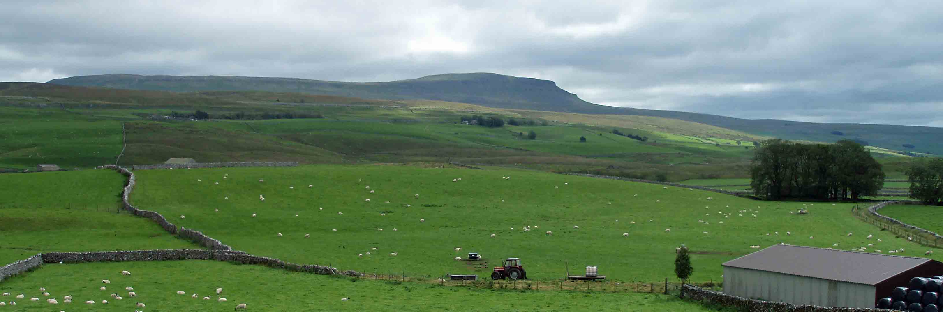
Pen-y-ghent, from Selside Shaw
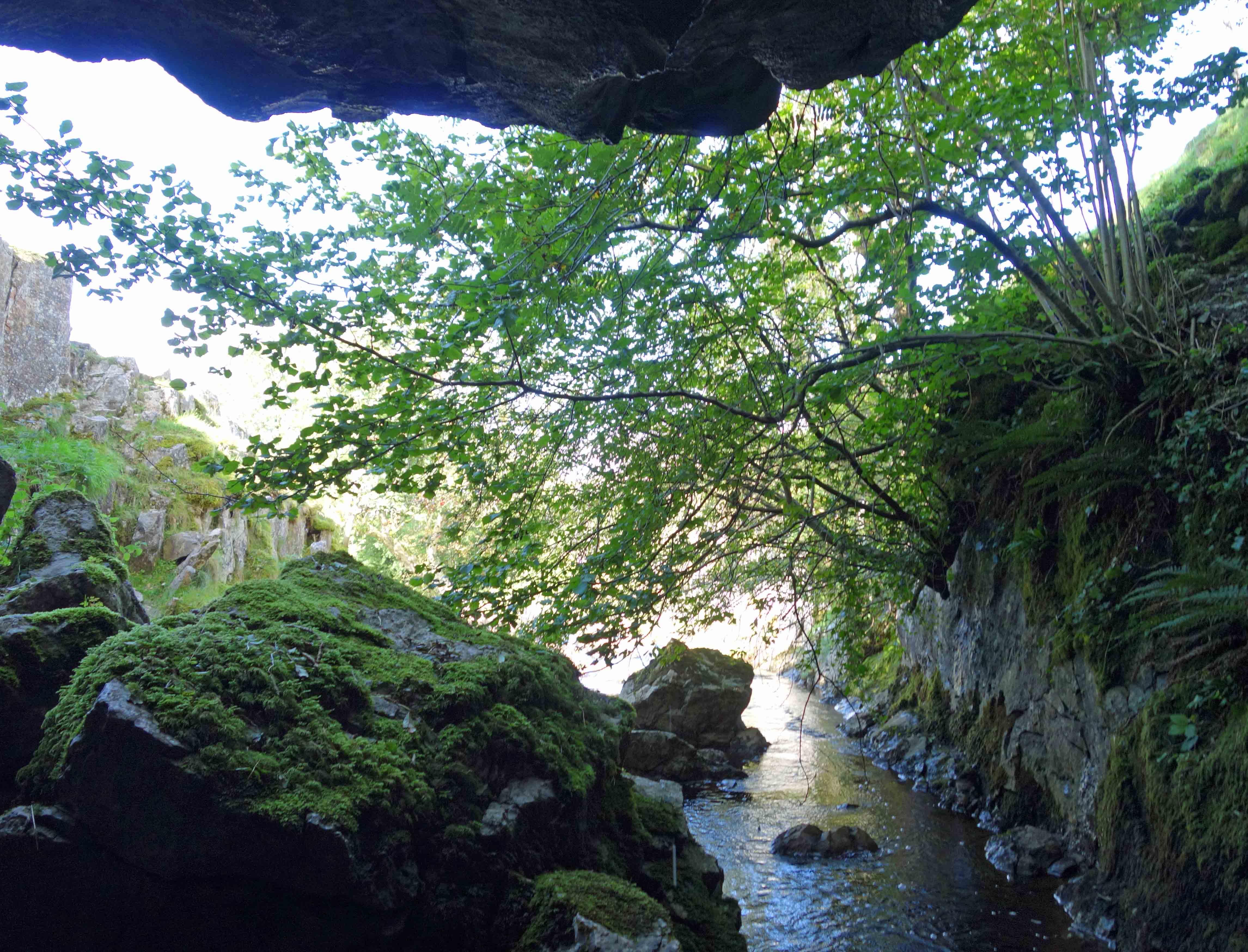 We paused at God’s Bridge, which is (as God’s Bridges usually are) a natural bridge formed, in this case, by a huge limestone slab
lying across Brow Gill Beck. Of course, almost all the Three Peakers marched straight over the bridge as they didn’t have the time to
pause to look at it. They certainly couldn't
detour a little to see Browgill Cave - they might need every bit of time and energy later. Here the beck emerges from a rather impressive
cave which it is possible to walk some distance
inside, although there was too much water gushing out for us to go far.
We paused at God’s Bridge, which is (as God’s Bridges usually are) a natural bridge formed, in this case, by a huge limestone slab
lying across Brow Gill Beck. Of course, almost all the Three Peakers marched straight over the bridge as they didn’t have the time to
pause to look at it. They certainly couldn't
detour a little to see Browgill Cave - they might need every bit of time and energy later. Here the beck emerges from a rather impressive
cave which it is possible to walk some distance
inside, although there was too much water gushing out for us to go far.
We returned to the Three Peaks path to continue against the endless stream of walkers. Sheep looked at them, puzzled,
wondering why they were all following in a line like, well, sheep. Who on earth thinks it’s sensible to take on these regimented
marches, twelve hours of toil, aches and pains, blisters and sore knees, up and down three mountains?
We did – a long time ago, so long ago, in fact, that at the time our friends calculated that our son (who's now a summer
chicken) was conceived
on our Three Peaks walk. It was a more isolated and relaxed walk then, but not that isolated and relaxed. The Wainwright (1970) description
of the Three Peaks walk comments at one point that “a decision must be taken: whether to trespass or not to trespass”. In those
days, you made your own way, as best you could to avoid the quagmires, especially on the long trek between Pen-y-ghent and Whernside.
Today’s walkers don’t need to make any decisions. They hardly need a map. The path is a reinforced thoroughfare most of the way and
in any case all you need to do is follow everybody ahead of you.
We left the Three Peakers at High Birkwith, the residents of which must be mightily relieved that Three Peakers are now
signposted well to the north of them, and dropped down past Low Birkwith, over the River Ribble, under the railway line, through
the hamlet of Selside,
and across the road and Selside Shaw to reach the area around Colt Park, part of the Ingleborough National Nature Reserve.
Here, there are fenced off limestone crags where the native flora is protected to allow it to flourish (and
where you need a permit to enter), fields where experiments are carried out to see how our flower-rich meadows may be restored, and
at an old quarry a reserve where many relatively rare native plants may be seen. However, this was not the time of year to see flowers,
so we resolved to return another time. Instead, we appreciated the play of light and shade on the drumlins across the valley.
Ribblesdale drumlins, from Selside Shaw
Date: August 29th 2020
Start: SD771796, on Blea Moor Road, Ribblehead (Map: OL2)
Route: NE on road, S over Thorns Gill bridge, E – Ribble Way – SW – Nether Lodge, High Birkwith – SW – Selside – N
on road, NW across Selside Shaw, N – Colt Park – NE, N – road – NW, N – Blea Moor Road
Distance: 8 miles; Ascent: 120 metres
Home
Preamble
Index
Areas
Dales
Hills
Lakes
Places
Reserves
Rivers
Structures
Villages
References
Me
© John Self, 2018-

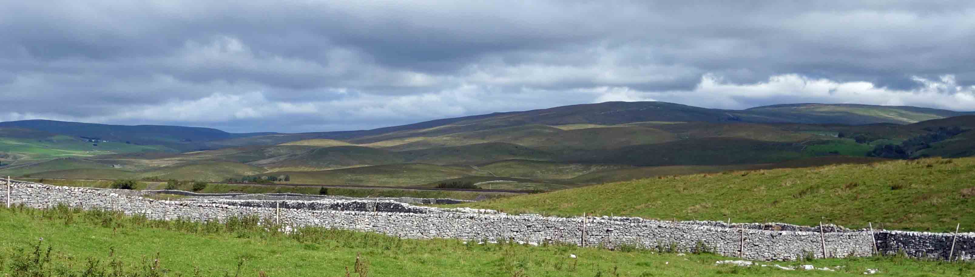
Top photo: The western Howgills from Dillicar;
Bottom photo: Blencathra from Great Mell Fell