
Home
Preamble
Index
Areas
Dales
Hills
Lakes
Places
Reserves
Rivers
Structures
Villages
References
Me
Saunterings: Walking in North-West England
Saunterings is a set of reflections based upon walks around the counties of Cumbria, Lancashire and
North Yorkshire in North-West England
(as defined in the Preamble).
Here is a list of all Saunterings so far.
If you'd like to give a comment, correction or update (all are very welcome) or to
be notified by email when a new item is posted - please send an email to johnselfdrakkar@gmail.com.
This is one of several relatively short items about local walks during the first
coronavirus lockdown, April - May 2020.
82. A Peek into Artle Dale
There are only eight woodland Sites of Special Scientific Interest in Lancashire (listed in
[78])
and the residents of Caton and Brookhouse have two of them within walking distance. One is the Burton Wood SSSI
(shown in the photo in [81]),
which we will no doubt walk through when the bluebells are out. The other is the
Artle Dale SSSI,
which runs for about 2 kilometres on the steep slopes of Artle Beck above Gresgarth Hall to near the Scout Camp at Udale Bridge.
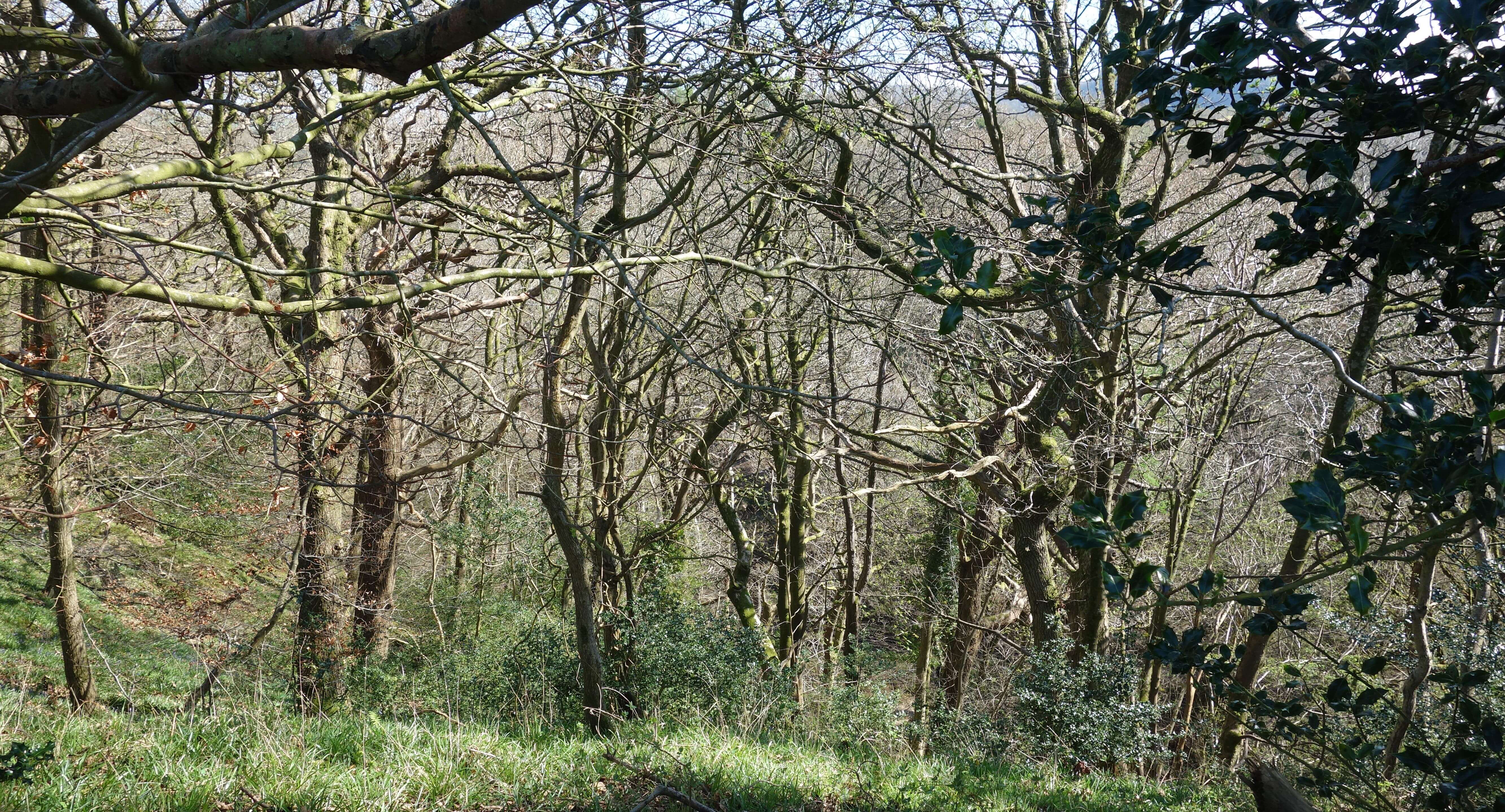
 Left: From near Forge Mill.
Artle Dale has no public access, unfortunately (for us, but fortunately for the wildlife therein). However, the
two public footpaths that run across fields between Littledale Road and Forge Mill allow us a circular walk on
which we may peek into the Artle Dale SSSI. We walked along the lower, northern path to Forge Mill and then
up the track by a wood to reach a stile. Here, the public footpath follows the northern wall of the field and
then cuts across to another stile – but we strayed a little by following the fence south and then east to have a view into the Artle Beck gorge (I hope the farmer doesn’t mind: we didn’t enter any fields that we are not allowed within).
 This looks like an ancient woodland, with a variety of tree species, within which one could imagine that fauna such as deer, badger and owl find a safe haven. However, it isn’t really the trees and the fauna that make Artle Dale an SSSI. It is the bryophytes. Whatever they are, Artle Dale has over 160 species of them, some of which are scarce and important nationally for being at the south-eastern limit of their British range, according to the SSSI citation.
As for what a bryophyte is, I will play safe and quote Phillips (1980): bryophytes, that is, mosses and liverworts, “reproduce by spores, as do the fern group, but have a simpler structure. They have stems and leaves but no roots, only modified stems forming root-like structures known as rhizoids … [Liverwort spore] capsules differ from moss capsules by breaking open into four flaps”. There are about 20,000 species of mosses and liverworts. All I am familiar with is the moss on the lawn and the sphagnum moss on the moors.
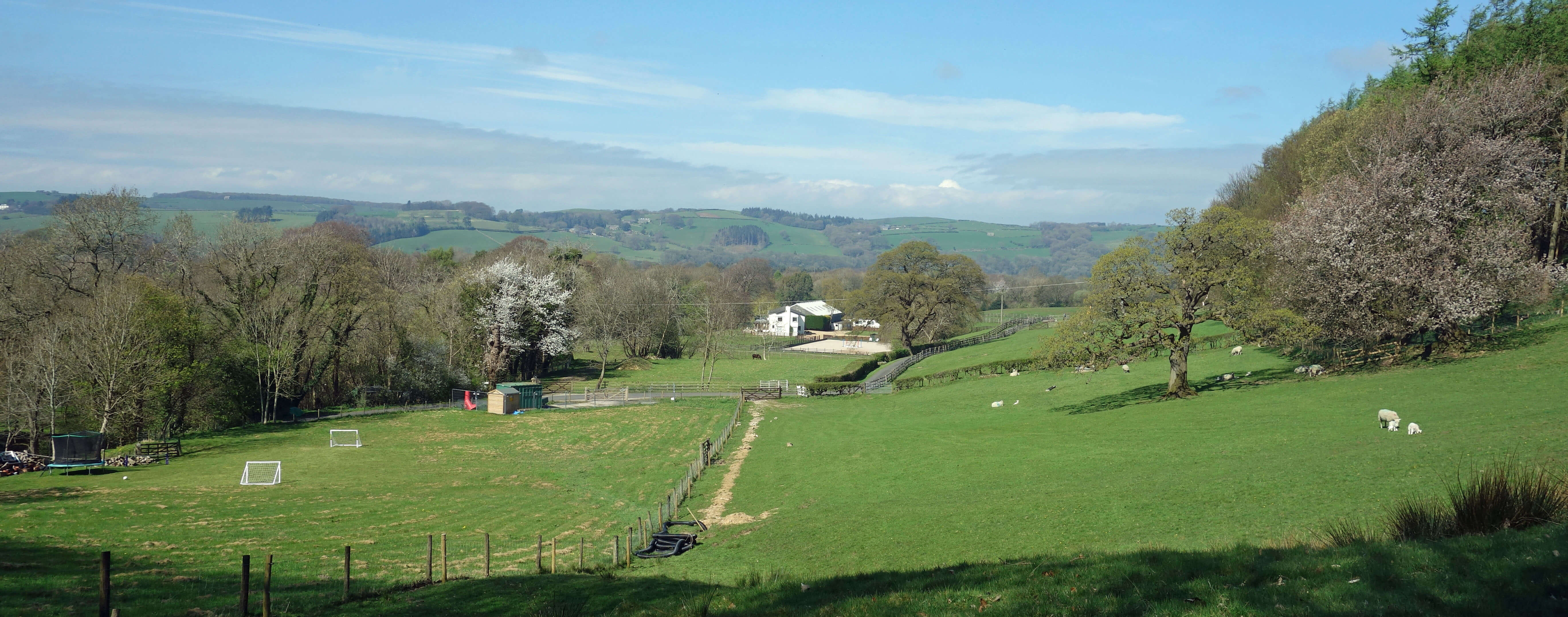
It’s good to know that they are there but mosses and liverworts are not very exciting for a non-botanist to look at. It might be better for walkers to behave and stay on the footpath by the northern wall. This provides excellent views of the Lune valley up to Kirkby Lonsdale, of Caton Moor and its windmills, and in the distance Black Combe and a glimpse of the Old Man of Coniston – at least, it does on a clear day. It was rather hazy on the day of our walk, the hottest day of the year so far.
The inaccessible Artle Dale
Date: April 11th 2020
Start: SD543644, Brookhouse (Map: OL41)
Route: SW – Forge Mill – E – Littledale Road – N – Brookhouse
Distance: 3 miles; Ascent: 70 metres
Home
Preamble
Index
Areas
Dales
Hills
Lakes
Places
Reserves
Rivers
Structures
Villages
References
Me
© John Self, 2018-

Top photo: The western Howgills from Dillicar;
Bottom photo: Blencathra from Great Mell Fell