
Home
Preamble
Index
Areas
Dales
Hills
Lakes
Places
Reserves
Rivers
Structures
Villages
References
Me
Saunterings: Walking in North-West England
Saunterings is a set of reflections based upon walks around the counties of Cumbria, Lancashire and
North Yorkshire in North-West England
(as defined in the Preamble).
Here is a list of all Saunterings so far.
If you'd like to give a comment, correction or update (all are very welcome) or to
be notified by email when a new item is posted - please send an email to johnselfdrakkar@gmail.com.
This is one of several relatively short items about local walks during the first
coronavirus lockdown, April - May 2020.
85. The Tarn Brook Heronry
On the face of it, the new police guidelines (April 16) that allow “driving to countryside and walking (where
far more time is spent walking than driving)” permit me to, say, drive to Jubilee Tower and walk up Ward’s Stone.
However, the guidelines reflect the reality of what can be policed and not necessarily the intention and spirit of
government advice and legislation. They acknowledge that some people need to travel to find somewhere worth
walking. I do not need to drive to the countryside: I am already there. The over-riding focus remains to minimise
unnecessary travel in order to limit the chance of infecting or being infected by others. I am mindful that
people who live elsewhere don’t want me there. So I’ll continue with local walks.
We have two default short walks of only thirty minutes or so, one ‘up the lane’, the other ‘down to the river’.
The former is along what we call Blackberry Lane, that is, the track up past the United Utilities reservoirs to
a gate and back. On the way there are views of the hills of Bowland and the Dales but the pičce de résistance
is the view from the gate over the Lune valley to the panorama of Lake District hills. It is reassuring to
know that they are still there, awaiting our return.
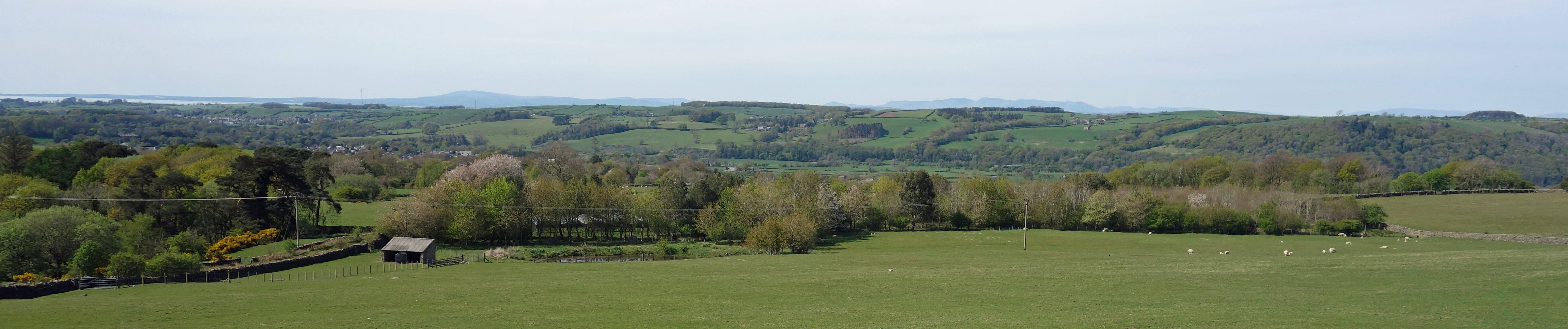
The view from the gate over the Lune valley to the Lake District
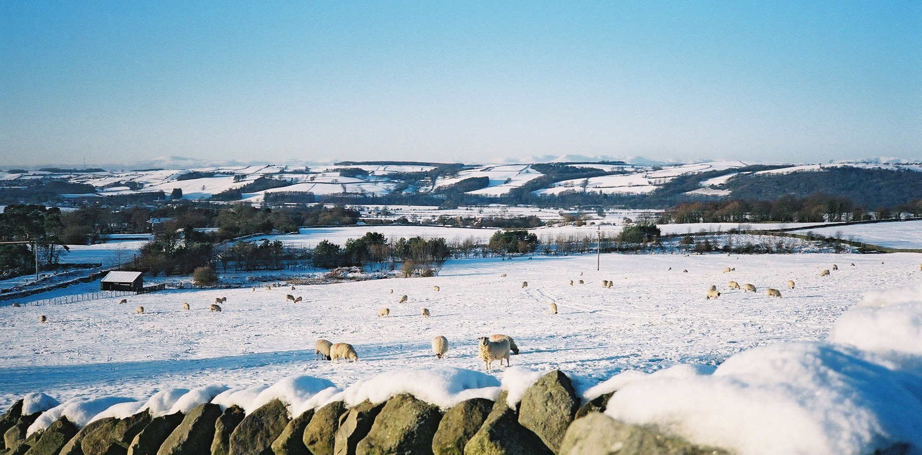
The view from the same spot on an earlier occasion
The enforced patrolling of our locality may help us become more familiar with it. We have managed to pinpoint
the source of strange kraaks heard in our garden in recent years. There are two heron nests in pines by
Tarn Brook (or Bull Beck), and we look to see how they are progressing every time we walk up the road. Herons are normally seen standing silent and still at the river’s edge or flying
with languid ease but when nesting they can make quite a din. I don’t know if two heron nests constitute a
heronry but if not they are the necessary first two steps towards one. It is an honour to have such fine birds
nesting within 200 metres of our house. It also good to know that there are adequate fish in our watercourses for them, despite appearances to my eye.
Vintage locals tell us that Tarn Brook has changed character since they were children. It used to have an equable
temperament, flowing steadily through most of the year, with plenty of fish. Now it is volatile. It is generally
placid with not much more than a trickle but occasionally it is ferocious. In the former state, any fish must be
marooned in deep pools, since there is not enough water to escape from them. In the latter state, fish can hardly
swim upstream against the huge boulders being washed down.
We attributed this change to the increased drainage of farmers’ fields but I am wondering if those reservoirs
have anything to do with it. A 1979 booklet produced by a Caton Village Exhibition Committee says that “Caton
reservoir at Moorside, built about 1860 and one of the oldest in the country, is fed by a network of pipes across
the moors”. The second reservoir was built in about 1970 and must also be fed from the moors. When there has
been little rain, as recently, the pipes must extract from what little water there is to keep the reservoirs
topped up, leaving Tarn Brook even lower than it would be. When there is a day-long deluge then the water must
shoot down those pipes, find the reservoirs full, and then continue to flood the beck. (I suspect that the
first reservoir is no longer used to water the residents of Caton. There are often United Utilities workers
at the filter house and second reservoir (which is covered and protected by CCTV and a high security fence) but
I have never seen them take any interest in the first reservoir.)
The number of fish in Tarn Brook has clearly decreased. Perhaps the heron get all the fish they need
from the Lune but there must be fewer fish there if all its tributaries are like Tarn Brook, almost devoid of
fish. I would be grateful if residents with garden pools could keep them well stocked with newts, frogs and
goldfish. So would the herons.
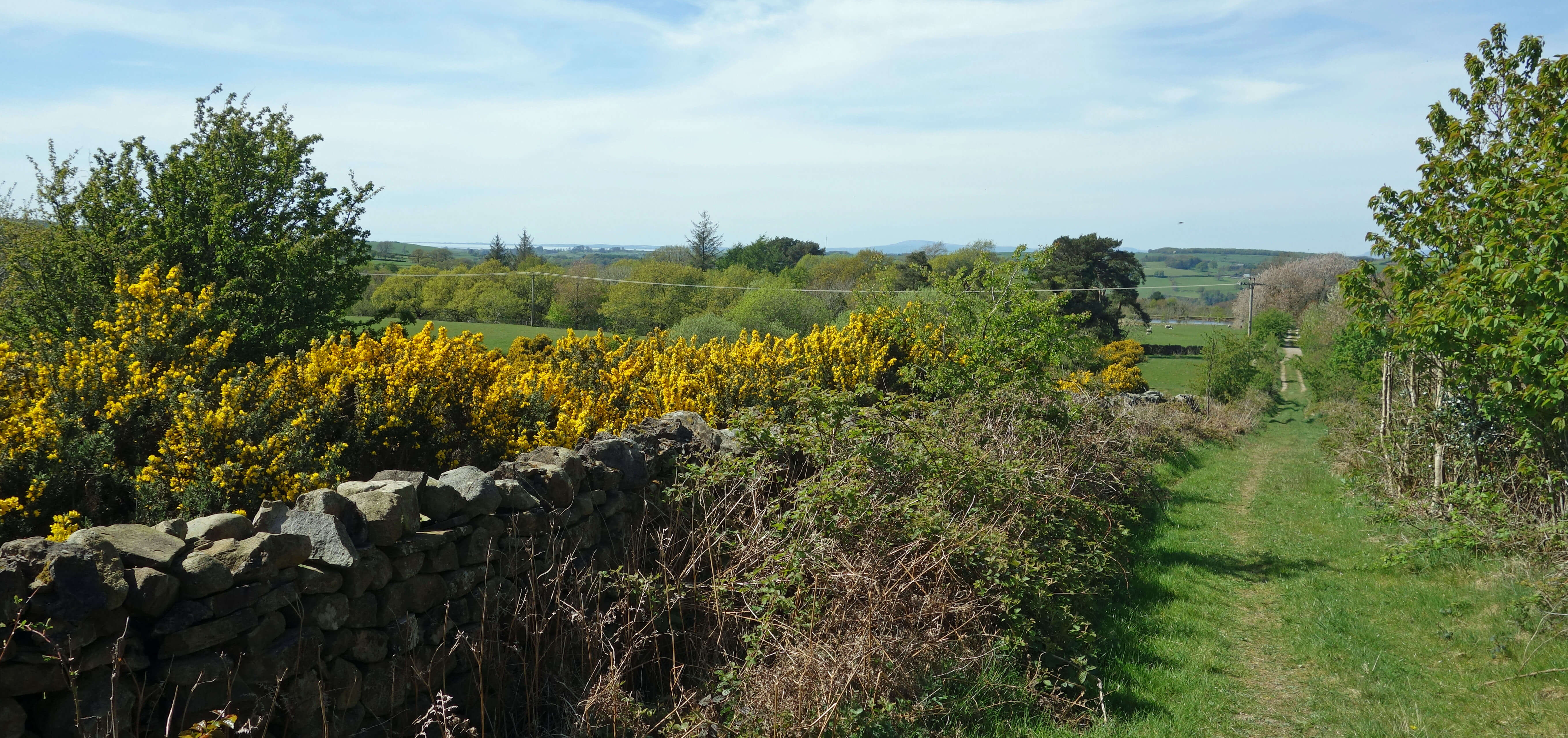
Blackberry Lane
Date: April 23rd 2020
Start: SD543644, Brookhouse (Map: OL41)
Route: SE along track by Moorgarth – Reservoir, gate – and back
Distance: 2 miles; Ascent: 70 metres
Home
Preamble
Index
Areas
Dales
Hills
Lakes
Places
Reserves
Rivers
Structures
Villages
References
Me
© John Self, 2018-

Top photo: The western Howgills from Dillicar;
Bottom photo: Blencathra from Great Mell Fell