
Home
Preamble
Index
Areas
Dales
Hills
Lakes
Places
Reserves
Rivers
Structures
Villages
References
Me
Saunterings: Walking in North-West England
Saunterings is a set of reflections based upon walks around the counties of Cumbria, Lancashire and
North Yorkshire in North-West England
(as defined in the Preamble).
Here is a list of all Saunterings so far.
If you'd like to give a comment, correction or update (all are very welcome) or to
be notified by email when a new item is posted - please send an email to johnselfdrakkar@gmail.com.
This is one of several relatively short items about local walks during the first
coronavirus lockdown, April - May 2020.
81. The Lost Meander of the Lune
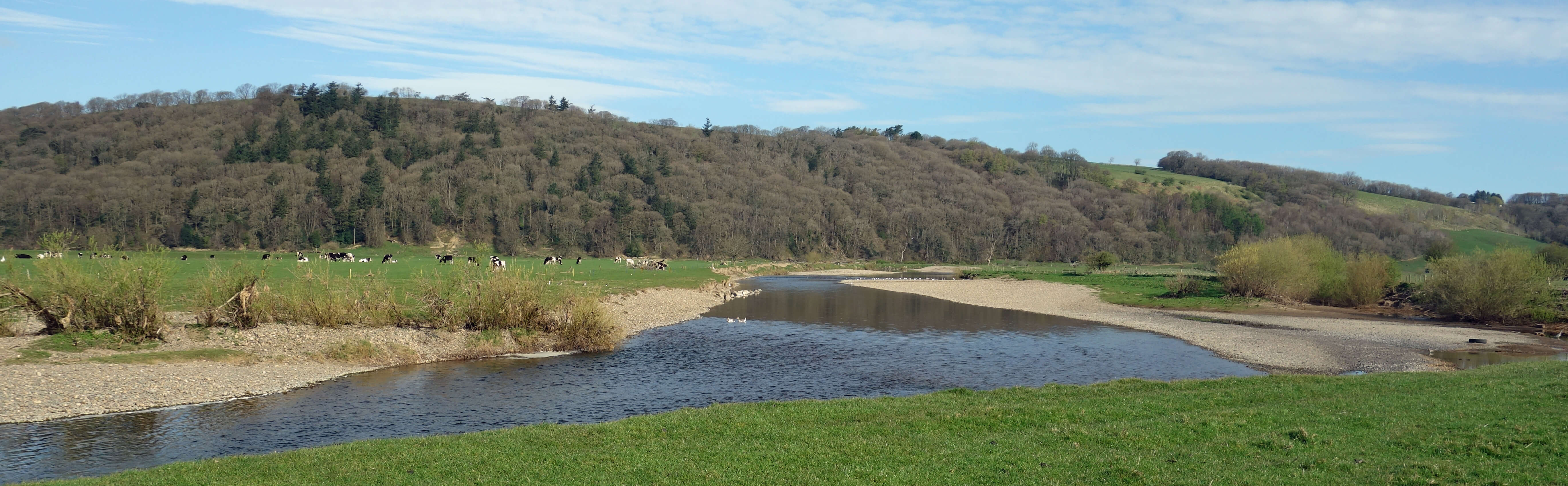
The River Lune, looking towards Burton Wood
 The River Lune flows southwest below Burton Wood and then turns south on a long meander that adds over a mile to the
length it would have had if it had continued directly southwest. This, however, is not the ‘lost’ meander of the title
because it is easily ‘found’ by anyone who walks along this part of the Lune or who glances at the OS map.
The River Lune flows southwest below Burton Wood and then turns south on a long meander that adds over a mile to the
length it would have had if it had continued directly southwest. This, however, is not the ‘lost’ meander of the title
because it is easily ‘found’ by anyone who walks along this part of the Lune or who glances at the OS map.
We walked along the Lune Millennium Park (the old railway line) and over a stile and then a footbridge across Mears Beck to follow the public footpath to the bank of the Lune. Here the OS map shows the footpath heading straight across the Lune to the opposite bank and then turning abruptly to cross back over the Lune. It is clearly impossible for any walker to cross the Lune at this point even if it’s as low as it is now. Thankfully we don’t have to, as there is a permissive path along the eastern bank. But why does
the public footpath cross and re-cross the Lune?
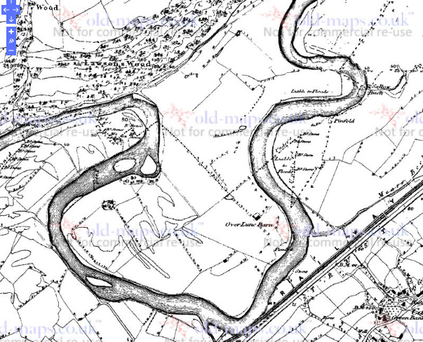
As you’ve probably guessed from what is to the right, the answer may lie in old maps. The 1847 OS map shows
that the Lune at that time followed an elaborate curve east and then west before continuing south. Where
the public footpath now crosses the river was probably all on the east bank in 1847.
We continued north alongside the Lune to see if we could detect any signs of this lost meander. The Lune is now settled deep within its banks. It is hard to believe that less than 200 years ago some of this river bed was a field. Or that some of this field was a river bed. I can almost understand how a river can wash away land to form a new river bed but how does an old river bed fill
itself in to disappear within a field?
We walked on to the deep, sharp bend of the river. The only sounds to be heard were of the gentle ripple of the low-flowing Lune and of the
birds. The noisiest of the birds were oystercatchers, apart from when we disturbed some geese. We also saw heron,
little egret, sand martin, cormorant, redshank, curlew, pied wagtail, and gulls (which I cannot identify). The neck
of the long meander is now much narrower than it was in 1847 but nowadays we can try to slow erosion by dumping huge boulders in
the river to protect the bank.
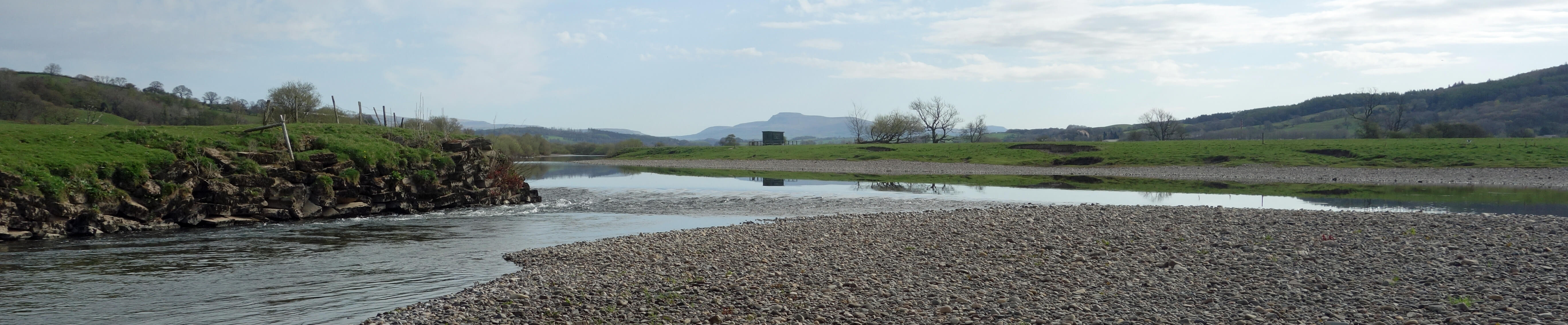
A very low Lune, with Ingleborough in the distance
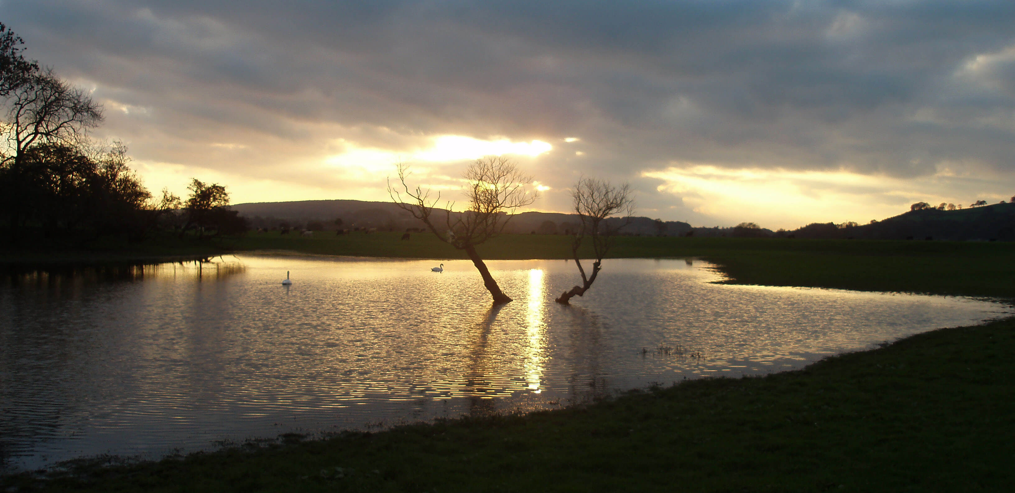
At the fishermen’s hut we turned back, walking more inland, to reach a large pond. This could be at the eastern end of the old bend, in which case I suppose it is an ox-bow lake, beloved of school geographers. It is hard now, though, to tell where the old Lune flowed towards and away from it.
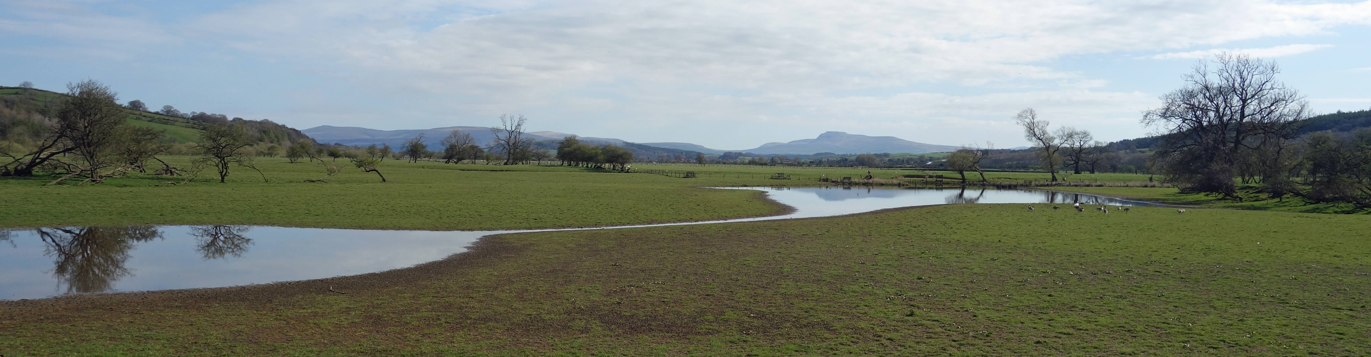
The pond possibly on the route of the old Lune
The 1847 map does not fully solve the puzzle of why the present footpath crosses and re-crosses the river. Above I assumed that the present footpath is on the line of an 1847 path. If it is then, yes, that might explain why the present path crosses the river but it would also mean that the 1847 path crossed the old Lune twice a little further north, which seems implausible.
It seems that our period of confinement is affecting our emotions, because at the end of this walk Ruth enthused “I just loved that so much – wow!”
P.S. I thought you might like this photo of the pond, rather fuller, taken from the other side
(on an earlier occasion, obviously).
Date: April 8th 2020
Start: SD543644, Brookhouse (Map: OL41)
Route: N on Holme Lane – A683 – E on old railway line, N by Lune –
fishermen’s hut – back via inland ponds – Bull Beck Bridge – SW – Brookhouse
Distance: 4 miles; Ascent: 40 metres
Home
Preamble
Index
Areas
Dales
Hills
Lakes
Places
Reserves
Rivers
Structures
Villages
References
Me
© John Self, 2018-

Top photo: The western Howgills from Dillicar;
Bottom photo: Blencathra from Great Mell Fell