
Home
Preamble
Index
Areas
Dales
Hills
Lakes
Places
Reserves
Rivers
Structures
Villages
References
Me
Saunterings: Walking in North-West England
Saunterings is a set of reflections based upon walks around the counties of Cumbria, Lancashire and
North Yorkshire in North-West England
(as defined in the Preamble).
Here is a list of all Saunterings so far.
If you'd like to give a comment, correction or update (all are very welcome) or to
be notified by email when a new item is posted - please send an email to johnselfdrakkar@gmail.com.
196. From Motte to Motte: Arkholme to Hornby
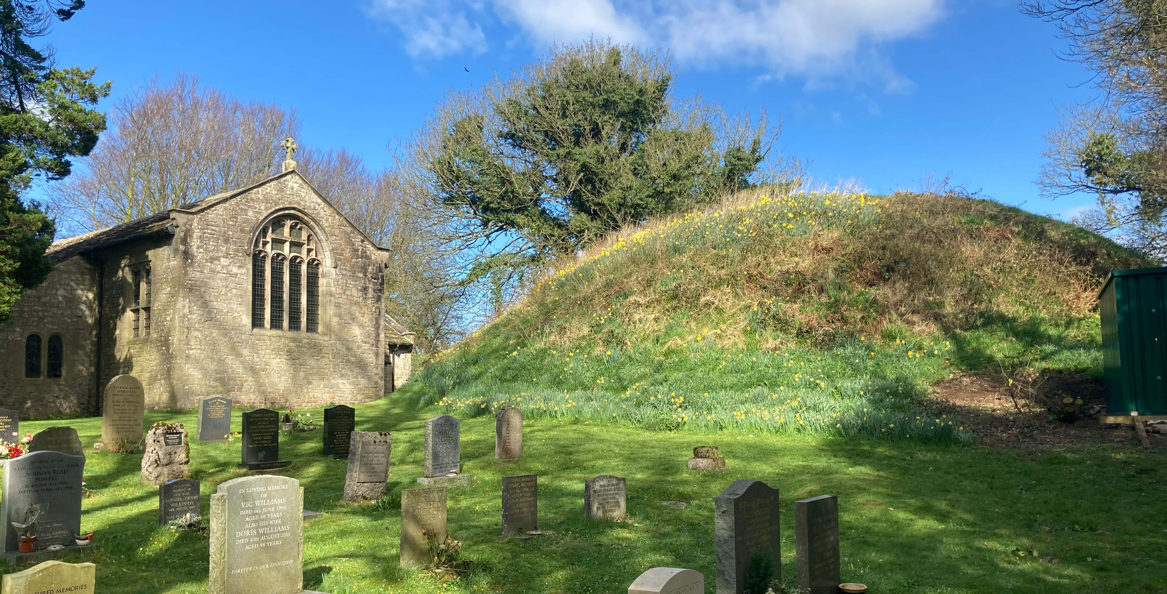 Right: The Arkholme motte.
Why were so many motte-and-bailey castles built along the Lune valley, the highest
concentration of such castles in England, it is said? Perhaps the Normans found the local natives
exceptionally stroppy. However, the castles were relatively small and
constructed of wood, not stone, so they were hardly impregnable fortifications. Probably
they were more like administrative centres, overseeing an important north-south route.
I set off along ArkholmeÆs Main Street ¢ its only street, really. The street is a
cul-de-sac, running at right angles from the Kirkby Lonsdale road down to near the river,
where there used to be a ferry. The street is therefore quiet and it is possible to stroll
along, admiring the various old houses, within the gardens of which the residents enjoy their
tranquillity. The street comes to an end at the church, which is adjacent to, almost
tucked into, the motte of the old motte-and-bailey castle. The church is, presumably,
within the old bailey, of which there is no sign today.
Motte-and-bailey castles consisted of a motte and a bailey. (My mission is to enlighten.) The
motte was a mound, usually not natural, upon
which a keep was built to protect valued property and people. Next to the motte was the
bailey, a courtyard protected by a fence and ditch. The bailey would contain various
buildings such as kitchens, stables, forges, and so on. The Lune valley motte-and-bailey
castles were at the smaller end of the spectrum of such castles and, since the built structures,
made of wood, have all disappeared, the remains of the castles are not that prominent
in the landscape. There are just some enigmatic humps and bumps to be seen.
The mottes were originally flat-topped but have become rounded over time.
Beyond the FerrymanÆs Cottage, I headed for the footpath that runs south by the
river. However, there was a sign to say that the path was closed because of damage to a
footbridge. It advised me to take an alternative route ¢ but it didnÆt tell me what
alternative that might be, because there isnÆt one.
So I pressed on anyway. I didnÆt
encounter any impassable obstacles ¢ but I did flounder in too much mud. It was clear
that much of this path had recently been under water and I hadnÆt anticipated quite how
wet it remained. I struggled on, pausing occasionally to enjoy the view of and across
the river, the best view being back up towards the Yorkshire Dales hills. Otherwise I
noticed little as my eyes were fixed on the mud to try to ensure that I didnÆt slip and jar my back.
Eventually I emerged at Loyn Bridge. I noticed a sign here from Gressingham
Anglers Ltd (Ltd, not Club: sounds rather formal) that said ōPlease do not disturb our
river from either bankö. I wondered about the æourÆ. Do they own the river? In
[192] I considered
who was responsible for our waterways. I didnÆt think that Angling Clubs were. And they
shouldnÆt be, as they have a one-dimensional view of what a river is for.
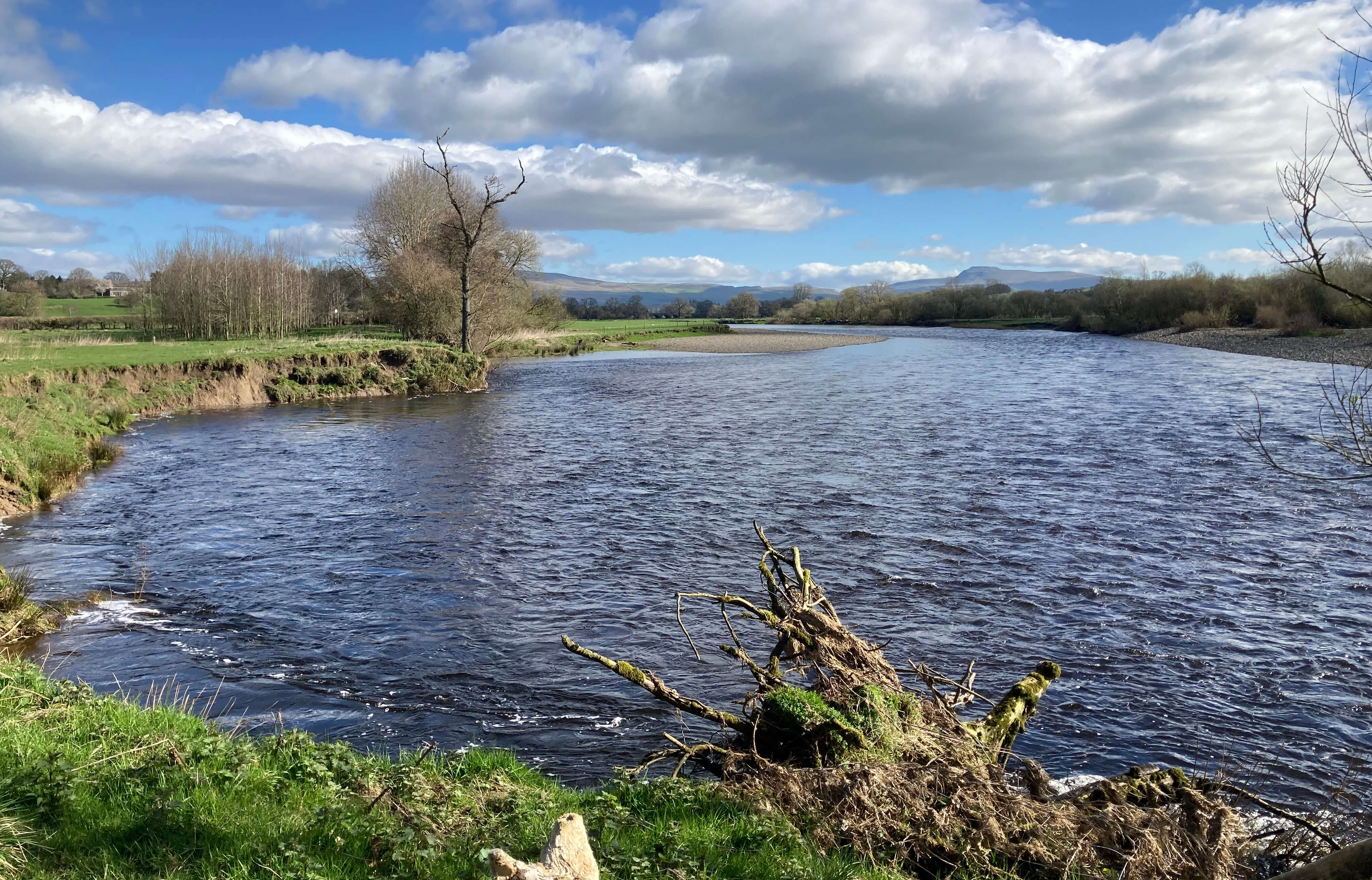
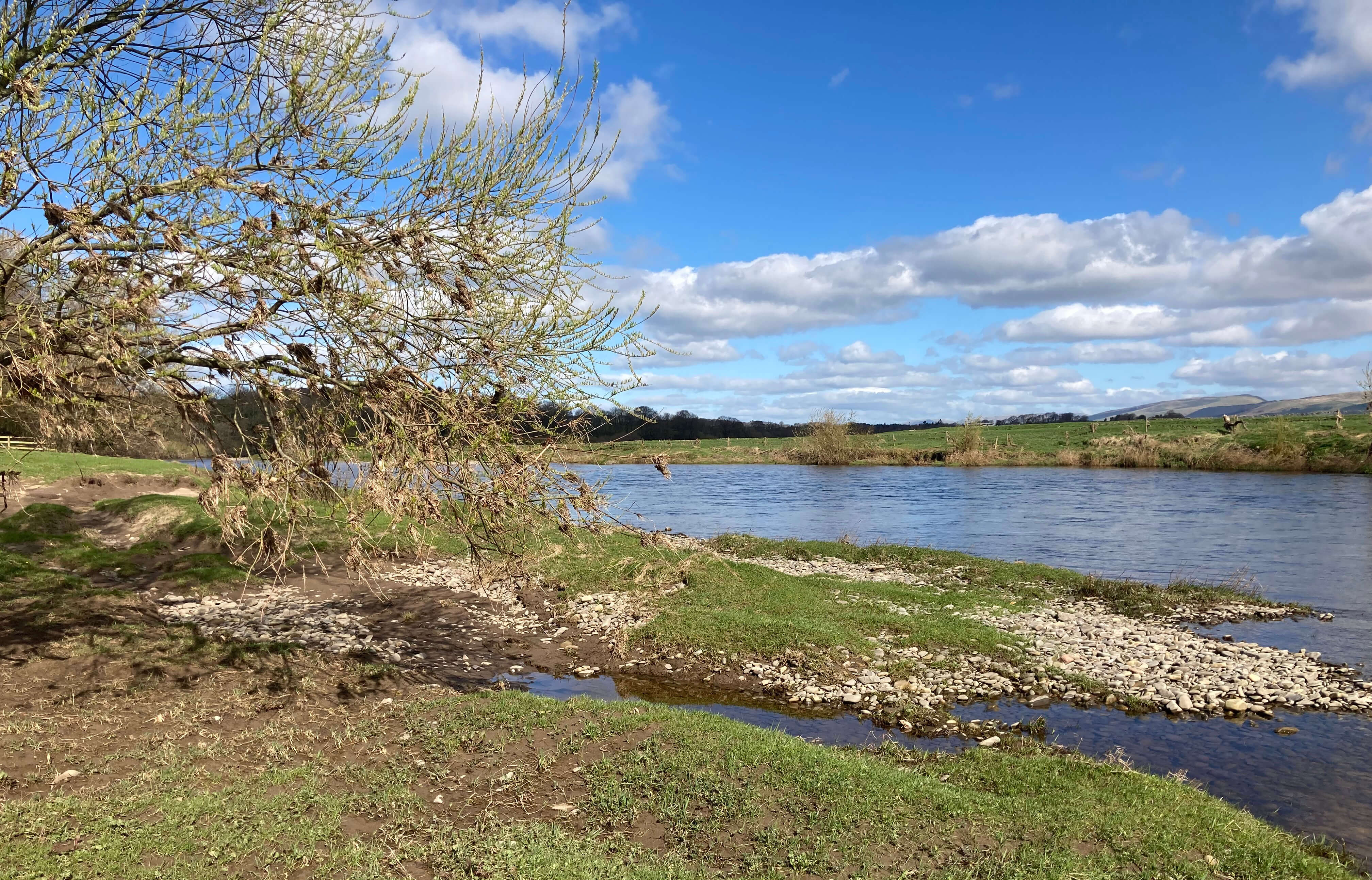
Left: The River Lune near Arkholme, showing erosion of the west bank; Right:
The River Lune near Loyn Bridge, with debris in the tree a metre above my head.
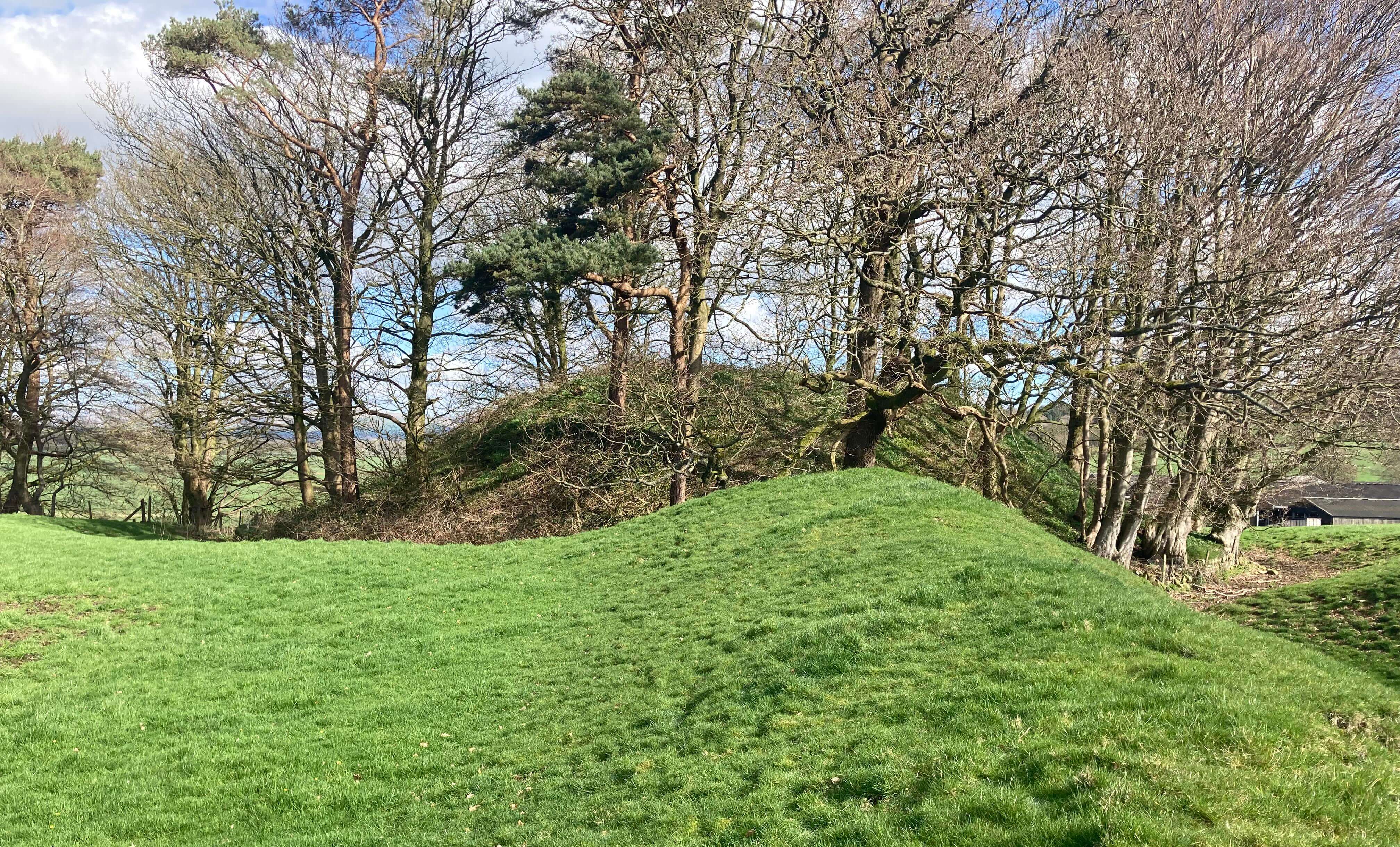 Right: Castle Stede, Hornby, from the ridge of the bailey, looking towards the motte, overgrown
with trees.
Right: Castle Stede, Hornby, from the ridge of the bailey, looking towards the motte, overgrown
with trees.
I crossed the bridge to have a look at the remains of the Castle Stede motte-and-bailey. This
is the best preserved of all the Lune valley motte-and-baileys. There are no buildings, of
course, but the shape of the motte and bailey can be well seen. The motte stands at the
eastern end, now with trees sprouting therefrom. A paddock of grass, kept under control by
sheep, I assume, shows the area of the original bailey. As can be appreciated, the site
provided (when the trees werenÆt here) a good vantage point along the Lune valley.
Castle Stede is thought to have been abandoned in the late 13th century when the villagers
of Hornby moved to gather round the new castle built there.
A public footpath
passes by the bailey and with a little accidental straying it is possible to wander into
the bailey to imagine activities of centuries ago.
Just for the record, the other motte-and-bailey castles along the Lune valley are at:
Ģ Castle Howe, near Tebay. This castle was built by a bend of
the Lune so that travellers on the M6 could see it without even leaving their car. The motte
has been reduced in size by river erosion.
Ģ Castlehaw, Sedbergh. This castle oversaw the approaches
from Rawtheydale and Garsdale. The motte is not easy to see today but can be viewed from
the footpath up Winder.
Ģ Cockpit Hill, Kirkby Lonsdale. Experts tell us that there
was a motte-and-bailey castle here, just west of RuskinÆs View. Today it looks like
a nondescript, overgrown hump. Perhaps old maps showed it as a castle, before it was adopted for a cockpit.
Ģ Whittington. The three-metre high remains of a motte lie in
the graveyard of the Whittington church, which was presumably built within the bailey. At
least, that is what experts say. It doesnÆt look a very strategic viewpoint to me.
Ģ Castle Hill, Burton-in-Lonsdale (if this counts as within
the Lune valley). This is the most prominent of the mottes, being clearly seen from the
main road through the village. This motte has, apparently, two baileys attached but it is
all on private land.
Ģ Melling. Here what remains of the motte can be seen by
peering over the wall of the churchyard into the rectory garden, where it has been adopted as a feature.
Ģ Castle Hill, Halton. A large flagpole marks the site of
the motte, which is helpful as not much of the original motte and bailey can be traced today.
Ģ Lancaster. It is assumed that a motte-and-bailey castle
was built on the site of the old Roman fort and then replaced by the stone edifice seen today.
I donÆt know if thereÆs any direct evidence for a motte-and-bailey castle here.
After completing a lap of the Castle Stede bailey, I returned to Loyn Bridge. I had planned
to continue alongside the Lune and then the Wenning into Hornby but after a hundred yards or
so my back said æenoughÆ. I agreed with it. All the tension to avoid slipping on mud was
proving too much, and I didnÆt really fancy slipping into the river. So I retreated and
walked slowly along the road into Hornby to await my bus.
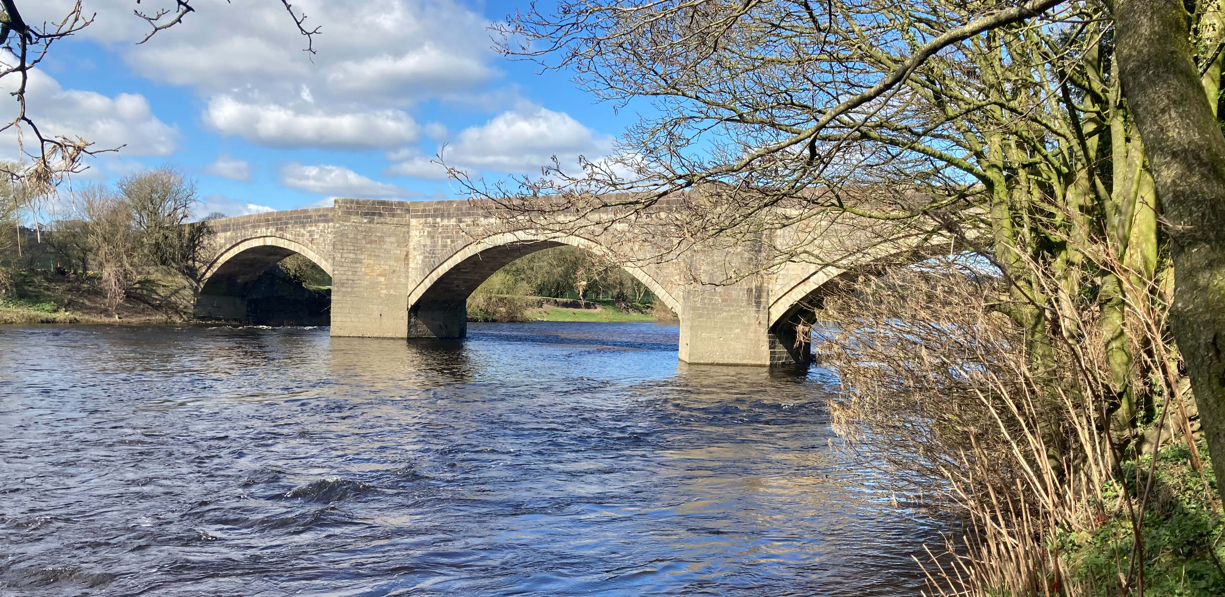
Loyn Bridge
Date: March 24th 2024
Start: SD583722, Arkholme bus stop (Map: OL2)
Route: (linear) SE on Main Street ¢ church ¢ SW, S on Lune Valley
Ramble path ¢ Loyn Bridge ¢ E ¢ Castle Stede ¢ W ¢ Loyn Bridge ¢ S for 100 yards, N ¢ Loyn
Bridge ¢ S ¢ Hornby bus stop
Distance: 4 miles; Ascent: 20 metres
Home
Preamble
Index
Areas
Dales
Hills
Lakes
Places
Reserves
Rivers
Structures
Villages
References
Me
® John Self, 2018-

Top photo: The western Howgills from Dillicar;
Bottom photo: Blencathra from Great Mell Fell