
Home
Preamble
Index
Areas
Hills
Lakes
Dales
References
Me
Saunterings: Walking in North-West England
Saunterings is a set of reflections based upon walks around the counties of Cumbria, Lancashire and
North Yorkshire in North-West England
(as defined in the Preamble).
Here is a list of all Saunterings so far.
If you'd like to give a comment, correction or update (all are very welcome) or to
be notified by email when a new item is posted - please send an email to johnselfdrakkar@gmail.com.
195. A (Mis?)Guided Tour of Kirkby Lonsdale
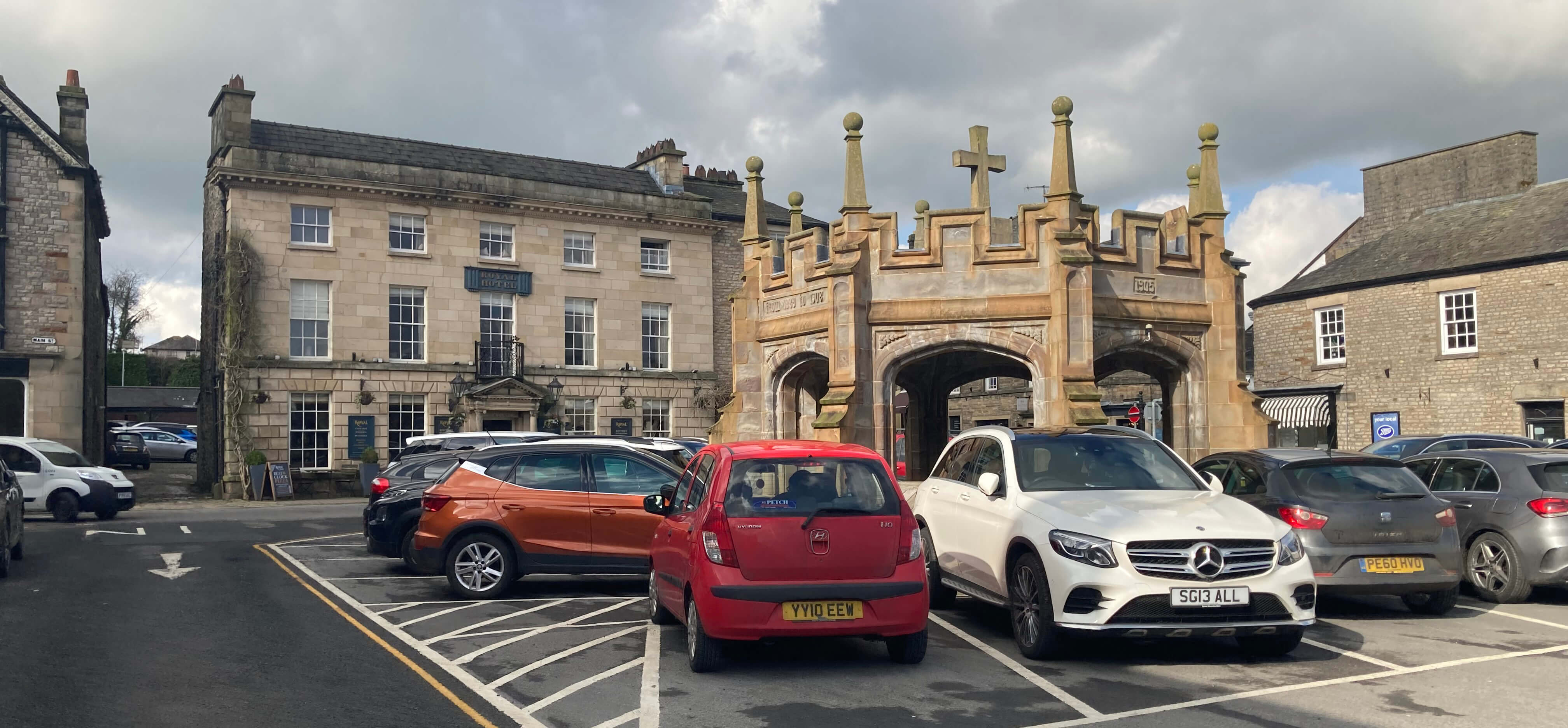 Right: Market Square and the Royal Hotel, Kirkby Lonsdale
So far in these Saunterings I have used Kirkby Lonsdale only as a base to walk away
from – to the south along the river [50], to the north-east to
Brownthwaite [139] and to the
west to Farleton Knott [181]. Kirkby Lonsdale deserves better. It is one of the more
attractive market towns of the region. So, in order to ease my sore back into action,
I set out for a gentle stroll around Kirkby Lonsdale, knowing that there would be ample
cafés and bars to collapse into, if necessary.
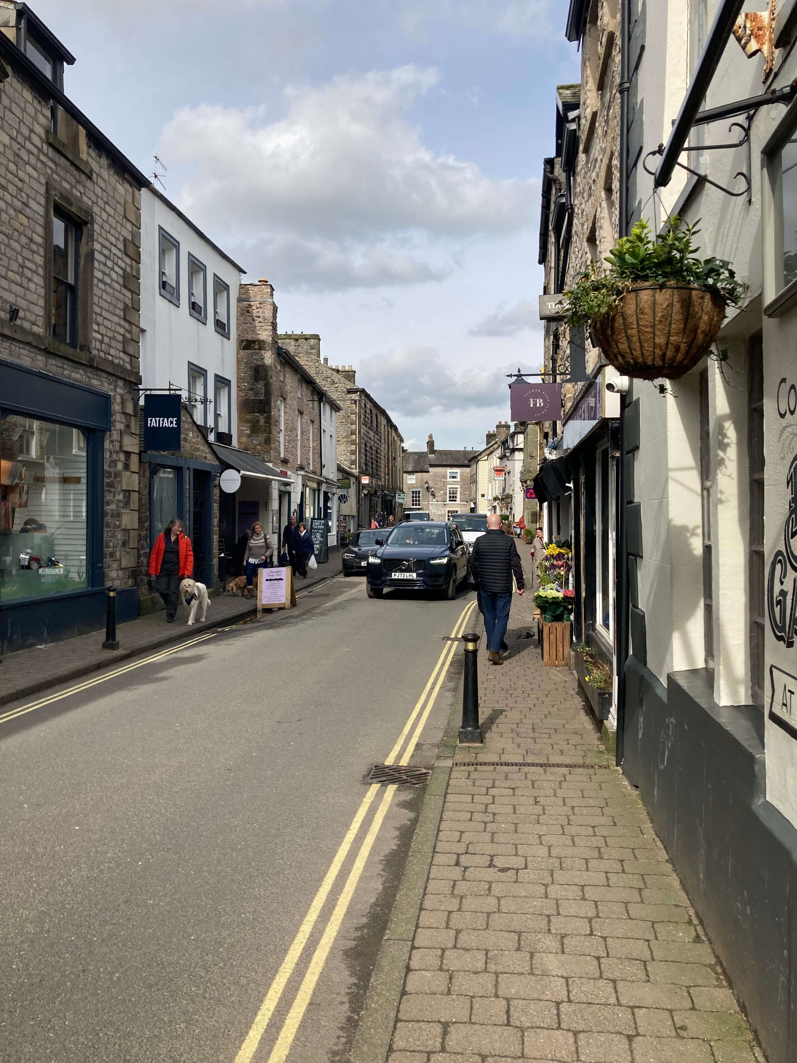
I walked from the Booths bus stop, with distant views of Ingleborough and Gragareth,
down New Road, passing Boo & Belle, Tiggywinkles, The Enchanted Chocolate Mine and the
Bath House Artisan of Natural Beauty, which set the tone for Kirkby Lonsdale. There was
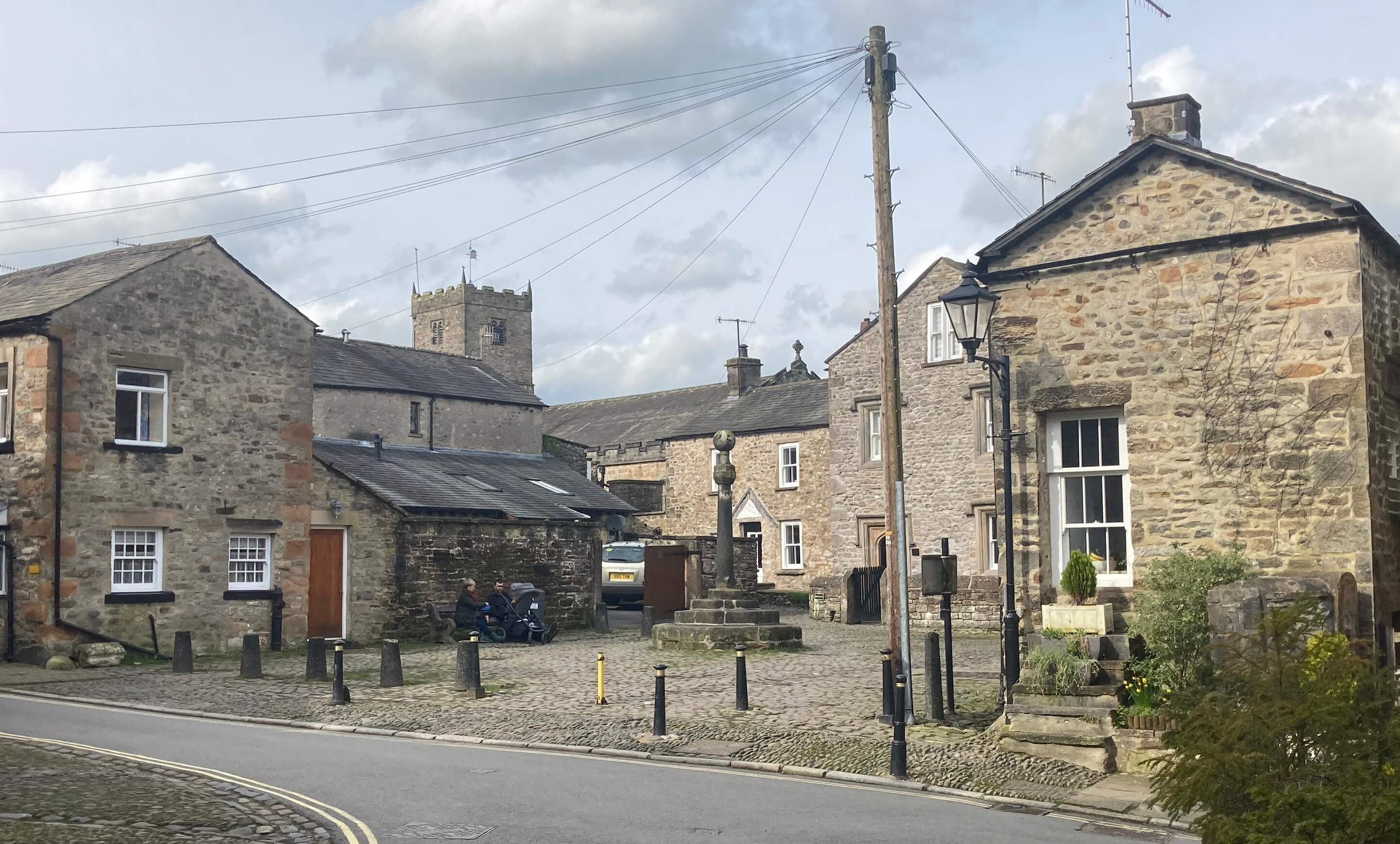
no market in Market Square, it not being market day (Thursday), but it had the usual
jumble of cars parked around the central shelter, of unique design. It must be unique
because surely nobody would copy it. Kirkby Lonsdale was granted a market charter in 1227.
Before that it had appeared in the Domesday Book of 1086 with the name of Cherchibi,
which shows that it had a significant church before that time.
Facing the square is the Royal Hotel, so re-named after a visit by Queen Adelaide.
I was never made to learn the kings and queens of England when at school. So, who was
Queen Adelaide? Did she do anything of note – apart from visiting
Kirkby Lonsdale? Well, she had a city in Australia named after her but
I’m not aware of anything else, and I’m happy to leave it that way.
I wandered to the information centre to pick up a leaflet for a short Kirkby Lonsdale walk.
I didn’t really need a leaflet but I wanted to help the assistant feel some purpose in life.
But it was closed. Never mind, nowadays we can get more information than we need from our
phones. Kirkby Lonsdale is blessed with two websites detailing its attractions,
one from
the Kirkby Lonsdale Chamber of Trade and
the other
from the Kirkby Lonsdale & Lune Valley Community Interest Company, with the former claiming
to be “the original and biggest website for Kirkby Lonsdale”. I sense a little local conflict,
which is a shame as this town ain’t big enough for both of them.
I walked down Jingling Lane, which I like to think refers to “Hey!
Mr Tambourine Man,
play a song for me. In the jingle jangle morning I’ll come following you” (Bob Dylan, about 1963).
It was certainly a jingle jangle morning for me. Crossing Stanley Bridge, I approached the
Devil’s Bridge from the other side for a change. This bridge was probably built for St
Mary’s Abbey of York, which owned the Kirkby Lonsdale church and lands from the 11th century,
to enable trade between the Yorkshire monasteries and the lands of Furness Abbey.
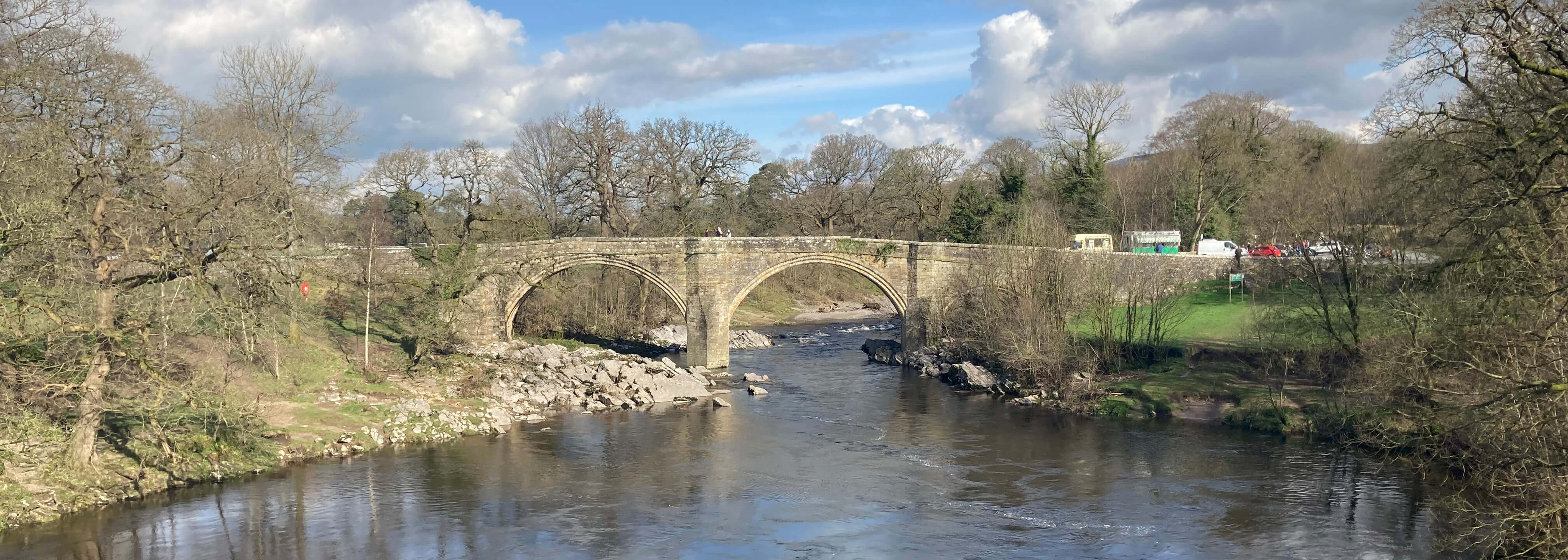
Devil's Bridge
There was the usual gathering of bikers at the bridge, although not as many as at peak times.
I know there’s a TV programme called ‘The Hairy Bikers’ (never watched by me), but hairy bikers
must be a rarity if the Kirkby Lonsdale gathering was a random subset. They were nearly all
bald, about fifty, and solidly built, but I mustn’t generalise to a stereotype. I wandered
among their bikes wondering if I’d be able to tell if any of them were electric. I didn’t
dare ask the bikers about electric bikes. I suspect they wouldn’t adopt them unless they could
be adapted to make a loud vroom.
From the bridge I walked upriver, along with several other strollers. The river was
livelier than I expected – it must have rained heavily around the headwaters at the Howgills –
but it was not, of course, as high as it can be, as evidenced by debris in the riverside shrubs,
showing that the river sometimes reaches almost unbelievable heights. Bold efforts have been
made to protect this path from erosion. At the end of the path I climbed the steps (slowly) to
Ruskin’s View (discussed in [139]).
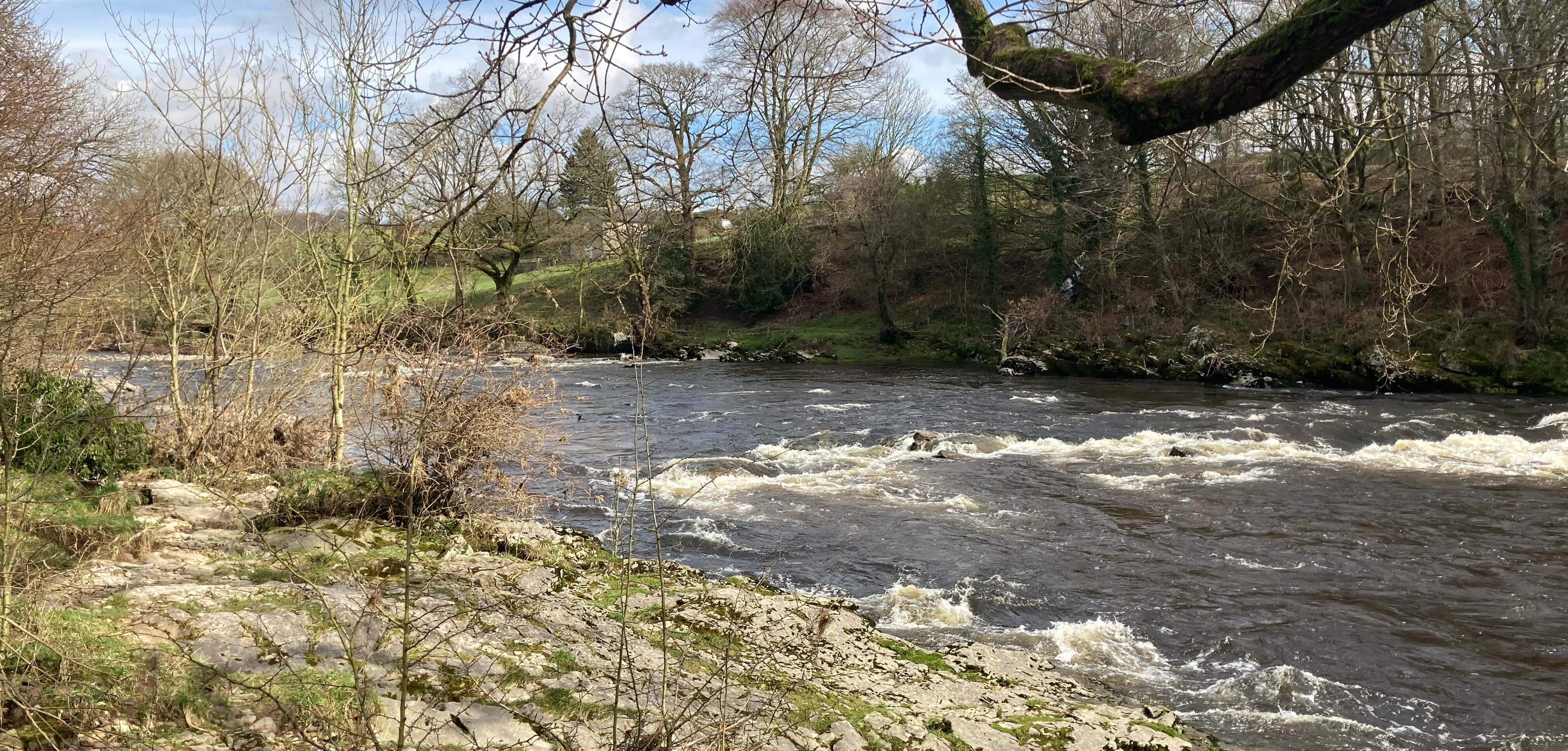
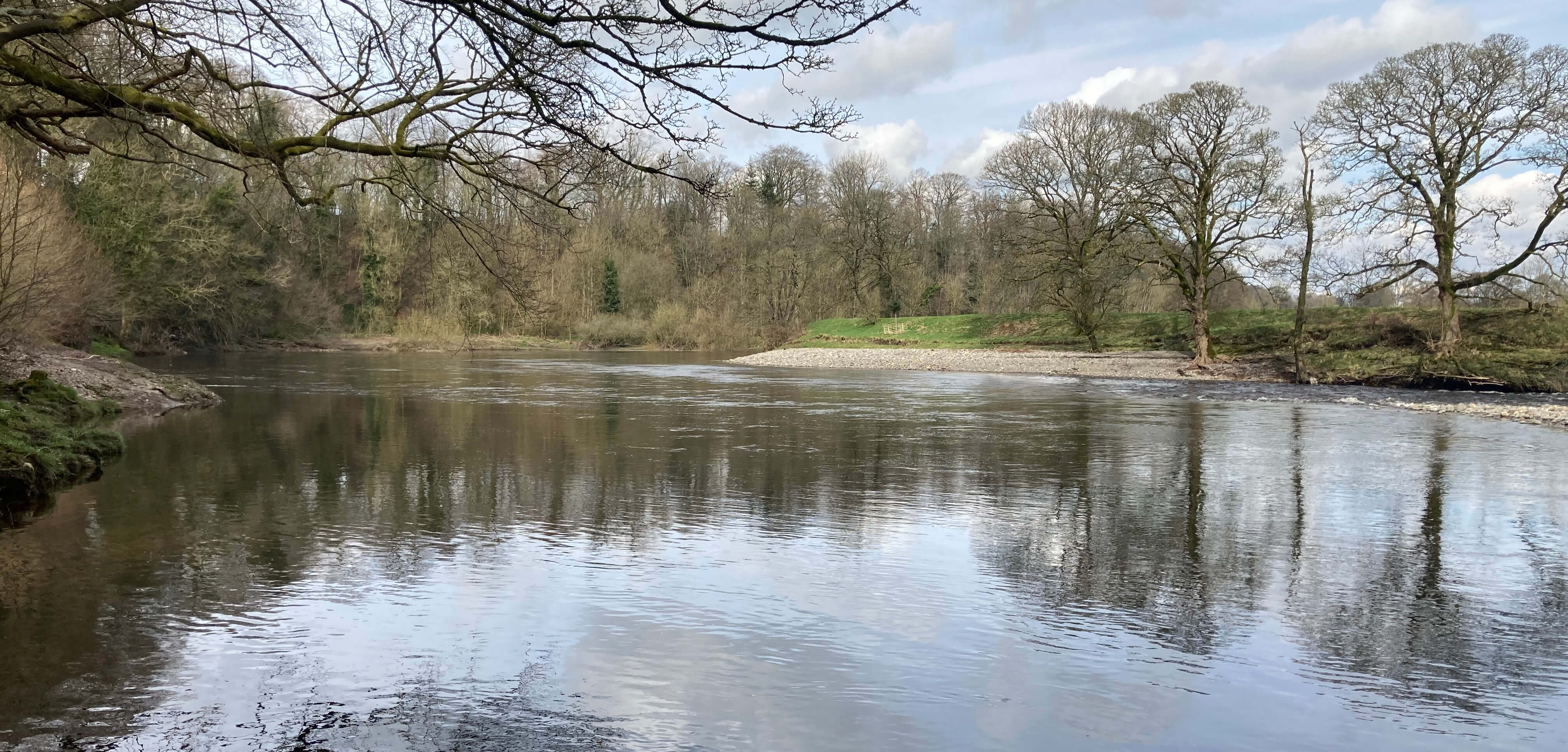
Left: The River Lune from the path from Devil's Bridge; Right:
The River Lune below the bank of Ruskin's View.
Ruskin's View was closed, as I knew it would be, because of bank erosion, precipitating an
appeal for Ł1 million for repairs. In 1992 Robert Swain had remarked that “the Lune is
eroding the land here …, making repairs essential or the path could be closed permanently
in the not too distant future” (Swain 1992). Were there any repairs after 1992? It
is obvious that this bank is vulnerable. The Lune is flowing straight towards it, sometimes,
as we’ve seen, as a raging torrent. I can see that with the difficulty of access and the
depth of the river at the bend it might well take a million to protect this bank.
Personally, I’d be more concerned to protect Kirkby Lonsdale itself than to save Ruskin’s View.
I wandered around the church, which was surrounded by a multitude of daffodils, and ventured inside. This church was probably built around 1100 on the site of an older Saxon church. Some of the pillars have a diamond pattern said to be similar to those seen in Durham Cathedral (which I have not visited). I am no judge of these things but the diamonds didn’t look particularly elegant to me but I suppose it’s helpful if they establish a kinship with Durham Cathedral.
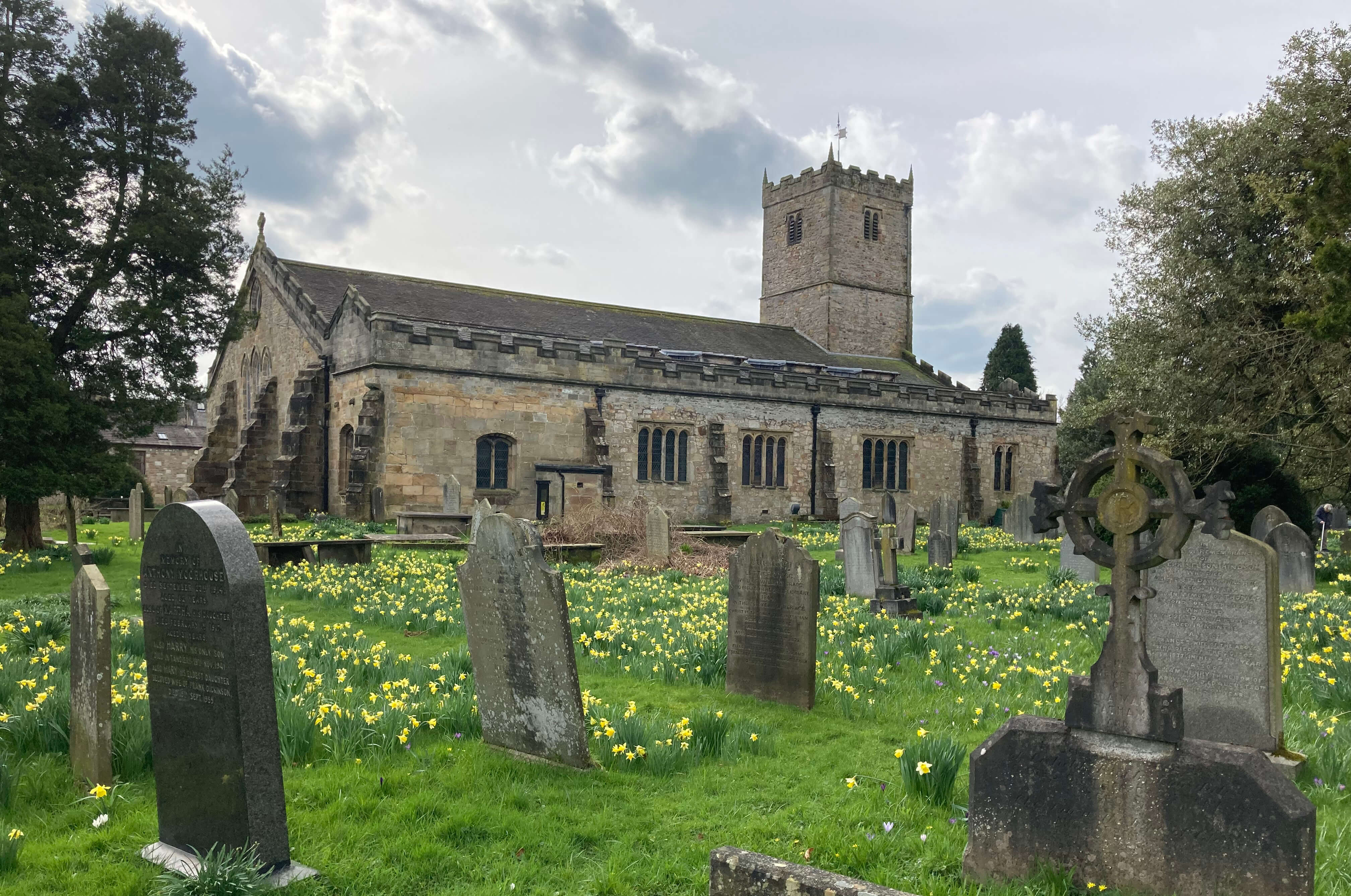
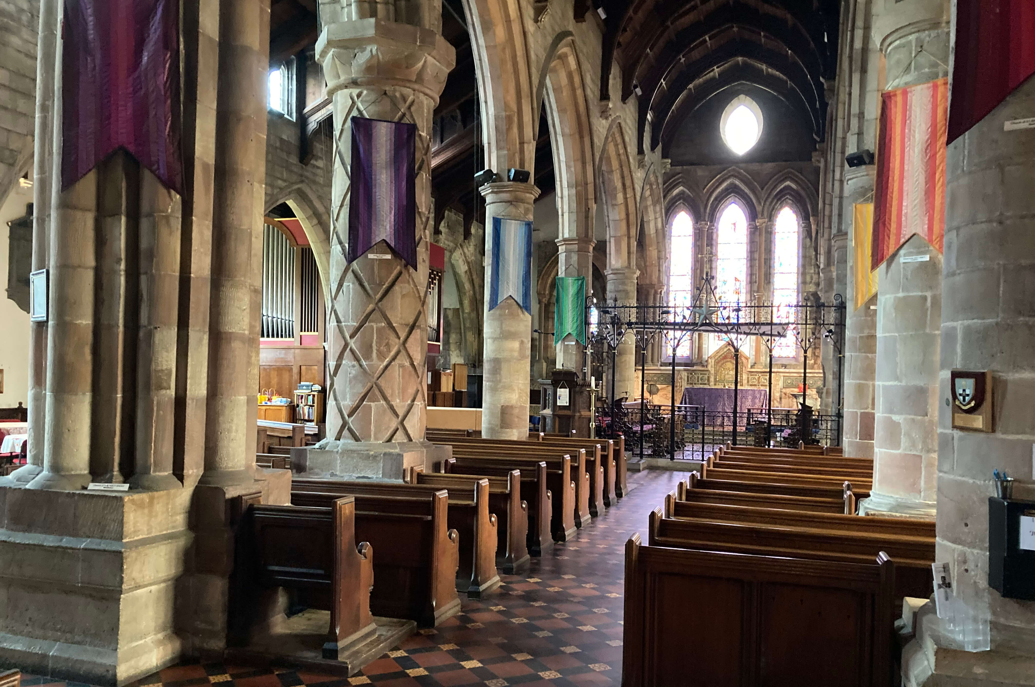
Kirkby Lonsdale church
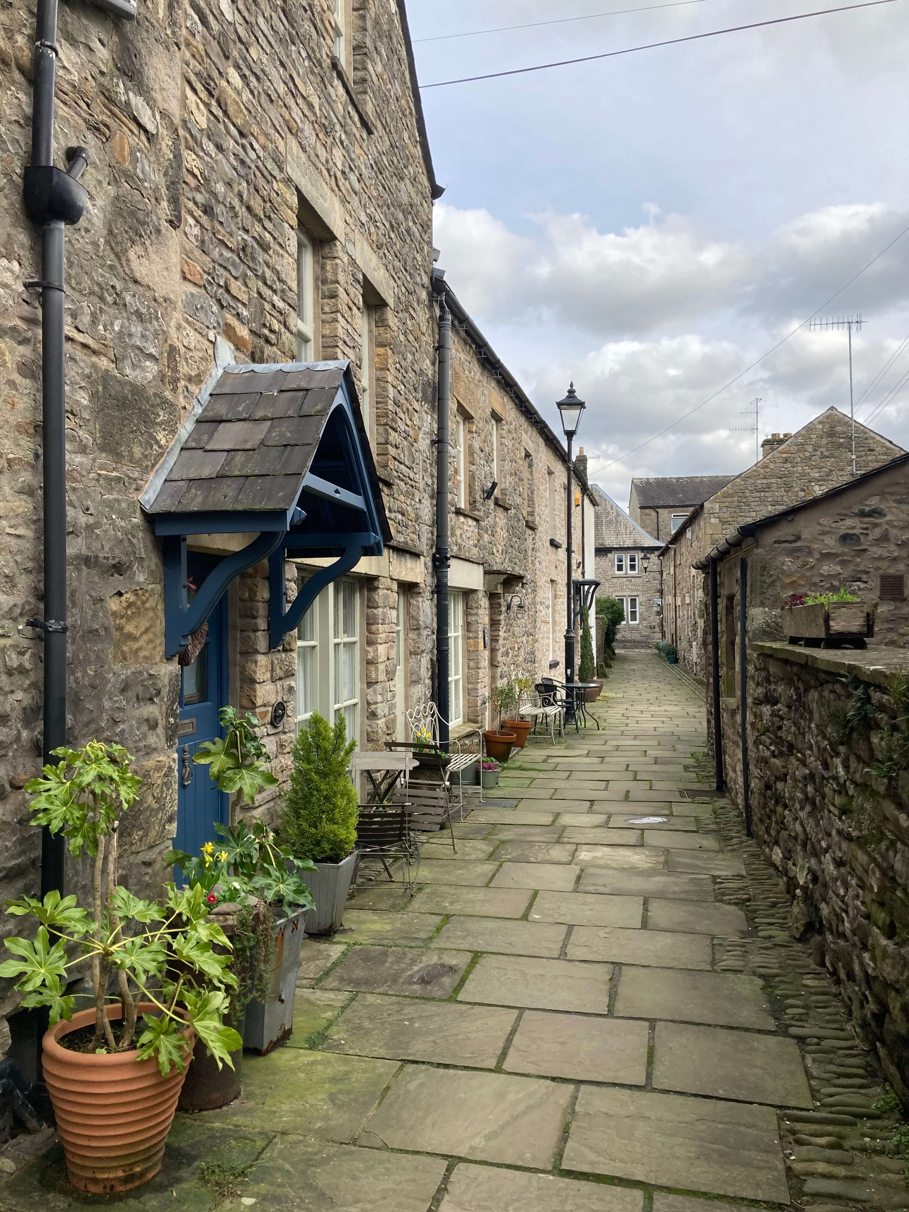
I continued aimlessly – which is the only way – around the narrow back lanes of Kirkby Lonsdale.
The parish of Kirkby Lonsdale has 163 listed buildings and I think I walked past most of them.
I don’t have anything of interest to say about them, other than that it is a pleasure to wander
about their higgledy-pigglediness, so here’s a few photos:
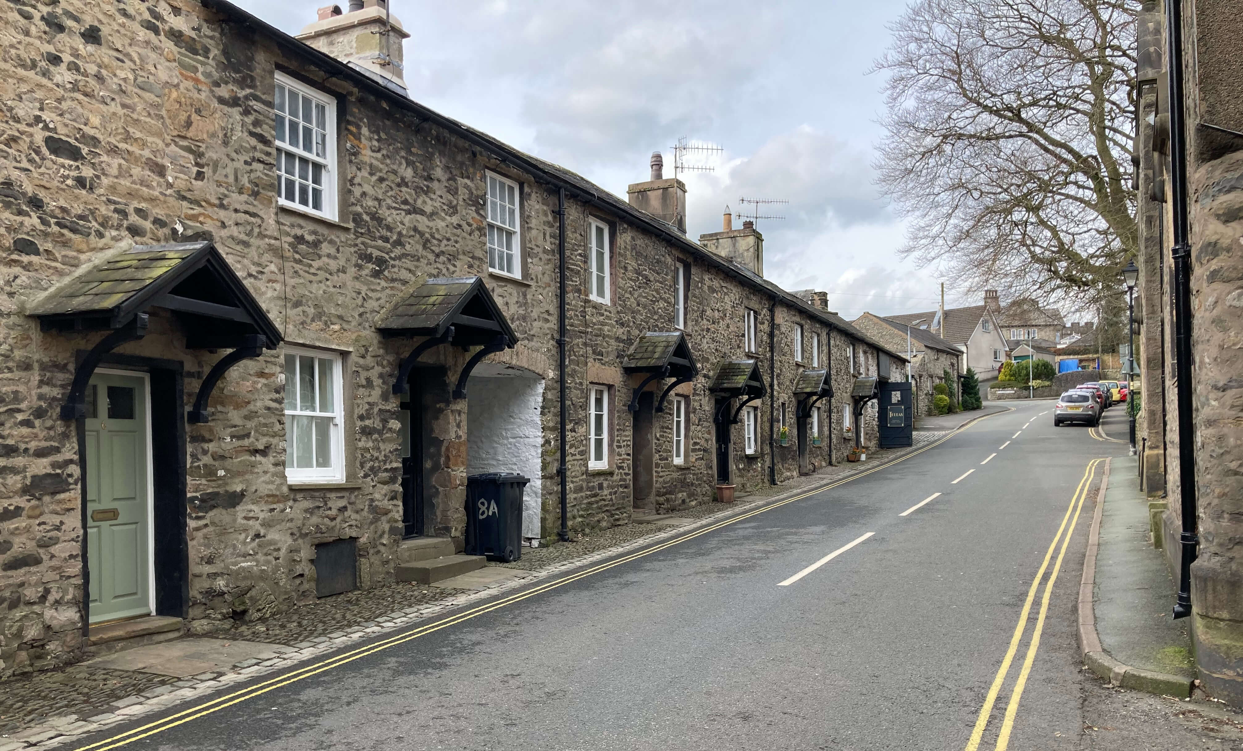
Left: Fairbank; Right:
Swine Market.
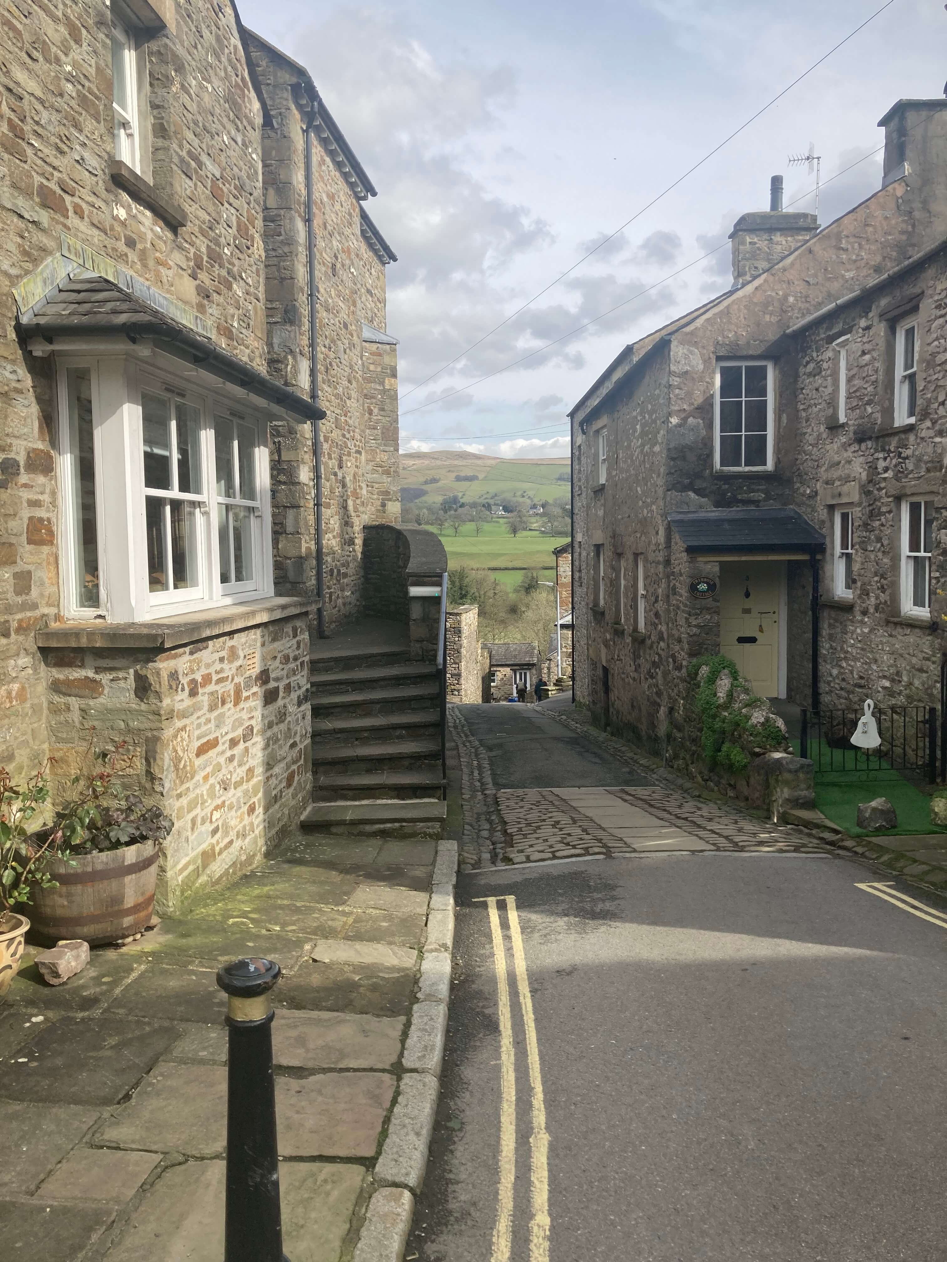
Left: Mill Brow; Middle: Salt Pie Lane; Right: Main Street.
Clearly, Kirkby Lonsdale has a lot going for it – a delightful stretch of the river, a magnificent
old bridge, an interesting church, some grand old limestone buildings, and a somewhat trendy
shopping area – but it is lacking in people. I don’t mean present-day people but people who
were born in, or just lived in, Kirkby Lonsdale and who have contributed significantly to the
nation. I saw no plaques, statues or dedications celebrating a person of distinction. You’d
think that generations over a thousand years would have produced somebody we’ve heard of – say,
an entertainer, a politician, a scientist, a sportsman, a murderer. He or she doesn’t have to
be famous as all of them – just one field of celebrity would suffice.
In case you think me unkind to Kirkby Lonsdale here is trusty Wikipedia’s list of
eminent people born in Kirkby Lonsdale: Robert Batty (physician), Jonathan Crowther (crossword
compiler), Arthur Llewellyn Davies (barrister), Jimmy Dodd (rugby player), Kate Ford (actress),
Gordon Garlick (cricketer), Edward North (politician), Richmond Palmer (barrister), and
Humphrey Procter-Gregg (composer). Have you heard of any of them? My favourite is
Kate Ford, who won the British Soap Award for Best Bitch in 2005. I bet Kirkby Lonsdale
doesn’t put that on a plaque.
Date: March 16th 2024
Start: SD609785, Kirkby Lonsdale bus stop (Map: OL2)
Route: (linear) N, E on New Road – Market Square – E on Jingling Lane, SE,
S – Stanley Bridge on A65 – N on A683, W – Devil’s Bridge – N, NW by River Lune – Radical Steps –
E – church – in all directions on back lanes – Market Square bus stop
Distance: 3 miles; Ascent: 50 metres
Note added a few days later: The walk was not misguided, as I feared it might be.
It did my back
no harm. I'm progressing step-by-step, if not in leaps and bounds.
Home
Preamble
Index
Areas
Hills
Lakes
Dales
References
Me
© John Self, 2018-

Top photo: The western Howgills from Dillicar;
Bottom photo: Blencathra from Great Mell Fell