
Home
Preamble
Index
Areas
Map
References
Me
Drakkar
Saunterings: Walking in North-West England
Saunterings is a set of reflections based upon walks around the counties of Cumbria, Lancashire and
North Yorkshire in North-West England
(as defined in the Preamble).
Here is a list of all Saunterings so far.
If you'd like to give a comment, correction or update (all are very welcome) or to
be notified by email when a new item is posted - please send an email to johnselfdrakkar@gmail.com.
148. The Man on the Clapham Omnibus ...
... is an ordinary, respectable man (it is a British legal term to that effect). On Tuesday he was me ľ
although my bus wasnĺt very omni. I was the only person on it for most of the way, apart from the
driver, of course. After a grey December, the first sign of sunshine in the weather forecast had
encouraged me to hop on the bus to the Yorkshire Dales. I aimed to take a low-level walk along
the southern border of the Dales between Clapham and Settle, which is a walk roughly along the
line of the Craven Faults that separate the limestone hills of the Dales from the younger millstone
grit moors of Bowland.
From the bus I watched as the promised sunshine appeared over the eastern horizon. I arrived in
Clapham to find it empty, for a change. I was tempted to dally there, exploring it without the usual
crowds, but I had far to walk. I headed through the Ingleborough Hall tunnels to reach Thwaite
Lane. This track is part of the ancient monastic road from Fountains Abbey to its estates in Cumbria.
The road ran along Mastiles Lane past Malham, through Settle, along this track, and on to Ingleton.
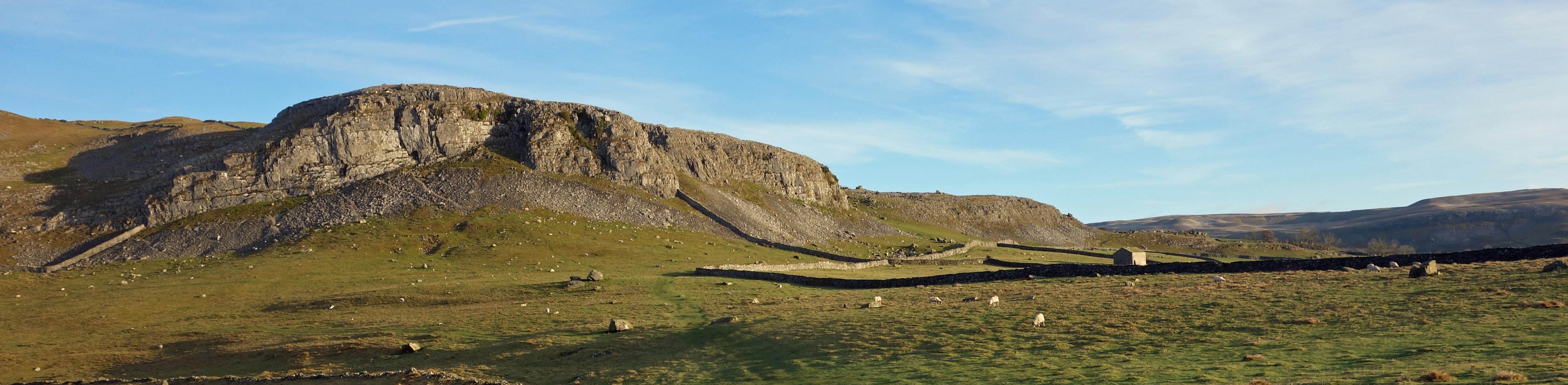
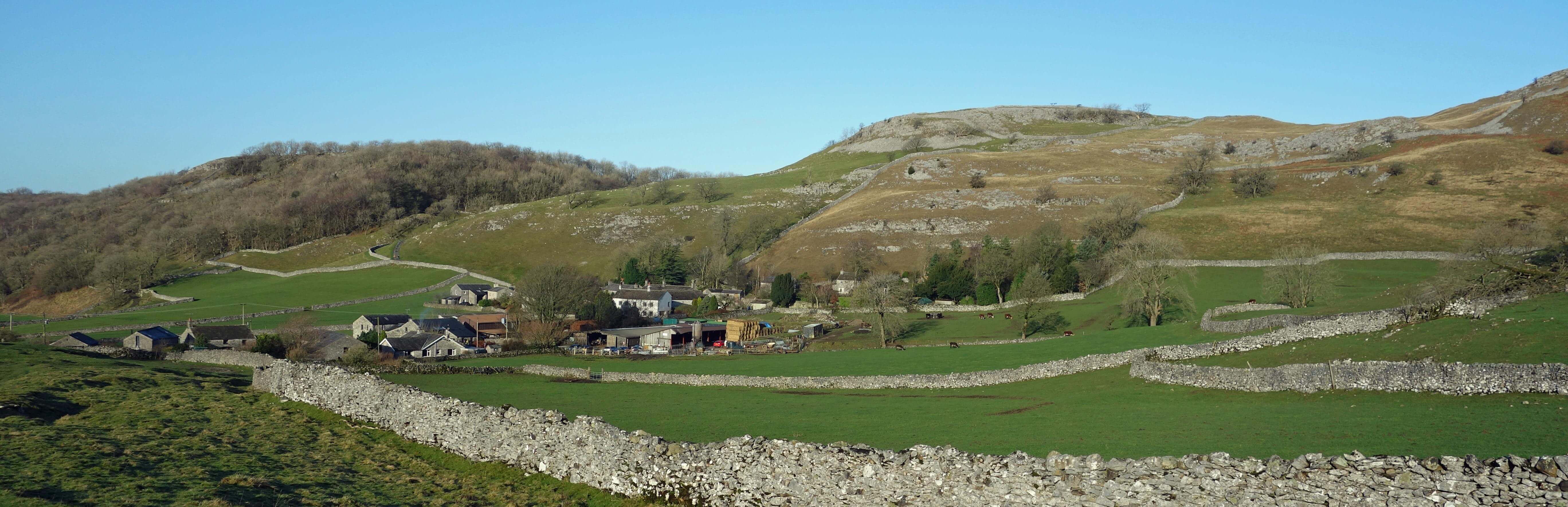
Robin Proctor's Scar and Nappa Scars from Thwaite Lane
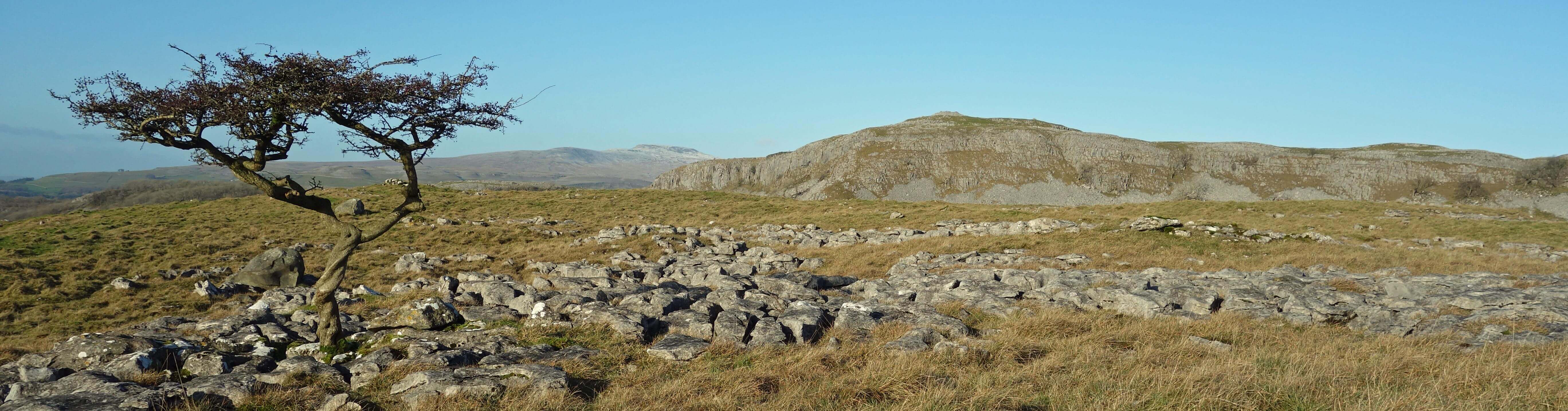
After a mile I left the track to walk across fields to the limestone crags of Nappa Scars and then
on to Norber Brow. Here are the famous
Norber Erratics,
surely the most impressive accumulation of
erratics in the country. Hundreds of huge grey boulders lay scattered over the limestone fields,
some perched on pedestals. Glaciers moved them here from further up Crummackdale and subsequent
erosion of the limestone not under the boulders has created the pedestals. Recently one of the most
iconic pedestalled boulders has toppled ľ or rather has been toppled.
A paper in Cave and Karst Science (which can be found by googling "demise of a Norber boulder")
considers it very likely that someone used a crow-bar to topple it. Why would anyone do that?
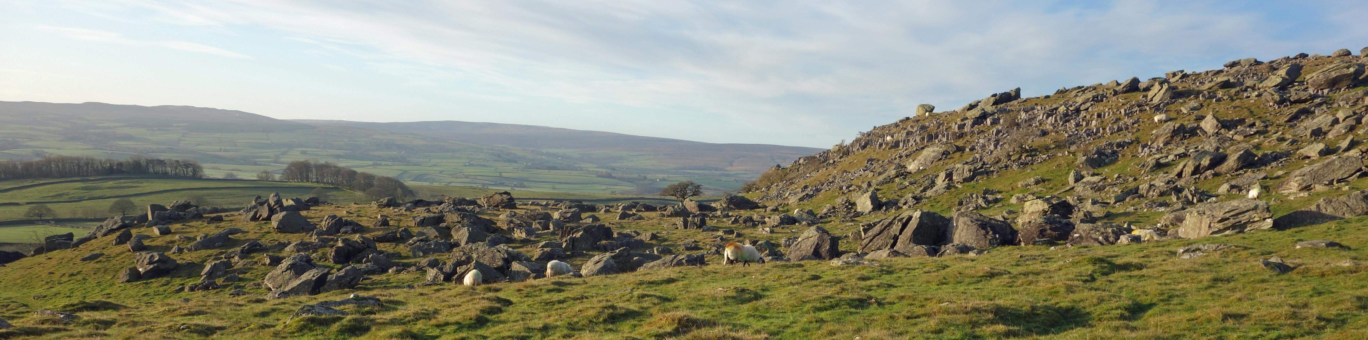
A few of the Norber Erratics
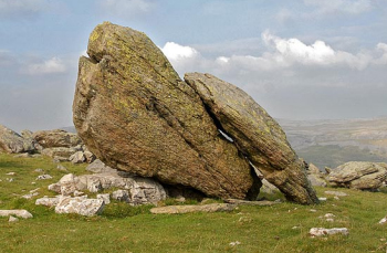
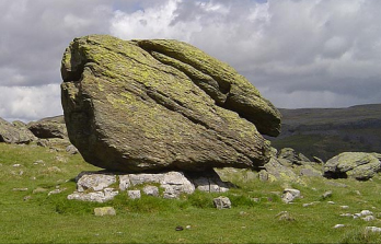 Right: The toppled erratic (before and after), from the Cave and Karst Science paper.
Among our Christmas messages there was a comment that said ôthanks for all your Saunterings during the
year ľ each one has lifted my heart and sustains me in my enthusiasm for this beautiful world!ö That
is, of course, cheering to hear but I have to say that it has not been my aim to present North-West England as
beautiful. As I said in the Preamble, I had the vague aim of giving
a balanced impression of the
region by visiting places within it more or less at random. The pandemic rather put the kibosh on that.
Nevertheless, I have written about things that would fit under a Ĺwarts and allĺ category:
Ľ scruffiness around Thieveley Pike (34);
squalor between Heysham and Overton (123);
a rubbish tip in Dentdale (135).
Ľ walks that I wouldnĺt recommend to anybody ľ
along the A682 (66);
from Skitham to Nateby (103);
on the northern outskirts of Preston (138).
Ľ regions that are attractive only because of questionable practices ľ
'sheep-wrecked' hills denuded of vegetation (17);
grouse moors that are ecological deserts (99).
Ľ the loss of wildlife ľ
eels (4),
hen harriers (59),
salmon (66),
belted beauties (76),
cuckoos (91).
Ľ re-wilding projects, which all implicitly acknowledge that weĺve made
such a mess of our world that we should try to repair it ľ
re-foresting the Howgills (38);
re-meandering the Lyvennet (97);
re-naturalising the Long Preston Deeps (145).
Ľ policies that may harm our environment ľ
zip-wires in the Lake District (3);
green lane policies (60);
a 'garden village' near Lancaster (136);
firing ranges (142);
climate change (146).
If, despite all this, the region seems beautiful then we must not forget that
there are still many things to be concerned about.
Which includes vandalism of the Norber Erratics.
But we mustnĺt focus only on the negatives or weĺd never get out of bed in the morning. I passed
a man walking his dogs who said ôGrand day!ö as is the custom hereabouts, at least when it is a grand
day, as it was. The becks were full to the brim with rushing, sparkling water, fresh from the overnight rain.
I walked along Wood Lane and Hale Lane, narrow, probably ancient, tracks between stone walls, to reach
the hamlet of Feizor. Here I was surprised to find the cafÚ not only open but busy for a Tuesday morning in January.
I had passed this cafÚ in 2008 or so, shortly after it had opened. At that time I thought it an overly
ambitious venture, since Feizor was tucked away up a cul-de-sac. Clearly, I was wrong.
Feizor
From Feizor I headed south-east and cut across the knobbly limestone of Feizor Thwaite, heading for
Smearsett Scar. I had read that it provides the best view of Pen-y-ghent. However, Smearsett Scar
seemed unnecessarily high (itĺs only 363 metres, in fact) considering that I had an adequate view of
Pen-y-ghent from the knoll to its east. Actually, I donĺt think this is the best view of Pen-y-ghent.
From here it appears as a rather distant, rounded hump, without the cliffs seen from other viewpoints.
Pot Scar, with Ingleborough in the distance, from Feizor Thwaite
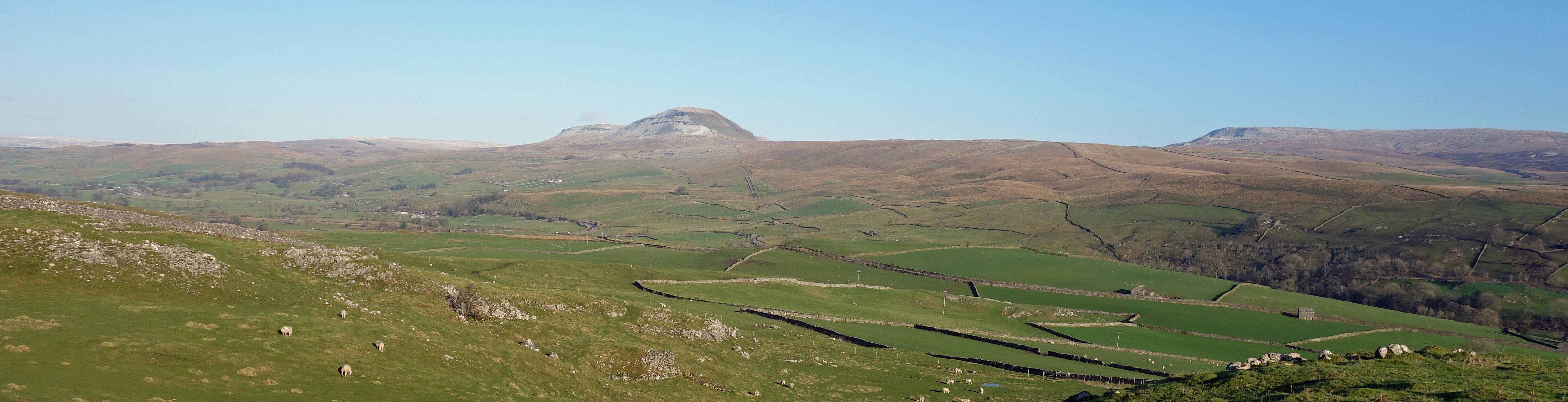
Pen-y-ghent and Fountains Fell from the knoll near Smearsett Scar
Looking from the knoll in the opposite direction, to the south, I could see on the horizon the dark
outline of the enigmatic so-called Celtic Wall. I walked to it. It is a solid wall, over a metre
thick and not much higher, but it is only twenty metres long. As far as Iĺm aware, the age and
function of this wall is not known, a circumstance that seems to bother some people. It doesnĺt
bother me much ľ there are many other things Iĺd prefer to know the reason for. For example, why someone
took a crow-bar to the Norber Erratics, but I mustnĺt start on that again.
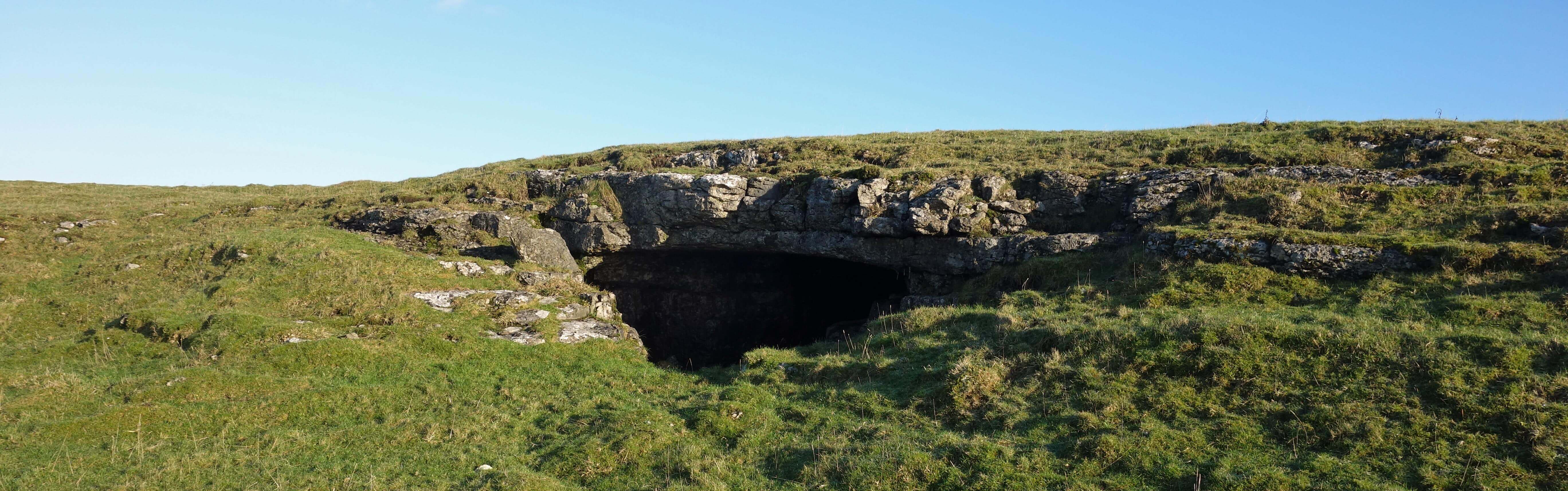
Left: The Celtic Wall; Right:
Dead Man's Cave.
I continued south and came upon Dead Manĺs Cave. I wasnĺt really looking for it. Searching for caves
marked on the map is often a futile exercise, for me. I wandered a little way into the cave. There
was no body there.
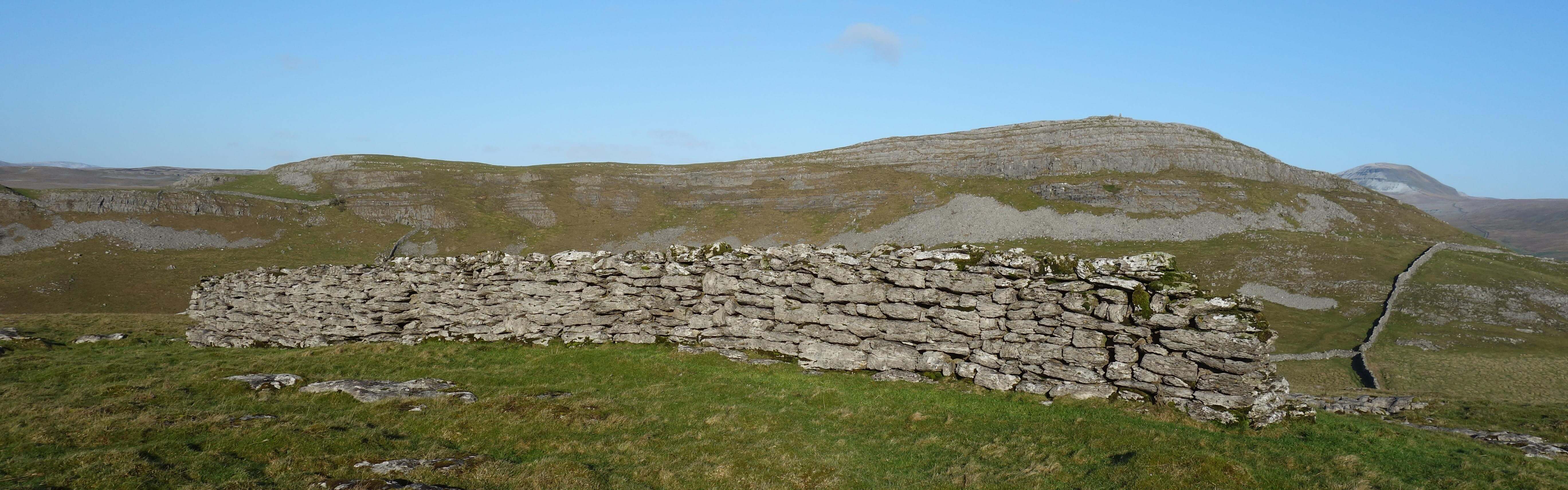
Further on I came to the edge of Giggleswick Scar and walked along its rim to Settle. The
scar itself is rather less impressive from the rim than it is from below but it was a good path and
there were fine views over
to the Bowland hills, softened a little by the hazy moisture in the air. Pendle, for example, was
just a light grey outline. The path skirted the huge crater of Giggleswick Quarry, which closed a
dozen years ago. I understand that the old quarry has been bought to develop into an Ĺindustrial
facilityĺ but I could see no sign of such activity within the crater.
I returned on the Settle omnibus, with the sun setting over Morecambe Bay and lending a diffuse
orange glow to the gathering valley mists.
Date: January 4th 2022
Start: SD745691, Clapham (Maps: OL2, OL41)
Route: (linear) N, E on Thwaite Lane, NE ľ Norber Brow ľ S across Norber Sike, E, SE, NE ľ
Silloth House ľ E, S on Wood Lane, E on Hale Lane ľ Feizor ľ SE, NE over Feizor Thwaite ľ near Smearsett
Scar ľ S past Dead Manĺs Cave, SE, S ľ Giggleswick Scar ľ E, SE ľ Settle
Distance: 9 miles; Ascent: 75 metres
Home
Preamble
Index
Areas
Map
References
Me
Drakkar
ę John Self, Drakkar Press, 2018-

Top photo: The western Howgills from Dillicar;
Bottom photo: Blencathra from Great Mell Fell