
Home
Preamble
Index
Areas
Dales
Hills
Lakes
Places
Reserves
Rivers
Structures
Villages
References
Me
Saunterings: Walking in North-West England
Saunterings is a set of reflections based upon walks around the counties of Cumbria, Lancashire and
North Yorkshire in North-West England
(as defined in the Preamble).
Here is a list of all Saunterings so far.
If you'd like to give a comment, correction or update (all are very welcome) or to
be notified by email when a new item is posted - please send an email to johnselfdrakkar@gmail.com.
157. The Preesall Salt of the Earth
The Preesall region is not the most dramatic in North-West England but it has hosted one of the
most surprising of our past industries – and may soon host one of the most surprising new ones too.
I walked around the site of both on this outing.
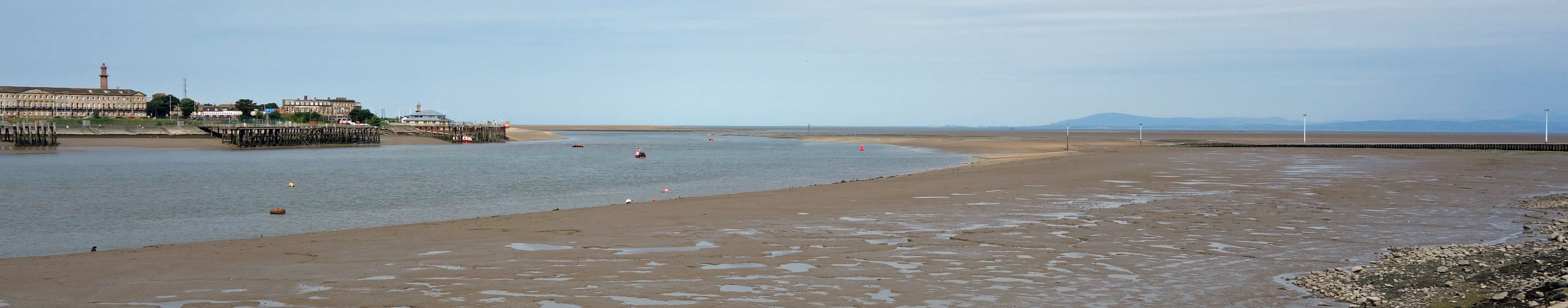
The Wyre estuary, at low tide, with Fleetwood to the left,
the Knott End jetty to the right,
and a distant Black Combe in the middle
I set off south from Knott End on the Wyre Way, which led me inland through a golf course
and past Hackensall Hall, which has many ornate chimneys and also many large derelict barns.
After a mile or so I reached the salt marshes of Barnaby’s Sands.
Salt marshes begin to form above bare mud flats that are inundated by every incoming tide.
Various pioneering salt-tolerant plants first gain a root-hold in the soft mud and the establishment
of a stable base then aids further growth and the accretion of sediment, with the marsh continuing
to grow upwards and outwards. Over time, as the marsh rises, it becomes less swamped by tides,
enabling other plants to colonise the surface. The result is a flat region of dull, muddy green
vegetation, deeply fissured with
winding salty creeks, as at Barnaby’s Sands (where
there are now no sands), forming here the largest area of ungrazed salt marsh in North-West England.
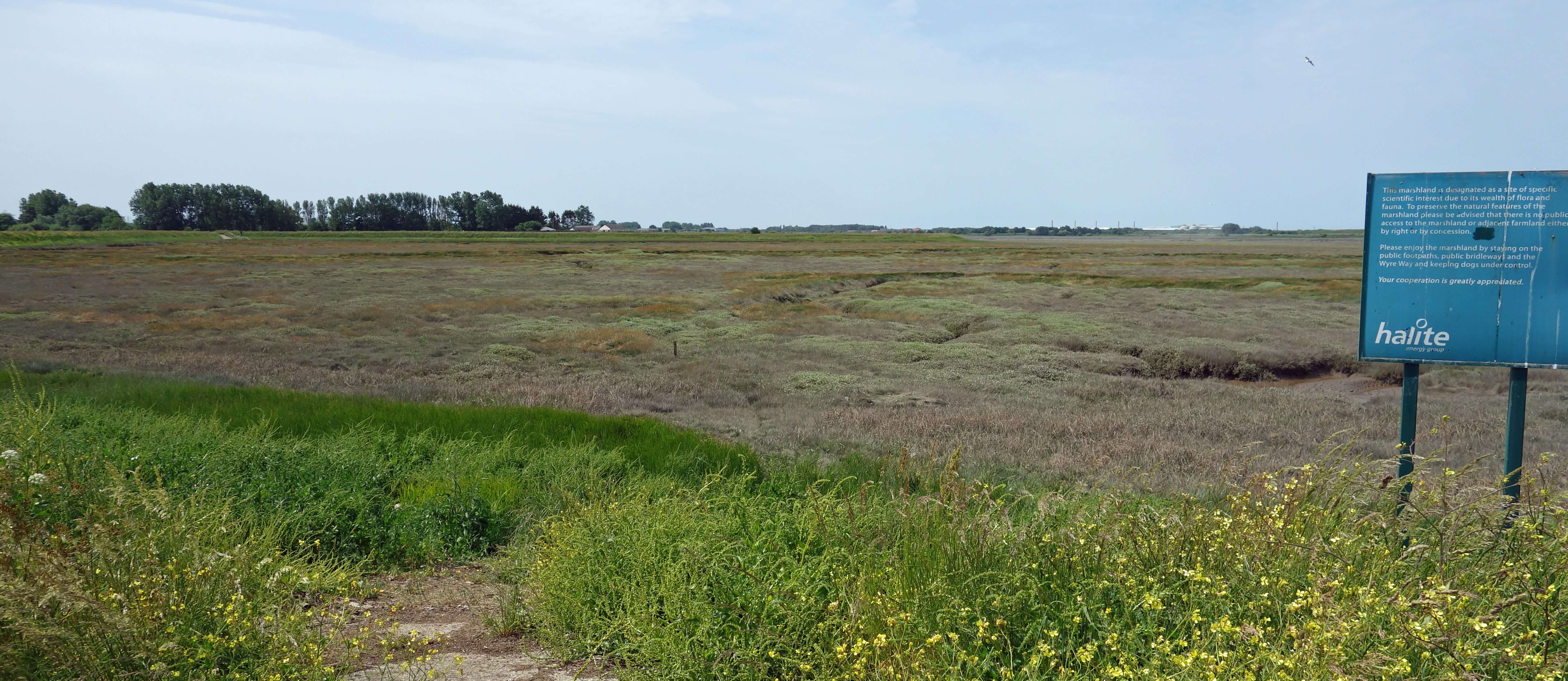 Right: Barnaby's Sands.
Large signs informed me that nobody is allowed to walk on Barnaby’s Sands, nor on
Burrows Marsh further on. Not that I was tempted, as they looked a maze of muddy creeks
from which one might not be able to extricate oneself. The most interesting thing about
these signs was the signature at the bottom: “Halite Energy Group”. In the previous Sauntering
I added several “Why”s in order to pause the narrative and prompt a reader to reflect on
why something is as it is. Here, too, we might ask: Why is an energy company and not,
say, Natural England, telling us to help the wildlife by keeping out?
I continued on the Wyre Way on the levee to the east of the salt marshes
and with flat, or at most gently undulating, fields of grass and maize inland. Disappointingly
for a Wyre Way, I had not seen the River Wyre since I left it to walk through the golf course,
unless you count the creeks of the salt marshes. Leaving Burrows Marsh and walking up Burrow’s
Lane (the map has an apostrophe for the latter) I reached a height of 23 metres, the highest point
of the walk, and found a gap in the hedge to survey the Wyre, at last. There wasn’t much of it to
see – the tide was out and there has been little rain to water the river.
 Left: A glimpse of the distant River Wyre from the Wyre Way.
At the hamlet of Staynall I felt that I had seen enough of the Wyre Way for now and
headed inland to walk back north along High Gate Lane and Back Lane. These are nondescript
lanes with nondescript fields both sides, so I won’t attempt to describe them. Further on,
as I neared Preesall, I noticed that many fields had signs saying “Private property. Keep
out” (again, I had not been tempted to enter them). Some of the signs added “This Area is
Liable to Subsidence”. Time for another ‘Why?’ Why should these ordinary-looking, virtually
flat, green fields be liable to subsidence?
I turned west to walk past several large unnamed ponds. They could easily be passed
without provoking any thought but the history of these ponds begins to answer our questions.
In 1872 engineers drilled in these fields hoping to find iron ore deposits, as had recently been
found around Barrow on the opposite side of Morecambe Bay.
They didn’t find iron ore but they did find, at about 100 metres down, a
layer of about 100 metres of salt. So they began to dig mines to extract it, with the Fleetwood Salt Company being
formed in 1883.
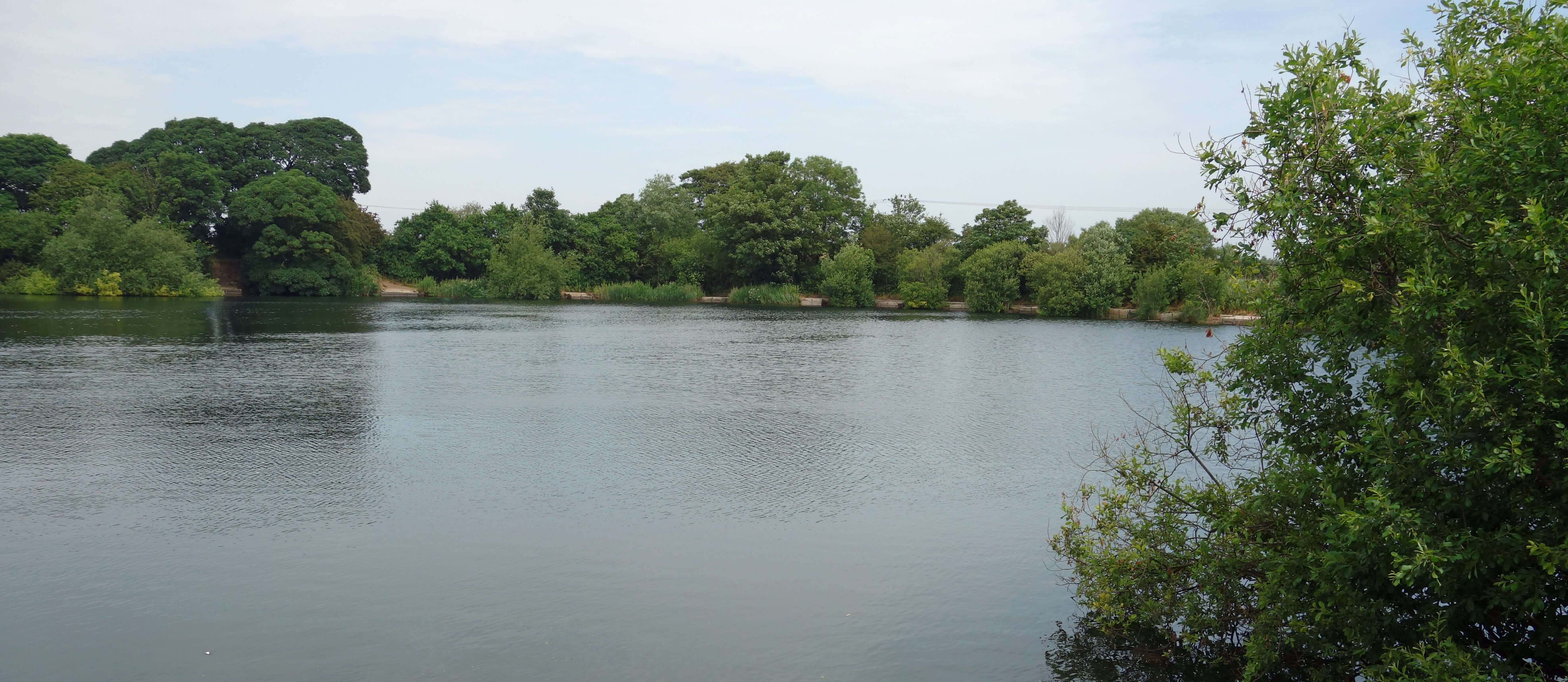 Right: A pond near Preesall.
Details of the Preesall salt industry are given at
this website and I have stolen some of them
for the brief summary here. By 1906 the mine was producing 140,000 tons of rock salt per annum
and steamers were being loaded at a new Preesall jetty on the Wyre, served by
railway trucks on a rail line direct from the mine (I had crossed this old rail
line on the Wyre Way – it’s just a track now). The Times of that year commented that
“A descent
into the Preesall pit is an experience of unusual interest. Though the mining operations have
only been conducted for a dozen years, the weird, lofty, cavernous vaults formed by the excavation
of over a million tons of salt are sufficiently impressive … to bewilder the spectator who visits
them for the first time”.
However, there had already been warning signs. Subsidence in 1890 and 1891 had led the
Fleetwood Chronicle to comment that
“no doubt the good people of Preesall will in time come to
regard the collapse of a field or two with supreme indifference.”
The basic difficulty with salt
mines is that salt dissolves in water and if water is allowed to leak into the mine or is used to
pump the salt out then the salt pillars that are left to support the roofs are liable to weaken.
In 1923 the Chronicle reported on a huge subsidence of 100 metres diameter from which
“there come
sounds as of the rushing of a subterranean cataract, then a rumble rising to the roar of thunder.
The roar has been heard at Pilling four miles away … Many persons were awakened in the small hours
of Sunday morning by bedsteads quivering beneath them. Far from any signs of becoming filled up,
the hole seems to be getting bigger … ”
Somehow, despite further subsidence, the mine limped on until abandoned in 1931. I noticed
that the angling club that now uses the ponds calls itself Alkali A.C. From the ponds I walked north
to the footpath that runs along the line of the old
Garstang & Knott End railway. The section
between Pilling and Knott End only ran between 1908 and 1950 and for a time was used to transport the
Preesall salt. There still seems to be a local fondness for this old railway, known as the Pilling
Pig, although it disappeared decades ago. I suppose the sight of this train chugging across these
flat, dull fields must have added a touch of excitement.
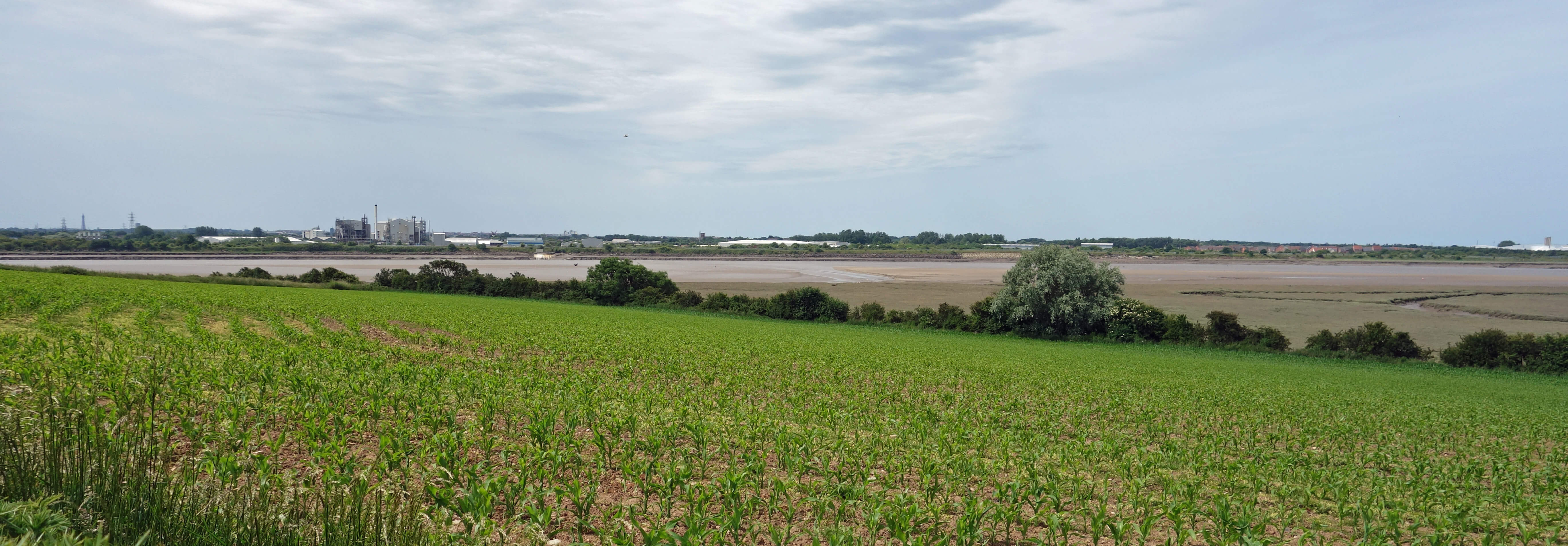
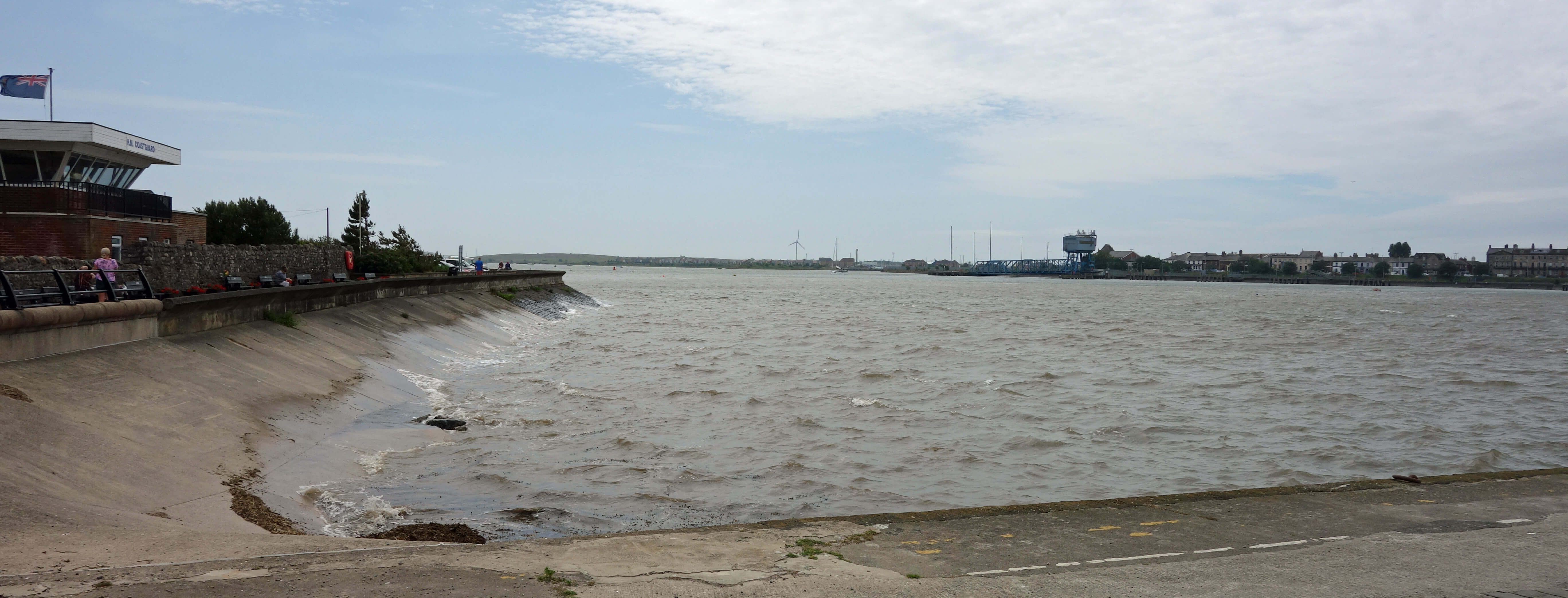 Left: The Wyre estuary with the tide now in.
From there I walked back along the Knott End-on-Sea sea front, with the tide now well in.
Most of the time it’s more of a marsh front. I don’t think Knott End was ever much of a resort.
Today few of the buildings overlooking the bay seem to be catering for visitors. There were a few
people wandering about near the ferry but there were more of them in the café, which seems to be the
only thing for them to do.
We mustn't forget the Halite Energy Group. This company has a proposal to use the site
of the old salt mines – perhaps even to use remaining old caverns and no doubt to build more – in order
to store vast quantities of gas (900 million cubic metres), as part of the nation’s programme to
better manage its energy reserves. This proposal has been rejected and accepted multiple times
in recent years. I don’t know if it’s in a state of rejection or acceptance at the moment (the
latest document
I could find on-line says that the Preesall Saltfield Underground Gas Storage facility
has been approved). I didn’t see any sign of on-going work to build such a facility. I presume
that Halite owns all the land, in case they ever get to work on the project.
Needless to say, local residents are not happy at the prospect of living above a huge
gas-holder. Especially when there’s also the prospect of fracking being revived not many miles
away to send earthquakes through the ground.
That could set the bedsteads quivering again.
Seriously, though, if we need to
contemplate fracking earthquakes and underground gas-holders
to sustain our way of life then
we’ve lost the plot, haven’t we?
Date: June 17th 2022
Start: SD346485, Knott End ferry (Map: 296)
Route: S on Wyre Way – Staynall – E, N on High Gate Lane, Back Lane, NW
through Curwens Hill, E on old railway line, N – coast – W – Knott End ferry
Distance: 8 miles; Ascent: 20 metres
Home
Preamble
Index
Areas
Dales
Hills
Lakes
Places
Reserves
Rivers
Structures
Villages
References
Me
© John Self, 2018-

Top photo: The western Howgills from Dillicar;
Bottom photo: Blencathra from Great Mell Fell