
Home
Preamble
Index
Areas
Dales
Hills
Lakes
Places
Reserves
Rivers
Structures
Villages
References
Me
Saunterings: Walking in North-West England
Saunterings is a set of reflections based upon walks around the counties of Cumbria, Lancashire and
North Yorkshire in North-West England
(as defined in the Preamble).
Here is a list of all Saunterings so far.
Guaranteed ad-free, AI-free and free!
If you'd like to give a comment, correction or update (all are very welcome) or to
be notified by email when a new item is posted - please send an email to johnselfdrakkar@gmail.com.
249. Up Summersgill Fell With and Without Permission
 There are many permissive paths but nobody knows where they are. There is no
publicly-accessible catalogue of permissive paths and they are not usually
shown on official maps. The reason for this is that their most important
property – at least for walkers – is that permission may be withdrawn at
any moment for any reason. Therefore, even if a walker knows of a permissive
path they cannot plan a walk that relies on the path’s continued existence.
There are many permissive paths but nobody knows where they are. There is no
publicly-accessible catalogue of permissive paths and they are not usually
shown on official maps. The reason for this is that their most important
property – at least for walkers – is that permission may be withdrawn at
any moment for any reason. Therefore, even if a walker knows of a permissive
path they cannot plan a walk that relies on the path’s continued existence.
Nevertheless, I set off from a parking space south of Lowgill, crossed
Stairend Bridge over the River Hindburn, passed Botton Mill, which bears a date of
1697, and looked out for a permissive path to the west. It was there twenty
years ago – would it still be there?
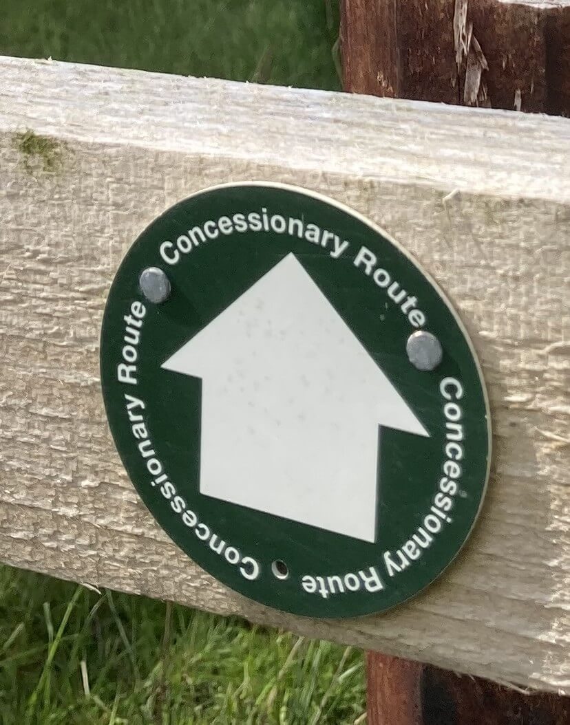
I nearly missed a little arrowed sign
with the words “Concessionary Route”, which I assume is the same as a permissive
path. Usually, at the beginning of a permissive path there is a map showing
you where you are permitted to walk. In the absence of a map, I anticipated
that there would be arrows to follow. I found one arrow over a footbridge but
no more. Either there were no more arrows or I was walking where I shouldn’t.
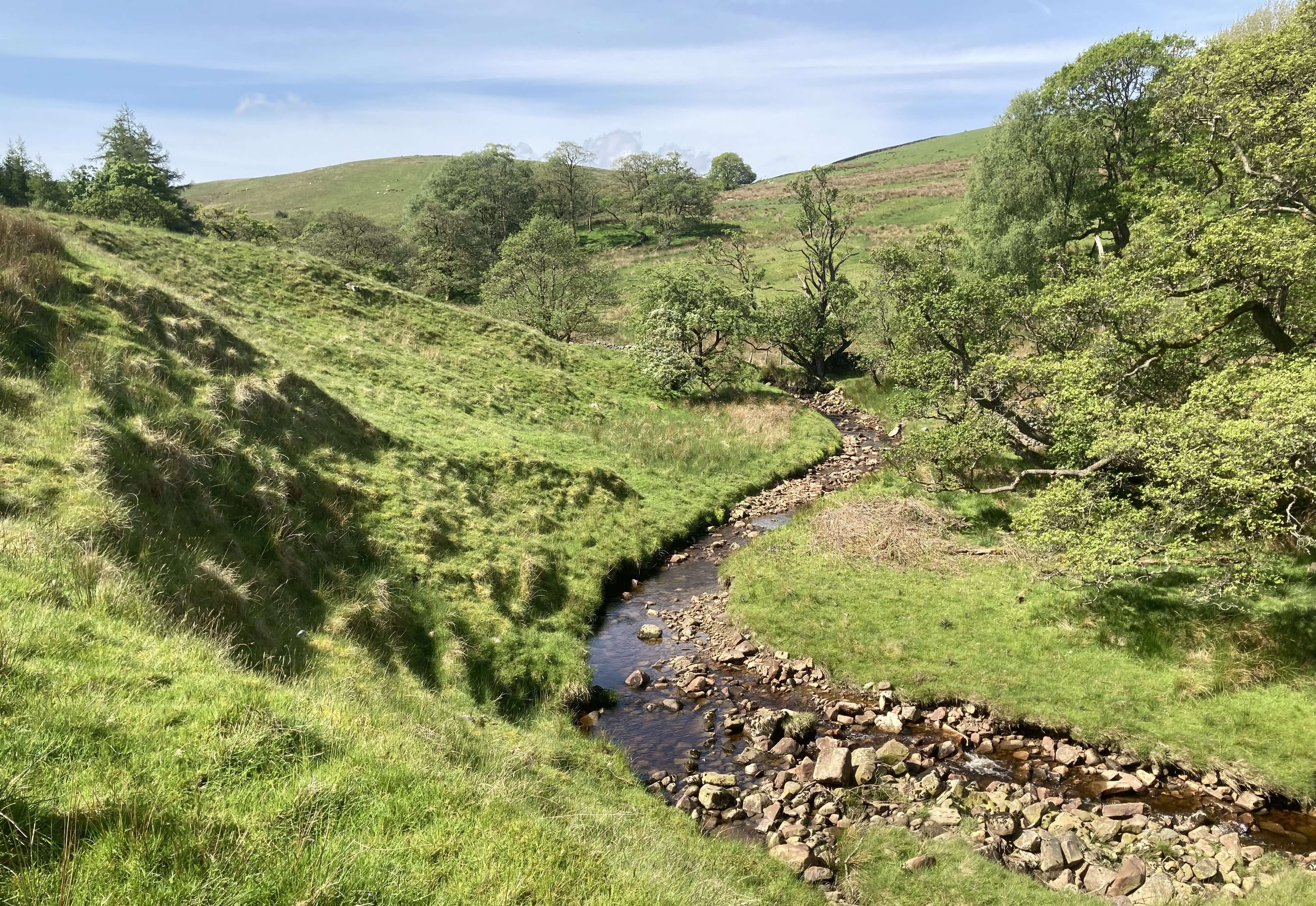
It was quite a pleasant walk, through open woodland by sparkling becks,
with a few patches of late bluebells. Many of the trees had nest-boxes. Some
time ago there was a project to add nest-boxes here specifically to help pied
flycatchers, a migratory bird whose numbers had dropped significantly. Perhaps
these are the same nest-boxes. I don’t know if the flycatchers have indeed been
helped. I didn’t spot any.
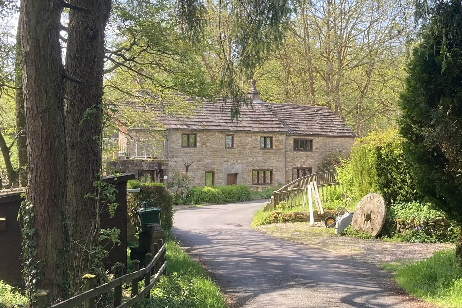
Left: Botton Mill; Right: Emerging from the woodland.
After a while I found myself on what must have been the wrong side
of a fence, because I was within the fringes of the Higher Thrushgill Plantation,
which was no pleasure to walk through. So I clambered over the fence, a beck and a wall
to reach an open field that was not marked as ‘open access’ but was, I could
only hope, on the permissive path (if it continued this far).
How does a permissive path come into being? I assume that it is at
the landowner’s initiative (I doubt that there is any body or anybody that
goes around trying to persuade landowners to allow a permissive path). Why
would a landowner want a permissive path? Perhaps it is a public-spirited
gesture or an attempt to maintain goodwill with locals. I suspect that it
is usually because a landowner becomes fed up with walkers wandering
willy-nilly about their land and decides to corral them into a specified
path, usually around the periphery of their land.
How is a permissive path ‘registered’? I don’t know but I guess that
the landowner informs the local authority (who would usually have no reason to
object) and perhaps that authority then takes on the responsibility of signage
and path maintenance (and may even pay the landowner for allowing the permissive
path).
What are the legal implications of establishing a permissive path? None
at all, as far as I can see. Permissive paths are not public rights of way,
that is, with a legally protected right of the public to pass. Landowners are
generally determined that a permissive path does not become a right of way.
To that end, they may close the path, at whim, for, say, a day a year so that
nobody can claim that they have walked the path every day for twenty years and
thereby argue that it should be deemed a right of way. Landowners are also
able to impose conditions on their permissive paths, such as no dogs or no
bikes (but I don’t know who enforces these conditions). Obviously, if the
conditions are ignored – by, for example, letting a dog loose to harass sheep –
then the landowner can simply withdraw permission.
Why are some (but only a few) permissive paths shown (in red-dotted
lines) on OS maps? I have no idea. Presumably the OS feels that the indicated paths
have some degree of permanence but even so there is no guarantee that they will
exist when a walker comes to walk them.
In North-West England most of the permissive paths that I come across
have a similar purpose. Much of our open access land lies on the high fells
and below that land there is generally pasture that is not open access.
Therefore, it is often the case that there is no way to walk to the open access
land without a long detour around to the sides of the fells. To prevent this
some permissive paths provide a direct way up a fell through pastures – and
very welcome they are.
The permissive path that I was on (and then off) is of this kind. It
enables access to the open moorland of Summersgill Fell, otherwise only reachable
after a long trek over surrounding moorland. As I climbed, views opened out of
distant hills, although it was a hot, hazy day. The bird-sound changed, from
woodland twittering to that of the moorland – some skylarks, a few curlew, a
distant buzzard and a single cuckoo. There weren’t, however, as many birds as
I expected. On that previous occasion here I was harangued by many nesting birds
but this time the few birds ignored me.
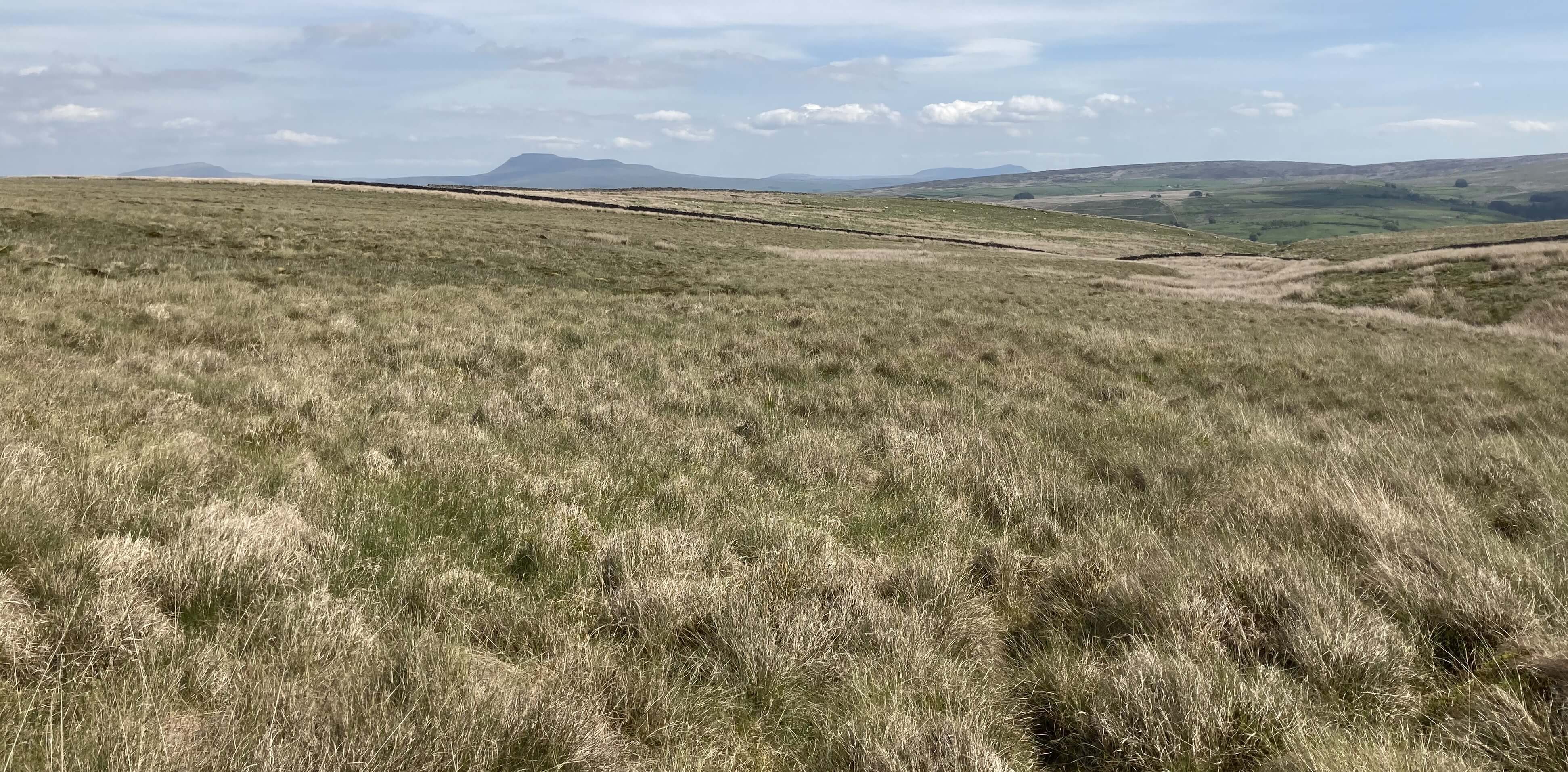
On Summersgill Fell, looking back to distant views of the Three Peaks
 I had to climb another wall (another indication that I was in the wrong place)
to reach the real, rough moorland. It was slow going. The hummocky
grass, with some surrounding squelchiness, prevented any rhythm in the
walking. I pressed slowly on, looking for the wall that the map
shows crossing the moor. I couldn’t find it. Perhaps it had been
removed? And then, after I’d given up looking for a wall, I
spotted some posts. They turned out to be part of a fence not easy
to see from a distance in this terrain, not the wall I expected.
I had to climb another wall (another indication that I was in the wrong place)
to reach the real, rough moorland. It was slow going. The hummocky
grass, with some surrounding squelchiness, prevented any rhythm in the
walking. I pressed slowly on, looking for the wall that the map
shows crossing the moor. I couldn’t find it. Perhaps it had been
removed? And then, after I’d given up looking for a wall, I
spotted some posts. They turned out to be part of a fence not easy
to see from a distance in this terrain, not the wall I expected.
Now I could relax (relatively) and follow, as best I could,
the fence north. There was nothing marked on the map and indeed
there was nothing of interest (to me, anyway) on the ground. The
solitary silence induced some introspection. The only thought on
my mind was: Why? Why was I walking here where hardly anybody
ever walks? Why was I walking where I would never recommend
anyone else to walk? Why was I flogging myself to exhaustion
across a dreary, pathless, wild emptiness?
Of course, Summersgill Fell is only dreary to those, like
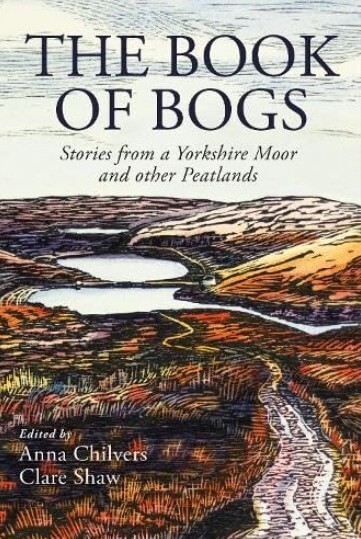
me, who can’t fully appreciate what they see. I’ve just been reading
The Book of Bogs (Chilvers and Shaw, 2025) in which one writer
is ecstatic to identify fifteen species of sphagnum moss on one walk.
However, I am not the only one uninspired by Summersgill Fell – for every walker here
there are thousands on Ingleborough. Perhaps this will change
with the increasing realisation that these peatlands are a vital but
endangered ecosystem, said to hold more carbon than all the world’s
forests combined.
My visit to Summersgill Fell was perhaps a subconscious
legacy of my original intention, expressed in the
Preamble in 2018, to not focus
on the ‘best bits’ but to sample areas in the North-West, somewhat
at random, to give a balanced impression of the region. It is
perhaps worthwhile to remind ourselves occasionally that although
we complain than in peak periods it is standing room only in the
Lake District it is still possible to find places of solitude. If
you stand at Grey Stone (a suitably unimaginative name) on
Summersgill Fell you can be sure that there will be nobody within a
mile of you. Moreover, you will see little to suggest that other
people exist – no buildings, no roads, nothing but moorland in all
directions.
I needed to get off the moor. I turned east at (what it says
on the map is) Jack’s Nook. I’ve no idea who Jack is or was, or
what’s Nooky about this spot. I walked across more moor and then
sheep fields, where the sheep indicated that I shouldn’t but I was
past caring. Perhaps the majestic sound of the curlew in its element
made it all worthwhile.
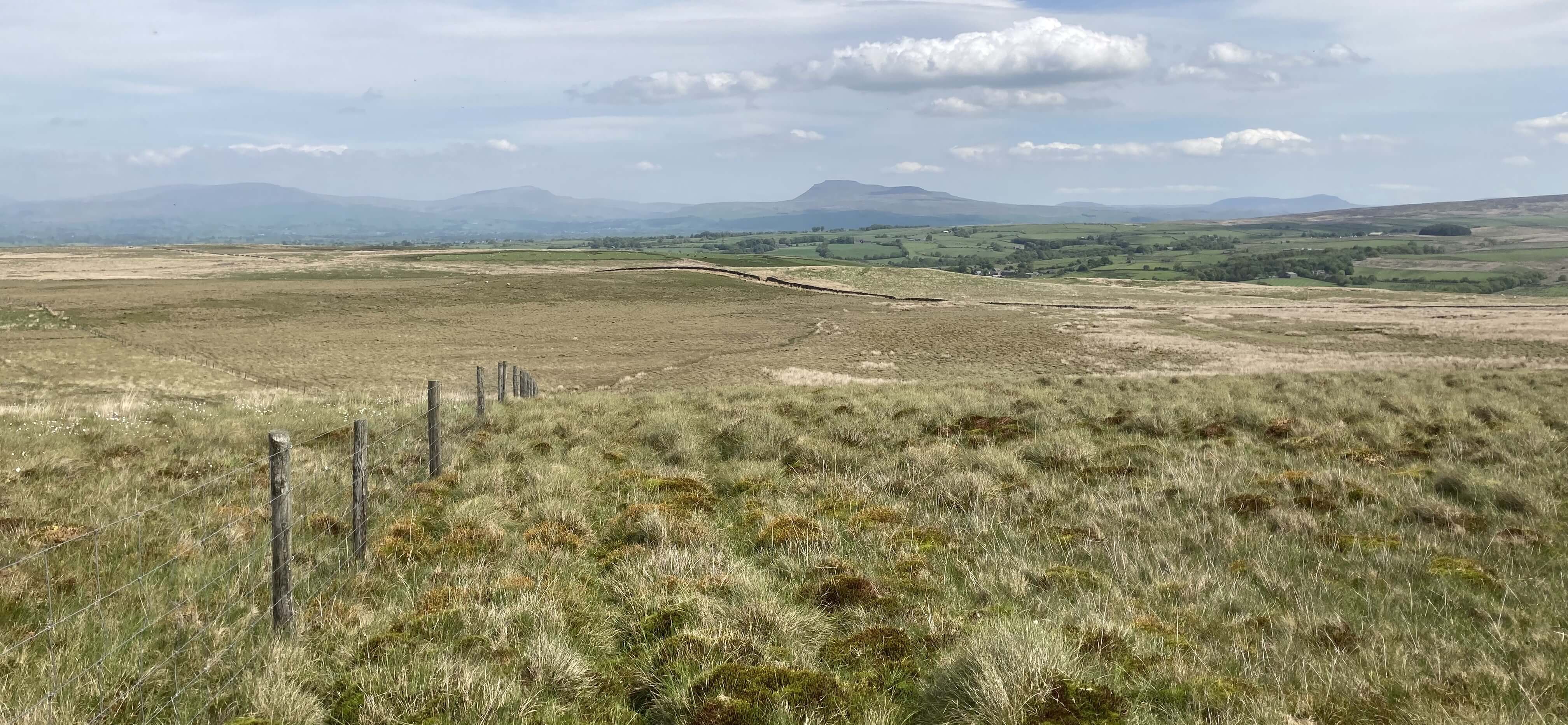
The fence to Jack's Nook, which is off to the left
Date: May 22nd 2026
Start: SD655640, corner above Stairend Bridge (Map: OL41)
Route: W, S – Botton Mill – S (for 200 yards), SW, W – Grey Stone – N –
Jack’s Nook – E – cattle grid – S, SE, N, E – parking place
Distance: 6 miles; Ascent: 210 metres
Home
Preamble
Index
Areas
Dales
Hills
Lakes
Places
Reserves
Rivers
Structures
Villages
References
Me
© John Self, 2018-

Top photo: Rainbow over Kisdon in Swaledale;
Bottom photo: Ullswater