Western Howgills

Home   Preamble   Index   Areas   Map   References   Me   Drakkar

Saunterings:  Walking in North-West England

Saunterings is a set of reflections based upon walks around the counties of Cumbria, Lancashire and North Yorkshire in North-West England (as defined in the Preamble). Here is a list of all Saunterings so far.
If you'd like to give a comment, correction or update (all are very welcome) or to be notified by email when a new item is posted - please send an email to johnselfdrakkar@gmail.com.

18.  Viewpoints around Keswick (part 1)

Keswick is the best place in North-West England for viewpoints, according to the Ordnance Survey. It uses its special viewpoint symbol 36 times on its maps of the region and four of those are within walking distance of Keswick. If you ran you could visit all four in a day. We settled for a walk along the eastern side of Derwent Water that would enable us to visit two of the OSVPs, as I will call them in order to distinguish them from run-of-the-mill viewpoints. They deserve an acronym after being honoured by the Ordnance Survey.
Walla Crag

Derwent Water, Keswick and Skiddaw from Walla Crag

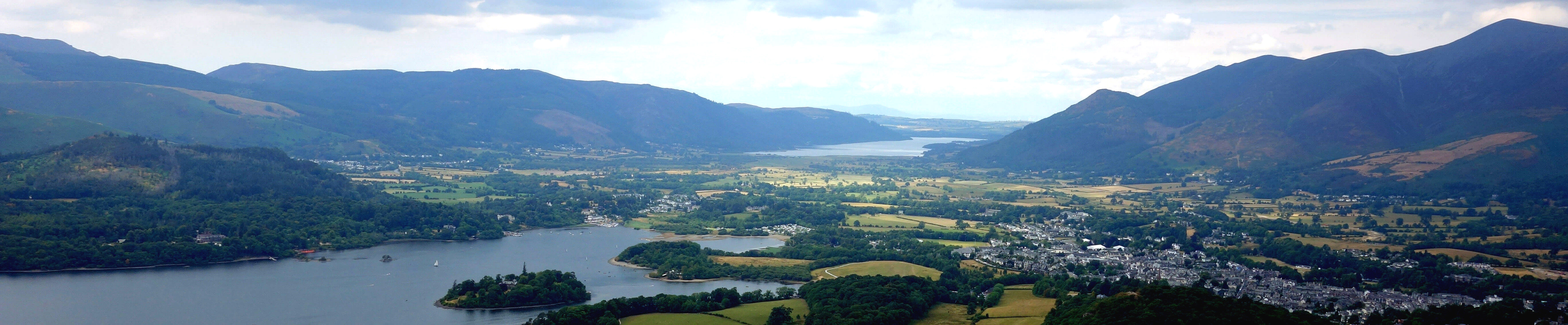
We first walked from Castlerigg Farm, past Rakefoot, to Walla Crag (379 metres). This airy perch provides a fine view of Derwent Water but not one that qualifies it as an OSVP. I don’t know what more the OS expects. There’s a view of Derwent Water directly below, with the islands arrayed and various water-craft idling about. We can look in any direction and see classic Lakeland peaks: to the north, Skiddaw and Blencathra; to the east, the Dodds and Helvellyn Lower Man; to the south, Scafell Pike and Great Gable; to the west, Robinson and Grisedale Pike. The various knobbly prominences of Borrowdale are also well seen, receding into the distance.
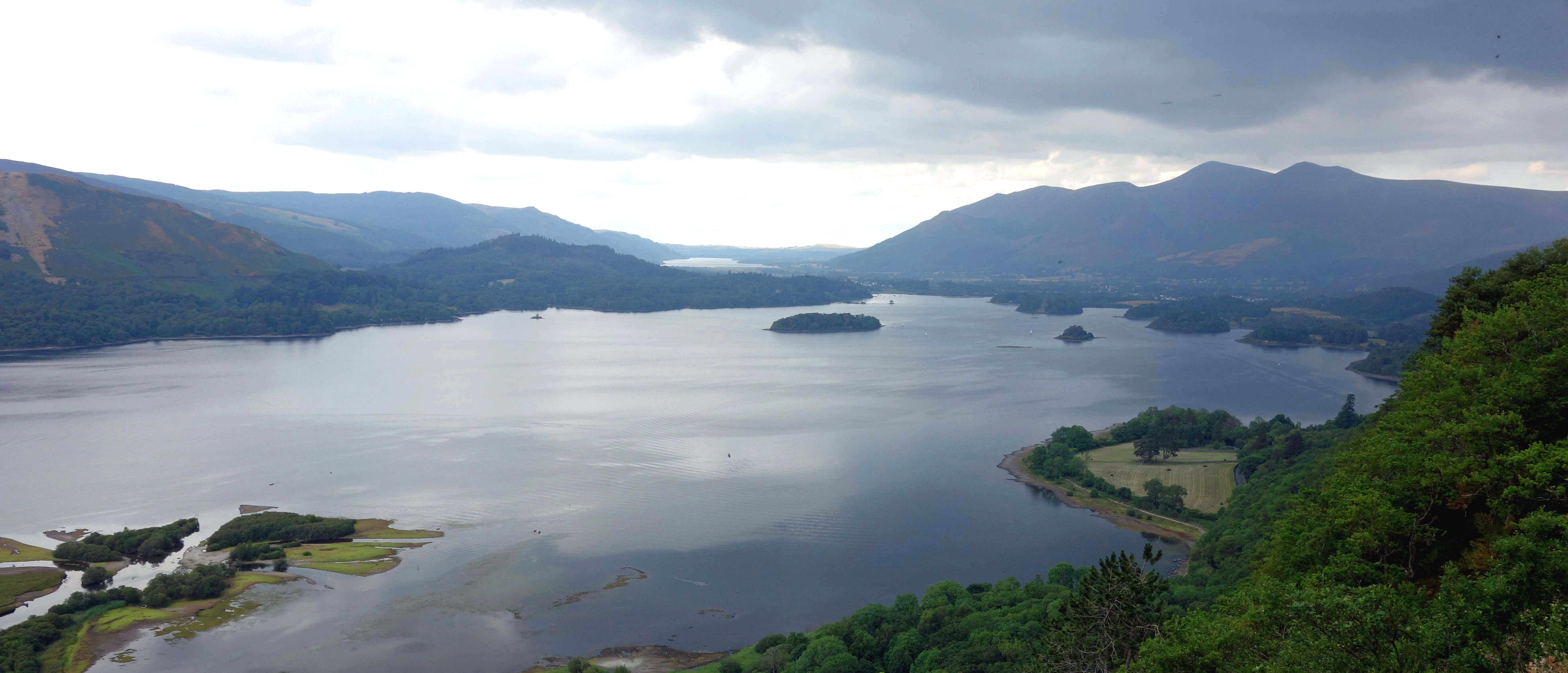
We continued south, with evolving viewpoints over Derwent Water, over the much-photographed Ashness Bridge, and on to the OSVP in Lodore Wood. This we found is called Surprise View. It’s like being told you’re to be given a surprise birthday party. It somewhat reduces the surprise. The view is as expected, steeply down to the higher reaches of Derwent Water, north to Bassenthwaite Lake and the Scottish hills in the distance, and south up Borrowdale. However, as the OS concedes, it is only half a viewpoint, to the west.
surprise view

The Surprise View

We returned to Ashness Bridge and walked below Falcon Crag, through the National Trust's Great Wood, the largest area of native broadleaf woodland in the Lake District, and dropped down to Calfclose Bay. On the picturesque pebble beach there's a sculpture, called the Centenary Stone, marking one hundred years of the National Trust. On the cleft surfaces of the split rock there's a design of ten rings in ten segments.
calfclose bay

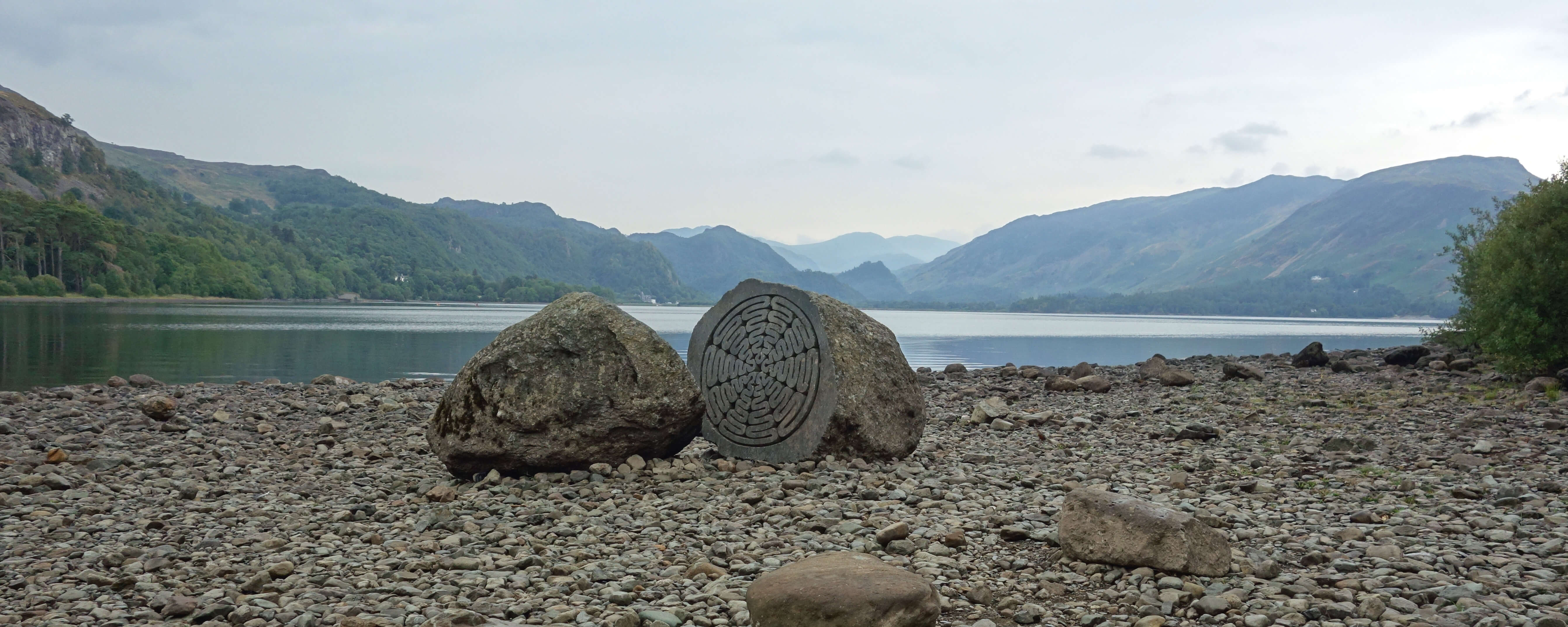
Calfclose Bay and Centenary Stone

Before proceeding to our second OSVP, we visited some of the 18th century equivalents of OSVPs. In 1778 Thomas West had in his guide to the Lake District described a set of ‘viewing stations’ (West, 1778). These stations were intended to tell tourists and artists the best places from which to view the picturesque beauty of the Lake District. As it happens, the list of viewing stations also indicates that Keswick provides the best base for visiting viewpoints. We could incorporate three of West's twenty-six stations into our walk alongside Derwent Water.

Our first station was at Stable Hills. However, the view is dominated by the nearby Lord’s Island. Perhaps in 1778 there was more of interest to see on the island than the trees of today. We continued through The Ings, trying not to step upon any of the many little brown frogs, past Friar’s Crag, which is itself a renowned viewpoint but neither an OSVP nor a viewing station, and up the gentle slope of Crow Park. This station provides, from its modest height of 90 metres, a grand view along the length of Derwent Water. We then walked through Cockshot Wood, the third of our viewing stations but now there is no view because of the trees that have grown since 1778.
Crow Park

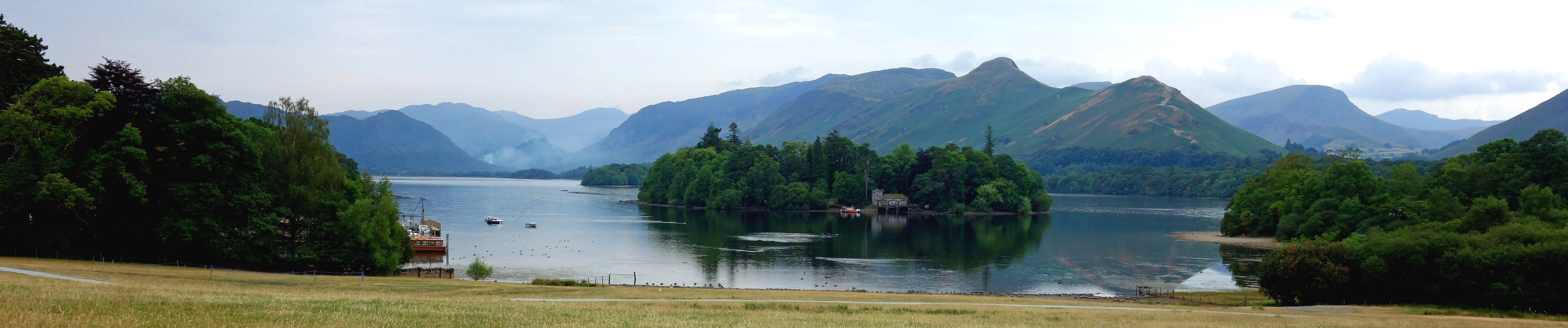
Derwent Water from Crow Park

We continued to our second OSVP, in Castlehead Wood. Unlike Surprise View, this is not an OSVP for motorists, that is, one where drivers may park, snap the view, and be on their way. Here there’s a short scramble to its top at 162 metres, sufficient to ensure that we had this top to ourselves, apart from a colony of flying ants. It is indeed an excellent view south, although sadly not north to Skiddaw, and we felt grateful to the OS for telling us it would be, because it is not obvious from below that a view is afforded from the top.
Castlehead Wood

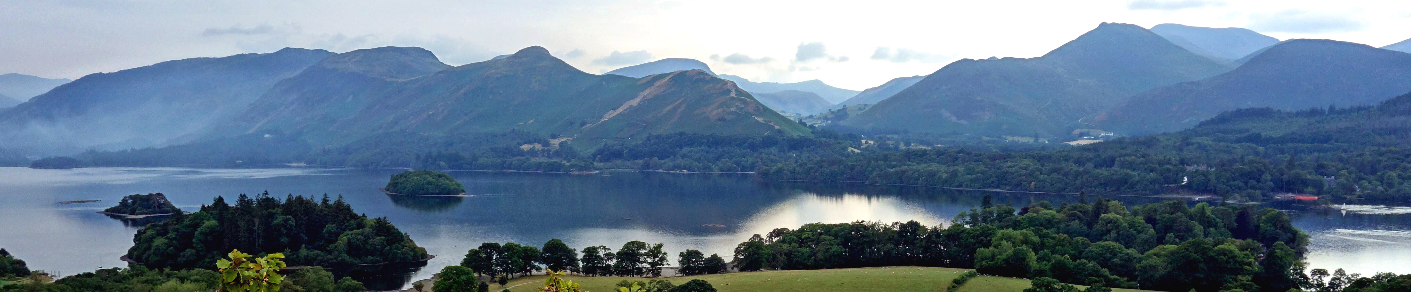
The view from Castlehead Wood

Continued in the next Sauntering.

    Date: July 12th 2018
    Start: NY283224, Castlerigg Hall camp-site  (Map: OL4)
    Route: S, SW – Walla Crag – S – Ashness Bridge, Lodore Wood – N – Ashness Bridge, Calfclose Bay – W, N – Stable Hills – N, W – Friar’s Crag – N, NW – Crow Park – SE through Cockshot Wood – E – Castlehead Wood – E through Springs Wood – Castlerigg Hall Farm
    Distance: 8 miles;   Ascent: 300 metres

The two following items:
     20.   On the Sunny Side of Pendle
     19.   Viewpoints around Keswick (part 2)
The two preceding items:
     17.   Sheep-Wrecked Matterdale?
     16.   The Wildflowers of Sulber
Two nearby items:
   143.   Two Days as a Lake District Tourist
   187.   From Glenridding to Pooley Bridge on the Ullswater Way
A list of all items so far:
             Saunterings

Home   Preamble   Index   Areas   Map   References   Me   Drakkar

    © John Self, Drakkar Press, 2018-

Blencathra

Top photo: The western Howgills from Dillicar; Bottom photo: Blencathra from Great Mell Fell