
Home
Preamble
Index
Areas
Dales
Hills
Lakes
Places
Reserves
Rivers
Structures
Villages
References
Me
Saunterings: Walking in North-West England
Saunterings is a set of reflections based upon walks around the counties of Cumbria, Lancashire and
North Yorkshire in North-West England
(as defined in the Preamble).
Here is a list of all Saunterings so far.
If you'd like to give a comment, correction or update (all are very welcome) or to
be notified by email when a new item is posted - please send an email to johnselfdrakkar@gmail.com.
19. Viewpoints around Keswick (part 2)
After our previous Sauntering around some of the viewpoints and viewing stations of Keswick,
we aimed to tackle a third OSVP (Ordnance Survey viewpoint), Skiddaw. We could have passed Keswickĺs fourth, Latrigg,
on the way but preferred to avoid the standard route up Skiddaw and visit instead the empty northern slopes.
However, Skiddaw was in cloud, and so we set off in hope rather than expectation.
We began from the village of Bassenthwaite, which for some reason gives its name to the lake, or vice versa.
The village immediately appealed for having goalposts on its triangular green. In most villages the green seems sacrosanct.
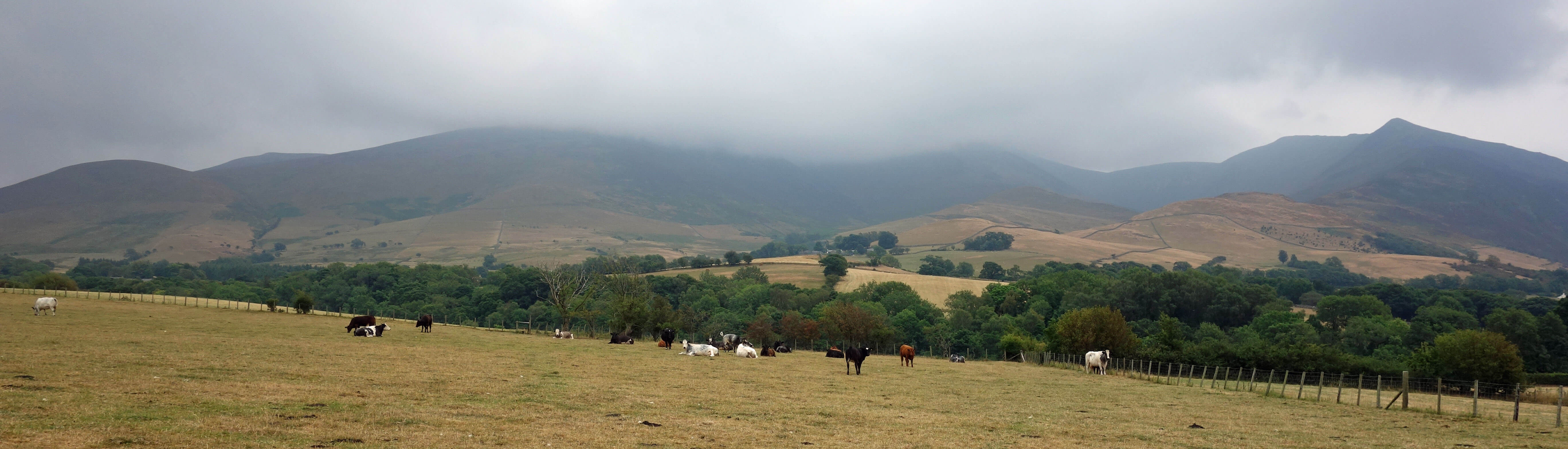
Skiddaw in cloud from near the village of Bassenthwaite
We followed the bridleway to pick up the Cumbria Way but left it as we entered open access land in
order to zigzag up Cockup (505 metres). Here we paused to review the situation. Angry clouds hovered
not far above Binsey (447 metres) to the north and the Uldale Fells to the east. Clouds billowed over Skiddaw to fill Southerndale, intermittently obscuring the dramatic slopes of Ullock Pike. An assault on Skiddaw seemed pointless, so we contoured below Broad End to explore Barkbethdale and Southerndale.
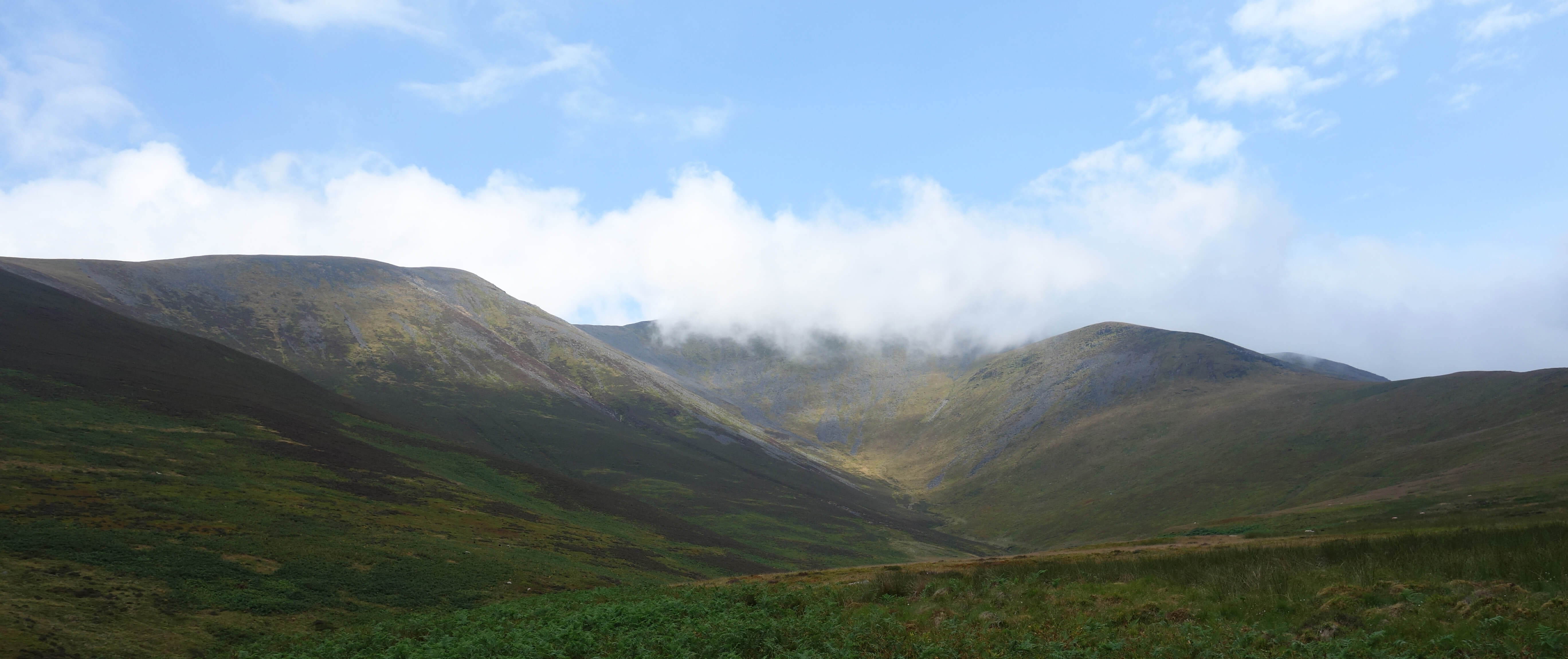
At White Horse we came upon a clear path that led upward. We decided to follow it up: if the
clouds came lower, we could safely follow the path back down; if the clouds magically lifted then we
could continue to the top of Skiddaw. They didnĺt. We climbed high enough (to about 830 metres) to see
the fence from Bakestall but we could see nothing in the direction of the top of Skiddaw. Since it would obviously be impossible to appreciate the OSVP of Skiddaw, we aborted and ambled back to Bassenthwaite.
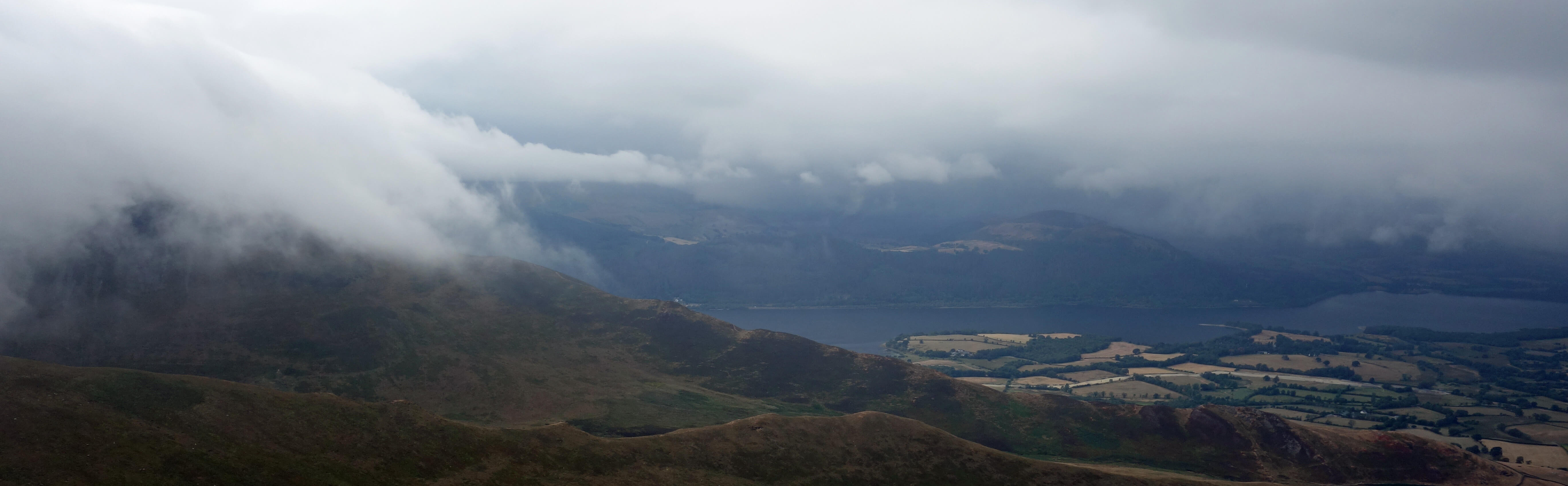
Cloud from Skiddaw billowing over Ullock Pike, with the northern end of Bassenthwaite Lake below
However, having visited Skiddaw before, I feel qualified to say that Skiddaw is not a perfect viewpoint even on a cloudless day. Naturally, being higher than all but three other Lakeland peaks, it offers a 360 degree panorama. On a clear day, the Isle of Man, the Galloway hills, and the northern Pennines are all in view. But the one-mile long flattish top of Skiddaw blocks some of the view from the trig point. In particular, the magnificent birdĺs-eye view of Derwent Water and Borrowdale is not seen from the top but only from the Ĺsouth topĺ of the ridge.
We tend nowadays to mock Westĺs viewing stations and the idea that visitors need to be told precisely
where to stand for the best view, especially when they were encouraged to view the scene backwards, using a
Claude glass mirror. However, the OSVPs are little better. The 38 OSVPs [*] are a strange set. They range
in height from Skiddaw (931 metres) to Lane Ends, Pilling (about 2 metres). Skiddaw is the only one of the Lake
Districtĺs peaks over 400 metres to be an OSVP. Ingleborough and Great Shunner Fell are the only
Dales peaks to qualify. Many OSVPs (such as Jubilee Tower, below Clougha Pike) mark places for motorists to
pause to admire the view. Often a little effort would yield a better view, for example, by walking up Clougha Pike from Jubilee Tower. Some OSVPs have a special tower from which to view. I have no idea what criteria the OS uses when deciding whether to slap a viewpoint symbol on the map. All their other symbols are objective statements of fact. The OS should not give us opinions.
However, it is my purpose in life to give them, so I will assert that Skiddaw affords the best phewpoint in the Lake District. The exclamation Ĺphewĺ expresses a mixture of tiredness, surprise and awe. So phewpoints involve toiling up a long, possibly dull, slope to reach a place where a surprising awe-inspiring view is suddenly revealed. A viewpoint is a place; a phewpoint is a moment in time. For example, Orrest Head is a much-acclaimed viewpoint, with its quality as a viewpoint independent of how you reach it, but for a phewpoint we need to specify the approach (say, along the leafy lane from the A591), the position (that is, Orrest Head itself) and the view (say, west towards the Langdale Pikes over the head of Windermere). That would be a good phewpoint but not the best because the approach is too short to cause tiredness or to build up a large element of surprise.
Most of the central Lakeland peaks provide good viewpoints but not necessarily good phewpoints, because the views on the way up are not so different to the new view from the top. On the standard route up Skiddaw from Keswick the best view (towards Derwent Water) can always be seen and the new view revealed at the top is of the relatively dull hills north of Skiddaw. On the other hand, the view from Skiddaw having arrived from the north is a surprise (at least, to virgin Lake District walkers!) because of the contrast between the rounded hills of the Caldbeck Fells, with no lakes, and the shapely peaks of volcanic rock encircling Derwent Water south. So, I nominate the walk up Broad End ľ a long toil over grass, heather and bilberry and then over the stony plateau ľ to the south top of Skiddaw to reveal the view over Derwent Water as providing the best phewpoint in the Lake District.
Eventually (too late) we saw some blue sky
[*] These are the 38 OSVPs, from north to south:
Skiddaw
Latrigg
Knott Head, Whinlatter
Nine Standards Rigg
Castlehead Wood, Keswick
Surprise View, Lodore Wood
Bowness Knott, Ennerdale
Orrest Head
Miller
Ground, Windermere
Brant Fell, Bowness
Great Shunner Fell
Side Bank Wood, Downholme, Swaledale
Latterbarrow, Hawkshead
Carron Crag, Grizedale Forest
Tom Croft Hill, Garsdale
Scout Scar, Kendal
Gummer's How
Long Stile Gate, Oughtershaw
Ruskinĺs View, Kirkby
Lonsdale
Hampsfell, near Grange-over-Sands
Hoad Hill, Ulverston
Arnside Knott
Askam, Duddon Estuary
Ingleborough
Jubilee Tower, below Clougha Pike
Tithe Barn Hill,
Glasson Dock
Lundĺs Tower, Sutton-in-Craven
Lane Ends,
Pilling
Beacon Fell, near Preston
Jeffrey Hill, Longridge
Crowshaw House, Stonyhurst
The Atom, Wycoller
Singing Ringing Tree, near Burnley
Billinge Hill, Blackburn
Peel Park, Accrington (n)
Peel Park, Accrington (w)
Darwen Hill
Anglezarke Reservoir.
I may have missed one or two.
Date: July 13th 2018
Start: NY230322, Bassenthwaite green (Map: OL4)
Route: E ľ Peter House Farm ľ SE on Cumbria Way ľ access land ľ W, S ľ Cockup ľ SW ľ
White Horse ľ SE ľ near north top of Skiddaw ľ NW ľ White Horse ľ W, NW ľ High Side House, Bassenthwaite
Distance: 9 miles; Ascent: 730 metres
Home
Preamble
Index
Areas
Dales
Hills
Lakes
Places
Reserves
Rivers
Structures
Villages
References
Me
> ę John Self, 2018-

Top photo: The western Howgills from Dillicar
Bottom photo: Blencathra from Great Mell Fell