
Home
Preamble
Index
Areas
References
Me
Saunterings: Walking in North-West England
Saunterings is a set of reflections based upon walks around the counties of Cumbria, Lancashire and
North Yorkshire in North-West England
(as defined in the Preamble).
Here is a list of all Saunterings so far.
If you'd like to give a comment, correction or update (all are very welcome) or to
be notified by email when a new item is posted - please send an email to johnselfdrakkar@gmail.com.
23. The Kentmere Diatomite
Kentmere Tarn is unique in the Lake District in three ways. First, it is the only body of water in
the National Park that is both a mere and a tarn. At least, I cannot think of anywhere else that has
both ‘mere’ and ‘tarn’ in its name, but I stand to be corrected. If the name ‘Kentmere’ referred to
a ‘mere’ then it can only have been this one, as there are no others in the valley apart, now, from
the reservoir built in 1848.
For my first sight of Kentmere Tarn I walked from Staveley on the open lanes and
tracks on the eastern slopes, rather than on the dark, enclosed road by the River Kent, and
scrambled up Millrigg Knott. The becks on the way were refreshingly alive, stirred into action by
the first real rain for months, and as I stood at Millrigg Knott I could see that more rain was falling
on the tops to keep the becks lively.
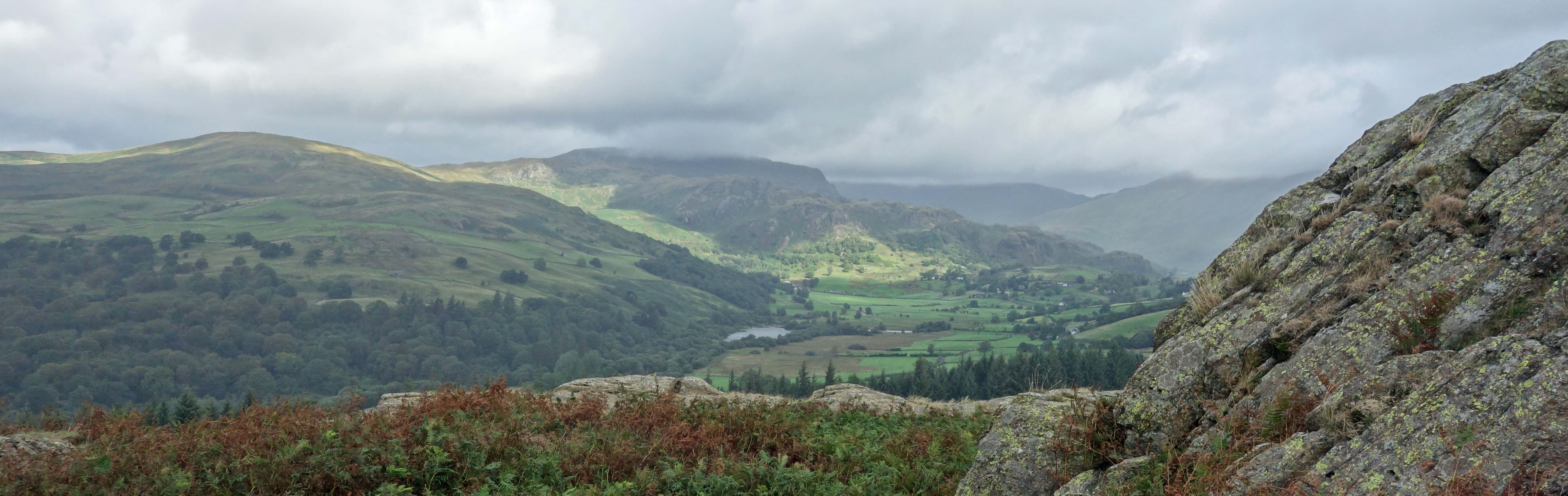
Kentmere Tarn from Millrigg Knott
Kentmere Tarn’s second unique property is that it is the only tarn to have disappeared and then
reappeared in a different place. This story may be told through the comments in contemporary guide
books. Otley (1823) wrote that “Kentmere Tarn, bordered by morass, and Skeggles Water … are neither
of them possessed of any striking features.” Ford (1839) said that “Kentmere Tarn … is one mile long,
and cannot be approached except at one point, owing to the swampiness of its margin.” So, in the early
19th century a boggy Kentmere Tarn existed.
Not long after, Martineau (1855) said that a visitor “will look
for Kentmere Tarn and wonder to see no trace of it. It is drained away; and fertile fields now occupy
the place of the swamp.” Baddeley (1880, 1922) wrote that “many people, on entering the valley, will
ask, why Kentmere? … There is no mere at all.” Martineau and Baddeley knew why there was no tarn (or
mere). In about 1840 a channel had been dug at its foot, so that the waters would drain away to leave
good farming land where the tarn was. Or so it was hoped. The land, however, gradually returned to
bogginess.
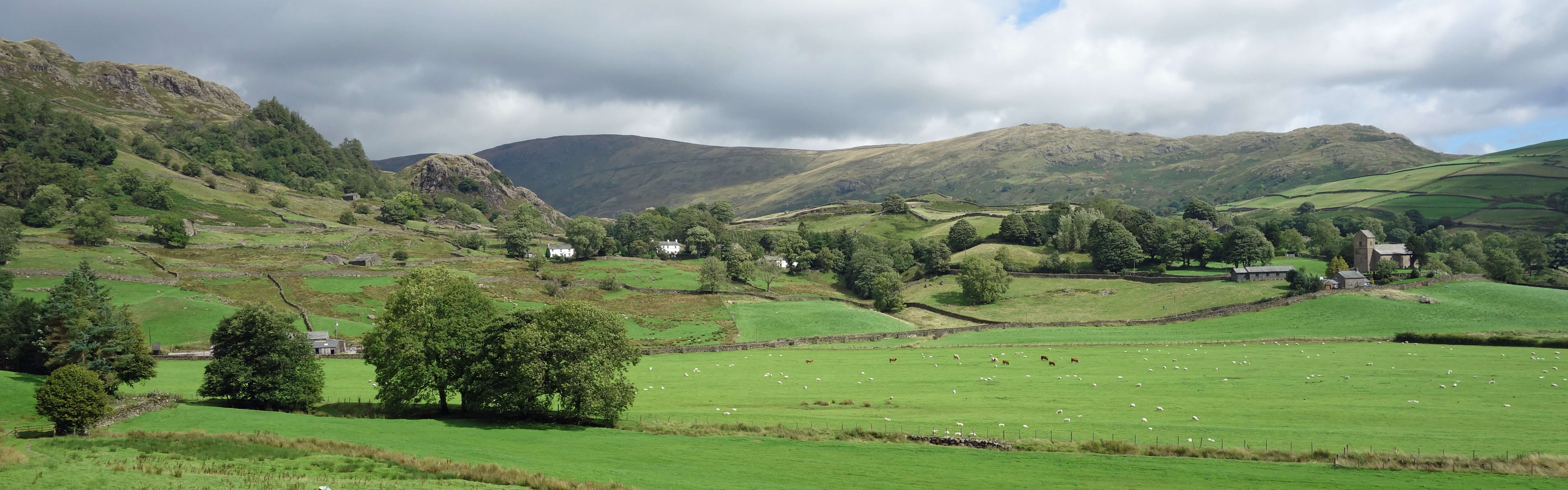
The village of Kentmere
I could not appreciate this from Millrigg Knott, so I pressed on to Kentmere village, past the
prominent, damp-looking St Cuthbert’s and various isolated homesteads, some looking less
naturally integrated into the hillside than others, and up towards the Kentmere Hall pele
tower, currently under repair (isn’t it always?). The path on the western side of the tarn is
disappointingly separated from it. The tarn seems to be reserved for anglers and it is
impossible to see it at close quarters without trespassing.
When I peered in, it looked surprisingly deep.
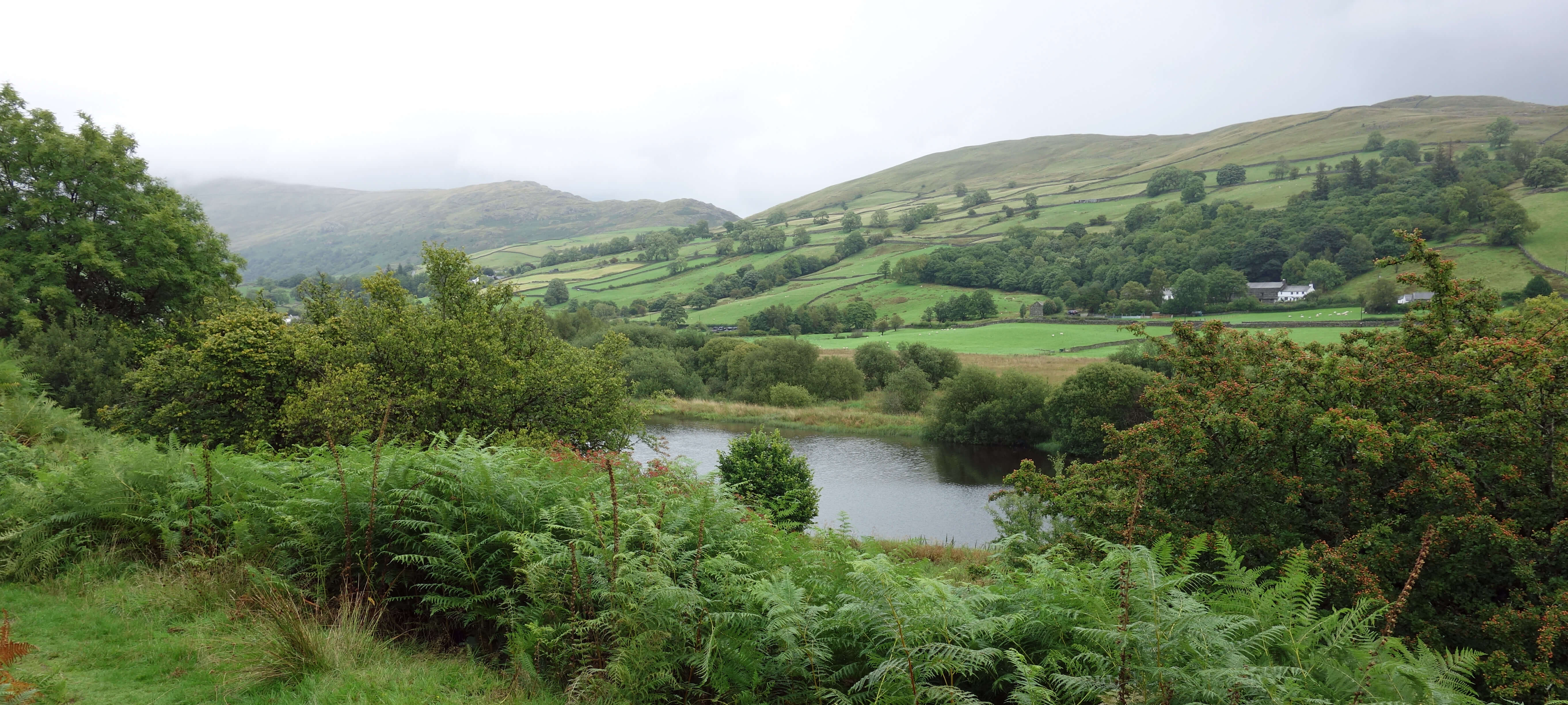
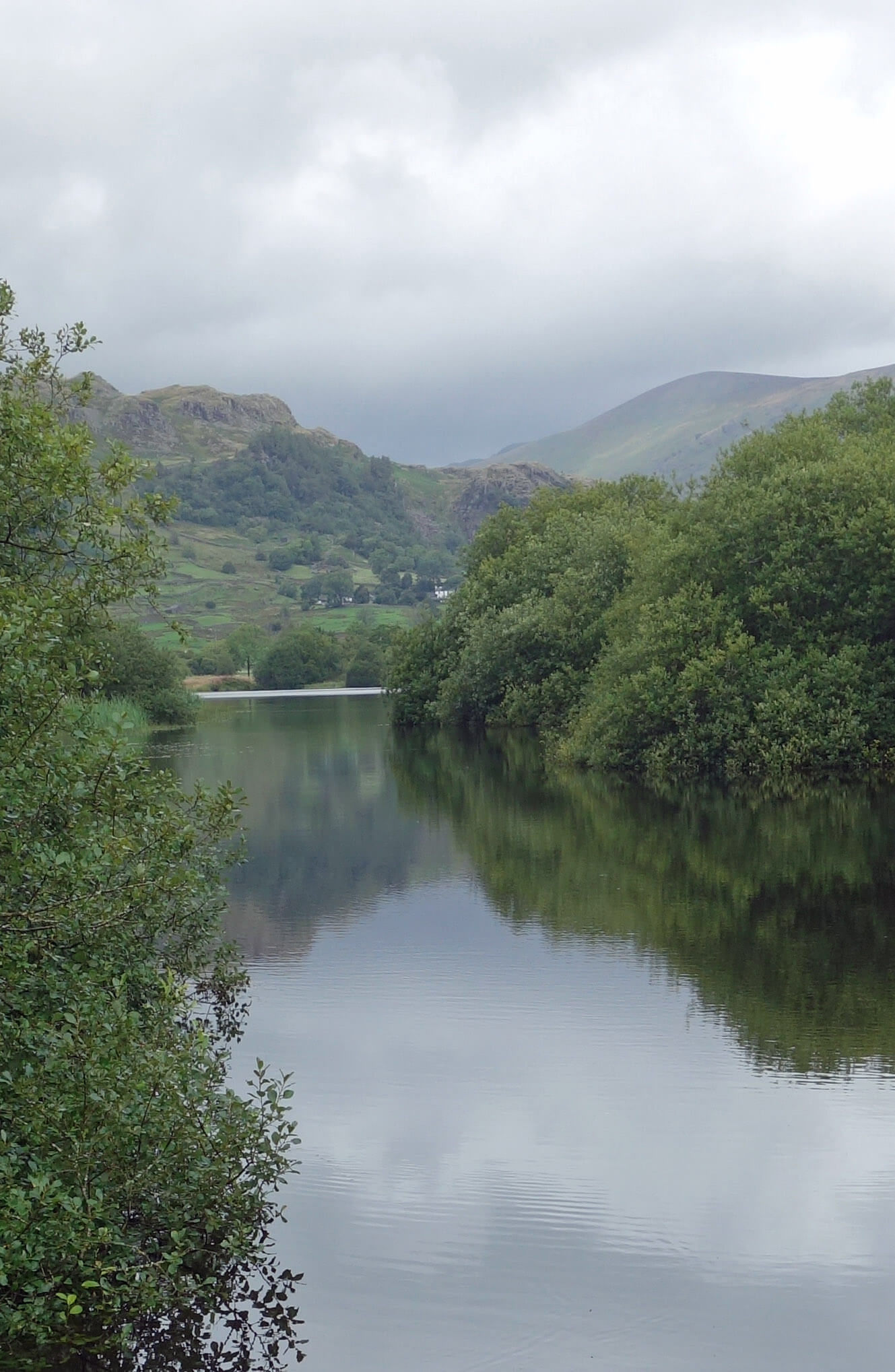 Left and Right: Kentmere Tarn.
The land would no doubt have continued to become boggier after the failed attempt to drain it but for the
discovery there in the 1920s of diatomite. I had assumed that diatomite was a kind of rock, on the
basis that most things ending in –ite are rocks. However, the
Gregory (2000)
history of the extractive
industries of Kentmere tells me that “the material consists of the microscopic skeletons of water-plants,
as many as 60 million to a cubic inch, which flourished in clear cold water at the end of the Ice Age.
It has remarkable insulation properties, especially for very high industrial temperatures when calcined
and ground, and it has other uses as an inert filtration medium, for industrial filling and polishing,
and in the manufacturing of explosives.” This diatomite is therefore much younger (at
about 12,000 years) than the volcanic and sedimentary rocks (at 300-500 million years) that form central Lake District. Is 12,000 years long enough for a sediment to become rock? Probably not, as I see that the material is sometimes referred to as diatomaceous earth.
This diatomite was valuable enough to be mined, or at least scooped, from what had been the bed of the old tarn. So, that’s the tarn’s third claim to fame: it was the site of England’s only diatomite works. This prompts the question: why? Why was diatomite formed only here? Or does it in fact exist in other tarns and lakes? If it does then why wasn’t it mined there too, since, according to
Nicholson (1977), diatomite had become “commercially the most important deposit still being worked in the inner Lake area”? At its peak, the annual production was 10,000 tons (Gregory, 2000).
However, the diatomite extraction became uneconomic, as is the fate of all mines, and the Cape
Asbestos Company abandoned it in about 1980. The old work-site has not been abandoned. There are now large green warehouses, with signs in five languages, and warnings not to take photographs. It had not occurred to me to take photographs of large warehouses but now I was tempted. There was no sound of activity. It seemed rather mysterious. I understand that the owners, Hollingsworth & Vose, make “synthetic electrostatic non woven materials for air filtration” but I don’t know why they make them in this out-of-the-way location.
So, upstream of Hollingsworth & Vose, nature has reasserted its claim to what was always a boggy area and is even more so now, after up to 10,000 tons a year have been extracted. And so Kentmere Tarn returned. It is now thinner and a bit further north than it was in 1800 – but I expect that it is still working on it.
Walking along the lane back I had an encounter with a hare. I saw it loping towards me, so I stopped.
It came to within five metres, stopped, turned, and loped ahead of me. It did so for some time. Perhaps
hares are not great leapers, able to jump walls and fences at the road-side. Then a car approached from the
opposite direction. The hare loped to within five metres of the car, stopped, turned, and loped ahead of it. It
loped to within five metres of me, stopped, turned … and so on … as the car slowly came nearer. When the car
stopped fifteen metres ahead of me, the hare ran back and forth, faster and faster, within its five metres between us. It then took a flying leap over a high wall.
Date: August 16th 2018
Start: SD470984, Staveley (Map: OL7)
Route: N – Barley Bridge – N on Hall Lane – Park House – N, W – Millrigg Knott –
NE – bridleway – NW – Long Houses – N – Kentmere – W – Kentmere Hall – S through Hall Wood, by
Kentmere Tarn – Works – S – Sawmill Cottage, Browfoot – SE on Browfoot Lane – Staveley
Distance: 9 miles; Ascent: 180 metres
Home
Preamble
Index
Areas
References
Me
© John Self, 2018-

Top photo: The western Howgills from Dillicar;
Bottom photo: Blencathra from Great Mell Fell