
Home
Preamble
Index
Areas
Dales
Hills
Lakes
Places
Reserves
Rivers
Structures
Villages
References
Me
Saunterings: Walking in North-West England
Saunterings is a set of reflections based upon walks around the counties of Cumbria, Lancashire and
North Yorkshire in North-West England
(as defined in the Preamble).
Here is a list of all Saunterings so far.
If you'd like to give a comment, correction or update (all are very welcome) or to
be notified by email when a new item is posted - please send an email to johnselfdrakkar@gmail.com.
26. A Booze by Any Other Name
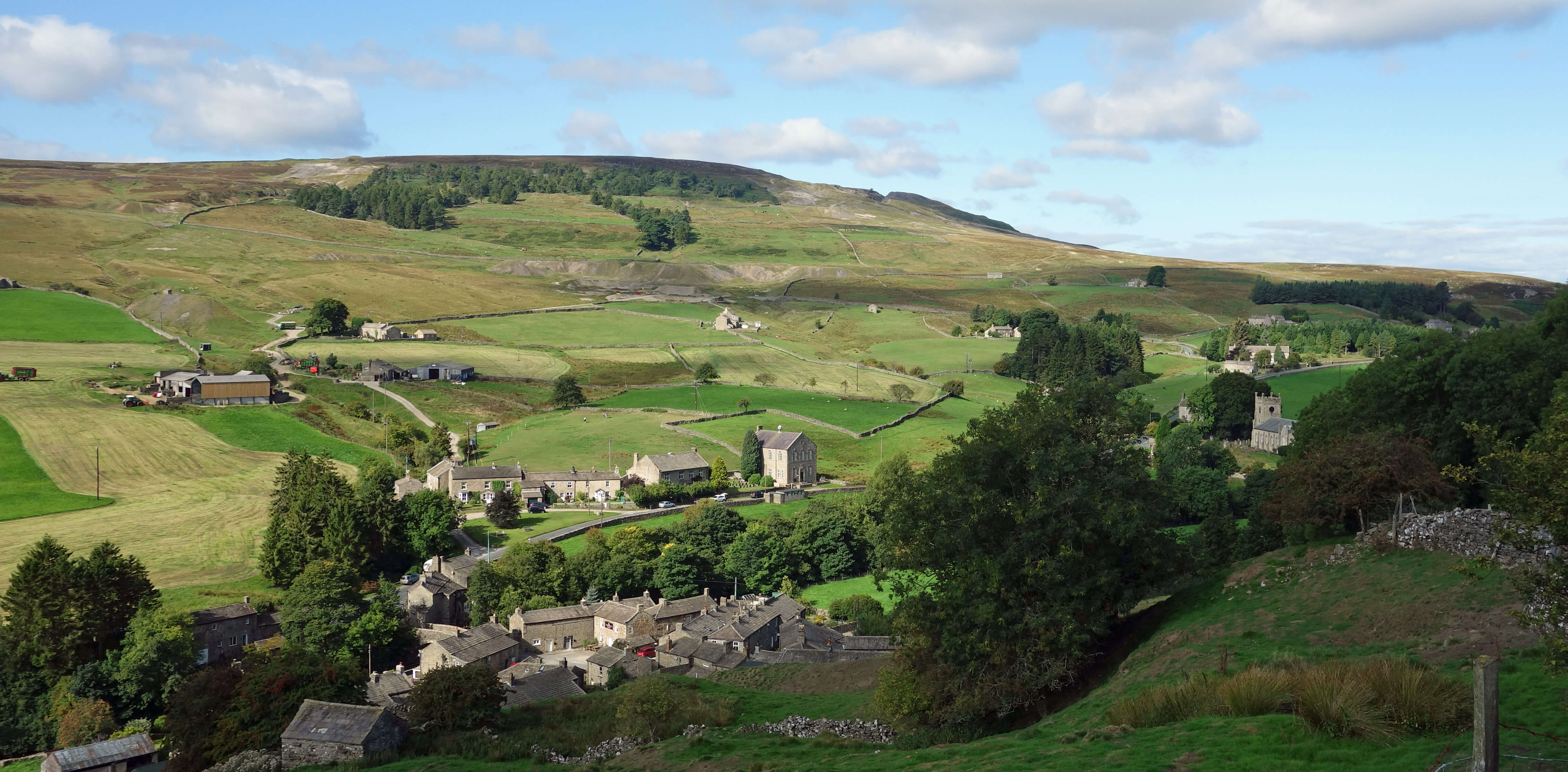 Right: Langthwaite.
This outing wins the prize for the most attractive set of place-names encountered. In general, the Yorkshire Dales has such a rich heritage entangled within its place-names that it can be hard for experts to decipher them. There may be embedded information about natural features, about people, about local fauna and flora, about local folklore and about practices at the time the name was bestowed. To complicate matters further, the spelling of the place-names may well have evolved over the centuries. And, of course, sometimes there may be no meaning to a name at all.
The first name encountered, Langthwaite, presents little problem. It is composed
of two components common in North-West England: ‘lang’ being the Old English (and modern
Scottish) for ‘long’ and ‘thwaite’ being Old Norse for ‘clearing’. The name therefore
seems to date from the arrival of the Vikings in the 10th century.
I wouldn’t like to be driven to Booze. The narrow, steep lane up peters out into
a rough track
before it reaches the hamlet of a dozen or so buildings, some even with roofs. I have
read several times
that ‘Booze’ derives from an Old English word meaning ‘the house on the curve of a hill’.
That’s a lot
of meaning to pack into one syllable. Was the concept of a house on the curve of a hill so crucial to
the old English that they needed a special word for it? If so then I’d expect to see more Boozes about but,
as far as I’m aware, this is the only one. I don’t know who first came up with this suggestion, and what evidence there is for it, but perhaps everybody since has just repeated it. [In the 13th century Beaula, a woman of easy virtue, lived here. The men of the region used to say “I’m just going up to Beau’s”. And the name Booze stuck. I have added that in the hope that some lazy cut-and-paste browser will extract it and it will become a definitive statement of fact.]
Next we walked up Slei Gill, past the dereliction of old lead mines, along a good walking track. ‘Gill’ is another Old Norse word, this time for ‘ravine’, as indeed Slei Gill is. I have been unable to find any suggestion for a meaning of ‘slei’. [The beck above is called Slack Wife Gill, which perhaps refers to Beaula. Clearly, as the beck flows through the ravine it has caused severe erosion and lost several letters.]
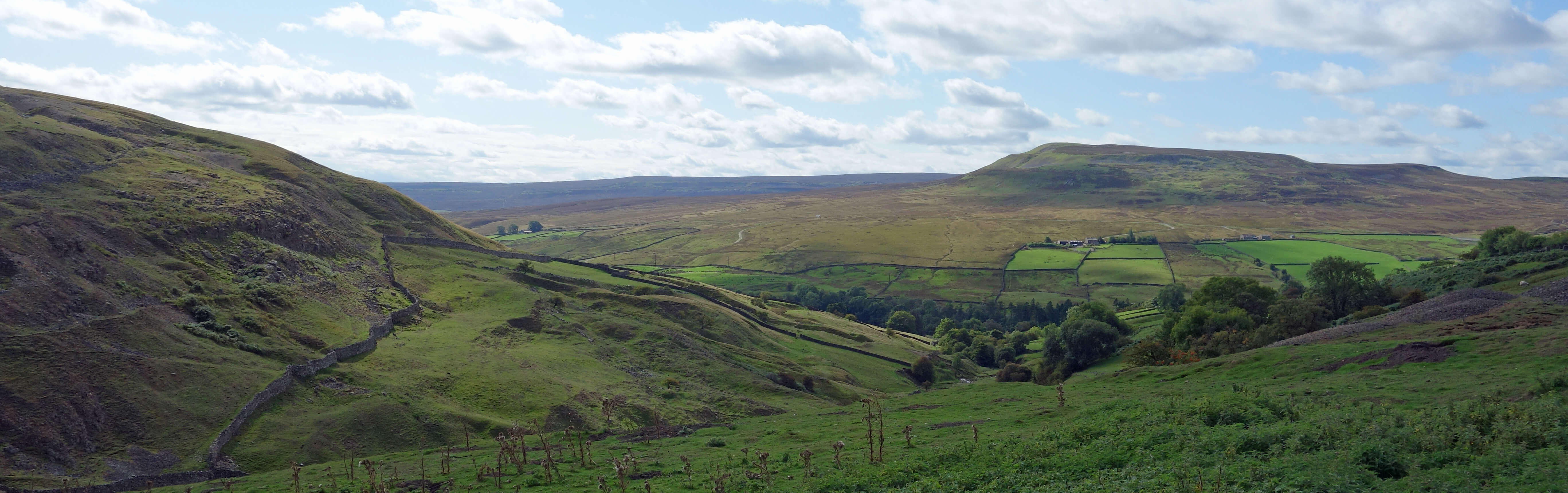
The view from Booze towards Calver Hill
We emerged onto a moorland plateau and found a grassy short-cut over to a new shooting lodge on the Moresdale Road track. We were not tempted to walk up the boringly-named Peat Moor Hill. [This name was invented by a minion in the Ordnance Survey office who felt that he couldn’t just leave a blank space on the map.]
We strolled down the track, below Langthwaite Scar, around Shaw Farm, over Low Moor,
and towards the tiny village of Whaw. Now there’s a name to conjure with.
What could it mean, if anything? We have other ‘haw’s in the Dales, where
the ‘haw’ is assumed to be from the Old English word for ‘view’. I doubt that
Whaw is derived from this ‘haw’ as Whaw is rather tucked down to provide a view. According to the respected Hartley and Ingilby (1956), Whaw is from the Norse and means ‘the enclosure near the fold where sheep are milked’. That’s even more meaning for one syllable! [‘Whaw’ is in fact an old Yorkshire dialect word, a contraction of ‘where’t heck are we?’.]
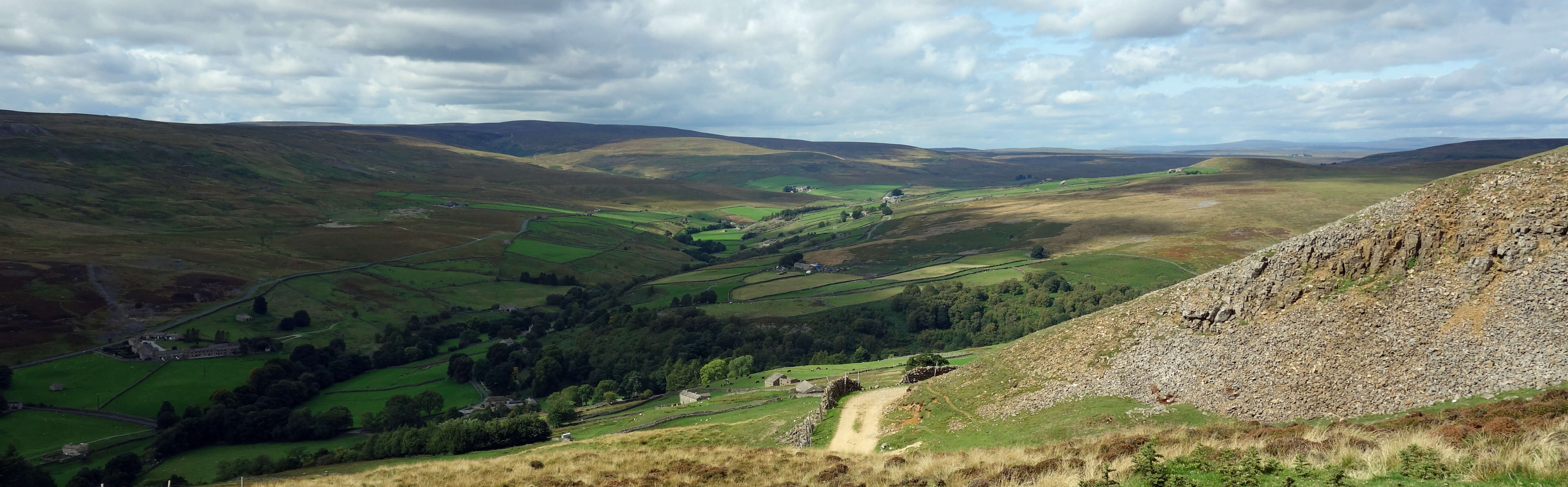
The view towards Whaw in Arkengarthdale
Whaw is by Arkle Beck, that is, the Old Norse stream of some old Norse man called Arkle or Arkil or some such. And hence the delightful name of ‘Arkengarthdale’ is a portmanteau of Old Norse for ‘the valley’ of ‘the enclosure’ of Arkle. We have therefore encountered a set of Old English and Old Norse names, with the exception of dull Peat Moor Hill. However, there are no –ham, –ton or –leys of Old English origin. Perhaps these suffixes required villages of some size, and there are none of those in Arkengarthdale, and there never were. Even at the peak of the lead mining industry, the population of Arkengarthdale was only 1,200 or so. According to Hartley and Ingilby (1956), this had dropped to 300 in 1951, although it may have perked up a little since then.
Below Eskeleth Bridge we passed the imposing Scar House, which looked dormant, with large blinds drawn
over the windows. The absence of footpath signs around the house excuses a wander around its gardens. I read that
Scar House
is a shooting lodge owned by the Duke of Norfolk (the Duchess, if there is one, doesn’t get a
mention) and that “the gardens of Scar House were initially designed for the ladies of the shooting
parties to stroll in whilst the men shot”. That’s a lot of strolling. And a lot of building, for a
shooting lodge. I picture the guests enjoying grouse omelette for breakfast, grouse paté for luncheon,
and roast grouse for dinner, with lead shot garnishing, all accompanied by Famous Grouse whisky.
According to the website referred to, an East Arkengarthdale Common Committee was set up in 1999 to preserve black grouse on the moors. I have not been able to find out if it was successful – but I doubt it. We saw red grouse a-plenty, but no black grouse. But I mustn’t allow the thought of grouse-shooting to tarnish an excellent, varied walk in fine scenery.
Somebody once said that a rose by any other name would smell as sweet. I don’t believe it.
If Booze were called, say, Boghole (a place near Inverness) then it wouldn’t be half
as attractive. Not to me, anyway.
Footnote: As a bonus, we were treated to a wonderfully vivid rainbow as we left Swaledale:
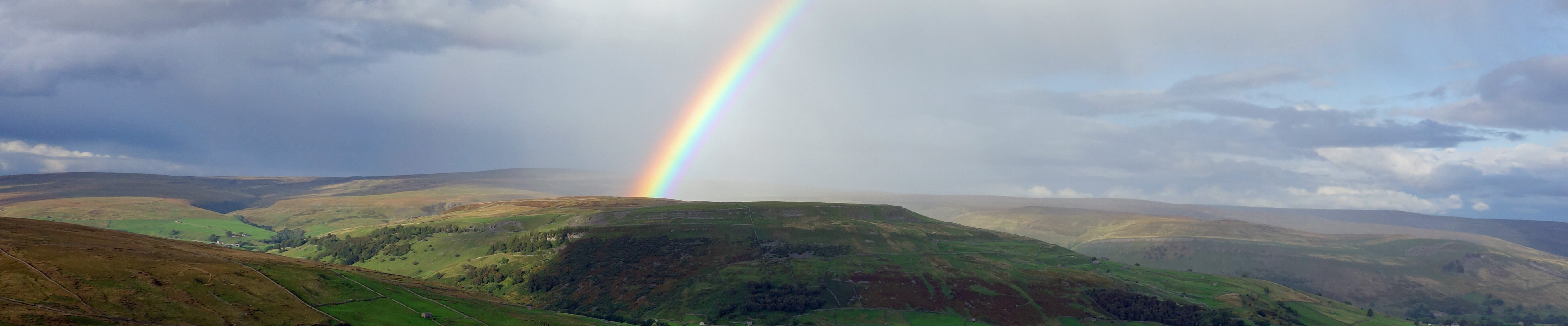
Rainbow over Kisdon from near the Butter Tubs
Date: September 6th 2018
Start: NZ004025, Langthwaite (Map: OL30)
Route: E – Booze – NE, along Slei Gill – N – bridleway – SW,
N, W – Stang Lane – N, E – Shaw Farm – SW – Green Bank – SE – Eskeleth Bridge – SE (past Scar House), S – Langthwaite
Distance: 9 miles; Ascent: 210 metres
169(+914)/2250
Home
Preamble
Index
Areas
Dales
Hills
Lakes
Places
Reserves
Rivers
Structures
Villages
References
Me
© John Self, 2018-

Top photo: The western Howgills from Dillicar;
Bottom photo: Blencathra from Great Mell Fell