
Home
Preamble
Index
Areas
Dales
Hills
Lakes
Places
Reserves
Rivers
Structures
Villages
References
Me
Saunterings: Walking in North-West England
Saunterings is a set of reflections based upon walks around the counties of Cumbria, Lancashire and
North Yorkshire in North-West England
(as defined in the Preamble).
Here is a list of all Saunterings so far.
If you'd like to give a comment, correction or update (all are very welcome) or to
be notified by email when a new item is posted - please send an email to johnselfdrakkar@gmail.com.
40. In the Borderlands of Burton-in-Lonsdale and Bentham
The villages of Burton-in-Lonsdale and Bentham are in the Craven District of North Yorkshire
but the rivers that flow through them – the Greta and the Wenning respectively – head west to
enter Lancashire and join the River Lune. Both rivers arise on the slopes of Whernside
and Ingleborough and have an exciting start in life, the Greta tumbling over the Ingleton Falls and the Wenning plunging into Gaping Gill. However, once they cross the A65, near Ingleton and Clapham respectively, they settle, under normal conditions, into a gentle maturity.
They run westwards, more or less in parallel, two or three miles apart, to form a
rough quadrilateral of relatively anonymous land between the A65 and the River Lune. It
is almost all rolling drumlin farmland that falls from about 200 metres in the east to
about 30 metres in the west. The region has no features that would appear on a tourist’s itinerary. There’s a golf course and a few caravan parks, and that’s about it for holiday-makers. Midway between the A65 and the Lune the rivers pass the villages of Burton-in-Lonsdale and Bentham (High and Low). I set out to saunter between them, sampling stretches of the two rivers, enjoying the quiet countryside, with no expectations of excitement.
And so it proved. The path from Wennington to Burton-in-Lonsdale crossed many grassy fields, all with sheep
apart from one with a disconsolate set of horses (their field had no grass). I crossed the county border into North
Yorkshire near Old Wennington but there was no sign to tell me that I had done so. Fine views of
Ingleborough opened out ahead.
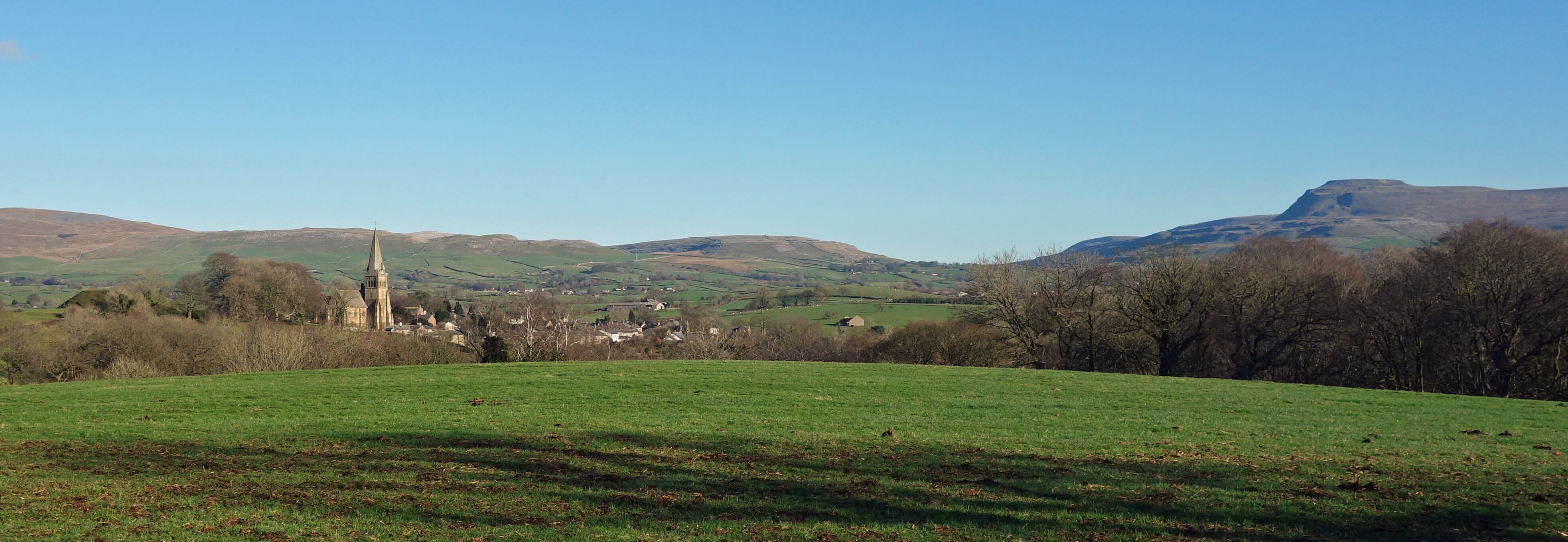
Burton-in-Lonsdale and Ingleborough from near Clifford Hall
I found my way past Clifford Hall, where they seem determined to have no footpath signs, into Greta Wood, where there are some impressive beech trees. I saw a sign to say that the wood is “dedicated to remember the coal mine donkeys”, which we have now done. I assume that this is a reference to the Ingleton coalfield within the parishes of Bentham, Burton-in-Lonsdale, Ingleton and Thornton-in-Lonsdale. The Ingleton Colliery, which at one time employed 900 people plus I-don’t-how-many donkeys, closed in 1936.
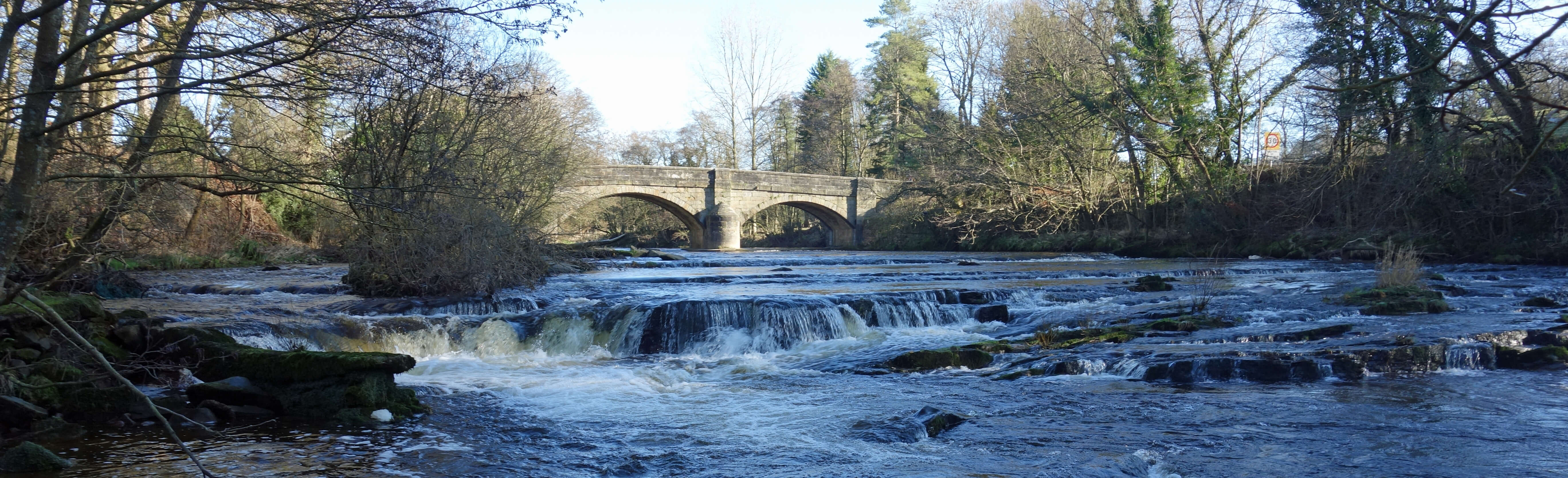
The River Greta and Burton Bridge
On the walk south from Burton-in-Lonsdale my eyes continued to be drawn towards the noble profile of Ingleborough.
The recent snow seemed to have all gone, although I could occasionally glimpse some distant snowy tops in the Lake
District and perhaps to the north (Great Shunner Fell perhaps?). In High Bentham I passed the home of the
Corio Raptor Care and Rehabilitation Centre
– I had to pass it as the ongoing work is not open to the public, although the owners are often to be
seen with their raptors at local shows. I managed, after some firm advice from a local, to find the
River Wenning after walking through a caravan park, empty of people as far as I noticed.
The path along the north bank is a well-used one, with a couple of benches from which to contemplate the sedate Wenning, but the route beyond Low Bentham higher on the south bank requires more careful navigation. At Robert Hall I left North Yorkshire. It is said that the Hall, built in the 16th century for the Cantsfield family, who were recusant Catholics, provided a refuge for fugitives escaping the law by crossing the county border. If so, perhaps our county borders were once as important as state borders seem to be in the US, if you believe many US films. I then passed The Blands, a building with many dubious legends, which I was pleased to see has been restored after a fire in 2009.
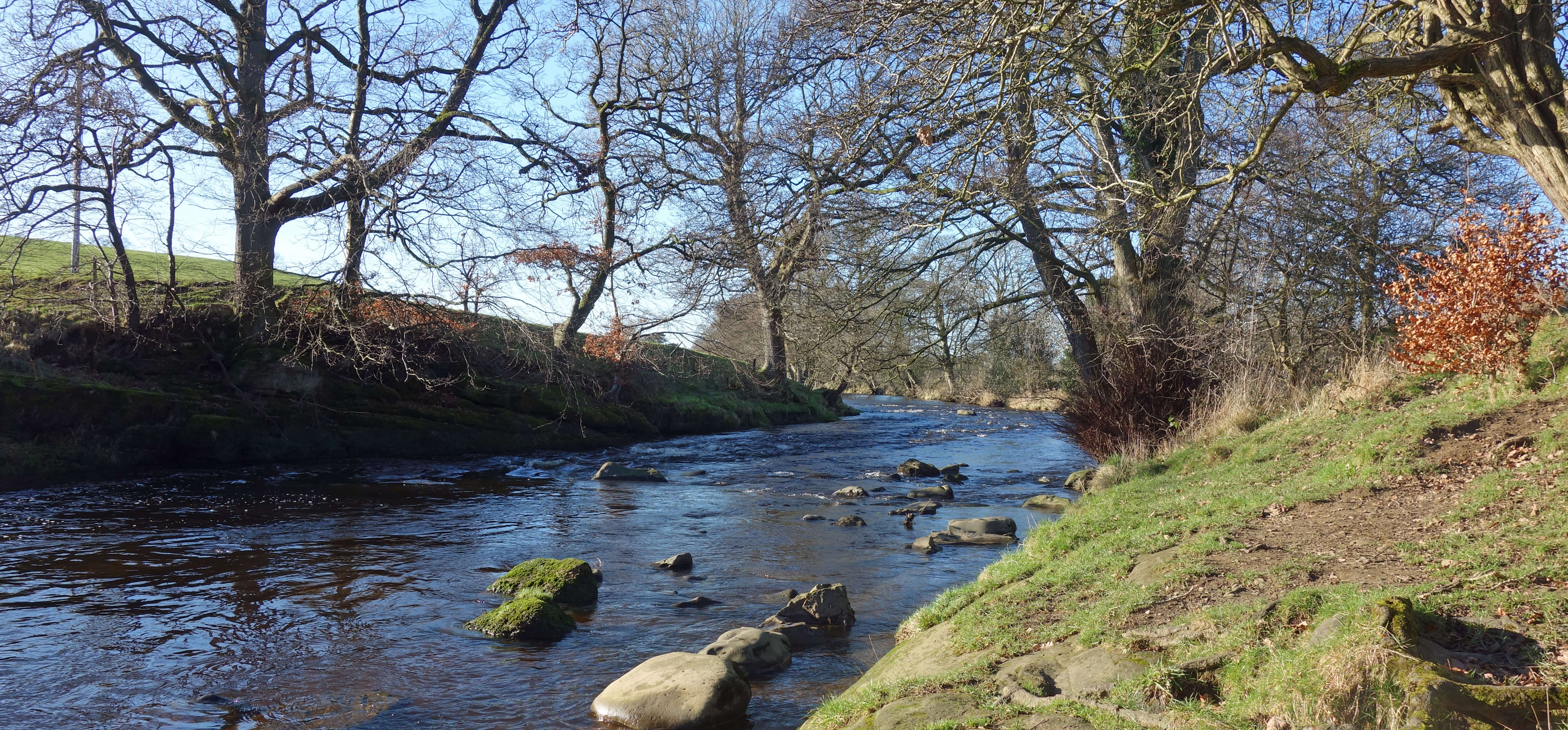
River Wenning
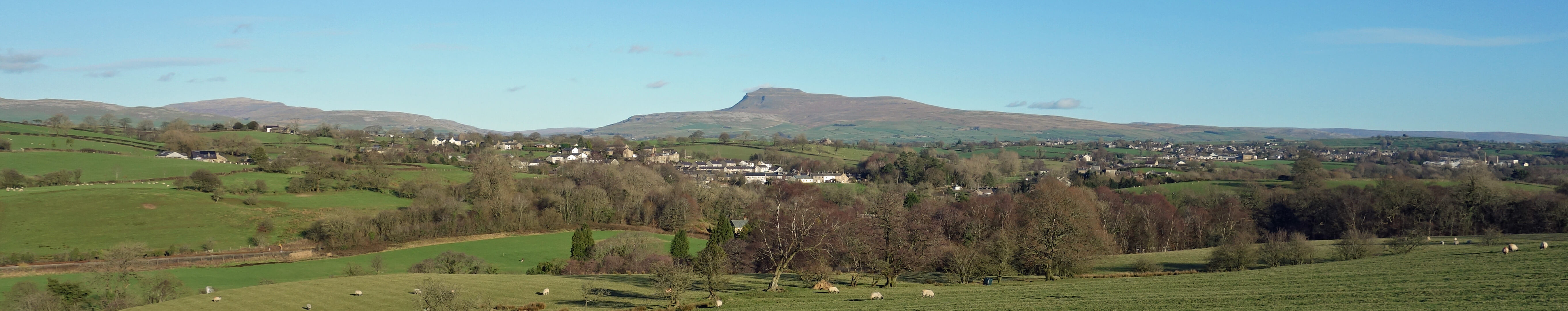
Low Bentham and High Bentham, with Whernside and Ingleborough beyond, from near Robert Hall
 Did I get away with it? Did you notice the mention of ‘Craven’ in the
first sentence? Almost every document about the Yorkshire Dales mentions
Craven as a noun and an adjective (Craven Fault, Craven Heifer, Craven Museum, Craven
Herald, Craven this, Craven that) without saying what it is. Maybe I should try to.
Did I get away with it? Did you notice the mention of ‘Craven’ in the
first sentence? Almost every document about the Yorkshire Dales mentions
Craven as a noun and an adjective (Craven Fault, Craven Heifer, Craven Museum, Craven
Herald, Craven this, Craven that) without saying what it is. Maybe I should try to.
Today, the meaning of ‘Craven’ is fairly simple. Craven is one of seven local government districts within the county of North Yorkshire. It extends from Bolton Abbey in the east to Burton-in-Lonsdale and Bentham in the west, these two villages forming part of one of the nineteen wards of Craven. Craven is, roughly speaking, the southern half of the Yorkshire Dales plus those parts of North Yorkshire south of it, including villages such as Thornton-in-Craven and Sutton-in-Craven, as it surely ought to. In area (454 square miles) Craven is larger than more than half the English counties!
However, it’s not that simple because some parts of old Craven that were transferred
to Lancashire in 1974 are now given the honorary title of West Craven. West Craven is
part of the Pendle borough of Lancashire and includes villages such as Barnoldswick and Earby.
To further complicate matters, the Church of England’s Archdeaconry of Craven is
much bigger than the government district of Craven and includes parts of Cumbria,
Lancashire and West Yorkshire.
But that’s all a doddle compared to the meaning of Craven over the centuries. In the Domesday Book of 1086 many places (some no longer considered to be within any form of Craven) are said to be ‘in Crave’, with the summary giving the heading of Cravescire, but there is no clear definition of ‘Crave’. As Craven continued to be used without a precise definition ever since, historians have great fun trying to work out what it referred to at various times. I’ll leave it at that.
Date: January 28th 2019
Start: SD616700, Wennington bus stop (Maps: OL41, OL2)
Route: E – Cravens Farm – NE – Old Wennington – E – Clifford Hall –
N, E – Burton Bridge – SE, S – River Wenning – W on north bank –
Low Bentham – S, W – Robert Hall, The Blands – NW – Wennington bus stop
Distance: 9 miles; Ascent: 80 metres
Home
Preamble
Index
Areas
Dales
Hills
Lakes
Places
Reserves
Rivers
Structures
Villages
References
Me
© John Self, 2018-

Top photo: The western Howgills from Dillicar;
Bottom photo: Blencathra from Great Mell Fell