
Home
Preamble
Index
Areas
Dales
Hills
Lakes
Places
Reserves
Rivers
Structures
Villages
References
Me
Saunterings: Walking in North-West England
Saunterings is a set of reflections based upon walks around the counties of Cumbria, Lancashire and
North Yorkshire in North-West England
(as defined in the Preamble).
Here is a list of all Saunterings so far.
Guaranteed ad-free, AI-free and free!
255. The Doline of Clapham Bottoms

Clapham Beck, very low
 We set off from Clapham, prompted by a comment in the book Ingleborough: Landscape
and History (Johnson, 2008, p87) that:
We set off from Clapham, prompted by a comment in the book Ingleborough: Landscape
and History (Johnson, 2008, p87) that:
“The Oscar for best doline [in the Yorkshire Dales] has to be awarded … to a run of
three huge depressions in Clapham Bottoms”.
Whenever I read of anything being the best of the North-West I have a convulsive
compulsion to see it. Otherwise, my life would be incomplete. And so would these
Saunterings.
I have found, after decades of experience, that – and I offer this advice for
no extra charge – when setting off in search of something it is wise to have an idea
of what you’re looking for. So I consulted Wikipedia to find out what a doline is.
It immediately redirected me to a page about sinkholes, which begins:
“A sinkhole is a depression or hole in the ground caused by some form of collapse of
the surface layer. The term is sometimes used to refer to doline, enclosed depressions
that are also known as shakeholes, and to openings where surface water enters into
underground passages known as … swallow holes.”
That suggests that sinkholes, dolines and shakeholes are pretty much the same thing,
with a swallow hole being a sinkhole with water entering. The OS maps put a space
in ‘shake hole’ (and Word keeps putting a squiggly red line under shakehole). The
OS doesn’t use ‘doline’ at all, as far as I’ve noticed. (The word ‘pothole’ is not
mentioned on the Wikipedia page, so I assume it’s not a scientific term. A pothole
is where potholers go.)
However, the Johnson (2008) book wants to draw distinctions based on the
different forms of collapse that Wikipedia mentions. In the Yorkshire Dales
sinkholes are formed where the bedrock is limestone, which may be covered by
metres of soil or glacial till. They result from one (or more) of three processes:
1. By the soil and till being washed away through fissures in the bedrock.
2. By the limestone itself dissolving and draining away.
3. By the collapse of bedrock into cave chambers underneath.
Type 1 and Type 2 sinkholes tend to cause funnel-shaped depressions, where overlying
material slumps down into the space created. Type 3 sinkholes tend to form more
vertical shafts.
Johnson (2008) wants to restrict the term ‘doline’ to a Type 2 sinkhole (caused
by limestone dissolution) and ‘shakehole’ to a Type 1 sinkhole (caused by soil and
till being washed away). The reason for wanting the distinction is that the Type 2
process is much slower than the Type 1 process and, in fact, is so slow that the size
of a doline often means that its creation must have begun before the last Ice Age.
The shakehole, on the other hand, since it involves glacial till being washed away, must
have begun life after the Ice Age. In general, then, dolines are (according to
Johnson (2008)) larger, deeper and older than shakeholes.
We did not head directly for Clapham Bottoms, which despite the name lies some
distance above the village of Clapham, but walked first to the hamlet of Newby Cote.
Here we noticed that some farm buildings, including a very large barn, were undergoing
impressive renovations. It is always good to see these vernacular buildings being
renovated for re-use, rather than demolished so that a builder may start afresh.
The track took us up to the moor, with Ingleborough (or probably Little Ingleborough)
in cloud to our left, and we headed roughly north-east in the direction of Gaping Gill,
keeping a wall in sight to our right. I always underestimate how much slower
progress is over rough moorland compared to on a clear path and even when we
located a sort of track it wasn’t much faster as it weaved around the many sinkholes.
These sinkholes were the reason for approaching Clapham Bottoms from this direction.
We hoped to see a contrast between the superlative doline that we were promised on
Clapham Bottoms and all these sinkholes, which Johnson (2008) would, I expect, call
shakeholes because they were quite small and shallow, only a few metres deep.
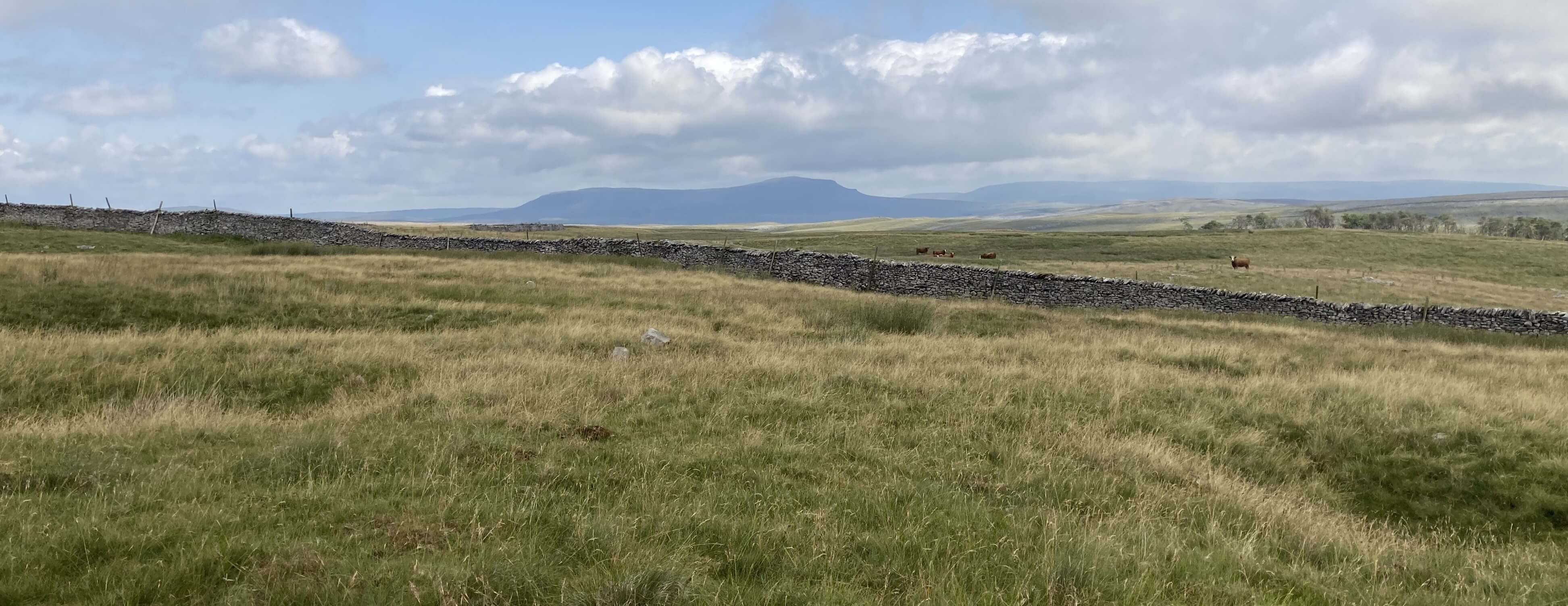
The moor dimpled with shakeholes, Pen-y-ghent in the distance
To restrain our excited anticipation, we paused for a lunch snack, sitting on the
rim of a shakehole, with the sun breaking through the clouds
that had gathered since we left Clapham and with views
of Pen-y-ghent and (intermittently) Ingleborough. We then went on to meet the track
that walkers take from Clapham to Ingleborough via Gaping Gill and then immediately
left it to walk around Clapham Bottoms. The doline that impressed Johnson (2008) did
not impress the Ordnance Survey enough for them to indicate it on their map. The
grid reference that Johnson (2008) gives (756719) indicates that the doline lies
just north of the track. So we walked along, looking out hopefully to our left but
seeing nothing that differed from the scores of shakeholes that we had already seen.
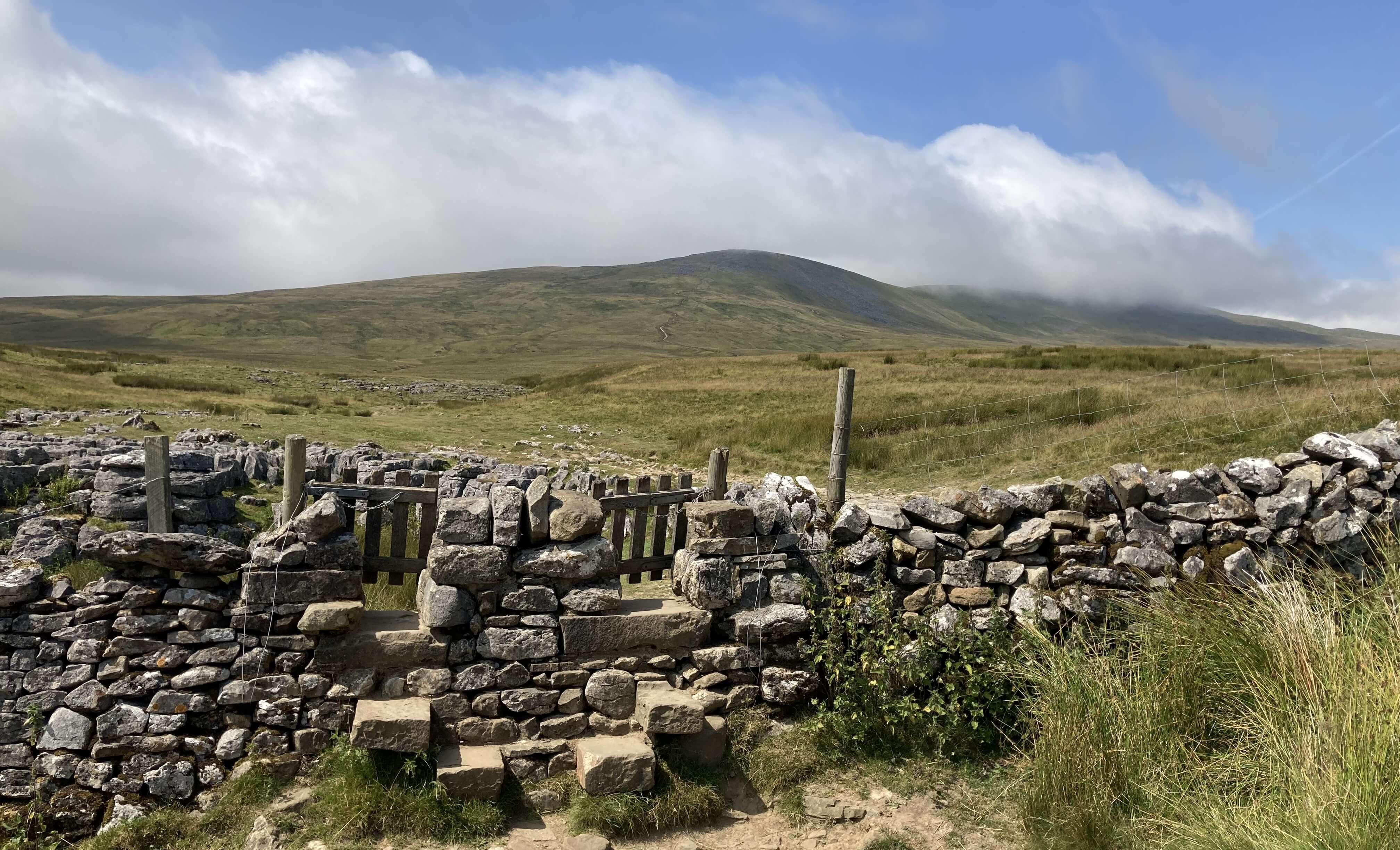
The dual stile on the Clapham-Ingleborough path, Little Ingleborough
ahead, with Ingleborough in cloud
But then we noticed, in the lower part of Clapham Bottoms, a line of three depressions,
one of which was larger than any previous sinkhole. They were aligned east-west, with
the western one being the largest of the three, as Johnson (2008) describes. This,
we concluded, must be it. The largest depression is of an impressive size but
I'll need to bring a tape measure next time to see if it is
as wide and as deep as Braithwaite Wife Hole, on the other side of
Ingleborough. We thought about celebrating our success at finding our best doline
by doing a hop, step and jump over the three depressions but decided not to because
there is no sand-pit beyond the third depression.

The doline (that's me on the rim of the first depression)
Overall, we were not overly excited by the doline. Johnson (2008) may want to
distinguish Type 1 and Type 2 sinkholes as shakeholes and dolines but they look
much the same to me. It probably requires a geologist to investigate whether it
is limestone or soil that has been washed away. In any case, it seems probable
that both processes are involved in many sinkholes.
It was perhaps unlikely that Johnson (2008) had identified something
superlatively good that nobody had noticed, mentioned or named before, although
if you write a 250-page book on a single mountain then you might well know more
about it than anyone else. Anyway, it gave us a pretext for an invigorating walk
over unfrequented terrain in the Yorkshire Dales. We saw only one other walker
all day, which is unusual in the Ingleborough area, until we reached Long Lane,
which proved to be indeed long, into Clapham. An ice-cream from the fine
village shop in Clapham revived us. It
cost £2.09, an interesting price that the saleswoman could smile about but not explain.
Date: July 21st 2026
Start: SD745692, Clapham (Map: OL2)
Route: NW – Newby Cote – N, NE – Clapham-Ingleborough path,
south of Gaping Gill – SE around Clapham Bottoms – Long Lane – S, W – Clapham
Distance: 7 miles; Ascent: 190 metres
953 +469 /2400
Home
Preamble
Index
Areas
Dales
Hills
Lakes
Places
Reserves
Rivers
Structures
Villages
References
Me
© John Self, 2018-
Contact: johnselfdrakkar@gmail.com

Top photo: Rainbow over Kisdon in Swaledale;
Bottom photo: Ullswater