The Land of the Lune
Chapter 9: Gretadale and a little more Lunesdale
The Introduction
The Previous Chapter (The Greta Headwaters)
The Next Chapter (The Wenning Headwaters)
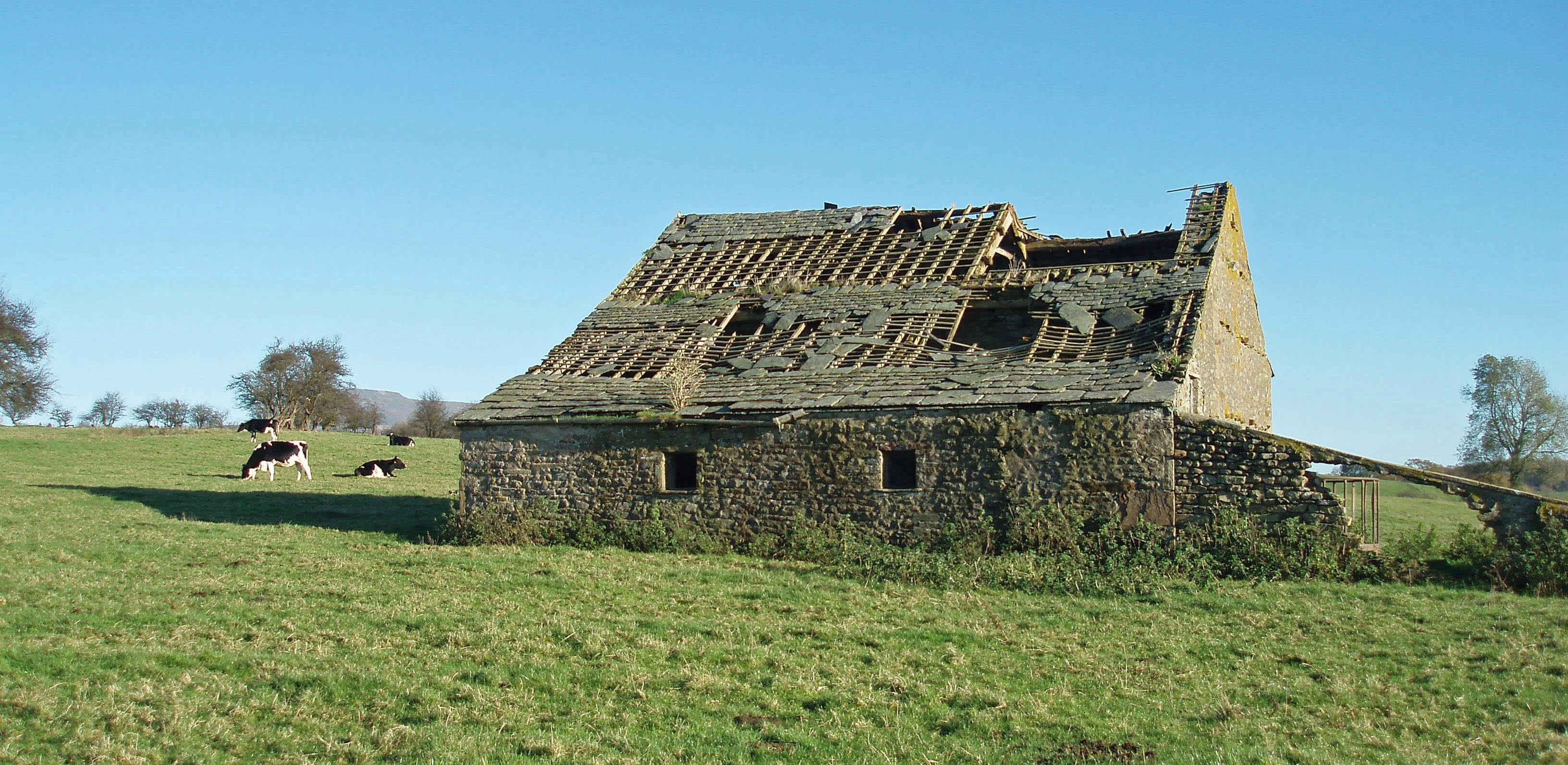
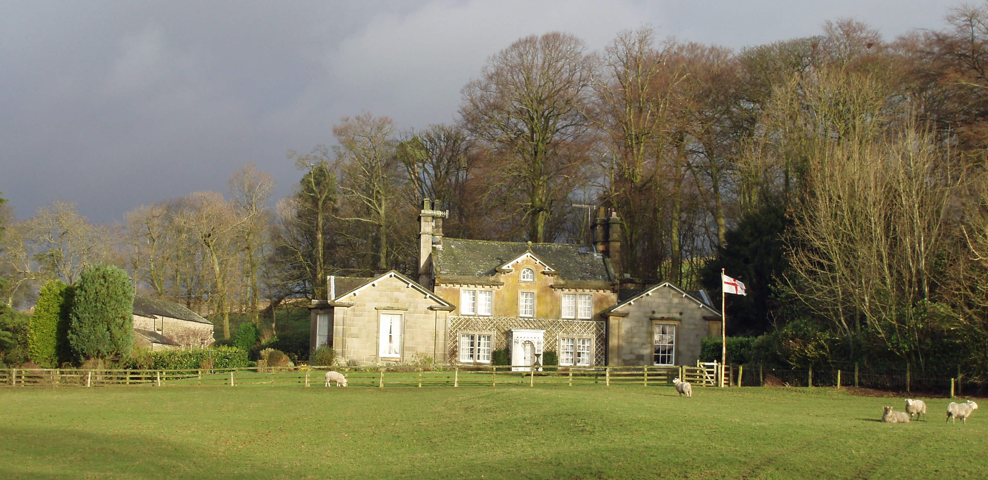
Barn near Burton-in-Lonsdale
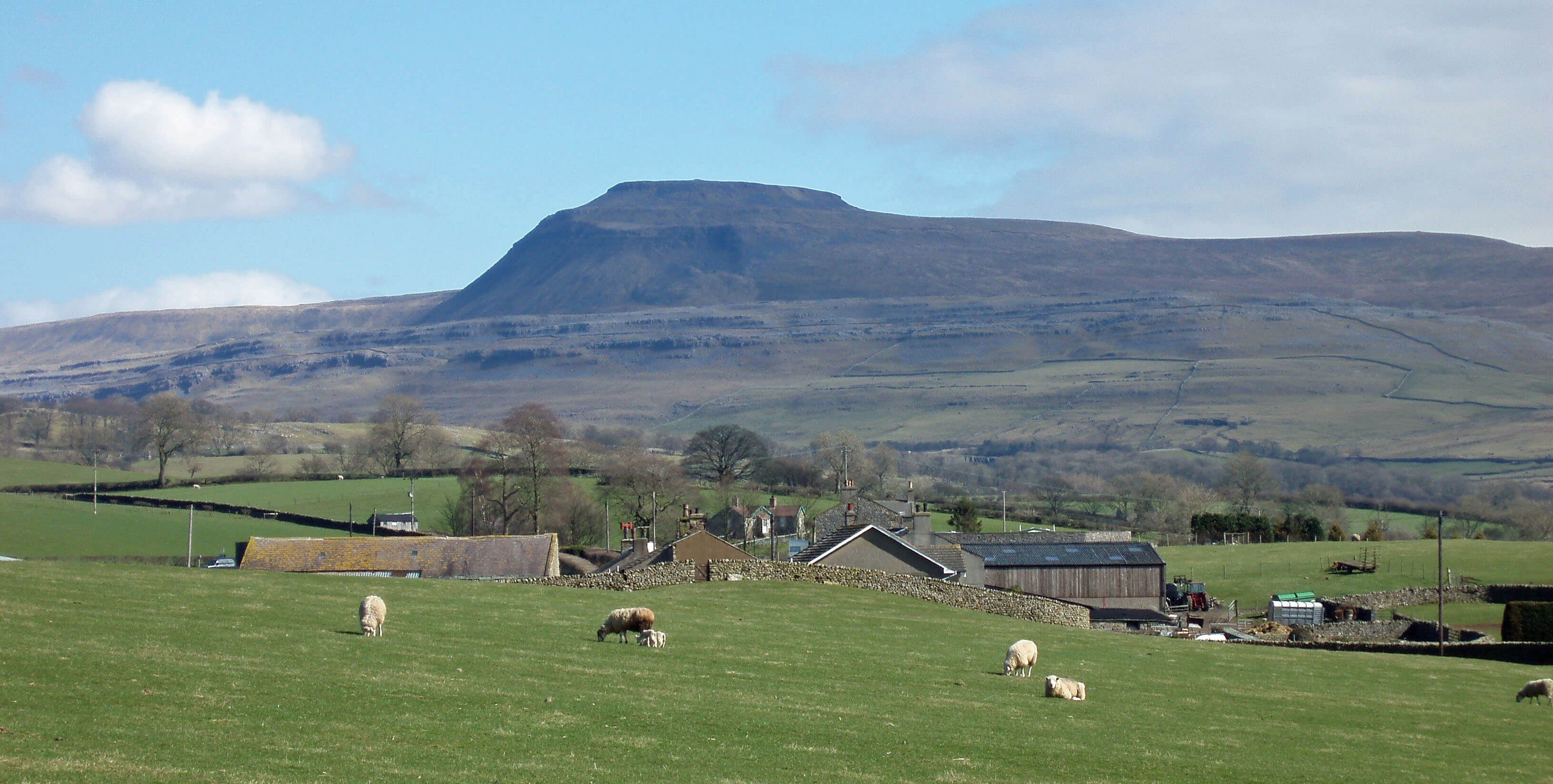
The Greta from Kingsdale Beck
Chapel Beck and Kingsdale Beck (or the Rivers
Twiss and Doe, or vice versa) merge to form the
Greta in the middle of Ingleton. Ingleton is always
thought of as part of the Yorkshire Dales although it is
in fact carefully excluded from the National Park, whose
boundary detours around the northern outskirts. Perhaps
the boundary makers agreed with the afore-mentioned
Thos Johnson who, writing of the church in 1872, said
that it “partakes of the character of the houses, being a
miserable, slap-dashed building, without one redeeming
feature.”
No writer would dare to be so offensive today but
even so it cannot be denied that Ingleton has more of
an industrial nature than places we’ve visited earlier.
Apart from the tourist industry, which dominates today,
there is still quarrying nearby, although on a lesser scale
than previously, and an industrial estate, close to the site
of the old Ingleton Colliery. In 2004 a monument was
erected near the A65 to help ensure that Ingleton’s coal
mining history is not forgotten. Small-scale coal mining,
as in Dentdale and Barbondale, existed here since the
17th century, although the seams were of poor quality
and thin, as indicated by their being called the ‘four
feet’ and ‘six feet’ seams. Numerous pits are shown on
the OS map, all marked as disused, which they became
once the railways made local coal mining uneconomic.
In 1913, however, a ‘ten feet’ seam was found deeper
underground (quite why anyone went to the trouble of
looking is unclear). The Ingleton Colliery operated until
1936, employing up to 900 people. There is no sign of
the colliery now but it is not inconceivable that, with
new technologies and changing energy policies, coal
mining will return to the region.
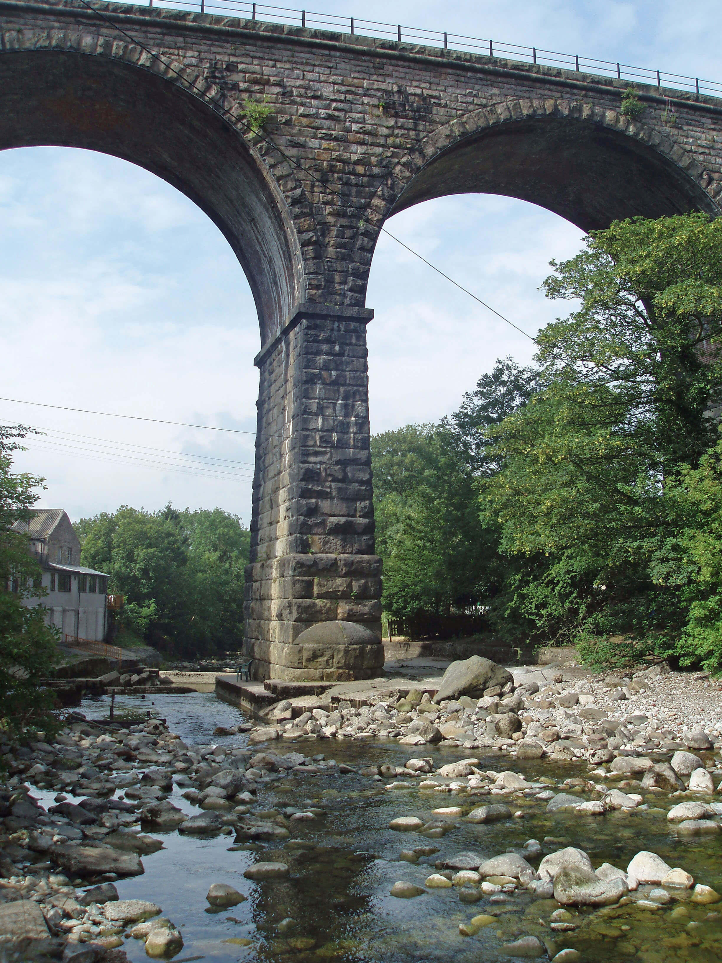 Left: Ingleton Viaduct, where Kingsdale Beck joins Chapel Beck to become the Greta
The Greta passes under the Ingleton Viaduct (for
the Lowgill-Clapham line) of eleven arches nearly
30m high. It is here that the ‘failure of railway politics’
mentioned in Chapter 3 was most manifest. Approval for
such a viaduct was granted in 1846 but dithering and
disagreements between the companies involved delayed
its building until 1861. Then the animosity between the
Midland Railway and the London and North Western
Railway led them to build two railway stations, the
former’s east of the viaduct and the latter’s to the west.
Through passengers were required to disembark and
transport themselves and their luggage between the two
stations. To maximise inconvenience the companies
ensured that the timetables did not mesh. (And we
complain about the modern rail system.)
Tourists from the industrial cities of the north
heading for the Ingleton Waterfalls disembarked at the
station to the east (where the information centre now is)
and were led by guides to the start of the walk, averting
eyes from the slap-dashed church, at least until 1886
when St Mary’s was rebuilt, retaining the old tower.
Inside the church there’s an interesting 12th century
font with carvings of gospel scenes. Ingleton is ancient,
appearing as Inglestune in the Domesday Book, but,
as Thos Johnson warns us, there are few old buildings
of interest. Around the viaduct and the entrance to the
waterfall walk, the main streets are lined with cafés and
shops and in summer the pavements are jostling with the
booted backpacked brigade.
The regions to the east and west of Ingleton drain to
the Greta, from below Tow Scar by becks flowing through
Thornton-in-Lonsdale and from Ingleborough Common,
south of Ingleborough, by Jenkin Beck and Aspland
Beck. Thornton-in-Lonsdale is the place furthest from
the Lune to acknowledge in its name an association with
it. A website for its Marton Arms says that “together with
historic St Oswald’s Church, they form the charming
hamlet of Thornton-in-Lonsdale.” There is a little more
to Thornton-in-Lonsdale than the pub and church, but
not much. The church is surprisingly large for such a
location and has a distinctive pyramid atop its tower. It
was rebuilt in 1933 after being burned down in a blizzard,
which sounds an event worth seeing.
Above Thornton-in-Lonsdale, on the road to the
radio station, there is an unusually smart barn. If you
peer through its windows, you will see its even more
unusual contents - a red sandstone arch. The explanation?
What else could it be but another Andy Goldsworthy
construction? This arch was built and dismantled at many
of the Goldsworthy Sheepfolds and ended up here.
Jenkin Beck forms the waterfall of Easegill Force
in a secluded gorge, falling behind a natural arch. The
beck dawdles across flat land to join the Greta 2km south
of Ingleton and it is followed shortly after by Aspland
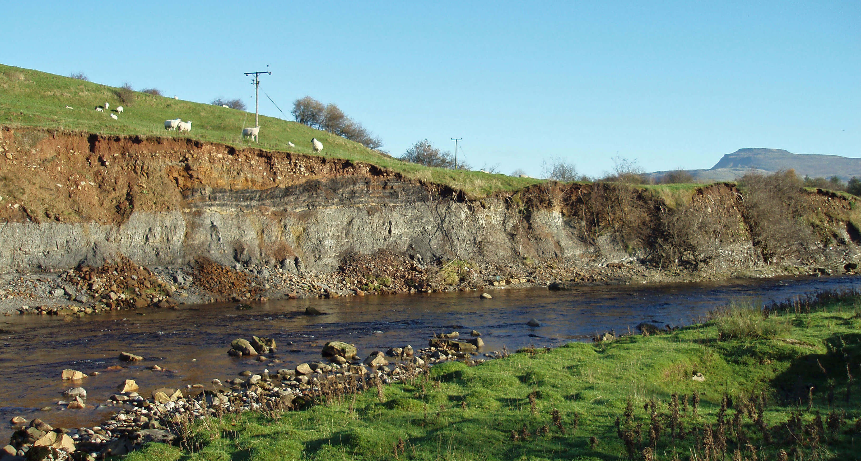
Beck, which similarly runs uneventfully west from Cold
Cotes. Here, the bed of the Greta is adorned with multi-coloured stones, reflecting the varied geology upstream,
and the banks are heavily eroded, revealing interesting
strata.
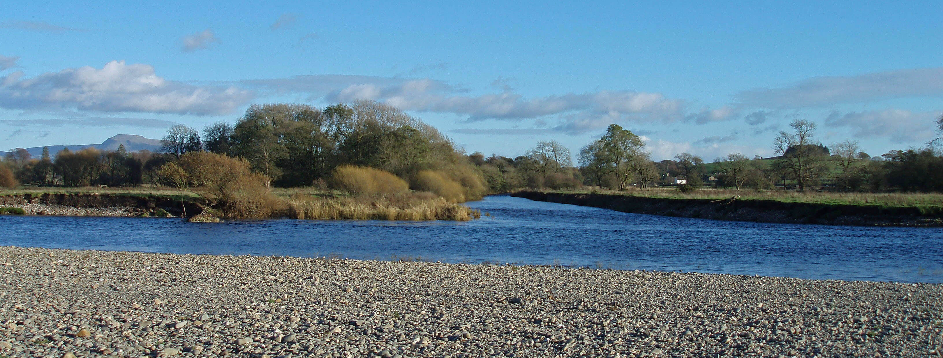
 Right: The Greta near Barnoldswick
As the Greta approaches
Burton-in-Lonsdale it passes
Waterside Pottery, which it isn’t
but which reminds us that potteries
thrived here from the early 18th
century until after the Second World
War. At one time there were fifteen
potteries. The only evidence today
is the pockmarked appearance of
the fields, from which the shale was
dug. Burton-in-Lonsdale was called
‘Black Burton’, in reference to the
earthenware produced, or to the coal
and shale used, or to the smoke from
the kilns. Or perhaps to distinguish
our Burton from the other Burton,
Burton-in-Kendal, just 12km west
in limestone country, although I can
find no record of the latter being
called ‘White Burton’.
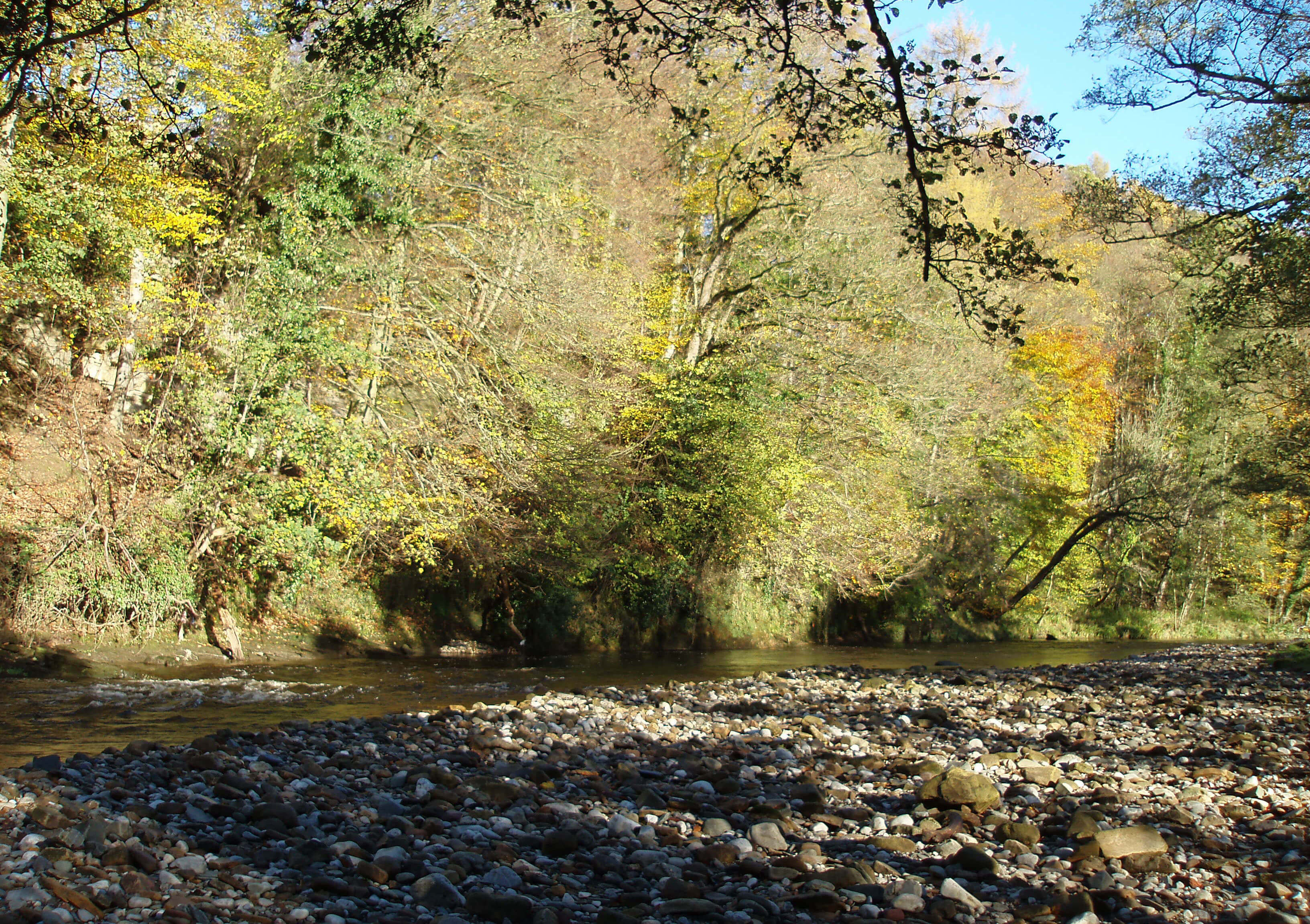 Left: The Greta at Scaleber Woods
On the outskirts of Burton-in-Lonsdale, the Greta is
joined by a millrace that runs from the old corn mill at
Bogg Bridge. On the 1850 OS map this bridge is called
Mill Race Bridge and the watercourse, for the 10km
from its origins on the slopes below Gragareth to the
Greta, is the “Mill Race or Water Cut”. This indicates
the considerable efforts that were made to control the
flow of water in order to power mills. In this case there
were several mills on the route of the millrace. Today
the watercourse looks entirely natural below Masongill
Fell Lane. Perhaps it was only the section to harness
Gragareth’s water that was man-made.
The beck, if we may call it that, runs past Masongill
Hall, on the east of the village of Masongill. This is a
quiet cul-de-sac, with most residences being conversions
of traditional long-houses. Masongill is responsible for
another of Loyne’s tenuous links with celebrity: in 1883
the mother of Sir Arthur Conan Doyle (who was then
27) moved here. Literary sleuths, who earnestly seek the
inspiration for the creator of Sherlock Holmes, know
that he regularly visited his mother and was sufficiently
part of the region to be married in 1885 at St Oswald’s
Church in Thornton-in-Lonsdale, where a certificate in
the porch names the bride as Louisa Hawkins. Some of
them are convinced that Masongill House is Baskerville
Hall, minus the hound. Others are intrigued that a
Randall Sherlock, brother of the Rev. Sherlock, vicar of
Ingleton and Bentham, was killed by lightning at Ingleton
station in 1874. I don’t know of any contemporary, local
comments on this ‘coincidence’ after Sherlock Holmes
made his appearance in A Study in Scarlet in 1887.
 Right: Masongill House
From Byber Mill the Water Cut seems not to follow
its old line but supplements Threaber Beck, which
joins Moor Gill from Westhouse near Low Threaber.
Westhouse is a distributed hamlet, with Higher, Lower
and Far Westhouse satellites. Its lodge, recently
renovated, has been given a new datestone of 1676.
The Wesleyan Chapel bears three dates, 1810, 1890 and
1912.
In 2002 over ten thousand native trees were planted
in fields north of Far Westhouse to create Edith’s Wood,
managed by the Woodland Trust. It is open to the public,
with benches from which to survey the growing trees,
with Ingleborough beyond. As the wood is a memorial,
we should remember to whom: Edith Bradshaw of
Ingleton, a teacher at Casterton School.
The Greta reaches the three-arched Burton Bridge,
with the sizable, ancient village of Burton-in-Lonsdale
on its northern slopes. It appeared as Borctune in the
Domesday Book and is the site of another motte and
bailey castle. In 1174, the de Mowbrays were ordered
to demolish the castle after an unsuccessful rebellion
against the king. A later stone castle stood until about
1350, since when the site has been abandoned. The motte,
at 10m high, is a prominent landmark, and remains of the
bailey and defensive ditches can still be seen, although
they are on private land.
 Left: Ingleborough from Westhouse
Also prominent is the nearby steeple – a rarity in
Loyne – of the All Saints Church, completed in 1870.
The steeple is surfaced with wooden slats. There is also
a Methodist church, built in 1871. Like many Loyne
communities, Burton-in-Lonsdale joined in the general
questioning of the established church that began in the
17th and 18th centuries and, unlike nearby Bentham, it
came to side more with the Methodists than with the
Quakers. Maybe John Wesley’s visit in 1764 played
a part in this. So the churches are not particularly old
and neither are the houses. Most of those of any age
have been renovated, so that the neat Low Street, off
the A687, presents a parade of Smithy House, The Old
Ropery, and so on.
Motorists driving west through Burton-in-Lonsdale
will see a blue sign saying “Richard Thornton’s Church
of England Primary School” and may wonder who he is
or was. He died in 1865, having amassed a huge fortune
of over Ł3m from his shipping business, and left Ł10,000
for a school for poor children in Burton-in-Lonsdale. He
also left Ł1m to his nephew Thomas Thornton, who duly
had the All Saints Church built. Behind the School is
the Old Vicarage, which has a plaque in its porch that
cannot be read without trespassing (I assume that it is to
the poet Laurence Binyon).
[Update: The school closed in 2014.
The buildings and land seem to be for sale.]
Below Burton-in-Lonsdale, the south bank of the
Greta is wooded, with two of the woods, Memorial
Plantation and Greta Wood, having recently been
acquired by the Woodland Trust. The former is typical
of 19th century small plantations on land that cannot be
farmed, with pine, beech and sycamore. Greta Wood is
an older ash and oak woodland, designated an Ancient
Semi-Natural Woodland. A riverside walk follows the
Greta west for 1km – and then stops. Perhaps it is more
for fishermen, who have given names to the various
stations along Blair’s Beat: Long Pool, Tommy’s Run,
The Dubs, and Black Hole.
The Greta runs west through secluded wooded
gullies, crossing the county border and the Roman road.
At Wrayton, the Greta passes under Greeta Bridge (as it
calls itself), which has been washed away a few times
but is now in more danger from the traffic on a difficult
junction of the A683 and A687. Just before the Greta
reaches the Lune, Cant Beck joins it from the north.
Laurence Binyon is a poet from whom, if not of whom,
everybody will have heard. He wrote the words intoned at
Remembrance Day events:
They shall grow not old, as we that are left grow old;
Age shall not weary them, nor the years condemn.
At the going down of the sun and in the morning
We will remember them.
The words are part of For the Fallen, which he wrote in
September 1914.
However, Burton-in-Lonsdale’s claim to Laurence
Binyon is a little weak. He was born in Lancaster in 1869,
moving a year later to Burton-in-Lonsdale, where his father
had been appointed the first vicar of All Saints Church. But
in 1874 the family left for Chelmsford. Later, working at
the British Museum, he became an authority on oriental
art.
We might imagine that the brief time in Burton-in-Lonsdale made little impression upon him but for his own
recollections of his first memories, which were of views
of Ingleborough from the vicarage windows. Ingleborough
inspired his poem Inheritance, which began “To a bare
blue hill” and ended “Beautiful, dark and solitary, the first
of England that spoke to me.”
Cant Beck
Cant Beck is a surprisingly modest beck considering
that it drains the broad parishes of Ireby, Cantsfield
and Tunstall between Leck Beck and the Greta. It loses
the momentum gained in flowing off Ireby Fell, as Ireby
Beck, in a sluggish meander across gently undulating
pastures to Tunstall.
Ireby Beck begins life uncertainly on the southern
slopes below Gragareth, hovering around the county
border and seeming to disappear into various potholes.
The most impressive on the surface is Marble Steps Pot,
which is enclosed within the only cluster of trees on Ireby
Fell. It drops 130m. Along the line of the beck, 400m
south, is Low Douk Cave and across the county border
is Ireby Fell Cavern, a large depression with at least two
holes into which water disappears and one hole, a pipe
cemented into place (is planning permission needed for
these mutilations?), into which potholers disappear -
and in some numbers, it would seem, as a group of 25
of them needed rescuing after becoming trapped in the
cavern by heavy rain in October 2008.
I have been carefully vague in the preceding
paragraph because I read that, contrary to superficial
appearance on the map, the water falling into these holes
does not join Ireby Beck at all. The water in Marble
Steps resurges at Keld Head in Kingsdale; that of Ireby
Fell Cavern at Leck Beck Head (probably). Of course,
flows may have differed in the past and may differ in the
future. I leave this all to experts – as far as fell walkers are
concerned, the potholes mentioned can be conveniently
viewed together, above the head of Ireby Beck.
Once Ireby Beck is incontrovertibly established it
heads past some unnatural-looking mounds on the fell
(old diggings or homesteads?), by Over Hall, a tower
house dated 1687 and recently smartened up, with a
cairn-like structure in the drive, towards the village
of Ireby. As a rule of thumb, any village with a beck
flowing through its centre is at ease with itself. It soothes
and adds a timeless quality. In Ireby, the old-style red
telephone box, the only public amenity, enhances this
feeling. The houses, some of the 17th century, have been
tastefully renovated and given countrified names – all
very nice but perhaps without the character to detain a
visitor.
The fields west of Ireby Hall Farm form pleasant
and peaceful farming country, with fine views of
Ingleborough and Leck Fell. The Roman road that we
have been following cuts across here, but you would
not notice it on the ground without being told. Cowdber
Farm is so isolated that it feels it needs to put a “you are
nearly there” sign on the track to it. But the quietness
has its benefits: in the plantation near Churchfield House
is the largest heronry in Loyne. Southeast of Cowdber
is Collingholme, which promotes the good name of
the region through its Lune Valley Hampers business,
supplying luxury goods from locally produced food.
Most farms in the region have been converted, partially
or wholly, into homes for holidaymakers. Laithbutts
has gone further: it provides a home for holidaymakers’
homes. If you wish to put your caravan into storage,
there are large barns for it at Laithbutts.
To the south, Cantsfield is a small community on
the A687. The rather fine Cantsfield House, dating back
to the 16th century or earlier, has an oddly appealing
asymmetric frontage that was built by the Tatham family
in the early 18th century.
A visitor’s impression of a place can be unfair. I
noticed a sign saying “This bridleway is over private
land and is for the sole purpose of making a journey
to Tunstall and Tunstall Church. It is not a dog loo.
Please keep out unless you intend to complete the full
journey.” The map says that this is a public bridleway.
It runs through land for cows, horses and sheep and
at Abbotson’s Farm I had just plodded through their
contribution (much more substantial than a dog’s) to the
countryside aroma. And why must I complete the full
journey and not turn back?
 Right: St John the Baptist Church, Tunstall
As it happens, I had no wish to return to Cantsfield.
I pressed on to Tunstall’s St John the Baptist Church,
on the site of a chapel recorded in the Domesday Book.
It escaped the 19th century renovations that ‘improved’
most Loyne churches and as a result is mainly of the
15th century, with some parts thought to be pre-Norman.
A Roman votive stone from the Over Burrow fort was
built into an eastern window during a 1907 restoration.
Despite all its merits the church is best known for the fact
that some girls used to come here in 1824. The Brontë
sisters ate their packed lunches here and it became the
Brocklebridge Church of Charlotte’s Jane Eyre.
Tunstall itself is 1km to the west, past the Old
School House of 1753. The old Post Office (which
it no longer is) bears a date “circa 1640”, which is
refreshingly honest and a warning to treat other dates (of
which there are several in Tunstall) with some suspicion.
Especially, perhaps, Marmaduke House, with a plaque
“Sir Marmaduke Tunstall 1506-57”, which I take to
be the date of Sir Marmaduke, not the house. As this
indicates, we are nearing the historic Tunstall family
home, Thurland Castle, by which Cant Beck flows.
Thurland Castle is open to the public only in the sense
that if you have half a million or so to spare you can buy
a flat and live in it – which is a shame for Loyne is short
of castles with pedigree. In Saxton’s map of 1579, often
regarded as the first map of England, Thurland Castle is
one of only four places in Loyne to be shown, the others
being Lancaster, Kirkby Lonsdale and Hornby Castle.
Sir Thomas Tunstall, knighted at Agincourt, was
granted a royal licence to fortify the site in 1402. The
most famous of the Tunstalls were Cuthbert, who became
Bishop of Durham from 1530 to 1559, and Sir Brian,
who was slain at the Battle of Flodden Field in 1513
– the ‘stainless knight’ described in Scott’s Marmion:
“Tunstall lies dead upon the field, His life-blood stains
the spotless shield”.
The Tunstalls sold the castle in 1605 to the
Girlingtons and they were the owners when it was razed
to the ground during the Civil War. It was restored in the
old style in 1809 and in the 1860s was owned by Major
North North. No, that is not a misprint: he was born
North Burton and assumed the surname of North when
he succeeded to the estate of Richard Toulmin North, his
great-uncle.
The castle was rebuilt again in the 1880s after a fire.
It has, no doubt, been tastefully renovated for the tenants
of the twelve flats created from the castle and adjacent
stables. The castle can now only be glimpsed from afar
through trees. It consists of a circuit of walls and towers,
enclosed in a moat, with a drawbridge into a courtyard
but with no keep.
The estate agents try to give the castle some prestige
by asserting that “in 1809 the architect James Wyatt,
who was working on Windsor Castle at the time, was
commissioned to restore the castle.” James Wyatt (1746-1813) was the principal architect of the day and was
notorious for taking on more commissions than he could
manage. His nephew Jeffry Wyatt (1766-1840), later
Wyattville, was probably more involved with Thurland
Castle and it was he who later (1824 to 1836) carried out
a major renovation of Windsor Castle. Thurland Castle
does not feature highly in either architect’s portfolio.
A short distance after Cant Beck has joined, the
Greta reaches the Lune, which it enters in a straightened
westerly channel, as old maps show the Greta entering
the Lune in a long curve to the south of its present course.
The Greta joins the Lune
Then, unnoticed (almost), Newton Beck sidles into the
Lune from the west.
Newton Beck
Like most becks on the west bank of the Lune,
Newton Beck begins in desultory fashion among
the low, rolling hills and never really gets going. It
runs alongside the Lune for 5km from High Biggins,
just south of Kirkby Lonsdale. At High Biggins there
are, apart from the Old Hall, three halls of strikingly
different architecture: Biggins Hall Farm, a black-and-white, seemingly half-timbered house with a red-tiled
roof; Lonsdale Hall, a white Georgian mansion; Sellet
Hall, a more vernacular stone building.
In 2006 the farm was sold in six lots (a subsequent
proposal to use some buildings for storage was rejected);
Lonsdale Hall houses a management consultancy; Sellet
Hall is the home of a forestry management company.
Loyne has no stately mansions like, say, Chatsworth
House, but it has many halls for the landed gentry of
the Middle Ages and later. The story of these halls, and
the attempts, of mixed success, to find them a role in the
21st century, would make a fascinating contribution to
the social history of the region.
Sellet Hall Beck and Pinfold Beck converge in the
village of Whittington, near an even more impressive
hall, Whittington Hall. It was designed in 1831 for the
Lancaster MP, Thomas Greene, by George Webster, four
of whose halls we have already met: Ingmire, Rigmaden,
Whelprigg and Underley. It is similarly in the Elizabethan
revival style, in this case with medieval features, such as
a peel tower. The best view of Whittington Hall is to be
had on the path north from Outfield, where a walk is in
silence apart from the screech of disturbed pheasants.
The hall is seen, from a distance admittedly, with the
Howgills and Middleton Fell behind.
East of the Hall is St Michael’s Church, which was
probably founded as the chapel within
the bailey of a motte and bailey castle.
The tower, of 1600 or so, is the oldest
part of the present church, which was
rebuilt in 1875. In the graveyard is a
headstone that reads “In memory of
Edward Baines of Whittington who
died of Asiatic cholera on board the ship
Brutus midway to America and was
buried at sea June 3rd 1832”. Historians
of Lancashire will be familiar with
Baines’s Gazetteer, that is, The History,
Directory and Gazetteer of the County
Palatine of Lancaster, written by Edward Baines in 1824
– which contains details of Whittington’s illustrious
history. They are, however, not the same Edward Baines
and, as far as I can determine, were unrelated.
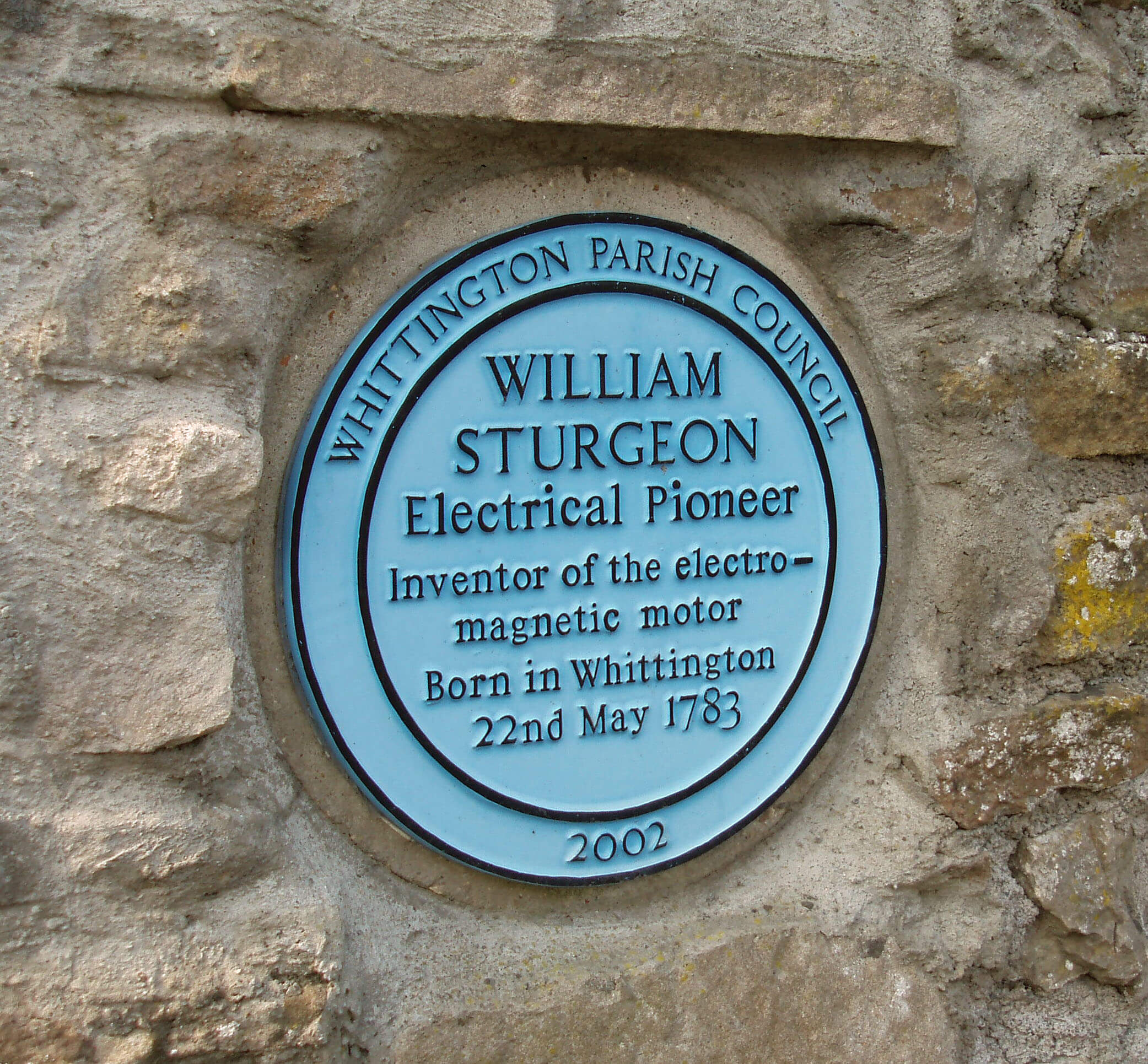 Left: William Sturgeon plaque
According to Baines (of the Gazetteer), before the
Norman Conquest, Tostig, Earl of Northumbria and
brother of Harold II, owned six carucates (over 2 sq km)
in Whittington, which was regarded as the capital of the
region between Sedbergh, Ingleton and Gressingham.
Tostig owned a further 20 sq km within this region. After
Tostig’s death at the Battle of Stamford Bridge, the estate
was broken up and by 1090 Whittington had passed into
the hands of Roger of Poitou, who eventually owned all
of what was to become Lancashire. At Baines’s time,
Whittington was one of five parishes in the deanery of
Lonsdale (the others being Claughton, Melling, Tatham
and Tunstall).
Some of this heritage may be appreciated by a
stroll around the village, where several houses bear 17th
century dates. The Manor House and T’Owd Rose Tree,
both 1658, share the prize for oldest house (subject to
appeal). Croft House in Main Street was the birthplace
in 1783 of William Sturgeon. As with other Loyne
notables, the response is probably: Who?
His plaque in Kirkby Lonsdale church predicted that
“His name will be perpetuated as long as the science he
cherished continues to exist”. The science of electricity
has flourished but William Sturgeon has been almost
forgotten. As a boy he helped his father poach salmon
from the Lune. He was then apprenticed to a cobbler
in Old Hutton, near Kirkby Lonsdale, but escaped in
1802 by enlisting in the army where he taught himself
enough science to be able to build the first practical
electromagnet in 1825 and to design the first rotary
electric motor. Perhaps his untutored, practical, blunt,
northern ways led to his neglect by the
gentlemen scientists of the day.
The becks merge to form Newton
Beck beyond Newton, which, like
Whittington, is old enough to be
in the Domesday Book. The beck
eventually makes it way past the flood
embankment to join the Lune near
Higher Broomfield. The finger of land
beyond the footbridge over Newton
Beck is not publicly accessible and
is therefore a haven for birds, such as
snipe.
The Lune from Newton Beck ...
The Lune passes under the bridge for the Wennington-Carnforth railway line. To be precise, it passes
through the second of the six arches, which, although
the largest, seems not large enough for the Lune to be
channelled through. Is there an explanation?
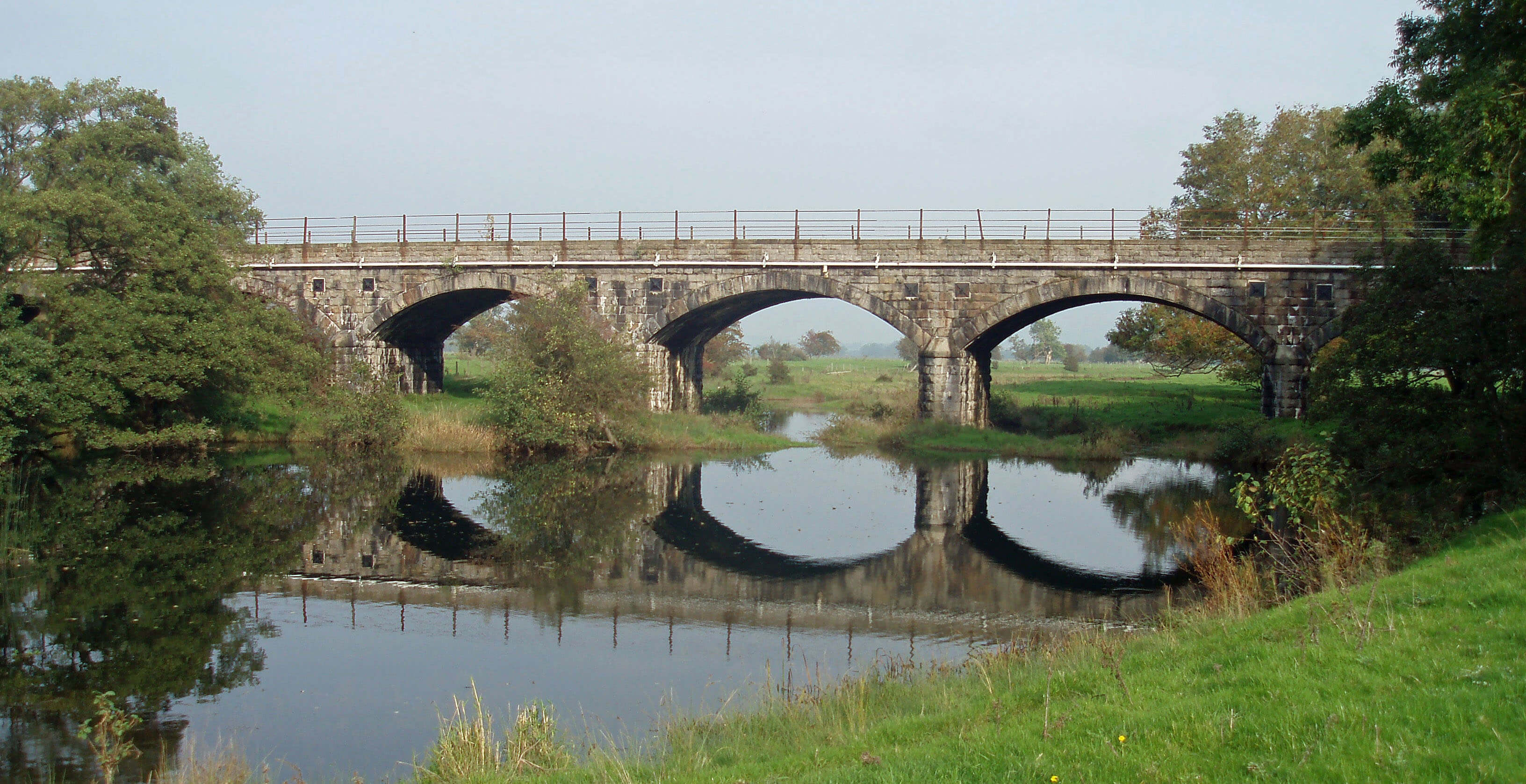 Right: The Melling Viaduct
There are, 500m east, a further sixteen arches. The
1847 OS map shows the Lune flowing there, with the
present course of the Lune, by Arkholme’s Chapel Hill,
then being a backwater marked as “old Lune”, indicating
that before 1847 the Lune had followed its present path.
Moreover, there is a second “old Lune” marked, near
Melling to the east, indicating a third Lune channel. In
short, the Lune has changed course frequently within
relatively recent times. It is thought that when the bridge
was built in 1867 the embankment between the two
sets of arches was on an island in the Lune. Today the
Melling Viaduct, which would form the longest bridge
across the Lune if only the Lune were still to run under
it, stands over ponds in green fields.
The railway line was built to link Furness Railway’s
eastern station at Carnforth with Midland Railway’s
‘little North Western’ line from Leeds to Lancaster,
and hence to link the growing port of Barrow with the
industries of Yorkshire. They must have been keen to
achieve this as the costs of such a long bridge and the
1km tunnel between Melling and Wennington must have
been high. When the Wennington-Lancaster line closed
in 1966, the Wennington-Carnforth line became part of
the Leeds-Lancaster route.
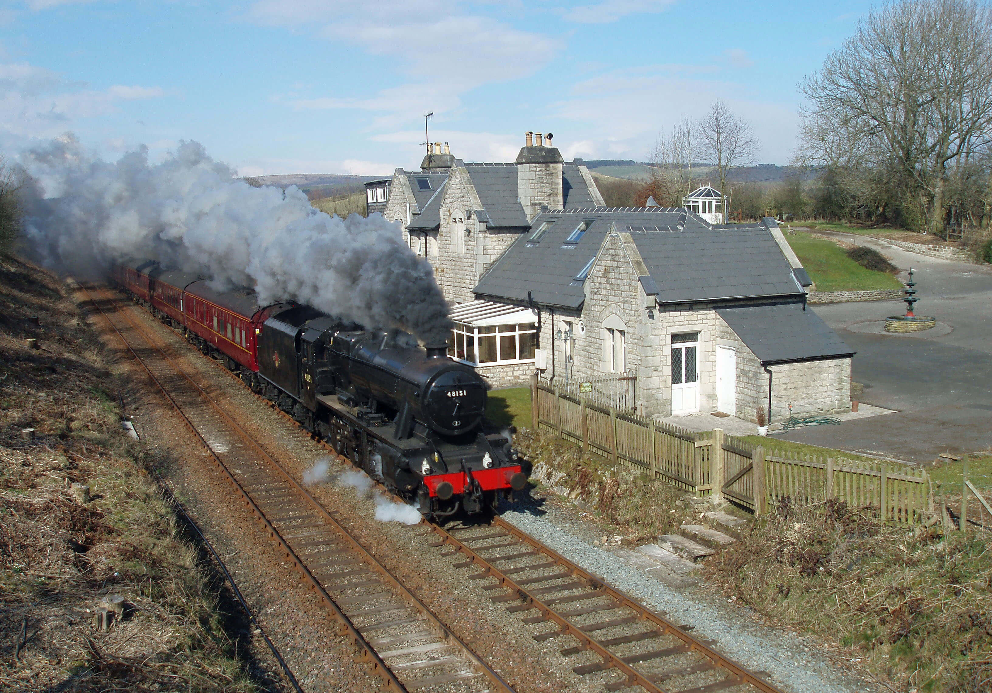 Left: The old Arkholme railway station
There were stations at both Arkholme and Melling
but they were closed in 1960. There is no footpath on
the railway line, the ferry across the Lune ended service
in the 1940s, and the ford has fallen into disuse, leaving
the two villages, only 1km apart, more separated now
than ever.
By fortune or foresight, the road in Arkholme runs
from the old ferry (from the Ferryman’s Cottage, in fact)
west for 1km to meet the Kirkby Lonsdale road at right
angles and is therefore a peaceful cul-de-sac. In summer,
colourful gardens face the road and there is a prettiness
and cheeriness, due to the relative absence of traffic. The
houses are strung out higgledy-piggledy, no two alike,
some old (17th century), some new (21st century).
Most of the older houses have names indicating
their previous lives, although I noticed none that refer
to the industry for which Arkholme was best known,
the making of baskets, from about 1700 to 1950. This
activity was typical of many Loyne industries, being
based on some local resource (here, osiers in the
Lune floodplain), intended to meet local needs (of, for
example, potato growers in Fylde), and passed on as a
family trade, but then succumbing to competition from
larger, more commercial ventures,
especially after the advent of the
railways.
On the other bank, its sister
Melling lies mainly along the busy
and narrow A683 and as a result
its doors and windows are shut, its
gardens are away from the road,
and people do not linger by the
noisy and dangerous traffic. Within
Melling, Green Close Studios,
which opened in 1997, has focussed
on locally-based art activities and
in 2009 initiated the Bowland Arts
Festival.
The future of Melling Hall,
an 18th century manor house,
more recently a hotel and now
a listed building, has been the
subject of a planning debate that
is an interesting example of the
difficulties of conservation policies. The building is a key
part of the Melling Conservation Area, and the Lancaster
District policy is that no pub or hotel will be converted
to residential use unless it can be demonstrated to be no
longer viable, even if, as in this case, it was originally
a residence. No buyer could be found to sustain it as a
hotel and, after some controversy, it has been converted
into flats.
[Update: The future of Melling Hall has continued to provide
confusing entertainment. Melling Manor, the old east wing of Melling Hall and valued at Ł845,000, was
sold by raffle in 2017.
(I think I was wrong to say that the Hall had been converted into flats.) The present Melling
Hall, valued at Ł930,000, was to be raffled in 2020 but not enough tickets were sold.
I suppose that means that Melling Hall is still for sale.]
Arkholme and Melling are listed in the Domesday
Book as Ergune and Mellinge, respectively. The parish
boundary between them lies near Melling, where the
Lune once flowed. Both Arkholme and Melling had
their motte and bailey castles and in
both cases a church has been built,
as at Whittington, within the bailey.
Arkholme’s St John the Baptist
Church is tucked below, almost
into, the motte, which is 30m in
diameter. Melling’s St Wilfrid’s is a
larger church, with a long nave and
square tower, and is a Biological
Heritage Site because of the lichens
on its gravestones. The Melling
motte is now a feature in the garden
of the Old Vicarage.
 Right: St Wilfrid’s Church, Melling
The Arkholme motte is close to
the Lune Valley Ramble, which the
Lune has accompanied from Kirkby
Lonsdale, and below Arkholme the
Ramble shares footsteps with the
Lunesdale Walk, a name that is even
more of an exaggeration than the
Ramble since its 59km cover only
6km of the Lune. The walk traces
an elaborate figure of eight route
from Carnforth to Roeburndale.
The Lune runs by flat, green
pastures on the east, where the old
Lune has created many ditches and
where enormous logs have been left
stranded by floods. Bank erosion
continues apace, and the Lune
shifts between various channels,
running by pebble beaches and
new islands. To the west, there are
gentle hills, on the horizon of which
can be seen the turrets of Storrs
Hall, which was rebuilt in 1850,
and from which minor tributaries
such as Bains Beck and Thrush Gill
enter the Lune. The hills are not
high, reaching only 142m at Cragg
Lot, but nevertheless there is an
application to put five 125m wind
turbines on them. This proposal is ominous for
the Lune valley, for if turbines are built in such a
location then no field and no view within the Lune
valley is safe.
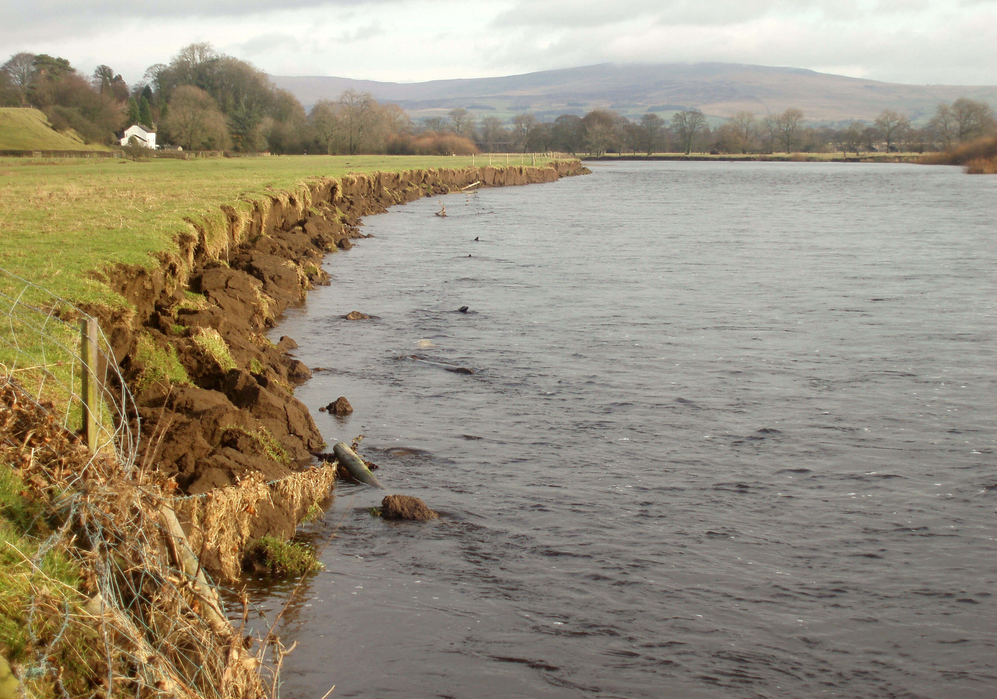 Left: Erosion of the Lune bank near Arkholme
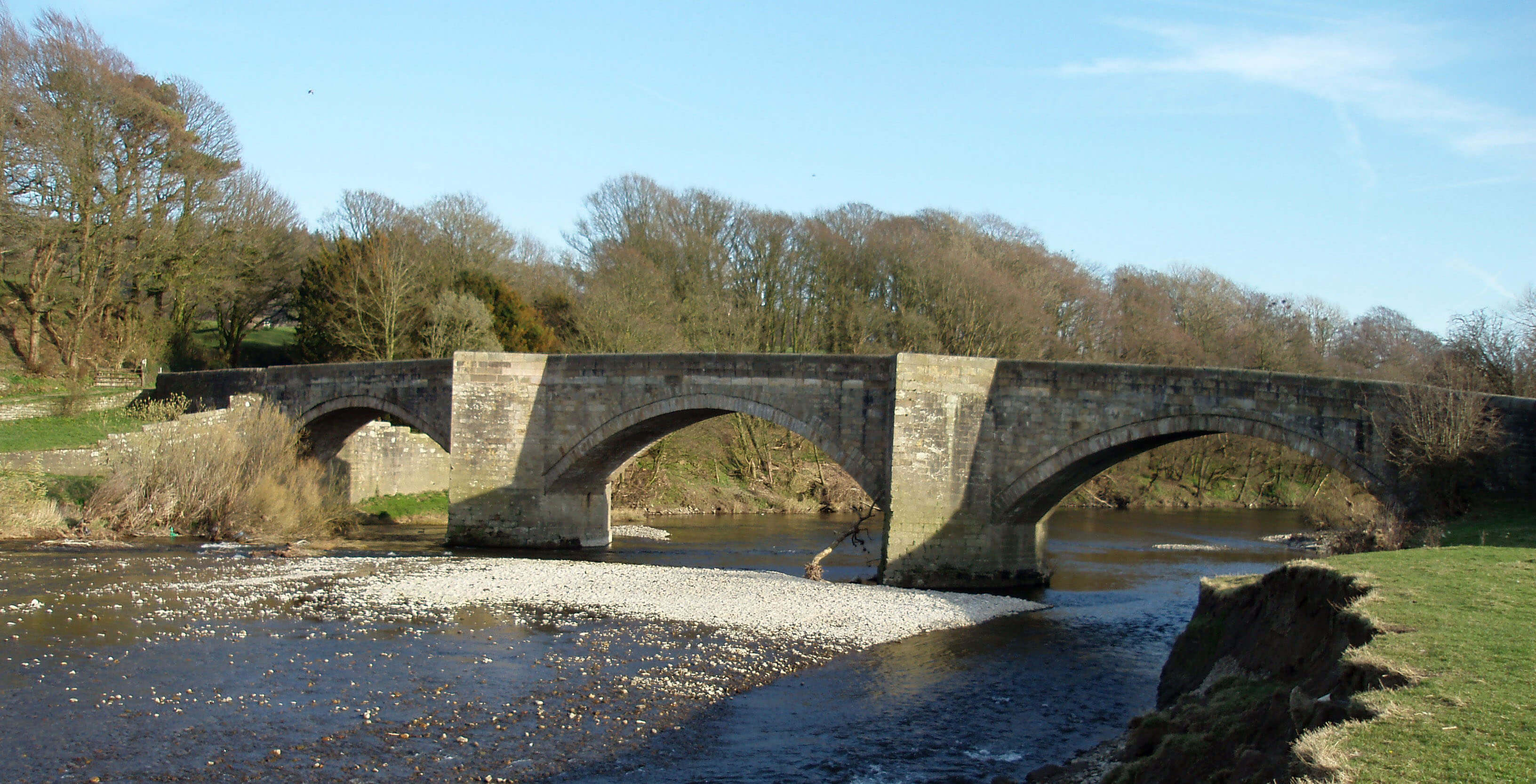
The Lune reaches Loyn Bridge, which was
built in 1684 or before – it is known that an earlier
bridge was reported as dangerous in 1591. The
bridge is built of sandstone blocks and has three
arches, the outer ones of 16m and the inner of
19m. The piers have pointed cutwaters that provide
alcoves on the 4m-wide carriageway. The bridge
provides the only vehicular crossing of the Lune
for about 8km in either direction. It is clearly sturdy
enough to withstand Lune floods but no doubt its
builders knew that when the Lune is high it takes a
short cut across the fields to the west, as damage to
the hedgerows shows.
Above Loyn Bridge to the east is Castle
Stede, the remains of a motte and bailey castle
(our eighth, if you are counting). When Castle
Stede was abandoned as a castle, later buildings
did not engulf it, so the original structures are well
preserved. We can see the 15m-high motte and the bailey,
with its defensive ramparts and ditch, and appreciate the
strategic position overlooking the Lune valley. Strictly,
it is off the public footpath but it is tempting to wander
over the causeway (probably where the original entrance
was) into the bailey and transport oneself back to the 12th
century by imagining the bustle of activity – kitchens,
stables, maybe a chapel – below the lord’s hall on the
motte.
At Loyn Bridge we enter for the first time the
Forest of Bowland Area of Outstanding Natural Beauty,
although we are still some distance from typical Bowland
country. The ambivalent regard for the Bowland region
is indicated by the inclusion of “Bowland and the Lune
Valley” (where they mean the lower Lune valley) as one
of twelve projects within the Culture 2000 European
Pathways to Cultural Landscapes programme, funded by
the European Union. This sounds like an honour indeed
– until we read that the project is “dedicated to ‘marginal’
landscapes, border regions and landscapes whose image
is one of poverty and historical insignificance”.
 Left: Loyn Bridge
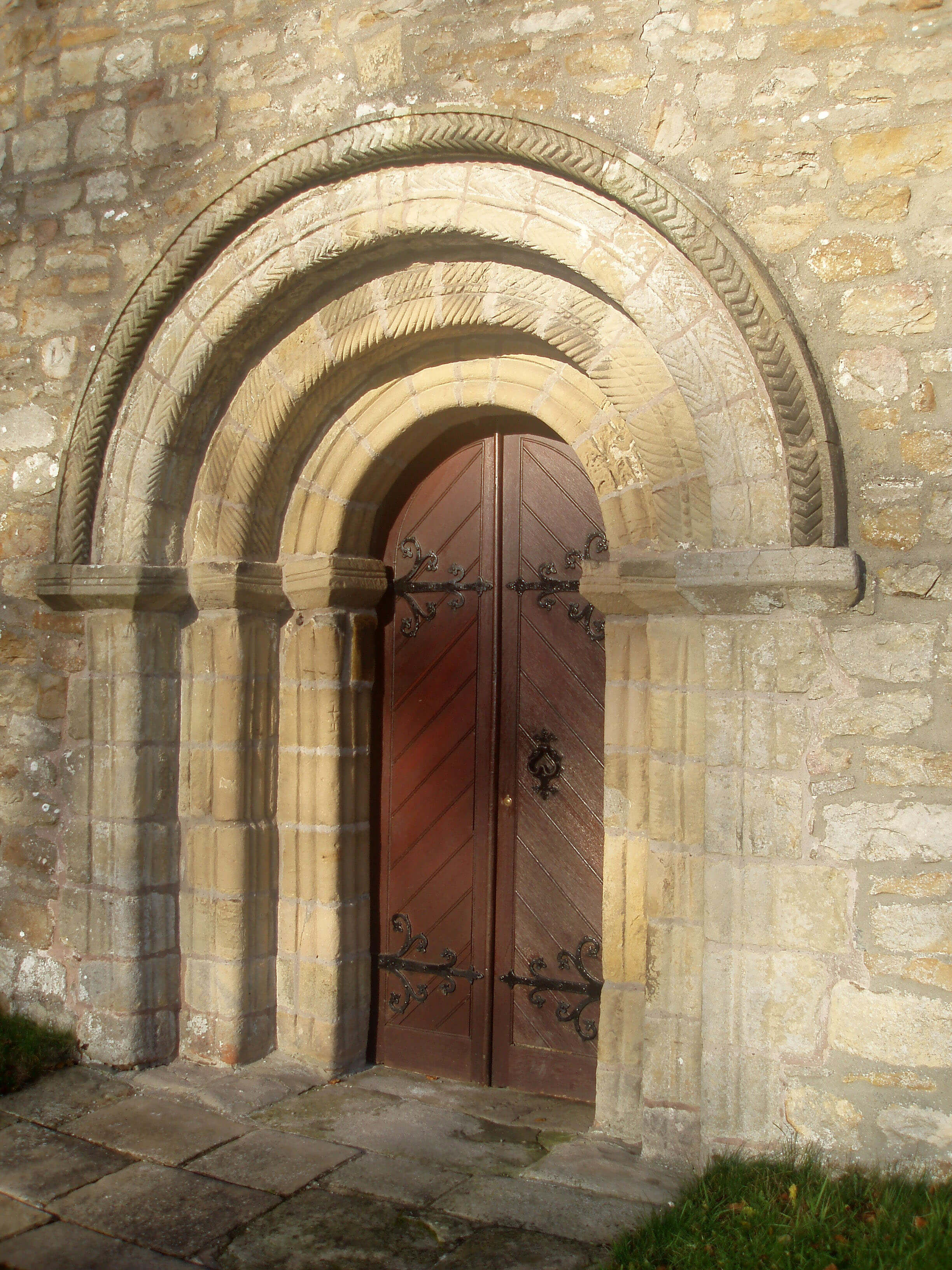
Right: The Norman doorway of Gressingham church
The Lune passes below Priory Farm, which is on
the site of an old Premonstratensian priory, that is, one
belonging to the order of ‘White Canons’ (from the
colour of their habit) founded at Prémontré in France.
Shortly after, the small Gressingham Beck enters from
the west. This beck gathers the waters from the rolling
green hinterland beyond the western ridge and, with
High Dam Beck (which runs from the ‘high dam’ that
used to power the mill), channels them through the
ancient village of Gressingham.
Gressingham is another of Earl Tostig’s holdings
that was listed in the Domesday Book (as Ghersinctune)
but nothing much has happened here since. The small
triangle of homesteads and the line of dwellings by the
beck are quietly attractive, as is the church with its 12th
century arch in the doorway, but the village does little
to draw attention to itself. As far as I am aware, it does
not even claim an association with the one thing that
makes its name famous, the Gressingham Duck, which
features on the best menus. However, assiduous research
(I asked the producers of the duck) revealed that “the
chap who first bred the duck is called Peter Dodd, [who]
lived in the village of Gressingham in Lancashire … the
breeding stock [was moved to] Suffolk in 1990”.
Next, the River Wenning joins the Lune from the
east.
The Forest of Bowland was designated an Area of
Outstanding Natural Beauty (AONB) in 1964 and its 800
sq km make it the 11th largest of the 41 AONBs in England
and Wales. An AONB designation recognises a region’s
scenic qualities and implies a commitment to conserve
its flora, fauna and landscape features, consistent with the
needs of residents. Only the northern third of Bowland lies
within Loyne. The remainder, reached by the two bleak
roads to Slaidburn or through the Trough of Bowland,
drains to the Wyre or Ribble.
The Forest of Bowland is a forest in the historical sense
of an unenclosed, outlying region of little use except for
hunting. Bowland was originally a Royal Forest, although
no sovereign is known to have hunted here. However, Henry
VI was himself hunted, when in 1465, during the Wars
of the Roses, he hid in Bolton-by-Bowland. Traditional
hunting has long gone, to be replaced by grouse shooting,
mainly on land owned by England’s richest aristocrat, the
Duke of Westminster. Until the Countryside and Rights of
Way Act took effect in 2004 (launched in Bowland), this
was England’s largest area without public access.
Lower Bowland consists of rolling green pastures
with picturesque grey stone buildings. The upland areas are
of millstone grit, with thin layers of sandstone and shale
on the slopes, giving rise to open and wild upland areas
of blanket bog and heather moorland that are incised by
fast becks to form steep cloughs and wooded valleys. The
wilderness areas of Bowland remain largely unspoilt by
exploitation, with the works of the water authorities and
the Forestry Commission lying mainly outside Loyne. The
higher fells have been maintained in a relatively natural
state for the sheep and grouse and, since 2004, humans.
The Introduction
The Previous Chapter (The Greta Headwaters)
The Next Chapter (The Wenning Headwaters)
© John Self