The Land of the Lune
Chapter 8: The Greta Headwaters
The Introduction
The Previous Chapter (Middle Lunesdale and Leck Fell)
The Next Chapter (Gretadale and a little more Lunesdale)
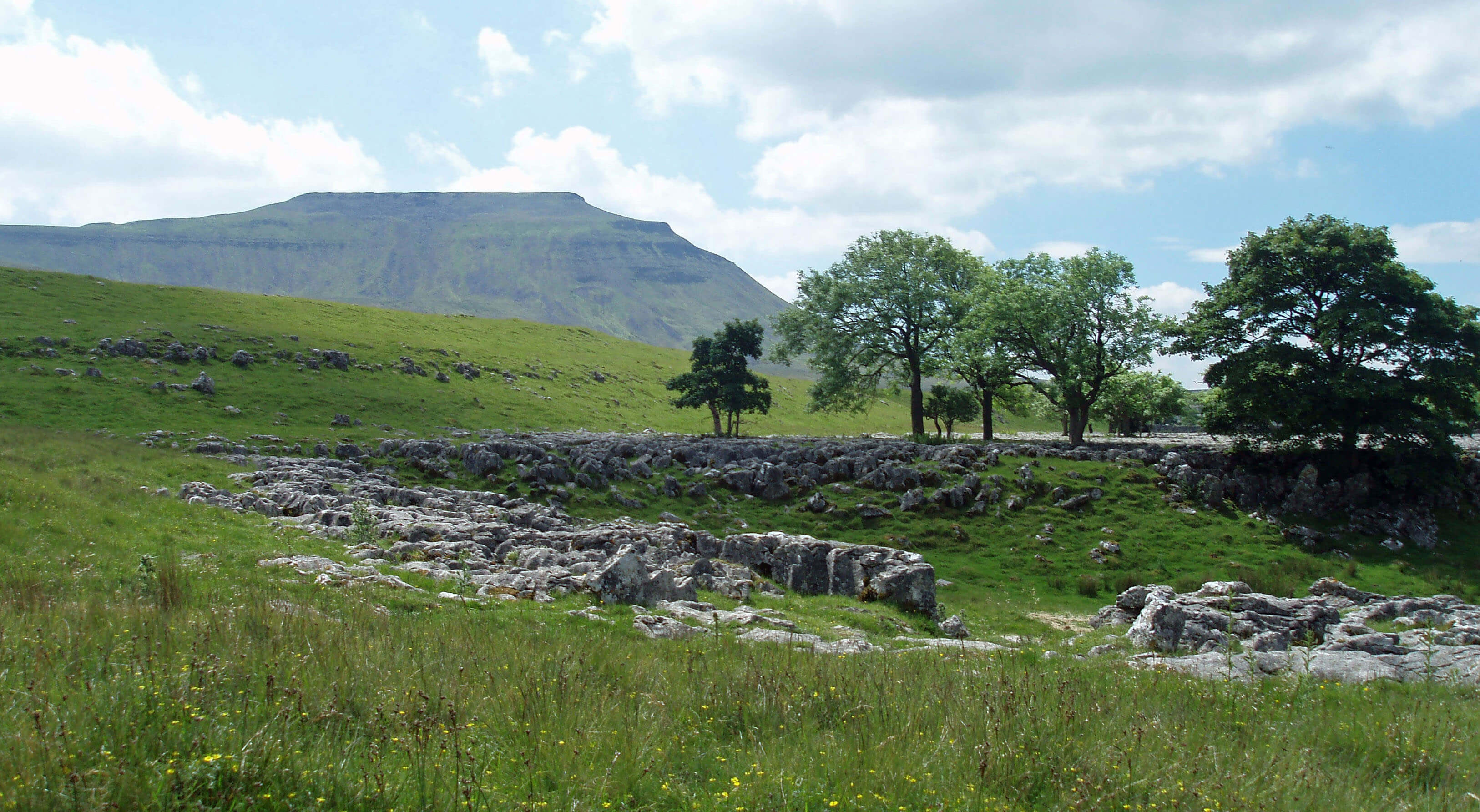
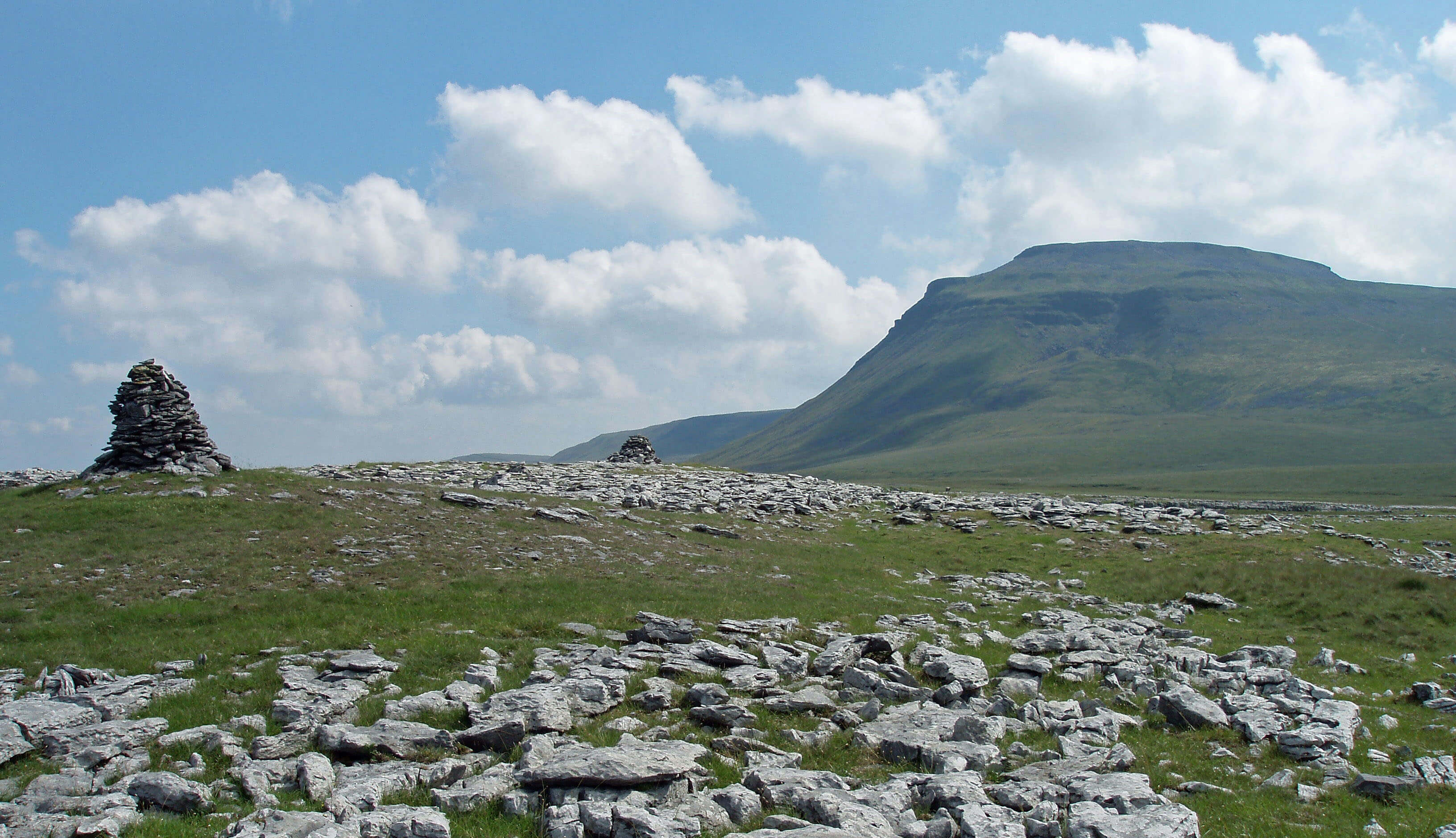
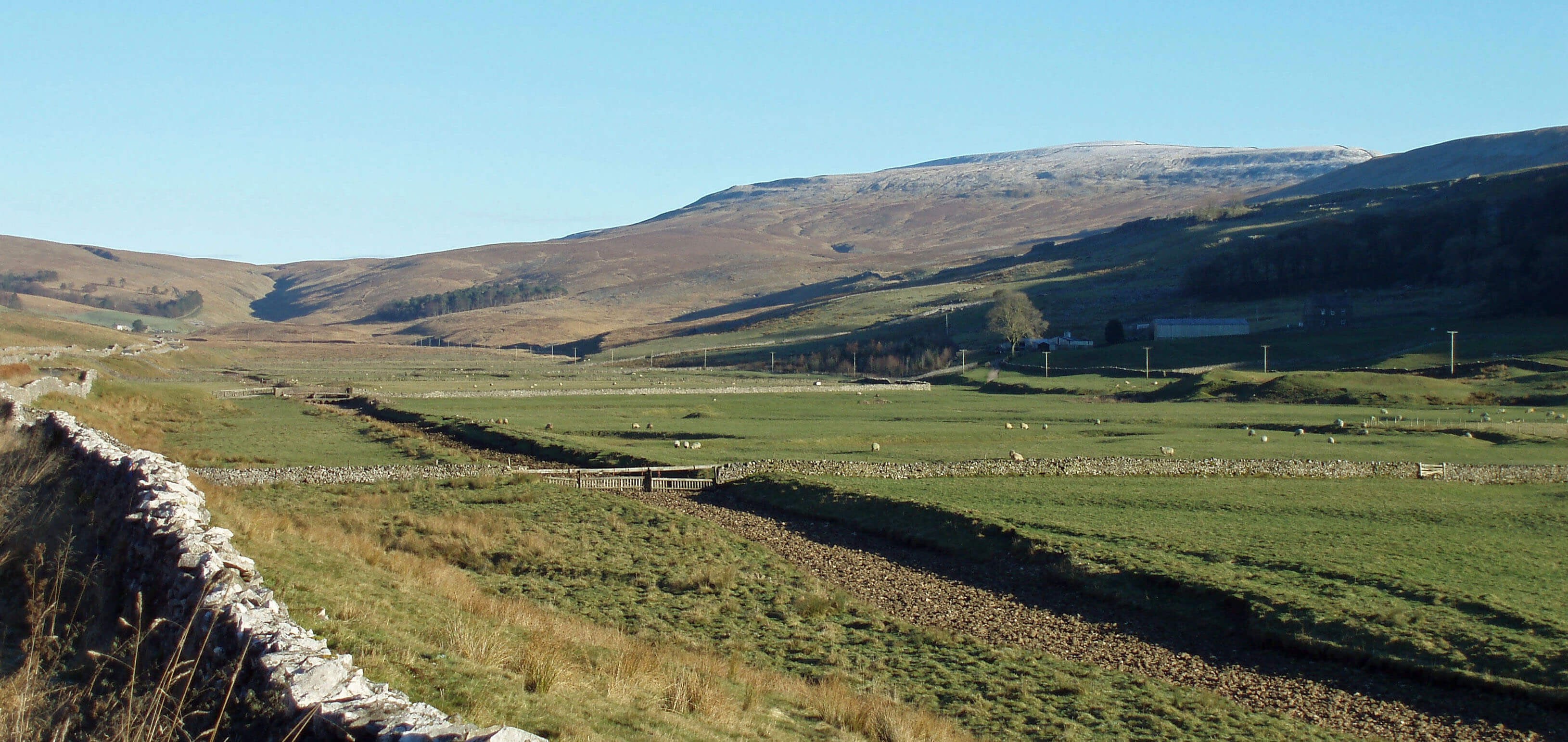
Ingleborough from Souther Scales
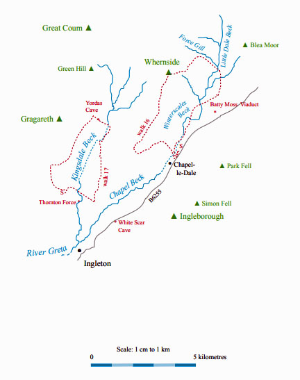
The River Greta (Chapel Beck) ...
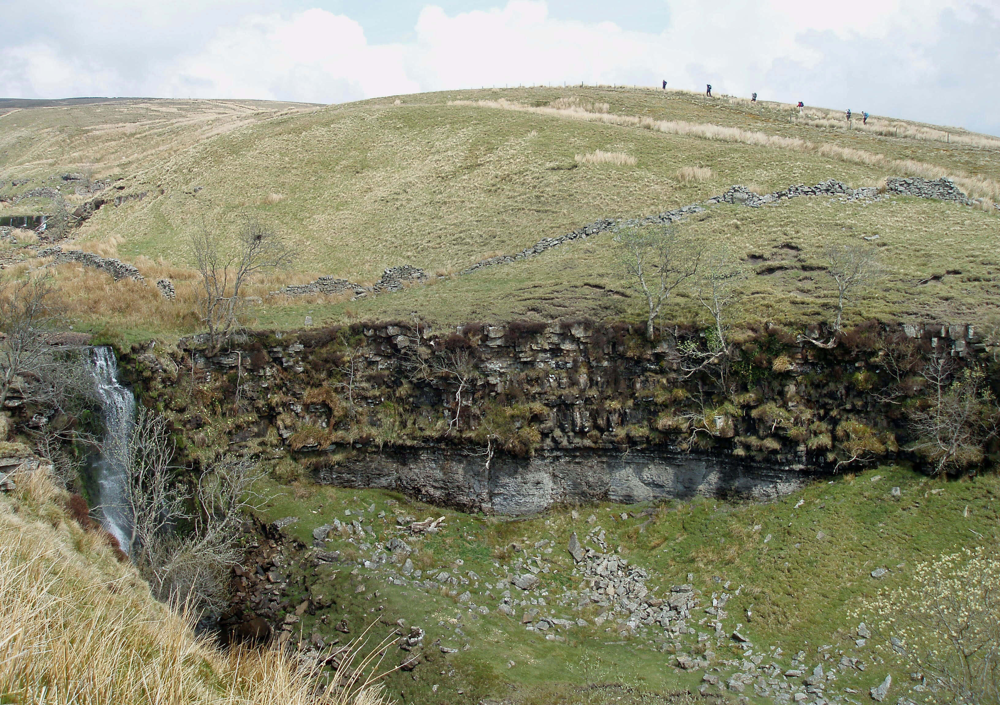 Right: Force Gill, with walkers on the Three Peaks route
The River Greta is formed at Ingleton by the
confluence of the River Doe and River Twiss.
Unfortunately, there is confusion as to which is
which. The Ordnance Survey and the Ingleton Waterfalls
Walk leaflet have the Doe to the east but Wainwright’s
Walks in Limestone Country and Ingleton’s own leaflet
have the Doe to the west. Upstream, the two rivers are
called Chapel Beck (in Chapel-le-Dale) and Kingsdale
Beck (in Kingsdale) and it seems simplest to retain those
names down to the Ingleton junction, rather than choose
between the river names.
As Chapel Beck is the larger of the two at the
junction I will consider that to provide the source of
the Greta, with Kingsdale Beck being a tributary. This
is supported by Thos Johnson’s 1872 book A Pictorial
Handbook to the Valley of the Lune and Gossiping
Guide to Morecambe and District (yes, really), which
considers Chapel-le-Dale to lie in Gretadale. Moreover,
he has a River Doe in Kingsdale, so if I were forced off
the fence, I’d say the Ordnance Survey has it wrong.
The source of Chapel Beck is at the head of Little
Dale between Whernside and Blea Moor. Here, Little
Dale Beck is joined by Force Gill, which has two fair-sized waterfalls and crosses the Settle-Carlisle railway
line over an aqueduct. Force Gill arises in Greensett, a
boggy plateau on the eastern slopes of Whernside. Our
obsession with getting to the tops of mountains – perhaps
understandable with Whernside, as it is the highest
peak of the Dales – tends to lead us to hurry past more
interesting areas. Although the slopes of Whernside are
now all CRoW land, 99% of walkers dutifully follow
the signposted route, part of the Three Peaks walk, via
Grain Head, ignoring Force Gill and Greensett.
Actually, my preferred route up Whernside is from
Kingsdale Head – all grass and no people (so forget
I mentioned it). But the CRoW policy does raise a
question: is it environmentally better that we all tread
the standard path, thereby giving up that path to erosion
and decay? Or should we spread ourselves thinly across
CRoW land? There seems little point in creating access
land if we are not expected to access it but, on the other
hand, even the occasional walker may be too much for
some of the flora and fauna.
The first time we walked the Three Peaks route we
came across a curlew’s nest right by the path. There’s
no chance of that today. The curlew is the bird most
redolent of the northern moors, with its distinctive call
as it glides earthwards. Some describe it as plaintive or
melancholy but it sounds bubblingly joyful to me. Never
mind the swallow and cuckoo, it is the call of the curlew
that is for me the most evocative of the new year (as
early as January in 2006) as the curlew returns up the
Lune valley to its nesting haunts.
Below the red-tinged sandstone slopes of Whernside,
grey slate tumbles towards the peat of Greensett Moss.
Here is Greensett Tarn, the sheltered home of black-headed gulls, and below the tarn is a line of shakeholes
and caves, including Greensett Cave. Their existence at
560m, when the main potholes and caves of the valley are
at about 300m, shows that there is a layer of limestone
here, as well as in the valley.
The Three Peaks are Whernside, Ingleborough and Pen-y-Ghent. The first two, at 736m and 724m, are the two
highest peaks in the Yorkshire Dales and are wholly within
Loyne. Pen-y-Ghent (694m) is the 7th highest Dales peak
and is in Ribblesdale.
The Three Peaks walk of about 38km, with nearly
1600m of ascent, is a challenging all-day expedition. The
Three Peaks fell race is even more challenging but should
not take all day (only serious runners are allowed: no
pantomime horses). The record is 2hr 46min for the present
course and 2hr 29min for a previous course, with the women's
record standing at 3hr 13min. In 2008 the 54th Three Peaks
race was run as the 5th World Long Distance Mountain
Running Challenge. The start used to be at Chapel-le-Dale
but is now at Horton-in-Ribblesdale, which has taken upon
itself the role of Three Peaks centre. Of course, walkers
may start at any point on the circuit.
[Update: The women's record is now 3hr 9min, set by
Victoria Wilkinson in 2017. For the record, the men's record was set in 1996 by Andy Peace.]
However, it is hardly a fell walk or race nowadays.
Much of the route has been so badly eroded that the natural
fell has been replaced. It is a shame that so many people
(an estimated 250,000 a year) continue to follow such a
worn path. Jack Sharp’s New Walks in the Yorkshire Dales
provides a score of alternative long-distance walks.
I would also suggest a Loyne Three Peaks – replace
Pen-y-Ghent with Great Coum. The latter is only 7m lower
and this route avoids the long trek over bog and on road
from Pen-y-Ghent to Whernside and the eyesore of the
Horton quarries (and it’s 10km shorter).
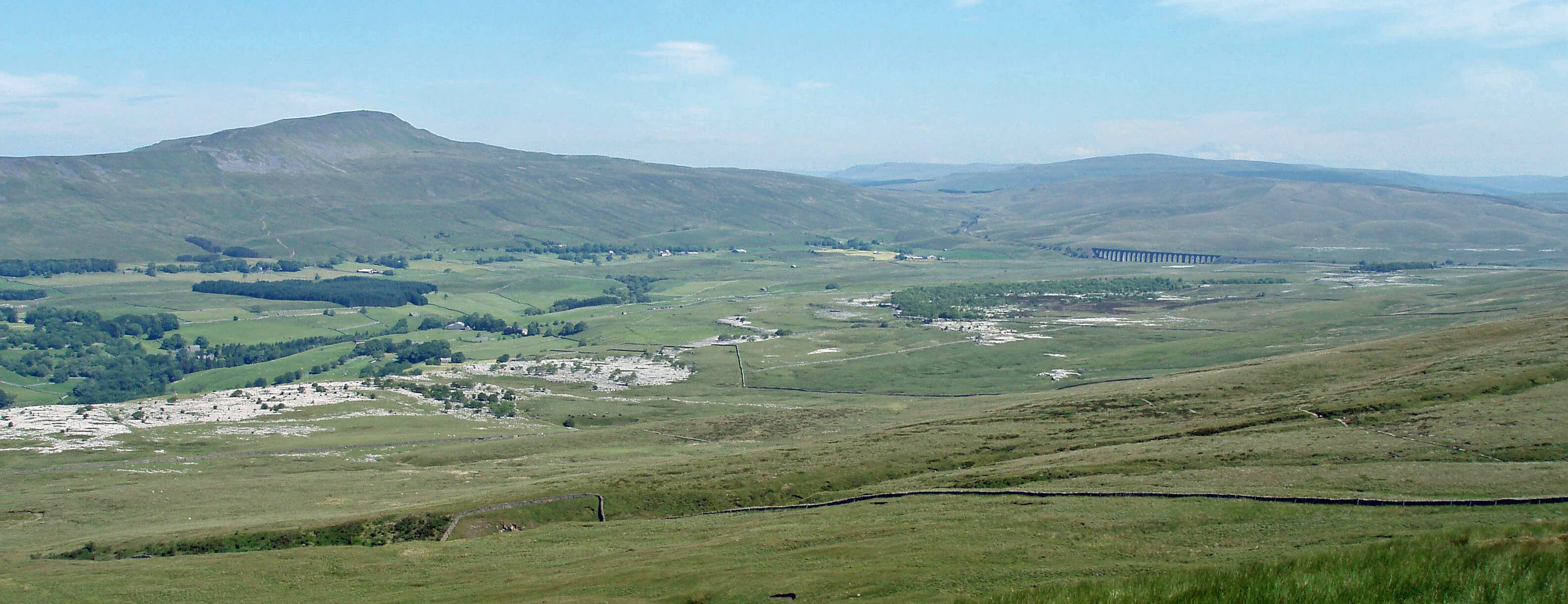
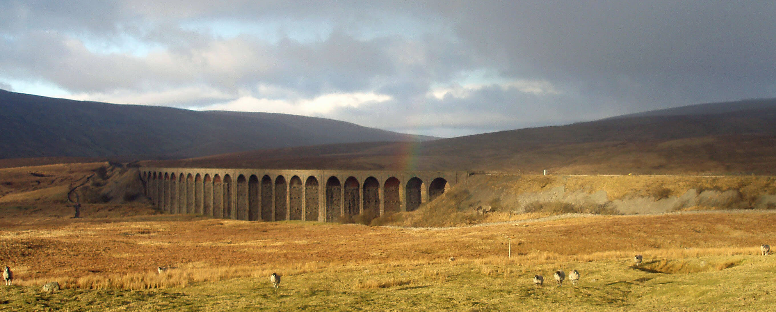 Right: Batty Moss Viaduct
Little Dale Beck absorbs Hare Gill and Foul Gutter
from Blea Moor before crossing under the railway
line, 1km north of the Ribblehead Viaduct, to become Winterscales Beck. This viaduct was originally called
Batty Moss Viaduct, in keeping with the tradition of
naming viaducts after what they cross (Dent Head, Arten
Gill and Dandry Mire). Its renaming, along with that of
Batty Green Station to Ribblehead Station, is a triumph
for the tourist industry of Ribblesdale.
The source of the Ribble is 8km north at Newby
Head in Widdale. Standing under the viaduct, it is hard
to tell whether water will flow southwest to the Lune
or southeast to the Ribble, precisely because the viaduct
was built over the watershed. If anything, it looks more
downhill to the southwest and, certainly, the largest beck
of any size that is close to the viaduct is Winterscales
Beck, which flows to the Lune.
It is too late to claim the viaduct for the Lune but
there is every justification for calling it Batty Moss
Viaduct, as I will, not least because its actual existence
here may be a little batty. The Settle-Carlisle railway
line is now absorbed into the romance of the Dales and
we may marvel at the skill and energy that produced the
scenic section from Batty Moss Viaduct to Dandrymire
Viaduct, via Bleamoor Tunnel, Dent Head Viaduct,
Artengill Viaduct and Risehill Tunnel. But we might
pause to ask: Why? Why was it necessary?
Imagine yourself to be a railway engineer in 1870,
standing at Selside in Ribblesdale. The Settle-Carlisle
line will proceed north up Ribblesdale and south below
Wild Boar Fell. How would you bridge the gap? Would
you go over the watershed to Dentdale and then out
again to Garsdale rather than through Widdale (the
present B6255 route), knowing that the line from Hawes
to Garsdale, completed in 1878, was already planned?
I am not a railway engineer but it seems to me that this
route requires no large viaducts and no tunnels.
Anyway, let us be grateful, for if they
had so decided all of the Settle-Carlisle
line would be outside Loyne. However, we
should always remember that the “thrilling
story of this magnificent engineering
enterprise”, as Wainwright’s Walks in
Limestone Country puts it, involved a
few thousand people working here, under
appalling conditions, for six years (less
for the two hundred or so who died). The
Batty Green shantytown sounds jolly but it
must have been a hard, tough life here in the
cold, wet, muddy desolation. I hope that the
workers’ sacrifices were not in the cause of
some vainglorious adventure.
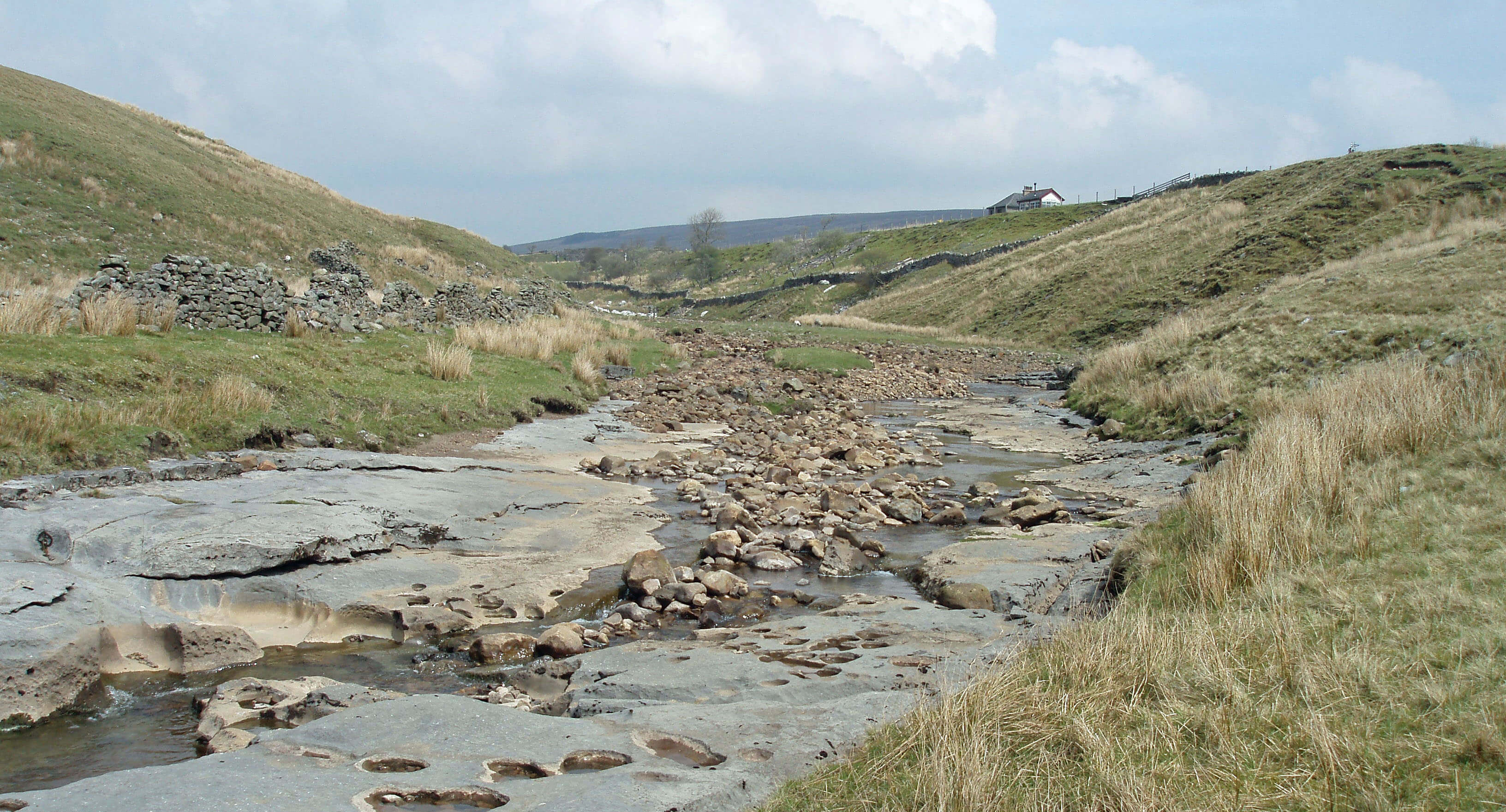 Left: Winterscales Beck near Winterscales Farm
Today, we may admire the results of
their labours. The Batty Moss Viaduct is
the most spectacular of all the engineering
works on the Settle-Carlisle line and an
awesome sight from Whernside and other
vantage points. Its 24 arches are made
from local limestone and the embankment
from earth excavated from Bleamoor Tunnel. The
viaduct is 32m high and 400m long and the spans are
7m wide, with each sixth pier thickened to help prevent
collapse. Its gentle curve seems fully in keeping with the
surroundings, now that the shantytown has long gone.
Winterscales Beck makes its way intermittently
southwest, repeatedly disappearing through its limestone
bed and being re-created by resurgences, of which the
largest is from Gatekirk Cave. In summer much of its
bed will be dry but it is obvious from the erosion that
after heavy rain this is a ferocious torrent. In places,
one can stand in the dry bed and see debris in the trees
several metres above.
After Winterscales Beck disappears, a series of
potholes and caves continues its line until the emergence
of Chapel Beck below Chapel-le-Dale. Some of these
potholes are described in the overblown prose of John
Hutton, vicar of Burton-in-Kendal, who in 1780 wrote
a 49-page pamphlet considered to be the first-ever book
on caving. He considered Weathercote Cave to be “the
most surprising natural curiosity of the kind in the
island of Great Britain … a stupendous subterranean
cataract.” Hurtle Pot, however, was “one of the most
dismal prospects we had yet been presented with … [and
he viewed] with horror and astonishment its dreadful
aspect.”
Like many rural hamlets, Chapel-le-Dale is known
for its pub and its church. The Hill Inn was long regarded
as a rowdy base for potholers. St Leonard’s Church is a
more sombre resting place for the “many men, women
and children … who died through accident or disease
during the construction of the Settle-Carlisle railway and
who were buried in this churchyard”, as a millennium
year memorial plaque puts it. Sadly, the plaque does not
list the two hundred names given in the burial register.
The church itself is neat, with mullioned windows and
bellcot, built in the 17th century and restored in 1869.
Walk 16: Whernside from Chapel-le-Dale
Map: OL2 (please read the general note about the walks in the
Introduction).
Starting point: A lay-by on the north side of the B6255 200m northwest of Hill Inn (744777).
Walk past the Hill Inn to take Philpin Lane north to Bruntscar. This is on the Three Peaks walk route but you will avoid the
steep, knee-jarring slog up the reinforced thoroughfare on the flank of Whernside by taking a more leisurely uphill amble, mainly
on grass.
Turn left past Bruntscar and Ellerbeck and on to the bridleway southwest. After about 1km leave the bridleway to cut across
to the straight wall that runs up the West Fell ridge. Follow this wall all the way to the top of Whernside, 1km before which you
rejoin the Three Peaks thoroughfare.
From the top, drop down the slope (steep but not too steep) to reach the remains of a wall 0.5km east and follow it northeast,
investigating the Greensett caves and potholes, as you wish. Follow the wall down east to see the Force Gill waterfalls. Rejoin the
footpath to cross the railway line and after 1km go under the railway to Winterscales and Ivescar. From Ivescar take the footpath
south to Winterscales Beck. Continue on the road and then footpath back to Philpin Lane, noting the caves and potholes and the
signs of damage wrought when the beck is in spate.
[Update: If you consider the slope down from Whernside too steep then you
could continue along the ridge path and make your way down from a less daunting height.]
When planning a high-level walk, it is always worth having a low-level alternative in mind, for often on arrival we find that
the tops have gathered cloud. Here there is a fine loop walk under the shelter of Whernside: from Chapel-le-Dale take Oddie’s
Lane to Twisleton Hall, then follow the footpath across Scales Moor to Bruntscar and on to Winterscales, and then work your
way back along Winterscales Beck.
Short walk variation: Follow the long walk through Bruntscar and Ellerbeck to the West Fell ridge. Walk by the wall north past
Combe Scar to where it is joined from the right by the broad path from Bruntscar (part of the Three Peaks route). Now you must
summon up all your resolve to not walk the further 1km to the top of Whernside, just 140m higher: this is supposed to be a short
walk and you really cannot expect to get to the highest point of the Yorkshire Dales on a short walk. So, with great fortitude, take
the path down to Bruntscar and back to Philpin Lane.
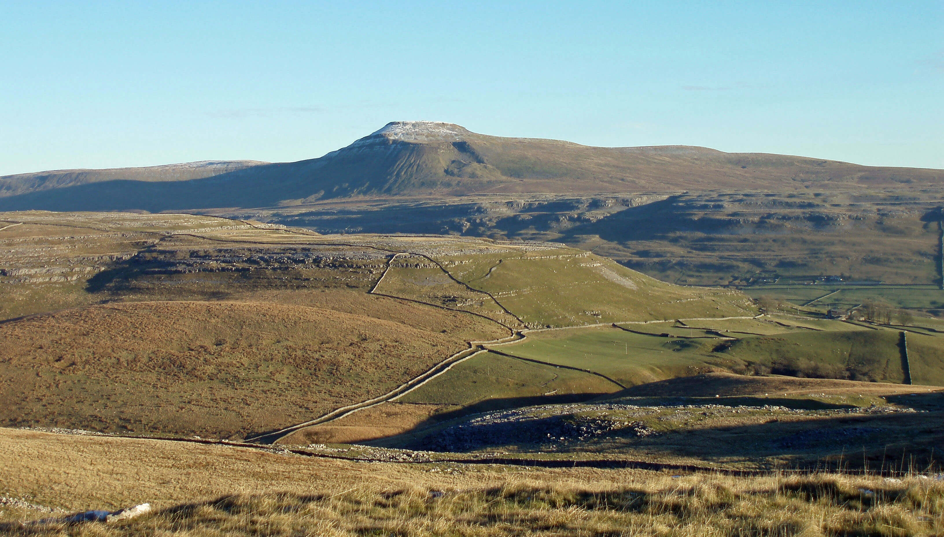
Above Chapel-le-Dale soars Ingleborough, the
supreme peak of the Yorkshire Dales. Although second
in height to Whernside, its isolated location and proud
profile make it seem higher from almost every direction.
Its position at the head of the Greta and Wenning valleys
means that it oversees, and can be seen from, much of
Loyne.
Ingleborough from White Scars
The Top 10 peaks in Loyne
(to look at, not from)
1. Ingleborough
2. Wild Boar Fell
3. Great Coum
4. Grayrigg Pike
5. Calf Top
6. Whinfell
7. Whernside
8. Clougha Pike
9. Winder
10. Mallowdale Pike
Its name alludes, perhaps fortuitously, to two early
roles. The word ‘ingle’ is from an old Gaelic word for
fire and no doubt, because of its domineering position,
Ingleborough was often in the past the site of a beacon.
The ‘borough’ (as we saw with Low Borrowbridge and
Over Burrow) may be associated with an old fortification.
In fact, the Ordnance Survey is bold enough to mark
‘fort’ on its map. The fort is variously believed to have
been built by the Romans, by the Brigantes (against the
Romans) and by pre-Roman Iron Age settlers. But David
Johnson, in his 2008 book on Ingleborough, doubts that
it was a fort at all. He does not consider that the remains
of the wall, which some call ramparts, that run round
the rim of the summit plateau are substantial enough to
indicate any defensive role. Also, the lack of water on
the plateau makes it an implausible defensive retreat.
This fact also leads Johnson to doubt that the score
or so of circular remains that can be seen on the plateau
are those of hut circles, as is usually stated. Ancient
people were hardy, but not necessarily masochistic, as
they would need to have been to choose to live here,
completely exposed to the elements, of which there
are many on the top of Ingleborough. He considers the
remains to be those of ring cairns and that in ancient times
the top of Ingleborough served symbolic or ceremonial
functions rather than military or residential ones. Much
like today, in fact.
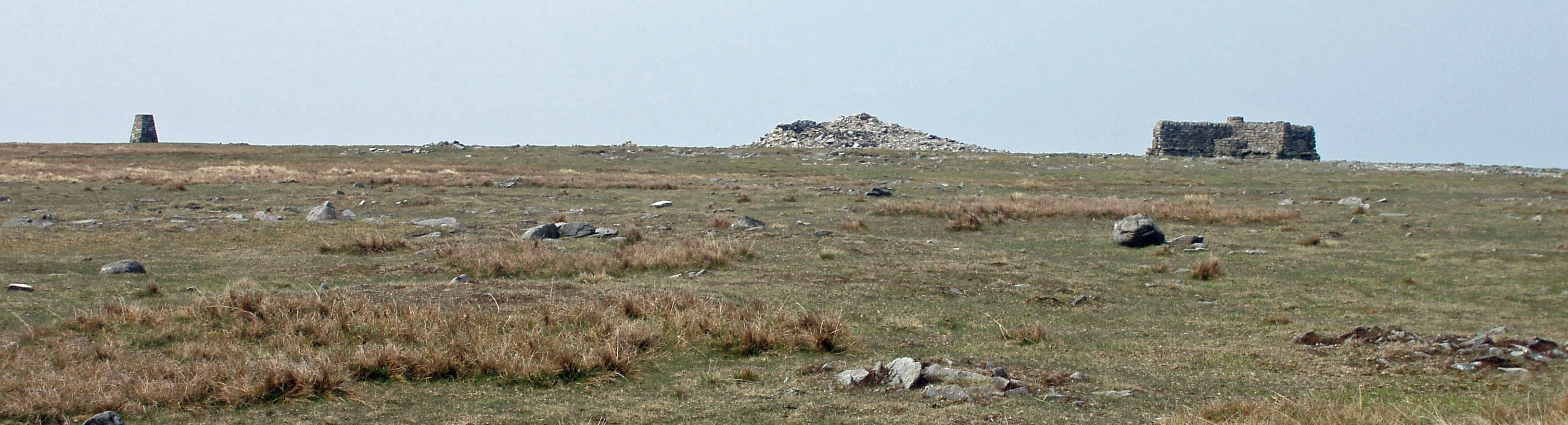 Left: Ingleborough top (with no people!)
These ancient remains should not be confused with
the great pile of stones on the western rim. This was a
hospice-cum-tower-cum-shooting-box. It was left to
fall into ruin after damage was caused at a boisterous
opening ceremony in 1830. Recalling this event in the
Lancaster Guardian in 1897, Joseph Carr described the
tower as “one of the wonders of Lunesdale” – note the
Lunesdale. Still standing is the cross-shaped wind shelter
erected in 1953. This provides endless entertainment for,
sitting in one quarter, one cannot help eavesdropping on
conversations in the other three quarters. These are often
disputes over the identification of distant peaks. One
can hardly intrude to point out the view indicator in the
middle of the cross.
Ingleborough’s distinctive profile is a consequence
of its geology, which is similar to that of Whernside and
Wild Boar Fell. The top 30m or so are of hardwearing
millstone grit. This sits atop 250m of conglomerate rocks
(the Yoredale series), mainly shales and sandstones, with
a little limestone, all covered with peat except where
exposed on the crags. Below this is a 200m layer of
limestone (the Great Scar limestone), which is visible
on the lower slopes of the mountain. These are all
sedimentary rocks of the Carboniferous period that have
not been distorted much from their horizontal layers.
Below the 250m contour are the much older Silurian
slates and grits, which have been folded and contorted.
And the whole has been much shaped by glacial action.
 Right: Whernside and the Batty Moss Viaduct from below The Arks, Ingleborough
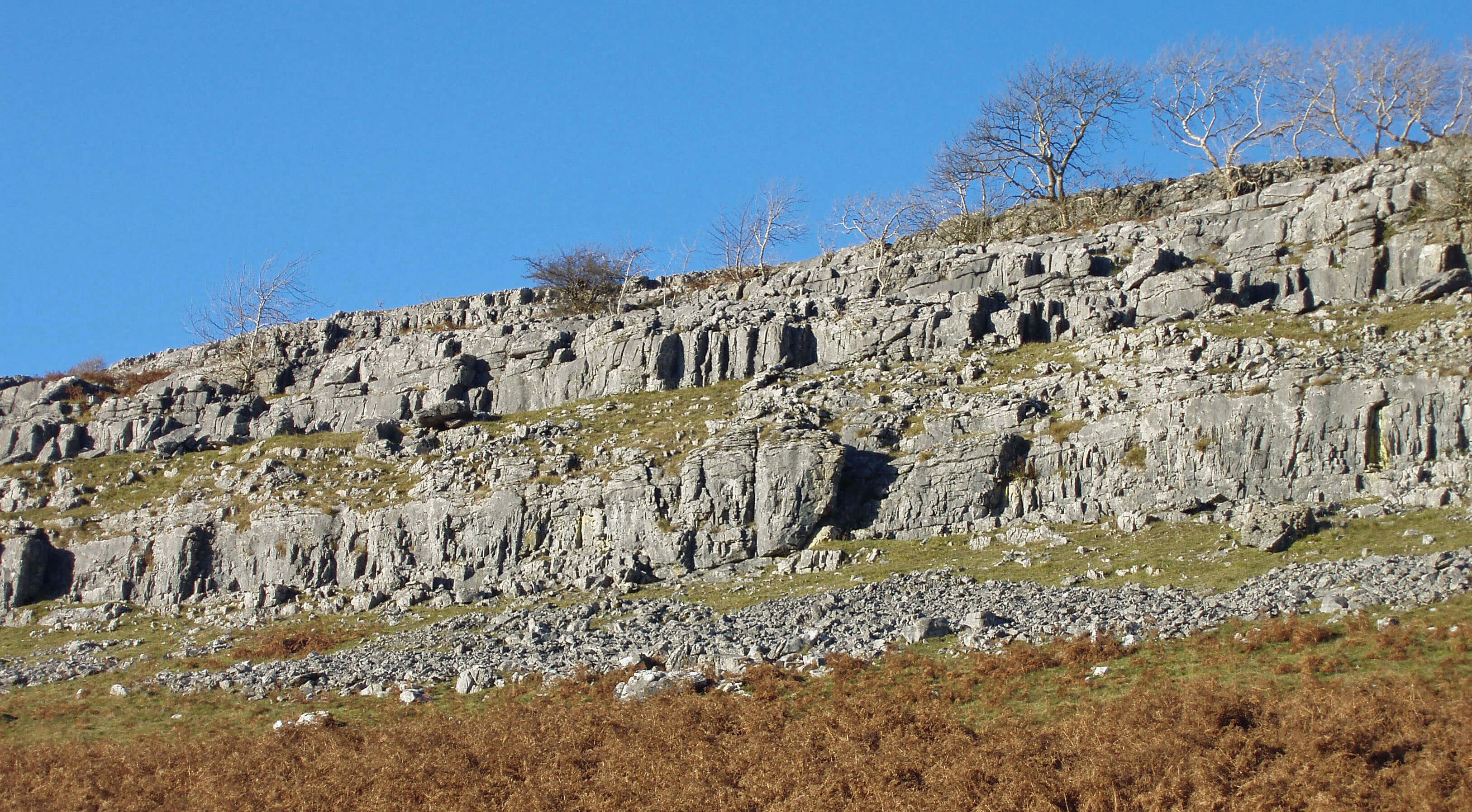
Some of the western slopes of Ingleborough and
Simon Fell form a National Nature Reserve, although at
the moment it is more a matter of reversing nature than
of reserving it. Previously the land had been fertilised
and over-grazed, preventing the growth of wildflowers
and trees. The moorland areas are now being managed
to restore lost acid-loving plants such as ling heather
and bilberry, to join plants such as bog asphodel and
purple moor-grass. The grazing regime on the limestone
grasslands is intended to enable the flowering of
different plants through the seasons: purple wild thyme,
orchids, yellow rockrose, harebell, and so on. Within the
grikes many woodland plants flourish but now trees and
shrubs (ash, elm, hawthorn, hazel, sycamore) also have
a chance to thrive. This process has been supported by
the Dales-wide Limestone Country Project, which was
partly funded by the EU and ran from 2003 to 2008.
The aim was to improve biodiversity by moving from
sheep-intensive farming towards mixed farming using
hardy upland cattle breeds, such as the Blue Grey and
Highland cattle that may be seen at High Howeth on the
western slopes of Ingleborough.
To the north, Scar Close has been protected for
longer and gives an idea of the clint-and-grike flora
before wood clearance and over-grazing. Ash, hazel and
rowan trees have become established. Further north, the
raised terrace of Howrake Rocks has formed a prominent
rectangle of woodland, showing how different the
Yorkshire Dales would look if left to revert to its natural
state.
Above the limestone terraces, there is a line of caves
and potholes where becks running off the fells disappear
underground. Great Douk Cave and Middle Washfold
Caves are popular with novice cavers. Braithwaite Wife
Hole (which Thos Johnson and Harry Speight, in their 19th
century guides, rendered more intriguingly as Barefoot
Wives Hole) is a huge shakehole, 60m in diameter.
Raven Scar Cave, only discovered in 1971, was found to
be a Neolithic burial site. Meregill Hole is 170m deep,
with the mere that gives the pot its name visible 12m
down – or so they say. The sound of a waterfall below,
when the beck above was dry, was enough for me.
There is a line of springs, particularly clearly seen
after rain, in the green fields below Twisleton Scars,
where the limestone meets the impermeable lower layer.
Below God’s Bridge, several resurgences can be seen
entering Chapel Beck – or in summer creating Chapel
Beck, for then the bed is dry above the bridge. God’s
Bridge, incidentally, is traditionally a name that denotes
a natural, as opposed to man-made or devil-made, bridge
but here it has been sacrilegiously cemented over.
Chapel Beck runs below Oddie’s Lane, which is
along the line of a Roman road that ran from Bainbridge
to near Ingleton and then probably to join the road at
Over Burrow. On the east bank is the site of the disused
Ingleton Granite Quarry. It is, in fact, not granite at all
but greywacke, an impure sandstone with a toughness
that made it a valued stone for roads.
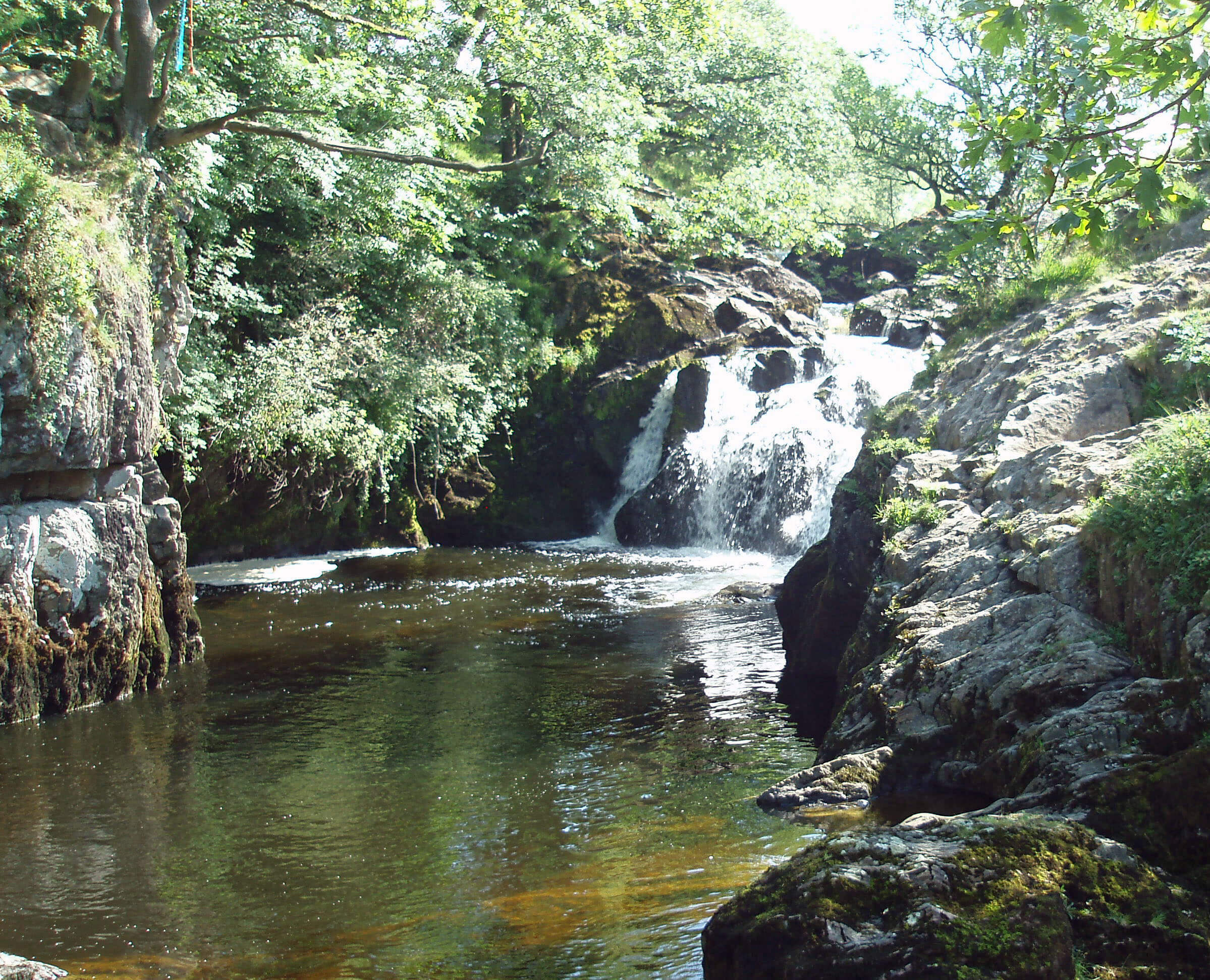 Right: Beezley Falls
As Chapel Beck flows gently south-east, on the left
a building comes into view that delivers exactly what
it says on its roof, that is, caves – to be precise, the
White Scar Caves. By the time Chapel Beck crosses
the footpath from Beezleys it is wide and docile enough
to require nearly fifty stepping-stones to cross. But it
is only girding its loins for a tumultuous fall through
Baxenghyll Gorge, including impressive cascades at
Beezley Falls, Rival Falls and Snow Falls, between
which the water lies black-brown in deep pools.
The glen is a Site of Special Scientific Interest
because of its geology and associated flora. It is also
designated an Ancient Semi-Natural Woodland, ancient
in this context being defined as pre-1600. Ancient
woodland is scarce locally because of grazing but much
of this glen is inaccessible to sheep or cattle, enabling
oak and birch, with occasional hazel, holly and rowan,
to flourish on the acidic soils that overlie the Silurian
slate. The woodlands are also important for their mosses
and liverworts, which thrive in dark gullies, and ground
plants such as wood rush, dog’s mercury and wild
garlic.
The path alongside the falls provides views of
several disused slate quarries, while from high to the
east the stone-crushing noise of Skirwith Quarry may
well intrude. This quarry continues to mine the Ingleton
Granite previously mined upstream.
As Chapel Beck emerges from the wooded glen
it passes through the remains of Mealbank Quarry.
It contains probably the thickest coal seam within an
English limestone sequence, and the sediments are rich
in fossils yet to be fully understood. The quarry also
has the ruins of England’s first Hoffmann kiln, which
operated from 1864 to 1909. This kiln had a literally
revolutionary design, whereby material was burned in
a continuous horizontal loop, rather than tipped into a
vertical furnace.
On the outskirts of Ingleton, Chapel Beck passes an
outdoor swimming pool that a plaque proudly informs
us has been ranked the 52nd such pool in the world. Just
before the viaduct for the old Lowgill-Clapham line
Chapel Beck is joined by Kingsdale Beck to form the
River Greta.
White Scar Caves are the longest show caves in England.
They were discovered in 1923 when two Cambridge
students, Christopher Long and John Churchill, investigated
Playfair’s Cave, then thought to lead only a short distance.
They had previously explored the Cheddar Gorge in
Somerset and Stump Cross Cavern near Harrogate and,
having concluded that there was money to be made from
developing a show cave, had come to Ingleborough with
that specific intention.
So, wearing, according to the Yorkshire Post, an outfit
that “consisted of all-leather clothes, thoroughly treated
with dubbin; a helmet, with three candles and an electric
lamp, served by a battery and switch attached to their belts;
rock-climbing boots and a plentiful application of vaseline
to such parts of their body as were exposed” (that is, most
of them), Long and Churchill ventured in. They found a
way beyond a pool and after crawling 200m reached the
first waterfall of the cave’s main stream. Subsequently they
explored upstream, passing many fine formations, now
bearing prosaic names such as the Sword of Damocles and
the Devil’s Tongue, as far as the lakes now bypassed by the
Bagshaw Tunnel.
Unfortunately, they were not rewarded for this
endeavour because Long, a manic depressive, died of a
drug overdose in 1924 and Churchill was unable to raise
sufficient funds to continue the development of the cave.
The cave was eventually opened to the public in 1925,
with the first manager, Tom Greenwood, adding further
galleries and passages in the 1930s. In 1971 the massive
200,000-year-old Battlefield Cavern, 100m long and 30m
high with thousands of delicate stalactites and undisturbed
prehistoric mud pools, was discovered and this now forms
the climax of the present tour, 1.5km and 90 minutes from
the entrance.
Kingsdale Beck
Most visitors to Kingsdale intend to go through
or under it, which is less than it deserves. They
are either using the road between Dent and Thornton-in-Lonsdale or they are aiming to tackle the potholes
arrayed along the sides of Kingsdale.
Kingsdale is a fine upland valley, flanked by
Whernside to the east and Great Coum and Gragareth
to the west, with its limestone scars below the millstone
grit tops providing superb views. It can be lonely and
wild but also, on sunny summer days, balmy and serene.
It would perhaps have its deserved appeal to tourists if
it reverted to its full name of Vikingsdale – some of the
names here (Yordas, Braida Garth) are of Norse origin,
as indeed are ‘beck’ and ‘dale’.
Kingsdale and Whernside
The valley runs straight from north to south for
7km with only 1˝ farmsteads in it – Braida Garth and
Kingsdale Head. The other ˝ of the latter is a holiday
cottage. The head of Kingsdale is 3km above Kingsdale
Head, where the road between Whernside and High Pike
begins to drop down steeply to Dentdale. Kingsdale
Beck gathers off the peaty slopes of Great Coum and
Whernside but, like Barbon Beck to the north, comes
and goes a few times. It has usually gone between
Kingsdale Head and Keld Head. This is convenient for it
means we can follow the new ‘conservation path’ across
the beck to investigate the Apronfull of Stones. This
20m-diameter ring of stones, with gaps to the east and
west (the latter probably from beck erosion), is a Bronze
Age burial cairn.
 Right: Gragareth and Yordas Wood from the Apronfull of Stones
Directly opposite is Yordas Cave, which was one
of the first tourist attractions in the Dales. The afore-mentioned Reverend Hutton said of Yordas Cave:
“Having never been in a cave before, a thousand ideas
… were excited in my imagination on my entrance
into this gloomy cavern … As we advanced ... and the
gloom and the horror increased, the den of Cacus, and
the cave of Poliphemus came into my mind [sadly, our
knowledge of Greek mythology is not what it was] …
The roof was so high, and the bottom and sides so dark,
that, with all the light we could procure from our candles
and torches, we were not able to see the dimensions of
this cavern [it’s about 20m high and 50m long] ... On the
right was the bishop’s throne, and on the left the chapter-house ... [the religious terminology was in use before the
reverend’s visit and is still used today]. Here we could
not but lament the devastation made in the ornaments of
these sacred places; some Goths not long since having
defaced both throne and chapter-house of their pendant
petrified works, which had been some ages in forming
[so vandalism is not a recent problem].”
Yordas Cave has been formed from Yordas Gill
dropping through the limestone, forming the waterfall
in the chapter-house, and running across the floor of the
cavern. After heavy rain, its present exit is insufficient
and the cavern begins to fill. It is one of a series of caves
and potholes that line the Turbary Road that runs above
the limestone terraces. This track provided access to
turbary, that is, common land where peat or turf may
be cut, an important right in ancient times. Today, it
provides an excellent walking track, safely guiding us
between the potholes.
 Left: Rowten Pot
These potholes and those on the eastern side of
Kingsdale hold a proud place in potholing history
because in 1991 the route from King Pot (on the east)
to Keld Head provided the then longest diving traverse
in the world. The best pothole to view from the surface,
Rowten Pot, can hardly be missed, although I hope it is
avoided. Walking from the south, the sound of the beck
will first be heard, rather scarily, from a hole barely 1m
from the Turbary Road. This hole is in the roof of Rowten
Cave, which can be entered 100m to the west. Rowten
Pot itself is a huge chasm 10m to the east. Actually, it is
two chasms, between which it is possible to walk – with
care, for the southern one falls 70m. Walking from the
north, it is the northern chasm, with trees sprouting out
of it, which is seen first.
The Turbary Road swings west towards Masongill
but there is a good path back to the Dent road, past
the Tow Scar trig point. From this there’s a view of
Ingleborough and Whernside and across the Greta and
Wenning valleys to the Bowland Fells and Pendle – a
much better view, in fact, than the one afforded by the
Millennium viewing station kindly provided on the Dent
road, for this is dominated to the south by the nearby
mast of a radio station and there is no view to the north.
 Right: Keld Head Scar
Meanwhile, Kingsdale Beck (if it exists) has run
along its straightened course to be replenished at Keld
Head, where the becks that disappear into the potholes re-emerge. At Keld Head the waters meet the impermeable
Silurian rocks that underlie the limestone and form a
huge underwater cavern. At first glance, it seems that
Kingsdale is enclosed on all four sides by higher ground,
with Raven Ray forming a barrier to the
south. It is easy to imagine Kingsdale as
a glaciated valley, with terminal moraines
being deposited at Raven Ray, so enclosing
a large lake. But there is now a way through
for Kingsdale Beck.
If you innocently follow the beck by
taking the path over Ravenray Bridge you
may be surprised to find yourself struggling
against the flow of walkers in the opposite
direction. Clearly there is something
special downstream – and we soon hear
and see it, that is, Thornton Force, which
many regard as the most picturesque
waterfall in the Dales. At 14m it is not the
highest but the graceful cascade within a
shrub-topped cliff face seems perfectly
designed for tourists’ snapshots from the
footpath. It is even possible, with care, to
scramble behind the waterfall to enhance
the magic.
A better reason for doing so is to
investigate at close quarters the geological
unconformity in the cliff face. An
unconformity does not just mean that there
is a change in the type of rock, which is
obvious to even the untrained eye, but that
two rocks are adjacent when they shouldn’t
be: a younger rock rests upon an older rock
with an expected intervening middle-aged
rock missing, because the sediment either
was never laid or has been eroded away.
Here, the sediments of 350 million year old
Carboniferous limestone lie above distorted
Silurian slates some 100 million years
older, with the Devonian layer missing,
the whole forming a textbook illustration
of severe earth movement and erosion. Between them is
a narrow band of softer conglomerate limestone that has
eroded to give the overhanging waterfall lip.
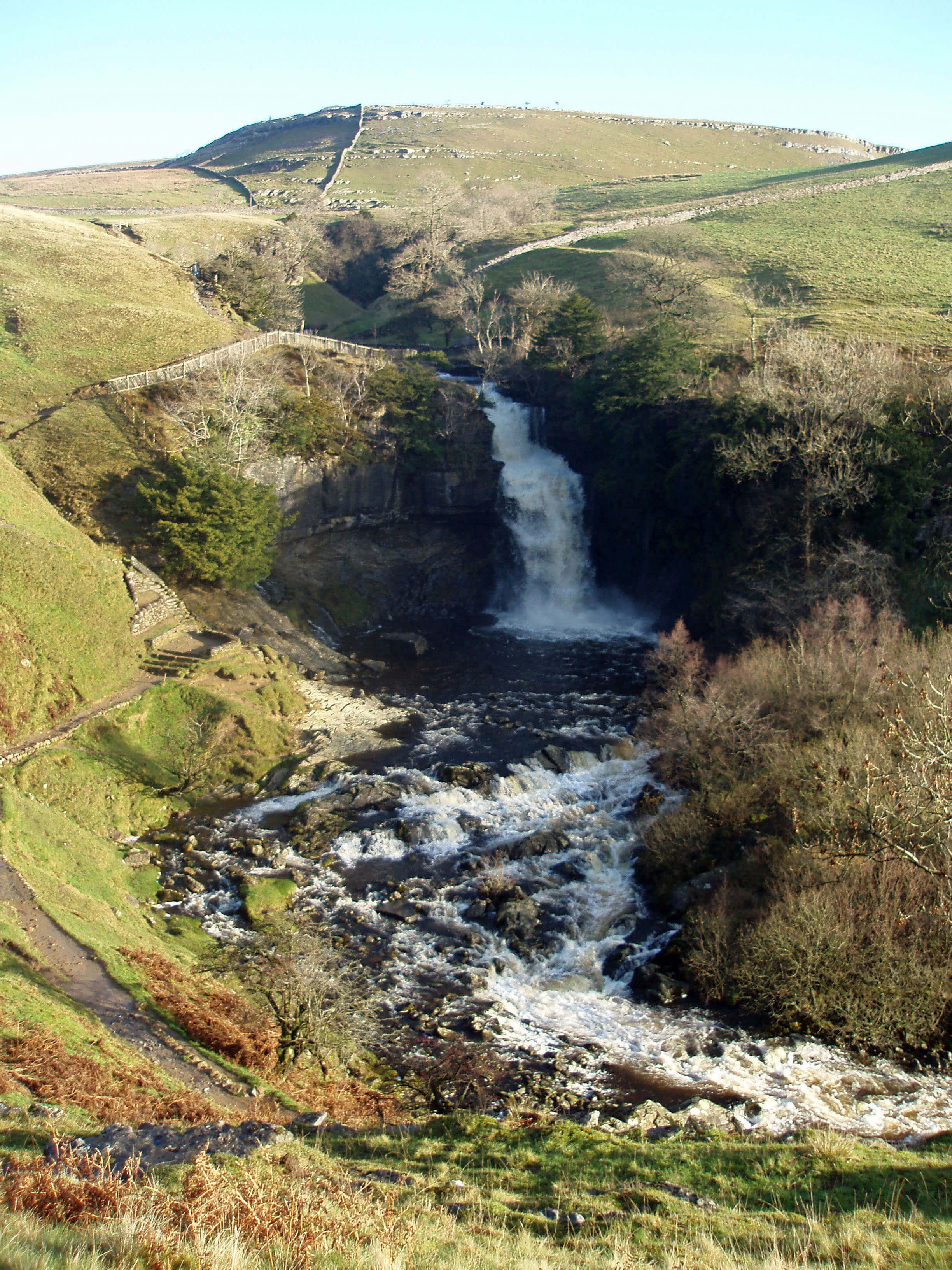
Thornton Force
The region clearly has a complex geology. Chapel
Beck and Kingsdale Beck are crossed by the North
Craven Fault, one of several Craven Faults that run
across the southern Yorkshire Dales, from Grassington
past Malham Cove and Ingleton towards Barbon. The
faults are responsible for some of the most dramatic
Dales scenery and for the clear change from limestone to
the north to millstone grit to the south. It is less apparent
that on a 2km stroll near Ingleton you may walk over the
oldest sedimentary bedrock in Loyne, that is, Ordovician
(Arenig), 500m years old, and also the youngest, Permian
Red Sandstone, 250m years old.
Our admiration of the outcome is enhanced as we
continue downstream, passing Hollybush Spout and
Pecca Falls, which fall over sandstone and slate, and
entering Swilla Glen, a deep gorge cut into limestone.
The gorge woodland is, like Baxenghyll Gorge, a Site
of Special Scientific Interest on account of its geology
and stands of ash, hazel, wych elm and yew, with rich
woodland herbs.
If you follow our path down by Chapel Beck and by
Kingsdale Beck then, as you emerge at Broadwood, an
official may well challenge your innocence by demanding
payment, for you have completed, in an unorthodox
fashion, the famous Ingleton Waterfalls Walk.
The Ingleton Waterfalls Walk is an 8km circular walk up
by Kingsdale Beck, across the path by Twisleton Hall and
Beezleys and back down by Chapel Beck, passing a series
of waterfalls.
The walk was opened in 1885 and soon there were
packed trains bringing multitudes from places such as
Leeds, Bradford and Manchester. Inevitably, this financial
windfall provoked disputes about who should benefit – the
developers of the pathways, the farmers whose lands were
being crossed, or the village of Ingleton itself. There was
also a debate with Mealbank Quarry, the noise of which
spoilt an idyllic country ramble. At one stage, there were
two companies involved, one charging for the western
glen, the other for the eastern glen. Many visitors were so
disgruntled at being charged twice for one walk that they
returned home to put up notices warning others “not to go
to Ingleton unless you want to be robbed”.
There is obviously a difficulty in charging for a walk
that has four entry points – the tops and bottoms of the two
glens. The tops may be freely entered, as may the bottom of
the Chapel Beck glen. Some people resent paying for what
nature has freely provided. Guidebooks agree that the fee
is a bargain, authors not wishing to appear curmudgeonly
or to belittle the undoubted splendour of the walk. For
example, Wainwright’s Walks in Limestone Country
effuses “So small a fee! So great a reward!”. But then it
was one shilling (5p) in 1970. It now costs an arm and a
leg, with reduces the pleasure, not to say feasibility, of the
walk. The paths do need to be maintained, and they are, to
a high standard, but does it cost so much to do so? Today,
the Waterfalls Walk is managed by the Ingleton Scenery
Company, with an address in Skipton.
Ingleborough from Tow Scar
Walk 17: Kingsdale and Yordas Cave
Map: OL2 (please read the general note about the walks in the
Introduction).
Starting point: A lay-by on the Thornton-in-Lonsdale to Dent road (692757).
This is a shorter walk than usual, to allow time for pottering about. Before I forget, take a torch with you.
From the lay-by walk 200m north along the road to take the track east over Kingsdale Beck. Continue for 1km and then take
the footpath that cuts back north heading for Braida Garth, 3km away. Follow this path below limestone scars to Braida Garth
and then continue across a field to the road.
At this point there is a new path alongside Kingsdale Beck to the Apronfull of Stones, 1km upstream. If Kingsdale Beck is
dry, as it usually is, walk to the Apronfull and then follow a new path west to Yordas Cave, where the torch will come in handy.
(If it isn’t, forget the Apronfull and just walk 1km along the road to the cave.) The field within which Yordas Wood is located is
CRoW land, so from the cave walk above the wood to locate the line of the permissive path linking to the Turbary Road, which
you follow south. Stray from the Turbary Road only with care, for example, to see Jingling Pot, Rowten Pot (and the cave above
it) and as many other pots as you wish.
Now it only remains to locate the path back to the starting point: after a section where the Turbary Road runs near a wall,
stay on the Road across another field, and your path, a clear track, is 200m further (at 685768), heading south. It goes past Tow
Scar (worth a detour to the trig point) and then drops down to near the lay-by.
Short walk variation: Follow the long walk to Yordas Cave and then return along the road
to the lay-by.
The Introduction
The Previous Chapter (Middle Lunesdale and Leck Fell)
The Next Chapter (Gretadale and a little more Lunesdale)
© John Self