The Land of the Lune
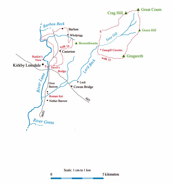
Chapter 7: Middle Lunesdale and Leck Fell
The Introduction
The Previous Chapter (Middleton Fell)
The Next Chapter (The Greta Headwaters)
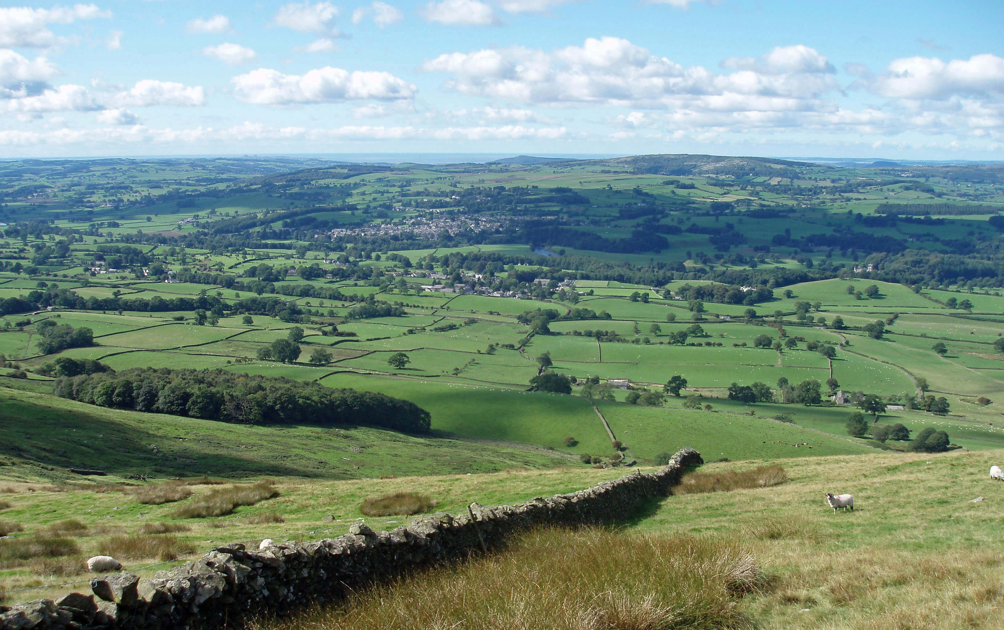
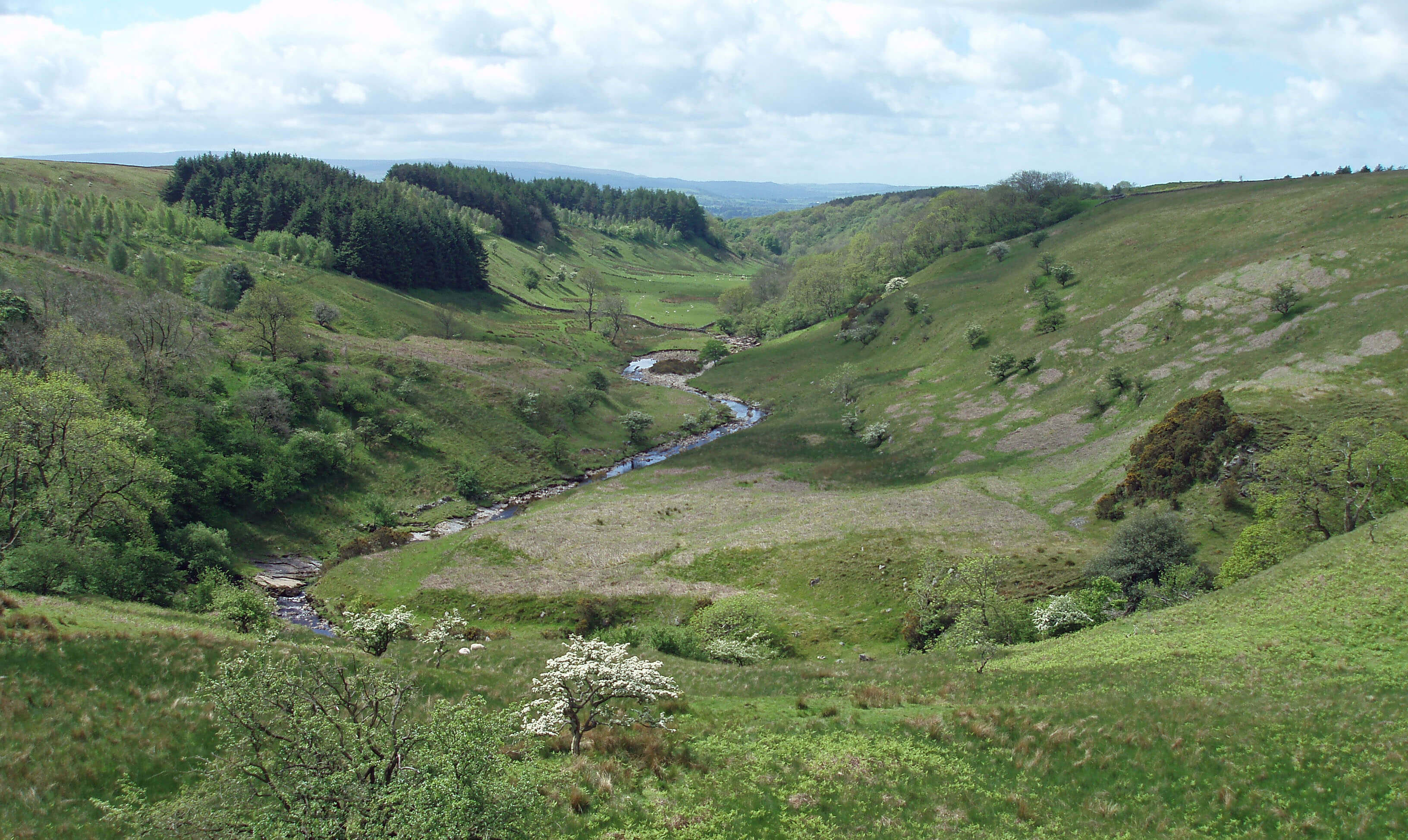
View towards Kirkby Lonsdale from Brownthwaite
The Lune from Barbon Beck ...
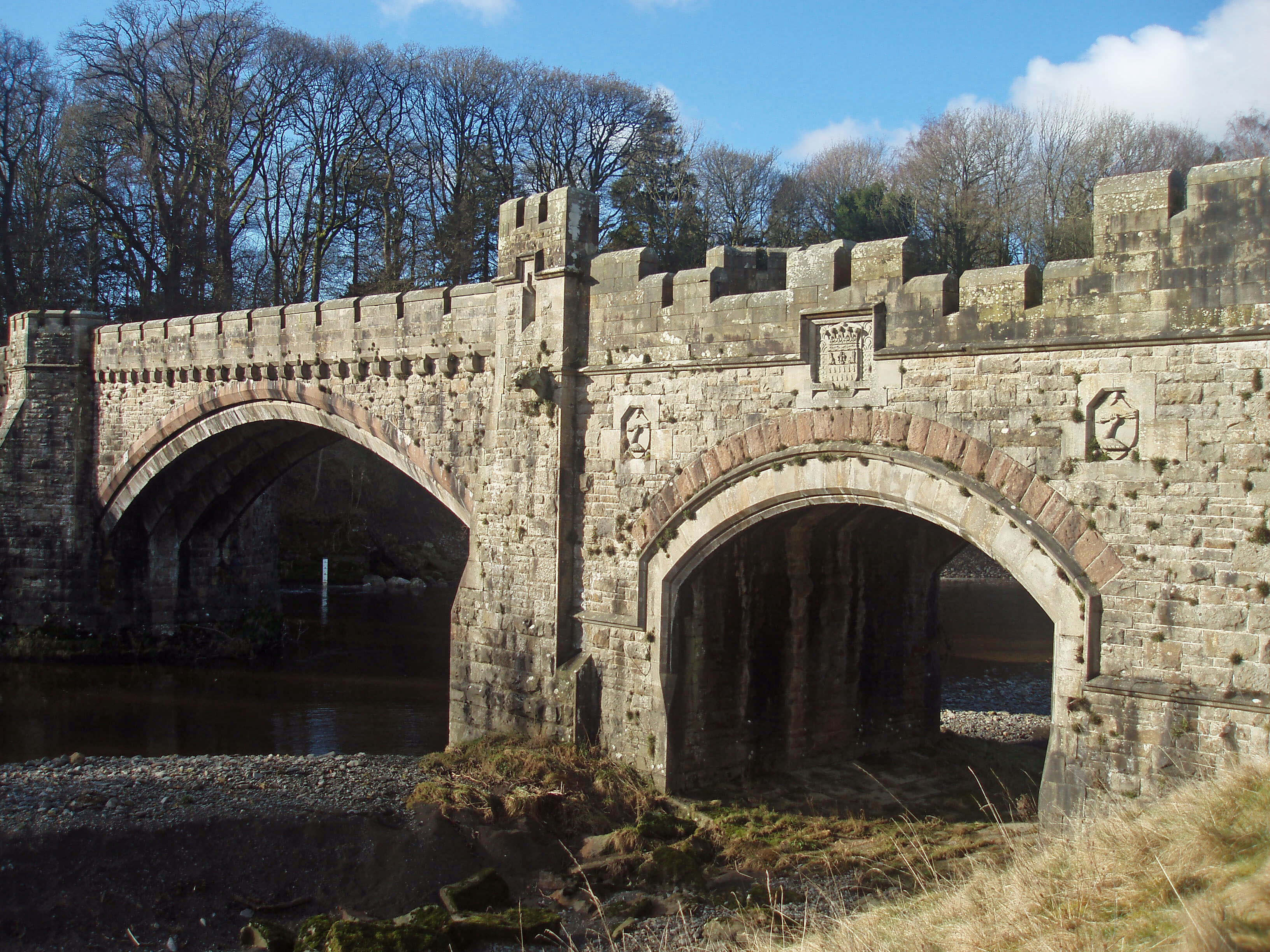 Left: Underley Bridge
A kilometre from the Barbon Beck junction the
Lune passes a badly eroded west bank, just before
Underley Bridge. The inordinate ornateness of
this bridge reflects its limited functionality, for it was
built in 1872 (or 1875, depending which datestone on
the bridge you believe) to enable gentry and their lady
folk to travel in their coaches from the Underley estate to
the Barbon railway station. The bridge was built for Lord
Kenlis, later the Earl of Bective, MP for Westmorland,
whose father, Lord Bective married Amelia, the daughter
of William Thompson, of the wealthy Westmorland
Thompson family, who was a Lord Mayor of London
and previous owner of the Underley estate. The bridge
is adorned with battlements, gargoyles and a motto
– consequitur quodcunque petit, that is, one attains
whatever one seeks (Barbon railway station, I assume).
Before the Lune sweeps south under a dramatic cliff
a small beck enters on the left. This has run off Barbon
Low Fell through Grove Gill and past Whelprigg, another
of Loyne’s fine country houses. The Whelprigg estate
belonged to the Gibson family, for whom Whelprigg was
built in 1834, in an imposing Victorian style. In the fields
by the drive to the house is an ancient cross, on the line
of the Roman road, and to the north six trees that seem
uniquely honoured by having their types specified on
the OS map (four ash and two oak), presumably because
they mark the parish boundary.
To the south of Whelprigg runs the old track of
Fellfoot Road, where it is difficult to turn a blind eye to
the Goldsworthy Sheepfolds (as we have done so far):
there are sixteen of them, all created in 2003.
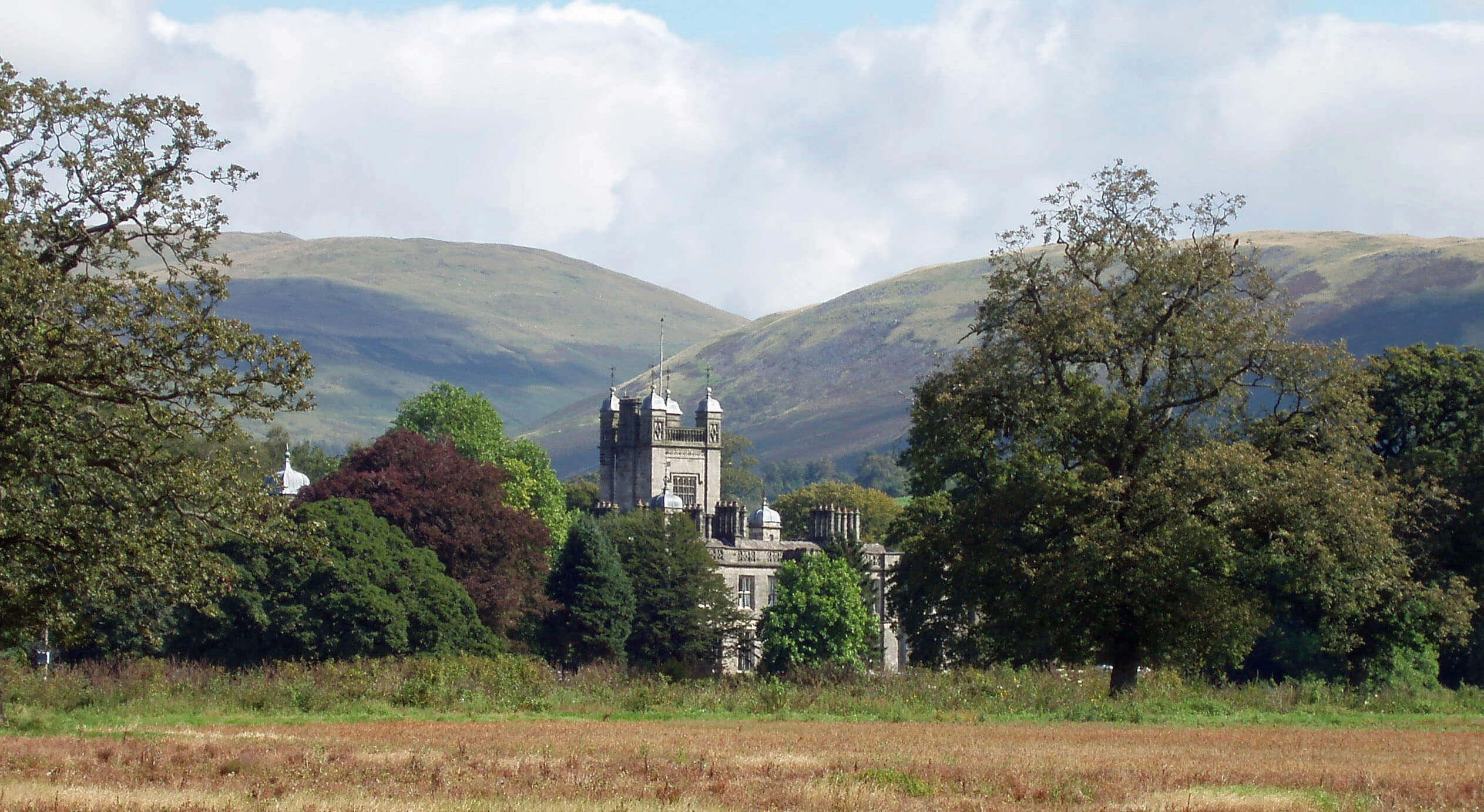 Right: Underley Hall
The Lune next runs by the elegant mansion of
Underley Hall. This was rebuilt in 1826 in the Gothic
style and later embellished and enlarged by the Earl
of Bective. The Earl and his successor at Underley,
Lord Cavendish-Bentinck (MP for South Nottingham),
who had married the Earl’s daughter, Olivia, and, of
course, the Countess and Lady, lived in the style that
befits such names. At one time, the estate employed 163
people, including 26 gardeners. The hall was known
for its shooting parties, a regular visitor to which was
the young Harold Macmillan, future Prime Minister. In
the Annals of Kirkby Lonsdale (1930), Lord Cavendish-Bentinck was described as “a magnificent specimen
of an English country gentleman”. Perhaps the author,
Alexander Pearson, was one of the 163 - at all events,
he is unlikely to have been neutral to the influence of the
Underley owners in the Kirkby Lonsdale region. On Lady
Cavendish-Bentinck’s death in 1939, the estate passed
to a cousin, Madeleine Pease. Since 1976 Underley
Hall has been a residential school for up to sixty young
people with emotional and behavioural difficulties but
the estate is still owned by the Pease family.
To the east is the old village of Casterton. It may not
be as old as its name suggests since there is no evidence
of a Roman castle on the site but it is old enough to
have been included in the Domesday Book. It is a small
village of class, with scarcely a house lacking style. It
has all the essentials of life: a school, a church, a garage-cum-shop, a pub and a golf course.
The Goldsworthy Sheepfolds were created between 1996
and 2003 by the environmental sculptor Andy Goldsworthy
during a project funded by Cumbria County Council. The
46 folds were built from existing folds that were derelict
or built anew where they were indicated on old maps.
Goldsworthy uses natural materials to create his art forms
and “feels the energy from nature and transcends that energy
into art form”. Each sheepfold was thus reinvigorated by
this new energy and re-connected to the farming traditions
of Cumbria. Inspiration, however, seems rather thin along
Fellfoot Road: all sixteen folds are similar, with a large
boulder enclosed in a small fold.
It is more in the spirit of the project if the sculptures
are appreciated by encountering them serendipitously and
by being momentarily confused by the strangely modern,
possibly functional, structures. (On our journey so far we
have passed Goldsworthy Sheepfolds at Raisbeck (the pinfold shown in Chapter 1),
Scout Green, Bretherdale, Cautley Crag, and
Barbondale.) However, now that the project is complete
and the folds are listed in leaflets and on websites,
inevitably people will set out purposefully to tick them off.
Whether they warrant such explicit attention I leave art-connoisseurs to judge.
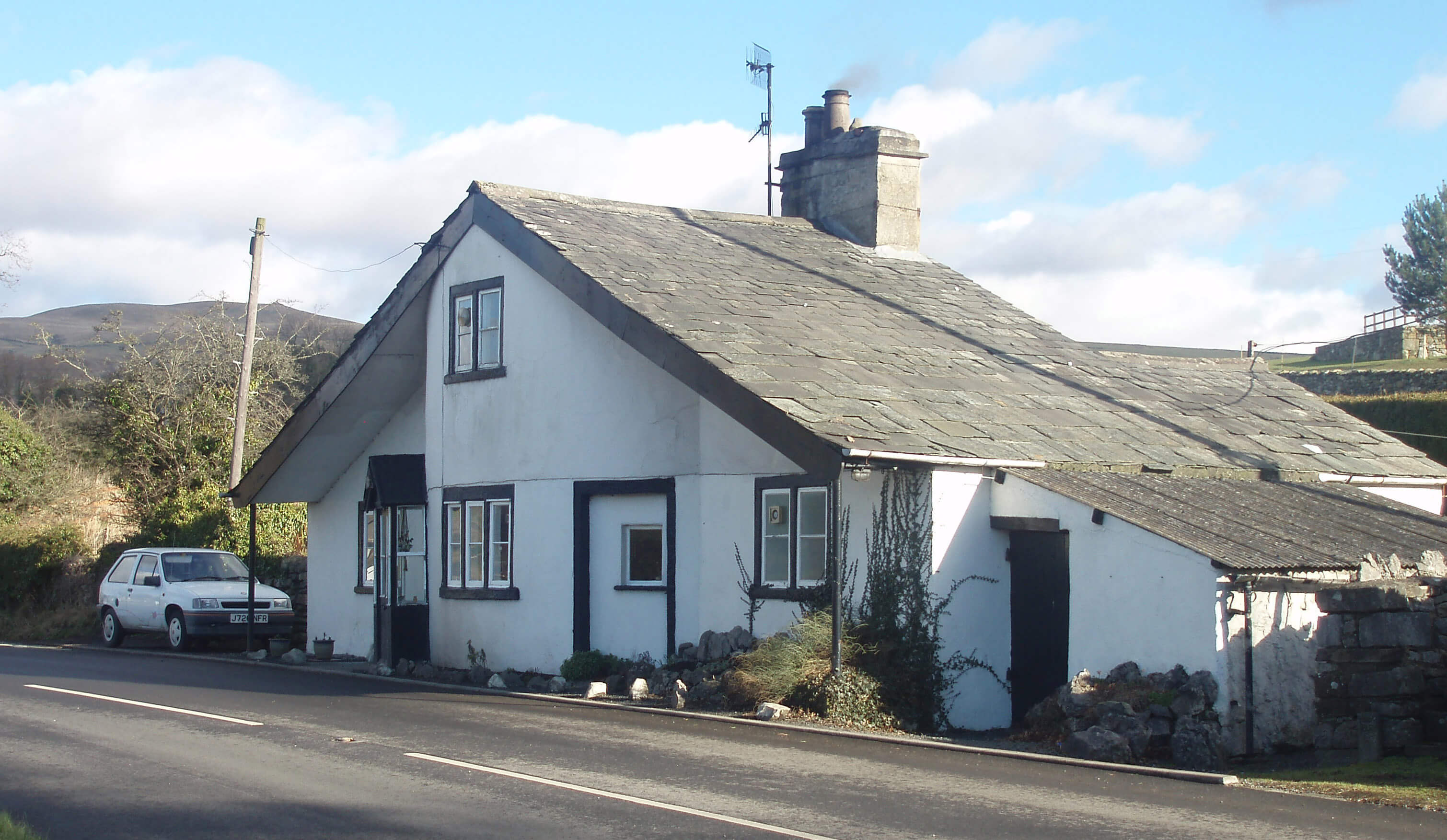 Right: Toll Bar Cottage, Casterton
Casterton School is an independent
boarding and day school for 320 girls (with
20 lucky? boys as day pupils). The school
began in the 1830s when Low Wood School,
which the Rev. William Carus Wilson had
established at Tunstall to train girls to be
servants, and the Clergy Daughters’ School
(of which, more shortly) that he’d started
at Cowan Bridge were both transferred to
Casterton. To help the clergy daughters
feel more at home, he had the Holy Trinity
Church built. And to help himself feel at
home, he moved into the neo-classical
Casterton Hall, which had been built in
1812 for his father.
Below Casterton Hall stands the 17th
century Kirfit Hall, with what looks like
a peel tower but is apparently a staircase
tower. Because of a planning dispute, one
of its barns has been garishly painted, in order to enliven
Ruskin’s View, which is a viewpoint at the top of a steep
bank of the Lune 1km south.
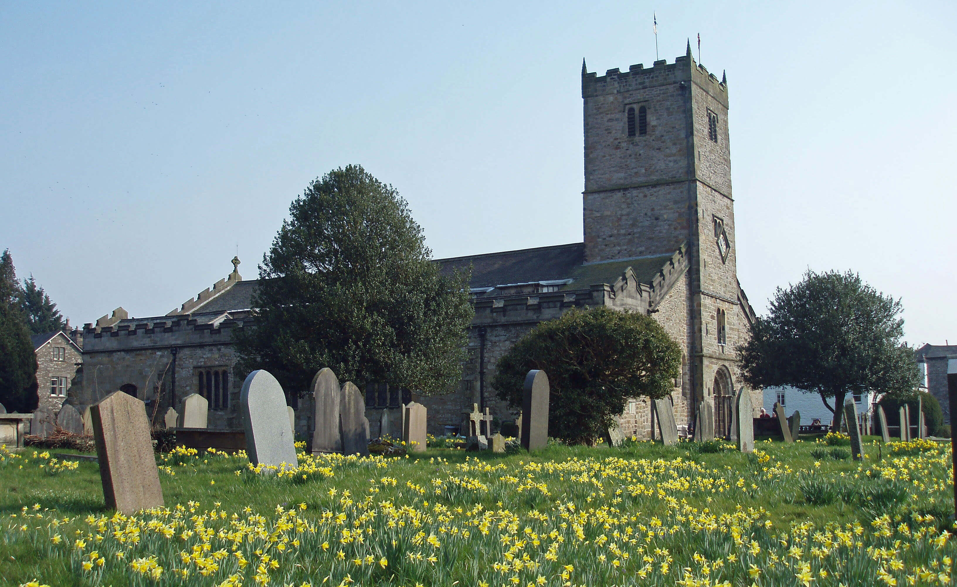 Left: St Mary’s Church, Kirkby Lonsdale
Near Ruskin’s View is Cockpit Hill, a 40m diameter,
overgrown mound that is thought to be the site of an
old motte and bailey castle, and behind it is Kirkby
Lonsdale’s Church of St Mary the Virgin, a substantial
edifice with many notable features. For most old
settlements, the church is the largest and most important
structure and it therefore becomes a focus for passing
visitors, even for those who rarely venture into churches.
Here, there is much of non-specialist
interest, both outside and inside the church.
Outside, the visitor may contemplate the
self-closing mechanism of the churchyard
gates, the oddly placed clocks on the tower,
the intriguing gazebo painted by Turner in
1818, and the pillar in memory of five young
women burned to death in 1820. Inside the
church, there’s some fine Jacobean wood
carving and on the northern side of the
nave there are three large Norman arches,
two of which have distinctive diamond
patterns. Some doorways and part of the
tower are also Norman. The church is
therefore at least as old as the 12th century
and is probably of Saxon origin, although
there has been much rebuilding, notably
in the 18th century and again in 1866.
Ruskin commented in 1875 that the church “has been
duly patched, botched, plastered and primmed up; and
is kept as tidy as a new pin”, in contrast to the bank of
what we now call Ruskin’s View, which was a “waste of
filth, town drainage, broken saucepans, tannin and mill-refuse”.
Passing through the churchyard, we enter Kirkby
Lonsdale, the most desirable location in Loyne, or so
estate agents tell us. It lies by the A65, midway between
the Lakes and the Dales, and does not try too hard to
detain tourists travelling between the two. The narrow
main street has shops and restaurants of refinement, even
trendiness (as epitomised by the renaming of the Green
Dragon as the Snooty Fox), and there is a profusion
of hanging baskets and other floral decorations. The
market square, however, has an unstylish crown-shaped
structure, now serving as a bus shelter, which used to
have a sort of dome with a cross atop. It was donated in
1905 by the vicar of Kirkby Lonsdale, whose generosity
could presumably not be declined.
The ambience is suburban, rather than rural, for,
apart from Ruskin’s View, Kirkby Lonsdale is inward-looking, focused on its own business, with little outlook
onto the surrounding fields. The older buildings are
of limestone, which outcrops locally. Apart from the
church and pubs, there are few buildings earlier than
the 18th century and on the outskirts many standard 20th
century houses.
Ruskin’s View is the only point along the Lune that the
Ordnance Survey considers worthy of a viewpoint symbol.
I’d prefer that OS maps kept to matters of fact rather than
opinion. For what it’s worth, my opinion is that the view is
OK, but neither high enough to provide an extensive view
of the Lune valley, with its fine surrounding hills receding
into the distance, nor low enough to enable an appreciation
of the sights and sounds of the riverside. Instead, we see one
bland bend of the Lune, with a backdrop of Brownthwaite
and Middleton Fell, among the least impressive of Loyne’s
hills.
The viewpoint is called Ruskin’s View, in thanks to
the art critic and thinker John Ruskin, whose opinion was
that “Here are moorland, sweet river and English forest at
their best … [the view is] one of the loveliest in England
and therefore in the world”. According to the Cumbrian
Directory, Ruskin said this in the 1870s after seeing
J.M.W. Turner’s 1818 painting of the view. One might
query Ruskin’s status as an art critic if he really considered
this view comparable to the one from his own window at
Brantwood, looking over Coniston Water.
Ruskin was a fervent promoter and protector of
Turner’s reputation. So much so that art historians
had always believed his statement in 1858 that he had
destroyed a set of erotic paintings by Turner, not wanting
his reputation to be sullied. However, the paintings were
found in 2005. Ruskin himself was fond of young girls. So
that’s two reputations sullied.
My point is that we should not just follow the opinions
of others – eminent aesthetes such as Turner or Ruskin,
or the OS, or, certainly, me. It is better to form your own
judgements about this and other views of the Lune.
 Left: The other view from Ruskin’s View, looking to The Island
Although there are few features of antiquity,
Kirkby Lonsdale is old, appearing in the Domesday
Book as Cherkeby Lownesdale and being granted its
market charter in 1227. The manor of Kirkby Lonsdale,
including the church, was given to St Mary’s Abbey
in York in the 1090s and after the Dissolution of the
Monasteries the church rights were granted to Trinity
College, Cambridge. Kirkby Lonsdale used to play
up to its history, without going back quite that far, by
holding a Victorian Fair in September, with participants
in period dress. This tradition was ended in 2008, being
considered to have outlived its usefulness.
Up to the 19th century there was a series of mills by
what is now called Mill Brow. From the market square
Jingling Lane drops down towards the Lune. The lane
meets up with the footpath that proceeds from
below Ruskin’s View alongside the Lune, where
there was a millrace for further mills. Anyone
walking along this path will notice the flood debris
in the tree branches above their head, indicating the
torrents that sometimes rage through this narrow
valley. All the more surprising, then, that the
elegant, three-arched Devil’s Bridge has withstood
the Lune for five centuries, or even longer. The date
of the bridge is unknown but, to be on the safe side,
it is a Scheduled Ancient Monument. Some think
it to be Roman, but this seems unlikely; others can
detect the same Norman hands as built the church;
others refer to records of repairs in 1275 and 1365
(which show only that there was a bridge here but not
necessarily this one); others consider the form of the
arches to be late 15th century at the earliest.
The name of the bridge is more recent, for until
the 19th century it was simply the Kirkby Lonsdale
Bridge. The uncertainty about the origin of the bridge’s
remarkable design encourages thoughts of a supernatural
agency. The legend is, in brief, that a woman entered a
Faustian deal with the devil to get the bridge built and
then sacrificed her dog to meet the conditions of the
deal.
For many people, hurrying between the Lakes and
the Dales and pausing at the Devil’s Bridge, this is the
only glimpse they will have of the Lune. It is a pity
that quiet contemplation of the bridge and the scenery
is difficult. There are normally crowds milling around
the snack bars and over the bridge and, at weekends,
motorcyclists, canoeists, picnickers, and maybe even
divers off the bridge. If we could but focus upon it
we’d appreciate the unique beauty and elegance of
the old bridge, 12m high, with ribbed, almost semi-circular arches, two of 17m and one of 9m span. The
breakwaters continue to the parapet to provide refuges
in the roadway, which with a width of only 3.5m is too
narrow for modern vehicular traffic. Below, the Lune
swirls through sloping crags.
The Lune runs under the A65 at Stanley Bridge,
built in 1932 150m south of the Devil’s Bridge. Stanley
– that is, Oliver Stanley, MP for Westmorland, after
whom the bridge was named – does not compete with
the devil. Instead, the new bridge, with its off-yellow
colouring and bold single span, provides a strong, if
inelegant, contrast. Just south of Stanley Bridge the
Lune enters the county of Lancashire.
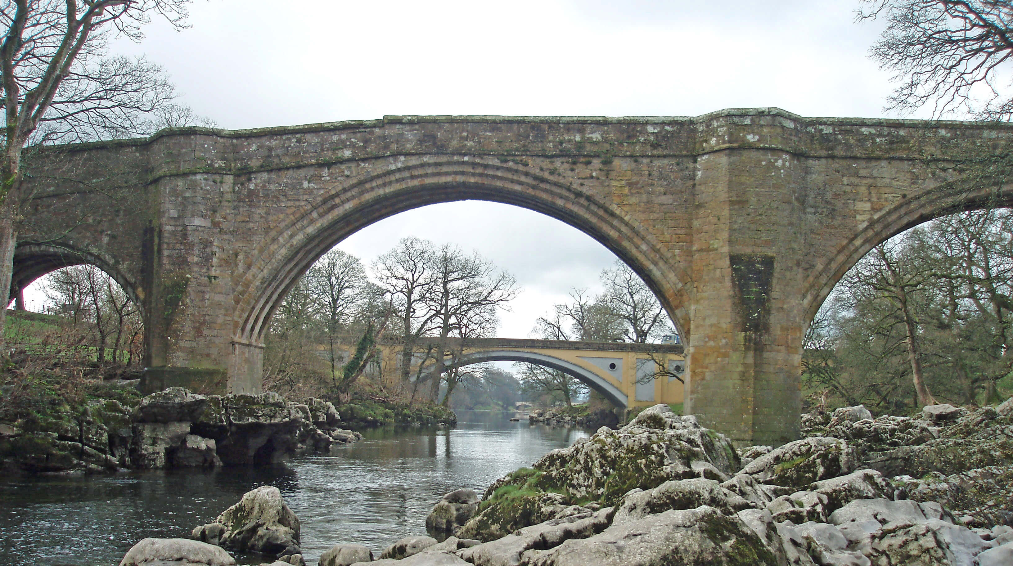
Devil's Bridge and Stanley Bridge
The Top 10 bridges in Loyne
1. Devil’s Bridge, Kirkby Lonsdale
2. Batty Moss (Ribblehead) Viaduct
3. Loyn Bridge, Hornby
4. Lowgill Viaduct
5. Lune Aqueduct, Lancaster Canal
6. Skerton Bridge, Lancaster
7. Crook of Lune Bridge, Lowgill
8. Artengill Viaduct, Dentdale
9. Lune’s Bridge, Tebay
10. Waterside Viaduct
Below Kirkby Lonsdale the Lune is accompanied
by the Lune Valley Ramble, which continues, mainly
on its west bank, for 26km to Lancaster. Since the more
varied and major part of the Lune valley lies to the north
of Kirkby Lonsdale it should perhaps be called the
Lower Lune Valley Ramble. This may seem pedantic
but the Lune is often underrated because the remit of the
body most concerned with its support and promotion,
Lancaster City Council, seems to end at the county
border. Its 2009 brochure describes the Lune valley as
“a pocket-sized part of England” that runs for “15-20
miles between Lancaster and Kirkby Lonsdale”. Its
‘official Lune Valley visitor website’ similarly considers
the Lune valley to begin at Kirkby Lonsdale. So I’ve
managed to write half a book about a river that
has not existed until this point.
The Ramble is a fine walk, the part here being best
tackled on a bright morning with the sun sparkling on
the rippling surface, with distant views of Leck Fell,
Ingleborough and the Bowland Fells. South of the
bridges oystercatchers assemble in March on their way
to their nesting sites on the shingle of the Lune. These
birds of the lower Lune, easily recognised by their long,
straight, dark red bill, red legs, and black and white
colouring, are more often seen in small numbers, flying
fast, with a shrill call.
One kilometre from Kirkby Lonsdale the Lune
passes under the 130km Haweswater Aqueduct, which
transports up to 500 million litres of water every day
to Manchester. It was completed in 1955, 36 years after
permission for the controversial Haweswater Reservoir
had been granted.
Showing excessive concern for walkers’ safety,
there are warnings to keep on the landward side of a
small embankment for flood protection. I assume the
real intention is to keep us away from fishermen, but if
they are absent the river-edge is much the better place
to be.
The next significant tributary is Leck Beck, joining
from the east.
Walk 14: A Loop between Kirkby Lonsdale and Barbon
Map: OL2 (please read the general note about the walks in the
Introduction).
Starting point: Near the Devil’s Bridge (617783).
This is a walk along country lanes and tracks, passing a variety of rural houses and reaching no great height. There is the
chance to refuel in Barbon.
Head east, past the caravan park, towards Chapel House and then follow Chapelhouse Lane to High Casterton, passing the
golf course on your left. After the Old Manor, cross the junction, following the sign to Low Casterton. Turn right at the Holy
Trinity church towards Langthwaite.
Immediately after Langthwaite take the footpath south to Fellfoot Road, which you follow north, past some Goldsworthy
Sheepfolds, until it drops down to a road. Turn left at the road and walk to Fell Garth. Take the path north past Whelprigg to
Underfell, to drop into Barbon by the church. From Barbon, walk southwest along Scaleber Lane to Low Beckfoot. You could
take a short detour north to see the packhorse bridge at Beckfoot Farm. At Low Beckfoot take the path west to the Lune.
At the Lune turn south to follow the long bend past Underley Bridge and then swing back to join Lowfields Lane. Walk
east and take the path south, below Underley Grange, to the wood below Gildard Hill, with views on the way across the river
to Underley Hall. If you should, accidentally, of course, stray west from the path in the wood, you would have a view down the
steepest and highest Luneside bank.
The path continues south to Casterton Hall and then across the field to the A683, where it is best to turn left for 100m or so
(take care) and follow the track (Laitha Lane) south from Toll Bar Cottage. This returns you to the Devil’s Bridge if you turn right
at the end (or via a short cut through the caravan park on the right).
Short walk variation: For a short walk it is necessary to forego Barbon. Follow the long walk as far as the junction after the Old
Manor and then turn right for 1km, over the old railway line and past Fell Yeat, the home of Brownthwaite Hardy Plants, which
deals with speciality perennials. Turn left at Fellfoot Road and walk north for 1km past some Goldsworthy Sheepfolds. Then turn
west past Langthwaite and on to Casterton. Cross the A683 and walk through the school to pick up the footpath that goes south
past Casterton Hall. Follow the last part of the long walk back to the Devil’s Bridge.
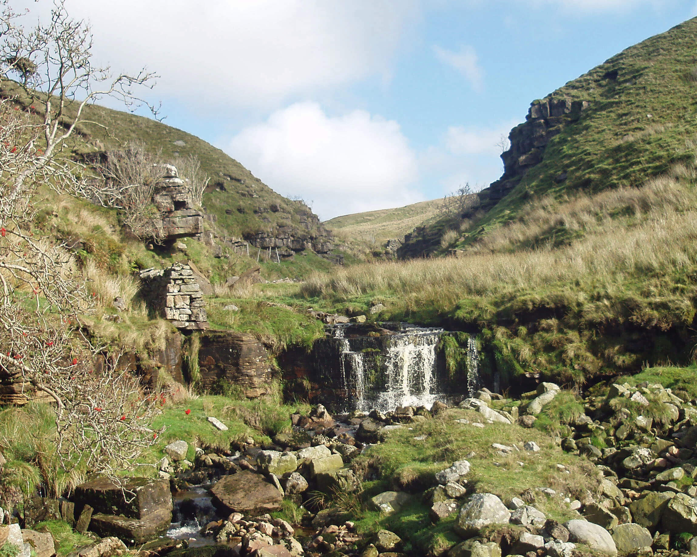
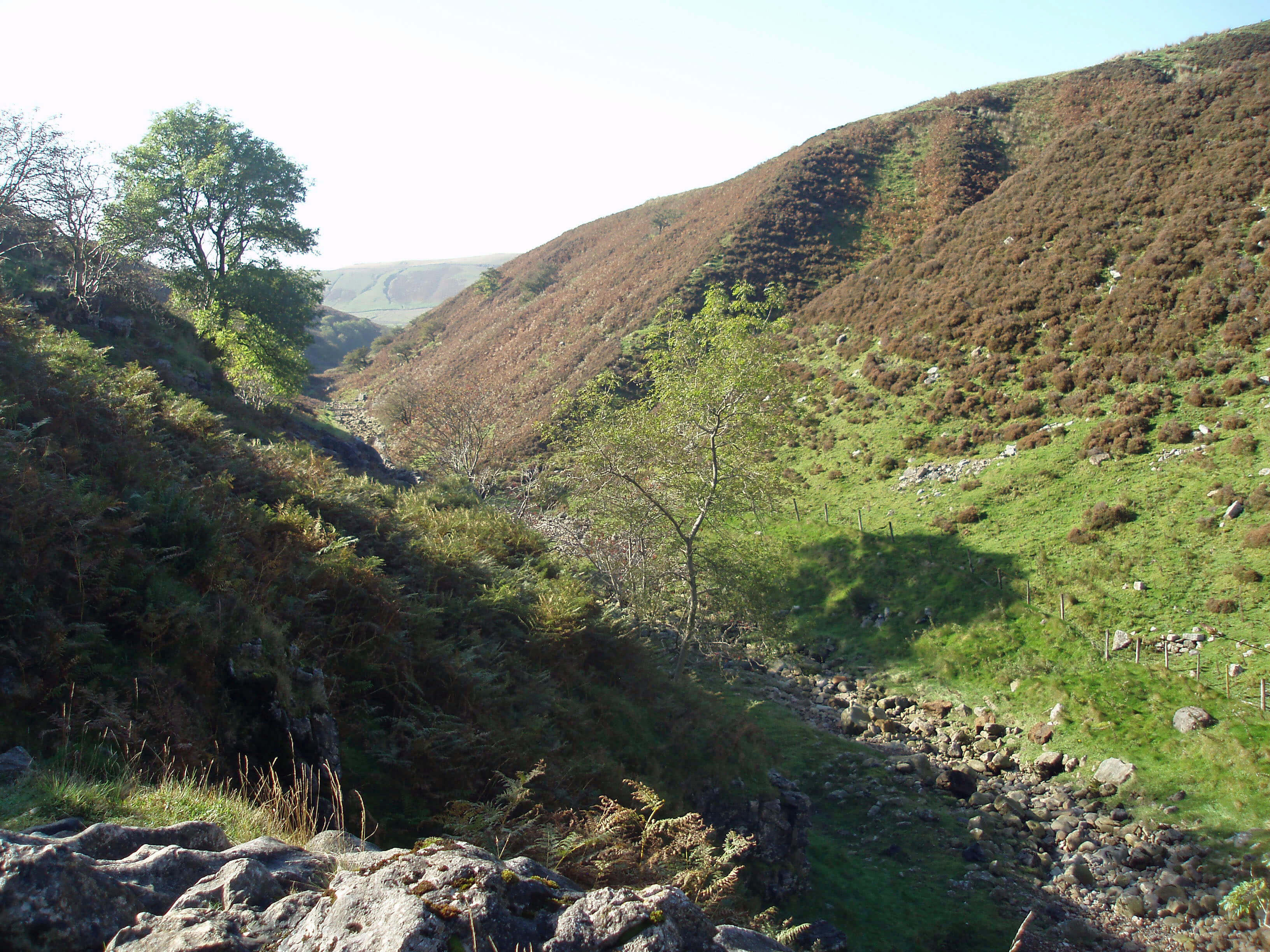
Leck Beck
The mature beck that gushes from the fellside at Leck
Beck Head emerges after an eventful and secretive
infancy. The waters that drain the southern slopes below
the fine ridge that arches from Crag Hill to Great Coum
and Gragareth form the becks of Aygill and Ease Gill,
which proceed normally enough over the high moorland
until they reach beds of limestone at about the 350m
contour, at which point they begin to disappear through
various potholes and caves.
The ridge to Gragareth from Great Coum
We have flirted with potholes and caves in Dentdale
and Barbondale but a confession is now required. My
guiding principle has been to write only about what I
have seen, wherever possible, and this has led me to visit
every one of Loyne’s 1285 sq km – but I draw the line
at going under them as well. This is unfortunate because
potholes are one of the few things in Loyne for which
we can dust off our superlatives, as it is undoubtedly
England’s best potholing region. However, I cannot
imagine ever standing at the entrance to a pothole and
opting to spend the next few hours in the damp, dark,
dangerous depths when I could be striding the hills, with
fresh air in my lungs, the wind in my hair, a spring in
my step, and a view in all directions. I can appreciate the
physical, mental and scientific challenge of potholing
but I prefer to resist it.
Therefore, apart from modest forays into cave
entrances and the tourist trips into White Scar Caves,
Ingleborough Cave and Gaping Gill, all the potholes
and caves are unknown territory to me. The little that I
say about them is passed on, second hand, in good faith.
Those who wish to venture seriously (and there should
be no other way) into potholes should consult more
reliable first-hand sources.
The potholes into which Ease Gill disappears are
part of the Easegill Caverns, which form, according to
Natural England’s description of the Leck Beck Head
Catchment Area Site of Special Scientific Interest, the
longest cave system in Britain and the 11th longest in the
world. Some call it, or used to call it, the Three Counties
System, as it stretches from Aygill (in Cumbria) across
Leck Fell (in Lancashire) to Ireby Fell (on the North
Yorkshire border). The caves under Casterton Fell (from
Lancaster Hole, Bull Pot of the Witches and others) have
60km of connected passages and these have a flooded
connection to a further 12km under Leck Fell (from Lost
John’s Cave and others). An additional 12km of passage
under southern Leck Fell are, as yet, unconnected. An
idea that there would be an eastern link to the Kingsdale
caves seems to be dormant. To the west the cave system
is ended by the Dent Fault.
Walk 15: Leck Fell, Gragareth and Great Coum
Map: OL2 (please read the general note about the walks in the
Introduction).
Starting point: The track near Bullpot Farm (663815).
This expedition provides a surface exploration of some potholes of the Easegill Caverns followed by a high-level ridge
walk.
From Bullpot Farm walk south 1km to cross a stile below Hellot Scales Barn. (In the very unlikely circumstance that Ease
Gill cannot be forded at this point, be sensible: abandon the suggested walk. Content yourself with a walk along the north bank
to view the rare sight of waterfalls in the Ease Gill valley and return to Bullpot Farm.)
Detour for 100m up the dry bed to view a chamber with a
U-shaped (dry!) waterfall (shown in the sixth of the eight photos below). Some people
call this Ease Gill Kirk but the name is properly applied to a less accessible but larger and more spectacular amphitheatre with
overhanging cliffs about 200m downstream from the stile. The Kirk (or Church, as it used to be called) is said to have been a
clandestine meeting place for Quakers. Returning to the stile, cross the bed of Ease Gill (leaving Cumbria for Lancashire) and
follow the footpath south. At a grassy slope a side-path allows a detour to see the real Ease Gill Kirk.
Leave the footpath before reaching a wall and head southeast across a field, viewing Big Meanie and Rumbling Hole en
route. Note the Three Men of Gragareth, the central group of a set of cairns, on the horizon as you cross the field. These are your
next objective. On reaching the road, take the track above Leck Fell House north for 100m and then scramble up to the Three
Men.
From the cairns, take a faint path east for 1km to the Gragareth trig point, and then continue for 150m to reach a wall (peer
over the wall into North Yorkshire). Walk north by the wall for 5km, passing Green Hill (628m, the highest point of Lancashire)
and the County Stone (the northernmost point of Lancashire) to reach Great Coum, from which there is an excellent view of the
Lakeland hills, the Howgills, the nearby Yorkshire Dales peaks, the lower Lune and Morecambe Bay.
[Update: In 2014 it was determined that Gragareth was 0.5 metres higher
than Green Hill and therefore the highest point of Lancashire.]
Walk west by the wall to Crag Hill (1km) and continue southwest to Richard Man, a rather inconspicuous set of stones (a
further 1km). At this point walk south for 250m to a parallel wall, which you then follow southwest for 2km to reach the Bullpot
Farm track.
Short walk variation: Follow the long walk as far as the track above Leck Fell House and then follow that track north for 2km.
Leave the track to follow the wall as it drops down to Ease Gill. Follow Ease Gill south for 1km until you reach a rather rickety
bridge. It is worth a short detour beyond the bridge to see Cow Dub. Return to cross the bridge and then follow the path northwest
for 1.5km back to Bullpot Farm.
It must be galling to the Yorkshire Dales National
Park, renowned for its potholing, to find that its borders
exclude Britain’s longest cave system. The old county
border that ran from Gragareth to Great Coum and into
Barbondale neatly steals the Easegill Caverns from the
Yorkshire Dales. Perhaps this will be remedied by the
review of the National Park boundaries.
The details of this three-dimensional underworld
are complex to unravel but the cause of the cave system
is as we have seen before. Water runs off the shale and
sandstone upper slopes to sink at the limestone boundary,
to make its way underground to the impermeable lower
layer and eventually re-emerge, in this case at Leck
Beck Head. Normally the bed of Ease Gill is dry for 2km
above Leck Beck Head but in flood conditions the caves
fill and Ease Gill becomes a torrent. Leck Beck actually
emerges about 100m north of the present line of the bed
of Ease Gill.
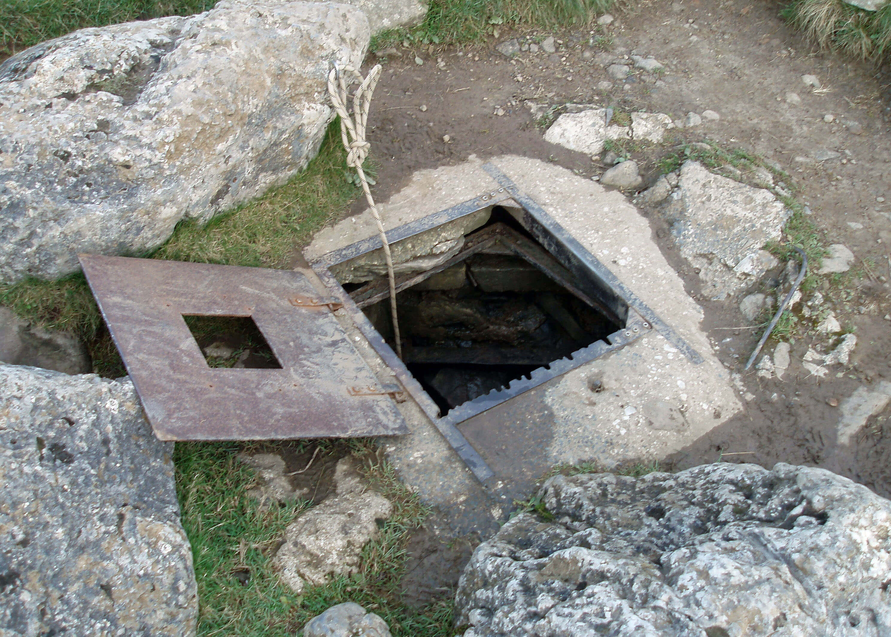
On the surface there is the barest indication of the
wonders underneath. At Lancaster Hole, for example,
there is only a manhole cover to see, unless it happens
to be raised, in which case you can peer down the 35m
shaft. The discovery of Lancaster Hole in 1946, which
really began the exploration of the Easegill Caverns, has
entered potholing legend: a resting caver noticed the
grass moving more than the breeze warranted, inferred
that a draught was issuing from underground, and shifted
a few rocks to reveal the pothole.
The Lakes and Dales National Park boundaries are to be
reviewed by Natural England (the review was postponed
until a decision on a South Downs proposal was reached,
which it finally was in April 2009). It seems likely to
propose that the Dales be extended westward to include
the northern part of the Howgills, Middleton Fell, Leck
Fell and Wild Boar Fell and that the Lakes be extended
eastward to include Birkbeck Fells – in short, that the upper
Lune becomes a border between the two National Parks.
There are many factors involved in determining
National Parks, as they are legal entities with administrative
roles. One factor concerns their role in conservation. It is
assumed that ‘undesirable’ developments would not be
permitted within a National Park. Therefore, by extending
the boundaries, the area protected from such developments
would, it is hoped, be increased.
In a rational world boundaries would not be determined
by politics or history but by natural properties that give a
region its coherence. In our case, the Dent Fault suggests
that Wild Boar Fell and Leck Fell (but not the Howgills
and Middleton Fell) belong to the Dales. The characteristic
areas of the Lake District are on igneous rocks that differ
from Loyne’s sedimentary rocks, including the Shap Fells,
which are now within the Lake District National Park (but
if we follow this line of reasoning we might conclude that
the areas south of Windermere and Coniston don’t belong
in the National Park either!).
Geologically, the Shap Fells, Birkbeck Fells, the
Howgills and Middleton Fell form a homogeneous
region. Perhaps this region could be designated an Area
of Outstanding Natural Beauty, for even the strongest
supporter could not claim it equal to the two National
Parks. It is, however, unlikely that areas already within the
National Parks (the Shap Fells and the southern Howgills)
will be excluded. Let’s leave it to the experts.
[Update: The National Park boundaries were duly revised in 2016.
As expected, the National Parks became bigger. The Lake District adopted the Birkbeck Fells,
Bretherdale and Borrowdale. The Yorkshire Dales border was moved north to include Wild Boar Fell, the
northern Howgills and the Orton Fells as far as Maulds Meaburn. The western boundary was moved
to include not only Barbondale and Middleton Fell but part of the Lune valley.
The River Lune can therefore now be considered a river of the Yorkshire Dales since it
is no longer on the border for a few miles but is actually within the National Park from its
source to Tebay and from Borrowdale to Kirkby Lonsdale.]
 Ease Gill runs from the slopes of Great Coum ...
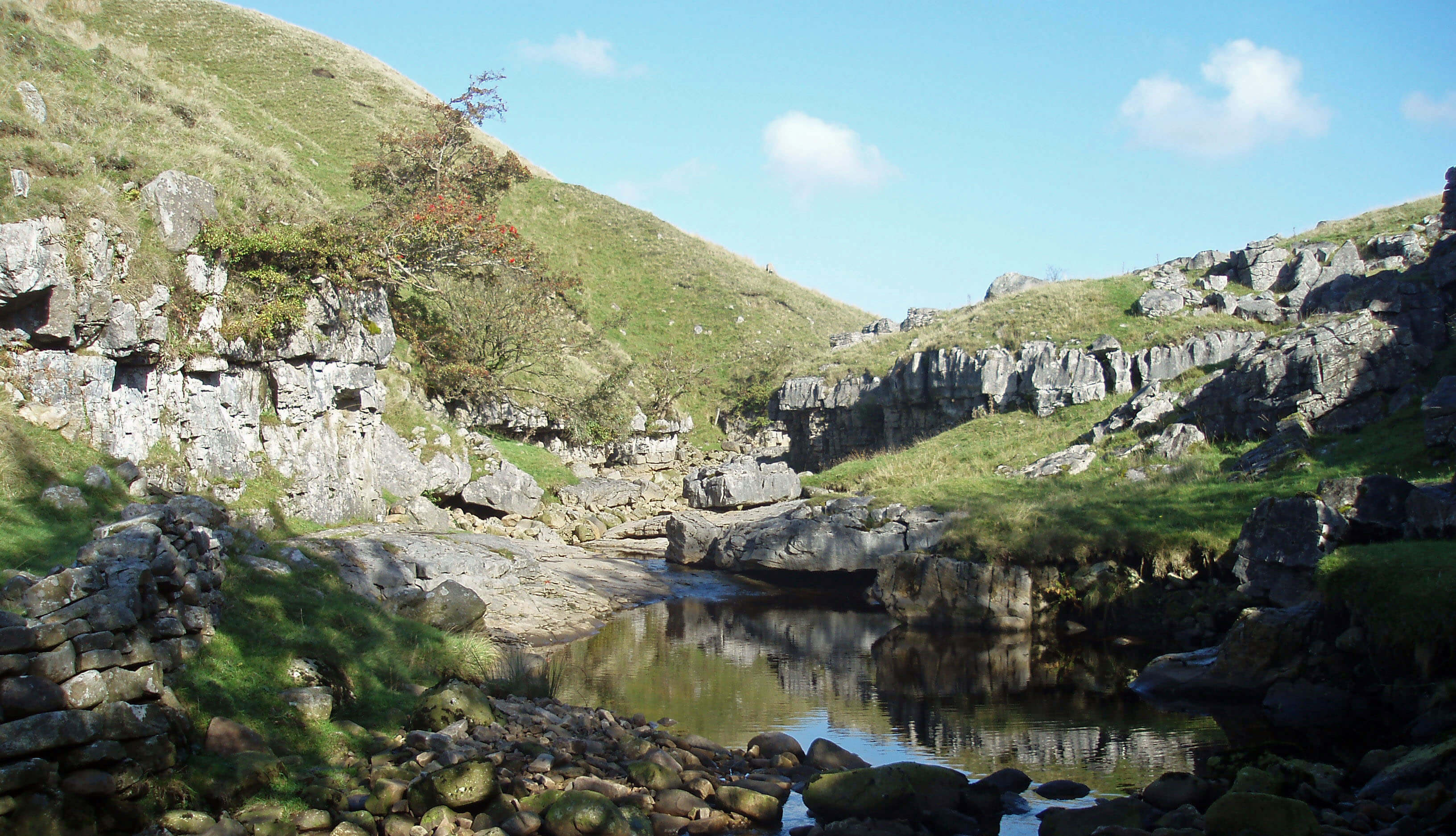 ... and gradually disappears through limestone ...
 ... the bed becoming completely dry in places ...
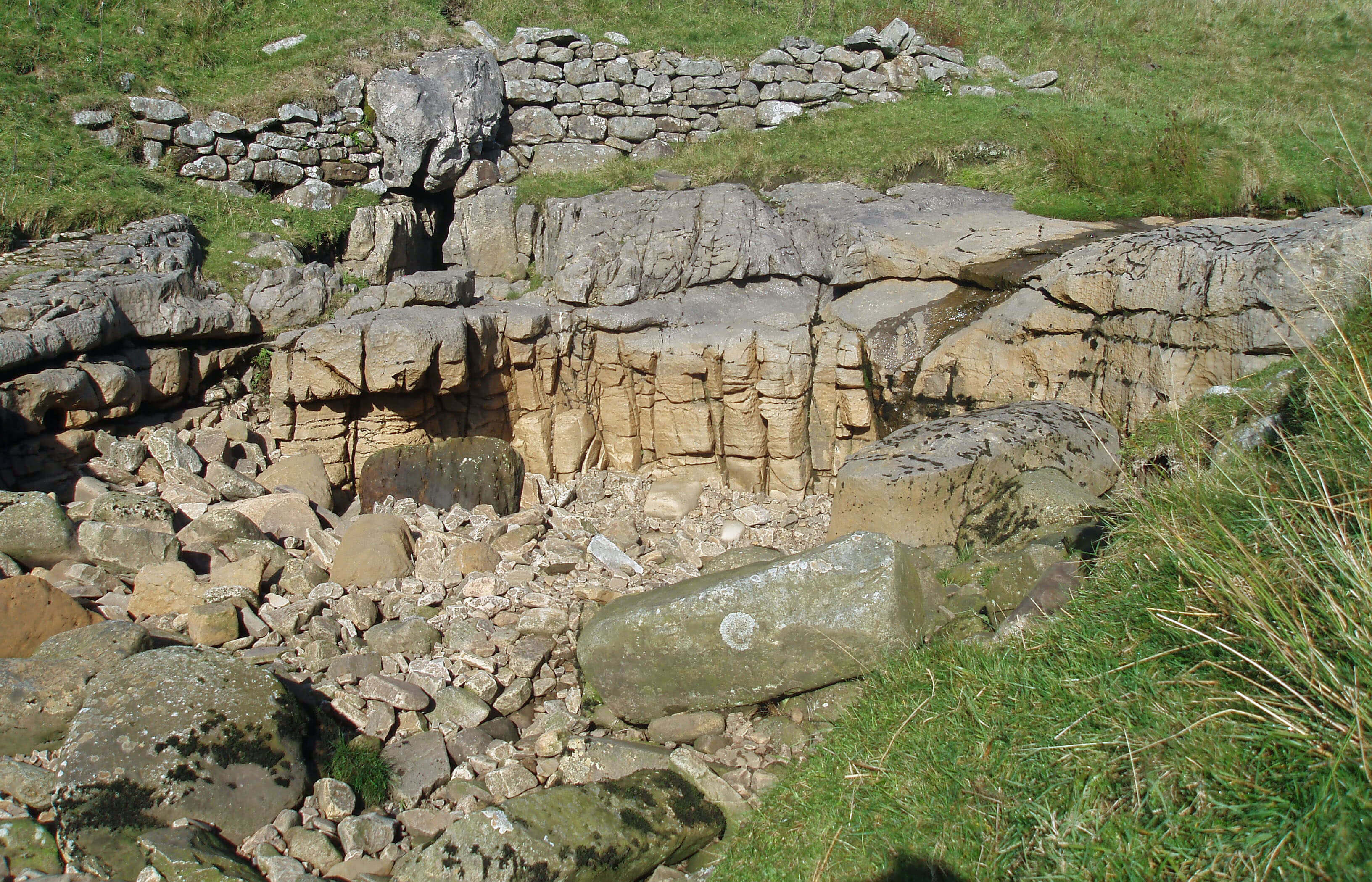
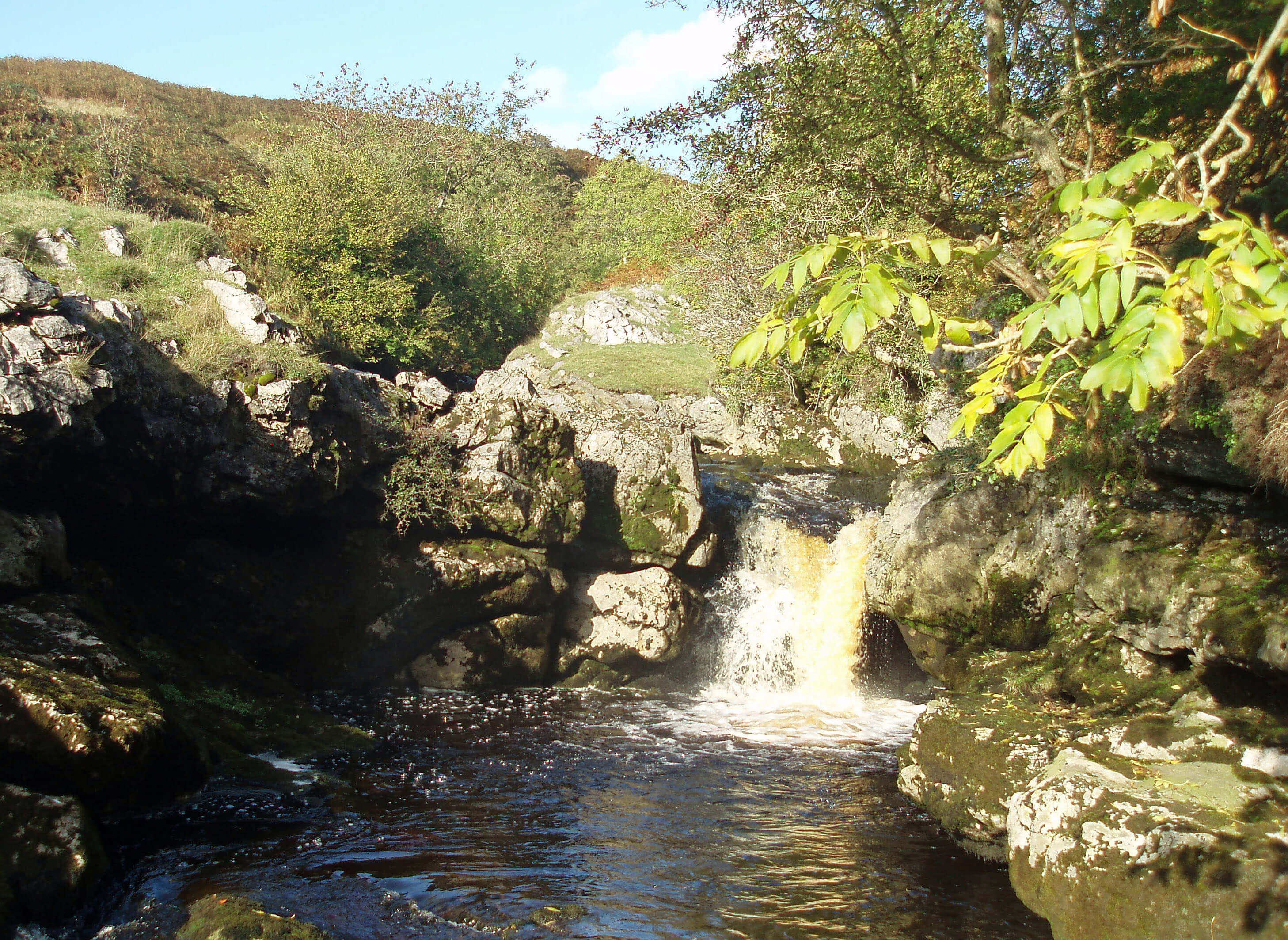
 ... though there’s usually a trickle at Cow Dub ...
 ... below which the valley is dry and quiet ...
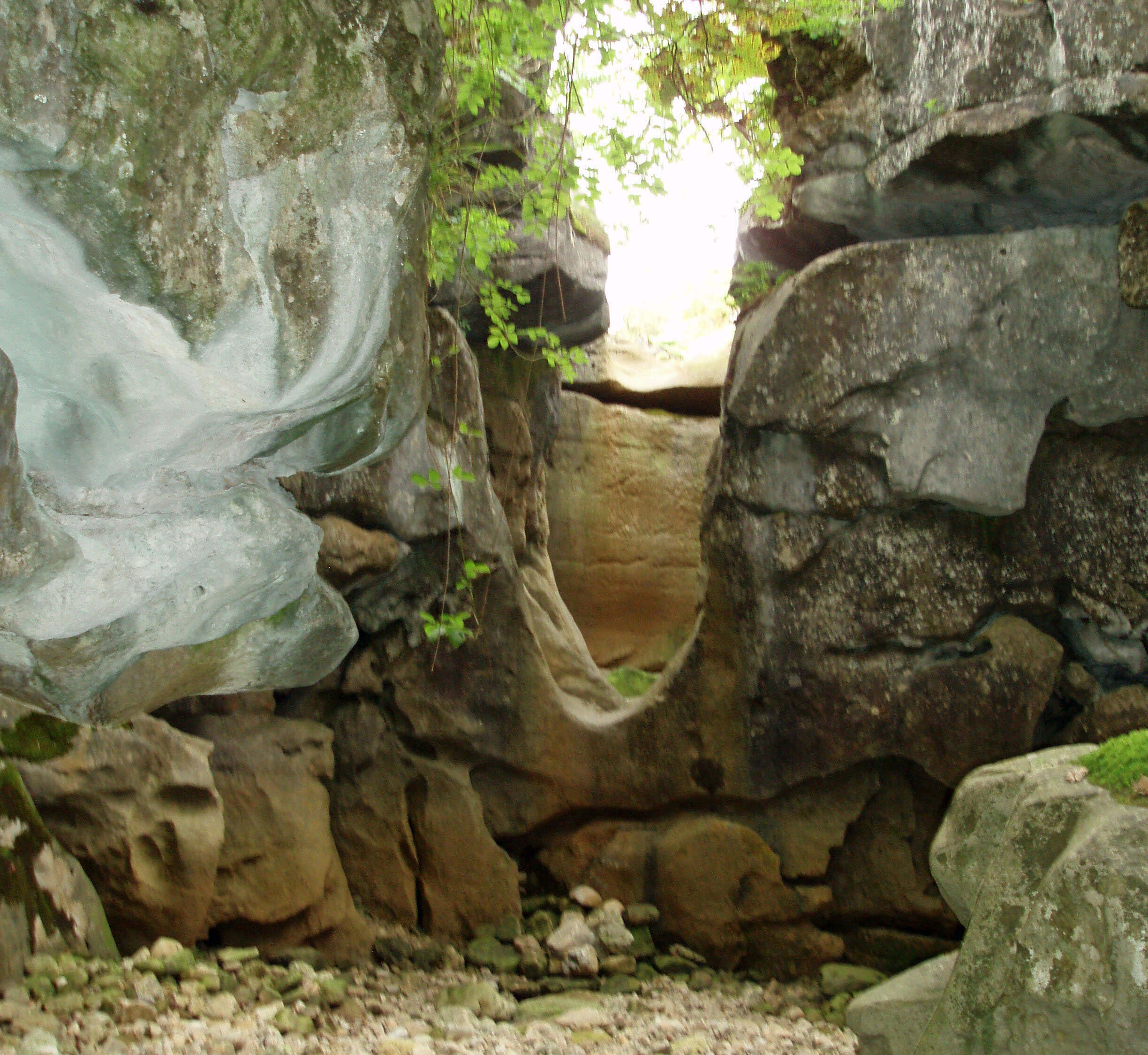 ... with eerie grottos and waterless waterfalls ...
 ... meanwhile the underground waters of
Ease Gill are exploring the Easegill Caverns, as
many potholers also do by, for example, entering
Lancaster Hole ...
... meanwhile the underground waters of
Ease Gill are exploring the Easegill Caverns, as
many potholers also do by, for example, entering
Lancaster Hole ...
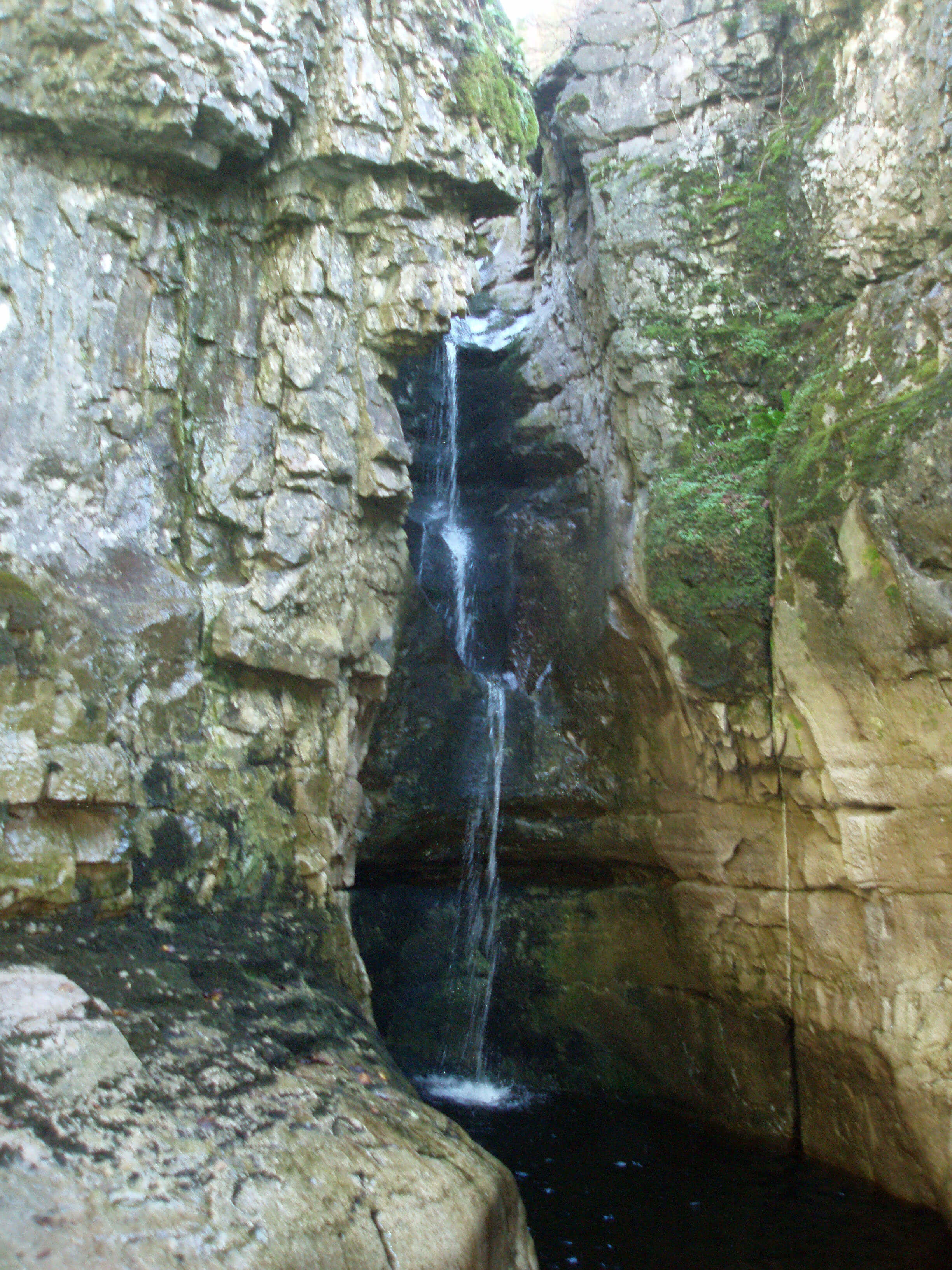
 ... and eventually, as the waters reach the
impermeable rock below the layer of limestone,
they re-emerge at Leck Beck Head near Ease Gill
Kirk to form Leck Beck.
... and eventually, as the waters reach the
impermeable rock below the layer of limestone,
they re-emerge at Leck Beck Head near Ease Gill
Kirk to form Leck Beck.
As Leck Beck runs through Springs Wood, a natural
wood unlike the many conifer plantations in the area, it
passes below Castle Hill to the east. Here are the remains
of – well, what exactly? There appears to be a roughly
circular ditch, 100m in diameter, with gaps to the north
and south. Within the ditch, there is some unevenness
and a few piles of rocks but no real sign of any building
– certainly no castle. It probably enclosed a few Iron Age
settlements. One thing we can be sure of: whoever lived
here had an excellent view of the lower Lune valley.
 Left: The Leck Beck valley
Across Leck Beck at High Park are the remains of
ancient settlements, visible on the ground as earthworks
and jumbled lines of rocks. Archaeologists tell us that
they date from 300 AD or so. Even older is the Casterton
stone circle, which lies southwest of Brownthwaite
Pike and dates from the late Neolithic or early Bronze
Age (2000-600 BC). There are about eighteen stones,
none higher than 30cm and some sunk in the grass,
in a 20m-diameter circle. It is said that 1,800 finds,
including drinking vessels, flint arrowheads and a
bronze spearhead, have been made here. The circle is
not, however, an impressive sight. In the same field are
many large piles of rocks, the remains of thick walls,
which are rather more intriguing.
You cannot see Kirkby Lonsdale from the stone
circle, as you might have expected since the stone circle
is marked on the display at Ruskin’s View. However,
if you climb to the prominent cairn on Brownthwaite
Pike, you are rewarded with an excellent view of Kirkby
Lonsdale, with Morecambe Bay behind, the Lakes
skyline to the right and the middle reaches of the Lune
to the left.
Leck Beck runs by the village of Leck, which is
not the traditional cluster of stone cottages: it is not a
cluster at all. The ingredients – an old mill, parsonage,
church, and school – are there but they do not seem to be
integrated to make a community. An ignored triangular
field looks like it would make a fine village green –
perhaps it once was, for many houses here were burnt
down in the 1800s after a smallpox outbreak. Leck Hall,
which was rebuilt in the early 19th century and bought
by the Kay-Shuttleworth family in 1952, stands apart.
From this outpost Lord Charles Shuttleworth serves
as Lord Lieutenant of Lancashire, a post instituted by
Henry VIII to deal with local defence. Perhaps the need
to repel Yorkshire invaders explains all the noise of
shooting heard hereabouts. Today, the Lord Lieutenant’s
role is to represent the Queen at events in the county and
to prepare programmes for royal visits to Lancashire.
At Cowan Bridge, Leck Beck passes under an
overgrown five-arched bridge for the old Lowgill-Clapham railway line. Cowan Bridge itself is bisected
by the busy A65. This is an ancient road along which
tolls were collected as early as the 16th century but
the traffic associated with the Yorkshire and Cumbria
woollen trade had died down by 1824, when the Brontë
sisters came. Cowan Bridge is now most remarked upon
because of its Brontë connection, excessively so, given
that it is the grim pestilence of the place that is recalled.
The Brontë connection began when the Rev. Patrick
Brontë sent four of his five daughters to the Clergy
Daughters’ School opened by the Rev. William Carus
Wilson in Cowan Bridge in 1824. They were only there
for a year, illness forcing them back to Haworth. Maria and
Elizabeth died of tuberculosis in 1825, although Charlotte
and Emily did, of course, survive to write novels. All they
wrote whilst at Cowan Bridge, however, was “Dearest
father, please, please get us out of this place”.
Elizabeth Gaskell’s biography (1857) of Charlotte
Brontë painted a harsh picture of the Clergy Daughters’
School (Lowood of Jane Eyre, perhaps derived from
the Low Wood School we met at Casterton) and of the
Rev. Carus Wilson (Mr. Brocklehurst), so much so that
threatened legal action brought changes to the third edition.
To put the Brontë’s illnesses into context, child mortality
in the region was so high at the time that average life
expectancy was only 26 years.
A plaque on the wall of Brontë Cottage by the old
road bridge commemorates the Brontë sisters’ brief and
unhappy time at the Cowan Bridge school.
South of Leck Beck, on Woodman Lane, there is a
poultry farm that is surprisingly large for such a quiet rural
area. Perhaps the authorities, too, were surprised, for the
buildings had neither planning permission nor an IPPC
(Integrated Pollution Prevention and Control) licence.
To avoid getting myself entangled in this legal dispute
I should clarify that ‘agricultural permitted development
tolerances’ allow a small amount of construction every
two years without planning permission. Lancaster City
Council refused a retrospective application in 2005, a
decision for which the council was later fined Ł87,000
as it was deemed unreasonable. Presumably this ensures
the future of Mayfield Chicks, if not the chicks.
Leck Beck next passes under Burrow Bridge,
whose two arches seem almost too low for the beck
when it is in flood. In alcoves on the bridge there are
acknowledgements to the work of those who built the
bridge in 1733 – labourers (on the west) separated from
management (on the east).
The bridge is midway between Nether Burrow and
Over Burrow, which together yield the novel parish name
of Burrow-with-Burrow. At the former is the 18th century
coaching inn, the Highwayman Inn, which has recently
been refurbished and resurrected as a ‘Ribble Valley
Inn’, a geographically remarkable transmogrification.
The Top 10 pubs in Loyne
(This ‘top 10’ has provoked more comment than all the
others combined. I think that I had better play safe and list
the pubs (generously, more than ten) in alphabetical order.
I am open to persuasion, financial or gustatory, from any
owner who feels their pub has been neglected.)
1=. Barbon Inn, Barbon
1=. Cross Keys Inn, Tebay
1=. Fenwick Arms, Claughton
1=. Game Cock, Austwick
1=. Golden Ball, Lancaster
1=. Hill Inn, Chapel-le-Dale
1=. Lunesdale Arms, Tunstall
1=. Marton Arms, Thornton-in-Lonsdale
1=. Redwell Inn, Gressingham/Arkholme
1=. Ship Inn, Caton
1=. Stork, Conder Green
1=. Sun Inn, Dent
1=. The Head, Middleton
1=. The Sun, Lancaster
1=. Water Witch, Lancaster
P.S. The Highwayman Inn is disqualified for calling itself
a Ribble Valley Inn.
[Update: I regret giving this list. I didn't visit pubs
often enough - and even less recently - to be qualified to provide such a list.
In any case, the quality of a pub changes as its ownership does, regularly.
The Highwayman Inn is, for example, no longer a Ribble Valley Inn, I think.]
If you walk to the gate at the drive of Burrow Hall
in Over Burrow and then 20m to the barn to the north
and look at the wall near the north end, about head high,
you will see a red sandstone block with carvings on it.
This is a remnant of Roman stonework and is all that can
be seen of the Roman fort that existed at Over Burrow
from the 1st to the 4th century.
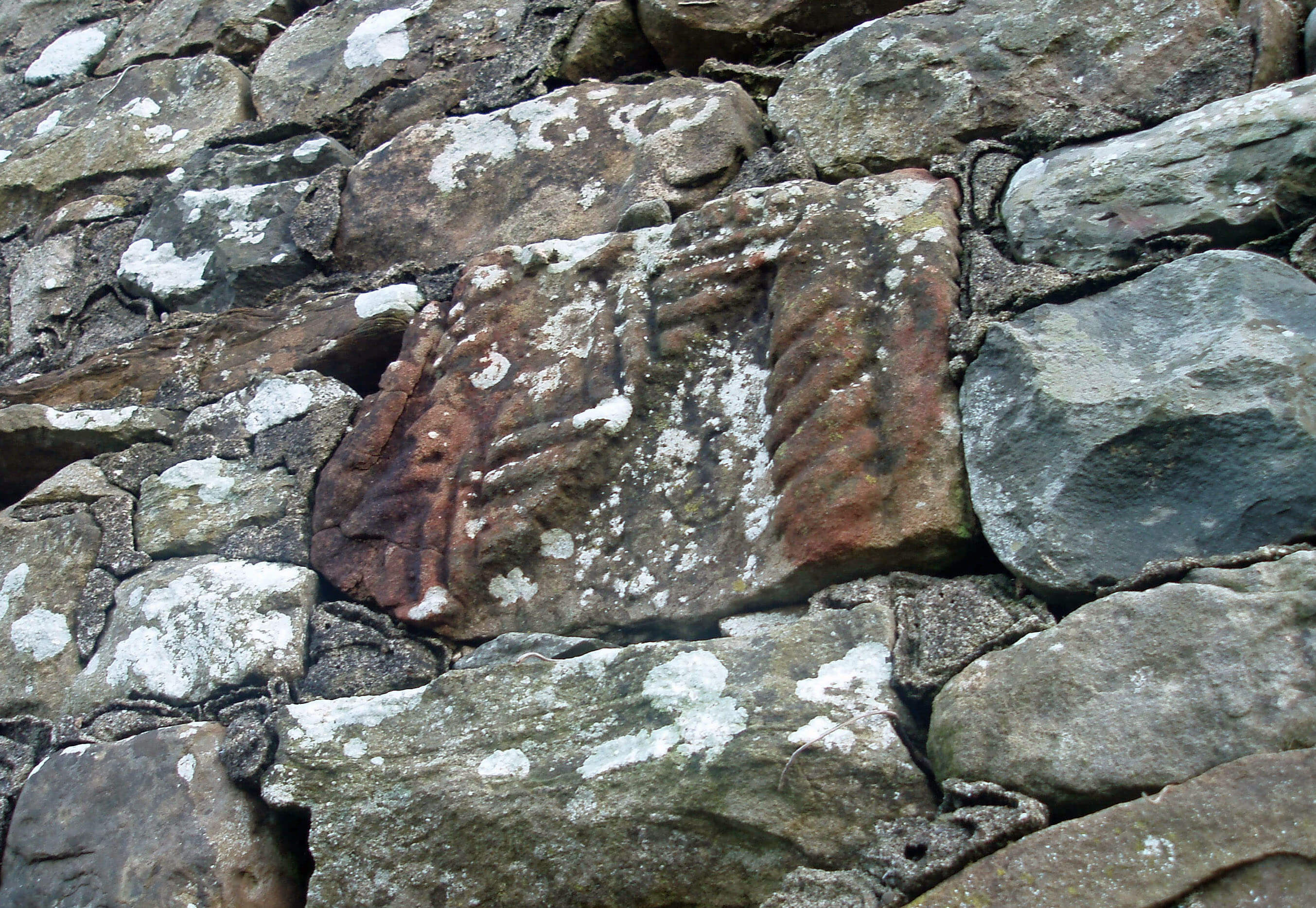 Right: Roman stonework in Over Burrow barn
The rest you must imagine. The gate to the hall
driveway is probably at the east entrance to the fort,
midway along the east wall. Burrow Hall itself, visible
up the drive, 140m away, is on the west wall of the fort.
The fort was roughly square, so the south wall was 70m
south of the drive, across the green field. The north wall
was similarly 70m north, where there are buildings now.
The fort thus enclosed about 2ha, enough space for a
thousand soldiers.
How do we know this, when there is so little to
see? The Roman’s Antonine Itinerary listed a fort
called Calacum 27 Roman miles from Bremetenacum
(Ribchester) and 30 Roman miles from Galava
(Ambleside) – in other words, here. In the past, Burrow
was regarded as a very old place and, not so long ago,
there was more evidence than there is today: William
Camden, in his great work Britannia (1610), the first
historical survey of Great Britain, wrote “… by divers
and sundry monuments exceeding ancient, by engraven
stones, pavements of square checker worke, peeces of
Roman coine, and by this new name Burrow, which with
us signifieth a Burgh, that place should seeme to bee of
great antiquity.”
Various excavations have been carried out,
particularly in the 1950s, to confirm the lines of the
walls and positions of the gates. About thirty coins have
been found, from Vespasian (69-79 AD) to Constantius I
(305-306 AD), but none from the 3rd century. Of course,
much remains unknown and may always be so. It is
assumed that a road went west across the Lune to Galava
although its route has not been traced. The road from
Low Borrowbridge, which we have been tracking south,
runs 1km to the east of the fort.
Burrow Hall is a substantial Grade I listed Georgian
mansion, best seen from the footpath to the north. After
the Civil War the Burrow estate was given to a Colonel
Briggs, who built the first hall in the 1650s. The estate was
sold to the Fenwick family in 1690 and Robert Fenwick,
Attorney General and MP for Lancaster, rebuilt the hall,
as we see it now, in 1740. After passing through various
hands, the estate was offered for sale in 2005 for Ł3.5m
and so, for what it’s worth, we have the estate agent’s
description of the interior of the building: the Baroque
ceilings, the marble fireplaces, the delicate cornicing of
its five grand reception rooms, the sumptuous master
suite, the stunning atrium with fabulous views, and so
on. The Burrow estate also includes 0.5km of fishing on
the Lune, which Leck Beck joins 300m below Burrow
Bridge.
The Lune from Leck Beck ...
The map shows a ford across the Lune immediately
after Leck Beck has entered the Lune and I can
vouch for the fact that it is indeed fordable, on foot
(sometimes). If the paddling expedition is from the east
and is timed properly, it is possible to sneak in on the
Whittington point to point steeplechases that are held on
Easter Saturdays in the fields opposite.
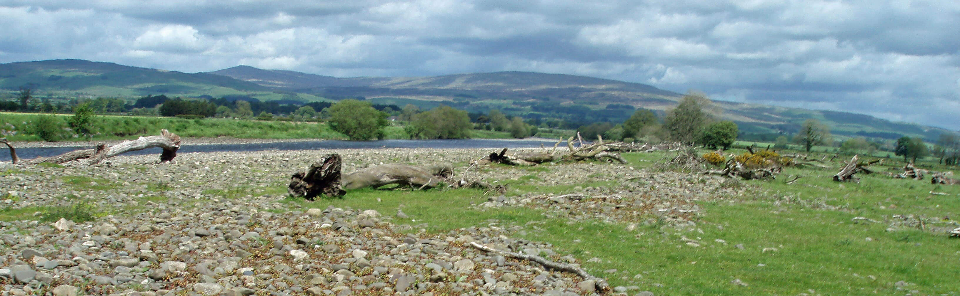
The Lune valley has now flattened out, giving long
views to the south, east and north. An island (when the
river is high) has been formed, with its shores strewn with
large boulders and tree-trunks washed down in floods.
The riverside fields show evidence of old river channels,
with the lagoons left by the shifting Lune being favourite
haunts of the heron, a bird that, unlike others, rises with
graceful dignity if disturbed and with slow beats of its
wings drifts off to settle in the long reeds where it can
keep a better eye on you than vice versa.
 Left: Logs and the Lune at the ‘island’
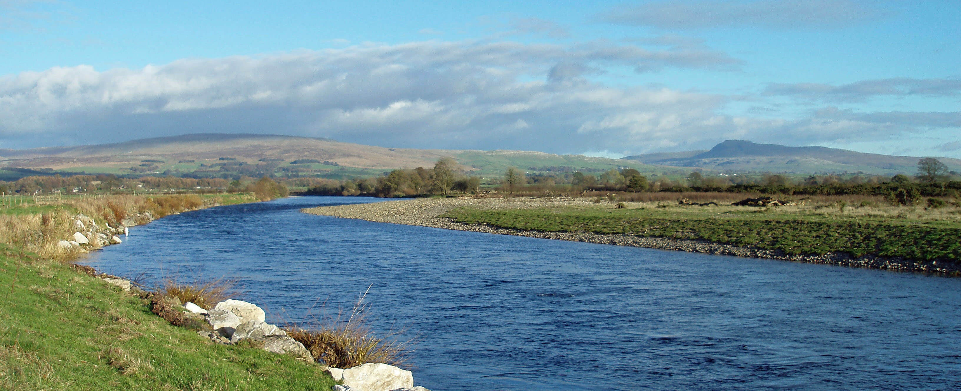
Right: The Lune at the ‘island’, with Leck Fell and Ingleborough beyond
This is a magnificent spot for seeing the salmon
leap. Settle on the west bank on a fine autumn day,
at a point opposite the island, where a deep stretch of
Lune runs straight towards you from the north. There
will be little noise, apart from the splashing salmon. If
the salmon should be resting, there will be, apart from
the heron, a display of bird-life such as oystercatcher,
snipe and kingfisher, if you are lucky – and all this with
a backdrop of the Howgills, Leck Fell and Ingleborough.
This beats Ruskin’s View by far!
The 1847 OS map shows that, south of the island,
the Lune swept in a wide curve half the way to Tunstall,
that is, 500m from its present course. All the fields east
and west of the Lune from Kirkby Lonsdale were marked
“liable to flooding”. The Lune floodplain, about 1km
wide and running 15km from Kirkby Lonsdale to Caton,
has all the characteristics of a textbook floodplain. In
normal conditions, the Lune meanders gently among
wide, flat and tranquil pastures, where glacial till and
regular alluvium deposits create rich soils to provide
fertile grazing land for sheep and cattle. Abandoned
channels and protected hollows create lagoons that
are replenished by floods and heavy rain to provide
important wetland habitats for birds, fish and plants.
Kingfishers and sand martins are able to nest in the
eroded riverbanks.
For obvious reasons, there are no human habitations
in the floodplain, increasing the sense that the area is
a haven for wildlife. The floodplain rises gently to its
undulating fringes, where homesteads have been built
and along which important lines of communication have
always existed. Communication across the floodplain
was more difficult, although there were several fords
between settlements on opposite banks. In general, the
Lune is fortunate that, although there has been some
drainage and flood protection work, there has been no
major urban or industrial development to affect these
ecologically important areas of grassland and wet
meadows.
The Lune continues south, to be joined by the major
tributary of the River Greta.
The salmon is the Lune’s jewel. The Lune has one of the
most important populations of Atlantic salmon in England,
salmon being found through much of the Lune’s catchment
area. The eggs are laid in autumn, with the young salmon
staying in their native beck for up to three years. The
mature salmon then spend two or three years in the sea
before returning to their beck in early summer in order to
spawn and then, usually, to die.
The Lune was once one of the best salmon fisheries
in England but numbers dropped in the 1960s because of
disease (ulcerative dermal necrosis, which certainly sounds
bad). There may well have been other factors, such as the
loss of spawning habitats, excessive fishing, poor water
quality, and barriers to the salmons’ swim upstream, as
well as causes external to the Lune. The Lune’s problems
are not unique as global catches of Atlantic salmon fell by
80% in the 30 years from 1970. Although the numbers of
Lune salmon have since revived they are not yet back to
previous levels and the numbers of sea-trout also remain
disappointing.
The Environment Agency now monitors salmon
populations through automatic counters at Forge Bank Weir,
Caton and Broadraine Weir, Killington and has developed
a ‘salmon action plan’ for the Lune. This includes giving
nature a hand by releasing four-month-old salmon fry,
reared from Lune eggs, into upstream tributaries.
[Update: The number of salmon in the Lune has
plummeted, according to recent reports. I'm not an angler but on my casual observations
of the river I rarely hear a salmon splash nowadays (unlike in previous decades) -
and I don't see as many anglers either.]
The Introduction
The Previous Chapter (Middleton Fell)
The Next Chapter (The Greta Headwaters)
© John Self