The Land of the Lune
Chapter 10: The Wenning Headwaters
The Introduction
The Previous Chapter (Gretadale and a little more Lunesdale)
The Next Chapter (Wenningdale, Hindburndale and Roeburndale)
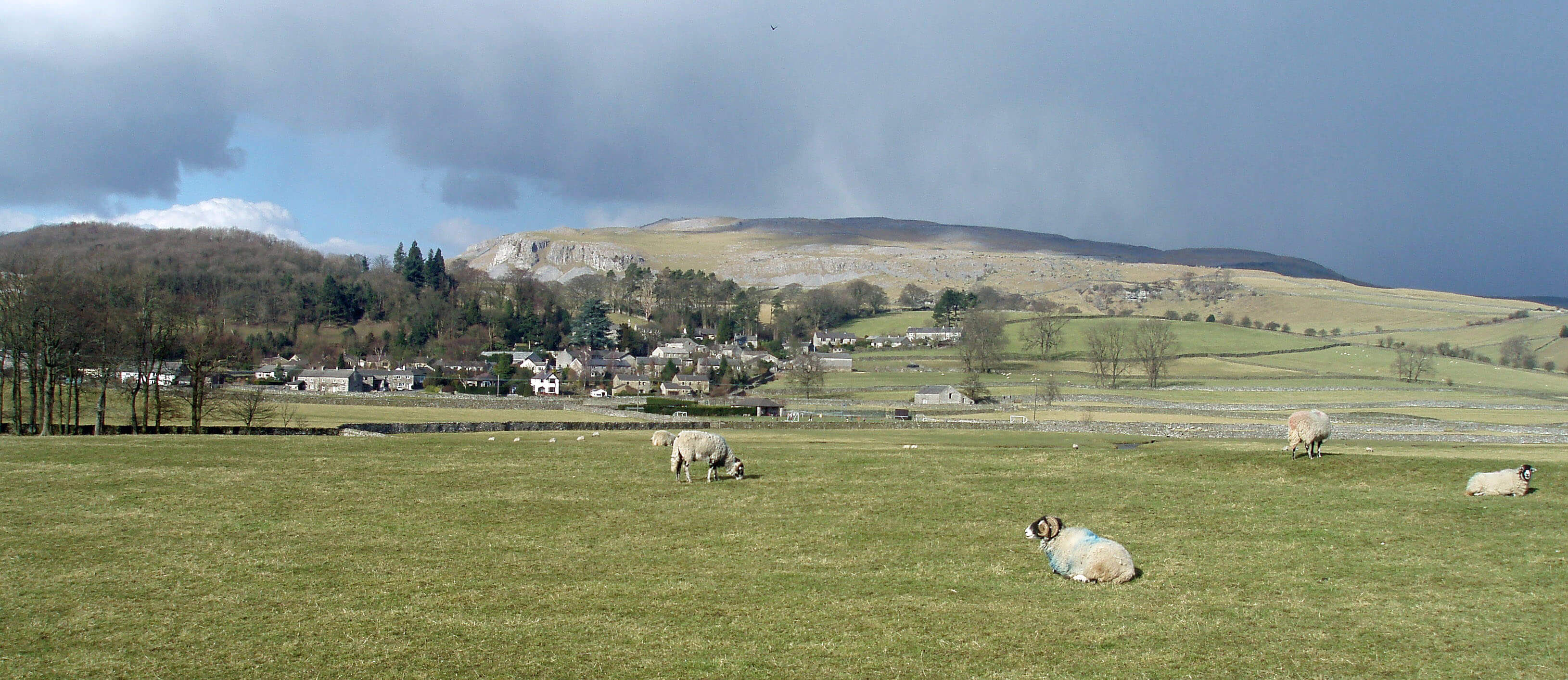
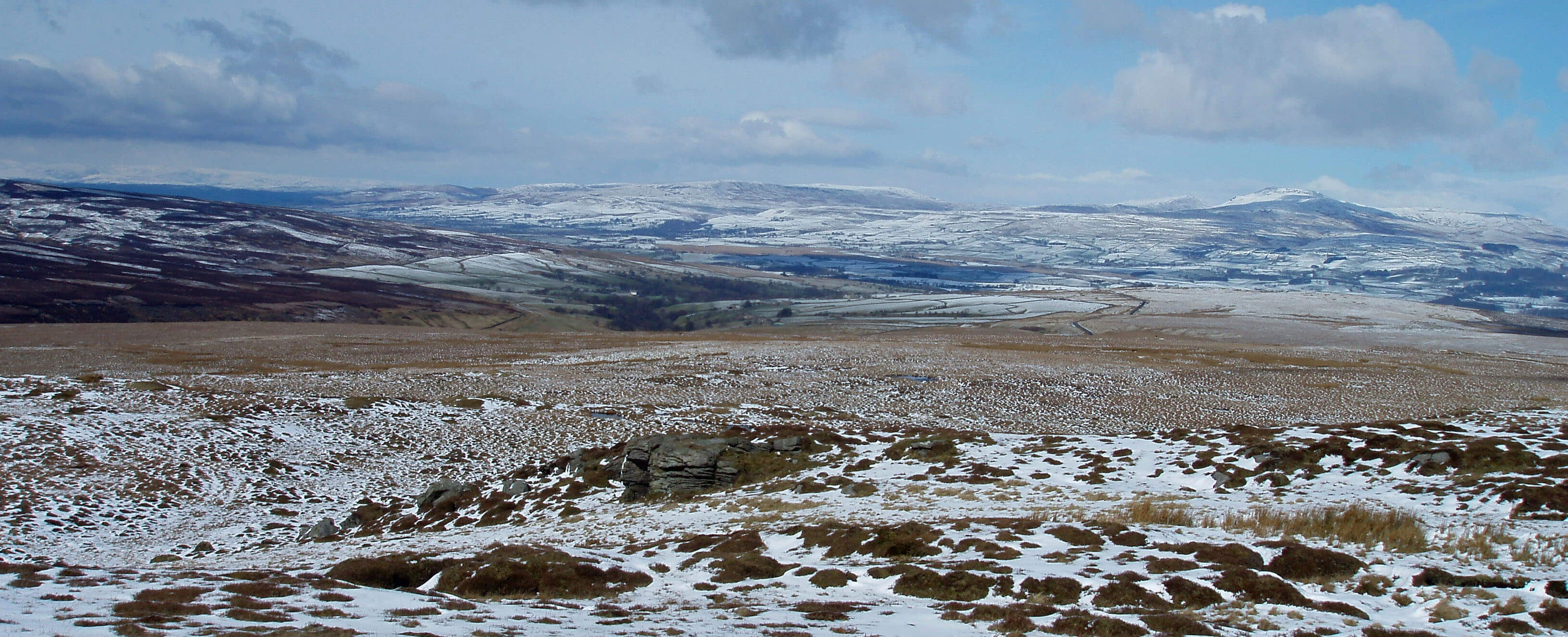
Austwick and Norber
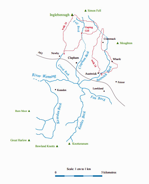
The River Wenning ...
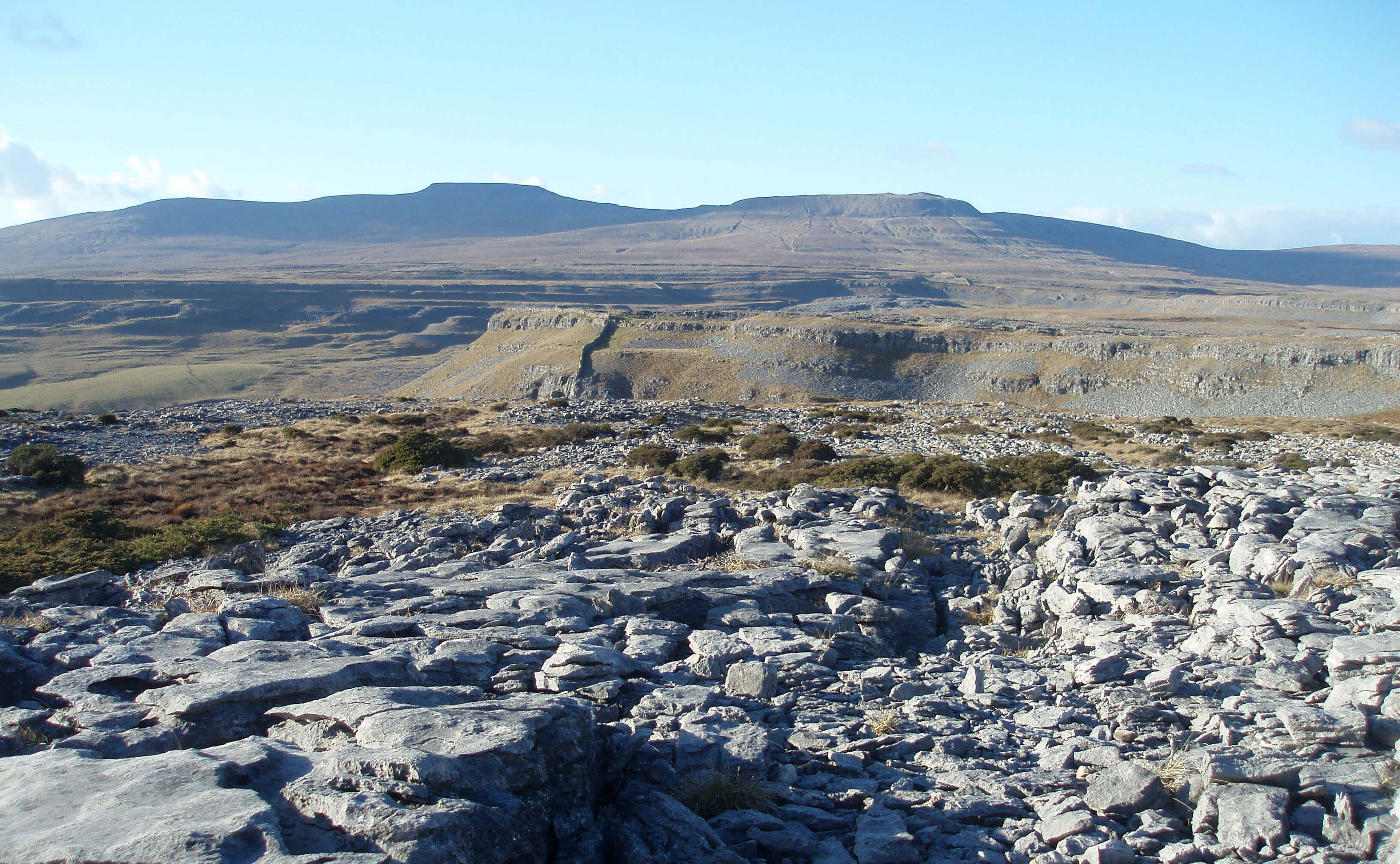
The Wenning has the most dramatic birth of all the
Lune’s tributaries. It springs forth at Swine Tail
just below Ingleborough’s plateau, gathers a few
more becks to form Fell Beck, and then plunges headlong
into the awesome chasm of Gaping Gill, Britain’s most
famous pothole.
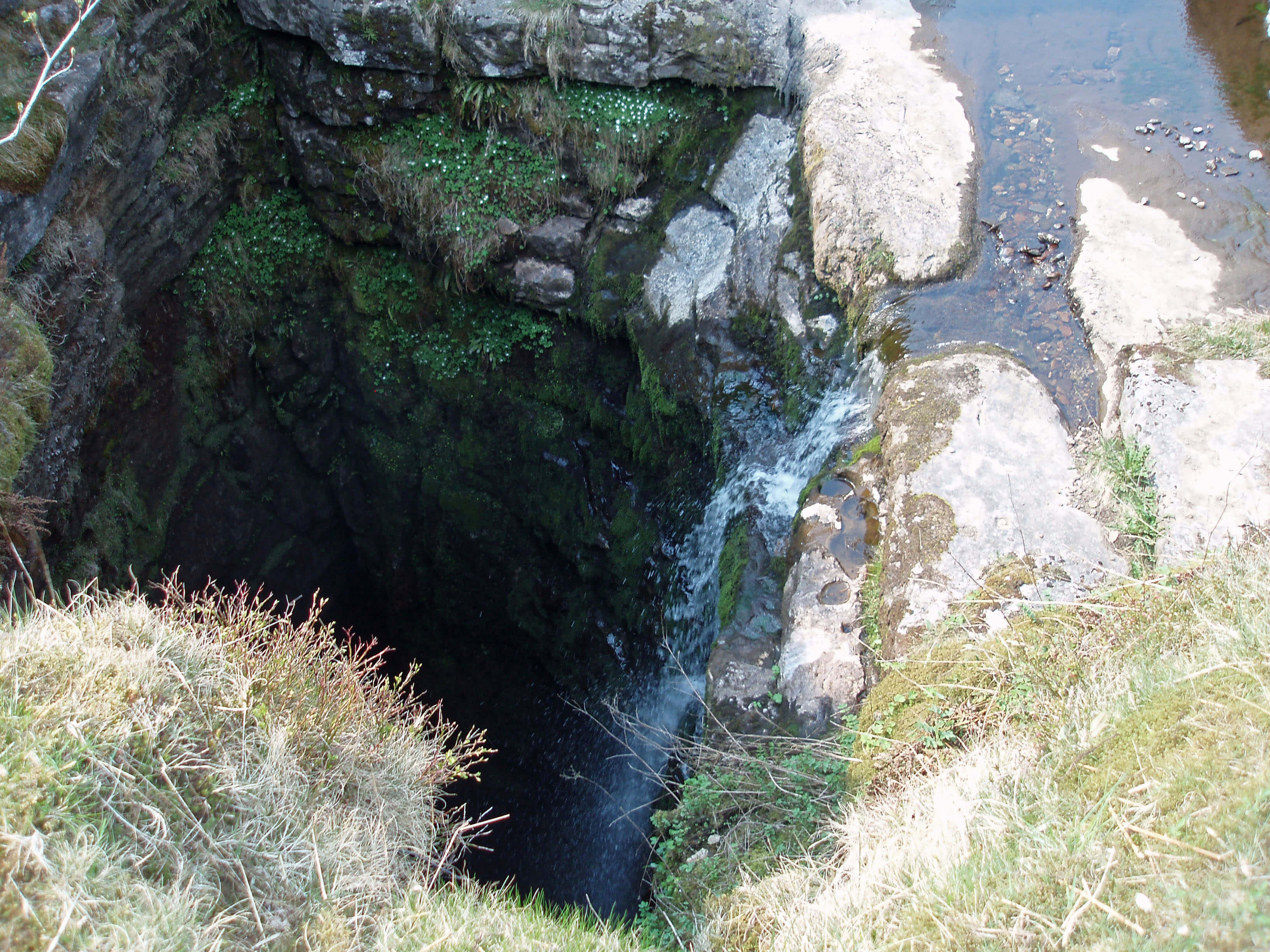 Right: Gaping Gill
The waters fall 111m, making it Britain’s largest
unbroken waterfall, according to the Guinness Book of
Records. The hole was first descended (intentionally) in
1895 by the French caver, Edouard Martel. He mapped
the main chamber, which is large enough, it is often said,
for York Minster to be fitted in. However, the latest laser
technology has measured the chamber as 136m by 46m,
and therefore the nave and transepts of the minster (at
159m by 75m) would be seriously damaged by any such
attempt.
You can judge for yourself by taking the winch that
local potholing clubs fit up at bank holiday weekends.
It is often said that it is free to go down ... but there’s a
charge to come up. In fact, they insist that you pay at the
top, in case you should disappear forever underground.
No, I must be fair: they are most solicitous about our
well-being and careful to count us all down and count us
all up again.
It is certainly an unforgettable
experience, as you sink slowly in
the cage below the diminishing
skylight, past the green, then grey,
then black, walls of the cavern, in
the shower of Fell Beck (although
most of it has been kindly diverted
away). On the floor of the cavern,
the water largely percolates
away through the boulders and
it is possible to scramble around
searching into various crannies of
the chamber. After a while, non-troglodytes would like to escape
– and then a problem becomes
clear: what goes down must come
up. On the surface, a numbered-ticket queueing system enables you
to lounge around, having a picnic,
smiling as people return drenched
and blinking, as you wait your
turn. Below, there isn’t: you must
stand in line. And if you waited 45 minutes in the sun on
top, you will have to wait 45 minutes in the cold, dark
Fell Beck shower below (or even longer, as potholers
tend to enter the cavern from elsewhere and lazily take
a ride out).
I see that there is now a leaflet advertising these
bank holiday treats and that the winch now operates for
a week. It’ll be a permanent tourist attraction soon, with
a snack bar and souvenir shop nearby, and umbrellas for
the queue below.
The geology of Gaping Gill is as we have come to
expect. Water streams off the gritstone on the eastern
slopes of Ingleborough and then disappears into the
limestone layer. Faulting has occurred at Gaping Gill to
enable such a large chasm to form. The Fell Beck water
then makes its way underground over the impermeable
slate and eventually emerges in Clapdale at the cave
spring of Beck Head to become Clapham Beck.
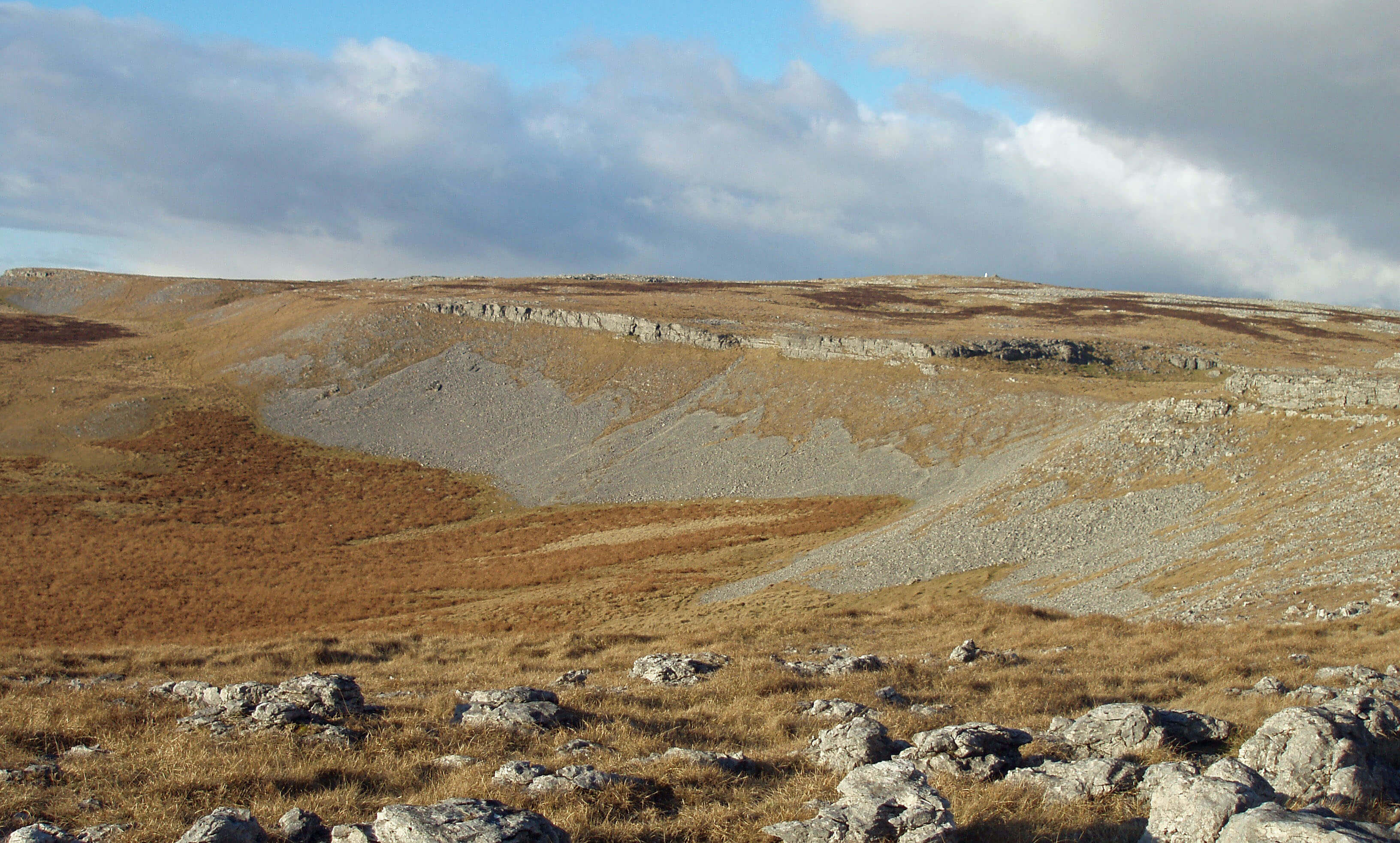
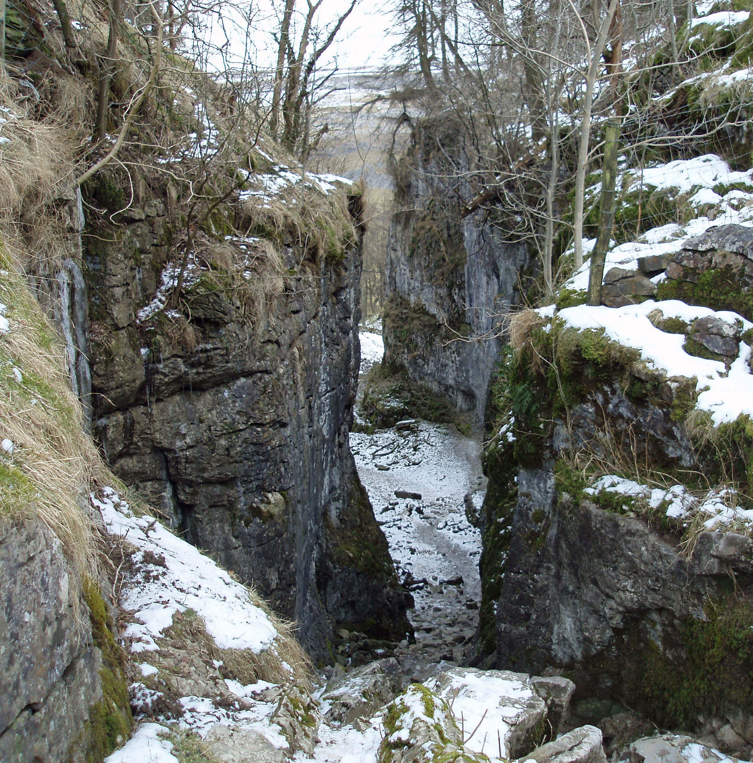 Left: Trow Gill
Potholers have found a difficult and dangerous way
through from Gaping Gill to Beck Head but over ground
we must make our way through the more appealing Trow
Gill. This is a dry gorge, with boulders heaped at the top,
between steep limestone cliffs. Trow Gill was caused by
a flood of meltwater after the Ice Age.
Below Trow Gill we enter Clapdale. On its eastern
side runs Long Lane, which is part of an ancient track
from Ribblesdale. From it, Thwaite Lane, an equally
ancient track that used to lead to Fountains Abbey,
heads east. As Long Lane approaches Clapham it passes
under two dank tunnels, built to protect the privacy of
Ingleborough Hall, a hall with no view of Ingleborough.
The Pennine Cycleway, which we met in the Lune
Gorge, passes through these tunnels, which must form
the only part of the cycleway upon which cyclists are
advised not to cycle!
On the west bank of Clapdale is Clapdale Drive,
which provides the most gentle of Dales walks. The
Farrer family created the drive for the carriages of guests
at their Ingleborough Hall in Clapham and, later, tourists
arriving by train at Clapham Station. Below a gate, the
drive becomes an artificially delightful environment
of trees, shrubs and lake, forming the Reginald Farrer
Nature Trail. As was the fashion, a grotto was added
to provide a romantic character that was presumably
perceived to be lacking. You may test your skill at
identifying trees and shrubs by ticking off ash, beech,
box, chestnut, European silver fir, larch, laurel, holly,
holm oak, Norway spruce, red oak, rhododendron, Sitka
spruce, Scots pine, and no doubt several others. Do not,
however, stray from the trail in your search, as there are
many warnings of “hidden dangers”, which I think mean
that you will be mistaken for a pheasant and shot.
By the cross in Clapham there is a footpath sign
informing walkers that it is 102m to the Brokken Bridge.
Clapham tries hard to be perfect. The natural valley of
Clapham Beck has been transformed with alien species
to provide a parkland stroll; the old village of Clapham
was redesigned by the Farrer family; St James’s Church,
which lists vicars back to 1160, was rebuilt in 1814 by the
Farrers; and now Clapham Beck runs from the waterfall
outlet of the lake through the village under several
unreasonably pretty bridges. Clapham’s tourist leaflet
lists the various attractions and services but does not
mention the Clapham-based Cave Rescue Organisation,
presumably not wishing to alarm tourists.
Two kilometres south of Clapham, a tributary from
the east joins Clapham Beck, which now becomes called
the River Wenning. This tributary has been formed 1km
east by the merger of Austwick Beck (from the north),
Fen Beck (from the east) and Kettles Beck (from the
south).
The Farrer family are largely responsible for the
attractiveness that we see today in Clapham.
Oliver Farrer, a rich lawyer, bought the estate in the
early 19th century. His two nephews, James and Oliver, re-planned the estate, including the building of the tunnels and
the replacement of much of the old village. They created
the drive and in 1837 opened Ingleborough Cave, the first
show cave in the region. It is apparent that Clapham Beck
used to flow through Ingleborough Cave. Today, visitors
may explore the floodlit passages for 1km underground to
see the 300m-year-old stalagmites and stalactites.
Reginald Farrer (1880-1920) was a botanist and
plant collector, particularly of exotic species from Asia,
many of which he introduced to Europe and especially
to the Clapham estate. He was also a painter and novelist
but he is most remembered for his botanical books, such
as The Garden of Asia, Alpines and Bog Plants, and My
Rock Garden. His name has been given to many of the
plants he introduced, such as gentiana farreri. He died in
the mountains of Burma, where, as the Buddhist he had
become, he was buried.
The Farrer family still own much of the estate around
the parish of Clapham.
The Cave Rescue Organisation (CRO) is a charity run
by volunteers to provide a rescue service around the Three
Peaks region. The emphasis on cave rescue in the title
reflects its history and the fact that these incidents are the
most demanding in terms of time, expertise and equipment
but nowadays 80% of CRO’s call-outs are to non-caving
incidents.
In the seven years 2002-2008 the CRO was called out
to 342 incidents, which is nearly one a week. These can be
classified as: walker (150), caver (74), animal (51), climber
(14), runner (11), cyclist (8), and other (34). Many of these
incidents involved more than one person: for example, on
October 4th 2008, 44 cavers were rescued in four separate
call-outs. The ‘other’ includes a motley collection of
mishaps, involving a foolhardy diver off Thornton Force,
someone who fell out of a tree, the rescue of cars stuck
in mud on the Occupation Road, the investigation of
abandoned canoes, and so on.
To assess the severity of incidents we can further
classify them as: fatal/involving injury/becoming lost,
exhausted or trapped. The caving incidents are 5/21/48,
although this 5 includes a person who collapsed and died in
White Scar Caves. Climbing incidents (1/11/2) are usually
serious. Although injuries are usually minor, walking
incidents (10/82/58) seem worst in terms of fatalities. The
10 fatalities include 5 heart attacks, 3 falls over a rock face,
and 2 unspecified. (Don’t have nightmares: these incidents
are still rare.)
Austwick Beck
At the head of Crummackdale a sizable beck
emerges from a couple of gashes in the fell-side.
This is called Austwick Beck Head but we are alert to
this situation now. The beck emerges after percolating
through the limestone fells above it and reaching the
impermeable lower layer at this level. The OS map
shows becks flowing off Simon Fell in this direction
only to disappear into potholes such as Juniper Gulf.
Tests show that this water emerges several days later at
Austwick Beck Head.
Austwick Beck Head is in an amphitheatre
surrounded by limestone scars. Its sheltered setting and
supply of fresh water no doubt encouraged the medieval
or earlier settlements, traces of which can still be seen.
Documents of the 13th century show that farming was at
that time active in Crummackdale. It is entirely livestock
farming now but this has only been so since the essentials
of life (bread and beer) could be transported from
elsewhere. There was arable farming in Crummackdale
until the 19th century.
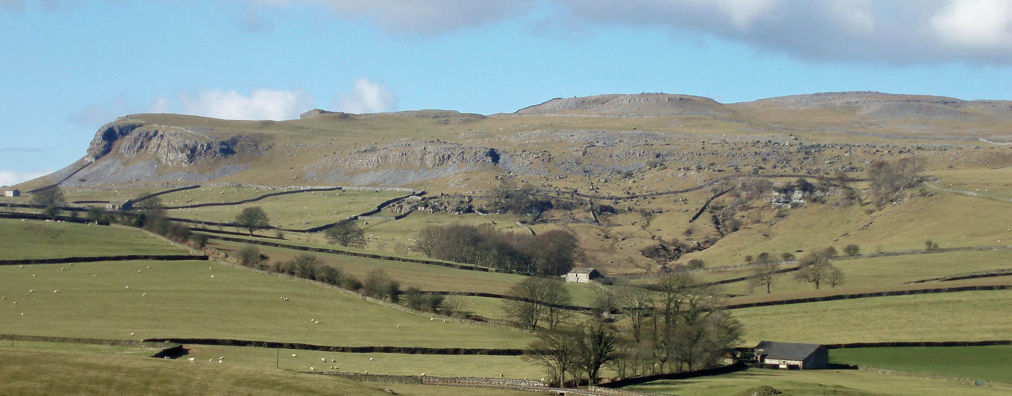
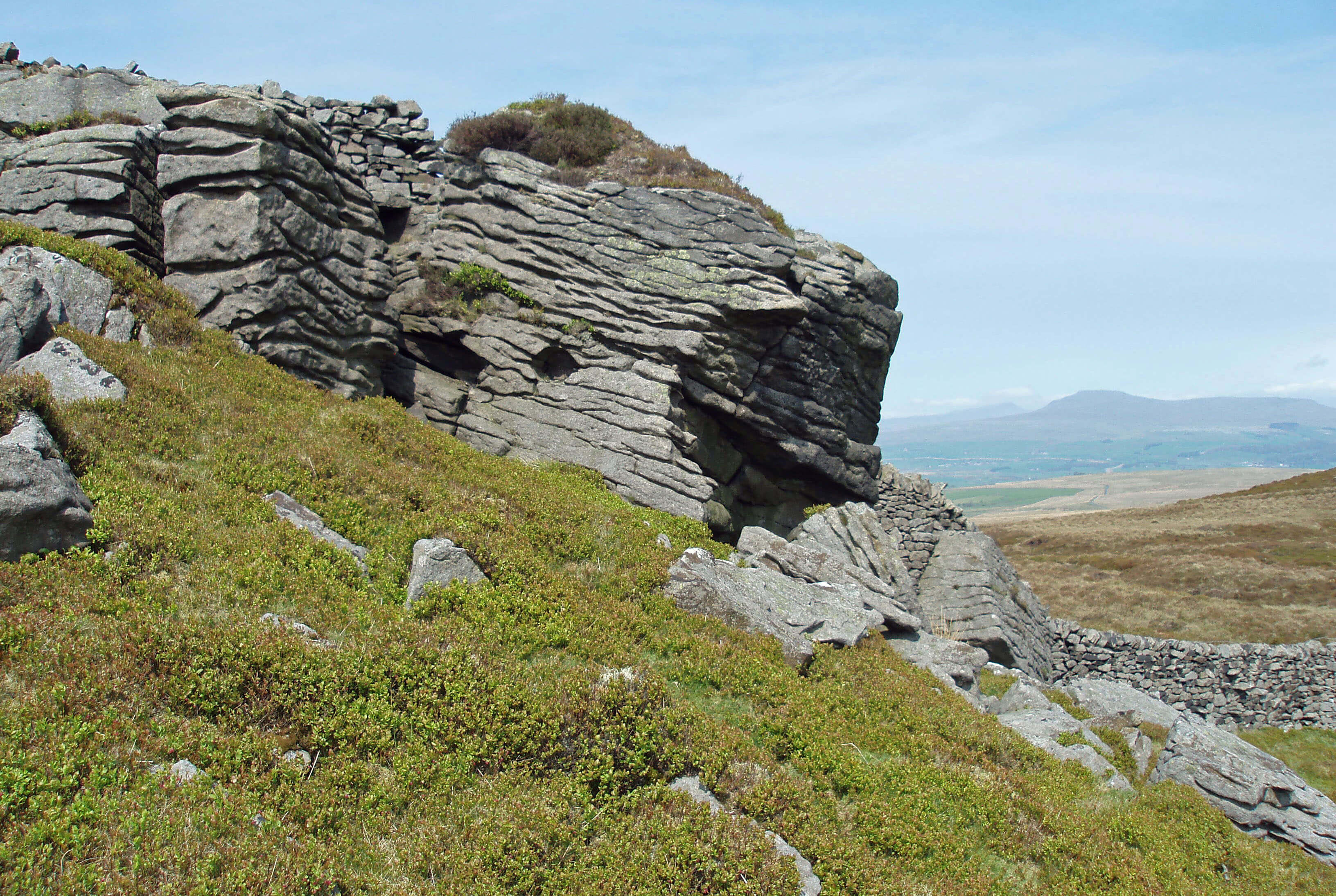
Opposite Crummack farm on Studrigg Scar is a
clear geological unconformity, with Silurian slates at 60
degrees below horizontal beds of limestone. The cliffs
on the eastern edge of Crummackdale rim the extensive
limestone plateau of Moughton, from which there are
splendid views of Pen-y-Ghent. The flora of Moughton
is surprising, for there are shrubs of juniper and heather.
The juniper is a rare remnant of the woodlands that
covered the region thousands of years ago. Heather does
not grow on soil derived from limestone but somehow
here sufficient soil has become raised high enough not to
receive the alkaline water draining from the limestone.
In the past the heather must have attracted enough
grouse to encourage the construction of shooting butts,
an unusual feature on limestone terraces.
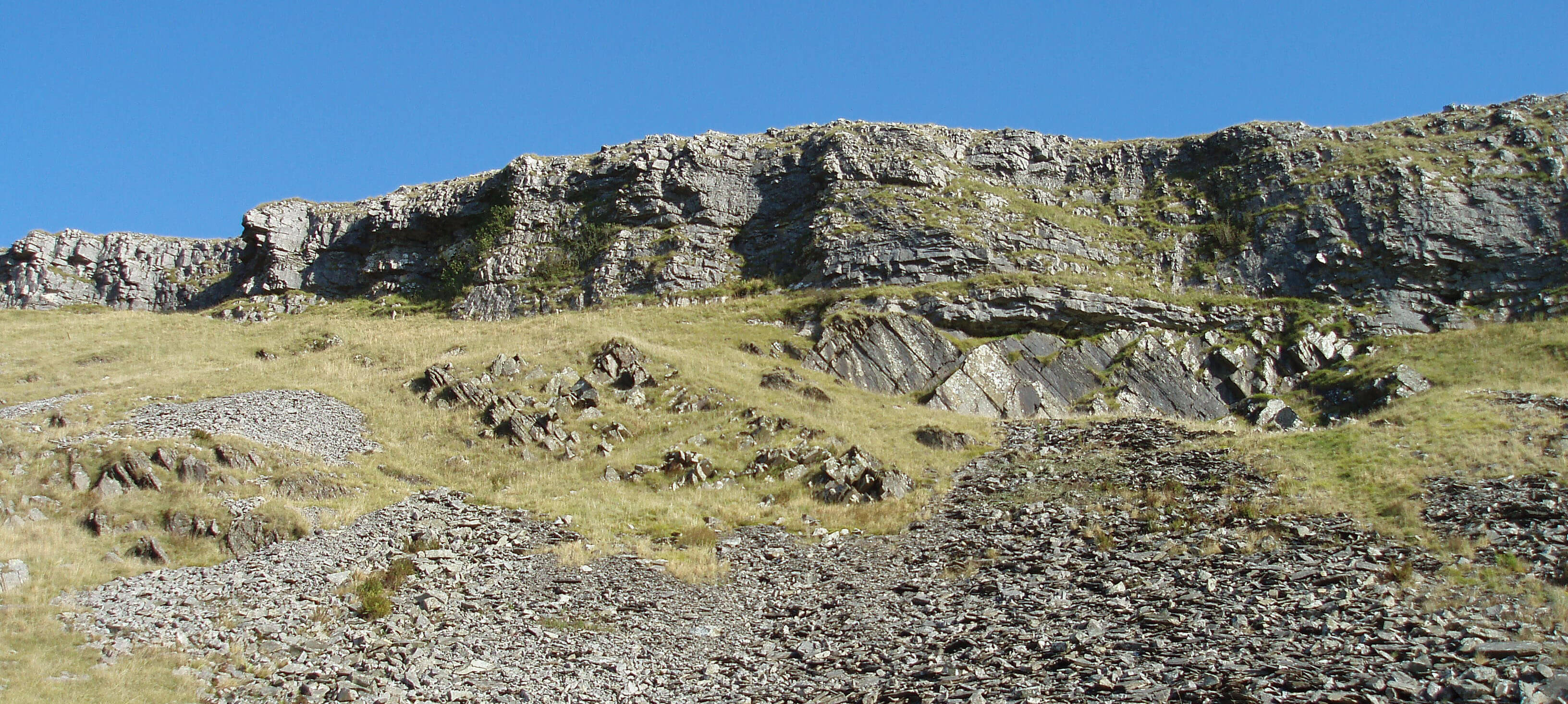
Studrigg Scar
Ingleborough from Moughton
Moughton
Careful study of the OS map reveals lines of grouse
butts on the southern and eastern slopes of Ingleborough.
Careful study on the ground reveals nothing much:
the butts were last used many decades ago and have
merged into their surroundings. The Farrers had bought
the Ingleborough manor as a shooting estate, the peaty
slopes being heather covered at that time. However,
over-grazing by sheep long ago removed all the heather
apart from a few remnants such as that on Moughton.
Before exploring Moughton, ensure that you are
fully familiar with a way off because it is surrounded
by quarries, steep cliffs and high walls. In the north the
footpath that runs from Crummackdale past Moughton
Scars is safe. In the south a high stile can be seen on
the horizon from the path that leads north from Wharfe.
However, it is in a state of disrepair, so it may be wise to
check before relying on it to get off Moughton.
Wharfe is a community of a dozen or so houses,
the owners of which have agreed not to waste money on
surfaced roads or exterior paint. So the cottages lie along
narrow, stony tracks and are of grey stone that seems at
one with the cliffs behind.
 Left: Robin Proctor’s Scar and Norber
Right: A Norber erratic
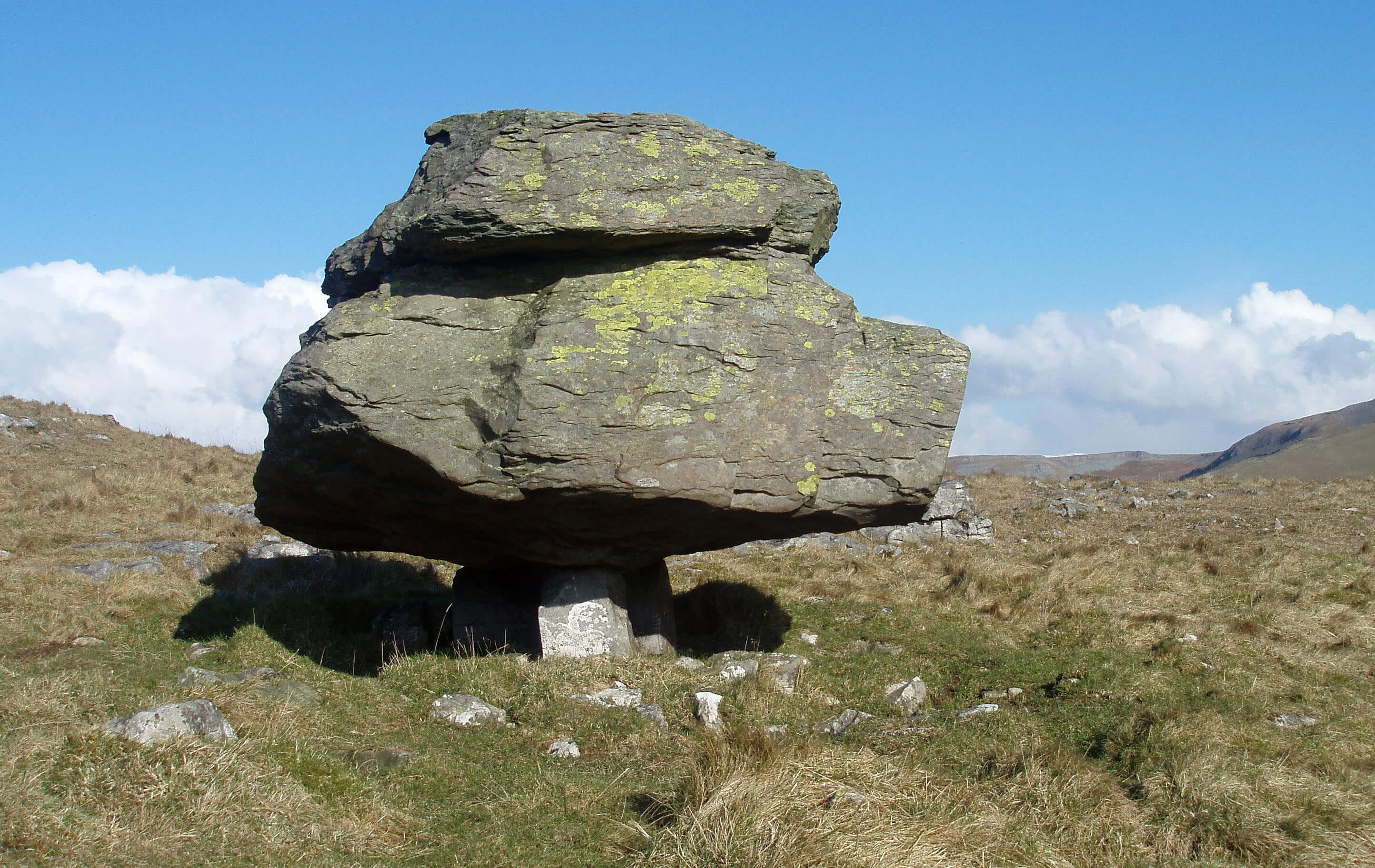
Across the valley from Wharfe lie the famous Norber
erratics. These are so well known that few people today
will reach these fields completely unprepared for the
sight of dark boulders scattered incongruously on white
limestone but the number and size of the boulders will
surely astonish anyone. Their presence here must have
been a great mystery, until it was all explained to us.
As is now described in many textbooks, Ice Age
glaciers transported the boulders here from the Silurian
slate that underlies Austwick Beck Head and outcrops in
Crummackdale. The highest boulders now lie at about
340m. Austwick Beck Head is at 280m. The immense
forces at work during the Ice Age are indicated by the
fact that these huge boulders were lifted not just along
but also up the valley.
When the ice melted, the Silurian slate boulders
were left above the younger Carboniferous limestone
rocks. As we know, the latter is eroded by rainwater but
here the limestone under the boulders has been protected
and, as a result, many boulders are now perched on
pedestals above the general level. The height of the
pedestals (about 50cm) is a measure of the erosion since
the Ice Age.
[Update: I have since read that the boulders were not
transported as far along the valley as I thought, and hardly up at all.
Also, experts now believe that the rather satisfying explanation for the pedestals is
not the full story.]
Below the erratics are Nappa Scars, with another
example of unconformity, and the cliff-face of Robin
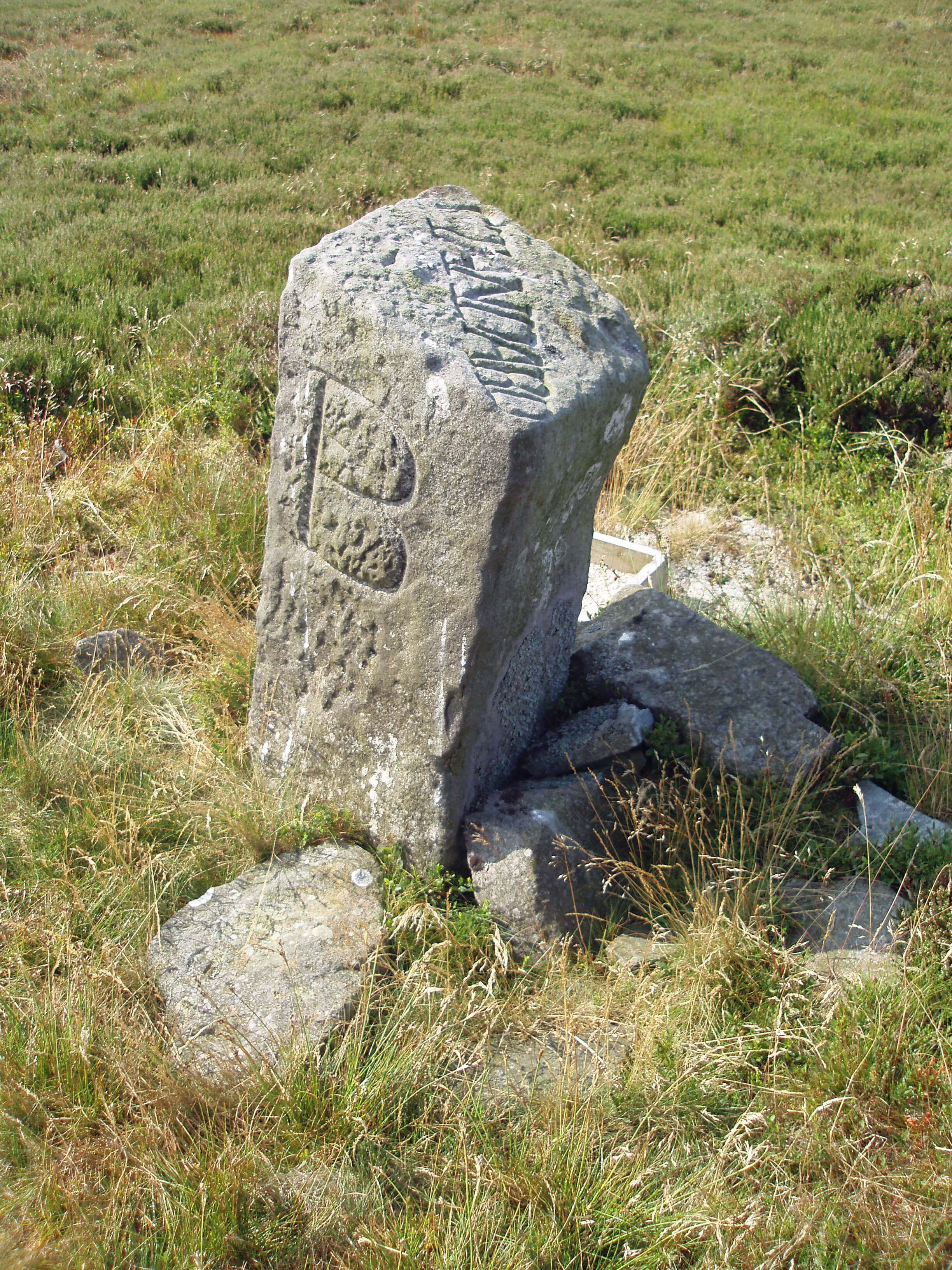
Proctor’s Scar, a name that demands an explanation.
There are several but they have in common the legend
that one Robin Proctor rode his horse over the precipice
to their deaths – a small price to pay to have one’s name
immortalised in full on Ordnance Survey maps.
These cliffs and those behind Wharfe, together
with the various ridges and contortions in the fields
of Crummackdale, tell us that this was a geologically
active area long ago – long before the Norber erratics
coincidentally added further geological interest. This
is the line of the North Craven Fault that we met at
Thornton Force above Ingleton. After the Silurian period
the layers of sandstone were crumpled and subsequently
eroded to leave steeply bedded, folded strata that are
now exposed in places. After the Carboniferous period
the area was raised above sea level with the greatest and
most irregular movements along the Craven Faults.
Walk 18: Crummackdale and the Norber Erratics
Map: OL2 (please read the general note about the walks in the
Introduction).
Starting point: By Austwick Bridge (769683) or elsewhere in Austwick.
This walk takes in many of the visible geological features of Crummackdale and also provides fine views of limestone
scenery.
Walk north through Austwick past a school to Town Head Lane on the left. 300m up the lane, before the last house on the
right, take the footpath through its garden. Across three fields you meet up again with Crummack Lane, which you cross to head
west for Nappa Scars. You can then stroll through the Norber erratics, heading for the stile in the northern corner (766703). From
the stile make your way north 2km along the indistinct ridge of Thwaite, which provides a good view of Ingleborough, to the
prominent cairn at Long Scar. From there take the clear path that runs to Sulber Gate, 1.5km northeast, with views of Pen-y-Ghent. Two hundred years ago this path was part of the Lancaster to Newcastle coach road.
Follow the path south over Thieves Moss to the fine Beggar’s Stile and then walk past ancient settlements and Crummack
farm and, 1km on from the farm, turn left to the ford and clapper bridge (that is, a bridge using long slabs of local rock) over
Austwick Beck at Wash Dub, where the sheep used to be cleansed. The unconformities on Studrigg Scar are visible from the track
from Crummack farm but for a closer look detour briefly up the track north from Wash Dub.
From the bridge follow the track 1km southeast to Wharfe. Continue through Wharfe to the road and then after a few metres
take the path right that leads over a footbridge and ford. Turn west, above the Wharfe Gill Sike waterfall, which deserves full
marks for effort, producing a fine cascade from only a trickle, and then by Jop Ridding to Wood Lane and back to Austwick
Bridge.
There is much to see on this walk and if you wish to take your time over it you might prefer to split the walk in two and do
the western half one day and the eastern half (including Moughton) on another day.
Short walk variation: Follow the long walk as far as the cairn on Long Scar. Then turn east to drop down to the farm of Crummack.
From there follow the track and Crummack Lane for 4km south to Austwick.
Austwick Beck passes the ancient village of
Austwick, the old core of which is surrounded by modern
houses, indicating that a legendary practice failed to
achieve its purpose. According to tradition, the residents
of Austwick used to pretend to be simpletons in order to
discourage outsiders from moving in. Harry Speight’s
Craven Highlands (1895) gives several examples of
Austwickian stupidity – but with no suggestion that this
was feigned. Today, Austwick revels in its reputation as
the ‘Cuckoo Town’. It would do better to revel in the
magnificent scenery with which it has been blessed.
There are man-made, as well as geological,
features to be seen in the landscape. Across the beck
from Austwick, Oxenber Wood is pockmarked with
old quarries, and common rights still permit Austwick
parishioners to gather stones there. Oxenber Wood and
the adjacent Wharfe Wood are old wood pastures that
are CRoW land. The dominant trees are
ash and hazel, with some hawthorn and
rowan, and, at the northern end, birch and
holly. The ground flora includes various
herbs such as wild thyme, salad burnet,
dog’s mercury and wood sorrel.
Also visible, especially in a low sun,
to the west and east of Austwick are the
stripes of ancient strip lynchets. These
are terraces up to 10m wide that were
created by Anglo-Saxons from the 7th
century onwards as they ploughed along
contours. These are the first lynchets we
have met and indicate how far west the
Anglo-Saxons colonised. Sometimes the
characteristic stone walls of the Dales
cross the lynchets, telling us that the
former are younger. Originally, a farmer
owned several strips of land but they
were distributed about different fields
in order to be fair to all. The need to
improve efficiency led to the creation of
individually owned enclosures, in a complex process
that began informally in the 12th century and became
enforced by parliamentary acts in the 18th century. The
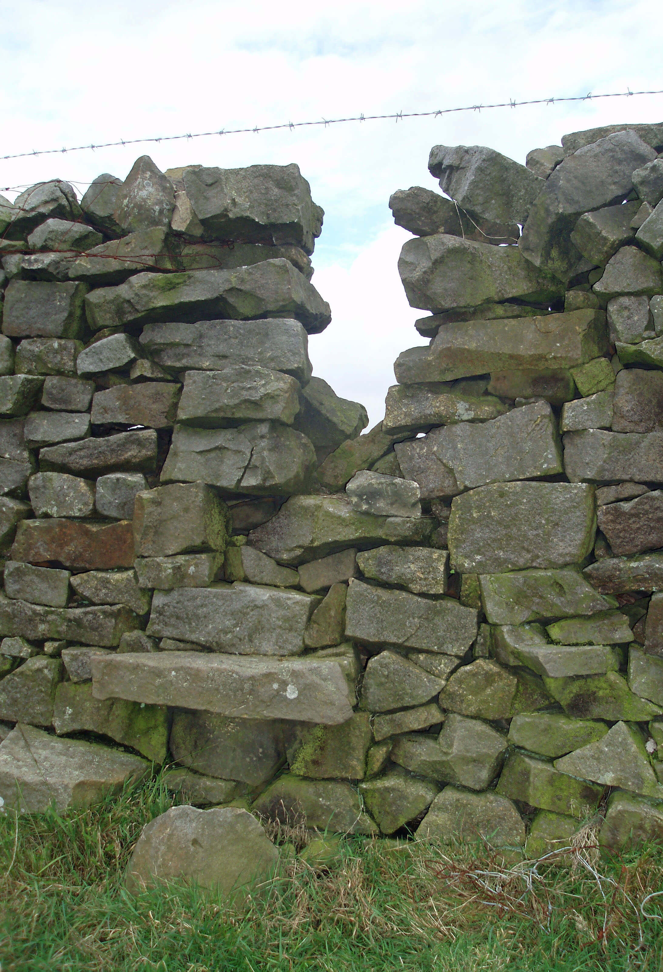
stone walls were built to delimit the enclosures.
Below Austwick, Austwick Beck passes the old
and new Harden Bridge, a name that reminds us of
Austwick’s weaving industry that survived until the
late 19th century, harden being a kind of coarse linen
made from the hard parts of flax. By Harden Bridge is a
campsite that uses buildings that until the 1980s formed
an isolation hospital for people with infectious diseases.
The Top 10 dales in Loyne
1. Crummackdale
2. Dentdale
3. Kingsdale
4. Roeburndale
5. Barbondale
6. Grisedale
7. Whernside
8. Bretherdale
9. Littledale
10. Bowderdale
(Does Chapel-le-Dale count as a dale?)
Fen Beck
Fen Beck arises on the easternmost edges of Loyne,
around Feizor and Lawkland. In this gently
undulating land below limestone scars the watershed is
uncertain. Some houses in Feizor used to be considered
to be in the parishes of Clapham and Giggleswick (on
the Ribble) in alternate years. Feizor itself is an out-of-the-way hamlet, nestled neatly under the cliffs of Pot
Scar, a favourite with climbers. Southwest of Feizor is
the Yorkshire Dales Falconry and Wildlife Conservation
Centre, established in 1991 to help preserve birds of
prey.
[Update: The Falconry Centre was closed in about 2016.
Through some oversight, the Centre had continued to operate although its licence had lapsed.
An application for a 'new' licence was presumably refused. The site is now occupied
by the Courtyard Dairy, a cheese shop and café.]
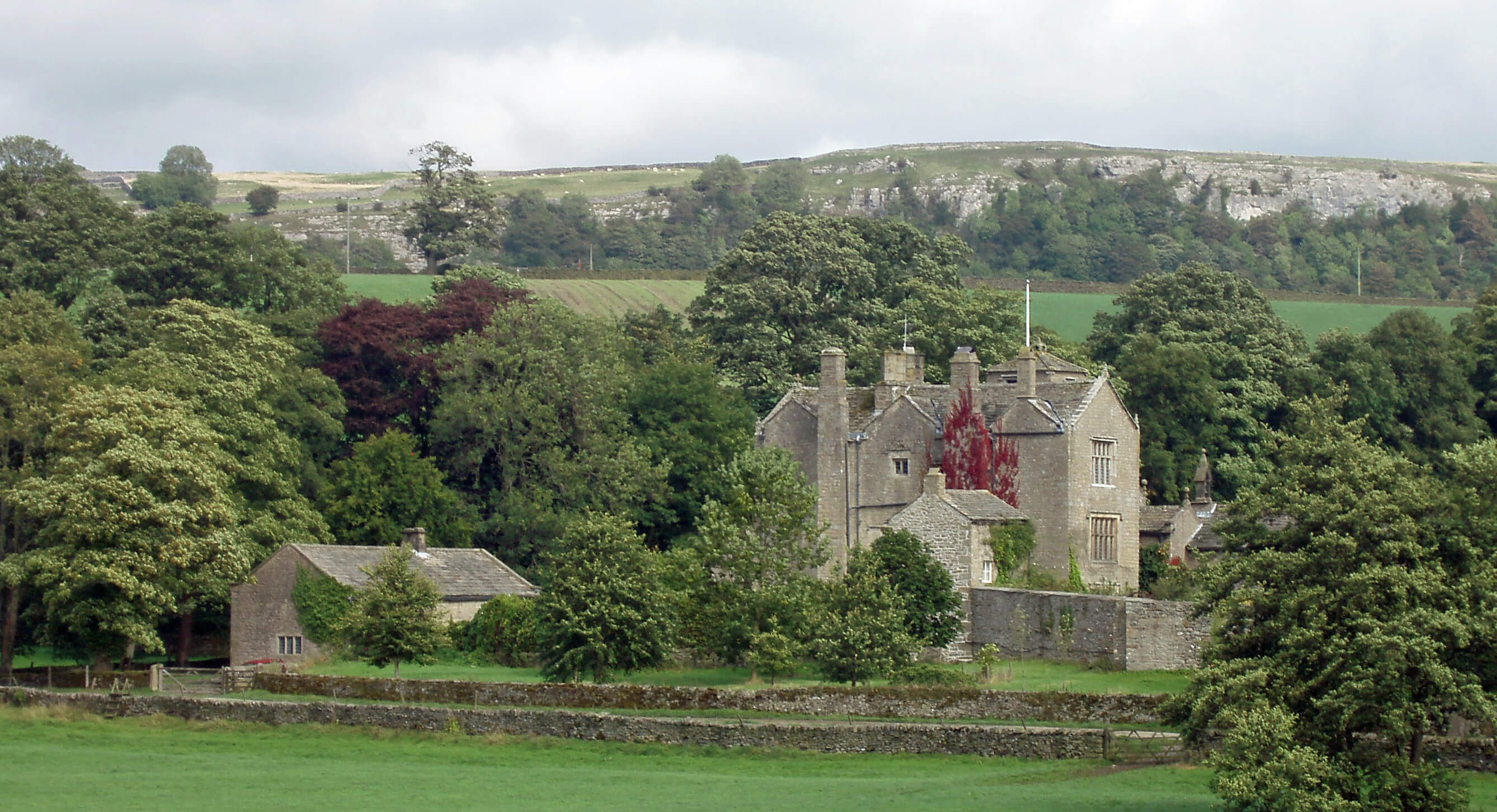
 Left: Lawkland Hall
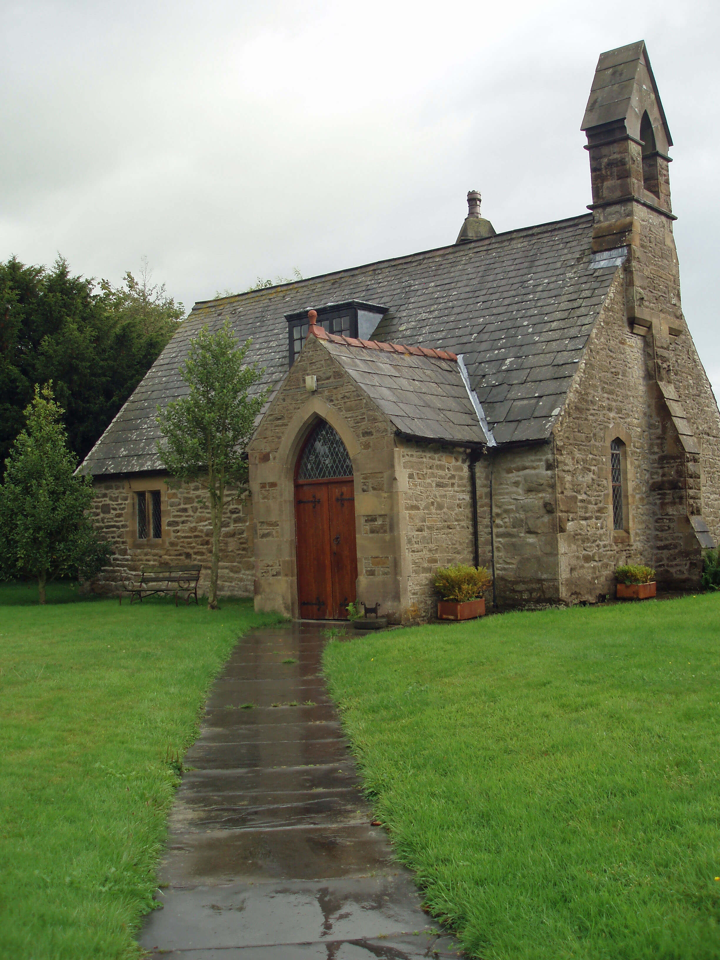
Right: Eldroth Chapel
The parish of Lawkland is even more of a backwater.
The main route from York to Lancaster used to pass by
Lawkland Hall but the parish now lies anonymously
between the busy A65 and the less busy Leeds-Lancaster railway line. The oldest part of the Grade I
listed Lawkland Hall is 16th century, and much folklore
surrounds the hall’s peel tower and priest hole. From
the 16th century until 1914 the renowned Ingleby family
of Ripley, Yorkshire owned the hall. The Inglebys also
acquired the manor of Austwick and Clapham. Arthur
Ingleby rebuilt the hall in 1679 and when he died in 1701
left money, apart from to dependents, for a schoolmaster
and three poor scholars at Eldroth Chapel. Overall,
though, it seems that the Catholic Inglebys preferred to
keep a low profile, to which Lawkland is well suited.
Somehow it seems appropriate that the central
feature of Lawkland is the extensive peat land of
Austwick and Lawkland Mosses, a Site of Special
Scientific Interest. This now rare form of habitat was
once much more common, as indicated by the many
place names with “moss” in them. Lowland bogs are
peat lands that have developed over thousands of years
under waterlogged conditions. Over time, the surface
of the peat, formed by plant debris, is raised above the
groundwater level, resulting in a ‘raised mire’. Typically,
they are gently domed, but here peat cutting has obscured
this impression.
From a distance Austwick Moss is seen as an island
of ancient trees and scrub surrounded by pastures. It is
also an island of CRoW land, inaccessible by public
footpath, which is just as well because it is difficult, wet,
tussocky walking. The conditions support many bog
mosses and, in drier parts, birch woodland and fenland.
Various wading birds, such as lapwing, redshank, reed
bunting and snipe, and rare insects, such as the small
pearl-bordered fritillary butterfly, find a home there. It’s
good to know it’s there, for the benefit of the birds and
insects, but, in truth, it’s a damp, desolate place of little
appeal to most of us.
Kettles Beck
 Left: A Kettlesbeck welcome for visitors: a stile on the
public footpath near East Kettlesbeck, with eye-level barbed wire
Left: A Kettlesbeck welcome for visitors: a stile on the
public footpath near East Kettlesbeck, with eye-level barbed wire
Right: Knotteranum
Kettles Beck is the first of many becks that we will
meet that flow north off the Bowland Fells and that,
because they flow over millstone grit, slate and sandstone
covered with glacial till, have a different character to
the becks of the mainly limestone Yorkshire Dales. At
first, the marked contrast between the dry whiteness of
the Dales and the muddy darkness of Bowland rather
depresses the spirits.
Bowland valleys tend to be deeply eroded, with fast-flowing becks tumbling through rocky channels over
small waterfalls. Trees have largely been cleared although
patches of ancient woodland remain in some steep-sided
valleys and there are a few conifer plantations, such as
Brow Side Plantation by Kettles Beck. The valleys are
rural, with verdant, rolling fields for cattle and sheep.
Population is sparse, being scattered in small villages
and isolated farmsteads, the latter being evenly but
thinly distributed, although many are no longer actively
farming. The buildings are usually of local gritstone,
adding to the sombre greyness, particularly in winter.
The farms are situated by flowing water and there is
often evidence, in the form of old millraces, weirs, and
so on, that it has been harnessed to power mills. There
are few hamlets above the main rivers of the Wenning
and Hindburn, and the lanes are narrow and winding,
with only two crossing the dark, bleak watershed to
Slaidburn.
The valley farmsteads are sheltered compared to
the windy, open higher fells. The fells are of heather
and grass, generally boggy and with few walls. The
high fells will be discussed further when we reach the
highest points of Bowland, but Kettles Beck itself arises
at the not very high but impressively knobbly peaks of
Bowland Knotts (430m) and Knotteranum (405m), on
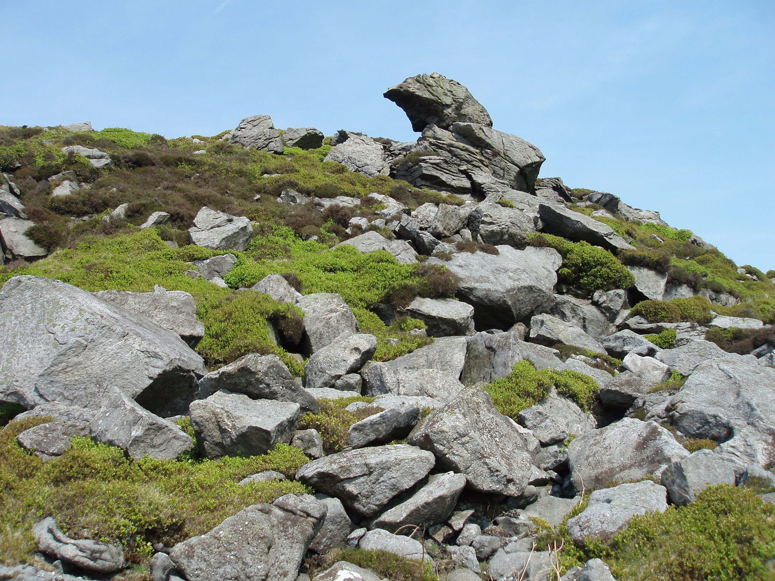
the Lancashire – North Yorkshire border. The ridge is
one of the finest gritstone outcrops in Bowland, with
great jumbles of huge rocks, enabling a good scramble
for those venturing a brief walk from the road at the
watershed.
Kettles Beck runs 6km south from the boggy ground
of Austwick Common through farmland that has not
inspired the locals in their farm names: there’s a High,
East, New and Low Kettlesbeck (although Israel Farm
is more intriguing). It doesn’t inspire me much either
although walking down beside Kettles Beck one can
look wistfully across to Ingleborough.
The Wenning from Kettles Beck ...
The Wenning runs east, being first joined by Crook
Beck, which runs from Newby Moor on the southern
slopes of Ingleborough through Newby Cote and Newby
and across the rough ground of Newby Moss. This
extensive area of common land is now a Site of Special
Scientific Interest, noted for its purple moor-grass,
mosses and fens. There are also breeding birds such as
curlew, lapwing, redshank and snipe and a population
of the small pearl-bordered fritillary that perhaps flutters
between here and Lawkland Moss.
Walk 19: Ingleborough and Gaping Gill
Map: OL2 (please read the general note about the walks in the
Introduction).
Starting point: At Newby Cote (732705), where there is space for one or two cars; otherwise by the green in Newby (727701).
None of the four well-worn routes up Ingleborough (from Ingleton, Clapham, Horton and Chapel-le-Dale) provides a
satisfactory loop walk. I prefer to walk from Newby Cote on a grassy path from which we saw the new millennium dawn.
Follow the track north, through the gate and by the wall to the open fell. Bear slightly left. After ten minutes or so Little
Ingleborough comes into view. Pick up the broad green path up it. From Little Ingleborough the beaten track to Ingleborough is
obvious. After a tour of the summit plateau, take the clear path east (part of the Three Peaks route). Note the Fell Beck spring (the
source of the Wenning) close by the path. After 1km cross a stile but after a further 1km don’t cross a second stile - instead, follow
the wall south at the foot of The Allotment. A path just above the limestone terrace runs 10m or so west of the wall.
A fence will be seen partially enclosing Juniper Cave. Juniper Gulf, into which falls water that becomes Austwick Beck,
is just above it. There’s a series of potholes, dangerous and difficult to find – don’t bother, as they do not compare with what’s
ahead. Keep near the wall. Eventually, a wall comes to it at right angles, leaving a gap. Don’t go through the gap but follow the
wall right and then left. A stile will be seen just ahead. Cross it and continue due west, which brings you to the unmistakable
chasm of Gaping Gill.
Take the path south (which leads to Clapham) and when a stile comes into view after about 150m bear half right. There are
many vague paths here but basically keep west of the wall, between the shakeholes, until, after 2km, as the wall swings south,
you see ahead the gap between the green pastures by which you gained access to the moor. Cut across the dry Cote Gill and
thence to Newby Cote.
Short walk variation: Follow the long walk as far as Little Ingleborough. (Continue to Ingleborough only if it is irresistible.) Turn
south east and follow the path to Gaping Gill. Continue, as for the long walk, back to Newby Cote.
The green hillocks that rise to 200m running west
from Clapham towards Bentham and Ingleton are fields
of drumlins created by glacial ice sheets flowing off the
hills of the Yorkshire Dales. The oval-shaped contours
on the map indicate the east to west trend of the glaciers.
The gentle slopes of the drumlins and their rich boulder
clay soil provided good sites for settlement and farming
from prehistoric times, which is shown in the increasing
occurrence of the Old English -ham, -ber and -ton in place
names. The grazed pastures are divided into irregular
patterns by stone walls and hedgerows, reflecting their
origins as pre-medieval fields rather than the later, more
systematic, enclosures of the higher fells.
The now well-established Wenning passes under
Clapham Viaduct, which, unlike earlier viaducts,
has no aesthetic merit. The viaduct carries the Leeds-Lancaster railway line. The original plan was to build
the Lowgill-Clapham line via Ingleton first but work on
this was suspended and instead the branch to Lancaster,
completed in 1850, became the main line, with the
Lowgill line eventually completed in 1861. The line to
Wennington runs down the Wenning valley, naturally
without all the meanders of the river, which it crosses
seven times in all.
Just beyond the viaduct the Wenning is joined
by Jack Beck, which runs past Jack Beck House,
where painting courses are run by the painter Norma
Stephenson. I like her description of her modus operandi
for producing her semi-abstract pastels of the northern
fells: “dissatisfaction sets in ... almost always ... because
the painting has become too explicit. Radical measures
are required ... I will often dribble water into the pastel,
causing rivulets and textured effects, or I will sweep my
hand across the surface to remove detail.” I have tried
this with the creation you are reading, to no great benefit,
alas. I conclude that it is not a work of art.
Beyond the new Skew Bridge, Keasden Beck joins
the Wenning.
Keasden Beck
Our journey has taken us to many hidden and unknown
becks but compared to Keasden Beck they are all
gaudily extrovert. Nobody seems ever to have written
a good or bad word about Keasden Beck. There are
no postcards of Keasdendale (in fact, I may have just
invented ‘Keasdendale’). In the 4km from Gregson’s
Hill to Turnerford Bridge there are no footpaths in the
valley or across it. There is no road in the valley: all
the farmsteads are reached by private tracks from the
Clapham to Bowland Knotts road.
Keasdendale
 Left: Bowland Knotts
However, now that all of Burn Moor above the
pastures has been made CRoW land we can at least gain
a long distance view into this secretive valley. Burn
Moor is tough going: all heather, grass tussocks and bog.
When it was restricted to grouse shooting Burn Moor
was called the ‘forbidden moor’: now, ‘forbidding’
would be a better word. There is a good path on springy
peat (in summer) along the ridge from Bowland Knotts
to Great Harlow (486m) and over Thistle Hill, but
elsewhere walking is a struggle. Should your eye catch
upon Ravens Castle and Raven’s Castle on the map,
be warned that there are no castles, although there are
ravens. And yet there is compensation up here. The
silence is complete, apart from birds such as skylark,
curlew and merlin, and the view of the Three Peaks is
much better than from the road, from where Whernside
is rather obscured by Ingleborough.
 Right: The ‘Standard on Burn Moor’ boundary stone, marked on OS maps
The most striking feature on an aerial photograph
of Burn Moor is the large stripes of different shades of
green. At first glance they look like the fairways of golf
courses. They are in fact the result of burning practices
and remind us that the fells are far from natural, despite
their familiar appearance.
After the last Ice Age the hills became covered with
broadleaved woodland, which was cleared from about
3000 BC. Peat then formed from decaying vegetation on
the gentle slopes and hilltops, so creating blanket bog.
We use words like ‘bog’, ‘heath’ and ‘marsh’ informally
but scientists need precise definitions. For them, ‘blanket
bog’ is peat deeper than 50cm (even if it is dry). Less
deep peat is ‘heath’ if there is at least 25% cover of
small shrub heather-like plants; otherwise it is ‘marsh’
or ‘marshy grassland’. It all gets more complicated,
as there are different types of bog, heath and marsh,
depending on altitude, slope, hydrology, geology, and
so on. Although the vast areas of Bowland’s bogs and
heaths may seem ample, they are actually rare in global
terms and, because of the threat to the Bowland Fells,
are priority habitats in the UK’s Biodiversity Action
Plan.
Keasden Beck gathers all the water that flows east
and north from the Burn Moor watershed, which here
forms the county border. Like all Bowland becks, it cuts
through hard millstone grit, occasionally exposing layers
of underlying sandstone and shale.
After a hidden run through the valley, Keasden
Beck emerges at Turnerford by Keasden Moor. This
insignificant-looking moor is a Site of Special Scientific
Interest, for being, according to its citation, “the only
known site for the marsh gentian Gentiana pneumonanthe
in the Yorkshire Dales” – which is quite something
considering that it is not even in the Yorkshire Dales.
The small pond in the middle of the moor is surrounded
by common marsh-bedstraw, sneezewort and lesser
skullcap (the names, at least, are fun).
By the moor are St Matthew’s Church and a
telephone box, which together constitute the hub of the
scattered village of Keasden. The church has a fine view
across to Ingleborough but, like most of Keasden, makes
little attempt to compete with the beauty of the Dales
hills. The peat brown Keasden Beck runs past various
farmsteads, some converted, some not. Clapham Wood
Hall is a rather sad cottage on the site of a much grander
hall that was demolished in the 19th century.
Until 1800 it was the home of the Faraday family,
from which came the eminent scientist Michael
Faraday (1791-1867), although Keasden cannot
claim him, as he was born in London after his
father had moved away from Keasden in 1780.
After a further 1km Keasden Beck joins the
Wenning by Hardacre Wood.
The threat to the Bowland Fells takes various forms:
draining, pollution, burning, over-grazing and the presence
of humans.
Land drainage for agricultural purposes is so
damaging to the ecology of bogs and heaths that very few
new hill drains have been allowed recently. Existing drains
remain a problem, as they lower the water table and lead to
shrinkage of the peat and increased fire risk.
As blanket bogs receive all their nutrients from the
atmosphere, they are very sensitive to air pollution. The
pollution provides too much nutrient and the increased
growth threatens more sensitive species.
Perhaps the most important factor is the practice of
rotational strip burning, which has been carried on for
centuries. First, it must been conceded that the practice
is necessary if the hills are to be conserved in something
like their present state, because if left to nature they would
revert to scrub and woodland. The controlled burning of
strips of heather every few years produces areas of heather
of different age and hence height and structure.
In recent years, the intention has been to provide
suitable habitats for grouse, although farmers may also
burn heather to produce young shoots for sheep to graze
and so spread the sheep more evenly over the fells. Either
way, there are benefits to many other species that depend
upon healthy moorland. Overall, the management of grouse
moors has helped retain the habitat but today the numbers
of grouse are in decline.
We must also acknowledge the threat to this sensitive
environment from increased human access, encouraged
by the Countryside and Rights of Way Act. We can now
wander where we will but the plants do not appreciate
walkers’ boots and neither do nesting birds. If horse-riders,
mountain-bikes, motorbikes and off-road vehicles were
allowed, would the fells survive?
[Update: At the time I wrote this I had been taken in by
landowners' and grouse-shooters' guff about the benefits of heather burning.
The practice damages peat and releases carbon. It should be banned, as it now is on some
moors of England. Before there is a complete ban, perhaps the practice will die out anyway when
the already fragile grouse-shooting industry becomes unviable as rich shooters
increasingly find other ways to spend their money than making themselves social pariahs and
figures of ridicule, as the general public
becomes more aware of what grouse-shooting entails.]
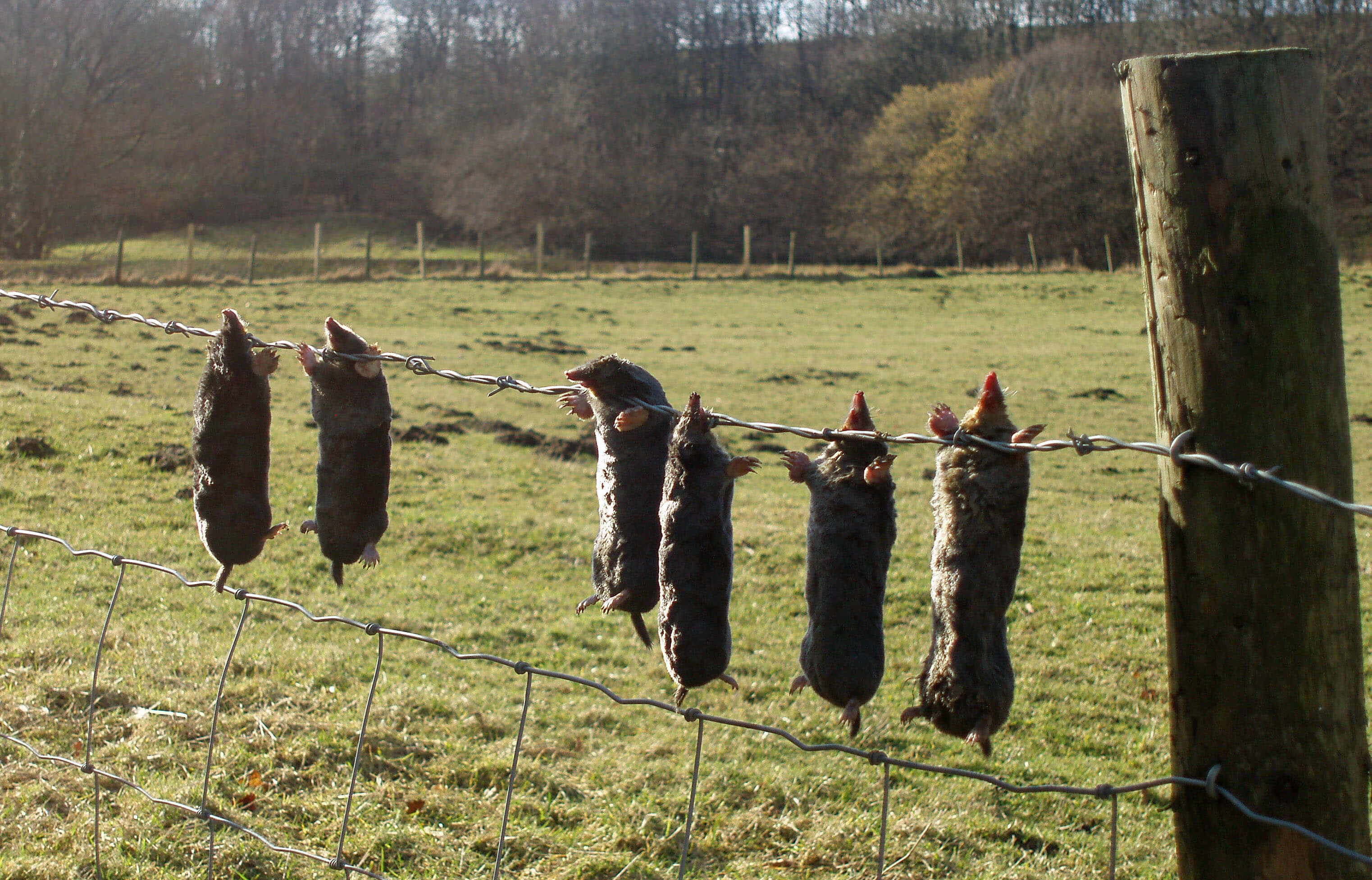
The work of the Keasden mole-catcher
The Introduction
The Previous Chapter (Gretadale and a little more Lunesdale)
The Next Chapter (Wenningdale, Hindburndale and Roeburndale)
© John Self