The Land of the Lune
Chapter 11: Wenningdale, Hindburndale and Roeburndale
The Introduction
The Previous Chapter (The Wenning Headwaters)
The Next Chapter (The Lune Floodplain and the Top of Bowland)
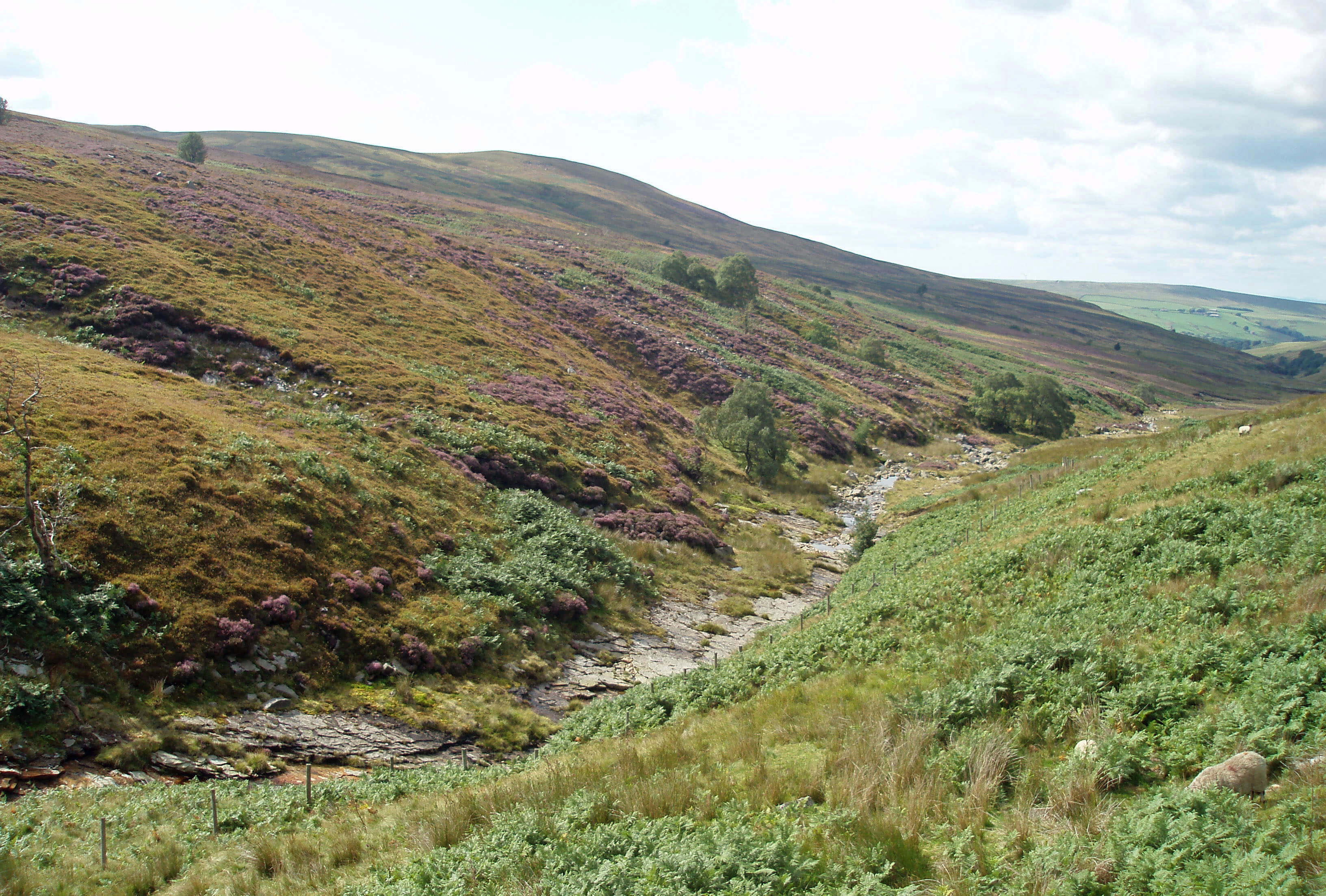
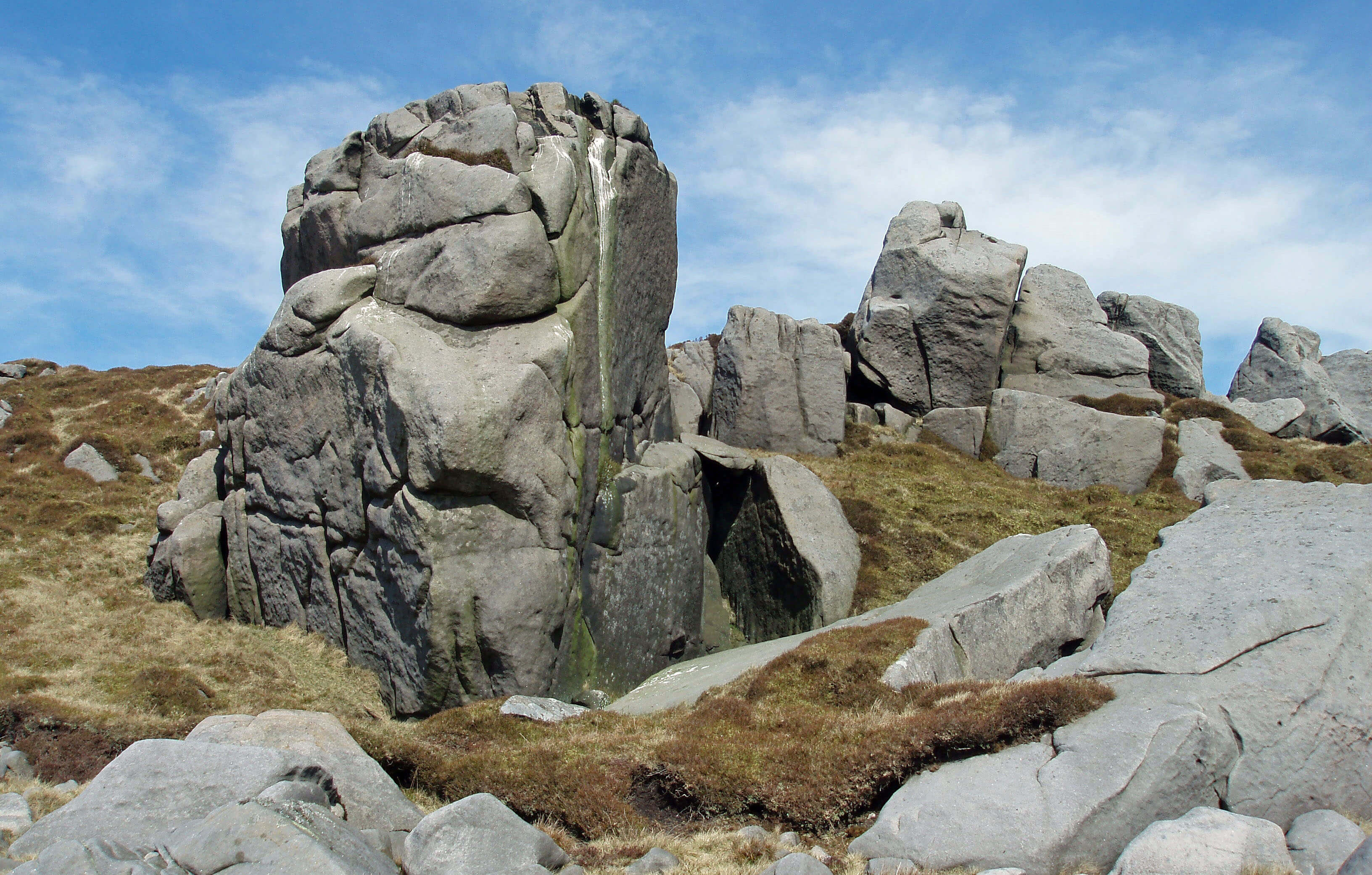
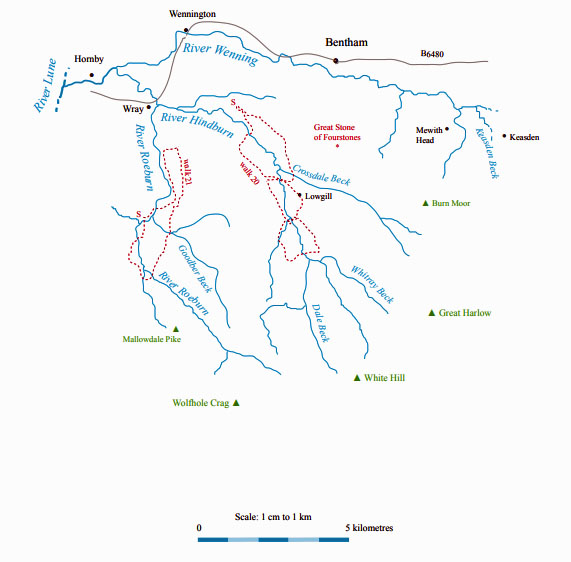
Upper Roeburndale
The Wenning from Keasden Beck ...
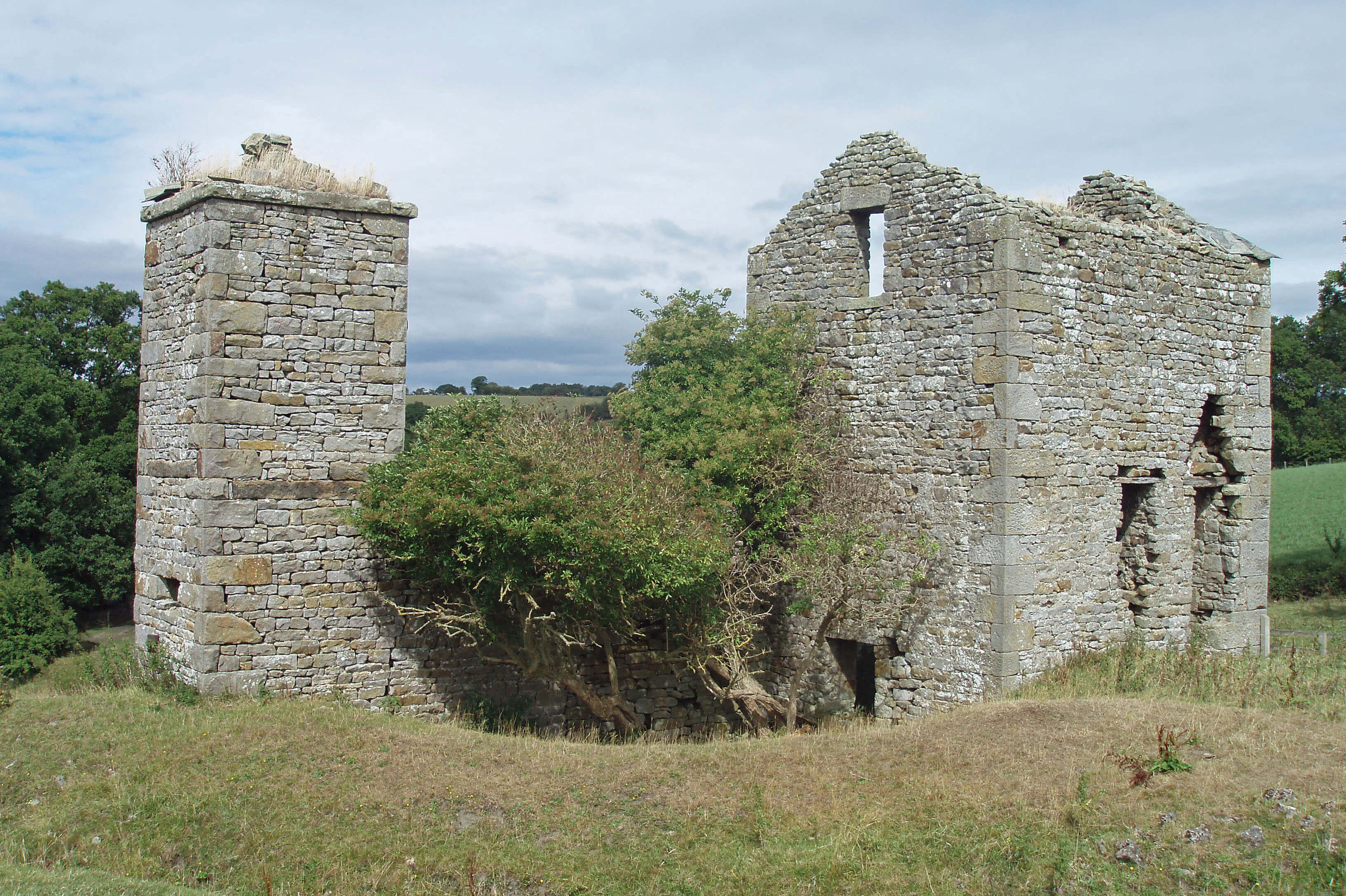
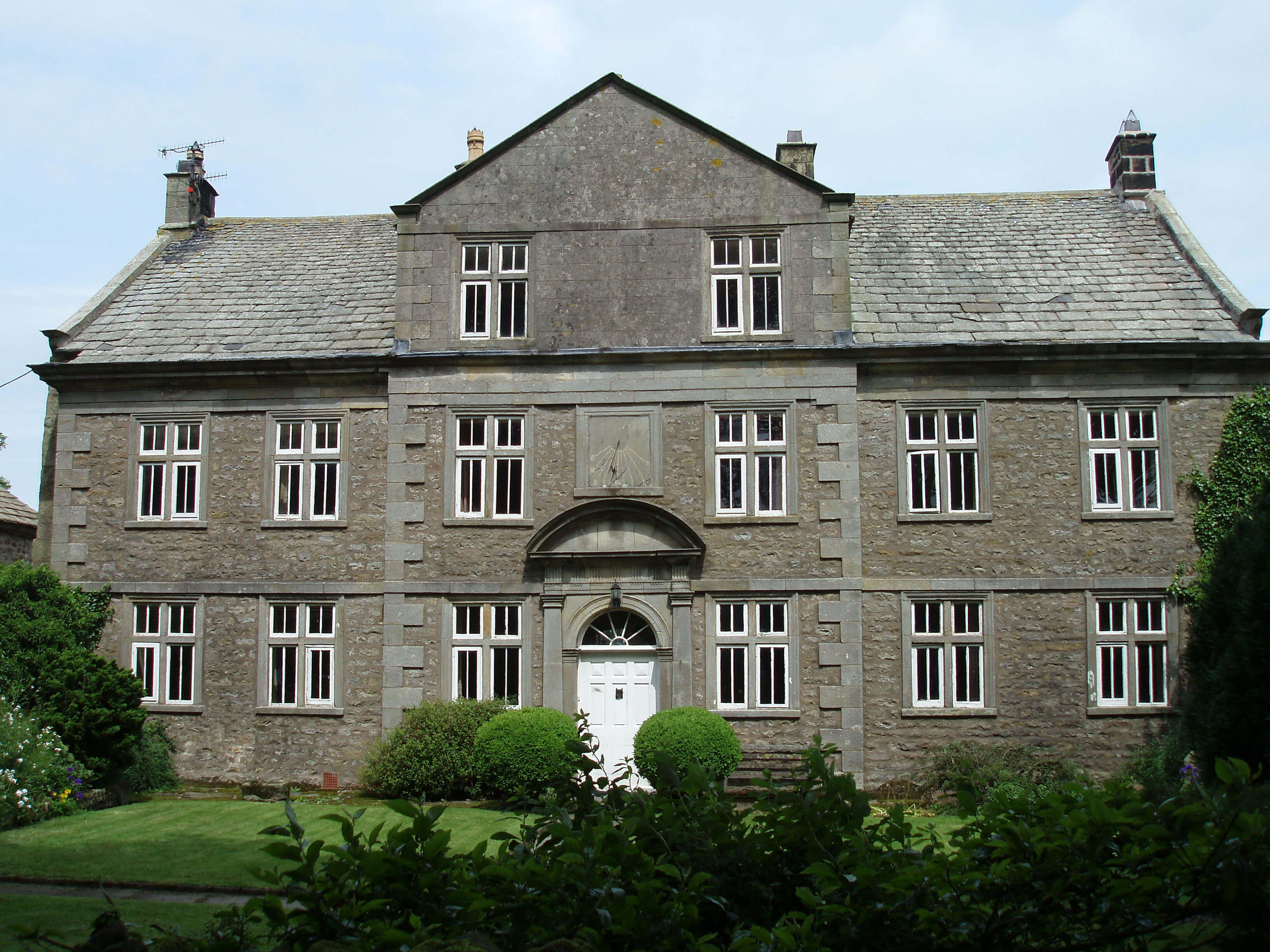 Right: Mewith Head Hall
The Wenning runs by the Forest of Mewith, below
the northern slopes of Burn Moor. Mewith is
an area of undulating farmland, with scattered
farmsteads, isolated woodlands, many paths and tracks,
and no discernible pattern. It is crossed by many becks
that flow off Burn Moor, where the county border runs
northwest past the Queen of Fairies Chair and the Great
Stone of Fourstones. The former is notable only for its
name but the latter is a remarkable 4m-high monolith,
from which there is a good view across to the Three
Peaks.
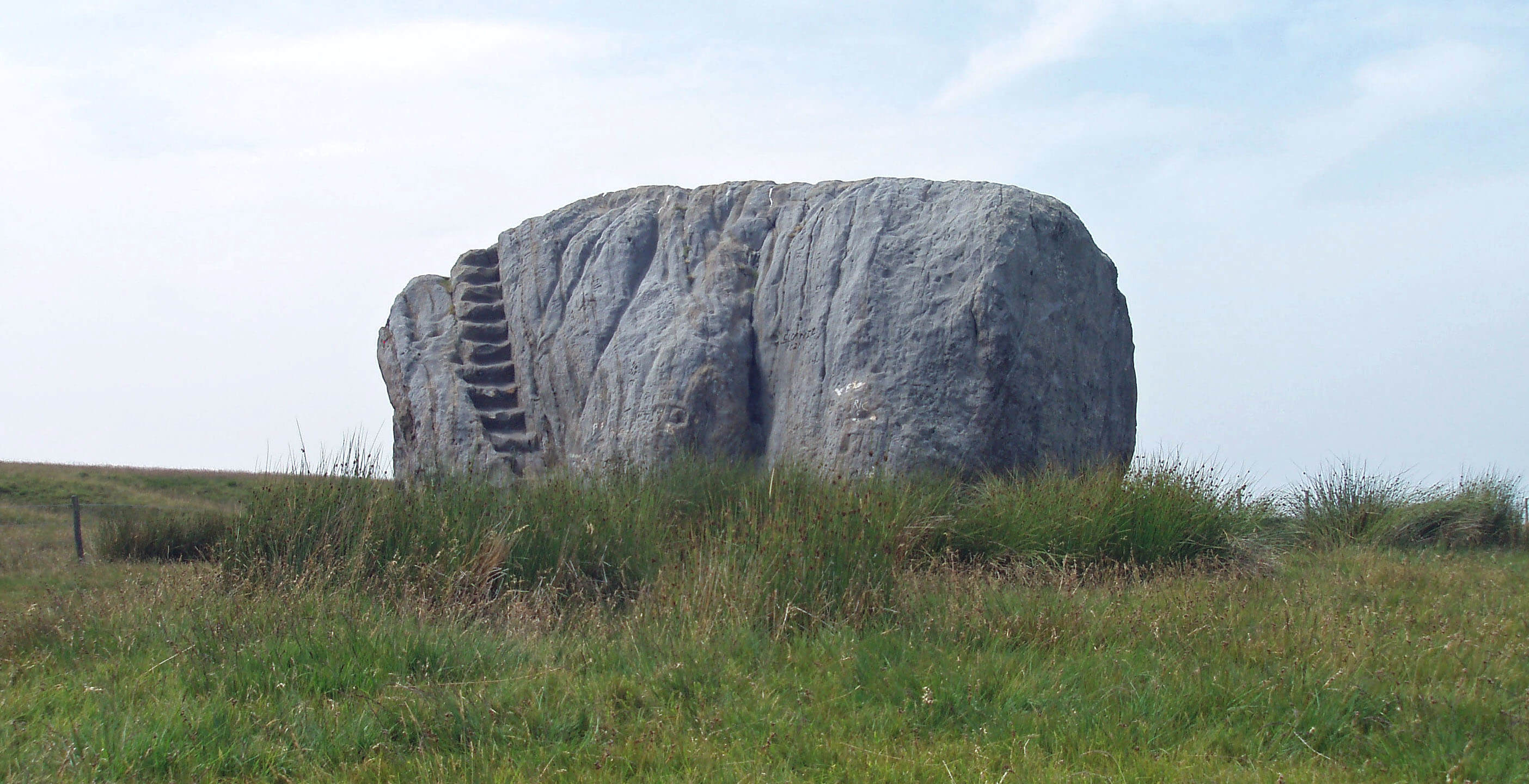 Left: Great Stone of Fourstones
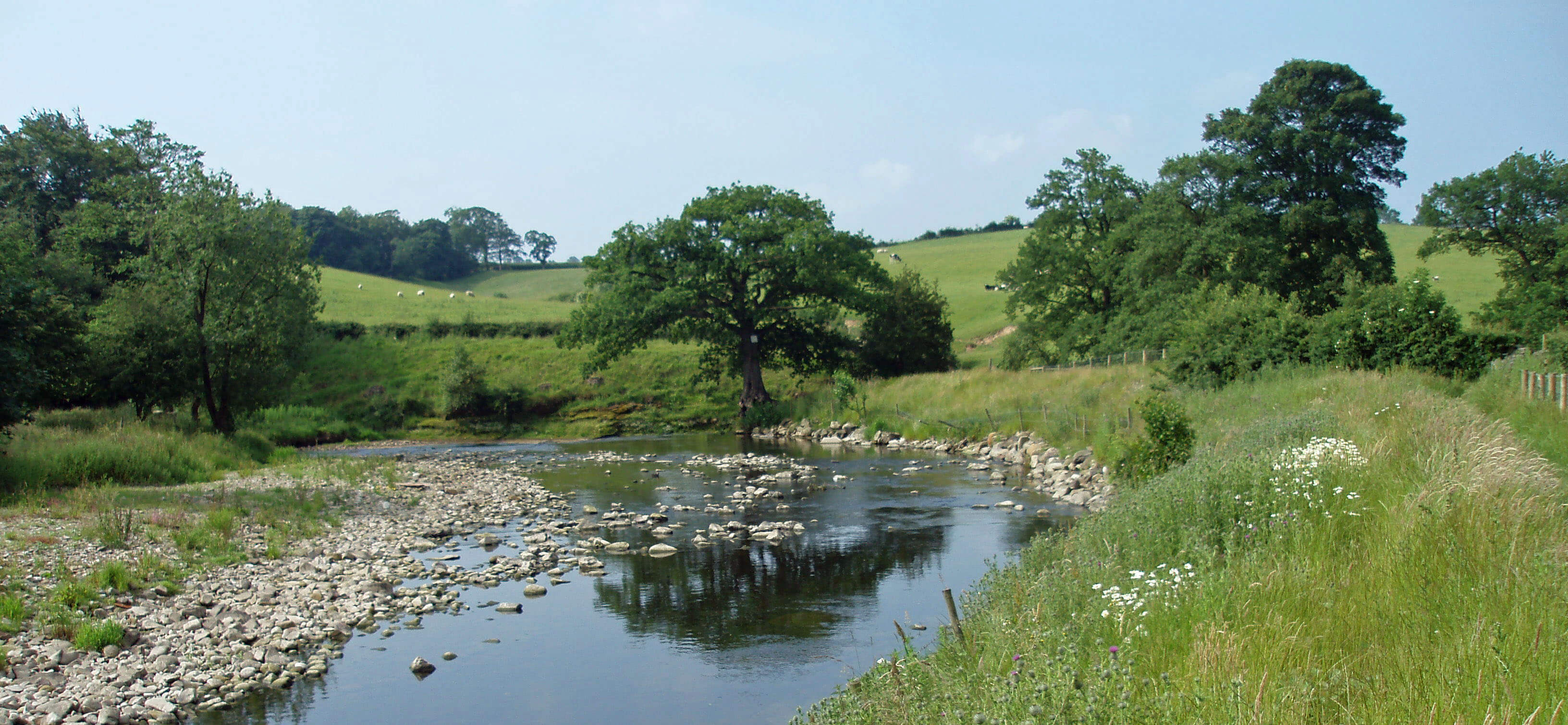
The Wenning flows calmly between banks
of alder, with birds such as common sandpiper,
dipper and grey wagtail, although sadly there are
few of the sea trout for which the river was once
known, partly because so many alien rainbow
trout have escaped from a trout farm. The river
reaches High Bentham and, shortly after, Low
Bentham, which is older but now smaller. High
Bentham expanded north, south and east and
Low Bentham expanded north, south, and west
but recently they have taken tentative steps along
the B6480 towards one another. I will consider
this dumbbell shape to be Bentham.
Its leaflet for tourists begins with the sentence
“Bentham is not a tourist centre”, which must
be welcome news for those staying at the large
caravan park. Bentham was once more positive,
for it had pioneered the idea of a holiday camp,
long before Butlin and Pontin. From 1908 to
1925 a tented village was set up on the banks of
the Wenning for holidaymakers: single men on
the north bank, everyone else on the south bank,
with a suspension bridge in between.
Bentham considers itself a market town
and shopping centre with an industrial heritage.
It appeared as Benetain in the Domesday Book
and was granted a market charter in 1306. High
Bentham Mill, using a millrace from the Wenning
near Bentham Bridge, was established in 1750,
possibly on the site of an old corn mill. It later
worked in tandem with Low Mill (built 1785), mainly
spinning flax. By 1795 the mills were importing Baltic
flax to make sailcloths. The owner in 1814, Hornby
Roughsedge, bought Bentham House, which no longer
exists, and the manorial rights to Ingleton.
It was Mr Roughsedge who had funded the ill-fated
hospice on Ingleborough (mentioned in Chapter 8). His
benefaction was more gratefully received in Bentham,
where he paid for St Margaret’s Church (Margaret
coincidentally being Mrs Roughsedge’s name), built in
1837 on a hill that now overlooks the unstylish Bentham
Bridge, which replaced one washed away in 1964.
 Right: The Wenning between High and Low Bentham
The mills were bought in 1877 by Benson
Ford to manufacture silk. The Ford family
were Quakers and their enlightened views
on the treatment of employees enhanced
the significant Quaker influence upon the
region. Quakerism had been strong since
the 1650s, with the Calf Cop meetinghouse
being established in 1718. The Quakers have
generally had a disproportionate influence on
Loyne’s society and commerce, to which they
directed their energy and enterprise as their
religious views barred them from professional
and political careers.
The mills once employed up to 800
people and were the dominant factor in village
life until they closed in 1970. One derivative
company, Angus Fire (now called Kiddes),
based on an invention to weave tubes to make
fire hoses, still operates but now on a site
across the railway line, the original mill site
having been converted for small businesses
and residences.
Before the 19th century, Bentham was unusual
in having no wealthy gentry to build large mansions.
There are some rows of 17th century cottages and
Collingwood Terrace has an intriguing conception. In
1726 the will of William Collingwood of York provided
for “the maintenance and support of six old decayed
housekeepers in [Bentham], men and women, six of
each sex”. I don’t know why he was so grateful to the
housekeepers of Bentham. According to its plaque, we
owe the continued existence of the terrace to a Mrs
Titterington, who provided funds in 1900 to restore the
houses as bungalows.
To the west of Bentham, the Wenning is joined by
Eskew Beck, which begins life as County Beck near the
Great Stone of Fourstones. Eskew Beck is important for
its exposures of Carboniferous rocks with rare fossils.
The county border is along County Beck and Eskew
Beck and then continues west along the Wenning. The
greater importance of county borders in earlier times,
when, for example, fugitives could escape the law by
crossing them, is reflected in the history of Robert Hall,
just to the south. It was built in the 16th century for the
Cansfield family, who, as recusant Catholics, needed
hiding places and escape routes.
To the southwest of Robert Hall is a moor that has
miraculously escaped the notice of man until recently,
for it has never been ploughed or drained. Consequently,
this is a Site of Special Scientific Interest for being
“the only extensive example of species-rich undrained
and unimproved base-flushed neutral grassland in
Lancashire”, including several rare plant communities.
To the non-specialist, it gives an idea of what would be
the natural state of this drumlin scenery.
 Left: The remains of the engine house of Clintsfield coal mine
In contrast, to the north at Clintsfield the signs of
human activity are evident, with the only significant
remains of the local coal mining industry. The old
engine house, which operated until about 1840 and was
later converted to a dwelling, and its adjoining square
chimney still stand, more or less, and traces of the ten or
more coal pits marked on old maps are still visible.
Above Clintsfield is The Blands, which was gutted
by fire in 2009. All the old farmsteads of Loyne, with the
intertwined families and colourful characters that lived
in them, have interesting histories but surely none can
match that of The Blands, once the home of Perpetual Arthur.
Just to the west, four pipes cross above the railway
line. This is the continuation of the Haweswater
Aqueduct, which we saw crossing the Lune near Kirkby
Lonsdale. The pipes go under the Wenning and then up
and over the railway. The aqueduct is gravity-fed (that is,
there are no pumps) but it is clearly not downhill all the
way. It is a single 2m pipe along most of its length but
is split into four smaller cast-iron pipes to cross rivers
and valleys.
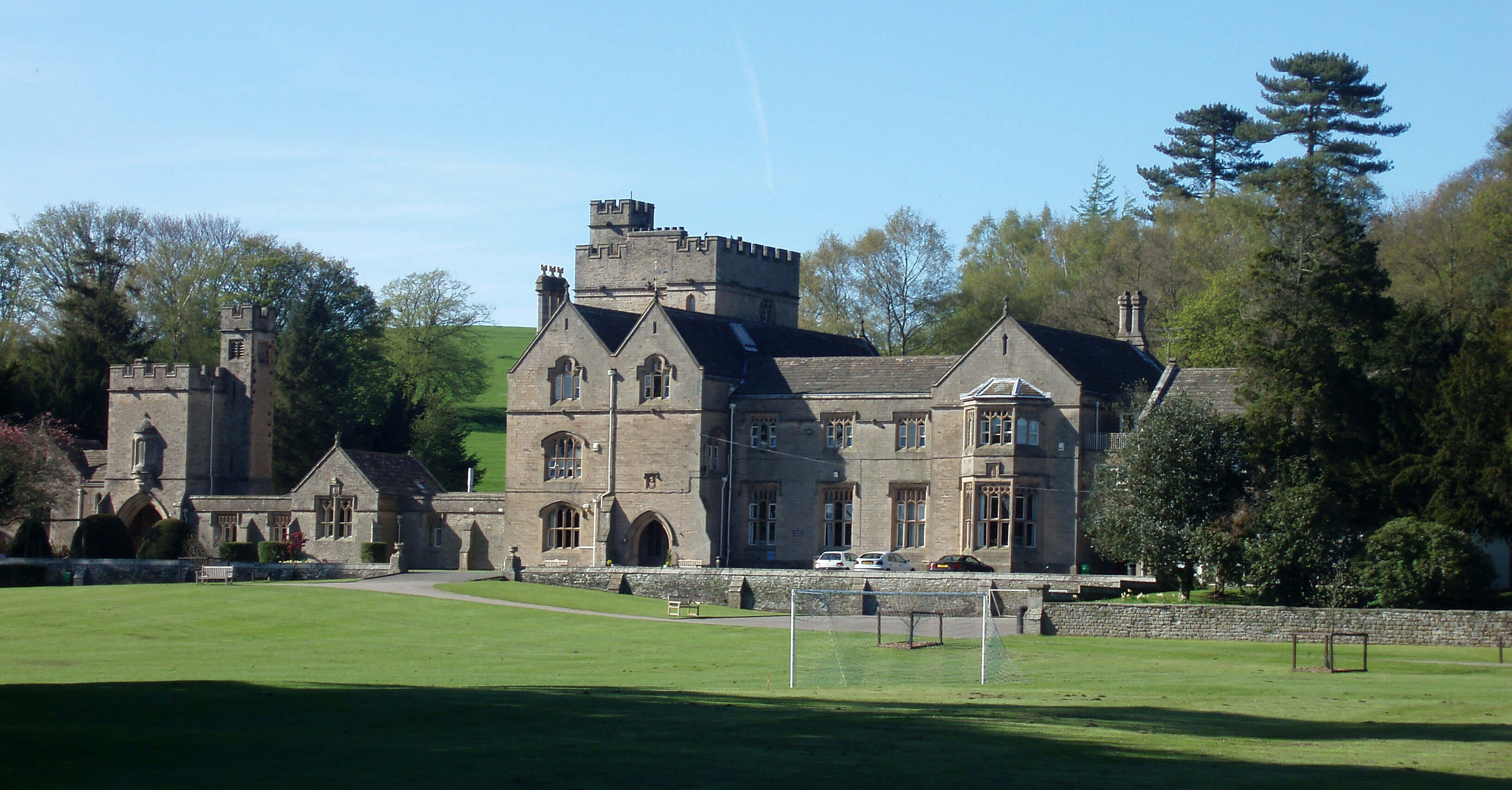 Right: Wennington Hall
Shortly after, the Wenning reaches its eponymous
village, Wennington, a triangle of houses around a green
bisected by the B6480. Its appearance has been improved
by the restoration of the old Foster’s Arms Hotel, empty
for many years. Wennington Hall, now a school, lies to
the north. It was re-designed in a Tudor-Gothic style
by Edward Paley in 1855. A notice at the gate informs
us of its history, including the fact that a motto of the
Morley family (who owned the hall from 1330 to 1678)
is inscribed in the headmaster’s study: “S’ils te mordent,
mord les” – ‘if they bite you, bite them’, which I trust
hasn’t been adopted as the school motto.
[Update: Wennington Hall closed as a school in 2022.
There are plans for it to be converted into a hotel.]
At Wennington, the dismantled railway line to
Lancaster and the still-existing line to Carnforth separate,
with the Wenning continuing beside the former. It passes
under the large Tatham Bridge, which can be barely seen
from the road. It has five arches, including one for the
railway, which it therefore does not pre-date. The line
opened in 1849 and for the first six months ran from
Lancaster only as far as a temporary Tatham Station,
just beyond the bridge. The bridge provides access to the
neat St James the Less Church, on a site where a church
is thought to have existed since Saxon times.
Perpetual Arthur was the nickname of Arthur Burrow
(1759-1827), who owned The Blands from 1787. This
relatively uneducated but multi-talented man became a
local legend for his many activities: blacksmith by trade, he
mined coal surreptitiously under The Blands, an entrance
to the shaft being conveniently close by the fireside; he
knew the bible better than many theologians, after being
taught to read in one night by an angel (according to him);
he built mysterious niches in his sunken garden, possibly
to intrigue gullible antiquarians; he distilled liquor; he ran
plum fairs; and he fathered thirteen children.
But the activity by which he was best known was his
unceasing quest to develop a perpetual motion machine, an
endeavour that attracted the interest of eminent engineers of
the day. Arthur would talk eloquently, enthusiastically and
at great length on his ideas for perpetual motion (and on the
bible, for that matter) if given half a chance. This was, of
course, in the early days of the Industrial Revolution, when
self-taught engineers were rapidly developing new forms
of power from coal and water. He redirected the nearby
beck to run under his house, which may have helped to
sustain the illusion of perpetual motion.
The History of the Parish of Tunstall considers that
“he had a touch of genius which, had his education been
sufficiently good, might have ranked him among the
world’s great men.” No doubt, if he had actually invented
a perpetual motion machine then he wouldn’t be all but
forgotten today.
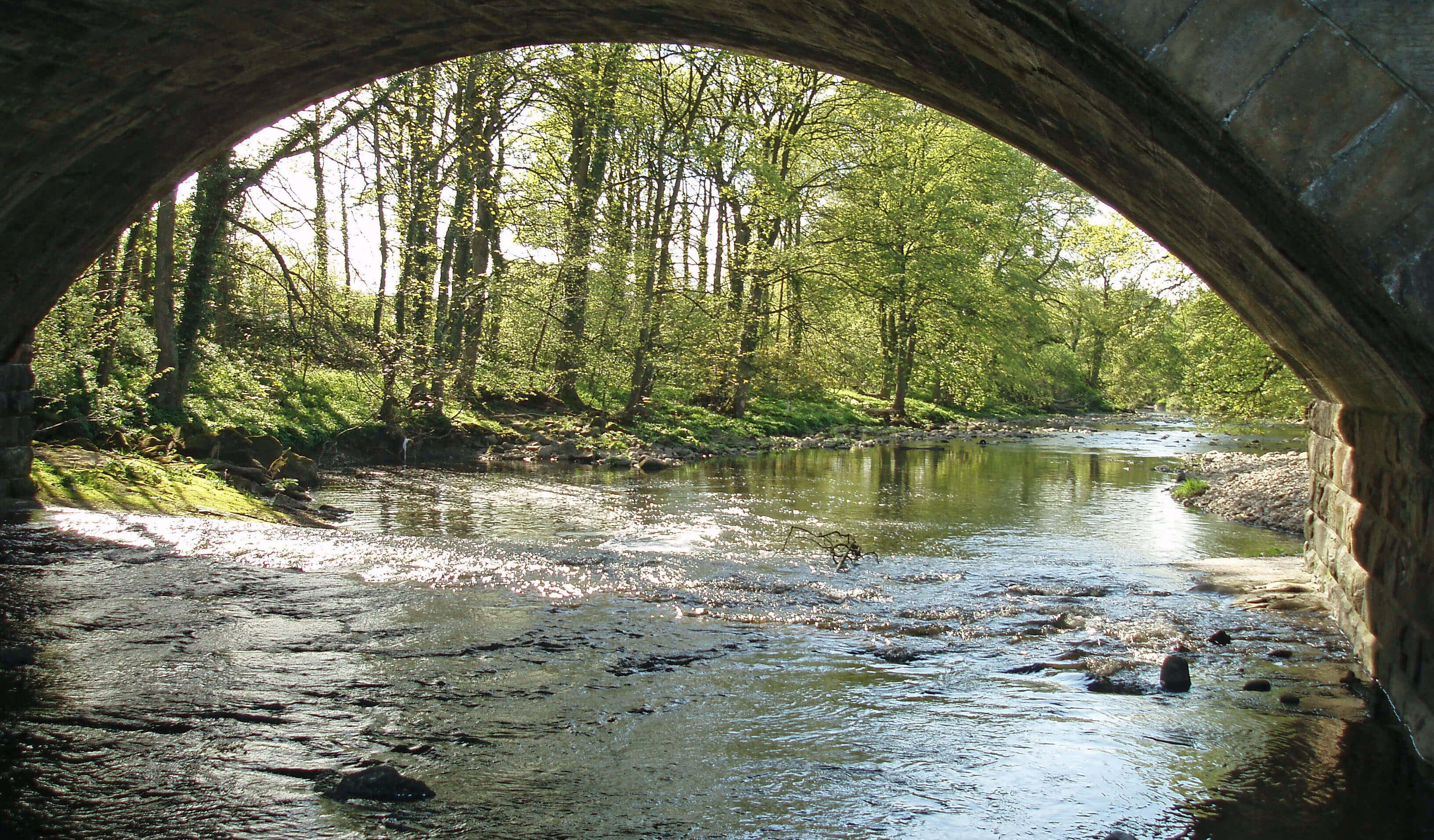
The Wenning at Wennington
East of Tatham Hall on a small hill by Tatham Park
Wood are various mounds
and ditches that look like the
remains of old settlements,
although they are not marked
as such on maps. According
to old maps, there were
many coal pits (Moorhead
Pits) to the east. The nearby
Netherwood Hall is much too
trim to retain its old name of
Bottom.
Below Hornby Park
Wood the River Hindburn
joins the Wenning.
The River Hindburn
By the time it reaches Botton Bridge the River
Hindburn is already a considerable size, having
gathered up all the becks that drain Greenbank Fell,
Botton Head Fell and Whitray Fell below the semi-circular ridge that runs to the ancient Cross of Greet
(which is no longer a cross but a large boulder with a
socket in which a cross may once have stood). This is
a vast area of peat bogs and heather, turning to grass
tussocks lower down. It is all CRoW land but walking
here is more of a challenge than a pleasure. In winter,
there are only grouse for company. From the ridge there
are broad views of Pendle and the southern Bowland
Fells and to the north Whernside looks particularly noble
(Ingleborough always does). The alignment of the ridges
– Ingleborough, Whernside, Gragareth, and Middleton
Fell – shows clearly that they all belong to Loyne.
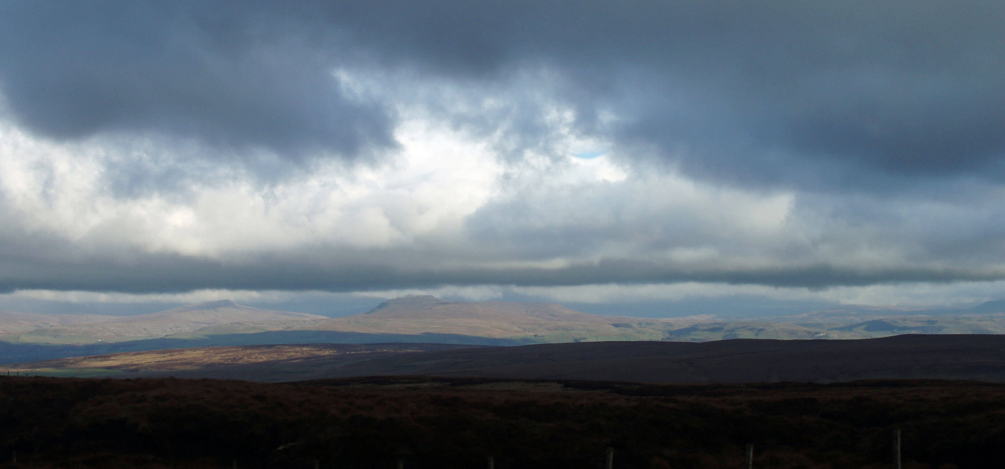
Looking towards the Three Peaks from White Hill
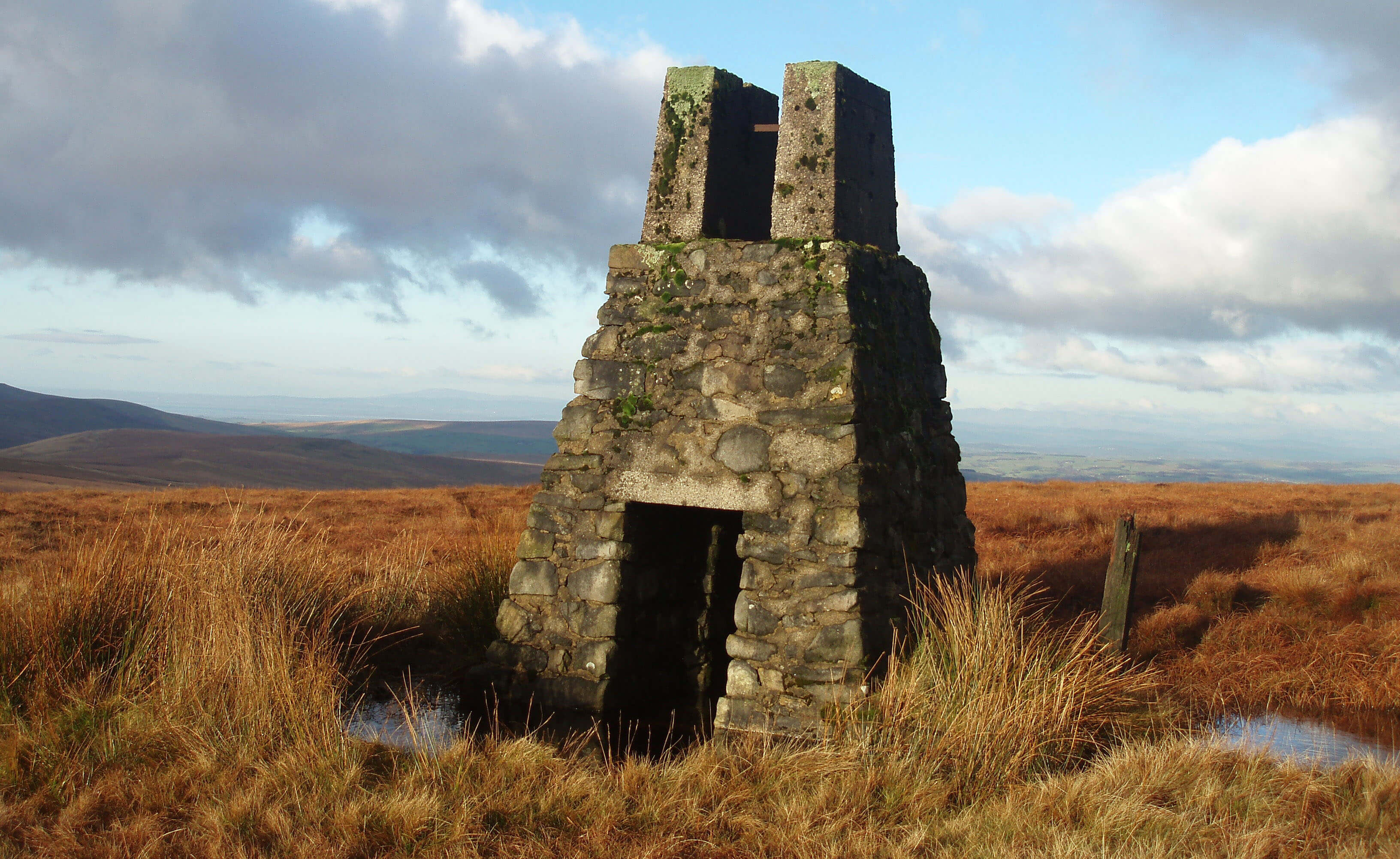 Right: The tower on White Hill
There is a rough path from the Cross of Greet to the
highest point of the ridge, White Hill (544m), but it has
few visitors, most of whom are puzzled by the tower
that stands near the trig point. It’s about 4m high, with a
notch in the top. It is in fact the middle of three towers
in a line, the other two being 500m north and south. The
other two cannot be seen when standing at the middle
one but if you walk to them you will see the notch of the
middle one back on the horizon.
If you have followed the narrative carefully, you
may suspect an answer to the puzzle. I think they are
sighting pillars used for surveying the Haweswater
Aqueduct, which we last saw near Wennington. If we
extrapolate the line of the towers on an OS map then
we find “air vents” marked on the exact line 3kms in
both directions. The towers seem to mark the line of the
aqueduct below our feet as we stand on White Hill. It
is a surprising thought, in the bleak emptiness of White
Hill, but the aqueduct must cross the Bowland Fells
somewhere and it certainly doesn’t go over them.
Other than the towers, there is no trace of this
engineering feat on the ground but if we plod over to
Round Hill on Botton Head Fell we may visit a much
older engineering construction that is (just about) visible.
We have passed many Roman roads on our journey but
have always had to take the expert’s word for it. Here
we might be able to convince ourselves that the slightly
raised ridge that runs between Goodman Syke and Dale
Beck is the line of a Roman road. It is actually more
convincing to view from a distance, for example, from
the footpath between Botton Bridge and Botton Head.
This is the Roman road that we have tracked from Over
Burrow past Low Bentham and that is now heading for
Ribchester.
Just above Botton Mill there is a permissive path that
enables access to Summersgill Fell. Here, at the parish
boundary fence, the nearest visible road or building is
far distant: ideal for those allergic to humanity or fond
of nude fell-walking (or, especially, both). A walk here
in spring is not, however, in silence: agitated lapwings,
curlews and grouse will attempt to distract you from
their nests.
 Left: Feathermire in Tatham
Once off the open fell we are among the lush green
pastures of the several farmsteads in the upper Hindburn
valley. Apart from the intrusive conifer plantation at
Higher Thrushgill, the map looks unchanged from a
century or two ago, and moreover most of the farmsteads
are still farmsteads, unlike most dales we have visited,
where many are derelict or converted into residences
and holiday cottages. There is an appealing timelessness
here, with the farms going about their business, nestled
below the rough fell and with open views across to
Ingleborough and the Lake District.
In contrast to nearby Keasdendale, the Hindburn
valley is crossed by many footpaths, which, to judge
from the curiosity of the sheep, are not often used. The
Hindburn passes below the quiet village of Lowgill,
a gathering of a score or so cottages on the line of the
Roman road. There’s also a primary school for about
forty pupils, some of whom must travel
far to get here and understandably so for
the school is known for the quality of
 education provided. The only other public
building seems to be the Wesleyan Chapel
of 1866. To the north, above Mill Bridge,
is the older (but rebuilt in 1888) and more
impressive Church of the Good Shepherd,
a fitting name for this rural area.
education provided. The only other public
building seems to be the Wesleyan Chapel
of 1866. To the north, above Mill Bridge,
is the older (but rebuilt in 1888) and more
impressive Church of the Good Shepherd,
a fitting name for this rural area.
Right: River Hindburn near Mill Houses
To the south of Lowgill, at Ivah Great
Hill, a new woodland of native trees
was created in 2003 by the community
group Treesponsibility’s nifty scheme of
engaging local people in tree-planting, to
help slow global warming. We, or at least
those who planted trees, are welcome to
visit to see the trees growing.
Three kilometres below Lowgill,
the Hindburn passes under a bridge built
in 1840 and carved with the name of
Furnessford Bridge, although the 1847 OS map calls
it Furnaceford Bridge. Below the bridge there are no
footpaths by the Hindburn, which is a pity as it runs
prettily by steep cliffs over minor waterfalls. I hardly
need to say what Mill Houses used to be but I ought
to mention the nearby meadow on the footpath from
Clear Beck Bridge. This meadow is too small to have
been affected by modern agriculture and as a result is
a Site of Special Scientific Interest for being “one of
the best examples of species-rich meadow grassland in
Lancashire”. It is so rich, in fact, that over 130 species
have been recorded.
Clear Beck joins the Hindburn after Hindburn
Bridge, running from Clearbeck House, which has
a garden with follies, sculptures, a lake, and views of
Ingleborough. The house is one of about twenty studios
on the Lunesdale Studio Trail, in which local artists open
their studios each summer to enable visitors to see their
work in paintings, textiles, prints, sculptures, mosaics,
jewellery, ceramics, drawings and photography.
Below Wray Bridge, the River Hindburn and the
River Roeburn come together, as nature intends.
Walk 20: Middle Hindburndale and Lowgill
Map: OL41 (please read the general note about the walks in the
Introduction).
Starting point: A large lay-by east of Ridges on the Wray to Low Bentham back road (633679).
Walks in the upper Hindburn do not compare with other high-level walks I’ve suggested: it is better to stroll through the
farmsteads of the middle Hindburn around Lowgill.
This walk uses four bridges over the Hindburn to make a route of three loops. There is some walking on roads but they are
generally quiet. Careful use of the OS map is needed, to locate about fifty stiles or gates.
Take the path that starts on the drive to Ridges and skirts around Riggs Farm next to it, continuing on the path south and
then southeast (diverted through a wood) to the Furnessford Road. Over Furnessford Bridge take the path past the barn and up a
fine old track through the wood to Birks Farm, dated 1667. The four large manholes seen here and by Riggs Farm mark the line
of the Haweswater Aqueduct. Follow the road southeast past Park House and take the track to Lower Houses. Turn left and after
0.5km drop down east by a wooded gully to a footbridge over the Hindburn.
Head south across an open field to the barn seen ahead. Then walk up through the wood behind it and across the fields,
heading for Lowgill School. Walk south through Lowgill to High Ivah (along the line of the Roman road), and drop down
southwest across the field to Stairend Bridge. Continue on the road past Botton Mill. After 1km turn left through Lower Thrushgill,
continuing east to walk across a field and down to a footbridge. Continue for 0.5km to join the bridleway through Swans (0.5km
north) and back to Stairend Bridge.
Walk 100m to the road corner again and this time take the path north, by the Hindburn. Follow this path for 2km past a few
derelict barns back to the wooded gully, and drop to the footbridge again. Over it, this time turn left through a wood and up to the
road near Mill Bridge, 1km east. Turn left and cross the bridge and, after an optional detour to the Church of the Good Shepherd,
continue on the road north for 2.5km to Spen Lodge. Beware of traffic as you contemplate the views of distant hills.
Beyond Spen Lodge take the footpath through Little Plantation if it is not too overgrown – otherwise continue on the road
and turn left onto Furnessford Road. Take the path west below Trimble Hall to rejoin the path from Ridges.
Short walk variation: Clearly, using only three, two or one of the bridges will shorten the walk. However, parking in the valley
is not easy although there is space on the corner near the track to Swans (655640). The best of the short walks is the loop south
from there through Lower Thrushgill and Swans, combined, if you have time, with a loop north to Over Houses Great Wood and
back through Lowgill.
The River Roeburn
We were once accosted by a friendly couple in
Roeburndale who felt that they had discovered
the best place in England and often journeyed over
from Blackpool to savour it. They were pleased, not
disappointed, to find others who shared their secret. The
view from the brow of the road after passing Thornbush
is enchanting: to the alpine-like green pastures down by
the woods up to the conical peak of Mallowdale Pike
and beyond, with the Three Peaks arrayed on the left.
And Roeburndale encompasses both the ancient and the
new, as we’ll see.
The River Roeburn rises at the old Yorkshire-Lancashire county border below Wolfhole Crag (527m)
and Salter Fell. This is open fell country, far from any
road and therefore likely to be deserted. It was not always
so, for Hornby Road (or the Old Salt Road) was once an
important route and in its southern part coincides with
the Roman road that came up Round Hill from Lowgill.
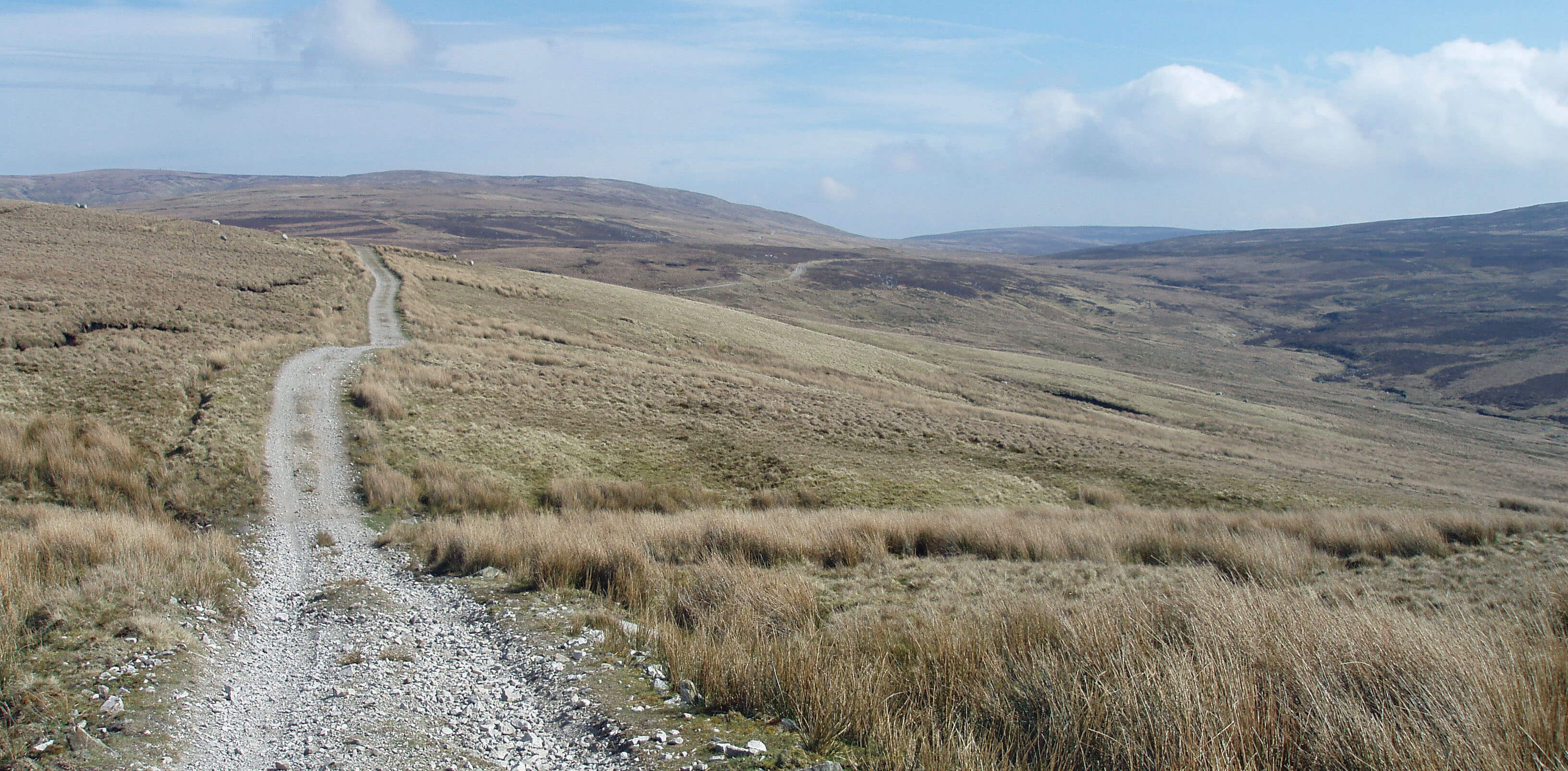
Hornby Road, with the head of Roeburndale to the right
 Left: Wolfhole Crag
It is possible that the CRoW policy will give a
new lease of life to Hornby Road. The track, which is
unusable by cars, provides an excellent
walking surface, although distances are
long and any loop off-track involves
strenuous going. Walking north, the
view that opens up at Alderstone Bank
is remarkable, with a long-distance
180° horizon from Black Combe to
Ingleborough. The track marked on
OS maps as going to a shooting cabin
on Mallowdale Fell now continues
over the ridge to join the track from
Tarnbrook Fell. It may therefore be
used to reach the ridge path to Ward’s
Stone but there will be awkward bogs
around Brown Syke after wet weather.
[Update: Recent OS maps show the new track over the
watershed and a number of other new tracks on the Bowland hills. Grouse-shooters must be getting lazier.]
If you walk up here you will
become aware of the screeching gulls
that nest on Mallowdale Fell and
Tarnbrook Fell. These are a relatively
new phenomenon, first being reported
in 1936. There are now over 25,000
pairs nesting annually, forming
England’s largest inland colony of
lesser black-backed gulls. Thousands
more are culled to avoid possible bacterial contamination
of the Lancaster water supply.
[Update: There aren't over 25,000 gulls now.
The saga of the lesser black-backed gulls on Bowland
is convoluted. In short, the land-owners continued to kill the gulls even though it became illegal,
with the authorities renewing the licence either through error or by turning a blind eye.
When the licence was eventually ended, killing continued, on and off, despite the
threat of legal action. The gulls are not really killed because they pollute our water -
they are killed because they get in the way of grouse. There seems to be some kind of stand-off at the moment, perhaps
because the legal status of the gulls' protection is unclear now that we are no longer
a member of the EU.]
Hornby Road is a recommended route for mountain
bikers, who are (at the moment) not allowed on the
increasing numbers of tracks on the Bowland Fells
proper. It is also part of the 45km North Lancashire
Bridleway, opened in 2004. This runs from Denny Beck,
Halton via Roeburndale to Chipping. Let us hope that
the few residents in these remote areas benefit from,
rather than resent, these new activities.
On Mallowdale Pike there is a memorial cairn to one
Anthony Mason-Hornby (1931-1994). The cairn gives
no explanation for its presence here. The area was out
of bounds to the public until the CRoW Act took effect
in 2004. Very few walkers will take advantage of the
opportunity to venture here but even so it is a regrettably
growing practice for private grief to impose upon special
places, without good reason.
 Right: The Irish bridge below Middle Salter
[Update: This so-called Irish bridge has been replaced.
It is hoped that fish can now move up-river, whereas before they could not pass
through the narrow pipes.]
At Mallowdale the Roeburn leaves the open fell
to run through woods past Lower Salter to be joined
by Bladder Stone Beck (what a charming name) and
Goodber Beck, which runs in a deep ravine from the
empty grasslands of Goodber Common. Even the most
desolate areas have their uses. The large heath butterfly,
one of only two English butterflies that are on the
European list of threatened species, breeds here. Hare’s
tail cotton grass, its main larval food plant, flourishes on
the Common.
The Roeburn runs through 5km of Roeburndale
Woods, one of the most extensive deciduous woodlands
in Lancashire, which is perhaps not saying much as it one
of the least wooded counties of England. These woods
provided an enclave for the red squirrel (until recently:
I have heard no recent reports of red squirrels here). A
permissive path in Outhwaite Wood enables us to see as
we walk north the gradations of tree types, reflecting the
changes of soil, from lime, birch, hazel and alder to ash,
elm and oak.
In a clearing opposite Outhwaite Wood is the Middle
Wood environmental centre. This was established in
1984 to “advance, research and provide education for the
public benefit in those techniques of farming, forestry,
wildlife and countryside management, building, energy
utilisation and human lifestyle, which are in tune with
the natural cycle and which do not upset the long term
ecological balance.” Quite foresighted, then, and today a
range of ecological buildings for sustainable development
can be seen. The study centre uses solar panels and a
wood-burning stove for heat and is powered by wind
power. The community yurt (a Mongolian circular tent)
is the main meeting place. Whenever I pass through
only a few wisps of smoke at most seem to disturb the
air of away-from-it-all self-sufficiency. After years of
apparently anonymous inactivity, the centre is now so
vigorously advertising its facilities (courses, website,
shop, study centre, rural classroom, camping barn) that
it is in danger of becoming mainstream.
The Top 10 body-parts in Loyne
1. Bladder Stone Beck, Roeburndale
2. Bosom Wood, Cautley
3. Backside Beck, east Howgills
4. High Stephen’s Head, near Ward’s Stone
5. Fleshbeck, below Old Town
6. Rotten Bottom, Dentdale
7. Heartside Plantation, Middleton Fell
8. Hand Lake, north Howgills
9. Long Tongue, Cockerham Sands
10. Bone Hill, near Pilling
From left to right, Gragareth, Whernside, Ingleborough and Pen-y-Ghent from above Middle Wood,
not forgetting the clouds
As the Roeburn nears the village of Wray it is joined
by Hunt’s Gill Beck, which runs past Smeer Hall. Here
the last coal pit in the region closed in 1896. On the
Roeburn’s right bank is a line of cottages associated
with the old Wray Mill. Like many mills we have
passed, it dates back centuries and went through many
incarnations (cotton, wool, bobbins, silk, and so on) in a
valiant attempt to survive, before finally succumbing in
the 20th century.
Just after the mill cottages, the Roeburn passes
under Kitten Bridge, the first of three bridges in Wray,
the others being Wray Bridge over the Roeburn and
Meal Bank Bridge over the Hindburn. The first and last
were washed away in the notorious flood of August 1967
and have since been replaced. Wray Bridge survived but
perhaps it would have been better if it hadn’t, because
the logs and debris piled up against the bridge, causing
the torrent to back up and demolish a number of cottages.
Luckily, there were no casualties but 37 people were
made homeless. The event is commemorated in a garden
close by Wray Bridge.
Some of the cottages washed away used to be the
homes of various Wray artisans, because from about
1700 to 1850 Wray was a veritable hive of industry.
Apart from the mill and local mining and quarrying,
Wray was known for the production of hats, nails, clogs
and baskets. It is unclear why Wray in particular became
an industrial centre but no doubt once it began to build
a reputation it was enhanced by other workers being
attracted to the area for employment. The industries
were relatively short-lived and Wray has since relaxed
into a quiet, commuting community.
Walk 21: Roeburndale
Map: OL41 (please read the general note about the walks in the
Introduction).
Starting point: Just north of the cattle grid north of Barkin Bridge (601638).
This walk gives a tour of middle Roeburndale, with views up to the wilderness of upper Roeburndale. It first makes use of
a new permissive path to and through Outhwaite Wood. This path is not marked on OS maps but there are clear signs to follow,
the first being by a stile a few metres northwest of the cattle grid. The footpath sign is a symbol of a deer: I hope that encouraging
us to look for them doesn’t scare them away.
The path crosses two fields and then drops down (rather muddily) to cross a new footbridge to the east bank. There are good
views at times of the Roeburn below. The path continues just outside the wood, which it eventually enters. It then joins a loop
walk within Outhwaite Wood. Take the lower path of the loop (it isn’t necessary to cross the swing bridge to the camping barn, but
it’s fun to do so (twice)). After 1km the path emerges below the wood and joins the public footpath that has crossed the footbridge
from Middle Wood. Continue north and then east up the path into fields.
Follow the footpath until it nearly reaches the road and then turn right, following the path for 3km above Outhwaite farm,
past Wray Wood Moor, and all the way to Harterbeck, where Goodber Beck forms an impressive waterfall. Cut southwest across
fields for 1km to reach High Salter, where Hornby Road ceases to be a road.
Drop down behind High Salter, cross Mallowdale Bridge, and after Mallowdale farm cross a footbridge to enter Melling
Wood. This path climbs up to give good views down into secluded Mallow Gill. At Haylot Farm take the paved road down to the
bridge across the Roeburn. Pass Lower Salter, with its tiny Methodist church, and return to Barkin Bridge.
The map shows other footpaths that may be used to shorten (or lengthen) the walk but avoid the one shown crossing
Goodber Beck in Park House Wood: a safe crossing point is hard to find and anyway slippage has made the path unusable. A stile
linking Bowskill Wood and CRoW land (at 611646) enables many variations on our route.
Short walk variation: Any short walk is, of course, constrained by the need to find bridges to cross the various rivers and becks.
One possibility is to follow the long walk as far as the footbridge to Middle Wood and to then cross the bridge and walk via Back
Farm and the road back to Barkin Bridge. Another possibility is to complete the southern half of the long walk, that is, to walk
south from Barkin Bridge, east through Lower Salter to the waterfall at Harterbeck and then follow the long walk from there.
A walk up the Main Street from Wray Bridge reveals
some of this history. First impressions suggest that Wray
is different from other Loyne villages. The grey, stone
buildings and converted farms and cottages are familiar
but they are set back from the road, with cobbled areas
in front. By Loyne standards, Wray is a new village, as
it is not listed in the Domesday Book. It was designed, if
that is not too bold a term, by the then Lord of Hornby in
the 13th century for his farm workers. The farm buildings
were set out on the wide street, with a village green at
the north end.
All except one of the farms have been converted into
residences but the original forms can still be discerned.
Overall, if Main Street were without its multitude of
parked cars then it would have a picturesque quality of
bygone times. The green, however, no longer exists, as
the B6480 was built across it. With the original road,
now called The Gars, it has made an island of Wray
House and a few other houses.
Despite its youth, Wray seems proud of its age:
almost every house bears a datestone, usually of the 17th
century, even one built in the 20th century. One of the
first houses met on the walk up Main Street from Wray
Bridge is that of Richard Pooley, or Captain Richard
Pooley as he insisted on being called. He flourished in
the Civil War and returned to the family home in Wray
to bequeath Ł200 a year to establish a primary school
in 1684. A plaque on the school wall confirms this; a
second asserts that “Bryan Holme (1776-1856) founder
of the Law Society was at school here” (there should
be an “a” before “founder”, as he did not do so alone).
The school is, unusually, not a church school, possibly
because it pre-dates local churches: Holy Trinity Church
was built in 1840 and the Methodist Chapel in 1867.
Anyone interested in rural architecture will enjoy a
stroll along Main Street. But not on May Bank Holidays,
for then the village and the roads around are jammed
for the Wray Fair, featuring the celebrated Scarecrow
Festival. The festival is part of an ancient springtime
ritual, passed down through generations of Wray
residents, dating all the way back to … 1996. The idea
was copied from a village in the Pyrenees in an attempt
to promote the Wray Fair. It succeeded beyond anyone’s
hopes and now tens of thousands visit, mainly to see the
scarecrows. Rather ironically, if that is your intention
then it is better to avoid the fair itself, as the scarecrows
adorn the village in the days before the fair, to the
distraction of unsuspecting passing motorists. Those
industrious workers of the 18th century, striving to make
a bare living, would be bemused by the feverish activity
of today’s villagers, as they strive to out-scarecrow one
another.
Beyond Wray Bridge the Roeburn joins the
Hindburn, which continues uneventfully for 2km to join
the Wenning.
The Wenning from the Hindburn
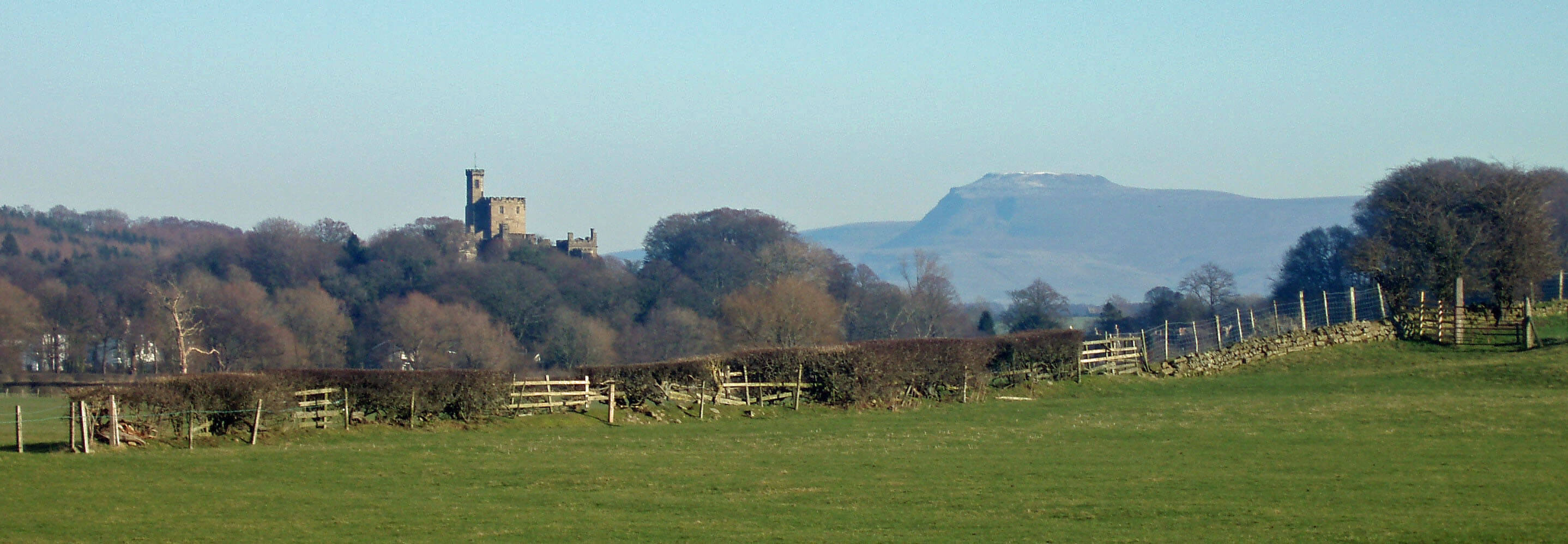
The Wenning swings south below Hornby Castle, a
prominent landmark of the lower Lune valley. The
Earl of Montbegon was granted the Hornby estate after
the Norman Conquest and was no doubt based at Castle
Stede by the Lune at first. At some time the village was
relocated, with a castle being built on the present site in
the 13th century. By the early 16th century the manor was
in the hands of Sir Edward Stanley, or Lord Monteagle
as he became after bravery at Flodden. It was the 4th
Lord Monteagle who received the warning letter about
the Gunpowder Plot of 1605. Actually, the letter advised
him to stay away from Parliament, which may suggest
that the plotters considered him to be a sympathetic
friend.
As a Royalist stronghold the castle was besieged
during the Civil War but for some reason was not
demolished after capture as it was supposed to be. In
time, however, all of the castle except the central tower
fell into ruin and has been replaced. Despite appearances,
the present structure is mainly of the second half of the
19th century, when it was remodelled in the Gothic style,
complete with battlements. The castle can be viewed
from Tatham or from the Lune valley with Ingleborough
behind or, at closer quarters, from Hornby Bridge, with
the lawns sweeping down from the castle.
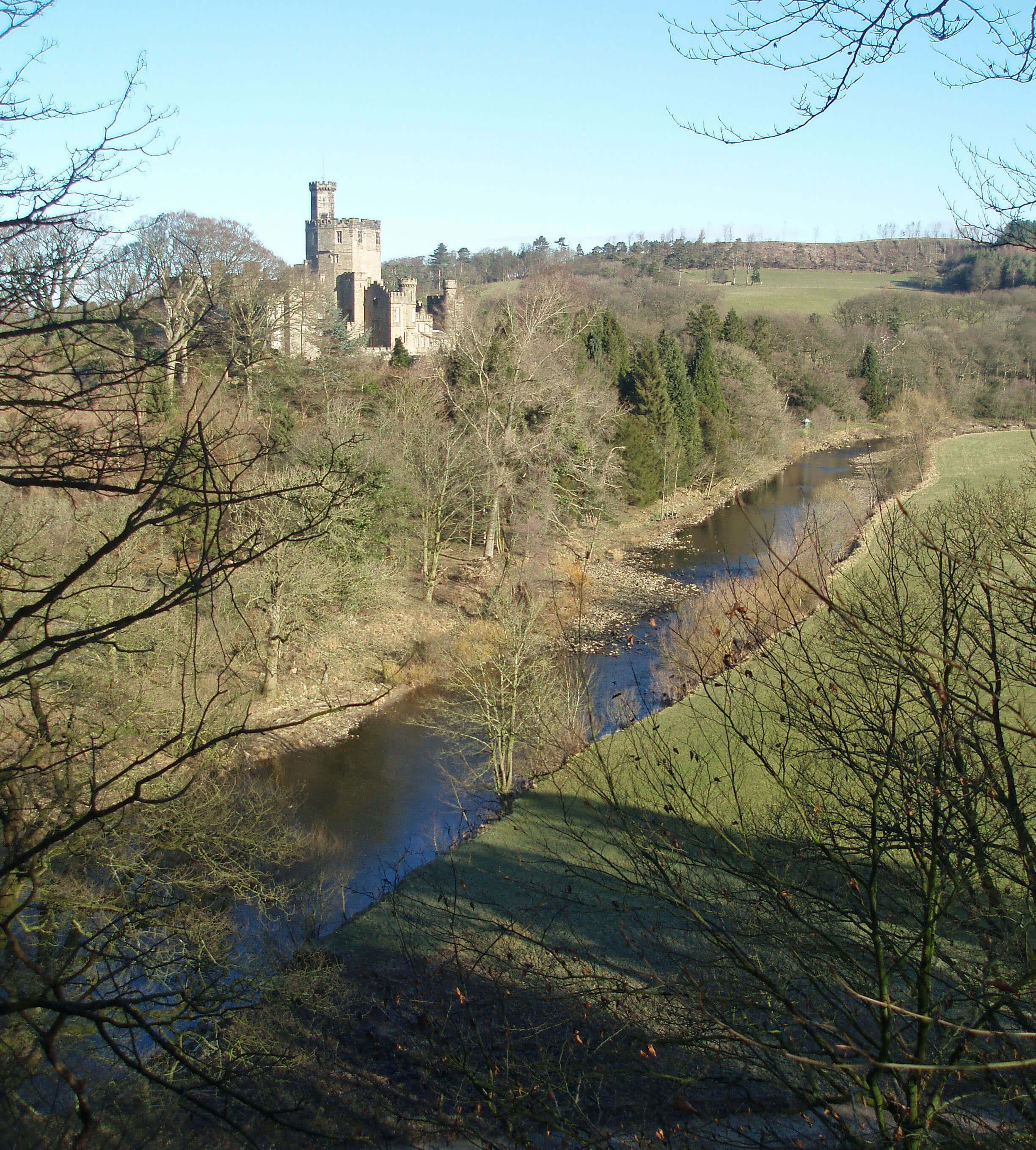
Hornby Castle and the Wenning
The castle’s structures are echoed in the octagonal
tower of St Margaret’s Church, built by the 1st Lord
Monteagle. It is probably on the site of an older church,
as it houses several ancient stones and crosses, one,
the ‘loaves and fishes’ cross, probably being pre-Norman. Opposite St Margaret’s is the Catholic Church
of St Mary, built in 1820, with the presbytery nearby,
where the noted historian John Lingard lived. By the
presbytery is indubitably the oldest bus stop in England,
with a datestone of 1629.
The two Grade I listed buildings (the castle and St
Margaret’s) set standards that the rest of Hornby does
well to live up to, which it does via a further 26 Grade
II listed structures. The main street has a number of fine
sandstone buildings and the institute has recently been
refurbished at a cost of Ł1.3m. Unfortunately, the Castle
Hotel, an old coaching inn, is letting the side down by
remaining boarded up and looking increasingly derelict.
The quiet residential tone reflects the fact that
Hornby, despite the market charter granted in 1292,
never developed any significant industrial activity,
unlike nearby Wray. In fact, its market town status had
lapsed by the 19th century.
The Wennington-Lancaster railway line ran to the
south of Hornby, enabling a short-lived livestock market.
Nearby is an interesting building built in 1872 by the
Lunesdale Poor Law Union as a workhouse for the poor
of 22 parishes. As with many other buildings, it has been
redeveloped for residential use.
I once sat for some time by the Wenning Bridge
in Hornby watching a heron attempting to swallow an
eel longer than itself - longer than its neck, at least.
It managed, somehow. There is concern about the
declining number of eels in the Lune, as in most British
rivers. I don’t think the heron is to blame. As with the
salmon, causes may be man-made (the various barriers
we have built to the eels’ migration up the rivers) and
natural (infections with parasites). DEFRA’s 2008
Eel Management Plan for the North West River Basin
District is on the case.
As the Wenning approaches the Lune it runs in a
much straighter line than in earlier times, with old river
channels visible on the south bank. Looking back from
the Lune, the Wenning points directly to its source on the
eastern flanks of Ingleborough.
John Lingard (1771-1851) is a rarity in Loyne – someone
who achieved eminence through activities within the
region. The plaque at the presbytery reads “Home of Dr
John Lingard, Catholic priest and historian, 1811-1851”,
which needs careful interpretation. The dates are those for
which the presbytery was Dr Lingard’s home, not those of
Dr Lingard himself. The Catholic Encyclopedia says that
he “retired to Hornby” in 1811 and refers to the “fruits of
his leisure there”. It is a little unclear, therefore, how active
he was as a Catholic priest in Hornby.
The ambiguity in “Catholic priest and historian”
is probably deliberate, for a key question is whether Dr
Lingard was a Catholic historian or a historian. He wrote
his eight-volume The History of England whilst living in
Hornby, the last volume appearing in 1830. The history was
later re-published in ten and then thirteen volumes. This
monumental work is important because, firstly, it provided
a comprehensive account of English history that has been
respected ever since it was first published and, secondly,
his methodology of not relying upon general opinion but of
going back to primary sources helped to change the nature
of historical research.
Inevitably, that general opinion did not always agree
with Lingard’s interpretations but he was always able
to refer back to his sources. Nowadays, we would not
expect the dispassionate objectivity that Lingard sought.
It is hardly surprising that his most controversial sections
concerned the Reformation, for he was, after all, a Catholic.
Nor that he was virtually ignored by academia but revered
by Catholics, so much so that it is thought that he was made
cardinal in petto (that is, in secret, to be announced later)
by Pope Leo XII.
Hornby Castle and Ingleborough
The Introduction
The Previous Chapter (The Wenning Headwaters)
The Next Chapter (The Lune Floodplain and the Top of Bowland)
© John Self