The Land of the Lune
Chapter 14: The Salt Marshes
The Introduction
The Previous Chapter (The Lune to Lancaster)
The Next Chapter (Into Morecambe Bay)
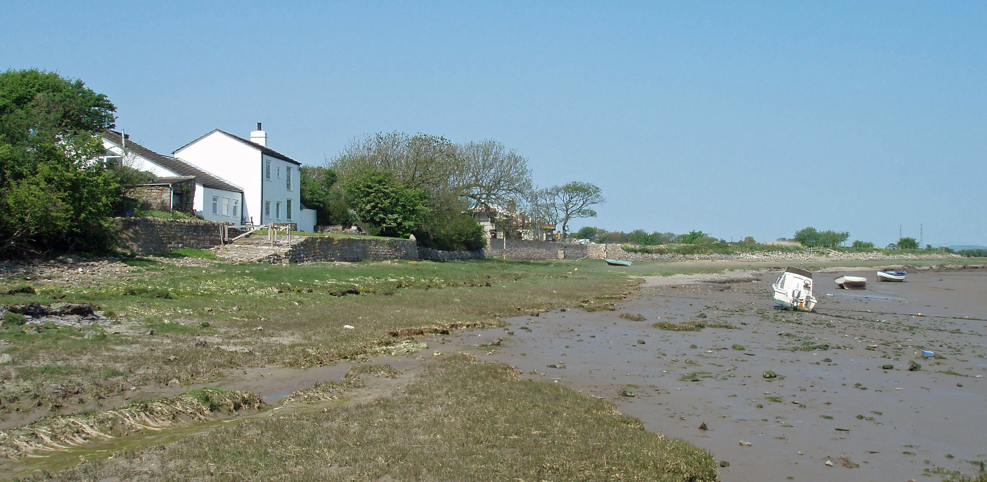
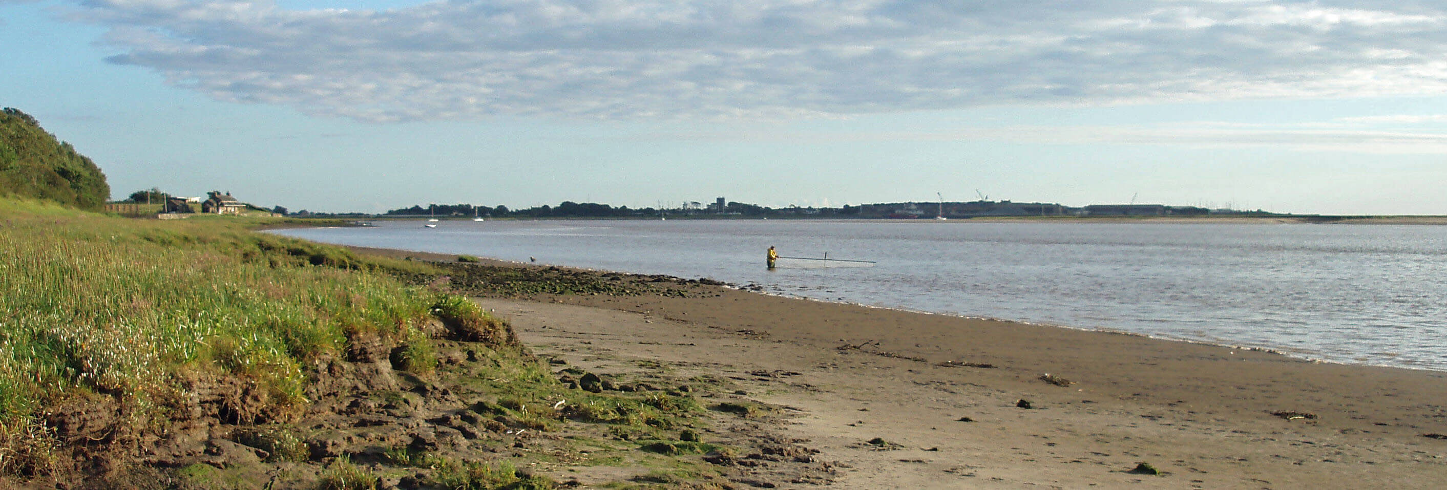
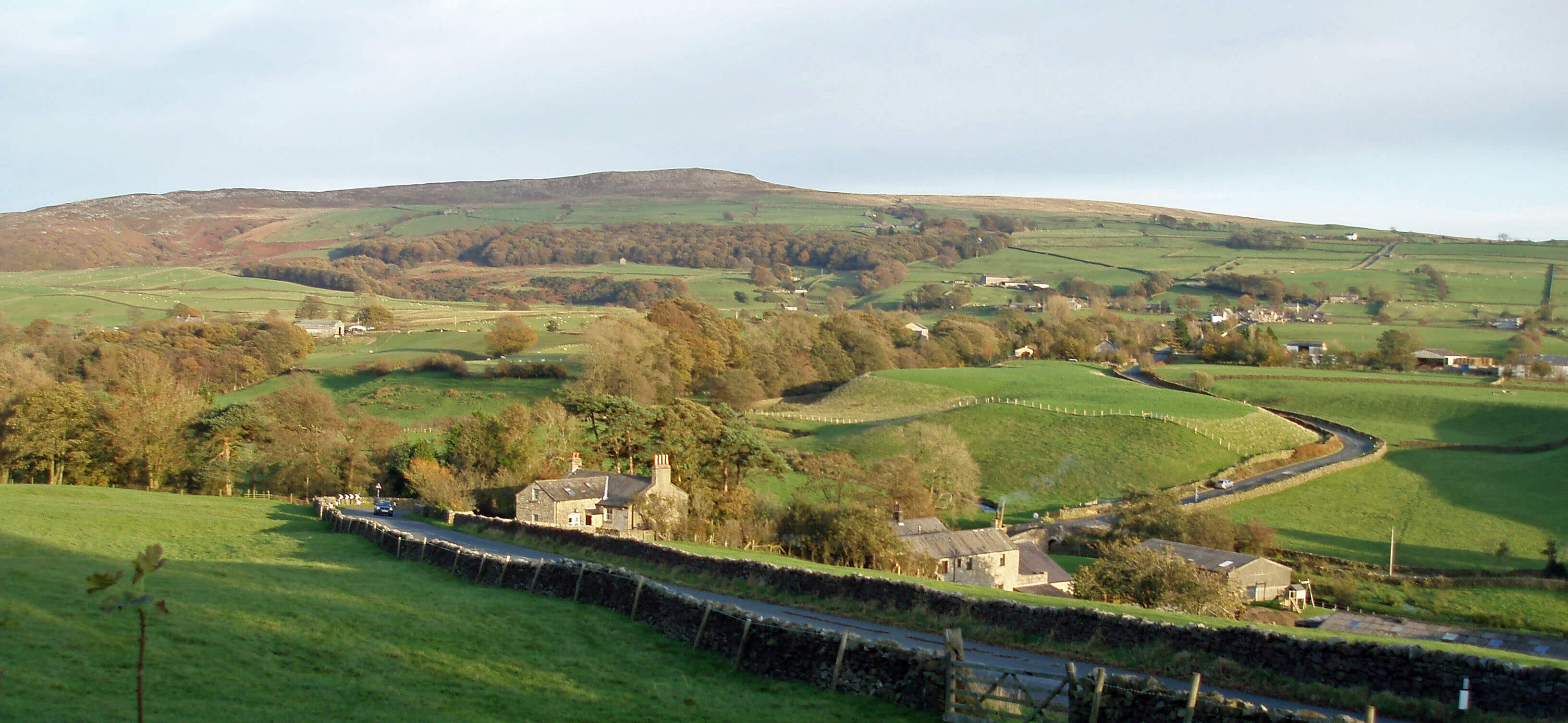
Bazil Point, Overton
The Lune from Lancaster ...
Beyond Carlisle Bridge the Lune swings south
and takes on a different character - in fact, two
characters and all shades in between. If the tide
is out and there is little water flowing down the Lune,
it is a gentle, low river, with sandy, or at least lightly
muddy, beaches, providing long, flat views. If the tide is
in and the Lune is flowing high, then it becomes a wide,
raging river, threatening flood defences.
These conditions give rise to the characteristic
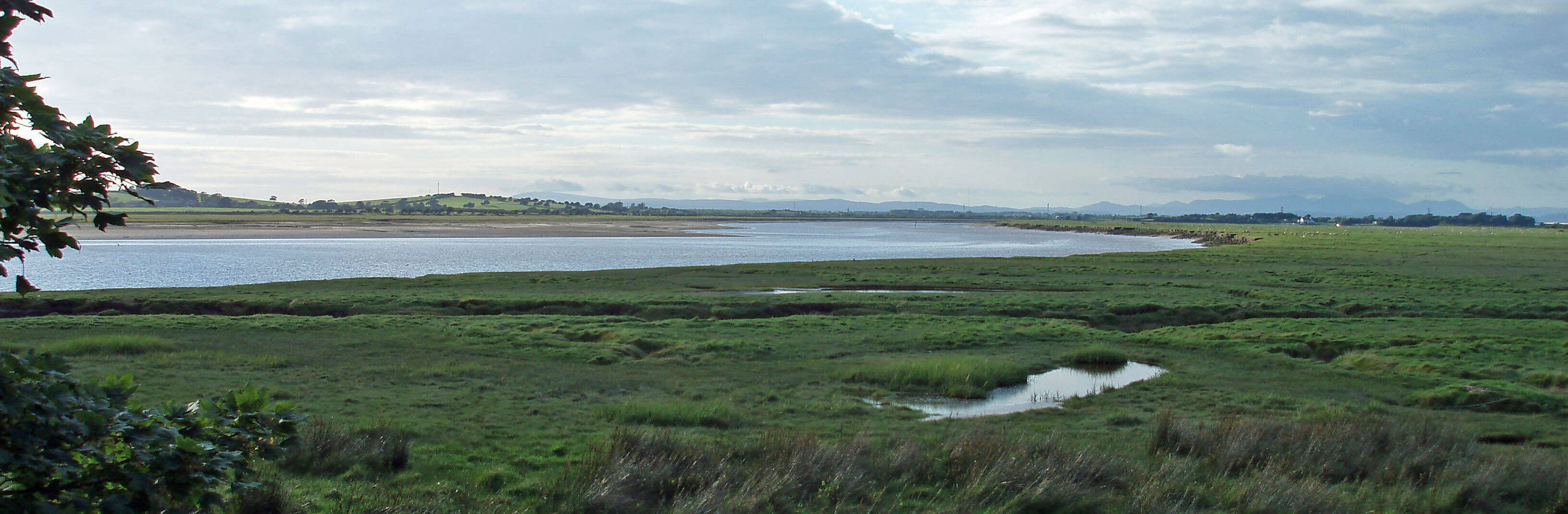
coastal salt marshes of the lower Lune. The marshes
form from marine alluvium deposited in sheltered areas
that are covered only by occasional high tides. Aldcliffe
Marsh, Heaton Marsh, Colloway Marsh, Lades Marsh
and Glasson Marsh continue for 6km, on both banks of
the Lune, down to Morecambe Bay. There’s an esoteric
appeal to these remote, simple, almost primeval,
landscapes, often aglow under the setting sun. The land
is naturally flat and open, heavily fissured with creeks,
and littered with the debris of high tides and floods. If
grazed the marshes are a close-cut, deep green; if not,
they are in summer full of colourful flowers such as
thrift and sea asters.
 Right: The Lune at the Golden Ball
The Lune passes Salt Ayre, which, like Green Ayre
upriver, used to be an island (the parish boundary, which
presumably follows the old course of the river, runs
through Salt Ayre). It is now a sizable hill, of which
the good citizens of Lancaster and Morecambe may be
proud – it is created from their rubbish. Beyond Salt
Ayre is the Golden Ball pub, facing the detritus left by
tidal waters. It is known as ‘Snatchems’ because of the
legend that passing ships short of crewmembers would
grab inebriated drinkers from the pub, a tradition that
has sadly lapsed. A similar custom would be welcome
for the modern pest, the jet-skiers who are increasingly
ruining the calm of the Lune estuary, now that they are
no longer allowed on Windermere.
 Left: Aldcliffe Marsh, looking towards the Lakeland hills
The salt marshes require peace – not for us,
because the winding creeks and glutinous mud make
this dangerous territory, but for the thousands of birds
that gather here. There are no buildings on the marshes
and the isolation and, ideally, tranquillity make this fine
feeding and roosting ground for many wildfowl and
wading birds, such as Bewick’s swans, little egrets,
ringed plovers and spotted redshanks.
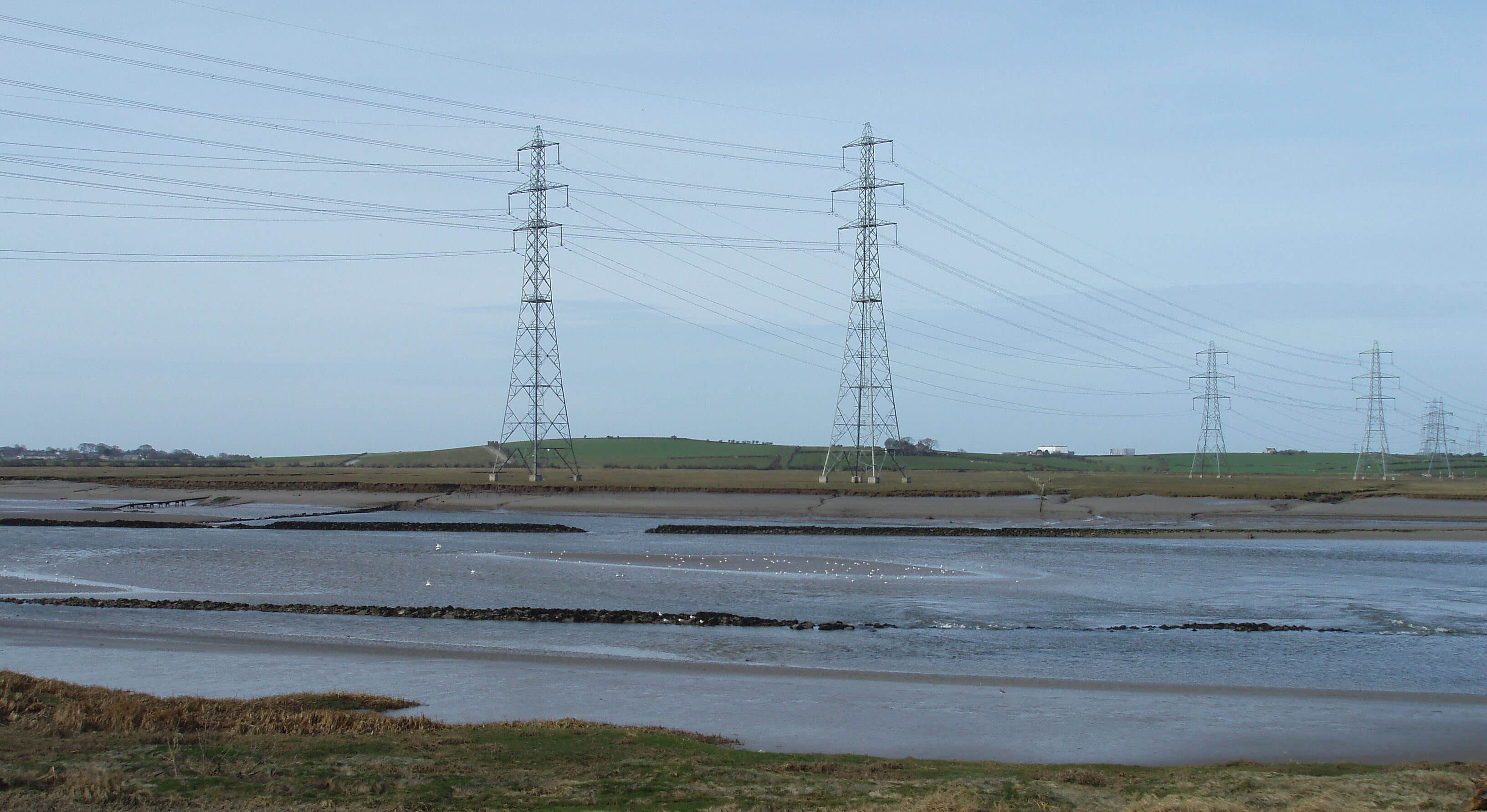 Right: Two lines of pylons from Heysham Power Station
marching over the old breakwaters on the Lune
Right: Two lines of pylons from Heysham Power Station
marching over the old breakwaters on the Lune
Inland of the salt marshes are low coastal drumlins.
They are oval-shaped, aligned north to south, indicating
the direction of glacial flow. The scattered farmsteads
are sited on the gentle slopes above the poorly drained
pastures, with the few trees bent by the prevailing wind.
The whole peninsula south of Morecambe reaches no
higher than Colloway Hill (36m). Inland of the low
Heaton-Colloway ridge is a wide, flat expanse, formerly
of bogs and mosses but now reclaimed pasture, with
many ditches lined with rushes. Seawaters have no doubt
inundated the area in the past. Today, it is traversed by
power lines from the nuclear power station and by the
A683 to Heysham, for people travelling to the many
caravan parks nestling by the power station.
On the east bank, the land rises to the old village of
Aldcliffe, which has managed to remain detached from
Lancaster. It has not, however, managed to retain its old
hall, once known as the Hall of the Catholic Virgins. In
the 17th century Aldcliffe Hall was the property of ten
sisters of Thomas Dalton of Thurnham, who was killed
at Newbury fighting for Charles I. Seven of them were
convicted of recusancy in 1640 and much of their estate
sequestered (this, as mentioned in the previous chapter,
was the period when Catholic priests were being
executed in Lancaster). After the restoration of Charles
II, two of the sisters felt bold enough in 1674 to set up a
stone inscription saying (in Latin) “Catholic virgins are
we; even with time we disdain to change.” They were
too bold, it transpired, for after the Jacobite Rebellion
of 1715 the government enquired into all estates held by
Catholics and duly confiscated Aldcliffe Hall, considering
that it was “given to Popish and superstitious uses”.
The hall, or rather its replacement built in 1817,
was demolished in 1960. The land is now occupied
by peaceful suburbia. It would not, however, still be
peaceful if the 1998 proposal for a western bypass from
the M6 at Hampson Green across the Lune to Heysham
had been approved. The road would have passed within
200m of Aldcliffe. Residents argued that a northern
bypass would be better but, in the end, they were saved
more by the bats and great crested newts, both European
protected species.
Along the Lune the flat horizons are broken only
by the tall pylons from Heysham Power Station. If these
should seem alien to you it might help to recall the words
of Stephen Spender in his 1933 poem ‘The Pylons’, a
poem that heralded a new school of poets, the Pylon
Poets, who used technological imagery as themes. He
wrote “... Pylons, those pillars bare like nude giant girls
that have no secret ...”. Nude girls?! - I think I prefer to
continue to see them as eyesores.
The ridge between the Lune and the A6 continues
south, past the old village of Stodday, where the wooded
gardens of the secluded Lunecliffe Hall (formerly
Stodday Lodge) were said to have Roman remains, to
its highest point at Burrow Heights (59m), below which
Burrow Beck runs to the Lune.
Burrow Beck
 Left: The Jessie Ashton Memorial
We followed the Roman road down the Lune valley,
from the Fairmile Road near Tebay, past Over
Burrow, by the assumed road that ran past the milestone
found at Caton, and on to the fort at Lancaster. Fine
place though it is, Lancaster is unlikely to have been the
Romans’ final destination. Common sense tells us that,
in addition to the high road we met crossing the Bowland
Fells above Lowgill, there would be a road heading
south on the low coastal plains. And remembering Low
Borrowbridge and Over Burrow, the name of Burrow
Beck, flowing around Burrow Heights, will raise our
suspicions.
Sure enough, aerial photographs indicate an old
road to the east of the trig point on Burrow Heights,
leading towards the Roman road known to pass east
of Garstang, heading for Ribchester. More tangibly,
four carved figures and two pillars were found near
Burrow Heights in the late 18th and early 19th century.
The pillars are usually described as milestones although
they are half the height of the Caton milestone and their
inscriptions only honour the emperor, without giving
distances anywhere.
Other finds confirm that a road set off from Lancaster
along the line of what is now Penny Street. Evidence
is still being uncovered. In 2005 a memorial plaque or
headstone, over 1m square, was found north of the canal
by Aldcliffe Road. The inscription is to Insus, son of
Vodullus, and the stone depicts a soldier on horseback
above a kneeling, decapitated man. The Lancaster
Roman Cavalry Tombstone, as it is now called, is on
display in Lancaster City Museum
Burrow Beck runs quietly for 7km from just east
of the Ashton Memorial in Williamson Park through
Bowerham and Scotforth, the southern suburbs of
Lancaster, to Ashton Hall by the Lune. The memorial
and the park were given to Lancaster by, and named
after, the industrialist, James Williamson, later Lord
Ashton. When ennobled in 1895, he named himself
after the manor of Ashton, where he had bought the
hall in 1884. He also gave to Lancaster the Town Hall
and the Victoria Monument, with a mural of Victorian
worthies, including his father. All this, together with
his high-profile roles as Liberal MP, High Sheriff, town
councillor, justice of the peace, and so on, might suggest
that he was no shrinking violet but he was apparently
a very private man. He did not allow any portraits of
himself in the Town Hall: the imposing one that now
stands at the top of the main stairway was added later.
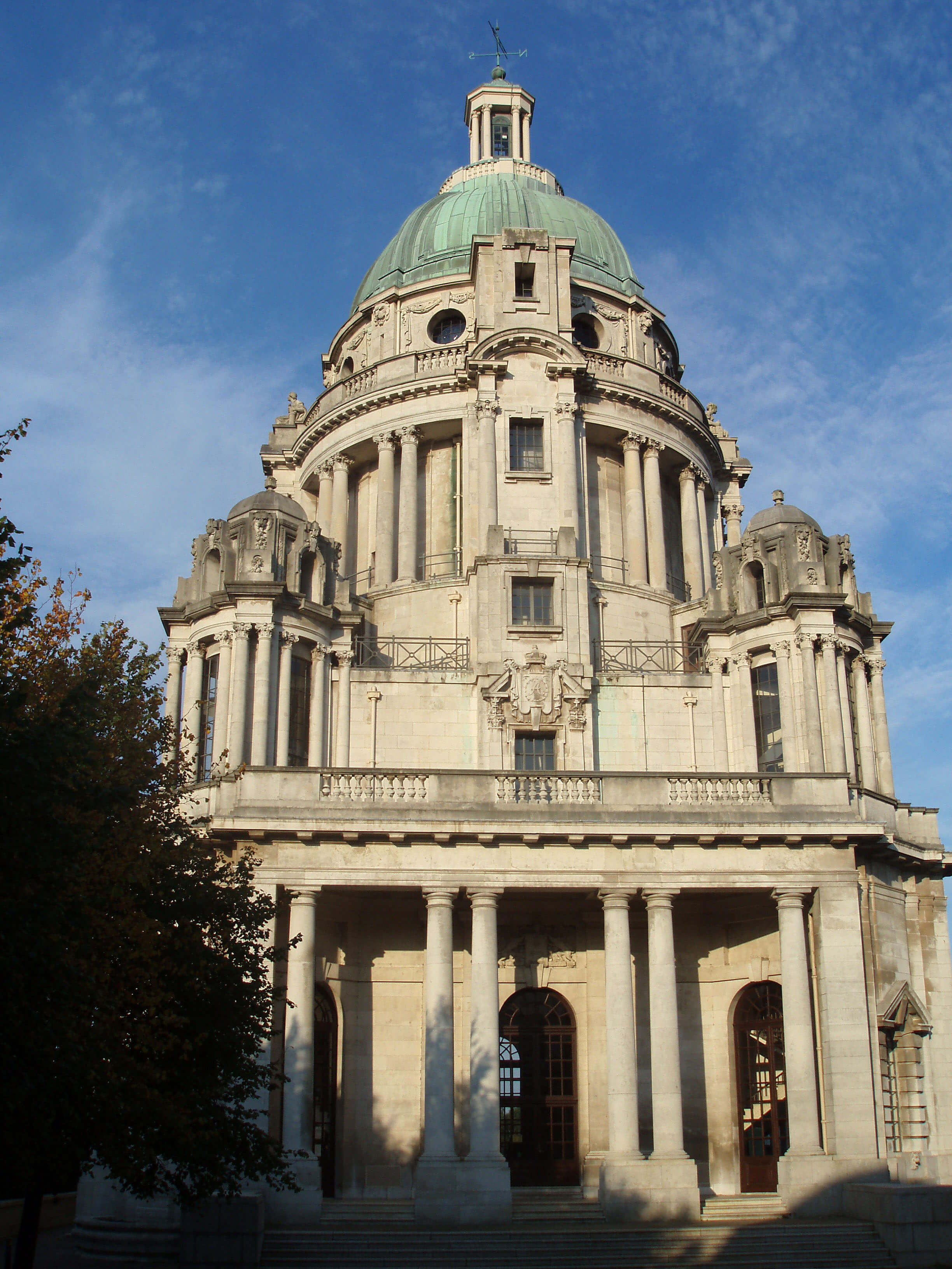
Williamson Park was created in 1881 from the old
Lancaster Moor quarry, stones from which had been used
to build most of Lancaster’s houses. The neo-classical
Ashton Memorial of 1909 is often described as a folly,
which my dictionary defines as “a building of strange
or fanciful shape, that has no particular purpose.” That
seems a slander on the designer (John Belcher) and a
slur to the second wife of Lord Ashton, for whom it
was intended as a memorial. If we called it the Jessie
Ashton Memorial then we wouldn’t mistake it for self-aggrandizement. It is said that the lady with whom
Lord Ashton took up after his wife’s death demurred
at such an ostentatious memorial to her
predecessor in the lord’s affections. The
plaque in the memorial merely says that
it is to the Ashton family.
Today, it is the most prominent
landmark in Lancaster, a proud symbol
to all who pass on the M6. However,
before it was restored in 1987, Lancaster
residents seemed to disown it. According
to the Lancaster City Museum exhibit,
Lord Ashton left Lancaster in high
dudgeon in 1911 to live at Lytham St
Anne’s. Writing to the local paper, he
said that some of his workforce had
become “disloyal and discontented” by
joining trade unions and voting Labour.
In return, the locals were content to let
the memorial (which they called ‘the
structure’) fall into decay, which it did.
Their attitude may have been coloured by
the fact that unlike most other industrial
philanthropists of the time he did not
provide any buildings of direct use to
his workers. He did, however, kindly
provide a footbridge by Carlisle Bridge
so that his Skerton workforce could get
to his factory.
Lord Ashton’s main home was
Ryelands House in Skerton rather
than the grand Ashton Hall. The hall
had been rebuilt in 1856 to retain a
tower probably of the 14th century. The
manor of Ashton was part of the lands
of Roger of Poitou until taken over by
the Lancaster family in 1102. Over the
centuries, the estate passed through the
hands of the Laurences, the Gerards,
the Gilberts, the Hamiltons, and the
Starkies, before reaching the Williamsons. The hall is
now the headquarters of Lancaster Golf Club.
Burrow Beck runs across the golf course, through
an ancient fishpond, into a lake, and under the old
Lancaster-Glasson railway line, completed in 1883,
before dribbling into the Lune. Lord Ashton had a
private railway station (Waterloo) at which trains could
be flagged down.
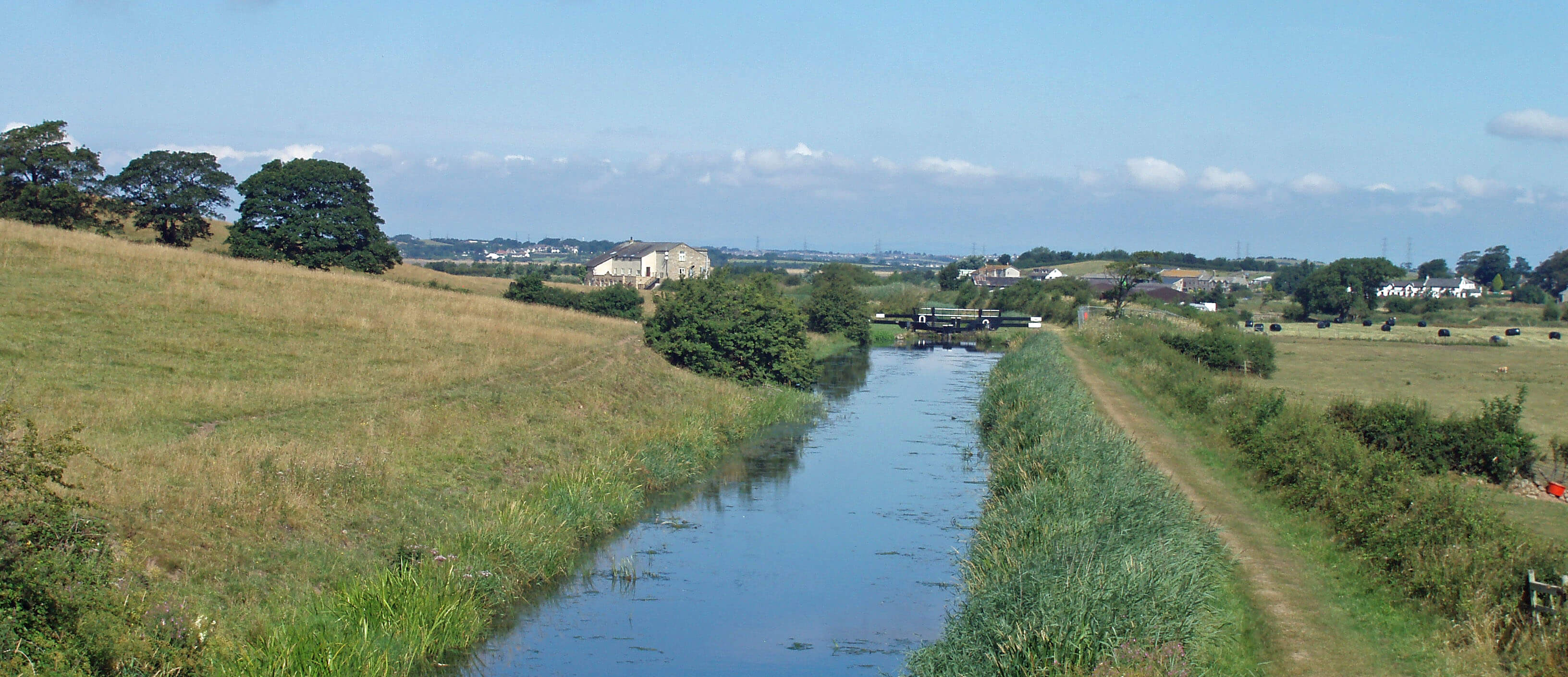
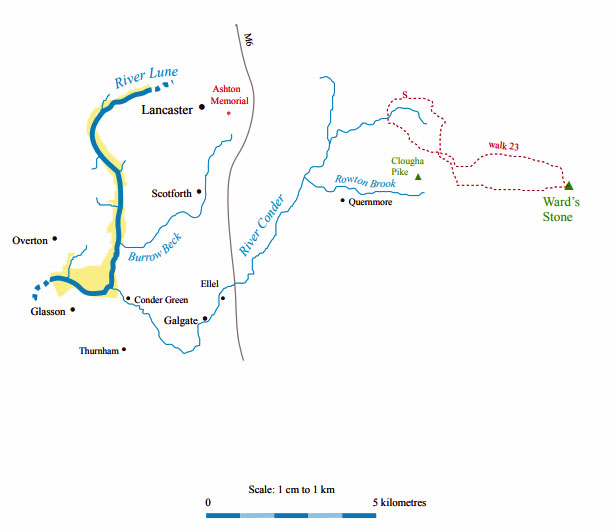
A further kilometre south the River Conder crosses
salt marsh into the Lune.
The Lune after Burrow Beck joins, with a fisherman trying a variant of the traditional method of haaf netting
The River Conder
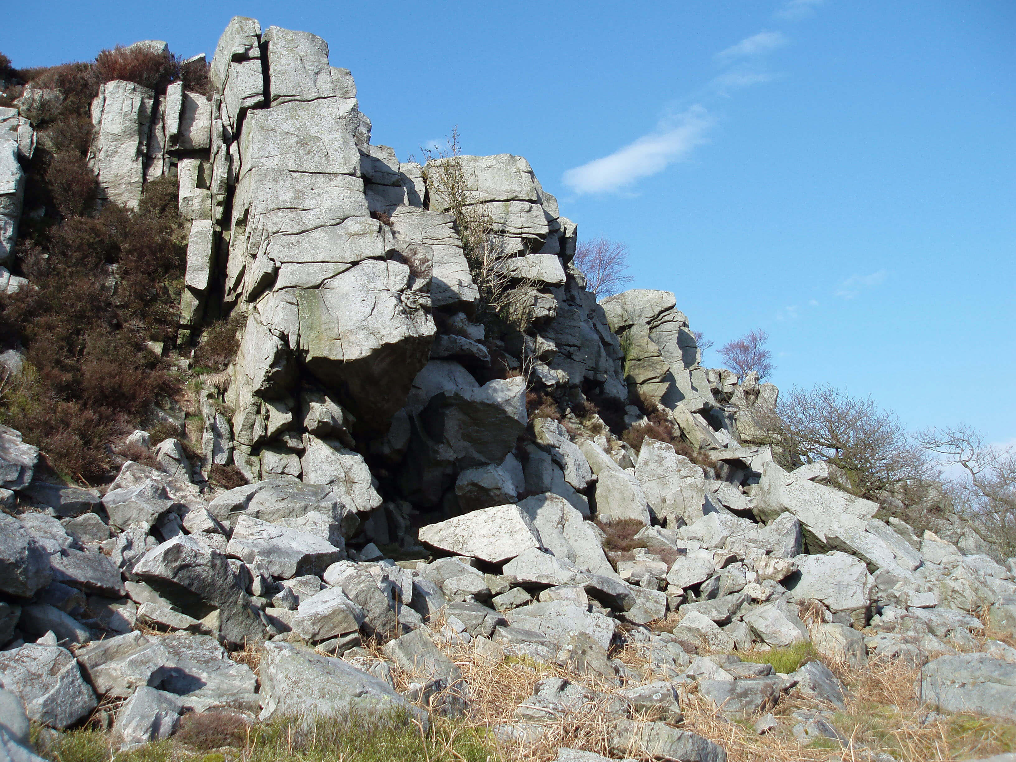 Left: Baines Cragg
Right: Across Cragg Wood from Baines Cragg
The River Conder arises at the Conder Head spring to
the north of Clougha and flows west through Cragg
Wood to the parish of Quernmore. The parish stretches
10km from Halton to Ellel and has long been settled.
Two Roman kilns have been found, one below Lythe
Brow Wood and the other near the village of Quernmore.
In medieval times, Quernmore was a hunting forest, at
one time in the charge of the Gernets of Halton and later
passing into the hands of the Duchy of Lancaster. It
was sold by the crown in 1630. The present Quernmore
Park Hall was built in 1794 by Thomas Harrison for the
Gibson family.
On Birk Bank there is a large three-arched bridge
over Ottergear Clough and two sturdy towers. The
function of these structures is unclear although they
presumably have something to do with the Thirlmere
Aqueduct. Below these slopes a few areas of reed bed,
a rare habitat for Loyne, are being restored, perhaps to
enable bearded tit and marsh harrier to breed.
The Conder merges with Mother Dyke, from near
Quernmore Park Hall, and passes the isolated St Peter’s
Church, built in 1834.
At Conder Mill, below the now
ornamental pond, it is joined by Rowton Brook, which
arises, properly enough, on Rowton Brook Fell on the
south flank of Clougha Pike (413m). Clougha Pike is not
really a peak, although it looks so from the southwest,
but is merely the end of the westerly ridge from Ward’s
Stone. Its position offers an extensive panorama
that includes, circling from the east: Ward’s Stone,
Hawthornthwaite Fell, Snowdon (on a very clear day),
Blackpool Tower, Morecambe Bay, the Isle of Man (on
a clear day), the Lakeland fells, the Howgills, Whernside
and Ingleborough. At closer quarters is a view of the
Lune valley, from its estuary up to the Lune Gorge in
the Howgills.
In 1851 it was proposed to use the waters of Rowton
Brook for a reservoir to supply water to Lancaster.
However, the city architect Edmund Sharpe asked, “why
… are we to drink the miserable storage of a dribbling
brook, four miles off, when we have at our very feet the
magnificent storage of the river Lune, through which a
whole river runs daily to change and purify it?” In the
end, it was decided, rather cheekily, to use the nearby
Grizedale Brook, which drains to the Wyre, for the
reservoir. The Lune was used much later.
To the north of Rowton Brook the jumbles of
millstone grit provide evidence of the quarrying of
querns that gave the region its name. In the fields you
may well see sheepdogs at work and, if not, you will
certainly hear them within Rooten Brook Farm, where
a dozen dogs are housed. These are no ordinary dogs
– they are the dogs of the champion sheepdog trialling
family, the Longtons. Tim Longton senior won the
English National in 1949 and his son, Tim junior, won
it five times from 1965. So renowned was the latter that
the first programme of the BBC’s One Man and his Dog,
explaining the nature of sheepdog trialling, was filmed
at Rooten Brook Farm. The fourth generation Longton,
Michael, won the English National in 2004 at the young
age of 24.
The Top 10 viewpoints in Loyne
1. Clougha Pike
2. Great Knoutberry Hill
3. Wild Boar Fell
4. Orton Scar
5. Ingleborough
6. Combe Top, Middleton Fell
7. Caton Moor
8. Hornby Road, Roeburndale
9. Whinfell Beacon
10. Brownthwaite Pike
Walk 23: Ward’s Stone
Map: OL41 (please read the general note about the walks in the
Introduction).
Starting point: Near Little Cragg (546618).
There are three conditions for this walk: no closure of the access area for grouse shooting (this is allowed for up to 28 days
a year: ring 0845 100 3298 if you want to check), no dogs and (preferably) good visibility. With few features marked on the map,
I’ll give the OS grid reference for strategic points.
From Little Cragg Ward’s Stone can be seen 5.5km southeast on the horizon but a direct route would involve much scrambling
over heather and rocks. So set off in the opposite direction, west down the road, past Baines Cragg. After Bark Barn, climb a stile
on your left, walk south across the infant Conder on a permissive footpath and enter CRoW land (at 537613). Keep on the track.
After cairns on the right (at 541605), the track swings left and becomes less steep. With three cubic structures visible ahead, note
a small post just after a large rocky outcrop on the left (at 552596).
[Update: The small post has disappeared - but the large rocky outcrop is
still there!]
At a junction of tracks (at 560597), follow the sign pointing right. At the next side-track, not marked on OS maps (at about
562592), turn left, ignoring the sign pointing ahead. Initially the track heads direct to Ward’s Stone but it then curves left and then
right. As you approach the shooters’ hut (at about 585588), note Ward’s Stone to its right and imagine your route. Scramble up
behind the hut, aiming for a cone-shaped stone on the horizon, and proceed to Ward’s Stone.
[Update: The 'next side-track' referred to is marked
on recent OS maps.]
At Ward’s Stone the panorama is revealed, with the Three Peaks, the Lakeland fells, the Lune estuary, and your starting
(and finishing) point. Ward’s Stone (560m) is sadistic: after battling to the stone, you find that the official top, just 1m higher (the
highest point of the Bowland Fells), is at a second trig point, visible 1km away. Climb the stone to get 1m above the first trig
point and settle for that.
Head west on the ridge path and after 2km (at 565588) turn right at the track you meet. After a few minutes, ignore the track
off to the right – you went that way earlier. Ignore the second track to the right, as you did earlier. The cubes, with enigmatic
plinths, come into view to the left. Pass below the cubes and reach the rocky outcrop with the little post. (If you miss the post,
just continue back the way you came.) Turn right here (at 552596) on a path that heads towards the Caton Moor wind turbines.
Small posts mark the way but they are difficult to see. Some kind souls are creating cairns.
The path continues towards the wind turbines and then curves left. A wall is seen 50m to your right (at 551608): the Conder
Head spring is just to the left. Keep the wall to your right until a stile is seen ahead. Climb the stile, turn right by Sweet Beck and
walk past Skelbow Barn to Little Cragg.
Short walk variation: The obvious short walk is to follow the long walk as far as the small post (at 552596) and then turn left and
follow the last part of the long walk. A shorter walk is possible along a path that runs east south of Cragg Wood to cross the beck
from the Conder Head spring and on to Sweet Beck.
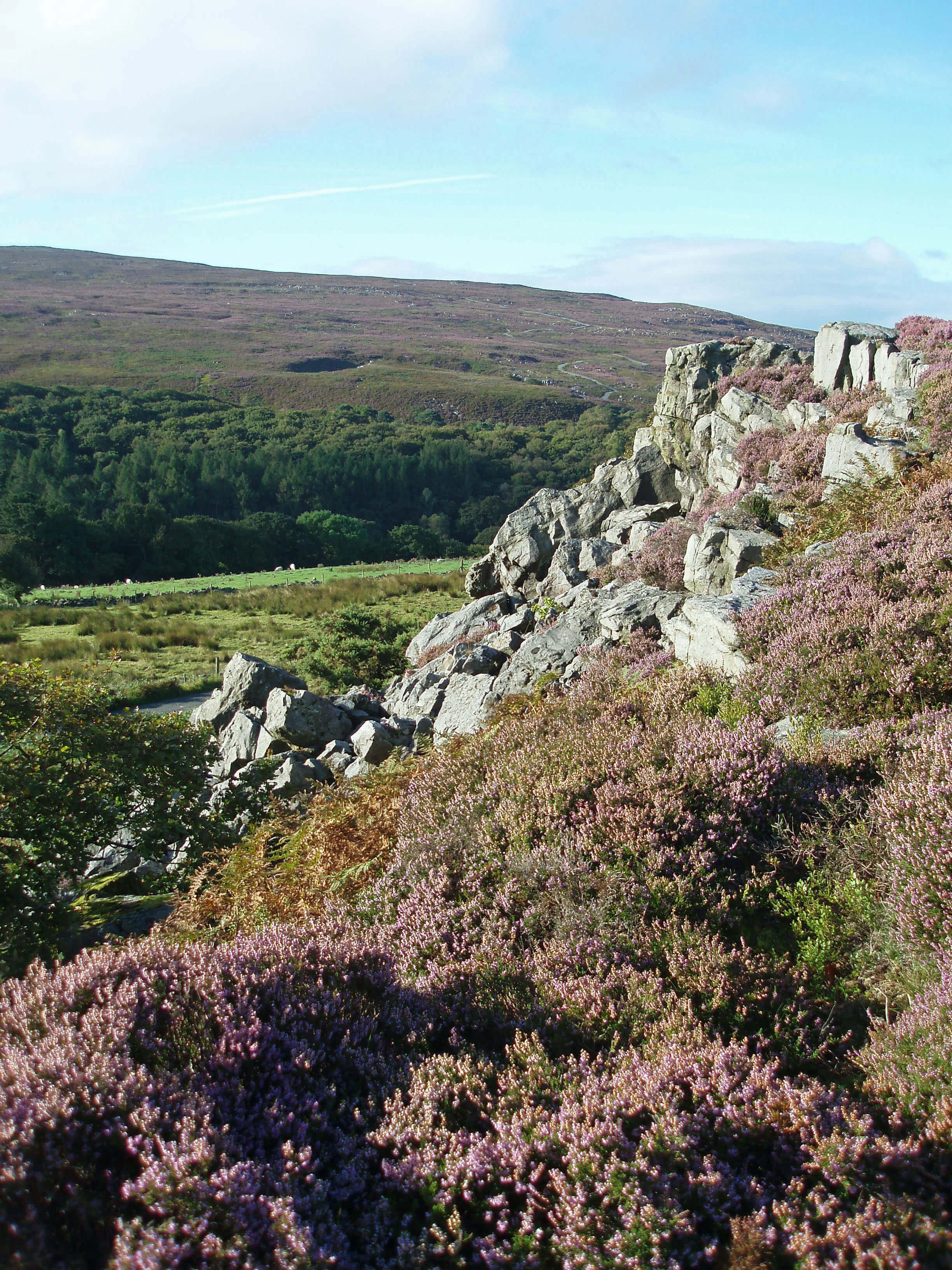
 Right: Across Quernmore to Clougha
The village of Quernmore has only a converted
barn or two, a row of new dwellings by Rowton Brook
and a residence called Temperance House, dated 1826.
The temperance movement was at that time becoming
more powerful. Lancaster’s Temperance Society was
formed in 1833 and at one time Lancaster had twelve
temperance hotels.
As you follow Rowton Brook
west, you may be increasingly
overcome by the nauseous stench
from the mushroom farms near
Nether Lodge. In 2002 thirty-three
illegal immigrants were found
working here and deported. The
mushroom farms are an anomalous
presence in the Quernmore valley,
for it is a rich agricultural area that
seems wasted on mushroom sheds.
Conder Mill Bridge is only
wide enough for a stream 2m across.
Something seems awry here. The
Langthwaite ridge to the west rises
100m above the Conder and is 4km
from Clougha Pike. The valley seems far too broad and
deep for such a trickle. And indeed it is, for before the
Ice Age the Lune ran through this valley, until glacial
deposits blocked its path.
The engineers’ attempt to defy this process of
nature by laying a pipe through the Quernmore valley
to take water from the Lune to the Wyre was sadly
rebuffed by nature itself, when an explosion at the valve
house in Abbeystead in 1984 killed sixteen people.
The investigation found that the explosion was caused
by the ignition of methane but that “the likelihood of
a flammable atmosphere arising there had not been
envisaged” – which seems an oversight given the history
of coal mining in the area.
The Langthwaite ridge from Knots Wood to
Hazelrigg is formed from millstone grit overlain by
boulder clay and supports mixed farming and woodland.
It separates the coastal drumlin fields of Lancaster and
its surroundings from the glacial sands and clay drift
of Quernmore. As might be expected, communication
masts are prominent.
The River Conder runs through the fishery and
golf course of Forrest Hills, set up in 1996 and another
example of rural diversification, this time of the farm
of Banton House. It is now also a resource centre with
green credentials, part of the Bowland Sustainable
Tourism network, which (simplifying) is concerned with
attracting visitors to an area without spoiling it.
Below Forrest Hills the Conder crosses the Kit
Brow stepping stones, where, as for all Loyne’s becks,
the ‘trickle’ is not always so. Lancaster University holds
an annual race over the stepping stones, which one year
were far under water, and I became so as well when I
was washed away from the safety rope provided.
The Conder passes the small village of Ellel and
the larger one of Galgate. Galgate has the misfortune to
be bisected twice, by the A6 and the west coast main
line railway. Perhaps that serves it right, for having a
name proclaiming it to be the gate or road to Galloway.
The only building of note is the old mill, which is said
to be the first mechanical silk mill in England. It was
bought as a corn mill in 1792, converted to spin silk, and
operated until 1970. It now houses “the country’s largest
bathroom emporium” and various smaller units.
 Left: Glasson Canal
The marina on the Lancaster Canal is relatively
peaceful although the public moorings are busy on
summer weekends. Just south of here the canal begins
a branch to Glasson, completed in 1826 with six locks.
In the dry summer of 2006, the branch was closed
for periods because the water levels were too low –
which raises a question: where does canal water come
from? Lancaster Canal itself is supplied by Killington
Reservoir but for the Glasson branch most of its water is
taken from the River Conder, small as it is and as a result
even smaller than it should be.
The Conder runs slowly west, north of the canal,
passing Thurnham Mill, now the Mill Inn. The mill
operated using water from the canal, which is possible
only through being next to a lock. To the south is
Thurnham Hall, with an interesting history.
The usual pattern with the grand halls of Loyne is
that for centuries they provided a home for the family
at the apex of the local rural hierarchy; in the 18th or
19th century they may have been bought by a newly-rich industrialist; either way, the residents continued to
lead the gentrified country life until the middle of the
20th century when societal changes meant that the halls
had to be converted to some other use, such as offices,
a school or flats. Thurnham Hall followed this pattern,
with unhappy consequences.
Thurnham Hall was the manorial home from the
12th century and was bought by Robert Dalton in 1556.
The Daltons continued to buy land around Lancaster,
to become the largest landowner in the region. Dalton
Square and nearby streets in Lancaster are named after
members of the Dalton family. The Daltons were staunch
Catholics, as we saw with Aldcliffe Hall, and funded the
nearby Church of St Thomas and St Elizabeth, built in
1745. After the Daltons left in the mid 20th century, the
hall lapsed until it was restored in 1973, to be a classy
restaurant for a while.
It was then bought to form the centrepiece of a
timeshare operation, Thurnham Leisure Group, with
headquarters in Lancaster. Holiday courtyards and a
swimming pool were built around the hall. However,
amid rising complaints from customers, the Group
crashed in 2004 leaving a Ł5m debt. The managing
director, Fred Fogg, was given a two-year prison
sentence for conspiring to defraud finance companies.
Sunterra Europe, with a head office in Lancaster but part
of the US-based Sunterra company, acquired the hall
and other property, plus the irate customers, for Ł2m.
Sunterra Europe was put up for sale in 2006 and bought
by Diamond Resorts International for Ł350m. However,
the Diamond Resorts office on Caton Road seems
somewhat inactive (or empty: it is hard to tell without
peering through the darkened windows). Today it is an
unnerving experience to walk on the public footpath
amongst the possibly disgruntled holidaymakers of
Thurnham Hall Country Club. Perhaps the renowned
ghosts of Thurnham Hall are restless.
For its last kilometre the Conder is tidal, with the
nearby roads occasionally under water, especially the
one to Glasson, which was badly flooded in 2002. In the
tranquil meanders derelict craft fall and rise but seem
never to be resurrected. Above the flood level is the
Stork, a 17th century inn that has retained something of
its old character. By the viaduct for the old Lancaster-Glasson railway line is the Conder Green picnic site,
which is on the route of the 220km Lancashire Coastal
Way. The Conder Green salt marshes are not grazed and
as a result have a great variety of plants, including the
rare lax-flowered sea-lavender.
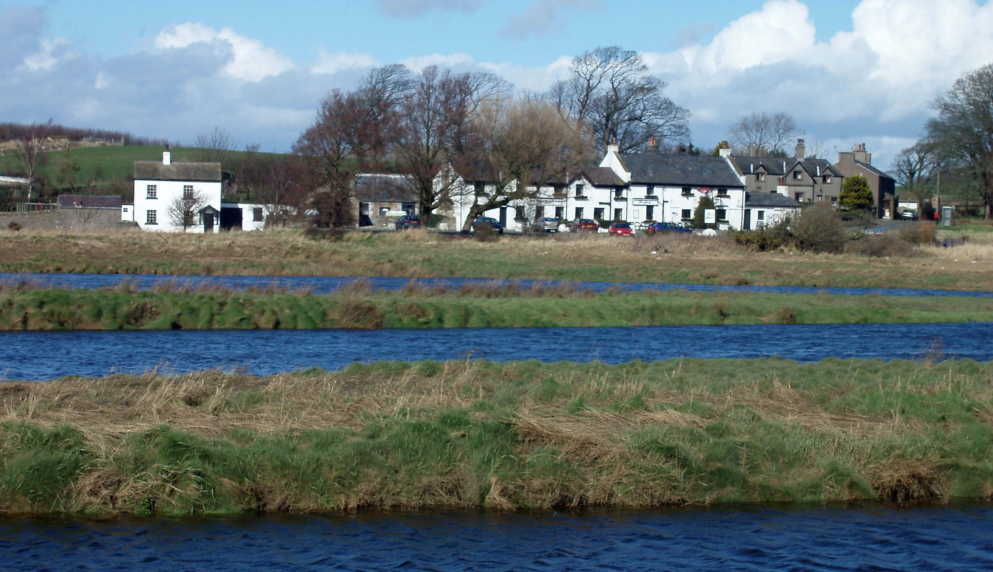
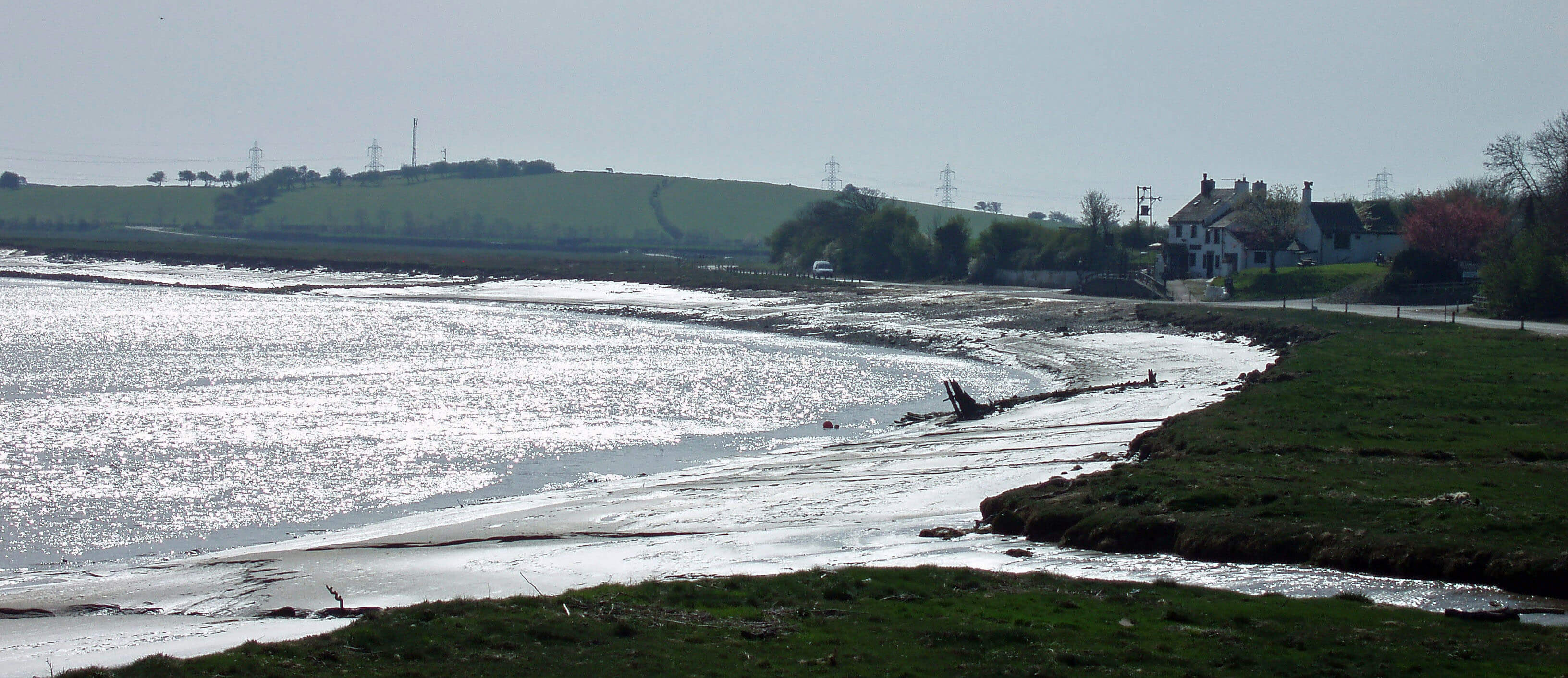
The Conder (three times) at the Stork, Conder Green
The Lune from the Conder ...
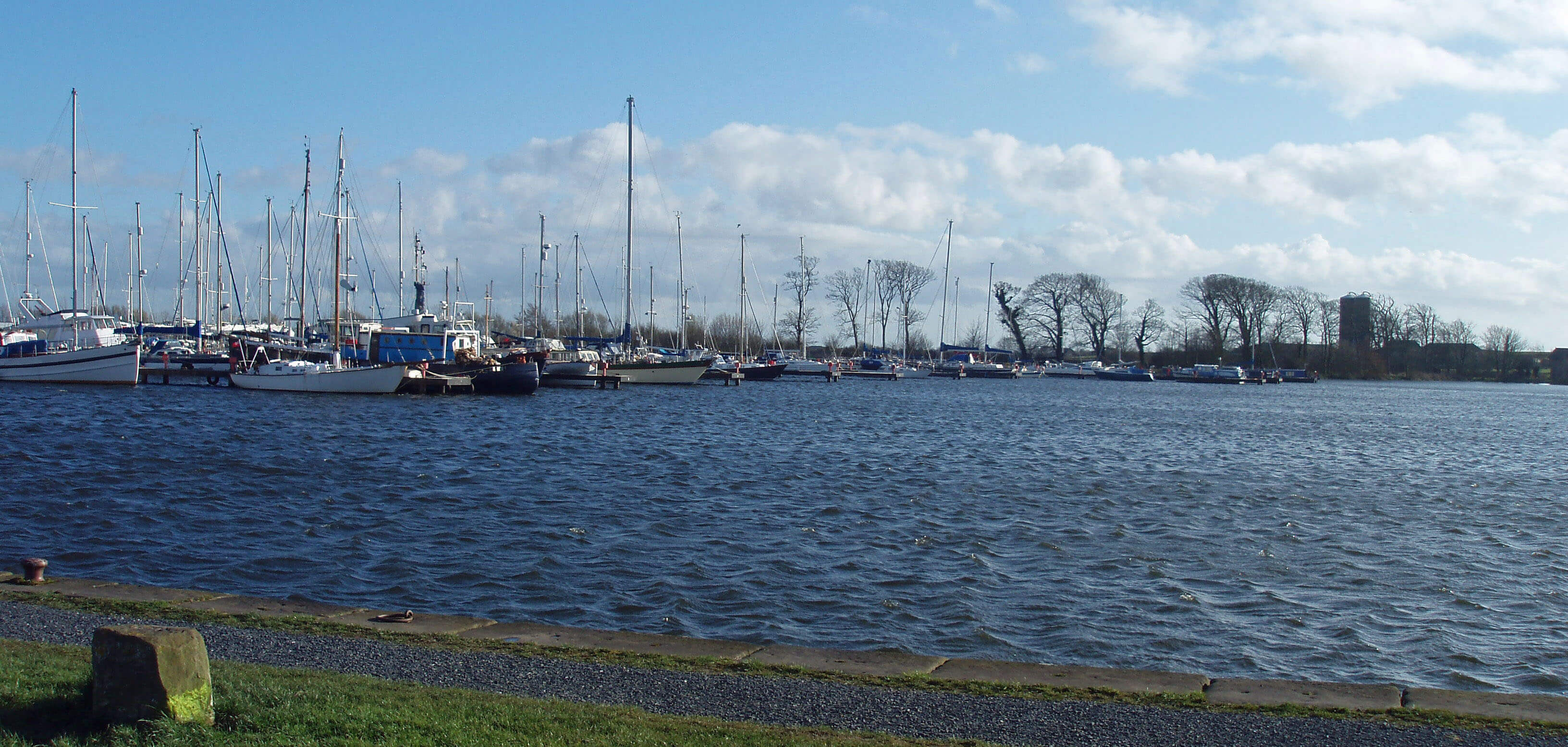 Left: Glasson marina
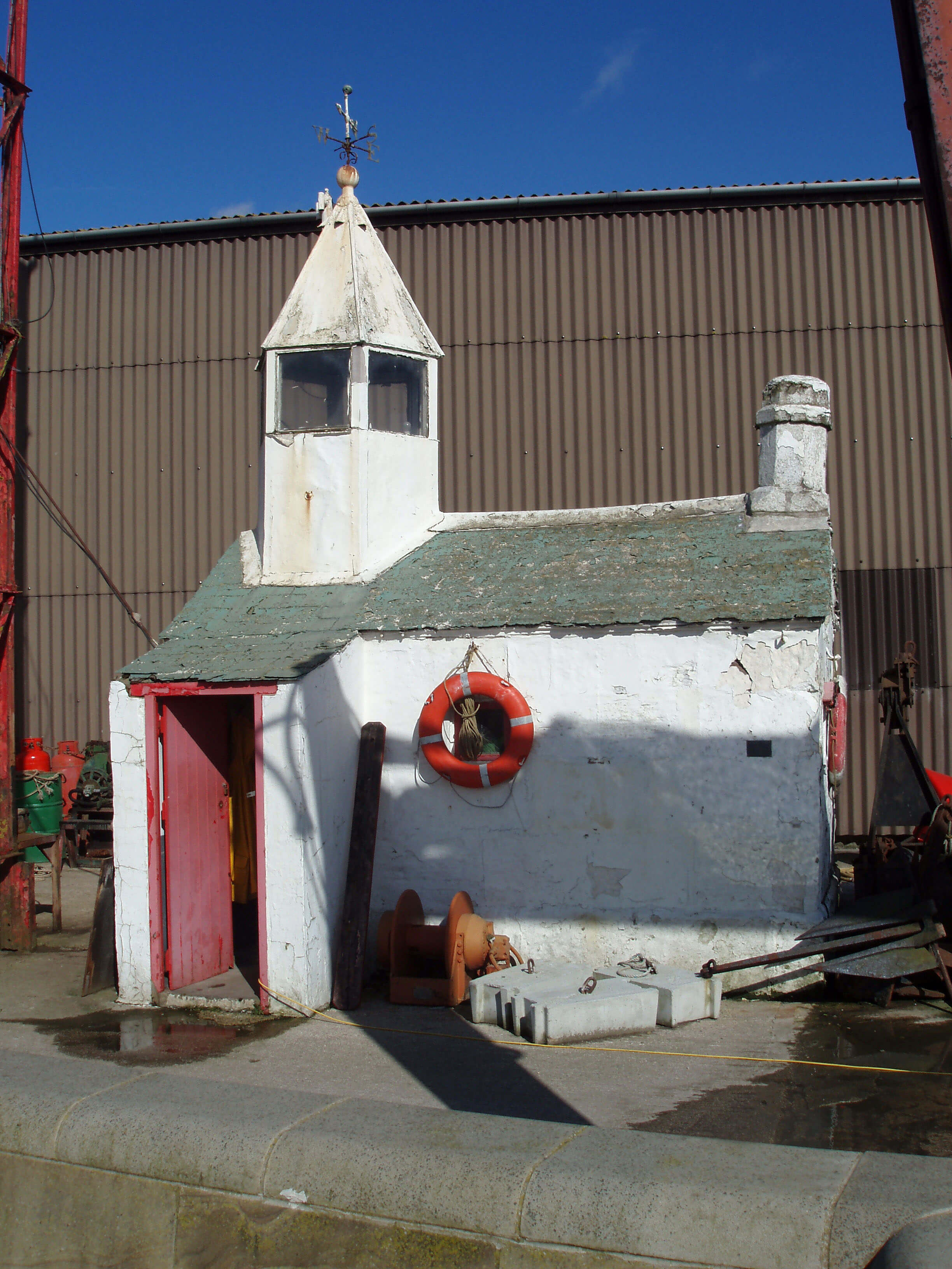
Right: Glasson Watch House
East of the Conder the Lune passes Glasson, which
is part port, part resort, but not much of either. On a
fine day, with a sea breeze gently fluttering the mastheads
in the marina, it makes a pleasant outing, although there
is not much to do or to see, apart from leisurely activity
about the boats. There is no beach or seaside promenade,
and only a few old-style catering establishments, with
two pubs.
A large barrier separates the Lune, and hence the
sea, from a dock that was completed in 1787 after the
Lancaster Port Commission resolved to build it for ships
unable to navigate the Lune to reach the new St George’s
Quay. Before then, the area was a marsh, with the farms
of Brows, Crook and Old Glasson to the south.
The dock did not flourish for long, against
competition from better docks at Preston and Fleetwood,
although the Glasson Group of companies is still an active
importer, especially of animal feedstuffs. Still standing
are the Custom House (which functioned from 1835 to
1924) and the Watch House (built 1836), which with
typical Loyne immodesty is claimed to be the smallest
lighthouse in England. A nearby dry dock for ship repair
functioned from 1841 to 1968, when it was filled in to
become an area for light industry. The Port of Lancaster
Smoke House, winner of the 2007 North West Fine Food
Producer of the Year award, is on the West Quay.
A further barrier separates the dock from the large
marina on the Glasson branch of the Lancaster Canal.
Commercial traffic ended long ago but canal-based
tourism is now Glasson’s main occupation. This it
supplements with other unassuming activities: an annual
folk-music festival; the racing of radio-controlled laser
boats in the marina; a weekend gathering point for
bikers.
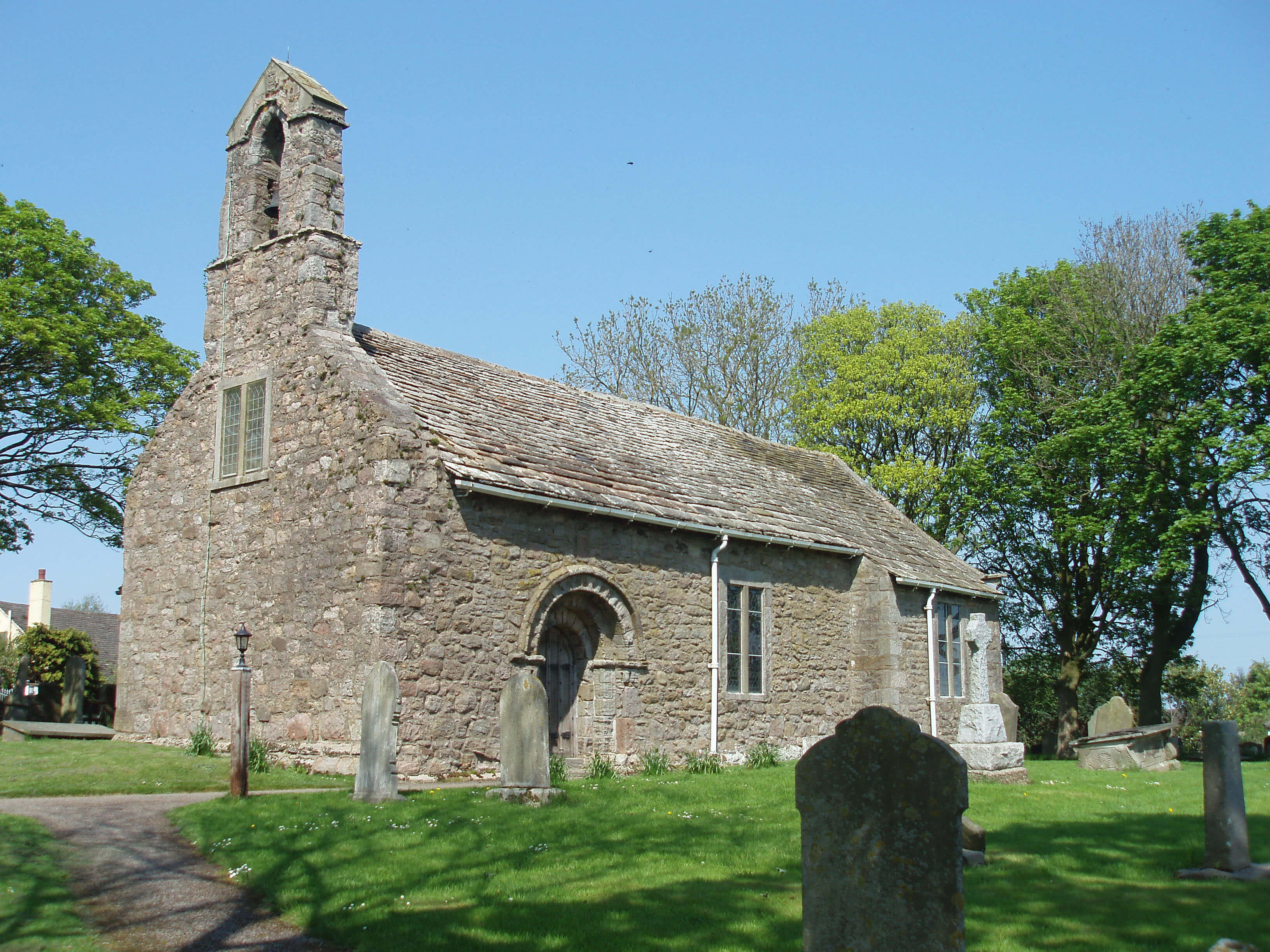 Left: St Helen’s Church, Overton
The railway, arriving late (1883) and departing early
(1930 for passengers, 1964 for freight), left little trace in
Glasson, apart from Railway Place, a group of cottages
that pre-date the railway. The line of the track now forms
part of the Lancashire Coastal Way, which continues over
the barrier separating dock and marina, through Glasson,
and up Tithe Barn Hill, which at a magnificent height of
20m provides a fine view, often with excellent sunsets,
across the estuary to Overton and Sunderland, with the
Lakeland hills beyond. There’s a 360ş view-indicator
and five benches, all facing Heysham power station.
Overton, across the Lune, is an ancient village,
appearing as Oureton in the Domesday Book. Modern
building for commuters surrounds the old core of the
village, leaving few signs of the traditional activities of
shipbuilding and fishing. Even so, the aroma of the fields
and the sea remains. Farms are still active in and around
the village, and twice a day the tide laps on its shores.
A walk around Bazil Point, from where there used to
be a ferry to Glasson, involves stepping through tidal
debris but provides open views across the marshes and
the Lune estuary.
The most notable feature of Overton is St Helen’s
Church, which is said to be the oldest church in
Lancashire. The church itself is more reticent, claiming
only, on a notice board inside, that the west wall is
“11th century or earlier” and that other parts, such as
the doorway arches, are “of about 1140”. Whatever its
age, it must have been one of the most isolated of early
churches. In outward appearance, the church is rather
colourless, with uninspired windows. Inside, however,
the small church is transformed, with the windows now
enlivened. The arrangement is novel, with a gallery to
the west, the pulpit by the south wall, and
the 1830 extension on the north side having
no view of the altar to the east.
South of Overton, the tidal Lades
Marsh used to be the outlet for the low-lying
expanse between Heysham and the Heaton-Colloway ridge. Once known as Little
Fylde, it was, like big Fylde, a waterlogged
wasteland. A remnant can be seen at
Heysham Moss, a reserve managed by the
Wildlife Trust. The reserve is home to many
breeding and wintering birds. The centre
of Heysham Moss is relatively pristine,
with characteristic bog plants (such as bog
myrtle and round-leaved sundew), mosses
and liverworts, plus indigenous electricity
pylons.
Today, the whole area outside
Heysham Moss is a mosaic of green fields
lined with ditches and gutters that, after
intensively staring at, I conclude no longer
flow anywhere, let alone to Lades Marsh.
Therefore, according to my self-imposed rule in the Introduction
(“if rain falling on an area makes its way to the Lune
estuary then the area is within my scope”), I should
ignore the old Little Fylde. But if enough rain fell, then I
suspect the flood would flow to Lades Marsh.
The Top 10 churches in Loyne
(for the non-religious)
1. St Helen’s, Overton
2. St John the Baptist, Tunstall
3. St Mary’s, Lancaster Priory
4. St Mary the Virgin, Kirkby Lonsdale
5. St Andrew’s, Sedbergh
6. St Wilfrid’s, Halton
7. St Margaret’s, Hornby
8. St Wilfrid’s, Melling
9. St Mary’s, Ingleton
10. St Andrew’s, Dent
The Introduction
The Previous Chapter (The Lune to Lancaster)
The Next Chapter (Into Morecambe Bay)
© John Self