The Land of the Lune
Chapter 13: The Lune to Lancaster
The Introduction
The Previous Chapter (The Lune Floodplain and the Top of Bowland)
The Next Chapter (The Salt Marshes)
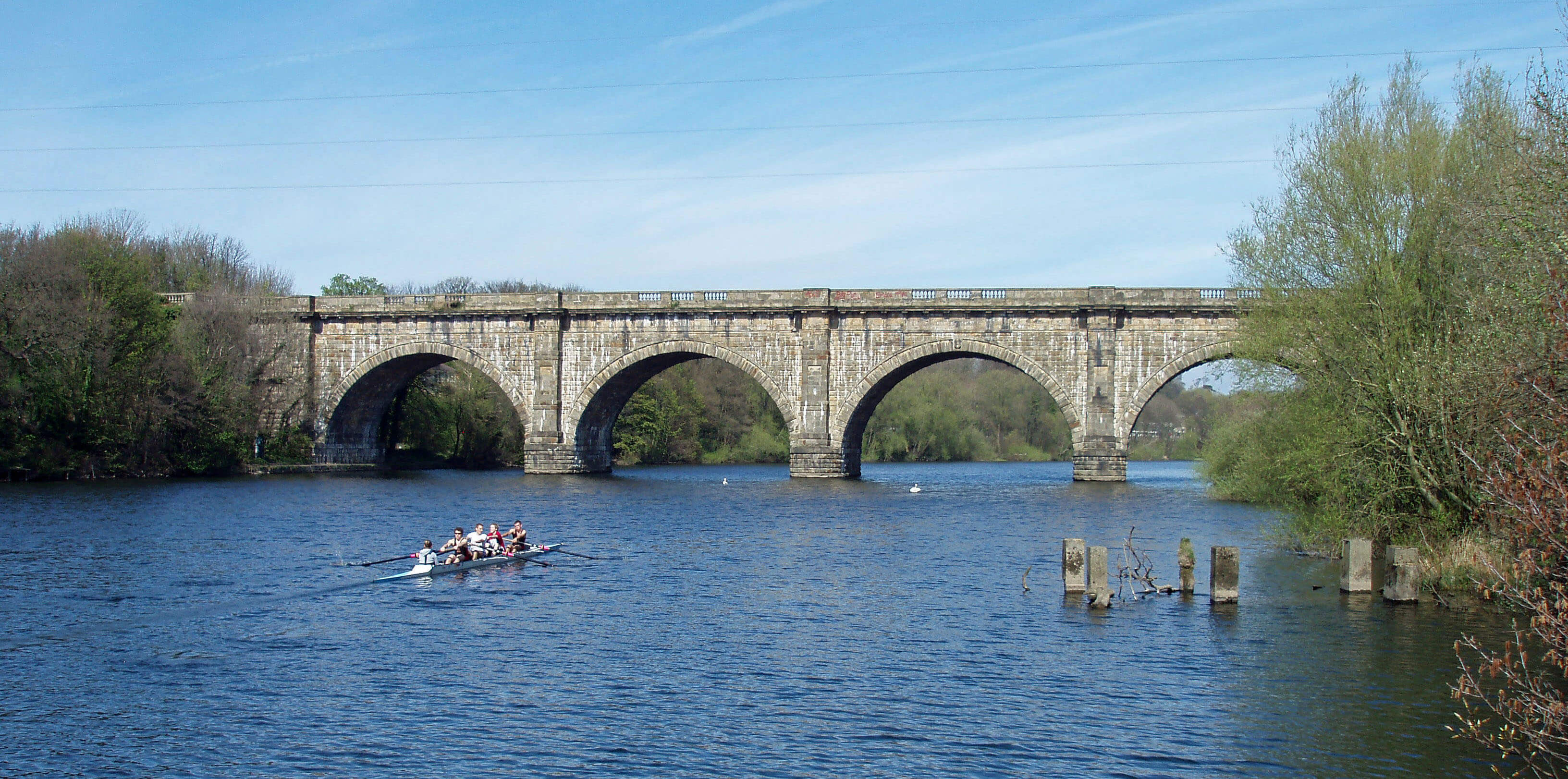
The Lune Aqueduct
The Lune from Artle Beck ...
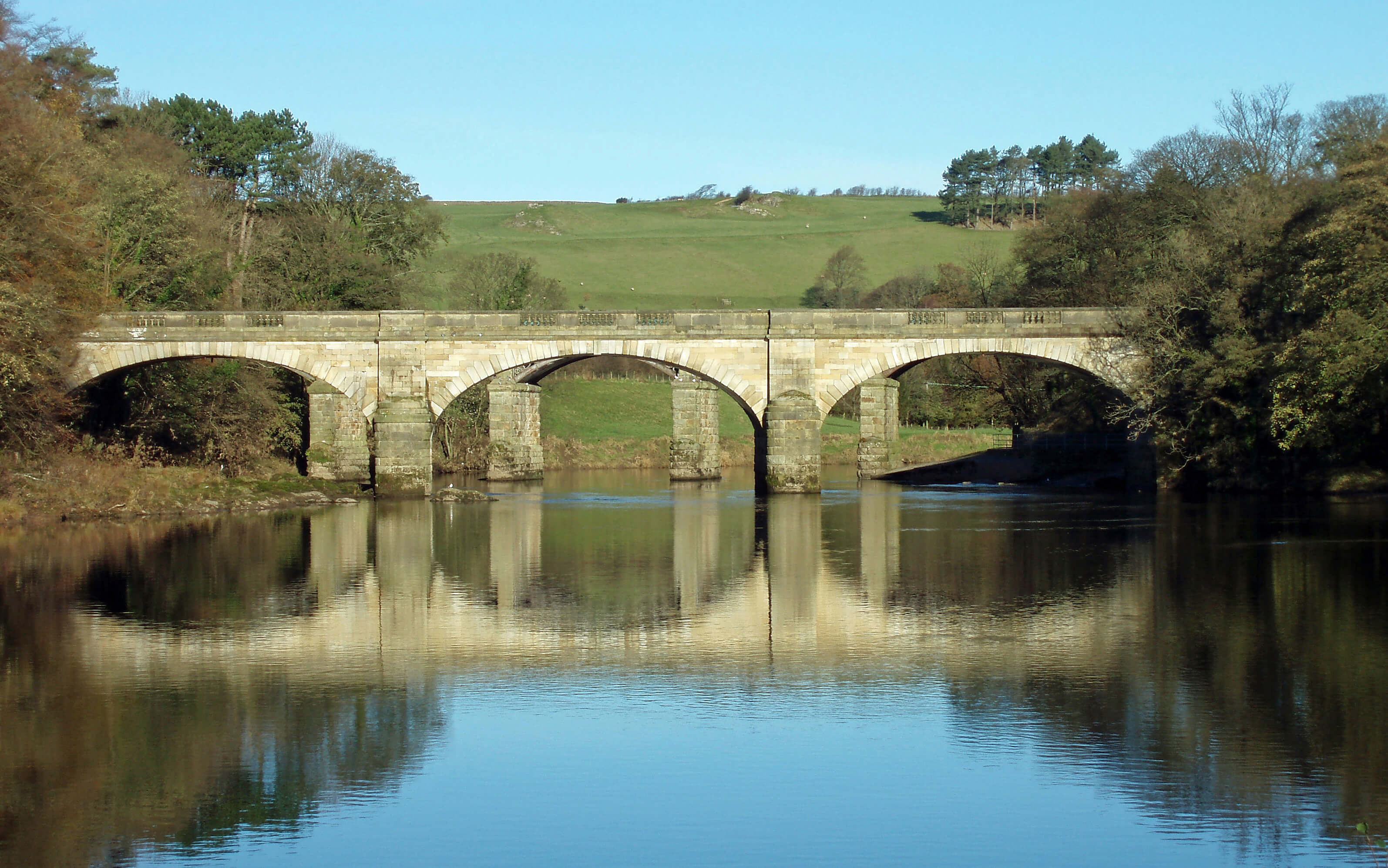 Right: Penny Bridge, Crook o’Lune
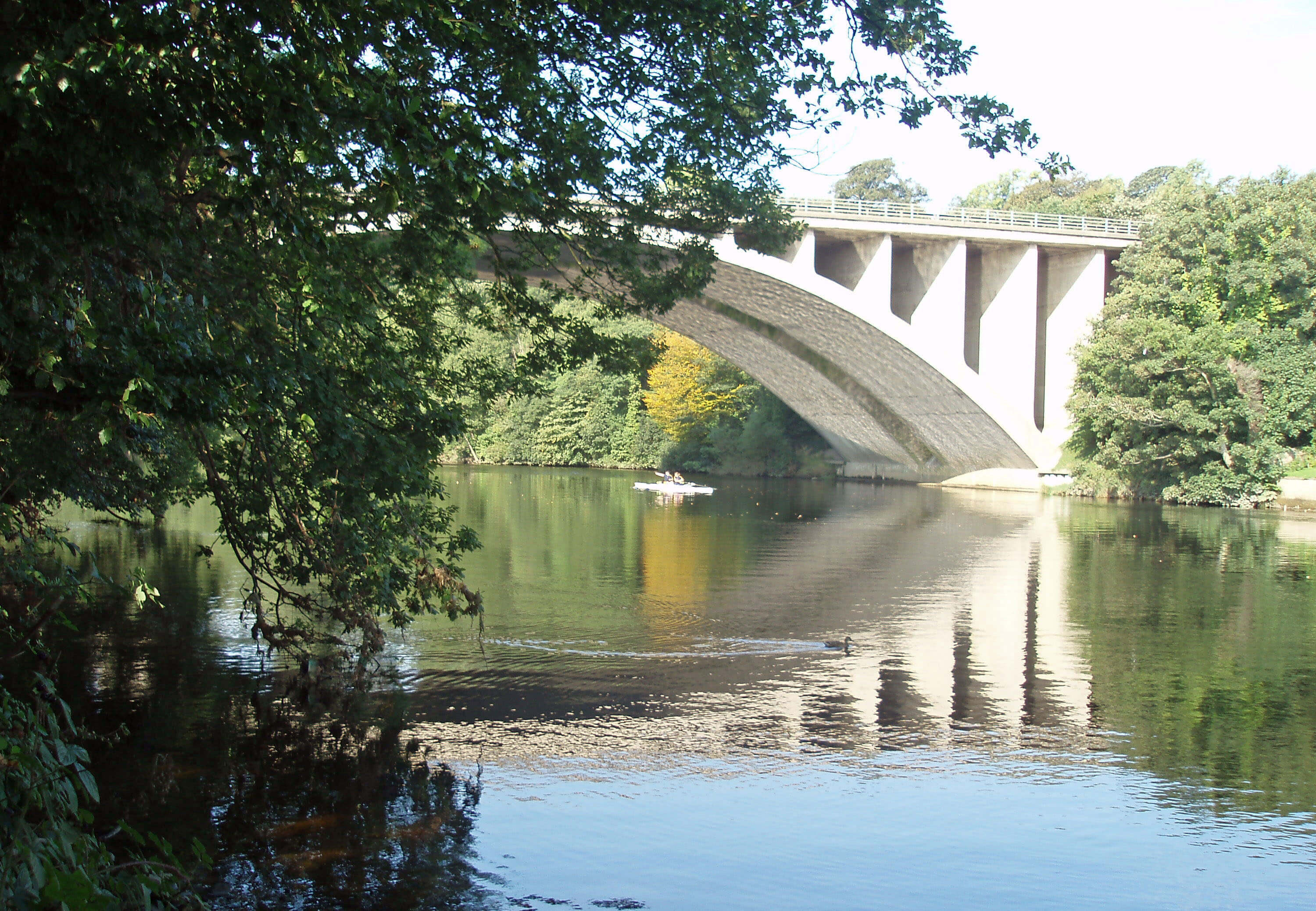
After 1km the Lune reaches the Crook o’Lune, a
popular picnic spot where the Lune meanders in
a graceful curve under wooded banks. There are
three bridges. The first and third, on opposite sides of
the meander, were for the Wennington-Lancaster railway
line. The second is Penny Bridge, which was built in
1883 after the 1806 bridge collapsed. This was a toll
bridge but rather than pay the toll some people preferred
to cross the Lune on foot, not always successfully.
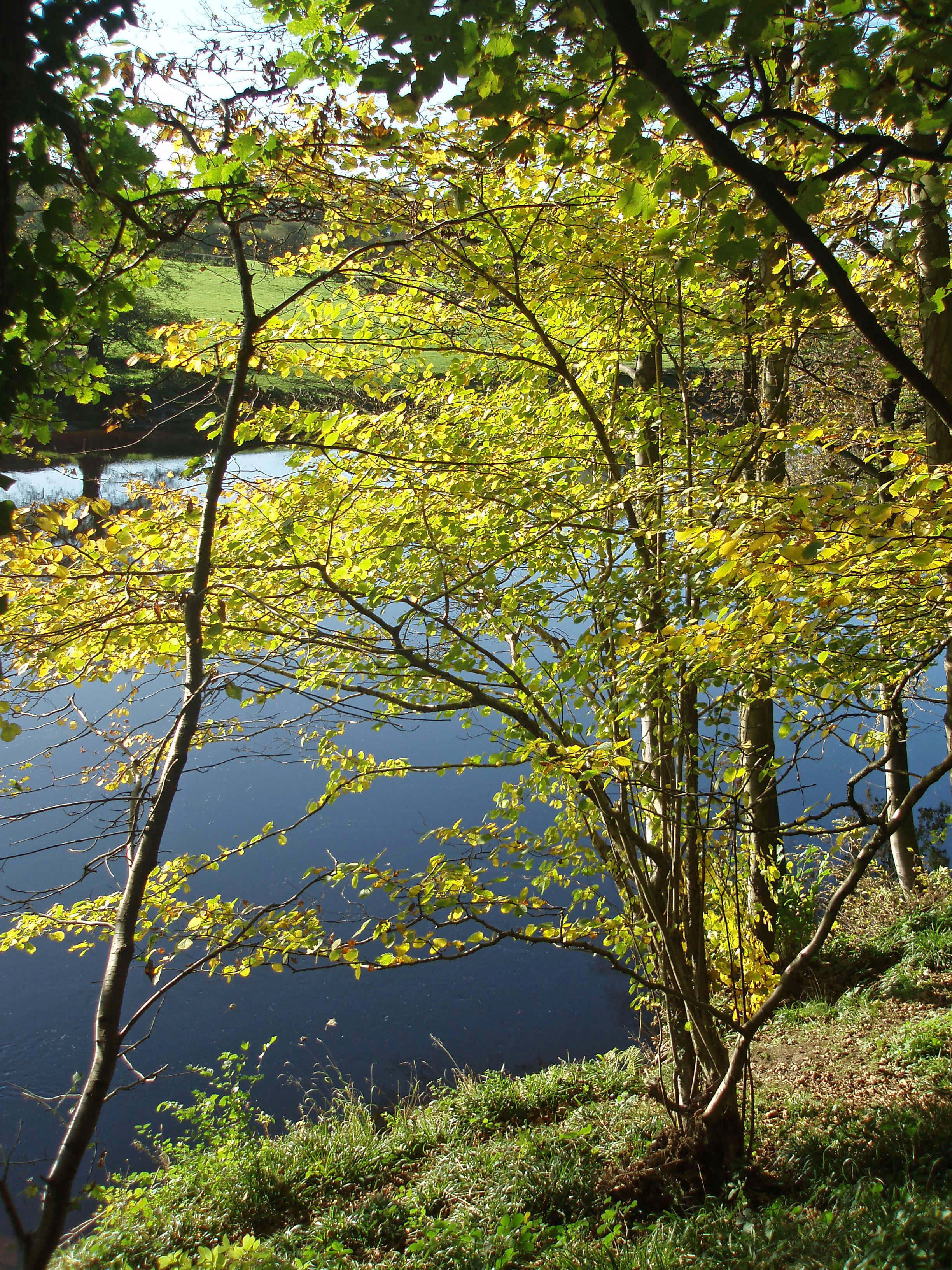
In the summer the river banks and surrounding
fields provide a colourful display that would be regarded
as beautiful in other contexts. Here it should be viewed
with alarm, for the purple flowers are of Himalayan
balsam, an alien, fast-growing, invasive species that
swamps native plants, so that when it dies down in the
autumn it leaves the banks vulnerable to erosion. Its
nectar-rich flowers also attract bees away from native
species. It can be eradicated relatively easily but attempts
to do so must begin in the upper reaches of the Lune
and Rawthey where the balsam has become established,
because its explosive pods spread the seeds, which are
carried downstream in floods.
At the Crook o’Lune a small beck, Escow Beck,
slips into the Lune. This, with its tributary Deys Beck,
originates 2km south in Flodden Hill Wood. This name is
thought to be due to Richard Baines, who was given land
in the area by Lord Monteagle of Hornby in reward for
his bravery at the Battle of Flodden Field. He no doubt
gave his own name to Baines Cragg, which provides
a fine viewpoint over Lancaster and Morecambe Bay.
Escow Beck flows through the pond at Escowbeck
House, which John Greg, the then owner of Low Mill,
built in 1842. He had the grounds landscaped so that a
sight of what he owned did not spoil his view, and as a
result it is difficult for us now to see the house.
Above the Crook o’Lune is Gray’s Seat, a recently
restored viewpoint that was eulogised by the poet
Thomas Gray in 1769. He wrote that “every feature which
constitutes a perfect landscape of the extensive sort is
here not only boldly marked but in its best position”.
These words are carved at the viewpoint, beside a grand
seat made by the renowned woodcarver Jim Partridge.
Gray’s view seems intended to rival Ruskin’s View
at Kirkby Lonsdale, which, after all, it does pre-date.
It was well known in the 19th century, as the effusive
paraphrase of Gray’s words in A Pictorial History of the
County of Lancashire (1854) indicates: the view “leaves
nothing to be desired in a landscape that pleases rather
than surprises, and of which the prevailing character is
more beauty than grandeur … we see nothing misplaced,
and desire neither to add to nor take away [a] solitary
object.” Since then we have added eight wind turbines.
Today, trees largely obscure the view and it is surprising
that we are encouraged to dash across the dangerous
A683 to see what’s left of it. (Gray’s Seat is probably
not Gray’s view at all: he stood to the north of the road,
400m below the “more advantageous station”, according
to the 1821 editor of Gray’s Guide to the Lakes.)
 Left: Near the Crook o’Lune
As we sit with our cuppa at the Crook o’Lune picnic
tables, admiring the view (shown in the
Introduction) up the Lune valley to Ingleborough,
contemplating the words of Thomas
Gray, mulling over the wind turbines on
Caton Moor, and fretting over the banks
of Himalayan balsam, we may lapse into
a reverie on the nature of naturalness. In
2006 various agencies coalesced to form
Natural England, which on first hearing
seems a rather strange name for a public
organisation. Its brief is “to conserve
and enhance the natural environment”.
So, naturally, we are led to ask: “What is
natural?” and in particular “What of Loyne
is natural?”
The name of Himalayan balsam tells
us that it doesn’t belong here. Similarly, for
the more pernicious Japanese knotweed.
What about the rhododendron that has run
amok at Kitmere and many other places
in Loyne? It is a native of Southern Asia.
Should we seek to eradicate it? Is there
any enthusiasm for giant hogweed (from
Asia)? Its name alone suggests we can do
without it! What about all those alien plants
that Reginald Farrer brought to Clapham?
Should we demand the removal of the fine
araucaria that stands alone in a field near
the Roman milestone at Middleton? It is
not a native tree: is it a natural one?
Apart from introduced species, what
about all those plants, such as cowslip and
primrose, that used to be abundant but are
now rare or extinct? Are they, or should
they be, part of the natural environment?
So many of our lowland meadows have been taken
over for agricultural purposes that those that remain in
anything like a natural state (such as those at Raisbeck,
Bretherdale and Tatham) are so rare that have been made
Sites of Special Scientific Interest. And, as we have seen,
the grouse moors have to be carefully managed to retain
what we now consider to be their natural state.
What could be more natural than the Ingleborough
that we see in the distance? Well, we know that a century
ago it would in the autumn have looked purple from the
Crook o’Lune viewpoint. Its slopes were then heather-clad. Before that, they would have been tree-covered.
Even Aughton Woods in the middle distance are not
entirely natural. Within Loyne the Forestry Commission
plantations, usually of conifers, occupy a greater area
than the remaining broad-leaved woodland. But before
the trees, of course, it would all have been ice-covered -
which is, if you take the long-term view, our most natural
state over the last million years.
There are similar considerations when we come
to consider the naturalness of Loyne’s animal life.
The red squirrel and grey squirrel debate is a familiar
one. Similarly, the otter and mink. We are seeking to
encourage the return of the former and to eradicate the
latter. What about the polecat? One has been trapped and
others sighted in Loyne. Should it be welcomed?
On farmland, do we mind alpaca (from South
America)? They are assuredly not as natural as our sheep
- the majority of which are (from) Swaledale. Why did I
include a photograph of a black swan rather than a white
one? Are we actually rather fond of the exotic?
Do we object to the red-legged partridge moving
north into our area? It is a handsome bird. Is our opinion
influenced by the fact that it was introduced as a game
bird in the 18th century (it is also known as the French
partridge)? Or that the once common grey partridge is
now on the red list of endangered species? Is it natural
for gulls to nest on Bowland Fells? Or for oystercatchers
to travel far inland? Would we welcome the eagle owl,
which has recently returned to other parts of England?
Is it more natural here than the little owl, which was
introduced in the 19th century? What about the pheasant,
introduced from Asia so long ago that nobody is quite
sure when?
Of course, none of the man-made constructions that
we see are natural. It is always the most recent (today,
the wind turbines) that are the most controversial. But
we can also see the old railway line, Low Mill at Caton,
electricity pylons, the chimneys of Claughton brickworks,
the Thirlmere aqueduct, and Hornby Castle. The last is
not even a ‘natural’ castle, since it was re-built in the
19th century to pretend to be one. To varying degrees,
we now accept these as part of the environment.
On a smaller scale, there are innumerable instances
of our tinkering with the environment. For example,
the Lune banks have in many places been reinforced
to prevent erosion. Fair enough: farmers don’t want to
see their fields disappear. But why are huge limestone
blocks often used? Their white gleam does not belong
here. As I write, a bulldozer is pushing rocks and soil
over the natural bank opposite Aughton Woods, burying
sand martin nests and anything else that happens to be
there. Just upstream from the Crook o’Lune a single
electricity wire crosses the Lune. It is surrounded by
seven prominent ‘danger of death’ signs. Fishermen
surely do not need such protection.
Almost everything mentioned in this reverie
concerns changes since Thomas Gray considered the
landscape perfect in 1769. Was the environment natural
then, or now? So many questions, but no answers. I
suppose the answer is that we should all notice, question
and decide about what we wish to see and have in our
environment.
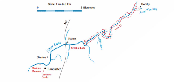
Walk 22: Crook o’Lune and Loyn Bridge
[Update: This walk is no longer possible because the bridge over Claughton Beck has
disappeared. A detour to Claughton and along the A683 is no fun at all. If you want a long walk
east from the Crook o'Lune it is better to stay on the north bank, continuing to Aughton or Eskrigge,
as you wish, and returning to the north through the Highfields. I have left the original walk
description here in case the bridge is restored (although, to be honest, I think I'd find
the walk too long and lacking in variety to recommend today).]
Map: OL41 (please read the general note about the walks in the
Introduction).
Starting point: The Crook o’Lune (522647).
Guidance for this suggested walk is simplicity itself: walk from the Crook o’Lune on the east side of the Lune to Loyn
Bridge and then back on the west side.
In a little more detail: Walk east over the old railway bridge and then immediately take the path right and then right again
to go under the bridge you’ve just crossed to gain the footpath on the east bank of the Lune. At the Waterworks Bridge continue
on the bank, as there is a good stretch of the Lune below Lawson’s Wood, where salmon often leap. Follow the long loop round
until you are again heading northeast. Don’t take the public footpath to Claughton but continue on the river bank where there is a
permissive footpath not marked on OS maps. This continues to the Wenning, where it is necessary to walk east to Hornby Bridge
and then back on the other side of the Wenning. Continue to Loyn Bridge where, if the footpath under the bridge is impassable
because the river is too high, you should cut up through the wood to reach the road. Walk over the bridge and take the path south
on the west bank of the Lune. As this is part of the Lune Valley Ramble there should be no difficulty in navigation. At the long
meander near Burton Wood nobody will object if, through exhaustion, you need to walk straight across.
The walk can alternatively be started from Loyn Bridge, which would have the advantage of enabling a half-way cuppa at
Woodies snack bar at the Crook o’Lune. Between the Crook o’Lune and Loyn Bridge there is only one way to cross the Lune - at
Waterworks Bridge (the footpaths marked on the OS map as crossing the Lune are not paths for feet).
Short walk variation: There are several short loop walks from the Crook o’Lune that may be combined in any way you wish:
northeast to Waterworks Bridge and back (5km); east over the old railway bridge, south on the south bank of the Lune and
back over the other bridge (1km); west over the bridge, along the south bank of the Lune to Halton Weir and back along the
Millennium Park (2km); west along the Millennium Park to the bridge at Denny Beck and back on the north bank of the Lune
through Halton Mills (4km).
Cuppa finished, let us move on. Beyond the meander,
the Lune curves west. Here, on a winter’s afternoon, is
a good place to spot the kingfisher, for in the absence of
other colours the setting sun makes its iridescent blue
and orange particularly vivid when seen from the south
bank. According to the Lune Waterways Bird Survey
there are at most half a dozen breeding pairs between
Lancaster and Kirkby Lonsdale, so their frequency here
seems surprising.
On the south bank, 100m before Forge Bank Weir,
is the Lune Intake, the first sign of any significant
management of the Lune. Up to this point the Lune
and its tributaries have run largely unrestrained from
their various fells. There used to be a millrace from
the weir to power Halton Mills, a substantial industrial
complex that survived for over two centuries, changing
when necessary between cotton, flax, leather, oilcloths
and coconut matting, until becoming derelict in the
1970s. A renovation of the site was begun in 2006 by
a company with the motto “property touches emotion”.
How true! The residents of Halton’s 1960s bungalows
angrily objected to the scores of self-contradictory “rural
townhouses”. The project has been left suspended,
unfinished, after the developers went into administration
in 2008.
[Update: The project was later revived and completed - and now
even more houses are being built in Halton.]
The management of the Lune is important to enable
proper use of water resources, to make flood predictions,
to assess the impact of discharges, and to support the use
of the Lune for recreation. There are four flow-measuring
stations on the Lune (at Lune’s Bridge, Tebay (3), Killington
New Bridge (6), Caton (17) and Halton (16)) and a further
four on the Conder, Hindburn, Rawthey and Wenning
tributaries. The figures in brackets show the median flows
in cubic metres per second. The Halton figure is lower than
the Caton one because of water extraction, particularly at
the Lune Intake.
Water is pumped from the Lune to help provide
Langthwaite Reservoir with Lancaster’s water supply and
also to be transferred to the River Wyre along a 13km
pipeline as part of Lancashire’s ‘conjunctive use scheme’.
The Wyre catchment is heavily exploited for industrial and
public water supply and may be supplemented from the
Lune, provided that its flow is high enough.
There are over a hundred licences for water abstraction
from the Lune and its tributaries and if all the allowed
water were taken the Lune would be ‘over licensed’, that
is, flows would fall below necessary levels. Thankfully,
the actual level of abstraction is lower than licensed and
has decreased recently because of changes in the region’s
industry.
The nature of the Lune catchment area makes
this monitoring important. Flows in the floodplain are
determined by rainfall on the fells, and these run-offs have
different characteristics. Rain in the Howgills runs quickly
off the hills but in the Dales water percolates into limestone
until it is saturated, giving rise to flash flood conditions.
The continued health of the Loyne riverside flora and
fauna depends upon maintaining the required conditions
of erosion and sedimentation, and this needs to be better
understood.
Between Forge Bank Weir and Lower Halton Weir
the Lune’s natural turbulence has been increased in order
to provide rapids for canoeists. Stone banks protrude into
the flow to create eddies and waves, suitable for novices
at the lower end and experts at the higher, especially
under spate conditions.
On the south bank the Lune Millennium Park
continues along the old railway line. Various artworks are
passed, of which the most striking is that of Giles Kent,
whose website says that he creates “in situ installations
that enhance and elaborate on the natural properties of
wood … [the work] compliments the natural landscape
by responding to lines and shapes found around each
particular site”. There are nine upside-down larch trunks
with roots aloft.
[Update: The upside-down trees were, to everyone's relief, removed in 2012,
being deemed dangerous through having rotted.]
The park reaches the old Halton railway station,
which looks different from all the others we’ve passed
because it was re-built in 1907 after a fire. By the station
there’s a temporary-looking bridge across the Lune that
has stood since 1913. The crossing here has a chequered
history. While the railway was being built there was no
bridge across the Lune here and workers were ferried
across from Halton. In 1849 eight of them died when
washed away in a flood. Today such an event would be a
national tragedy; then it seems to have been accepted as
a price to be paid. A new bridge was opened in December
1849: it wouldn’t do to have potential customers from
Halton washed away. This was swept away in 1869 and
replaced in the same year. This in turn was replaced in
1913 by using the remains of the old Greyhound Bridge
then being demolished in Lancaster. The bridge operated
as a toll bridge until the 1960s and since the railway line
closed in 1966 it has been a matter of contention who is
responsible for its upkeep.
The Lune at Halton
North of the Lune is the village of Halton, the
larger eastern part of which is mainly new housing for
commuters but the older part of which is rich in heritage.
This part is clustered around the small tributary of Cote
Beck, which enters the Lune unobtrusively 200m below
the bridge. Cote Beck arises south of Nether Kellet,
rather tentatively, as is usual in limestone country,
below the large quarries. It runs by the M6 and then past
Furnace Cottage, where Cote Beck used to be called
Foundry Beck.
Below Dale Wood, Cote Beck passes the site of
Halton’s motte and bailey castle, now marked by a
flagpole. The site is relatively small but the motte, rising
3m above the bailey, can be clearly seen (although the
present top is not original) and traces of the bailey are
visible despite recent ploughing. The site is on private
land.
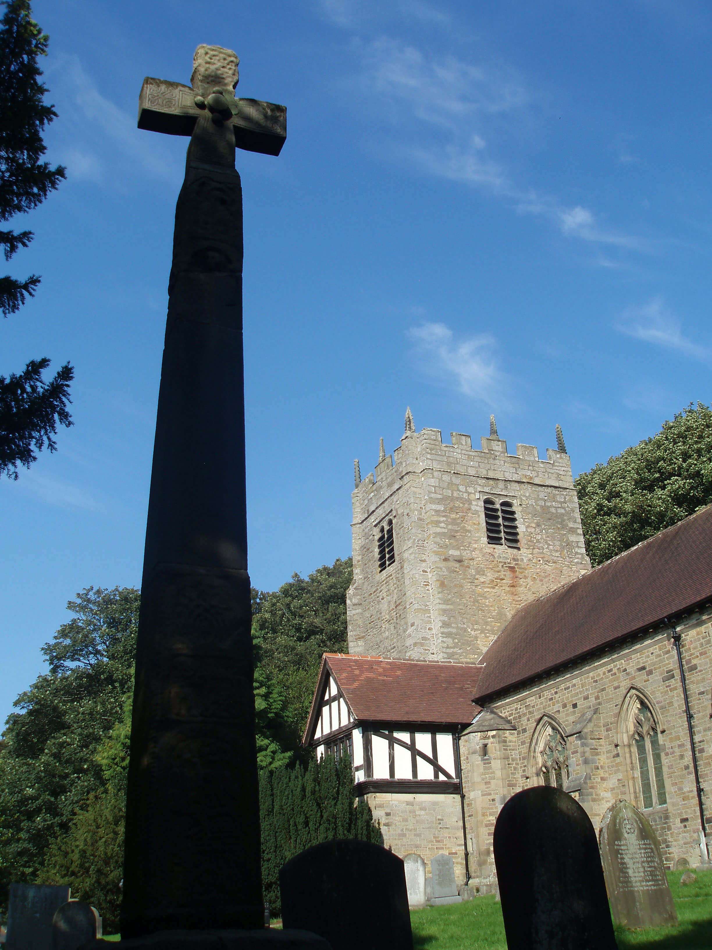 Left: The Viking cross at St Wilfrid’s, Halton
On the other side of the beck is the church, dedicated
to St Wilfrid, a 7th century Archbishop of York. Maybe
there was a church here from that time, although the
earliest remains are 12th century Norman stones built into
the arch. As we have seen with other churches, the tower
was retained when the church was rebuilt (by Paley &
Austin again) in the 19th century.
A Roman altar was found in the churchyard in 1794
and is now in the Lancaster City Museum. It bears an
inscription to the god Mars from Sabinus and his unit of
boatmen, perhaps grateful for their safe passage up the
Lune from Lancaster. There is no other evidence of any
Roman settlement at Halton, although it is likely that
there was a camp on what became the site of the castle
and it is assumed that there was a Roman road on the
north bank of the Lune up to Whittington and over a ford
to Over Burrow. Still in the churchyard is a cross carved
with Christian symbols and a version of the Sigurd the
Volsung legend by Norse settlers who came to the region
in the 10th century. It is 3.5m high, mounted on three
steps, with the top parts having been rather inexpertly
reassembled.
Halton, then, was an important centre before
the Norman Conquest, when it was held, like many
places we’ve visited, by Earl Tostig. At the time of the
Domesday survey, Halton was regarded as the centre
of lower Lune, with twenty-two villages, including
Lancaster, considered to belong to the manor of Halton.
When Roger of Poitou took over, he preferred to make
Lancaster his centre and the importance
of Halton waned. The Royal Foresters,
responsible for managing the king’s
forests in Lancashire, had Halton for
their principal manor until the Gernet
inheritance passed to the Dacre family
in about 1290. The lords of the manor
in 1715, the Carus family, perhaps still
smarting from Halton’s subordination to
Lancaster, gave helpful information to
the Jacobite Army on its way to occupy
Lancaster. From the 18th century, the
manor house, Halton Hall, passed through
several hands, gradually being split up
and demolished. Only one 19th century
wing remains, the rest having gone by the
1930s, apart from the boathouse on the
Lune.
 Right: The M6 bridge
The Lune is slow, deep and wide,
and local rowing clubs make good use of
this section, down towards Skerton Weir.
Rowers get the best view of the fine M6
bridge, whose single-span arch of 70m
provides a frame for an attractive stretch
of the Lune.
In view of the on-going controversy
about a proposed link road from the M6
just north of the Lune to Heysham, it is
interesting that this was already part of
the original plan in the 1950s. It was only
when the Lancaster emergency services
expressed concern at the difficulties of
gaining access to the motorway that an
interchange south of the Lune was built,
to lower design standards than normal and
only later, after public representation, that it was opened
for general use.
[Update: This motorway junction was duly reconstructed during the 2010s,
with a new bridge being built over the Lune to link to the Bay Gateway to Morecambe and Heysham.]
After passing the Halton Training Camp for army
cadets on the north bank and a hotel and industrial
buildings on the south, the Lune reaches the Lune
Aqueduct, one of the finest aqueducts in England. It is
200m long, with five semi-circular arches carrying the
Lancaster Canal 18m above the Lune. It was one of
the first bridges designed by John Rennie, who went on
to design Waterloo Bridge and London Bridge, and was
a great civil engineering feat for its time. The aqueduct
was completed in 1797 and some indication of its impact
and aesthetic appeal can be gained from the fact that
Turner sketched it on his 1797 tour of northern England.
This was the only time on his tour that he addressed
a contemporary subject, although he could not resist
framing a view of Lancaster Castle within one of the
arches.
However, the grandeur of the aqueduct’s design was
not without its critics. A committee set up in 1819 to
review progress on the Lancaster Canal commented that
resources had been wasted in “ornamenting the town of
Lancaster, with a grand aqueduct over the Lune, upon
which the water had lain stagnant for over twenty years.”
It is not stagnant now: it is leaking. The aqueduct was
closed for repairs in 2009, as part of a Ł3m project to
develop the Lancaster Canal as a key part of the visitor
infrastructure.
After 1km the Lune reaches Skerton Weir, the
normal tidal limit. A weir has existed here for centuries,
to provide water for a millrace to power corn mills by
the Lune, but the present structure was built in 1979 to
prevent salt water entering intakes for the Lune-side
industries upstream. It does, of course, have a fish pass
for salmon and trout.
The weir is of disappointing design. It is unsightly;
it is not integrated into the so-called riverside parks
to provide an appealing leisure amenity; and it is a
hazard for river users, who are regularly swept over
it, sometimes with fatal consequences. The UK Rivers
guidebook describes the weir as “extremely dangerous”
and “lethal in high water”, rating the weir as grade 6
on the International Grading Scale, that is, the highest
possible (or most dangerous) grade.
In the past the weir was renowned for its salmon
fishing. Fishing is now regulated by the Environment
Agency, who own three beats on the Lune. Fishing directly
below the weir is prohibited but further downstream fly-fishing is allowed. Above the weir, coarse fishing with
a single rod is permitted, outside the close season, of
course. The Agency’s other two beats are upstream, at
Halton Lower Beat and Halton Top Beat. The former is a
game fishery, best fished at high water; the latter is slow,
deep water and is said to be the most productive of all
the Agency’s salmon fisheries.
Lancaster Canal was intended to connect Kendal with
Houghton, and hence the Leeds–Liverpool Canal, but has
yet to achieve that goal. The Act approving its construction
was passed in 1792 and the sections from Tewitfield to
Preston and from Walton Summit (6km south of Preston)
to Houghton were completed by 1803. The costs, however,
were high: for example, the bill for the Lune Aqueduct
(Ł48,000) was nearly three times the original estimate.
The Kendal to Tewitfield section took until 1819 but
no canal link between Preston and Walton Summit was
constructed – until 2003, when the Millennium Ribble Link
was finally built. But by this time the Kendal to Tewitfield
section, now cut off by the M6, had largely been filled in.
The grandly named Association for the Restoration of the
Lancaster Canal, formed in 1963 at the time of the M6-enforced separation, still hopes to re-open the Kendal to
Tewitfield section for navigation.
The Lancaster Canal is misnamed because, although
it was intended to help get goods to and from Lancaster
avoiding the Lune, the main beneficiaries were Preston and
Kendal and other villages en route. Preston, which had its
own problems with navigation in the Ribble, was in 1792
smaller than Lancaster but its population trebled in thirty
years as new markets opened up. The main effect within
Lancaster, which had lacked water-powered mills, was the
development of steam-powered mills alongside the canal,
where coal could be delivered easily.
The eight-hour journey from Kendal to Preston
could not compete with the railway when it arrived and
the Lancaster Canal Company was duly dissolved in 1886,
with the last freight being carried in 1947.
Today, the 66km from Tewitfield to Preston is for
leisure only. As it follows the contour there are no locks, to
the disappointment of today’s canal travellers, who seem to
revel in them. If that makes the canal too boring they could
try counting the bridges (Lancaster City Museum asserts
that there are 247 of them, including 22 aqueducts – which
I assume includes those bridges still standing, mysteriously,
in fields between Kendal and Tewitfield). Or they could
tackle the Ribble Link, which has nine locks in 6km.
The Lune flows through the built-up areas on the
outskirts of Lancaster and the becks, such as they are, run
unobtrusively through culverts to the river. For example,
Newton Beck joins on the east bank from the estates of
Ridge and Newton. On the west bank is Skerton, which
was mentioned as a separate village in the Domesday
Book and remained apart from Lancaster until the late
19th century.
Skerton Bridge was designed by Thomas Harrison,
who had studied in Italy, and is in a classical style
similar to that of the old Roman bridge at Rimini. Its flat
roadway and use of balustrades across the width were
innovatory for English bridges. There are five elliptical
arches, each spanning 20m. It was completed in 1788 and
soon influenced other designers. We might, for example,
detect an echo of Skerton Bridge in the Lune Aqueduct,
for John Rennie came to see it and a flat design was
exactly what was needed for the aqueduct.
A sixth, inferior arch was later added to Skerton
Bridge on the east bank for the Wennington-Lancaster
railway line. The station was just south of the bridge
at Green Ayre, which is today a rare example of an
industrial site that has been returned to a green field,
quiet apart from the skate-boarders’ ramp and the
traffic. The railway line continued from Green Ayre over
Greyhound Bridge to Poulton-le-Sands, or Morecambe
as it became called. The present Greyhound Bridge was
built in 1911, replacing earlier bridges of 1849 and 1864,
and converted for road traffic after the closure of the
railway line in 1966.
Green Ayre has had a long and active past. Some
experts believe that at the time of the Romans, Green
Ayre was an island, with the main flow of the Lune
being south of its present course, along the line of
the present Damside Street. A millrace followed this
line and powered what is believed to be the oldest
recorded water mill in Lancashire, being referred to in
the borough charter of 1193. Green Ayre then became
a busy quay and from 1763 a shipyard. It doesn’t seem
an ideal spot for such activities because the old bridge,
dating back to at least the 13th century, prevented large
ships from reaching Green Ayre. Newly built ships were
floated from the shipyard under the bridge in parts and
assembled downstream.
When Skerton Bridge was built the old bridge
became redundant. The shipyard bought the bridge
in 1800 and removed one arch, which reduced its
functionality somewhat but allowed tall ships to pass
through. By 1845 the whole bridge had fallen down or
been demolished.
 Left: Greyhound Bridge and the Millennium Bridge below the castle and priory
The Millennium Bridge, opened in 2001 for
cyclists and pedestrians only, is roughly where the old
bridge stood. Opinions on this new bridge are mixed:
some people don’t like it much; others don’t like it at
all. Certainly, for cyclists and pedestrians it is a boon,
because for them Skerton Bridge and Greyhound Bridge
are inconvenient and dangerous. The bridge is a key part
of the Lune Millennium Park, linking the cycleways
along the old railway lines from Caton and Morecambe
to form part of National Cycle Network route 6. It was
designed by Whitby Bird, cost Ł1.8m, has a span of
64m and is suspended from 40m masts. Perhaps we will
eventually come to admire the classic view of Lancaster’s
castle and priory now framed by the long blue fingers
that are supposed to echo old sailing ships.
From Green Ayre, the castle and priory look as
one, overseeing the city of Lancaster, dominating the
strategically important lowest old fording point of the
Lune, and providing extensive views over Morecambe
Bay and up the Lune valley to Ingleborough. What is
now called Castle Hill was settled long before the castle
existed, with Neolithic and Bronze Age artefacts having
been found here.
The Romans recognised its key position overlooking
a main route between Scotland and western England. Of
the Roman fort that was based on Castle Hill there is little
to be seen but more than we saw at Low Borrowbridge
and Over Burrow. Most of the site is under the present
castle and priory but to the north in Vicarage Fields
the remains of a 2nd century bathhouse, excavated and
preserved in 1973, can be seen. The meagreness of the
remains does not excuse the shabbiness of the site and the
shamefully poor foreign language information board.
When Roger of Poitou moved his base from Halton
to Lancaster he no doubt built a motte and bailey castle
within the site of the old fort, although there is no trace
of this castle today. The Domesday Book records a
village called Loncastre here. The castle would have
been rebuilt in stone and strengthened part by part. The
12th century keep is the oldest surviving part. Scottish
raiders in 1322 and 1389 ruined much of Lancaster but
spared the castle and, to a lesser extent, the priory. During
the Civil War, Parliament ordered that the castle (apart
from the courts and gaol) be demolished but in 1663 the
king agreed to have it repaired. The gatehouse, the most
impressive external feature, is 15th century, with the John
of Gaunt statue added to it in 1822.
The name Loncastre may prompt some speculation on
the origin of the name ‘Lune’. Since the Domesday Book
the name has appeared in many forms (Lon, Loin, Loon,
Lonn, Lone, Lona, Loune, Loone, Loyne, Loine, Lan, and,
of course, Lune) but clearly it has pre-Norman origins.
There is not yet agreement on what the Romans called
their fort at Lancaster. The assignment of Alauna or Alone
is now discredited. Possibly it was the Calunio or Caluvio
of what’s called the Ravenna Cosmography. The Artle
Beck milestone’s “I L M P IIII” suggests that the name
began with ‘L’. It seems probable, then, that a Lune-like
name existed in Roman times.
So the origin is lost in pre-history and, in this case, we
may as well adopt a suggestion that appeals. Eilert Ekwall
concludes in English River Names (1928) that it comes
from the old Irish (and probably old British) slán, meaning
healthy, sound or safe, which is a fair enough description
of the Lune.
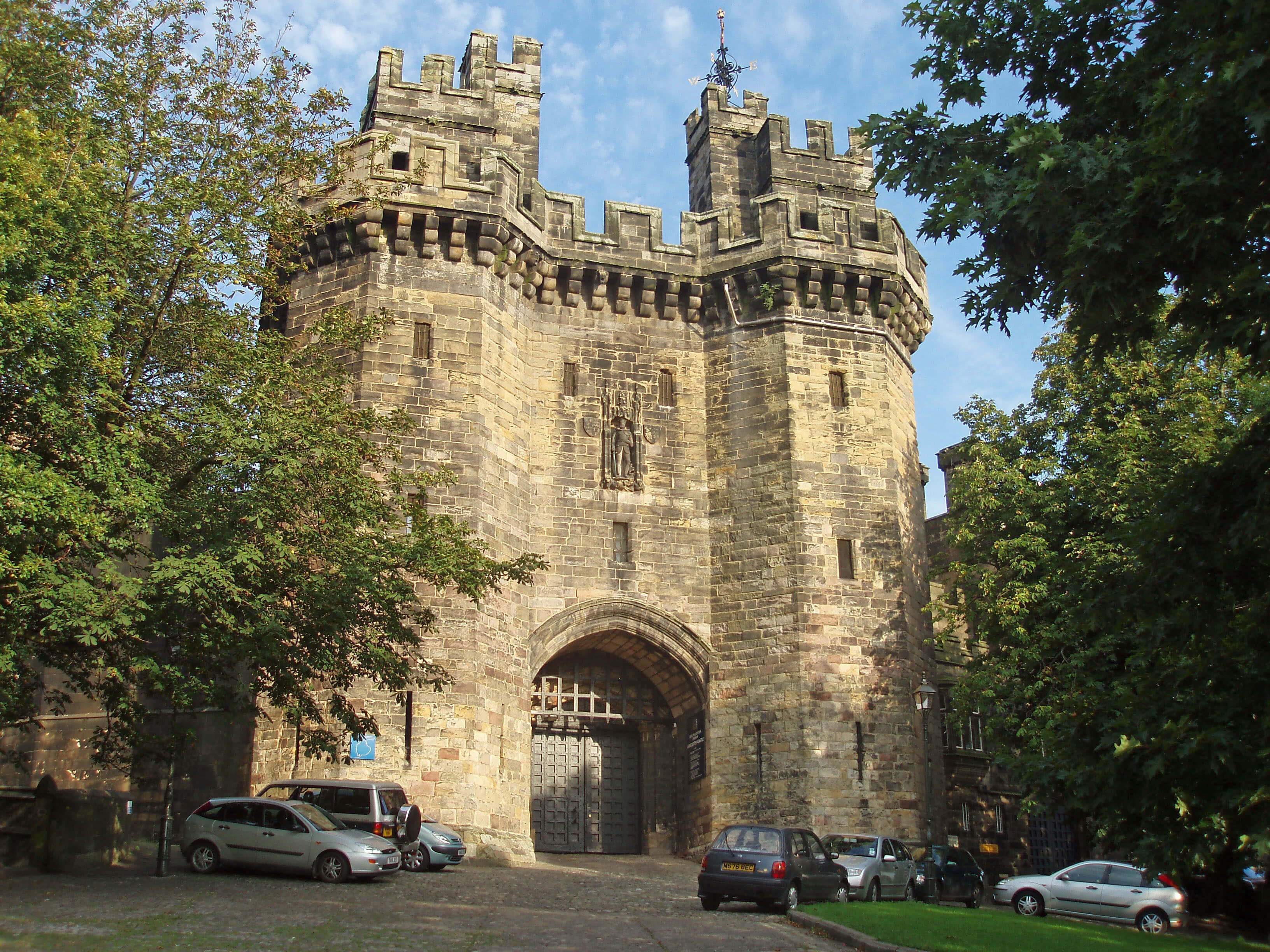 Right: Lancaster Castle gatehouse
The grandeur of the long-distance view, with the
battlements on the skyline, is not sustained at close
quarters, where the bland, relatively modern, external
wall dominates. If you prefer a castle to be in dramatic
ruins redolent of historic battles then Lancaster Castle
is a disappointment: it is still in good enough repair to
continue as a working castle, functioning as court and
prison. Even so, it is arguably Lancashire’s greatest
historical building.
[Update: The castle ceased functioning as a court and prison in 2011.
It is now open to the public, after being refurbished with a piazza and café.]
Lancashire became a County Palatine in 1351,
with John of Gaunt becoming Duke of Lancaster, a title
that passed to his son, who became Henry IV in 1399.
Since that date the monarch has continued to be Duke
of Lancaster and has retained the Duchy and the castle
as a separate estate to those of the Crown. As county
town, Lancaster held the Assizes two or three times a
year. They were held in the Crown Court from 1176 until
1971, when a Royal Commission on Assizes, chaired
by Lord Beeching (a second, and less controversial,
Beeching Report), recommended changes. Until 1835
it had been the only Assize Court in Lancashire. The
regular influx of Lancastrian gentry helped to sustain
Lancaster’s relative importance and to preserve its status
as county town even after the Industrial Revolution.
According to H.V. Morton’s In Search of England
(1927), “It is remarkable that Lancashire, which
possesses Liverpool and Manchester, should own a
delicious, sleepy, old county town like Lancaster, and
this is itself symbolic of the fact that the great industrial
new-rich cities of northern England – vast and mighty
as they are – fall into perspective as mere black specks
against the mighty background of history and the great
green expanse of fine country which is the real North of
England.” Since then, the black specks of Liverpool and
Manchester have been evicted from Lancashire.
Over the centuries, many famous and infamous
trials have been held at the castle. In 1612 ten ‘Pendle
witches’ were sentenced to death. Between 1584 and
1646 seventeen Roman Catholic priests were executed.
From 1660, about 270 Quakers, including George Fox,
were imprisoned. Innumerable felons were sentenced to
death, to provide public spectacles that up to 1799 were
held on the moor east of Lancaster and between 1799
and 1865 at what is now called Hanging Corner, outside
the castle. Grammar school boys were given a half-day
off to learn the price of sin. This entertainment was more
frequent than elsewhere, as the Lancaster court passed
more death sentences than any other.
We do things differently nowadays, but less so than
we might think. In 1975 the Birmingham Six, accused of
the Birmingham pub-bombings, were tried in Lancaster,
which with its high security prison next to the court was
felt safest for Britain’s biggest mass-murder trial. They
were sentenced to life imprisonment mainly on the basis
of confessions that were extracted under conditions that
“if the defendants’ stories were to be believed [implied
that] many police officers had behaved in a manner that
recalled the Star Chamber, the rack and the thumbscrews
of four or five hundred years ago”, as the judge said in
his summing up. They had – and the convictions were
eventually overturned in 1991.
The Shire Hall and Crown Court, which were
designed by Thomas Harrison and completed in 1798,
may be seen, along with Hanging Corner, in a tour of the
castle. In the Shire Hall are the heraldic shields of all High
Sheriffs of Lancashire since 1129. The High Sheriffs
are appointed annually and the ceremony of Shield
Hanging is deemed so important that it necessitated an
adjournment of the Birmingham Six trial. Within the
castle, the tour includes the ancient keep, the dungeons
and the medieval Hadrian’s Tower and Well Tower (or
Witches’ Tower).
The Top 10 historical sites in Loyne
By ‘historical’ I mean anything over a hundred years old:
1. Lancaster Castle
2. Norber erratics, near Austwick
3. Brigflatts, near Sedbergh
4. Castle Stede, Hornby
5. Middleton Hall
6. Sedgwick Trail, Garsdale
7. Leck Fell ancient mounds
8. Rayseat Long Cairn, near Sunbiggin
9. Claughton brickworks
10. Low Borrowbridge
Next to the castle stands Lancaster Priory. At
least, that is what everyone calls it although there has
not been a prior here since 1430. The church is said to
date from 630, or earlier. There is a Saxon doorway in
the west wall of the nave. The priory was founded in
the 11th century and Roger of Poitou promptly gave it
to the Benedictine Abbey of Saint Martin of Seez in
Normandy. This arrangement, whereby income was sent
to France, was strained by our war-like relationship with
that country and duly ended in 1414 when Henry V gave
the priory to the Convent of Syon in Middlesex. The
priory then became the parish church of Lancaster and
with the Dissolution of the Monasteries came under the
see of Chester.
Unlike most other churches we have met, the
tower (of the 18th century) is newer than the rest, which
mainly dates from a 15th century restoration. In external
appearance it retains the graceful serenity that we like
to imagine for that period. Internally, there have been
changes but not to the most outstanding feature, the
carved choir stalls of about 1340, which some people
consider the finest in England.
Despite its long history, Lancaster has few buildings
older than 1750, other than the castle and priory. Most
of its fine stone buildings in the Georgian style date
from the 18th and 19th century. Usually unnoticed,
perhaps because they are understandably not near the
city centre, are some impressive buildings that possibly
result from Lancaster’s role as county town. The Royal
Albert Asylum for “idiots and imbeciles of the seven
northern counties” was built in 1870, its opening being
declared a public holiday, suggesting that it was a matter
of civic pride. It closed as a hospital in 1996 and is now
the Jamea Al Kauthar Islamic College, catering for over
four hundred girls from across the world. The Ripley
Orphanage was built in 1864 and is now a school and the
1816 County Lunatic Asylum at Lancaster Moor, which
cared for three thousand people, has been converted into
residences, with the 1883 annexe currently up
for sale.
[Update: The annex has now also been converted into residences.]
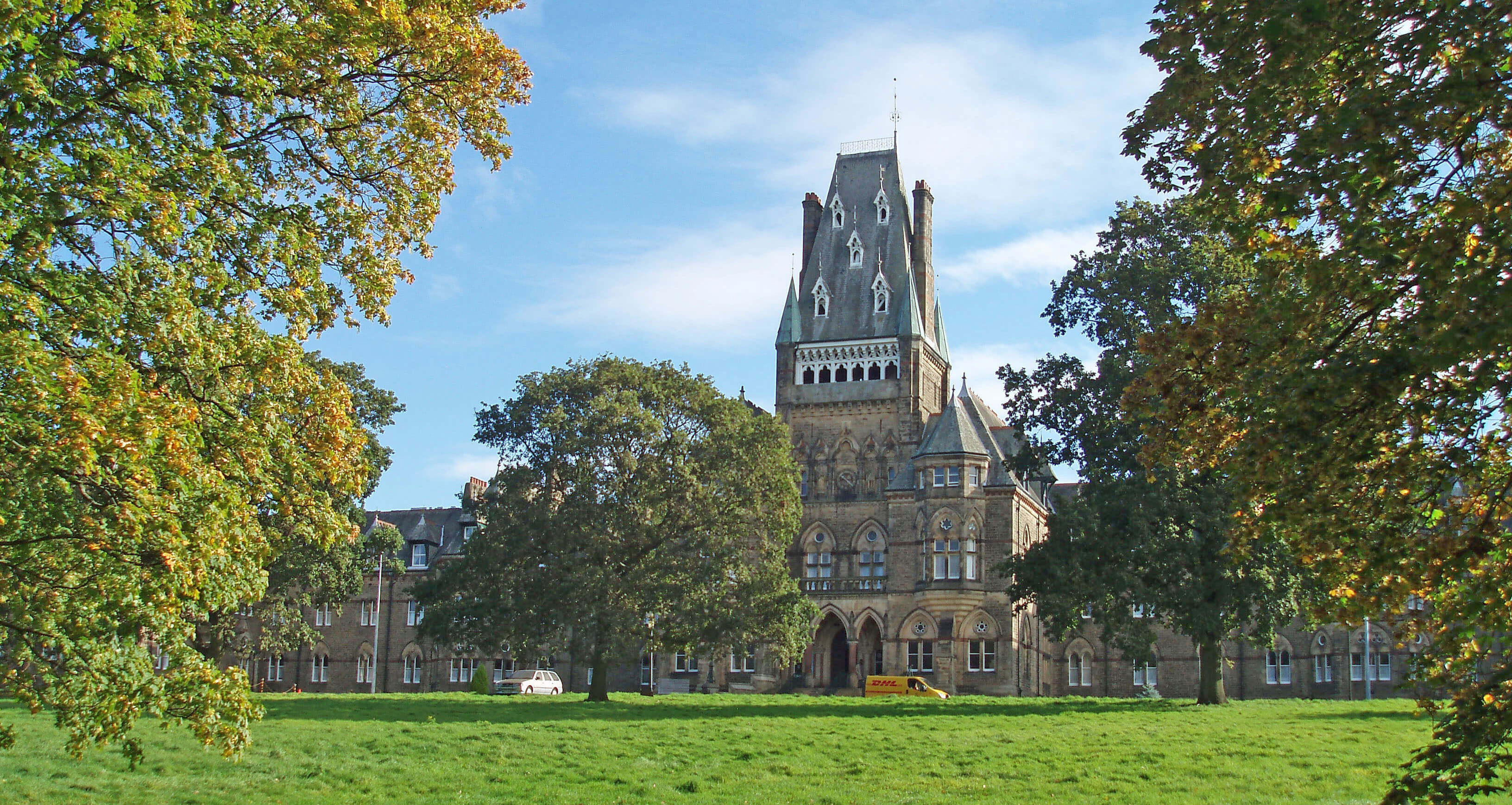 Right: The Jamea Al Kauthar Islamic College (née the Royal Albert)
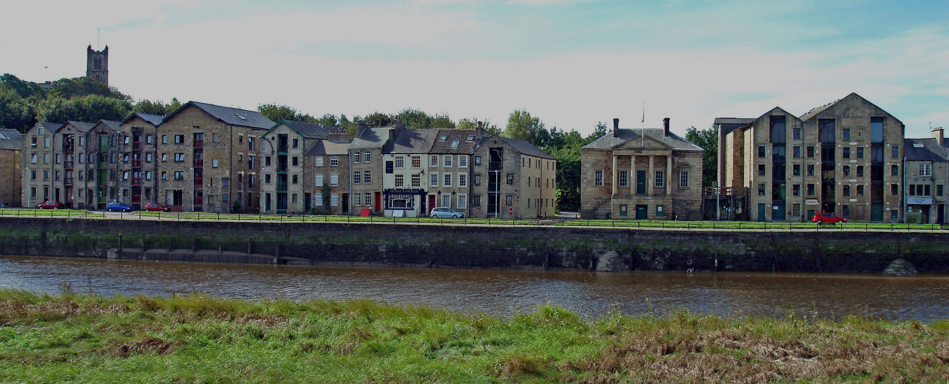
The Lune passes the most visible
indication of Lancaster’s period of prosperity,
St George’s Quay, built to inspire the ‘golden
age’ of Lancaster’s shipping trade, from
1750 to 1800. An Act was passed in 1749 “for
improving the navigation of the River Loyne,
otherwise called Lune, and for building a Quay
or Wharf, etc.” This was in spite of, or because
of, the difficulties that the port faced. Daniel
Defoe wrote in about 1730 that Lancaster
had “little to recommend it but a decayed
castle and a more decayed port” and Samuel
Simpson considered in 1746 that “the port is
so choaked up with sand, that it is incapable of
receiving ships of any considerable burden, and
consequently trade finds little encouragement
here.”
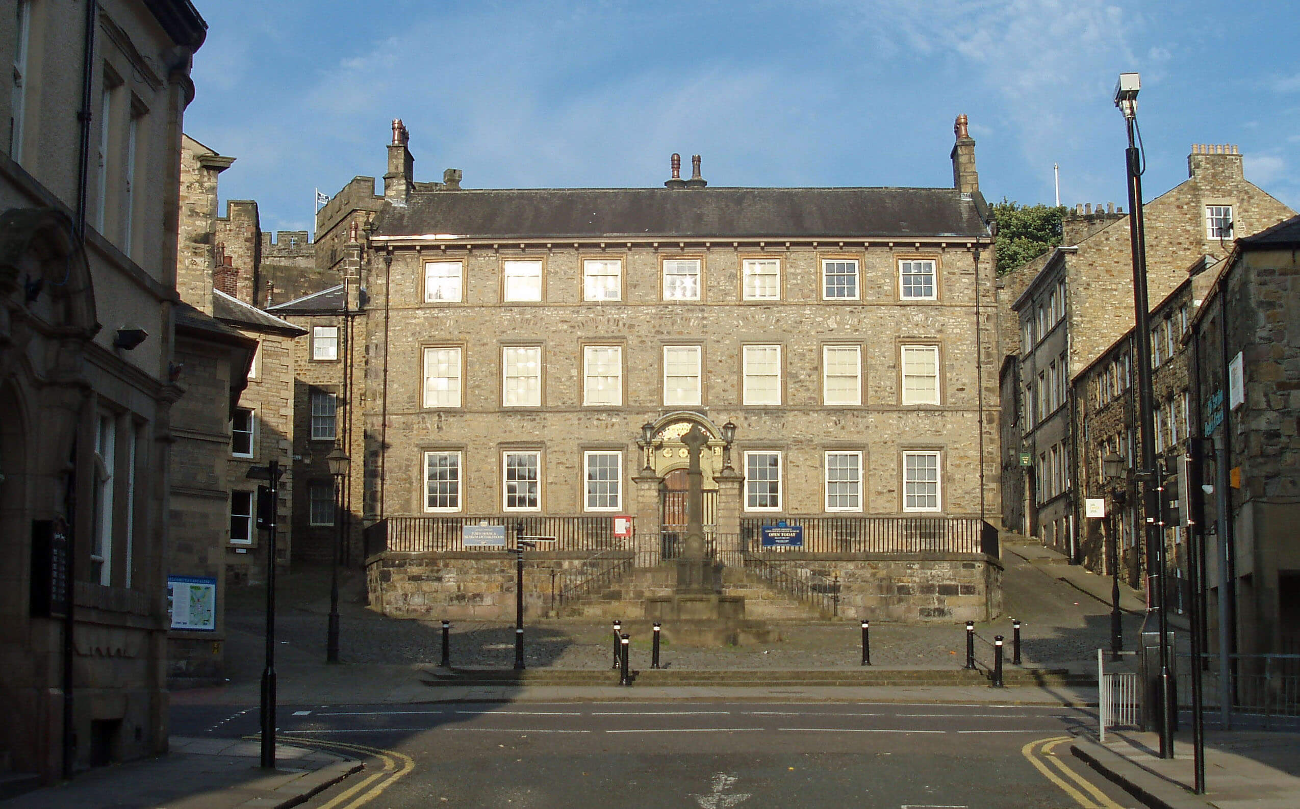 Left: The Judges’ Lodgings
St George’s Quay was duly built by 1755,
with merchants buying blocks of land behind
the new quay wall to build warehouses. The
Custom House, for the payment of harbour
dues, was built in 1764 with graceful Ionic
columns, to the design of Richard Gillow,
who had a particular interest in the success of
the quay because his company (founded by
his father, Robert) depended on the import of
mahogany from the West Indies. The Gillow
company became world famous for the quality
of its furniture, still widely admired today.
Samples of its work can be seen in the Lancaster
Town Hall and in the Gillow Museum, which
is housed in the Judges’ Lodgings, Lancaster’s
finest town house. Later, Gillows fitted out
royal yachts but, after merging with S.J. Waring
in 1903, the company closed in 1961.
Today, most of the warehouses have been
converted into flats. The Custom House ceased
functioning in 1882 and passed through various
roles, including that of theatre, before finding
an eminently suitable one as the Maritime
Museum in 1985. The museum provides an
excellent picture of the lower Lune, including
the port, the canal and Morecambe Bay.
While we are on an aquatic theme, I’ll
mention the zenith of Loyne’s sporting prowess.
The region has no major sporting venues or
events but in the suitably unsung sport of water polo
Lancaster won the British Championship every year
from 2003 to 2009, with the exception of 2008.
The Lune passes under its 43rd and last bridge,
Carlisle Bridge, for the west coast main line. Its
construction in 1846 conceded defeat for St George’s
Quay, because larger ships could no longer reach it.
The 1848 OS map marks Scale Ford 0.5km below the
bridge, indicating that the Lune here was much too
shallow for large boats anyway. In fact, in 1826 the new
steam ship John o’Gaunt had run aground here, much
to the disappointment (or amusement) of the assembled
spectators. The Port Commission did not give up
entirely: it used the compensation received from the
railway company to develop New Quay downriver of
the bridge.
Lancaster’s shipping trade, in terms of ships arriving
from or leaving for foreign ports, peaked in 1800 at 78
ships. It is a common, but mistaken, belief that Lancaster
was once a much bigger port than Liverpool and that it was
the rapid growth of the latter that ended Lancaster’s trade.
The figures show that both Lancaster and Liverpool were
minor ports in the early 17th century, with Lancaster being
the smaller, and that Lancaster grew slowly through the
18th century as Liverpool grew faster.
The main trade was with the West Indies, importing
sugar, rum, mahogany and cotton and exporting hardware
and woollen goods. Lancaster was the fourth largest port
for the West Indies trade, with about 8% of the outward
and 5% of the inward trade. The disparity in the two figures
results from Lancaster taking less part in the triangular slave
trade (whereby ships travelled to Africa, then America and
back to England) than other ports. The register shows that
the highest number of ships travelling from Lancaster to
Africa in any one year was 6 in 1772 (Liverpool registered
107 such ships in 1771).
There was also considerable European trade, such
as the import of timber from the Baltic, and much local
shipping: in 1800, 273 ships registered for trade within
Britain. After 1800, wars at sea harmed foreign trade
generally and continued silting harmed the port of Lancaster
in particular. Several local banks failed and merchants
took their trade to Liverpool and elsewhere. Although the
numbers of ships continued to rise until 1845, reaching a
peak of 712, very few of these were from overseas and
Lancaster’s proportion of the increased national trade was
much reduced. The quay was transferred from the Port
Commission to Lancaster Corporation in 1901.
The Top 10 cultural sites in Loyne
1. Maritime Museum, Lancaster
2. Lancaster City Museum
3. Ruskin Library, Lancaster University
4. Farfield Mill, Sedbergh
5. Storey Gallery, Lancaster
6. Judges’ Lodgings, Lancaster
7. Dent Village Heritage Centre
8. Cottage Museum, Lancaster
9. Bentham Pottery
10. Finestra Gallery, Kirkby Lonsdale
The Lune Shipbuilding Company was established
beside New Quay in 1863, aiming to build iron clippers.
Its first ship, the Wennington (the company chairman
lived at Wennington Hall), took three sets of emigrants
to New Zealand before disappearing in the Bali Straits
in 1878. The Lune Shipbuilding Company had already
disappeared by then, having gone bust in 1870, after
building just fourteen ships.
The site was then bought to extend St George’s
Works, a factory built from 1854. By the 1890s this
was said to be the biggest factory in the world owned
by a single man. There is no way of verifying this
now (although it seems unlikely) but the factory was
certainly large enough to employ a quarter of Lancaster’s
workforce. The ‘single man’ was James Williamson the
younger. His father, also James, had invented a type of
oilcloth as a table baize and set up the company, which
the son took over in 1875 and developed to manufacture
linoleum, in particular. He eventually became Lord
Ashton – the Lord Linoleum of Philip Gooderson’s 1995
book, Lord Linoleum: Lord Ashton, Lancaster and the
Rise of the British Oilcloth and Linoleum Industry.
In 2004 a Ł10m project for the Lancaster Economic
Development Zone was launched to revitalise ‘Luneside
East’. The industrial eyesore is being cleared and sold
to developers to build a “high quality, mixed-use urban
neighbourhood” by 2009, it was originally hoped.
However, in June 2008 the firm that had planned to
build 327 homes withdrew as a result of the housing
market downturn. In preparation, a 3km-long flood
defence has been installed, designed to protect lower
Lancaster against all except 1-in-500-year floods. It is a
bold person who will predict the effect of climate change
on sea levels in 500 years time.
[Update: Luneside East has since been redeveloped with
new houses but I don't know if this has followed the 2004 plan.]
The Priory and Custom House across the Lune
(the view after the trees were removed and before a 1.4m high flood defence barrier was installed)
The Introduction
The Previous Chapter (The Lune Floodplain and the Top of Bowland)
The Next Chapter (The Salt Marshes)
© John Self