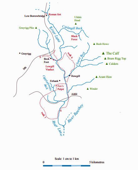
The Land of the Lune
Chapter 3: Western Howgills and Firbank Fell
The Introduction
The Previous Chapter (Shap Fells and Birkbeck Fells)
The Next Chapter (Upper Rawtheydale)
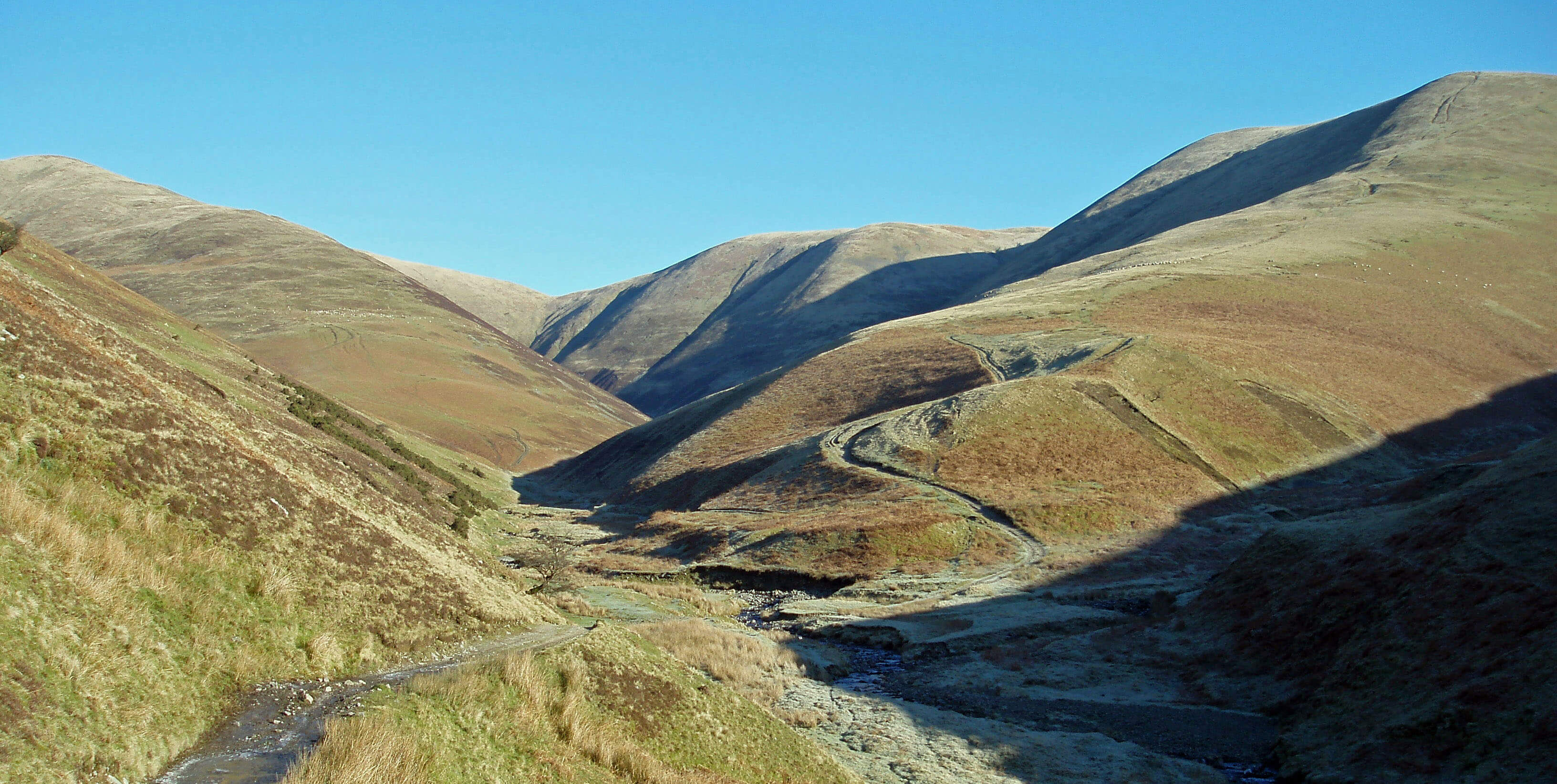
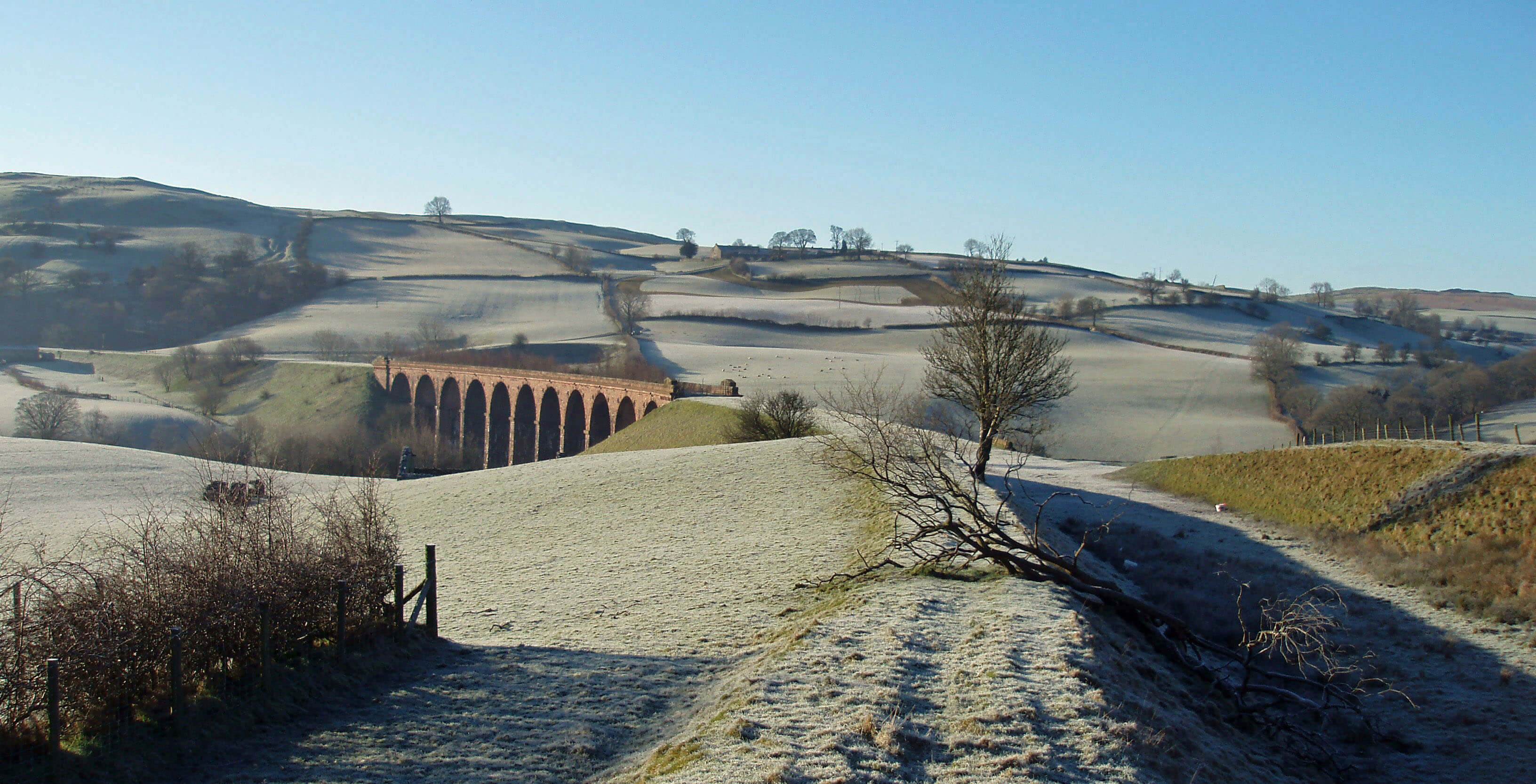
Chapel Beck, looking towards Bush Howe
The Lune from Borrow Beck ...
 Right: Low Borrowbridge
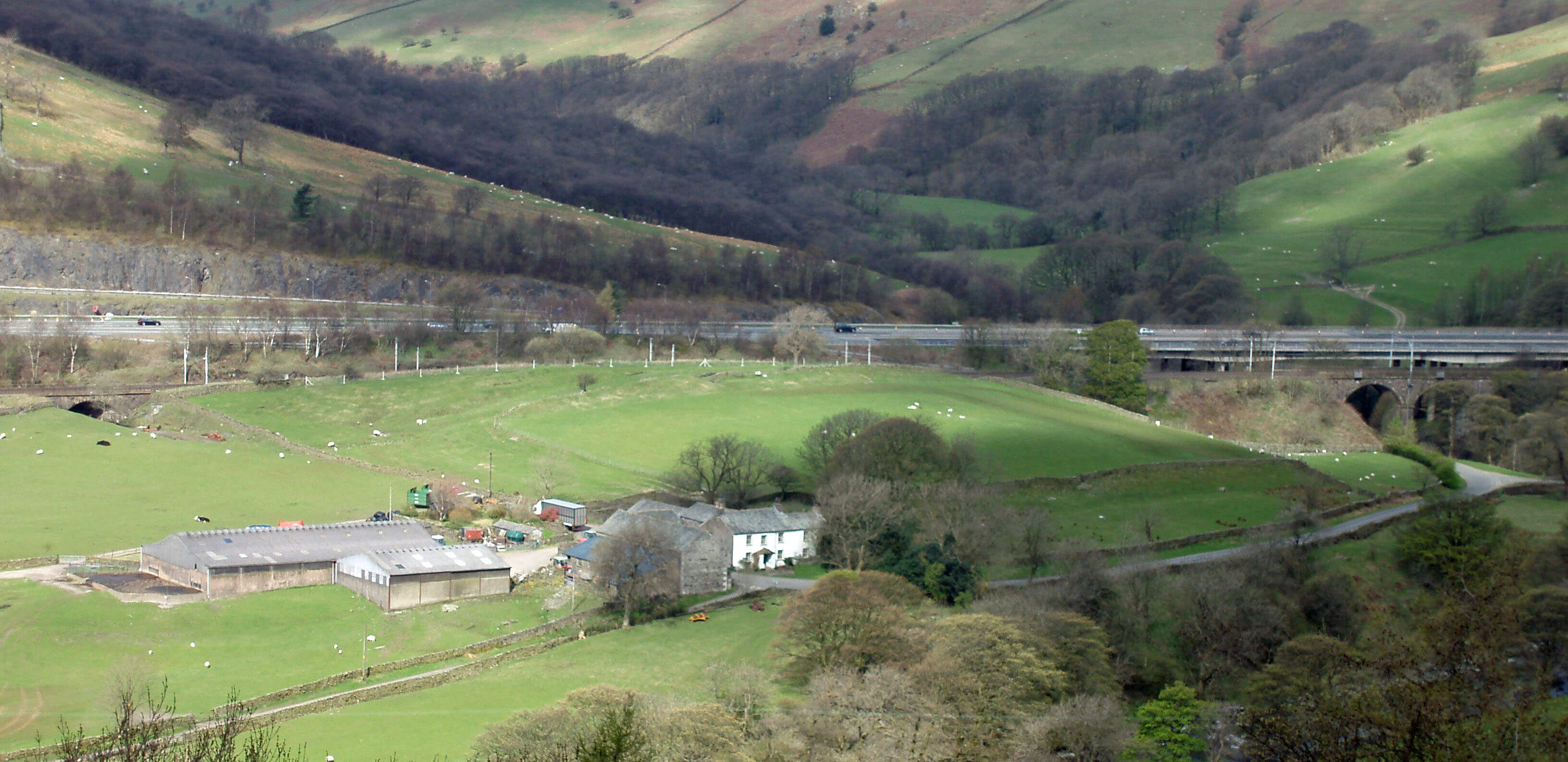
Just beyond the Borrow Beck junction at Low
Borrowbridge there is a flat, green field that seen
from the fells on either side looks like a sports arena,
which in a way it was because until the late 19th century
a large sheep fair used to be held here, with associated
sports and other activities. But long before that, from the
1st to the 4th century, this was the site of a Roman fort.
Somehow this fact became forgotten, despite the
reminder of Borrow (or burgh) Beck, until it was re-discovered in the early 19th century. This is especially
surprising since the site has been relatively undisturbed
by later building. The fort measures 130m by 100m,
adequate for five hundred soldiers. It lies on the Carlisle-Chester route and is the first of three sites of Roman
forts that we will meet. Excavations in the 20th century
have confirmed the layout of the fort but seem to have
uncovered few remains. More has been found at the
cemetery to the south, including a tombstone with the
touching inscription (not in English, of course): “Gods
of the underworld, Aelia Sentica lived for 35 years.
Aurelius Verulus erected this stone for his loving wife”.
Although the outline of the fort is clear, there is not much
to see on the ground, only ramparts along the line of the
old walls and on the west side a few ditches. Some claim
that, ignoring the railway, motorway and A685 (quite a
feat), the line of an aqueduct can be made out running
towards the fort from the slopes below Grayrigg Pike.
Grayrigg Pike is seen by many but noticed by few.
The steep crags and slopes around Great Coum and
Little Coum make them the most scenic cliffs we have
met so far but the rebounding noise of M6 traffic lessens
their appeal to walkers.
The Lune passes under Salterwath Bridge. We have
met a few ‘wath’s already and, as you might suspect, it
is an old word (Viking, in fact) for a ford. The bridge
itself was last rebuilt in 1824. At about this point, the
drove road that followed the Lune from Greenholme
swung west to skirt Grayrigg and climbed to the Lune
watershed, which it more or less followed south to
Kirkby Lonsdale.
Beyond Low Carlingill farm, the Lune meets the
most dramatic beck of the Howgills, Carlingill Beck.
Carlingill Beck
Carlingill Beck and the River Lune mark the
northwestern boundary of the Yorkshire Dales
National Park. Today this seems anomalous. A boundary
has to be somewhere but there seems no discernible
reason for it to include the southern part of the Howgills
but to exclude the northern part, as they are the same
in terms of geology and scenery. The boundary is here
simply because the old Westmorland-Yorkshire county
border lay along Carlingill Beck at the time the National
Park was established in 1954.
[Update: As has been remarked in previous updates,
the National Park boundaries were changed in 2016.
All of the Howgills are now within the Yorkshire Dales.]
The Yorkshire Dales National Park occupies some
1760 sq km and is the third largest of Britain’s fourteen
National Parks. The part we encounter in the Howgills is
uncharacteristic of the Dales, which are normally pictured
in terms of spectacular limestone scenery. The Yorkshire
Dales are no longer all in Yorkshire: the Howgills,
Dentdale and Garsdale are in Cumbria. (Some diehards,
usually Yorkshiremen, consider that the 1974 boundaries
defined new administrative regions and had nothing to do
with the traditional counties. The fact that the new regions
were also called counties and that many of them used old
county names was unfortunate but irrelevant. On that basis,
the southern Howgills, Dentdale and Garsdale continue to
be in (the traditional county of) Yorkshire and are also in
(the new administrative region of) Cumbria.)
As we will see, only a few of the Dales lie within Loyne
– Dentdale, Garsdale, Kingsdale and Chapel-le-Dale. The
Lune is the western border for 12km and Lunesdale is not
sensibly regarded as one of the Yorkshire Dales.
Like all British National Parks, the Yorkshire Dales
National Park is not state-owned but consists of privately
owned estates and farms administered by an authority
responsible for conservation and recreation. It is therefore
both a tourist attraction and a working area, which even
includes some large quarries.
 Left: Upper Carlingill Beck, with The Spout
middle right
Left: Upper Carlingill Beck, with The Spout
middle right
Right: The exposed rocks on the western slopes of
Black Force, with Carlin Gill and Grayrigg beyond
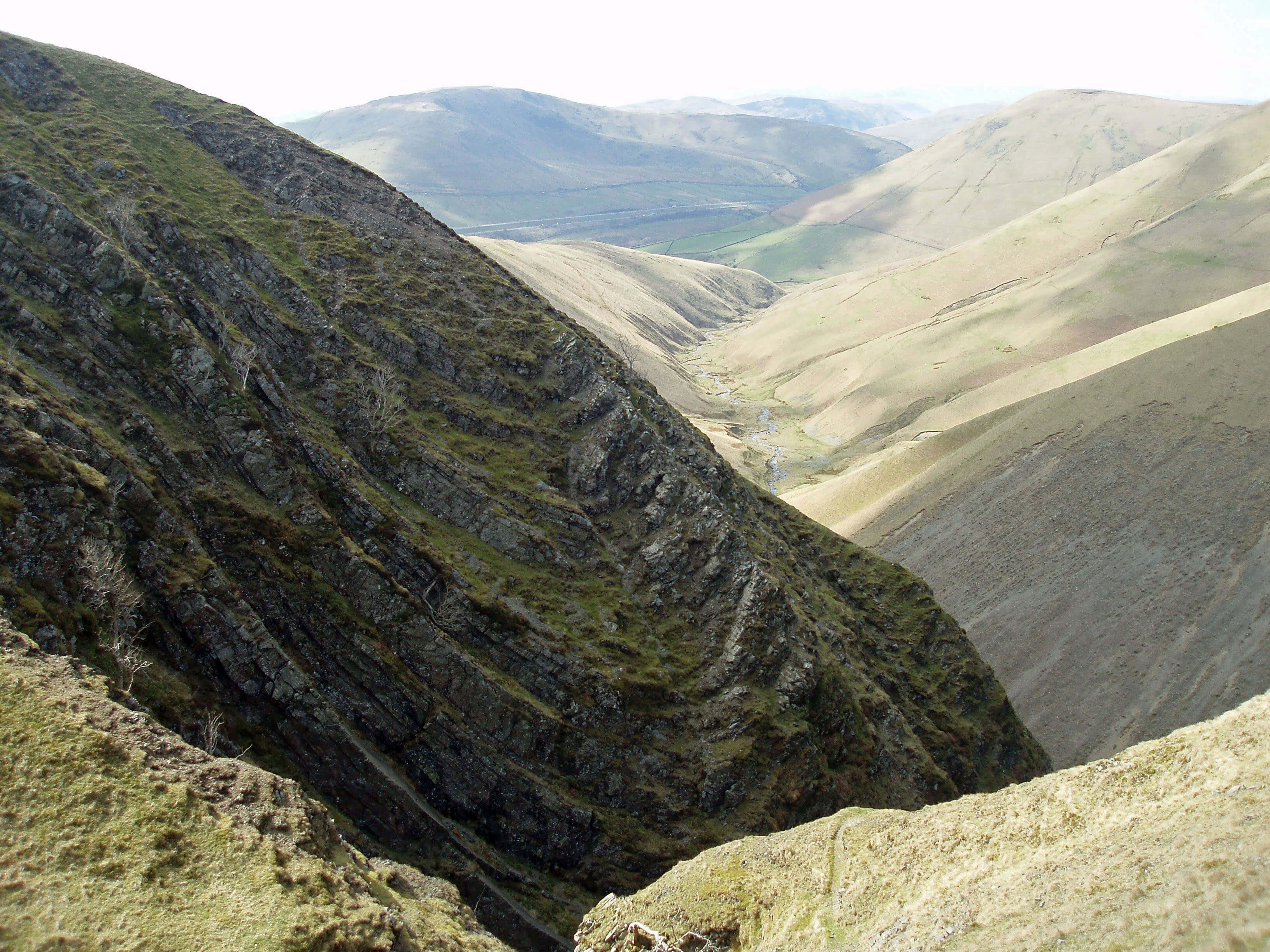
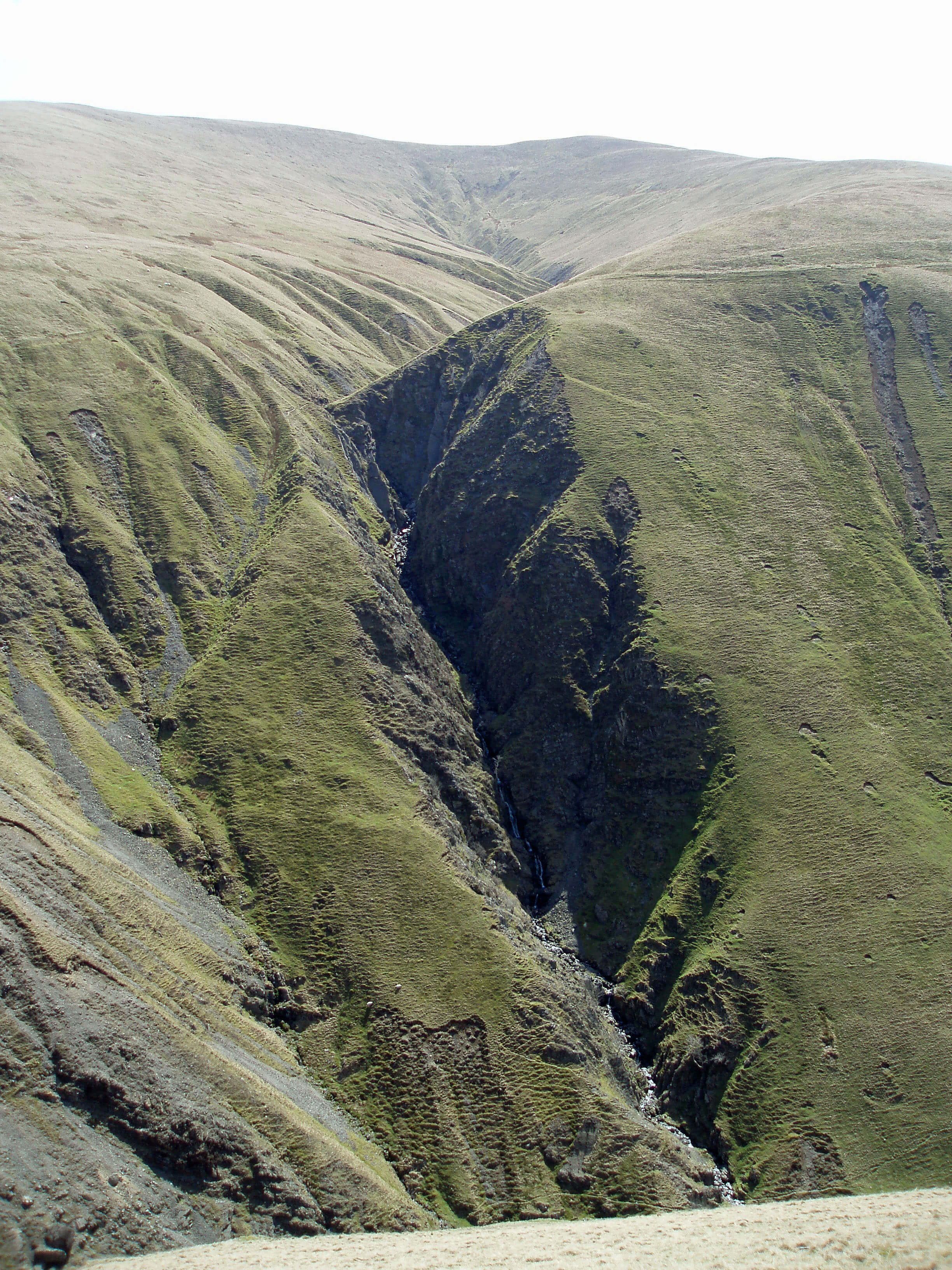
Carlingill Beck is an excellent site for students of
fluvial geomorphology (that is, of how flowing water
affects the land), providing some good illustrations of
post-glacial erosion. The beck arises as Great Ulgill
Beck below Wind Scarth and Breaks Head, on a
ridge that runs from The Calf, and then curves west at
Blakethwaite Bottom, a sheltered upland meadow below
Uldale Head. It enters an increasingly narrow gorge,
with contorted rock formations exposed on the southern
side, giving us our first real view of the Silurian slate
of the Howgills. The beck then forms The Spout, which
is as much a water shoot as a waterfall, as it tumbles
steeply over 10m of tilted rocks. To the north are
steep screes and further exposed contorted rocks
and below to the south looms the deep, dark gash
formed by Little Ulgill Beck.
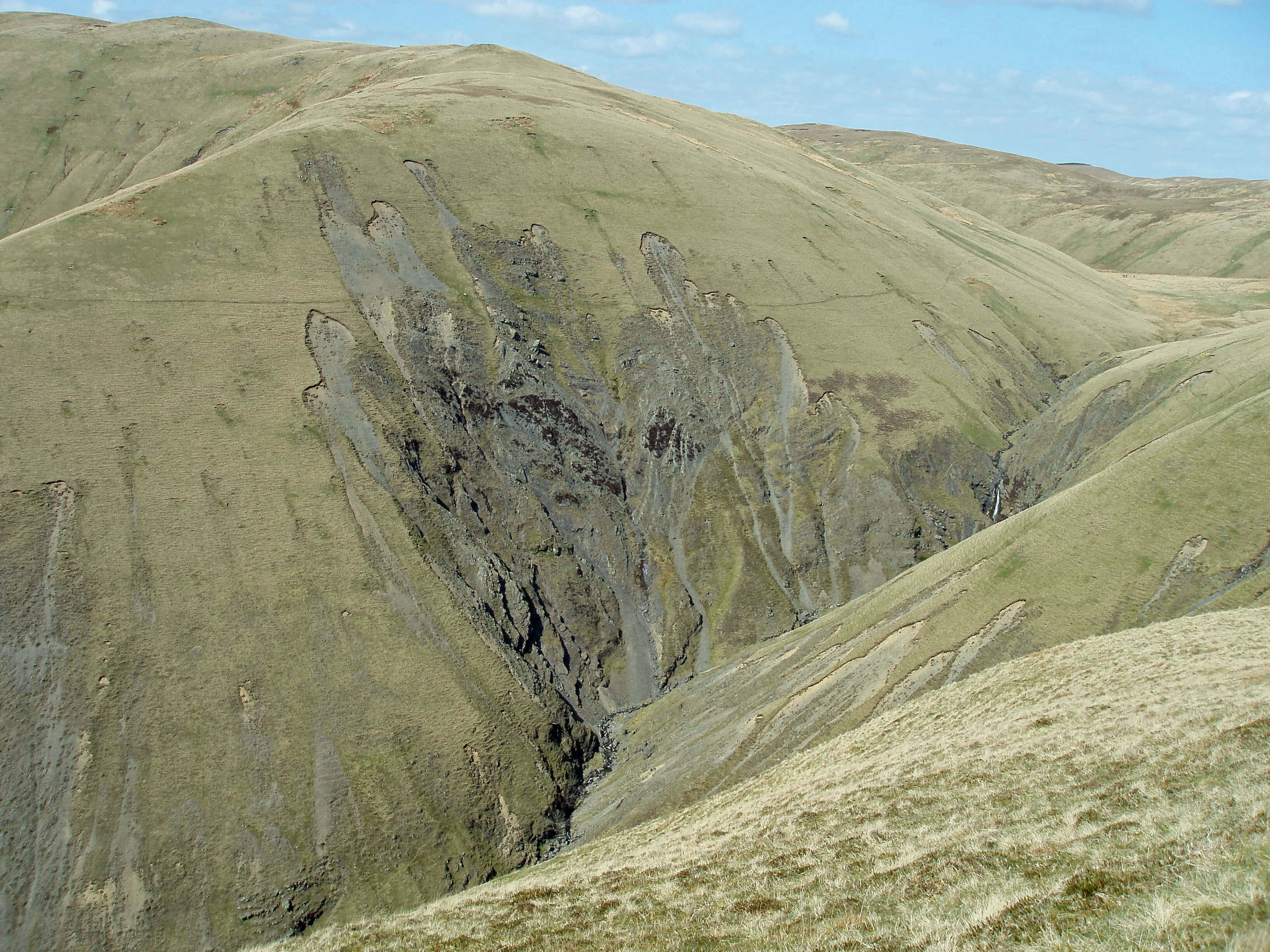
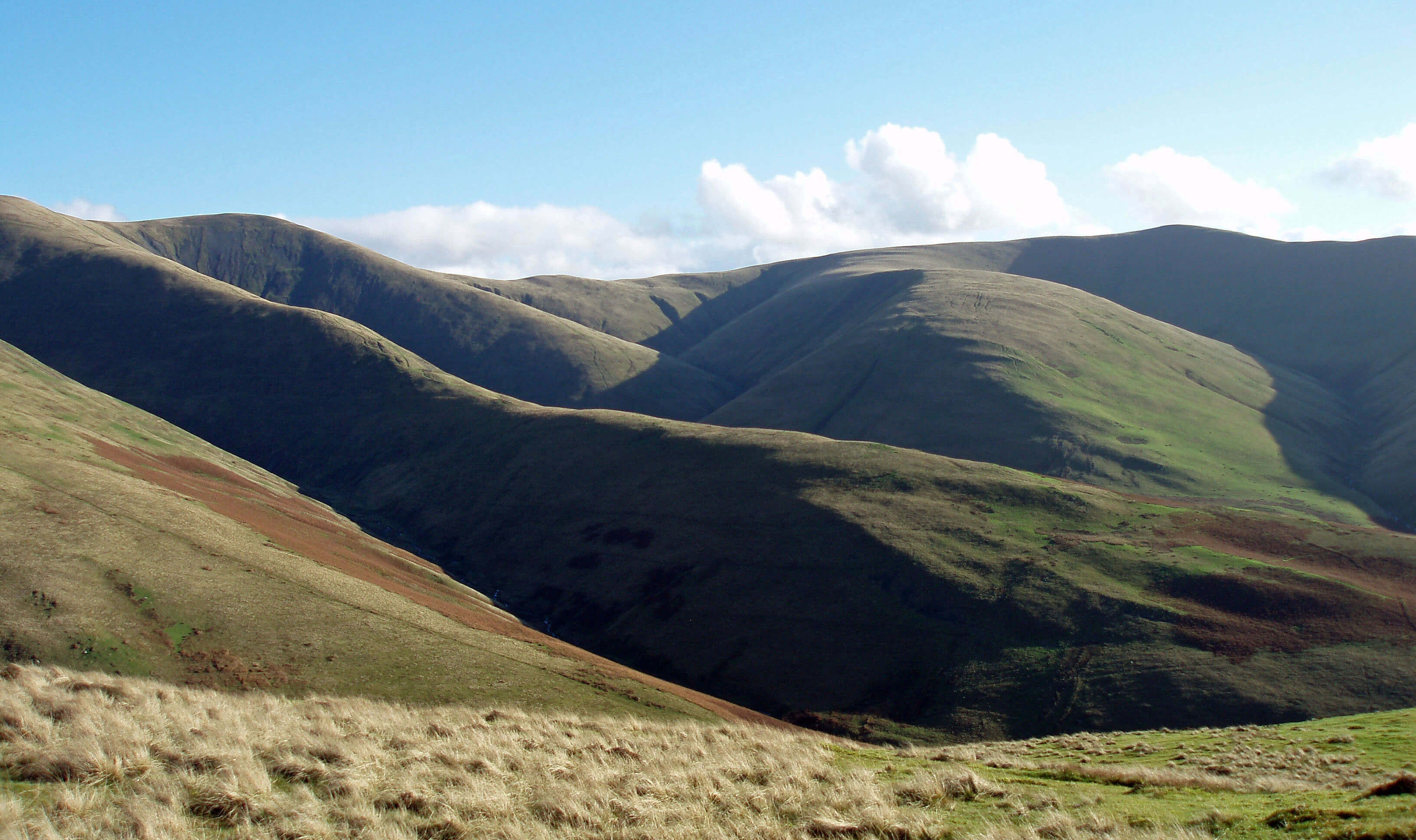
Here is Black Force, the most spectacular
scene of the Howgills: not one force but a series
of cascades, deep within a V-shaped ravine that
has remarkable rock formations exposed on its
western side. Our journey through the northern
Howgills showed us little to hint at the striking
degree of erosion hidden within this gill.
Black Force (the scale may be judged
by the two walkers and a dog on the path
top right - you can’t see them? - precisely)
Beyond admiring the awesome sights, we
might wonder about causes and effects. The
benign, smooth slopes of the Howgills do not
suggest the convulsions needed to form the
contorted rocks seen by Carlingill Beck. Are
these contortions limited to Carlingill Beck, or
are there similar rock formations hidden elsewhere? If
the latter, why have they been so dramatically exposed
only here, in such deep gullies, from such relatively
small becks? Or did the contortions cause weaknesses
that the becks have exploited?
Below Black Force, Carlingill Beck begins to
calm down. It still runs in a narrow valley, with small
waterfalls and eroded sides, but, as becks tend to do,
it eventually levels off and opens out. The lower parts
of Carlingill Beck and its tributaries, especially Grains
Gill, still show fine examples of post-glacial erosion,
in the form of deep gullies, alluvial fans and cones.
The relative absence of human and animal disturbance
and the frequency of heavy flooding enable the study
of hillside erosion, the changes of flow directions, and
the dynamics of debris flow and deposition. Even to the
non-expert, the scenes provide remarkable evidence of
the continuing impact of erosive forces.
The beck passes under the old Carlingill Bridge.
Being on a county border is a problem for any self-respecting bridge: in 1780, when Carlingill Bridge
was dilapidated, Westmorland quarter sessions ordered
a contract to rebuild half of it. Happily, the bridge
is now all in Cumbria. Unhappily, it was still in need
of repair when I last visited. There is a final burst of
energy as Carlingill Beck runs through the narrow gorge
of Lummers Gill to enter the Lune but, under normal
conditions, it still seems far too demure to have caused
the effects seen upstream.
Any walkers who have strolled in Bowderdale and
Langdale and are wondering about an outing along
Carlingill Beck should be warned that this is a more
serious undertaking. Walking by the beck itself involves
a fair amount of rough scrambling and, if the beck is
high, may be impossible. Black Force cannot be walked
up, although it is possible to clamber up the grassy slope
to the east. The path to The Spout is increasingly difficult
and it likewise becomes impassable, although there is
a challenging escape to the north. The public footpath
from the south past Linghaw, which can be continued to
Blakethwaite Bottom, provides no view into the Black
Force ravine.
The Lune from Carlingill Beck ...
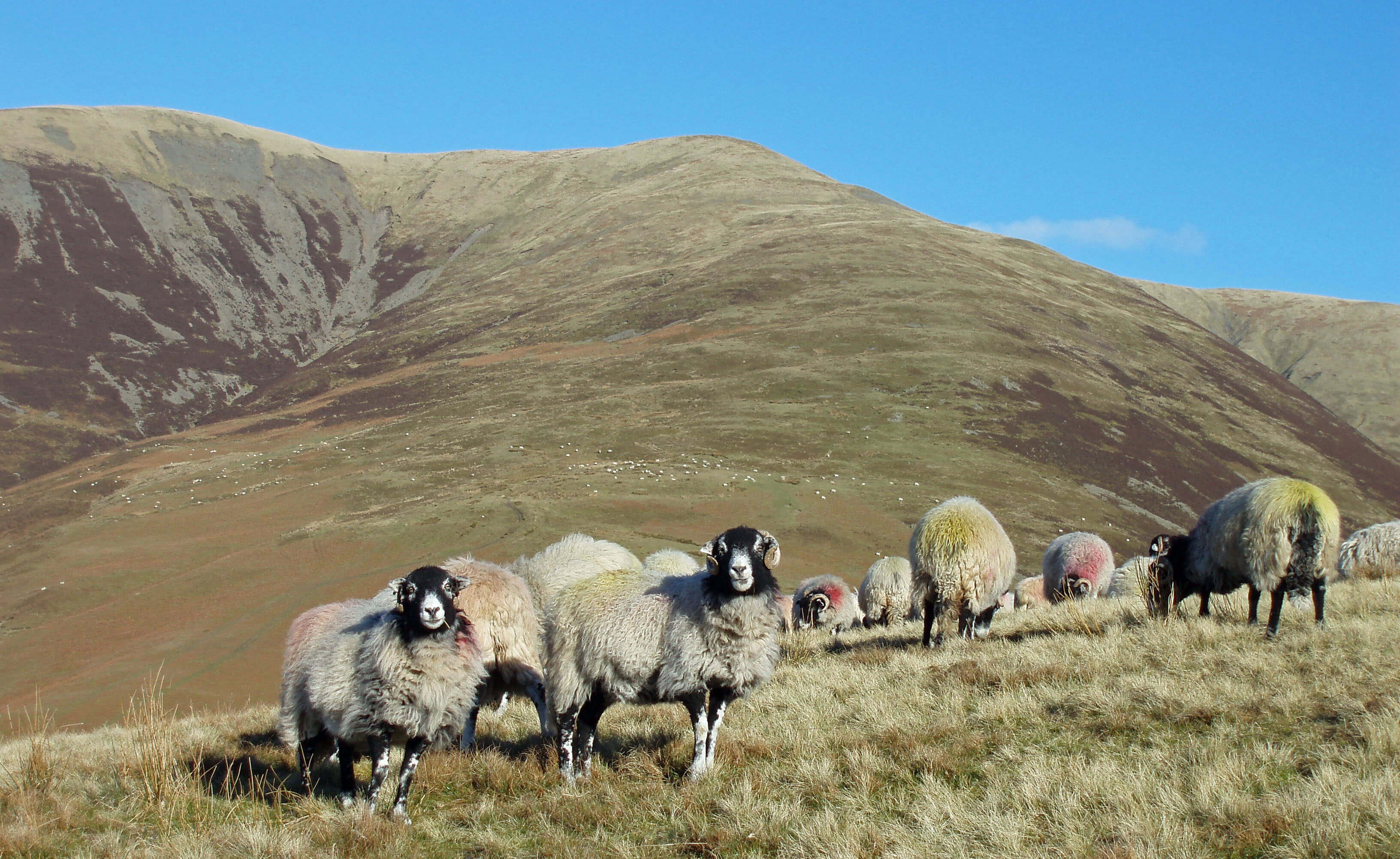
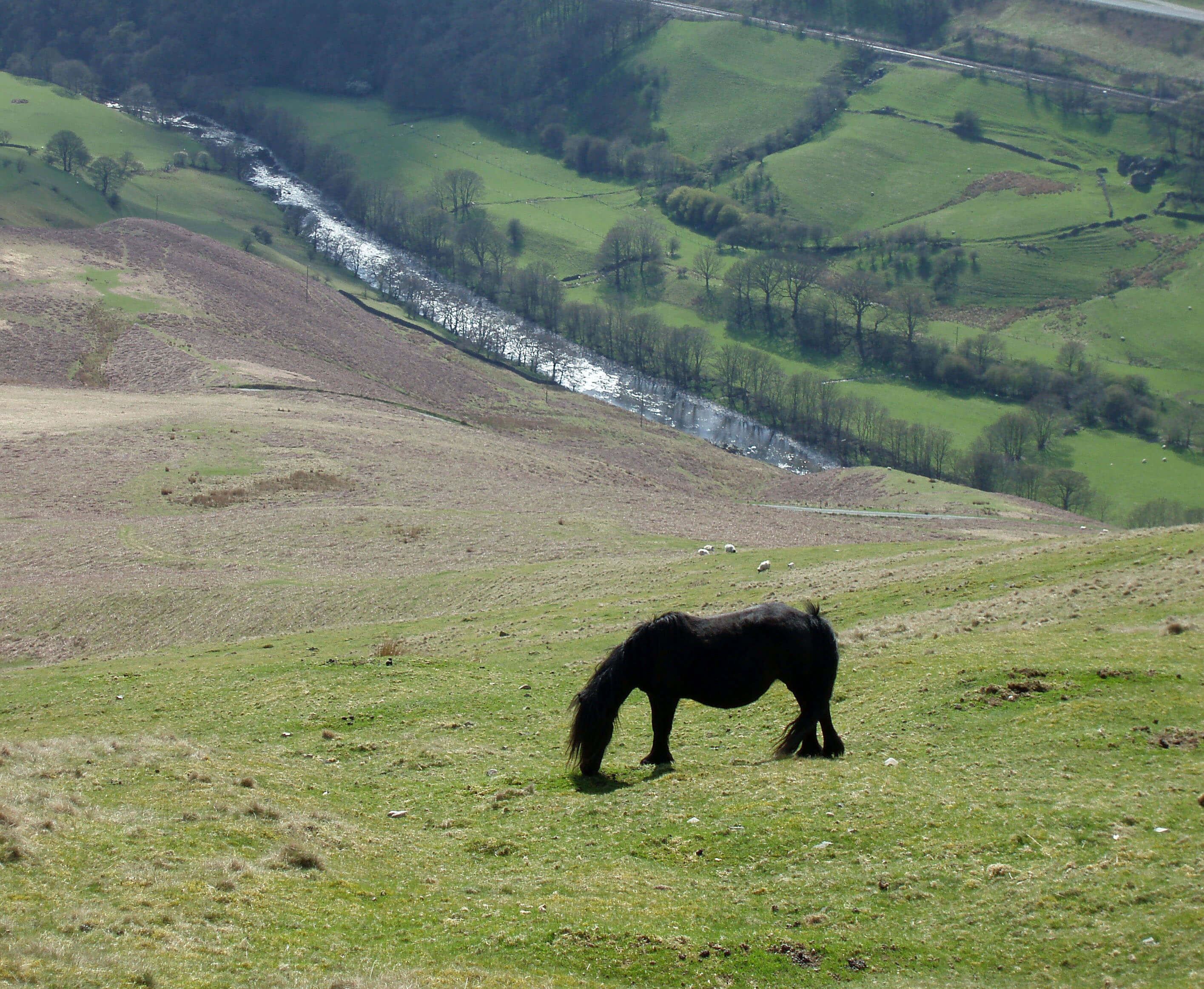 Left: Sheep below Fell Head
Right: Fell pony and the River Lune from Linghaw
According to a generally accepted theory, long
ago the Lune used to begin about here. It is
believed that the Lune was then formed from the
becks that drain south from the Howgills, with
all the becks we’ve met up to now (Bowderdale
Beck, Langdale Beck, Borrow Beck, and so
on) at that time flowing north within the Eden
catchment area. The Lune watershed was then
south of what is now the Lune Gorge. In time,
the headwaters of the Lune eroded northwards to
capture Borrow Beck and then all the other becks
to divert their flow southward. The evidence for
this is complicated, involving the ‘open cols’ to
the north through which no water now flows,
or much less water than the size of the valleys
would suggest; the fact that the flow of the
northern becks is discordant to the underlying
rocks; and the history of geological uplifts and
tilts. The more recent glaciation has obscured
most of this evidence for the untutored eye.
Above the Lune is Gibbet Hill, where the
bodies of miscreants were displayed and where
alleged eerie noises are now drowned by the M6.
The small road to the east of the Lune, Fairmile
Road, is along the line of the Roman road that
led south from Low Borrowbridge. A part of the
Roman road that diverges from the present road
was investigated in 1962. At Fairmile Gate, the
road crosses Fairmile Beck, which runs from the
hills by Fell Head and Linghaw, which are good
vantage points for the Lune valley. Fell Head is
one of the more identifiable hills of the Howgills,
having a covering of heather and hence a dark
appearance.
The Lune reaches the Crook of Lune Bridge,
which is the quirkiest of all the Lune bridges. It
is a sturdy yet graceful 16th century construction,
with two 10m arches and a width of about 2m.
Being a little upstream of the two lanes that
drop down to it, it makes a tricky manoeuvre for
vehicles. It’s as though the 16th century builders
wanted to ensure that no 21st century juggernaut
could cross.
At the bridge we meet the Dales Way at
exactly the point that it leaves (or enters) the
Dales. The Dales Way is a 125km footpath
between Ilkley and Bowness-on-Windermere, passing
through many of the most attractive dales, especially, if
I may say so, this stretch of the Lune.
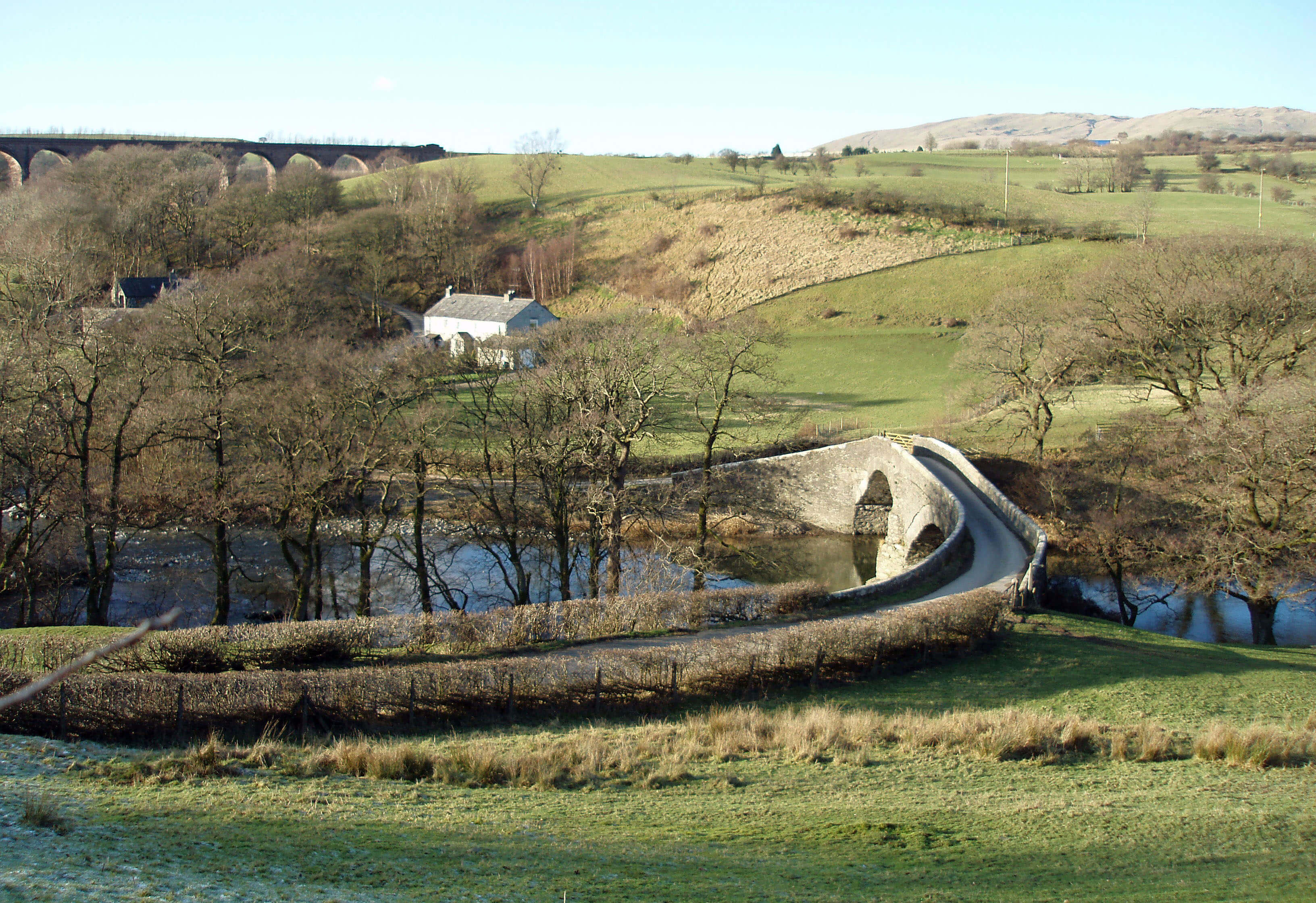
Crook of Lune Bridge
Just beyond the bridge, Lummer Gill joins the
Lune, having run from Grayrigg Common, through
Deep Gill, under the motorway and railway (where,
thankfully, they veer away from the Lune valley), past
the village of Beck Foot and then under the magnificent
curved Lowgill Viaduct. The eleven red arches stand
30m high and seem so thin as to be flimsy but for over
a hundred years (1861 to 1964) they carried trains on
the Lowgill-Clapham line, a central part of the Loyne
railway network. A failure of railway politics meant
that it was never used as originally intended, that is, for
Ingleton to Scotland traffic – until the winter of 1963
blocked the Settle-Carlisle line. Thanks to the work of
the British Railways Board (Residuary) Ltd in 2009 the
viaduct is no longer the aerial arboretum it had become,
with shrubs and trees sprouting from the track.
Lowgill Viaduct
The Lune accompanies the Dales Way for 2.5km.
This is a gentle, bubbling stream in summer, but a
torrent after heavy rain on the Howgills. Debris in the
tree branches shows that the floodplains are indeed
occasionally under water.
This is a good stretch along which to spot the
dipper, the bird that best represents the spirit of the
becks. It is the only passerine (that is, perching bird) that
is adapted to aquatic life, in being able to close its ears
and nostrils under water, having no air sacs in its bones,
and in being able to store more oxygen in its blood
than other passerines. It uses its wings to swim under
turbulent water in its search for insect larvae. It will be
seen bobbing on a rock or flying fast and direct, low over
the water.
The presence of dippers along any beck is a measure
of the health of that beck. Sadly, the number of dippers
seems to be declining along the Lune and its tributaries,
probably because of the damage to riverbanks, where it
nests, and the building of weirs for flood control, which
reduces the turbulence that dippers need.
The Top 10 birds in Loyne
1. Dipper: for its spirit
2. Curlew: for its call
3. Lapwing: for its flight
4. Kingfisher: for its colour
5. Skylark: for its song
6. Oystercatcher: for its bill
7. Heron: for its style
8. Hen harrier: for its rarity
9. Sand martin: for its nest
10. Swan: for its grace
Honourable mention: the snipe.
Ellergill Beck, running from Brown Moor past
Beck House, and the more substantial Chapel Beck
next supplement the Lune. Chapel Beck is the largest
beck of the western Howgills. The western slopes below
Arant Haw, Calders, Bram Rigg Top, The Calf, White
Fell Head and Breaks Head all contribute to it. Its slopes
also have two of the clearest paths in the Howgills, on
either side of Calf Beck, providing an excellent walk
to The Calf. On this walk you would see the Horse of
Bush Howe. This is a natural (it seems to me) rocky
outcrop in the vague shape of a horse, although there are
stories that in the past people devoted a day each year to
keeping the horse in shape. (The horse can be seen in the
photograph at the beginning of this chapter: it is bisected by the shadow on
the hill middle right.) One legend is that it was created
as a signal for smugglers in Morecambe Bay. One can
only smile at the misguided attempts to add a touch of
glamour to the Howgills, and move on.
Looking towards Arant Haw and Brant Fell
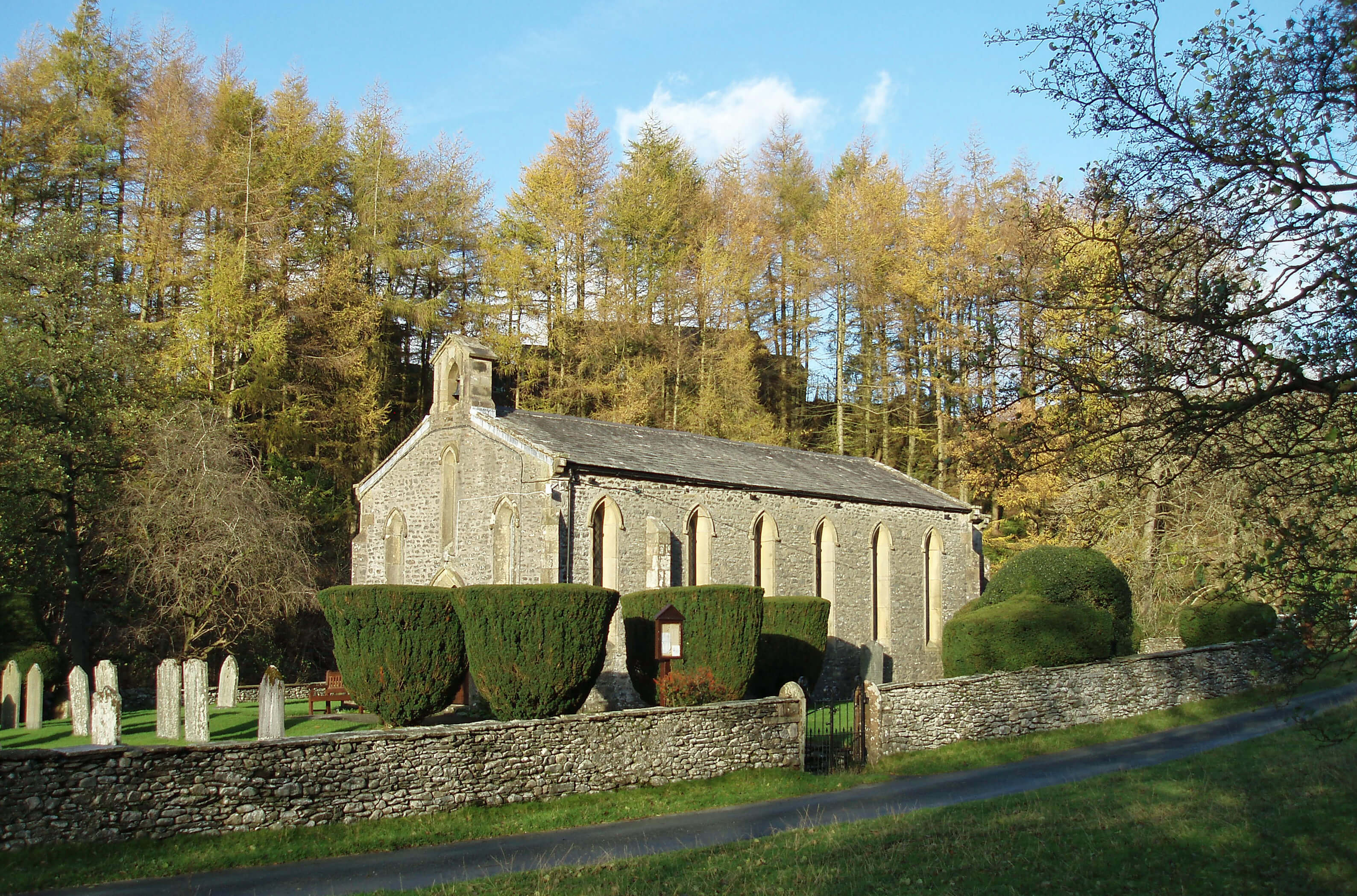 Right: Holy Trinity Chapel, Howgill
After Castley Wood, Chapel Beck passes through
what is, if anywhere is, the centre of the scattered
parish of Howgill, which gives its name to the whole
area. The Holy Trinity Chapel, built in 1838, presents
an unreasonably pretty picture, with its narrow windows
and its neatly shaped bushes and with the old mill,
school and cottages nearby. Below the chapel we see an
example of the work of the Lune Rivers Trust.
The Lune Rivers Trust (formerly the Lune Habitat Group)
was formed in 1997 to help protect watercourses, regenerate
habitats, and encourage the biodiversity of the Lune - and
its tributaries, for of course the Lune cannot be healthy if
its tributaries are not. The aim is to improve landscapes,
reduce erosion and safeguard water quality. The Trust is a
public charity aiming to develop coordinated programmes
of action involving farmers, land-owners, national parks,
government ministries, angling clubs, and anyone else with
a concerned interest in the Lune.
Some of the Lune’s problems are attributed to the
damage that sheep and cattle cause to riverbanks. Therefore,
as at Chapel Beck, the Trust has carried out a programme
of fencing and tree planting in order to stabilise the banks.
So far, some 60km of riverbank have been protected, to
benefit wildlife such as otters, water voles, kingfishers and
dippers, as well as fish populations.
The maturing Lune runs deep below grassy slopes,
passing under the Waterside Viaduct, which is notable
for being the highest bridge across the Lune, 30m above
the heads of walkers on the Dales Way. Like the Lowgill
Viaduct, the Waterside Viaduct used to carry the Lowgill-Clapham railway and is a fine structure, although here the
seven arches are of irregular size and the middle section
is of metal. Both viaducts are Grade II listed structures
and, like the Lowgill Viaduct, the Waterside Viaduct has
recently been renovated.
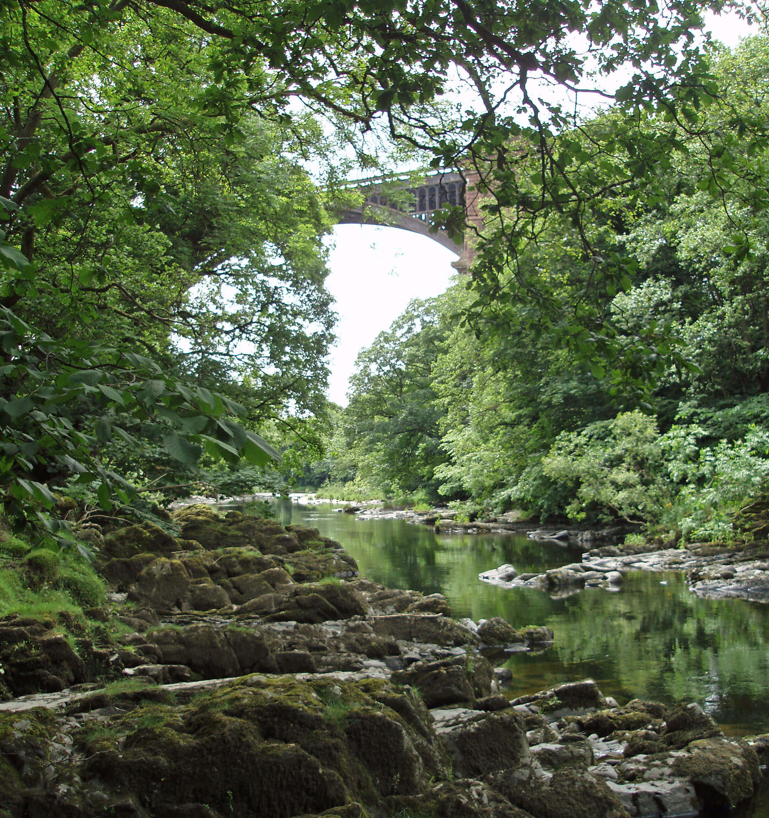
Waterside Viaduct
Walk 6: Lowgill and Brown Moor
Map: OL19 (please read the general note about the walks in the
Introduction).
Starting point: The roadside verge by the railway before the road drops down to Beck Foot (610964).
This walk includes the best stretch of path beside the Lune and a taste of the Howgills, without going to the highest tops. The
initial noise of the motorway and railway perhaps adds to our appreciation of the serenity of the Lune valley.
Walk east to the B6257 (with the Lowgill Viaduct directly ahead) and pass under the viaduct, noticing the packhorse bridge
dwarfed under it, to Crook of Lune Bridge. Immediately after the bridge, turn left, taking the path above Nether Fields Wood to
Brunt Sike. Then double back, walking across fields to Gate House.
Continue to Beck House and Beck Houses Gate, beyond which you are on the open fell. Walk up Brown Moor (412m) and
stop to admire the view, from Fell Head on the left to Brant Fell on the right. There’s a good view of the so-called Horse of Bush
Howe but better is the sight of the neatly interlacing ridges up the various valleys.
Walk south to Castley Knotts, drop down to the footpath, and follow it through Castley to Gate Side. Walk south on the road
and turn right after Chapel Beck, past the Holy Trinity Chapel, and take the track to Thwaite, where the path is rather hidden
behind the barn to the left. Continue towards Hole House but don’t go that far: at Smithy Beck drop down to the Lune. Now
you follow the Dales Way back to the Crook of Lune Bridge. Route finding is no problem, so you may concentrate on spotting
dippers, kingfishers, herons, and other riverside birds.
From the bridge you could return the way you came or, trusting the OS map (for there is no signpost), turn right across fields
to Nether House, which although marked on the map is just a small pile of rubble. Walk up its old drive and detour right along the
road for 400m to view the neat, red Railway Terrace. Return past Lowgill Farm, turn left on the B6257 and right through Beck
Foot back to the starting point and the noise of modern transport.
Short walk variation: For a short walk I’d suggest heading straight for Brown Moor and back via Castley Knotts. So, walk over
the Crook of Lune Bridge, east for 1km, turn left through Riddings, on to Gate House, then up to Brown Moor and Castley
Knotts, and back west past Castley and Cookson’s Tenement and on 3km to the starting point.
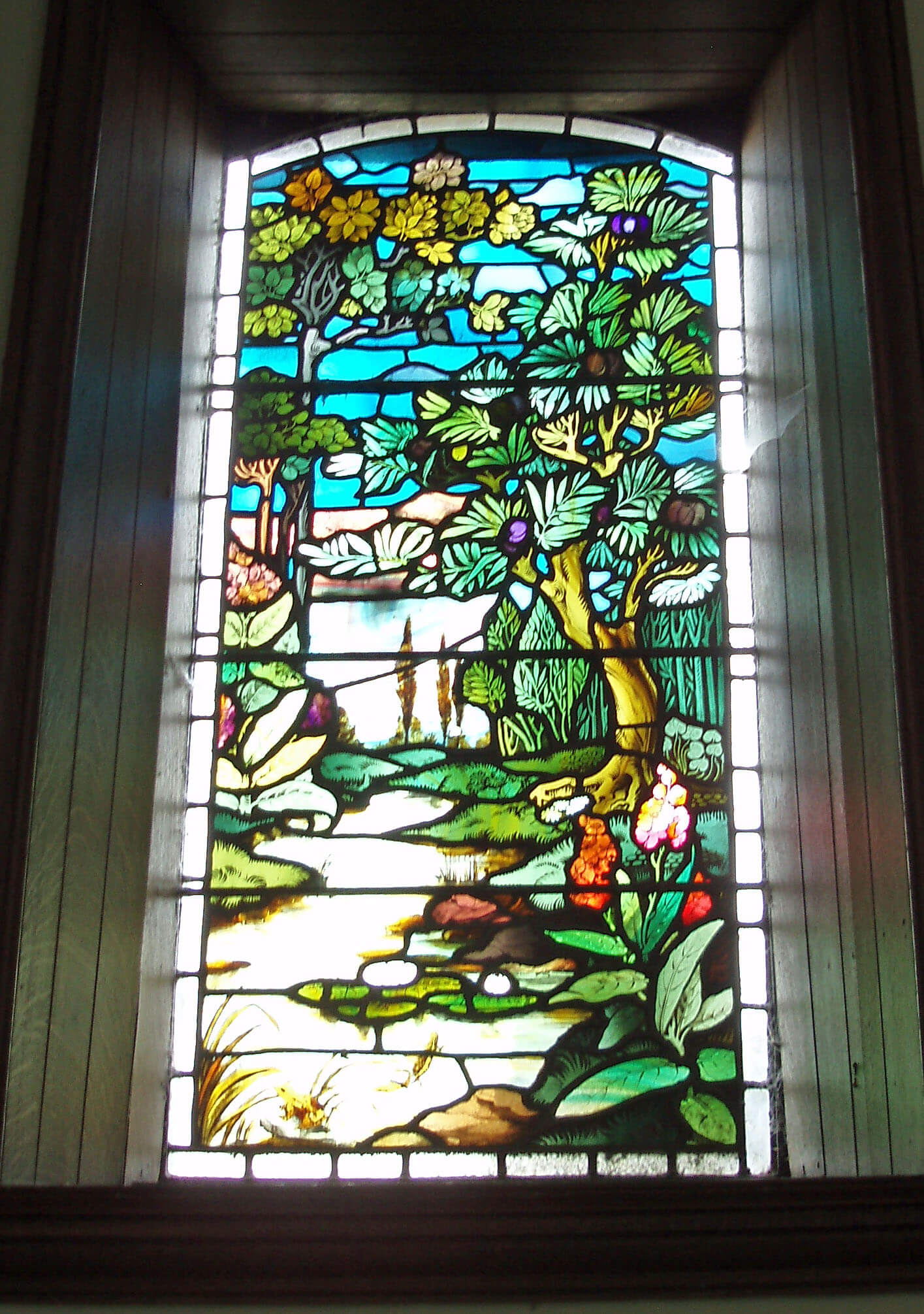 Right: The stained glass windows of the Vale of
Lune chapel, which illustrate nature rather than
religious themes
Right: The stained glass windows of the Vale of
Lune chapel, which illustrate nature rather than
religious themes
The Lune accepts the tributary of Crosdale Beck,
which runs off the slopes of Arant Haw, and moves
towards the 17th century Lincoln’s Inn Bridge. Sadly,
Mr Lincoln and his inn are no longer with us, and some
might wish the same of the bridge, as it makes a narrow,
awkward turn on the busy A684. Like most bridges, it
forms a better impression from the riverside.
Here we detect some pride in being next to the Lune,
for as well as the farm of Luneside there is, just along the
A684, a Vale of Lune Chapel, now called St Gregory’s.
This was built in the 1860s, whilst the railway line
was being constructed, and, judging from its unusual,
robust design, it may have been built by rail workers.
This supposition is perhaps supported by a comment
in a booklet about the chapel that it was designed to be
“a plain building of studied ugliness”. Would a proper
architect take on such a challenge?
Opposite Luneside, Capplethwaite Beck enters the
Lune.
Capplethwaite Beck
Capplethwaite Beck and its tributary Priestfield Beck
run from Firbank Fell behind the ridge to the west
of the Waterside Viaduct. This unprepossessing moor
is known only for two things: Fox’s Pulpit and its
magnificent views of the Howgills.
From the plaque at Fox’s Pulpit there is a view
south along the Lune valley to the Ward’s Stone ridge
of Bowland Fells, 35km away. However, there is no
view of the Howgills, which is strange. One of the
Quaker beliefs, as noted in Fox’s journal, is that “the
steeplehouse and that ground on which it stood were
no more holy than that mountain”. Surely Fox would
have positioned himself about 200m east so that when
expressing such a sentiment he could gesture towards
the Howgills. That would convince anyone, and I could
even imagine listening to a three-hour sermon myself
if I could look at the Howgills at the same time. There
is still a graveyard by Fox’s Pulpit but the church that
Fox disdained has left in a huff, demolished by a gale
in 1839.
Fox’s Pulpit marks one of the few events in Loyne to be
considered of national importance. Here on June 13th 1652
George Fox preached to one thousand people for three
hours, according to his own journal, an event nowadays
often regarded as establishing the Society of Friends (or
Quakers).
The Quaker movement has been particularly
influential in the Loyne region. No doubt the emphasis on
equality and on the spirituality within people, rather than
churches, rituals and sacraments, appealed to independent,
poor northerners.
The mid 17th century – Oliver Cromwell, Civil
Wars, and so on – was a fertile, if challenging, time for
non-conformist religious movements but Quakerism was
a social movement as well, because the promotion of
equality naturally upset the privileged, powerful members
of society who did not receive from Quakers the respect
or deference they expected. This partly explains the years
of persecution suffered by Quakers. Fox himself was
imprisoned seven times.
It also explains the large number of ‘meetinghouses’
that we will pass. Quakers did not build churches, as it
was against their beliefs and would have been asking for
trouble. To begin with, they met within one another’s
houses. In some Loyne valleys almost every farmstead
may be described as an old Quaker meetinghouse – that
is, an old farmstead within which Quakers met. After the
Restoration of the monarchy (1660), matters gradually
improved for Quakers but the laws under which they had
been persecuted were not ended until the 1689 Act of
Toleration.
Incidentally, given the Quakers’ views on the
established church, is it coincidence that the two
becks’ names (Capplethwaite (chapel-meadow?) and
Priestfield) should assert their religiosity?
The name of Firbank is in fact known for a third
reason, at least by Australians: Firbank Grammar School
is one of the leading private schools in Australia. Another
coincidence? No, it was established in 1909 by Henry
Lowther Clarke, archbishop of Australia, who was born
at New Field, Firbank, 1 km south of Fox’s Pulpit.
The footpaths of Loyne pass through many hundreds
of farmsteads. I have found (with but one exception,
which I prefer not to dwell upon) that residents welcome,
or at least accept or are resigned to, strangers wandering
through their yards. I have also found an extraordinary
range of objects within these yards, showing that many
farmsteads are no longer farming or have needed to
diversify in order to supplement their farming income,
which is indicative of the continually evolving rural
character of Loyne. For example, at Shacklabank, 2km
south of Fox’s Pulpit, there is a gypsy caravan in the
yard (actually, I recall a set of them but the website says
that there is only one: I will have to return and count
them or it). This provides accommodation for visitors on
“free range walking holidays” or who consider mucking
in on the farm a holiday. This development received a
Cumbria Tourism Award in 2008.
Capplethwaite Beck runs past the 16th century
Capplethwaite Hall, which was the home of the Morland
family, one of whom, Jacob, was painted in 1763 by
George Romney before he became so obsessed with
Emma (later Lady) Hamilton that he painted her sixty
times. This portrait is now in the Tate Britain gallery,
and a grand figure he looks, although not as grand as the
Howgills behind, which unfortunately he is obscuring.
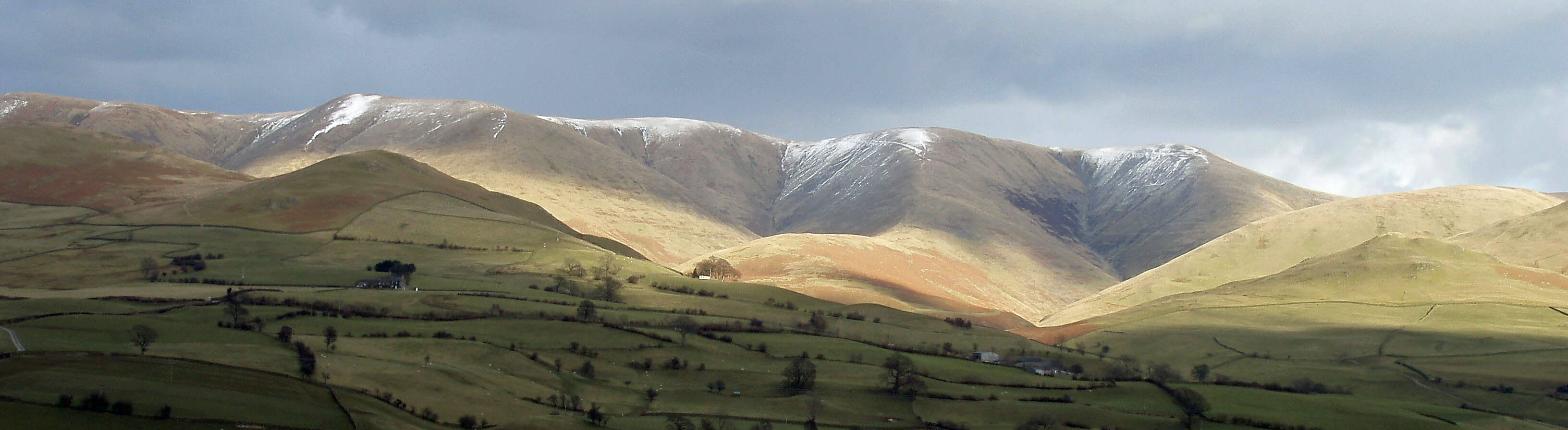
The western Howgills from Dillicar
Walk 7: Fox’s Pulpit and the Waterside Viaduct
Map: OL19 (please read the general note about the walks in the
Introduction).
Starting point: Killington New Bridge (623908).
Walk south by the Lune to Bowersike and take the track up to Greenholme, where there’s a good view back to Winder,
Baugh Fell and Middleton Fell. Through Greenholme, follow the wall on the right that swings north. Across a small beck, the
track turns west towards a plantation where there’s a reassuring footpath sign. It’s quiet here, among the bracken and heather, but
from the corner of the plantation you see, a few kilometres away, reminders of the 21st century – Killington Service Station and
the Lambrigg wind turbines.
Beyond the plantation the path drops down to a white gate, where you turn right to another white gate, from which there
is a view of the Howgills from Winder to Fell Head. Note the prominent white building 2km ahead (New Field), which is your
next objective.
Cross the A684. There is no clear path on the CRoW land but make your way across to Ghyll Farm, which is on Capplethwaite
Beck. There seem to be no signposts at Ghyll Farm, so be careful to turn left off the drive, before a barn, heading north. After
500m you reach the white building you noted before.
[Update: A reader says that a more accurate description of the
path from Ghyll Farm is "to turn left off the drive, to the left side of a large barn, ending up
behind it, from where the path heads north through a gate. There is another small gate in the wall across the
field which you need to go through". I'll take the reader's word for it - all I remember now is
that I became somewhat puzzled around Ghyll Farm.]
From New Field, walk 1km along the road to Fox’s Pulpit. By now, you might appreciate that Fox did well to attract a
thousand people up here. Walk east across the CRoW land of Knotts and, when the view ahead is revealed, pause to relate the
panorama to your map – in particular, identify the large farm of Hole House, 1km northeast. Head in the general direction of Hole
House until you reach either a wall or a clear footpath running north-south (between Stocks and Whinny Haw). In the former
case, follow the wall to the right until the footpath is reached.
Walk to Stocks and continue on the road north but before Goodies turn right over the old railway line and cross the Lune
footbridge. Walk up by Smithy Beck to Hole House. You are now on the well sign-posted Dales Way. Follow this for 3km past
the Waterside Viaduct, Lincoln’s Inn Bridge and Luneside.
Short walk variation: From the bridge, walk west, first on the road and then on a footpath, to Grassrigg. Walk south 200m to gain
the footpath that runs north above Grassrigg. Cross the A684 and take the path to Shacklabank. Walk north for 500m to take the
path that drops through Hawkrigg Wood, across the B6257, to Lincoln’s Inn Bridge. Follow the Dales Way south and where it
turns left to The Oaks, turn right to the Lune and back to Killington New Bridge.
The Lune from Capplethwaite Beck ...
 Left: The Lune at Killington New Bridge
Right: The Lune at Stangerthwaite
Paddlers (in a canoe, that is) feel the adrenaline
rising as they and the Lune approach the next
section, which includes a narrow rapid called the Strid
that drops 2m into a large pool. This is the liveliest
part of the whole Lune, as it tumbles through and over
sloping rocks and into deep pools, and one of the most
challenging canoeing stretches in northwest England.
(An experienced outdoor instructor died here in 2007.)
It may be viewed from a footpath that leads north from
Killington New Bridge. The bridge has a single 18m
arch and is not new. A proposal to build holiday chalets
in the field southwest of the bridge would, if accepted,
enable many more visitors to enjoy, or spoil, the scenic
tranquillity of the region.
At the bridge there used to be a notice: “SAA No
canoeing”. I expect that SAA is the Sedbergh Angling
Association but I was unsure of the legal status of their
notice. The SAA presumably owns the banks and can
insist upon private fishing. Does it own the Lune too? Can
it prevent others using the Lune? Obviously, they would
prefer canoeists not to tangle their lines and disturb their
fish. Indeed, I would prefer canoeists not to disturb the
dippers, kingfishers, and other wildlife (and anglers not
to disturb salmon, come to that). Nevertheless, canoeists
do tackle the Lune and its tributaries, with or without
permission, and good luck to them. The notice was
replaced in 2008 to read “Private fishing SAA”, which
seems more reasonable.
Canoeists will, I imagine, be also concerned with
the dangerous-looking weir that follows at Broad Raine.
Further south, at Stangerthwaite, the public bridleway
and ford seem impenetrable, at least to horses and
vehicles. It used to link two tracks, one of which leads
up to Four Lane Ends, the other three old lanes now
forming the A683 and B6256.
After this turbulent stretch, the Lune swings west to
meet the largest tributary so far, the River Rawthey.
The Introduction
The Previous Chapter (Shap Fells and Birkbeck Fells)
The Next Chapter (Upper Rawtheydale)
© John Self