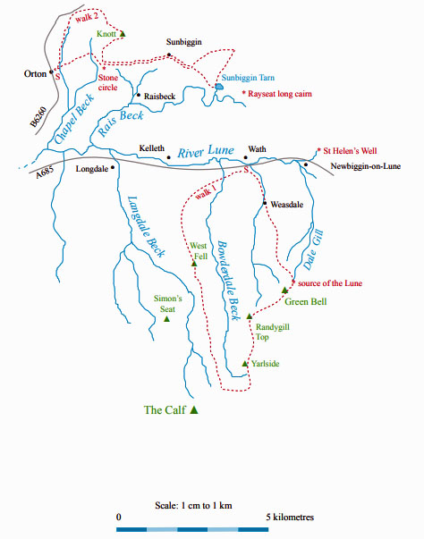
The Land of the Lune
Chapter 1: Northern Howgills and Orton Fells
The Introduction
The Next Chapter (Shap Fells and Birkbeck Fells)
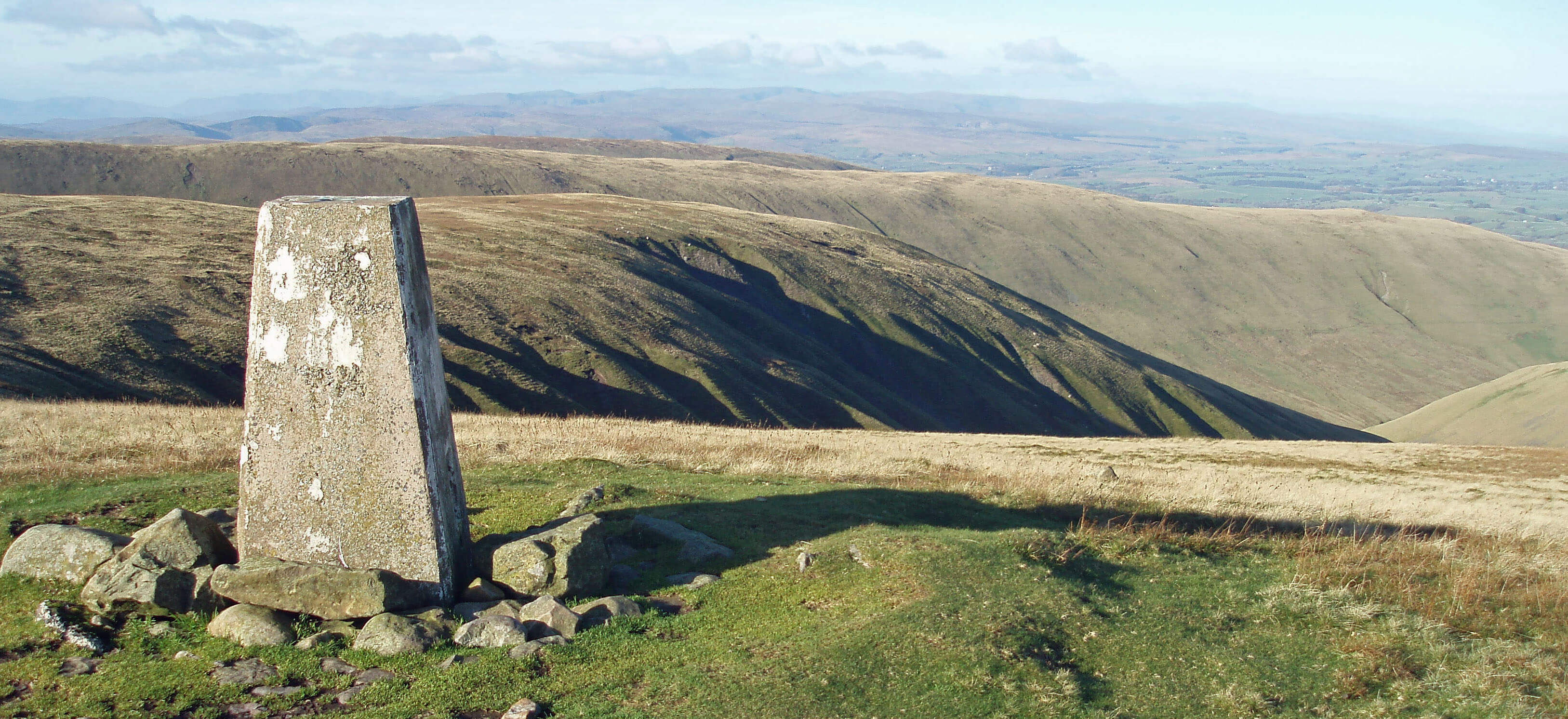
Green Bell trig point, looking over Weasdale
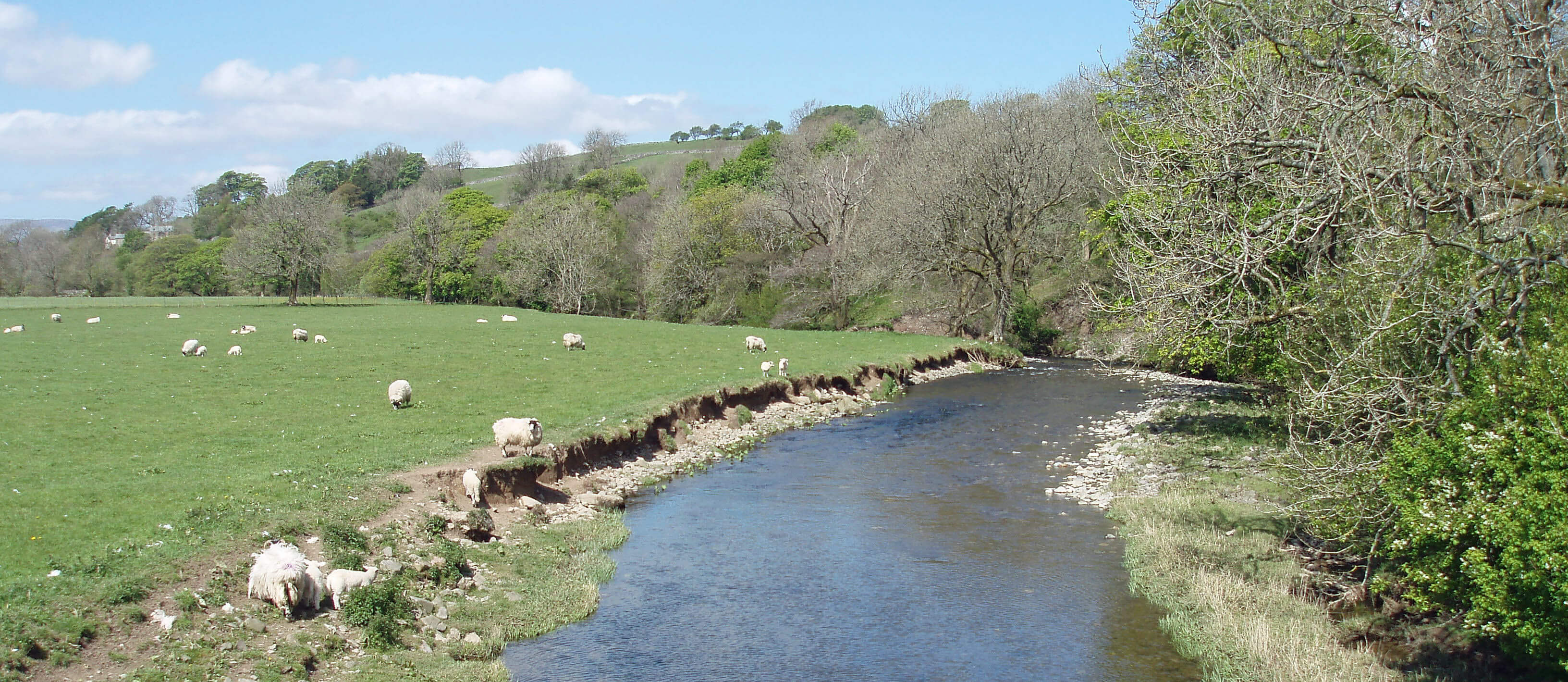
The River Lune ...
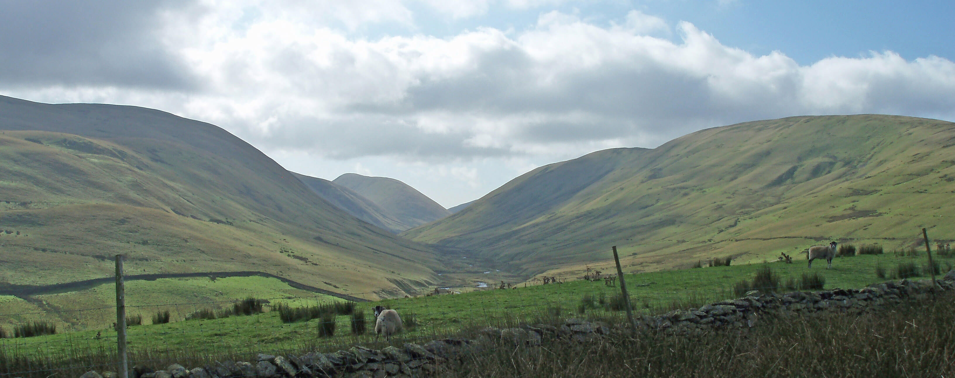
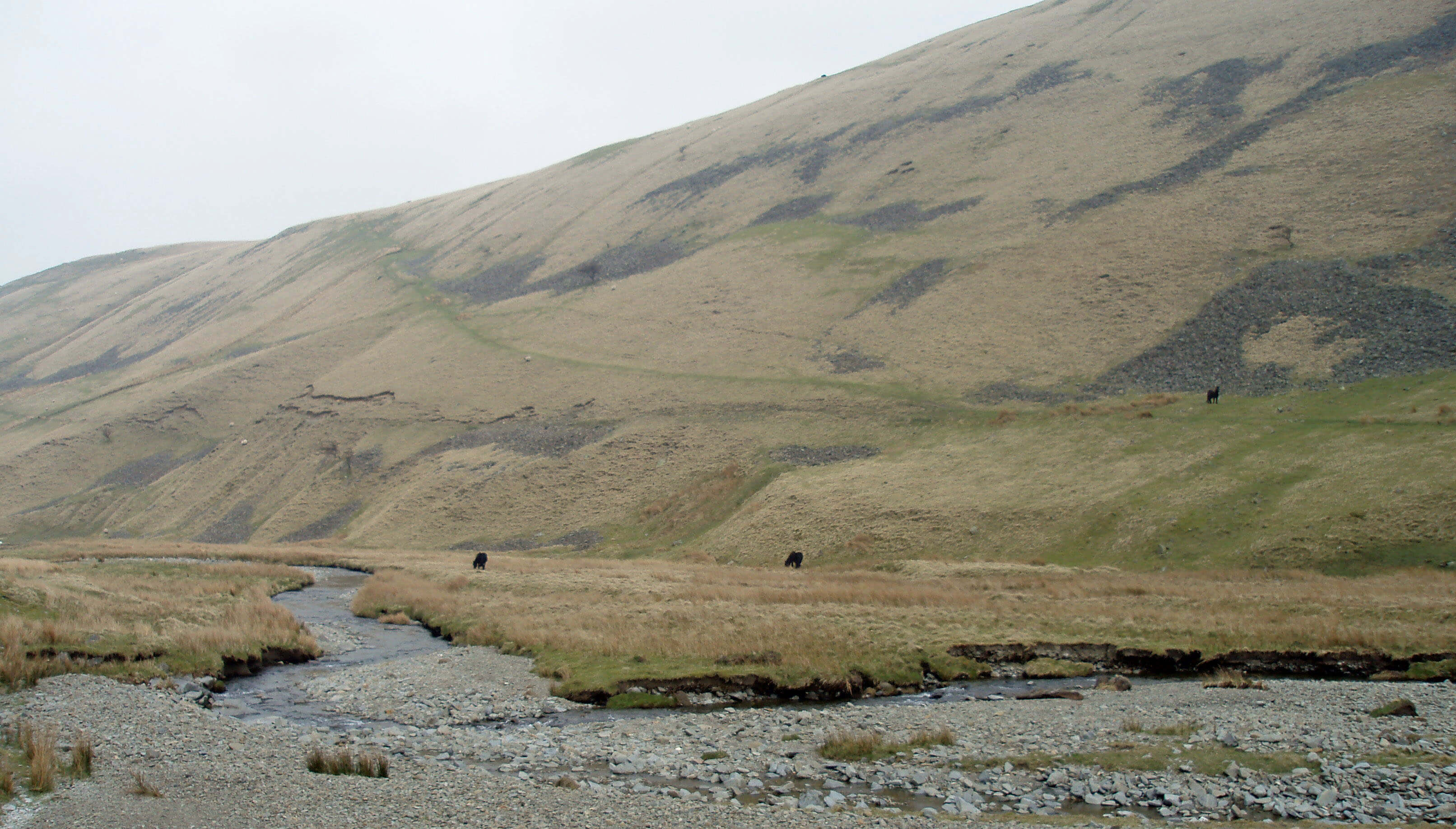
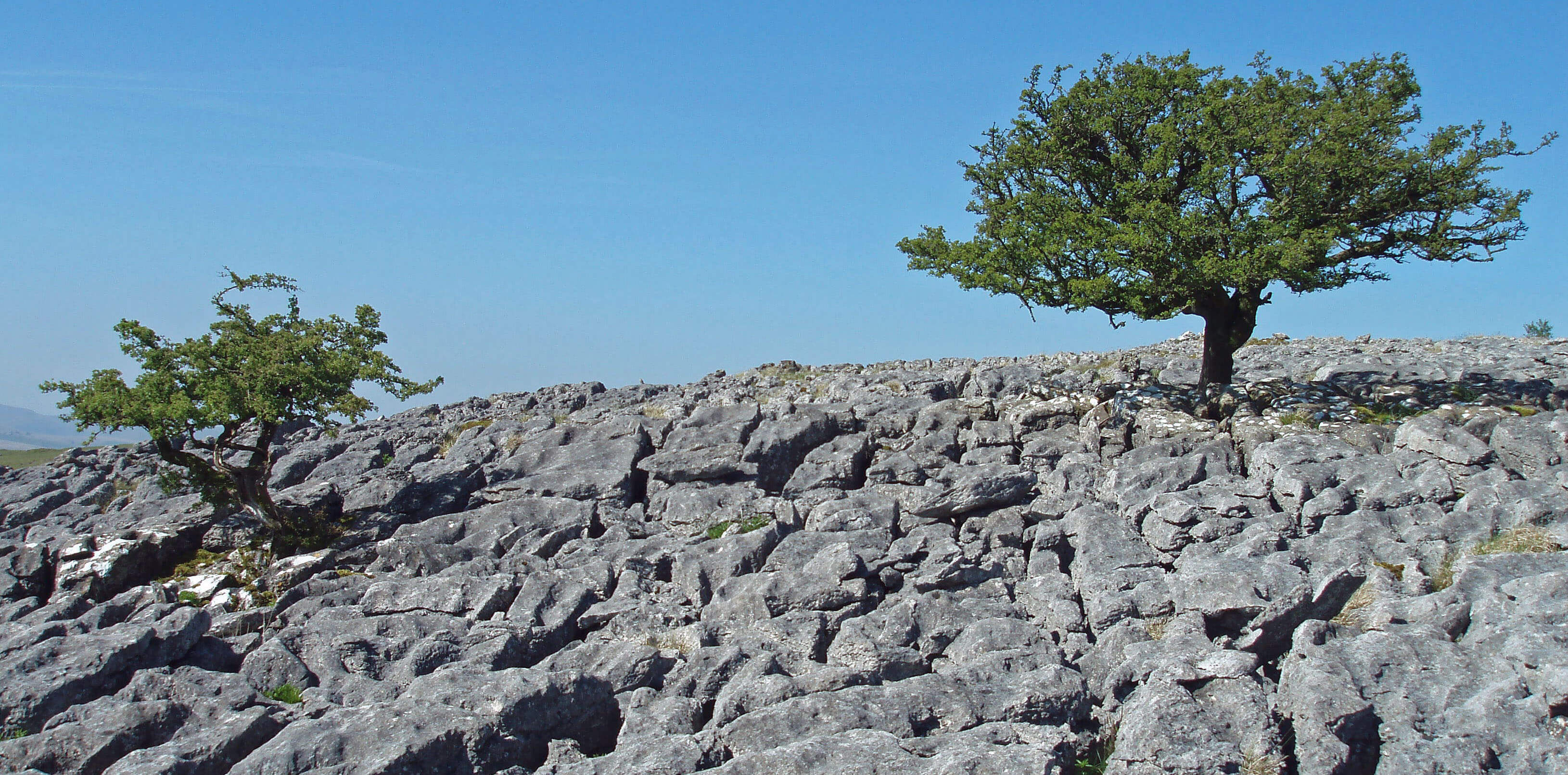
 Left: The view north standing at the source of the Lune on Green Bell
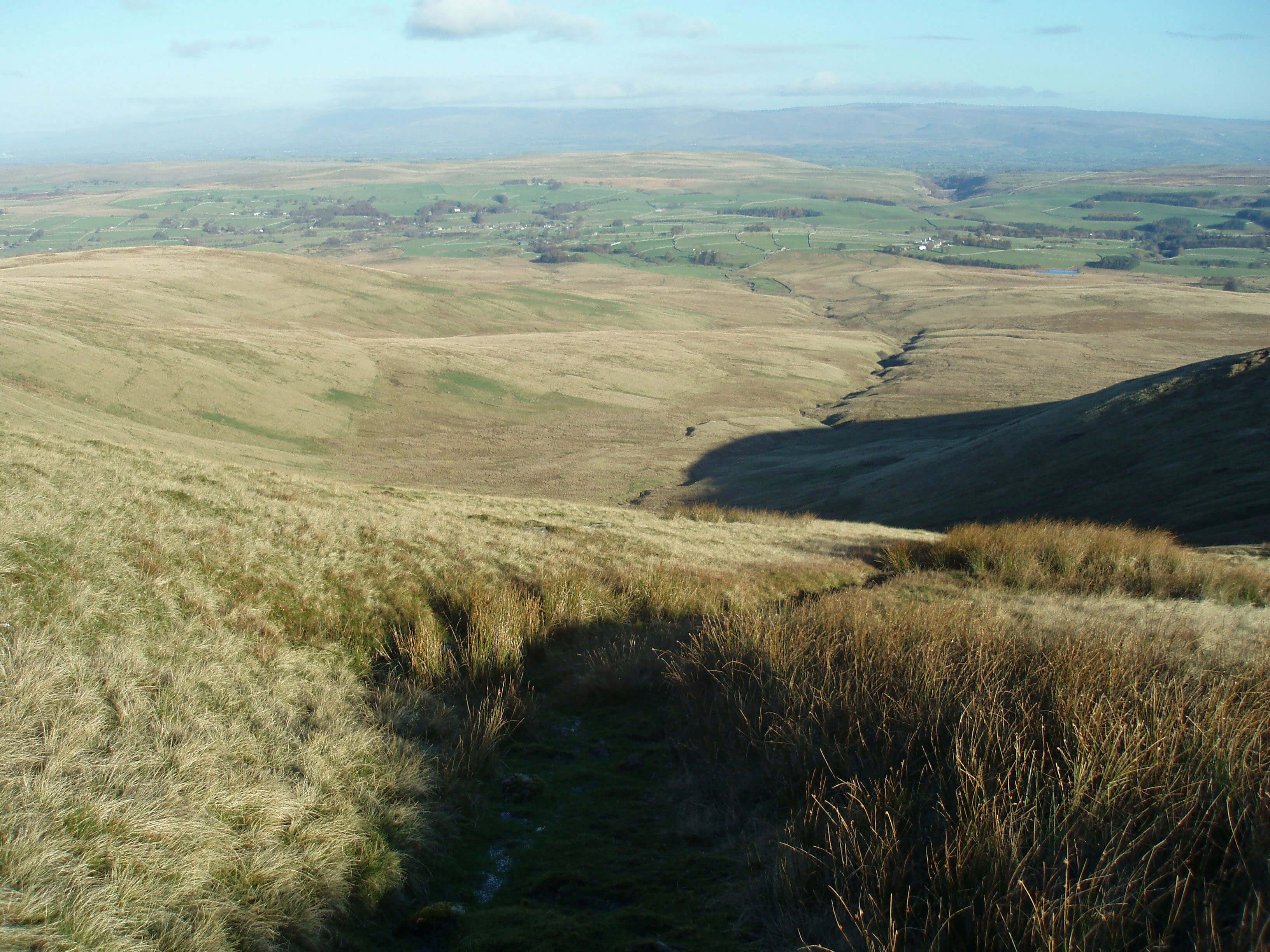
Right: The Lune near Wath (Green Bell in the distance)
A great oak may grow from a single acorn but great
rivers need very many sources. For some reason,
we like to distinguish one of these as the source
of the river, although there are no agreed rules for doing
so. The determination of the source of the Lune has been
made easy for us by the fact that its name continues far
upstream along one particular branch among its many
headwaters, to the helpfully named village of Newbiggin-on-Lune, 9km east of Tebay.
Above Newbiggin-on-Lune, various becks run
north off Green Bell to form the infant Lune. Of these
the longest and highest is Dale Gill, arising from a spring
200m northeast of the Green Bell summit (605m). Since
any rain falling just north of Green Bell will drain into
the Lune we may regard Green Bell itself as our sought-for source. Green Bell is an appropriate name for the
rounded, grassy hill but then so it would be for most
of the fifty or so other named summits in the Howgills.
Green Bell, however, is rightly honoured with a trig
point, one of only four in the Howgills (the others being
at Winder, Middleton and The Calf).
Dale Gill runs 4km north from Green Bell, changing
name twice (to Greenside Beck and Dry Beck), to
become the Lune at Newbiggin-on-Lune. Here, Bessy
Beck joins the Lune after refreshing the three lakes of a
trout fishery. Bessy Beck may be named after Elizabeth
Gaunt of Tower House, near Brownber
Hall, who in 1685 gained the dubious
distinction of being the last woman
to be burned at the stake in England.
Although she may now be regarded
as a virtuous, charitable lady only
too willing to help those in need, the
fact seems to be that she knowingly
helped someone involved in a plot to
assassinate Charles II. The penalty for
high treason duly followed.
Newbiggin-on-Lune is spread
out along what is now a large lay-by,
bypassed by the A685 but not by far enough, as it is
quite noisy. At the eastern end of Newbiggin-on-Lune
is the old St Helen’s Well, which some people insist is
the source of the Lune, because it is never dry, unlike
the Green Bell springs. As this would add dignity to the
Lune’s birth, it deserves investigation. I was informed
at the Lune Spring Garden Centre that the well lies
just across the A685 behind the chapel. The chapel, it
transpires, is a small mound and the well just a seepage
in the field, which is most uninspiring compared to the
slopes of Green Bell.
The fledgling Lune turns west and after 2km reaches
Wath, which most on-line encyclopedias assert is the
start of the Lune, at the confluence of Sandwath Beck
and Weasdale Beck. This seems absurd, as we have
already passed Newbiggin, which insists it is on-Lune.
The appendage, however, is a new one: the 1861 OS
map has a simple Newbiggin. But the old map considers
the stream, which the encyclopedias regard as Sandwath
Beck, resulting from the merger of becks east of Wath to
be the River Lune, as I have done.
Weasdale Beck, equal in size to the Lune at this
point, runs north from near Randygill Top (624m)
through the fine, deep valleys of Weasdale and Great
Swindale. These valleys, however, are not as fine as
the adjacent, parallel Bowderdale, through which flows
Bowderdale Beck to join the now undisputed Lune 1km
below Wath.
The Howgills is the name given to the homogeneous
group of hills in the triangle of about 100 sq km between
Ravenstonedale, Sedbergh and Tebay (or between the
A685, the A683 and the Lune valley).
The hills are well drained, rounded and grassy, with
no bogs and little heather. There are no walls above the
pastures and only one fence. There are significant rocks
in only two places, Cautley Crag and Carlin Gill. So, the
Howgills is a place for striding out along the ridges – but
not across them for then you would have steep eroded
slopes to contend with.
The highest point is The Calf (676m), from which
the ridges radiate to over twenty further tops above 500m.
Walking is easy and airy but, according to Walking Britain
(2005), edited by Lou Johnson, “the Howgills have little
interest underfoot … The reward for scaling the heights
comes from the superb views of the Northern Pennines, the
eastern fells of the Lake District, and the higher peaks of
the Yorkshire Dales”.
This, however, is the wrong frame of mind for tackling
the Howgills. The Howgills must be appreciated on their
own merits. There is no need to be envious of the other peaks
(yes, the views are good but a little distant to be “superb”).
As often the case, Harry Griffin captured the required
spirit best in one of the last of the Country Diary vignettes,
usually about the Lake District, that he contributed for over
fifty years to the Guardian: “the Howgill Fells have always
entranced me. Compared with Lakeland, overrun by the
hordes and vastly over-publicized, they have retained their
quiet, unspoiled beauty.”
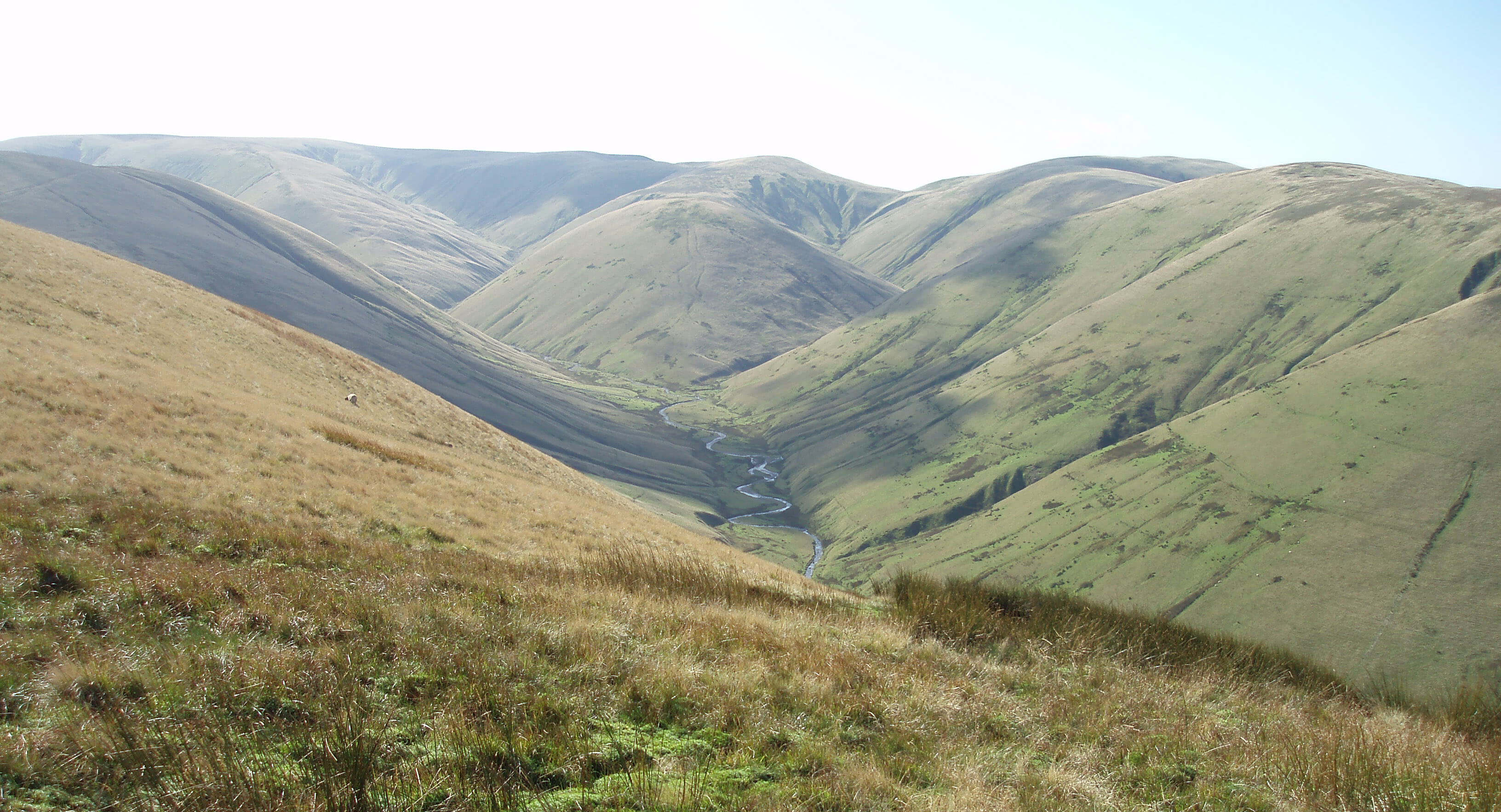
Bowderdale Beck
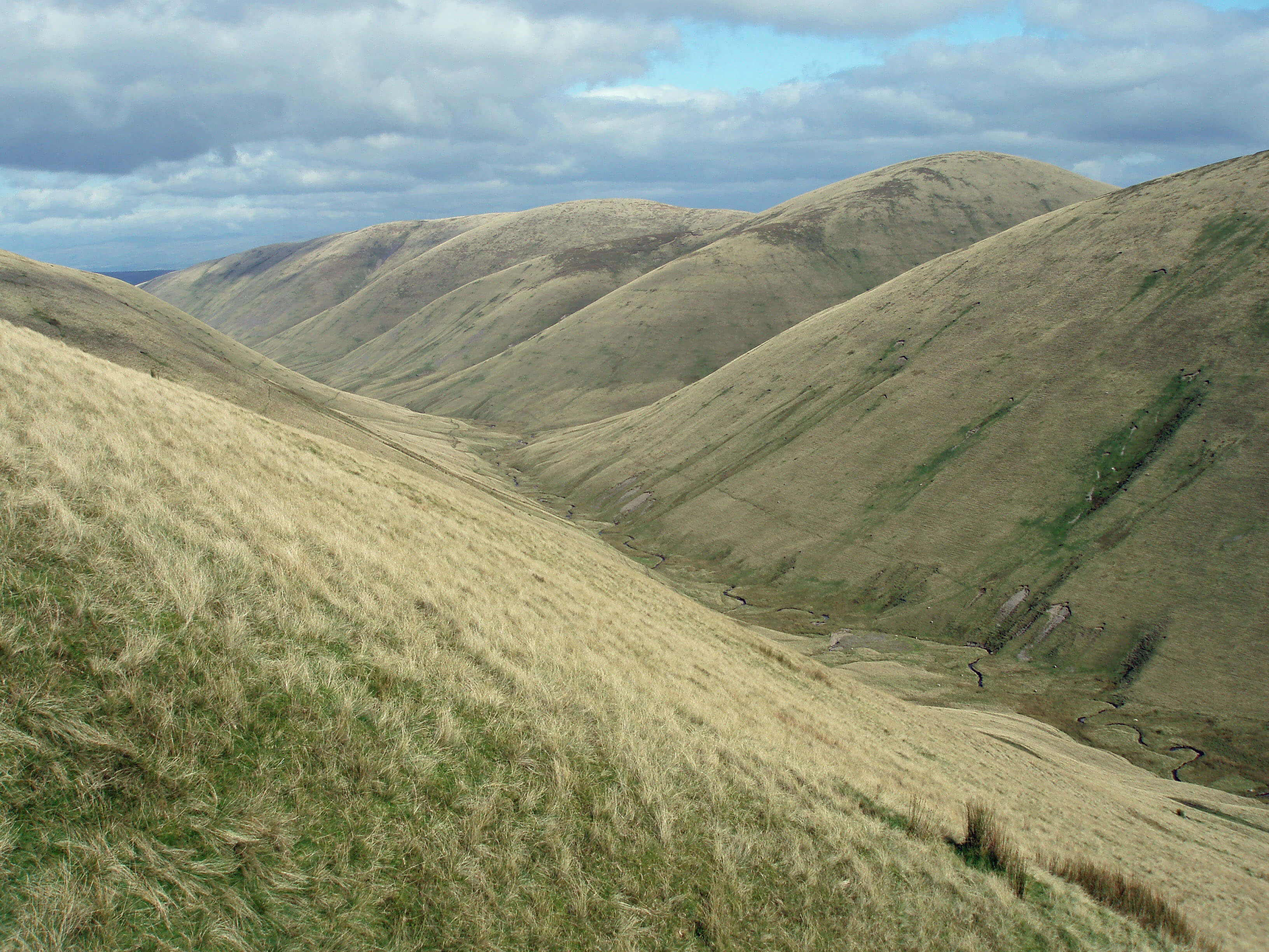
Looking down Bowderdale
Right: Looking up Bowderdale
There is nobility in the simplicity of Bowderdale.
What you see is definitely what you get: there are no
hidden secrets. And yet it is a marvellous valley, running
due north for 6km or so and forming the prototypical
U-shape that illustrates the effects of glaciation. There
are also fine examples of Holocene (that is, post-glacial)
fluvial erosion, with alluvial fans, terraces, meanders
and braided channels.
The effects of glaciation are widespread in Loyne. It has
been covered with ice several times and in the last glacial
period, ending about 10,000 years ago, all but the highest
tops were under ice.
Glaciation has two general effects: erosion and
deposition. The most apparent erosive effect is the
scouring of valleys (such as Bowderdale), deepening and
straightening them to form the characteristic U or parabolic
shape. When ice accumulates in the lee of valleys, it may
form bowl-shaped cirques with deep sides. Generally,
though, Loyne rocks are too soft to provide the more
spectacular glacial forms seen, for example, in the Scottish
Highlands.
Deposits are in the form of till or boulder clay, that is,
largish pebbles in clay dropped by the ice, and sands and
gravel left by the actions of glacial meltwater. Drumlins
– the rolling, hummocky hills formed from boulder clay
– are common in Loyne. Sometimes, the deposits at the
ends or sides of glaciers (terminal or lateral moraines)
form barriers sufficient to change watersheds. The most
intriguing deposits are erratics, which are rocks carried on
glaciers and left in an alien landscape.
The detailed effects of glaciation are difficult to
unravel, especially when they involve major changes such
as the breaking through of watersheds, the formation of
new flow directions as glaciers block one another, and the
sudden release of huge volumes of meltwater.
Bowderdale Beck runs uneventfully from the head of
Bowderdale, 2km from The Calf, to the small community
of Bowderdale and then to join the Lune. The region
provides a typical Howgills walking area, with its long,
open ridges and steep, grassy slopes, striped with sheep
tracks, falling to an enclosed valley, empty of manmade
objects apart from a few old sheepfolds. There is little
excitement to be found on the ridge tops: Yarlside has a
distinctive dome; Kensgriff a few crags; Randygill Top
a small cairn; otherwise, there are just gentle rises that
provide extensive views.
Walk 1: A Circuit of Bowderdale, including Green Bell
Map: OL19 (please read the general note about the walks in the
Introduction).
Starting point: Near Wath on the road south of the A685 (685050).
There are three obvious routes between Bowderdale Foot and the head of Bowderdale – the west ridge, the east ridge, and
the valley bottom. Higher mathematics shows that there are six loops possible.
The walk along the valley bottom should be experienced, but not on a first visit. Impressive though the symmetrical valley
is, it becomes claustrophobic after a while. There is only one view and only the odd sheepfold to break the monotony. The west
ridge, beginning with West Fell, is the better one, providing good views into Bowderdale and Langdale and, in the distance, an
evolving panorama of the hills of the Lakes and Dales.
So begin by setting off southwest, past Brow Foot, to Bowderdale Foot and then onto the footpath that leads to West Fell
and Hazelgill Knott. You will meet many sheep, a few ponies perhaps, and, only if you are really lucky (or unlucky, as the case
may be), one or two other walkers.
Continue 2km south of Hazelgill Knott and, as the path begins to swing right (heading for The Calf), leave it to turn east to
Hare Shaw and Bowderdale Head to the unnamed hill south of Yarlside. Head north over Yarlside, Kensgriff and Randygill Top,
with distant views of Cross Fell, Wild Boar Fell, Ingleborough and the Lakes skyline.
Continue to Green Bell, where you may locate the spring that is the source of the Lune, just below some ruins off the Green
Bell to Knoutberry path. As you wish, follow the fledgling Lune down or, better, the path over Stwarth, in both cases cutting
across to Weasdale and thence to Wath (just follow the OS map through gates and fields: there are few reassuring signposts).
The distances are long but walking is easy apart from on the slopes of Yarlside. Route finding may be a challenge on the
eastern ridge but the trig point on Green Bell is a reassuring presence.
Short walk variation: A short walk up Bowderdale is hardly possible without tackling its steep slopes, so instead head directly for
Green Bell. Walk through Gars to Weasdale and then up Stwarth to Green Bell. Then, from the source of the Lune, follow Dale
Gill to Dale Tongue and cut over to Weasdale and then back.
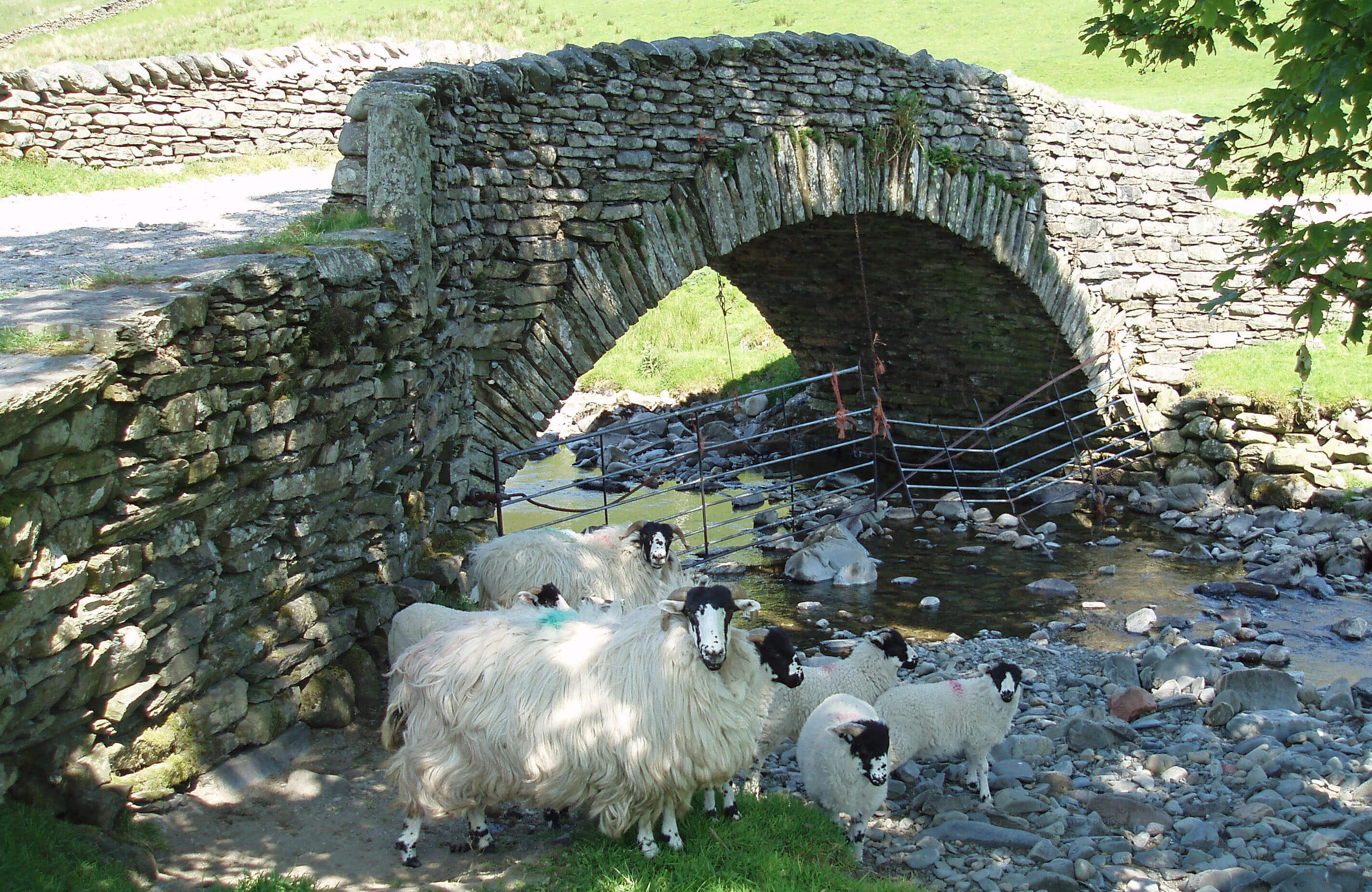
The Lune from Bowderdale Beck ...
 Right: The Lune at Kelleth
The Lune runs due west, more due than it used to as
it was straightened to run alongside the A685 when
it was rebuilt on the line of the old Newbiggin-on-Lune
to Tebay railway after it closed in 1962. This seems an
unnecessarily brutal way to treat the young Lune, just as
it is making its way in the world.
Becks, such as Flakebridge Beck and Cotegill Beck,
continue to enter the Lune from the south but very little
water flows from the north. The old limestone quarries
and limekilns that are seen on the slopes between
Potlands and Kelleth hint at the reason for the dryness of
the northern slopes. Limekilns, which usually date from
the 18th or 19th century, were used to burn limestone to
make quicklime. This was then slaked with water and
used to reduce the acidity of pastures and also to lime-wash buildings. The limestone was tipped into the
kiln from the top onto a fire of coal or wood, and then
more coal and limestone layered on top. The open arch
provided air to keep the fire going.
The members of Kelleth Rigg’s herd of pedigree
Blonde d’Aquitaine cattle look lime-washed too. Kelleth
itself is a small village, recently enlarged by new building,
aligned along the now quiet road by-passed by the A685.
The Lune reaches the rather ornate Rayne Bridge, built
of red sandstone. Well, the parapet and wall are of red
sandstone – the bridge itself isn’t, as a side view from
the east reveals. The bridge was built in 1903 to replace
one that required an abrupt turn on the road. Soon after
Rayne Bridge, Langdale Beck joins the Lune.
Langdale Beck
 Left: Langdale from West Fell
Langdale Beck runs north from The Calf for 12km
through the deserted valley of Langdale to emerge
at the small village of Longdale, close by the Lune.
There is sometimes debate about which of Langdale
or Longdale has been misspelled but they are surely
different renditions of the northern vowel sound that we
have in auld lang syne. Anyway, the dale is undoubtedly
the langest in the Howgills.
The Calf is the focal point of the Howgills and from
it there are extensive views in all directions. To the south,
the Lune looks like a snail’s trail entering Morecambe
Bay, and circling around we see the Bowland Fells,
Ingleborough, Whernside, Pen-y-Ghent, Baugh Fell,
Wild Boar Fell, and Cross Fell. Most eyes, however, will
be drawn westwards in the attempt to identify the classic
Lakeland peaks, such as Crinkle Crags, Great Gable and
Blencathra. The Calf itself is hardly a peak, being merely
slightly higher than several nearby mounds. There is no
bird’s eye view into nearby valleys that the best peaks
provide.
The Calf has many ridges leading towards it but it is
closer to the southern point of the Howgills triangle than
it is to the northern side. To the south there is one main
ridge (from Winder by Arant Haw) but to the north there
are many long, complicated, interlocking ridges, all very
similar in appearance. Langdale Beck itself drains a vast
area, with several significant tributaries creating deep
gullies with ridges between them.
The apparently timeless appearance of the Howgills
is misleading. Pollen evidence indicates that a few
thousand years ago Langdale was wooded, with alder,
birch and hazel on the valley floor and oak and elm on the
slopes. The almost complete removal of the woodland,
probably following the introduction of sheep farming in
the 10th century, has led to greatly increased soil erosion
and gully development.
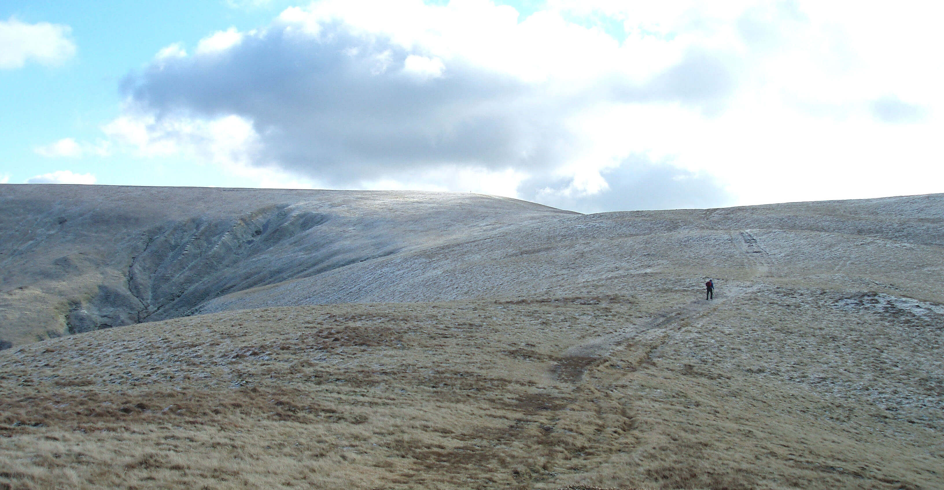 Right: A walker near the head of Langdale (to the left), heading for The Calf
Walking around Langdale is deceptively easy.
Physically, there is little problem because the grass is
easy to walk on and the slopes are gentle. There are more
tracks than are marked on the map, thanks to the farmers’
quads rather than walkers or sheep. Most people will
opt to walk on the ridges but if you wish to sample a
Howgills valley then Langdale is the best, because the
middle section has a flat valley bottom that provides an
openness lacking in other valleys, such as Bowderdale,
and there is an interesting series of incoming gullies.
The main problem is one of navigation. This is an
area where you should heed the advice to know where
you are on the map at all times. Don’t walk for two
hours and then try to work it out because there are few
distinctive features to help you. Keep careful track of the
few features there are (sheepfolds, gullies, scree) and if
on the ridges identify the few distinguishable tops (Green
Bell and Middleton with trig points, Randygill Top) and
keep them in perspective as you move along. Above the
pastures, there is no sign of past human habitation or
exploitation, such as quarries, to serve as a guide.
 Left: Langdale, near Langdale Knott, with fell ponies
It is my duty not to exaggerate the attractions of
walking in the Howgills. Given a choice between walking
in the Lakes or the Howgills, I would choose the former
nine times out of ten. But on that tenth occasion, I’d look
forward to wandering lonely less the crowd.
The ordinary walker will relish the scenery and
solitude but specialists such as geologists and botanists
will find more of interest, especially within the eroded
gullies and scree slopes that are rarely visited by human
or sheep.
Langdale Beck is formed by the merger of West,
Middle and East Grain below The Calf, with the
relatively distinctive top of Simon’s Seat (587m) to the
west. Near a picturesque packhorse bridge, Nevy Gill
and the combined waters of Churngill Beck and Uldale
Beck join Langdale Beck, which then continues through
wooded pastures that are not part of CRoW land.
Langdale Beck is a fair size by the time it reaches
Longdale, a village of one farm, one row of cottages, a
couple more buildings, and the old school house. Within
the last began the education of Thomas Barlow (1607-1691), who became Bishop of Lincoln. He is a candidate
model for the traditional folk song character, the Vicar of
Bray, who blithely adapted his religious beliefs to meet
the changing political needs of the day. This is surely
a calumny, for northerners are known for the stalwart
independence of their views.
To the west of Longdale is the growing village of
Gaisgill, on the Ellergill Beck tributary of the Lune.
New ‘luxury homes’ have been built on the site of an
old garage. Nearby are a number of slightly less new
residences, and beyond them New House, dated 1848,
and beyond that Barbara’s Cottage, with a defiant date
of 1648.
Langdale Beck almost doubles the size of the
infant Lune, which is next joined by the first significant
tributary from the north, Rais Beck.
Rais Beck
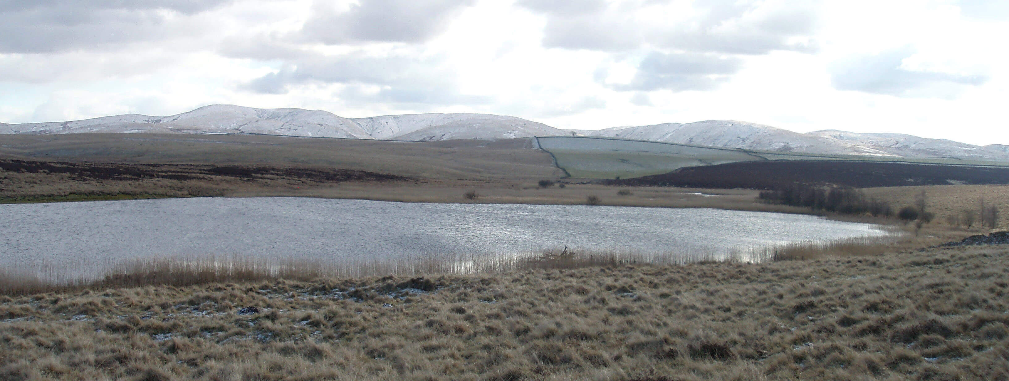
Right: Sunbiggin Tarn, with the northern Howgills beyond
Rais Beck drains the broad, tranquil pastures that
lie between Sunbiggin and the ridge of 300m hills
to the north of the Lune between Newbiggin-on-Lune
and Raisgill Hall. It is formed by becks that run west
from Sunbiggin Tarn and south from the small village
of Sunbiggin.
The area around Sunbiggin Tarn and the adjacent
Cow Dub Tarn is appreciated by ornithologists, botanists
and malacologists (that is, experts on molluscs) – and
also by leisurely picnickers watching the shadows
lengthen on the Howgills. Although Sunbiggin Tarn
forms only 6 hectares of open water, it is the largest for some
distance around and is therefore an oasis for many birds.
Breeding species include wigeon, teal, tufted duck,
gadwall, mallard, little grebe, sedge warbler, water rail,
lapwing, curlew, redshank and snipe. The large colony
of black-headed gulls for which the tarn was known has
recently moved away.
Left: The view across Sunbiggin Moor to the Howgills
The tarn lies within a limestone upland and is
surrounded by heath, acid grassland, swamps, and areas
of chalky mire. These soils support a rich variety of plant
life, including various sedges, rushes and mosses as well
as the marsh orchid and rare bird’s eye primrose.
And for those malacologists, there are two rare
snails: Vertigo geyeri is known at no other British site
and Catinella arenaria at only three others. So, there’s
something of interest underfoot here at least.
[Update: These two snails are not as rare as I thought.
They are both on the list of endangered species in Britain but they have, in fact, been
found at several sites - although nowhere else in Loyne, I believe.]
The outflow from Sunbiggin Tarn joins Rayseat Sike
to form Tarn Sike, which is a Cumbria Wildlife Trust
nature reserve. Rayseat Sike runs by a Neolithic barrow
that was excavated in 1875 by William Greenwell, who
was, amongst many other things, a canon at Durham
Cathedral. In his remarkable 98-year life he investigated
400 burial sites and provided thousands of artefacts for
the British Museum. He served as a magistrate until the
age of 85 when he gained notoriety for suggesting that
speeding motorcyclists should be shot.
I would expect Rayseat Long Cairn to rank highly
among Canon Greenwell’s 400. The barrow is 70m long
and has a number of chambers in which burnt human
remains were found. Archaeologists speculate that it
could be one of the oldest such relics in the region. It is an
evocative site, now isolated on a rather bleak moor.
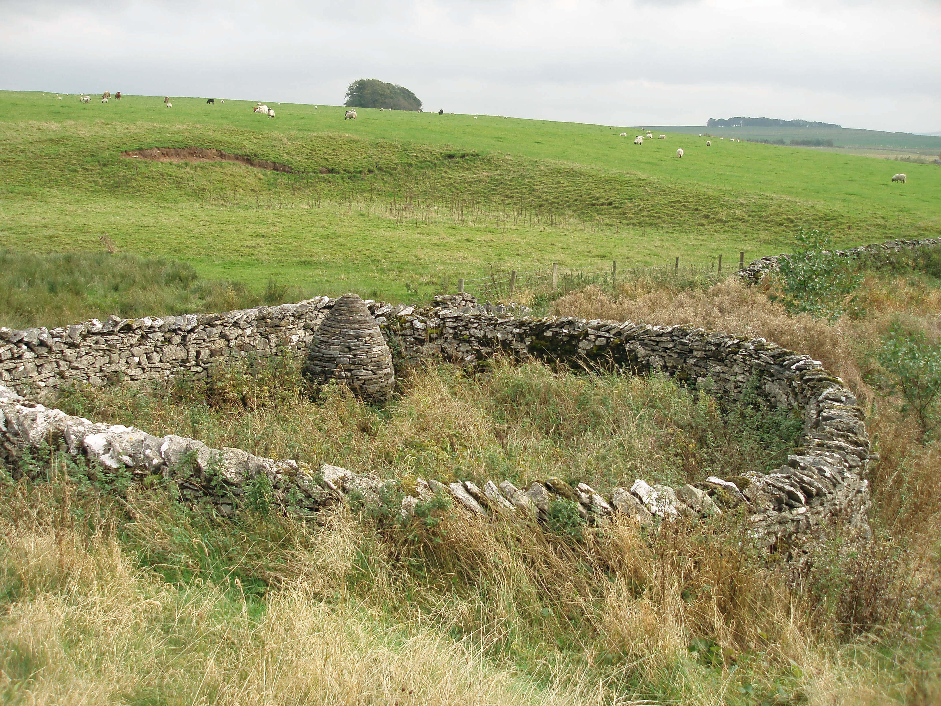
Right: Raisbeck pinfold, near Pinfold Bridge
Tarn Sike runs into a large pond at Holme House,
where it seeps away – except after heavy rain, when
it continues to form Rais Beck proper at Slapestone
Bridge, joining with becks running from the quietly
rural hamlets of Sunbiggin and Raisbeck. The latter
has a notice board with a helpful OS map so old that
all colour has long disappeared. The roads have wide
grass verges, indicating their origin as drove roads, with
limestone walls and scattered Scots pine and ash.
Rais Beck gathers pace as it passes Fawcett Mill,
built in 1794 and now a holiday home. Five fields north
of the mill may seem unexceptional but they have been
designated a Site of Special Scientific Interest for their
very naturalness. The site is one of the few remaining
traditionally managed plant-rich hay meadows,
relatively unspoilt by modern agricultural practices. The
flora includes betony, orchid, burnet, primrose, cowslip
and fescue.
Below Fawcett Mill is Raisgill Hall, a place with a
long history. There is an ancient tumulus nearby but it is
not worth a visit unless you are a trained archaeologist.
Manorial courts, to regulate the use of the commons,
were held at Raisgill Hall until the 18th century. They
were then taken over by the court at Orton, not without
considerable animosity and legal wrangling about the
boundaries and use of Orton and Raisbeck Commons.
However, the present owners of the Hall do not wallow
in the past: they are leaders of an active local farming
cooperative, which has received support from Prince
Charles, no less.
On a bench overlooking the Lune at Raisgill Hall
Bridge is carved “Go softly by this riverside for when
you would depart you’ll find it’s ever winding tied
and knotted round your heart”, which, if there weren’t
five differences, I’d assume to be an unacknowledged
quotation from The Prairie by Rudyard Kipling. We
bear the sentiments in mind as we follow the Lune for
1.5km with Tebaygill Beck joining from the south and
then Chapel Beck from the north.
Chapel Beck
 Left: Limestone pavement at Great Kinmond on Orton Fells
The Lune watershed north of the A685 is formed by
the Orton Fells, comprising Orton Scar, Great Asby
Scar and Little Asby Scar. These are examples of karst, a
kind of landscape that we will meet elsewhere in Loyne.
The Orton Fells provide the largest area of limestone
pavement in England outside the Yorkshire Dales. It is
unfortunately not as large as it was because of earlier
quarrying but the area is now protected by law.
[Update: The Orton Fells are now within the Yorkshire Dales,
after the 2016 changes to the National Park boundaries.]
The best undamaged pavements are found on Great
Asby Scar, to the north of Raisbeck and Sunbiggin, and
are now protected as a reserve by Natural England. The
folding and jointing of the pavements is particularly
notable. The exposure of the site and the effects of
over-grazing have left only a few stunted trees, such as
hawthorn and holly. Within the grikes further woody and
non-woody species flourish, especially various ferns and
herbs.
The dry surface of these limestone plateaus was no
doubt partly why it was a favoured area for human
habitation long ago, as shown by the many remains of
ancient earthworks on the Orton Fells. Castle Folds,
near the trig point on Knott, is an Iron Age site, with
the ruins of hut circles on a natural limestone platform.
Below Knott there’s an ancient 40m-diameter circle of
about thirty stones, of variable size, all but one of pink
granite.
The pink granite may be a surprise, below the
limestone scars, but the occasional pink boulder can be
seen perched on the limestone pavements and scattered
in fields. They are erratics, brought here from the Shap
Fells by glaciers. Prehistoric man is not alone in finding
a use for these intriguing boulders: some amusement can
be obtained in spotting them in barn walls, protecting
beck banks, ornamenting houses, and marking boundaries
(for example, Mitchell’s Stone, 1km north of Sunbiggin
Tarn).
Karst refers to any terrain with soluble bedrock where, as
a result, there is little or no surface drainage. It is named
after an area of Slovenia but there are many kinds of karst
in the world, depending on climate, location, type of
bedrock, and so on. In our case, the bedrock is limestone,
which is dissolved by the mildly acidic rainfall formed by
the absorption of carbon dioxide.
The rainwater dissolves fractures in the bedrock,
gradually enlarging them into deep fissures called grikes.
The limestone blocks between grikes are called clints. On
the surface, these limestone pavements look barren, as
little soil forms on the clints, but within the deep, sheltered
grikes specialised plant communities flourish.
Underground, the rainwater continues to erode the
limestone, until meeting an impermeable lower layer,
giving rise to several characteristic features, such as: caves
with stalactites and stalagmites; sinkholes, shakeholes,
swallowholes and potholes, through the collapse of bedrock
above a void; springs, as water emerges at an impermeable
layer; disappearing streams, through water flowing into a
pothole. Over time, as underground passages are adopted
and abandoned, complex and extensive cave systems may
develop, to be explored by potholers.
The headwaters of Chapel Beck run from Orton
Scar, which on maps from the 16th century was marked
as “Orton Beacon” or by a beacon symbol. The beacon
warned of marauding Caledonians. Today Beacon Hill
has a prominent monument erected in 1887 for Queen
Victoria’s golden jubilee.
The becks run by and through Orton, the largest
settlement so far, as shown by the fact that we find our
first public house. Orton was made a market town in the
13th century and the numerous converging roads, tracks
and paths indicate Orton’s importance in the old droving
days. This rural heritage is echoed in the Orton Market
that today wins prizes, such as National Farmers Market
of the Year 2005, for its emphasis on local produce.
 Left: Rough Fell sheep
In 2006 Orton hosted a “Festival of the Rough
Fell” to celebrate the ancient breed of Rough Fell sheep,
its history, and the crafts associated with Rough Fell
farming. The majority of Rough Fell sheep are found
on the Howgills and surrounding fells. As the name
indicates, the Rough Fell is hardy enough to live on the
poor upland grasses of exposed fells. It is a large sheep,
with a black and white face and curved horns, renowned
for its thick wool, which is used to make carpets and
mattresses, and high quality meat.
The festival marked a recovery from the foot and
mouth epidemic of 2001, which caused great problems
throughout Loyne and, in particular, reduced the number
of Rough Fell sheep from 18,000 to 10,000. As the fells
were closed, the epidemic threatened the traditional
methods of fell management, whereby every flock knows
its own territory or ‘heaf’, with each lamb learning it
from its mother.
The mingling of old and new typifies modern
Orton: from the stocks near the church to the chocolates
from the recently established industry. Likewise, among
the few modern dwellings are some fine old buildings.
Petty Hall has a door lintel dated 1604. Orton Hall, to
the south, was built in 1662 and was once the home of
Richard Burn (1709-1785), vicar of Orton and author of
texts on the law and local history.
Right: All Saints Church, Orton
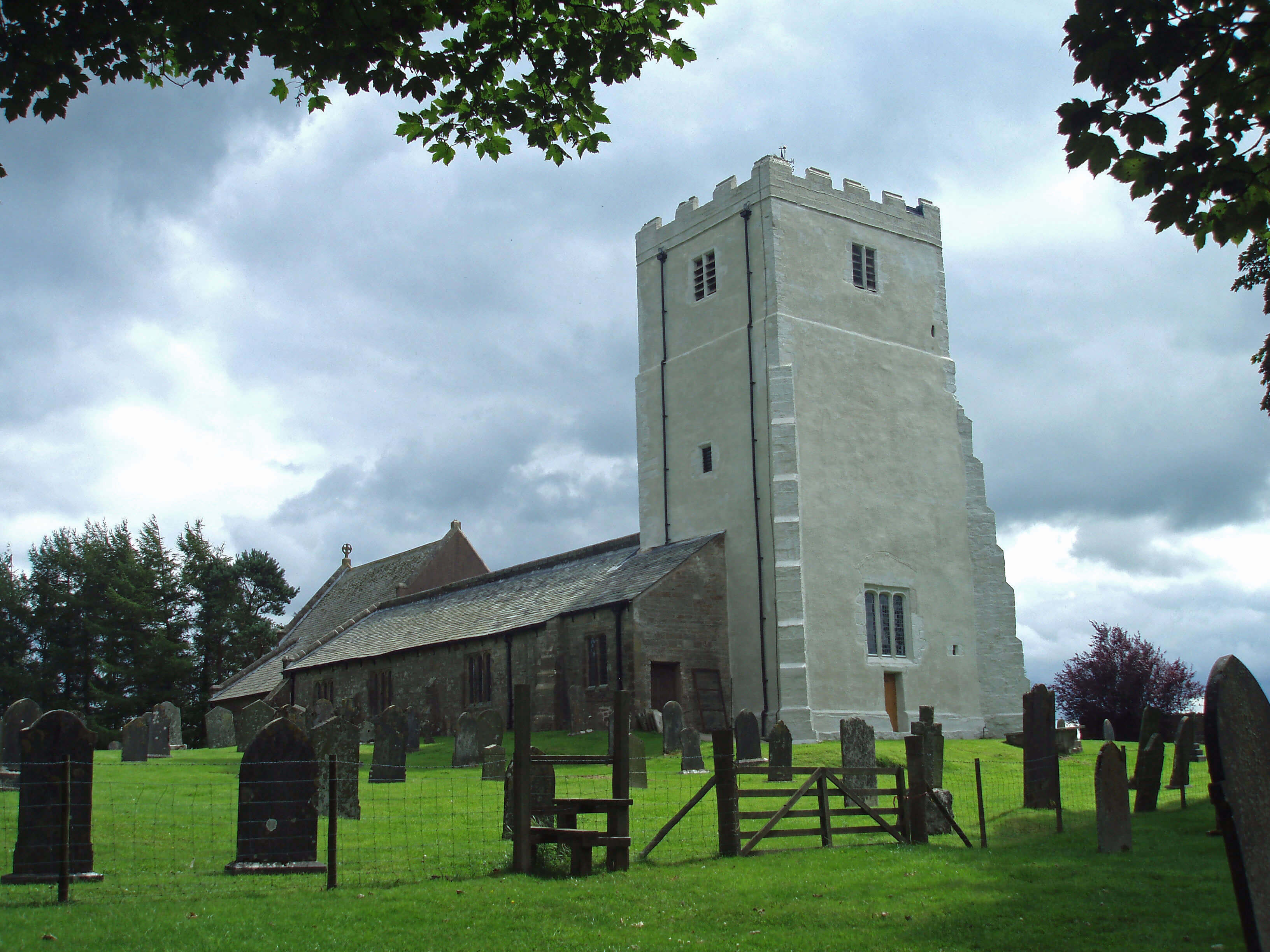
The All Saints Church was built in the 13th century,
replacing earlier temporary structures, and has been
rebuilt several times since. Inside the church there is a
display of three old bells, the oldest of 1530, and a list
of vicars back to 1293. The early 16th century west tower
is the oldest remaining part and today is an eye-catching
off-white. After modern methods to seal the leaking
tower failed, it was decided to resort to the traditional
treatment of lime washing. So far, it has worked.
Chapel Beck gains its name as it runs south past
Chapel House, where there is a spring, Lady Well, which
was known for its health-giving properties. As Chapel
Beck approaches the Lune we may glance east up the
Lune valley towards Newbiggin-on-Lune and reflect on
the contrast between the hills to the north (Orton Fells)
and to the south (the Howgills).
The geology of Loyne has a major impact on the
appearance and activities of the region but it is not as
complicated as, for example, the Lake District’s geology.
In general, rocks are of three types: sedimentary (formed
by the settlement of debris), igneous (derived from
magma or lava that has solidified on the earth’s surface)
and metamorphic (rocks that have been altered by heat
and pressure). The bedrocks of Loyne are almost entirely
sedimentary, with the sediments having been laid down
in the following order (youngest on top, naturally):
• about 300m years ago: Carboniferous (Silesian)
– mainly millstone grit
• about 350m years ago: Carboniferous (Dinantian)
– mainly limestone
• about 400m years ago: Devonian
– mainly sandstone
• about 450m years ago: Silurian and Ordovician
– mainly slates and shales.
The Howgills (apart from
the northeast corner) have had all
layers eroded away to the Silurian
and Ordovician. Orton Fells have
been eroded to the Carboniferous
limestone. Clearly, if the Howgills
still had a Carboniferous limestone
layer it would be much higher than
Orton Fells. This implies a tilt or slip
(a fault) to raise the Howgills side,
which would have made it more
exposed and vulnerable to erosion.
The word ‘fault’ suggests a minor
matter but the slippage, spread over
millennia, would have been of a
kilometre or more (the 2005 Asian
tsunami is thought to have been
caused by a slippage of a few metres).
There are literally all sorts of twists
and turns – some sudden, some slow
(but over unimaginable timescales)
– to complicate this brief outline but
it may serve as a starting point for
understanding Loyne geology.
Walk 2: Orton, Orton Fells and Sunbiggin Tarn
Map: OL19 (please read the general note about the walks in the
Introduction).
Starting point: The centre of Orton (622082).
Head for the unmistakable All Saints Church and walk east past the vicarage to locate the path north to Broadfell (on the left
bank of the beck). Take this path and after 100m follow the sign left through the houses. Thereafter, the path is clear, beside the
beck and beyond its spring, and emerges at a disused quarry on the B6260.
Cross the cattle grid and walk east on the north side of the wall to the monument on Beacon Hill. Within the extensive
panorama of the northern Pennines and the Howgills, locate on the skyline, 1km southeast, the trig point on Knott to the left of
a tree. That is your next objective.
Follow the wall east to a gate near the corner and through the gate turn half-left to another gate, picking up the bridleway.
Keep the tree in view and when the bridleway turns south leave it to head between limestone crags towards the tree. From the
trig point, there’s an excellent view, with Castle Folds prominent nearby. (Unfortunately, Castle Folds cannot be visited without
climbing a wall: the stile that can be seen is over an adjacent wall. In any case, I would not recommend walking east over the
limestone, as the clints are fragile and the grikes are deep. If you do so, a gate in the wall east at 658094 might be welcome.)
From the trig point, walk west on grass between the limestone to regain the bridleway and enter Knott Lane. Turn left on
a clear path (part of the Coast-to-Coast route) just north of the stone circle. Continue east to Acres and then along the quiet lane
to Sunbiggin and Stony Head, after which the road becomes a track. Shortly after entering the CRoW moorland, the bridleway
forks. Take the left branch heading northeast, to reach the road north of Spear Pots (a small tarn now almost overgrown). Walk
south on the grassy roadside verge to Sunbiggin Tarn, with good views of the Howgills beyond.
Past the cattle grid, take the bridleway right to reach the branch you met earlier. Now return to Knott Lane. This is the only
significant retracing of steps in our 24 walks but the path is excellent, with good views in both directions, and much better than
walking on the limestone scars or on the nearby roads. Cross Knott Lane and continue west past Scarside, across fields to Street
Lane and on to Orton.
Short walk variation: The long walk is a figure of eight. So the obvious short walk is to do half of the eight. Follow the long walk
to Knott Lane and then, instead of turning east to Acres, turn west to Scarside and Orton.
The Lune from Chapel Beck ...
Immediately after Chapel Beck joins, the Lune passes
under Tebay Bridge, a sign that we are approaching
Tebay. The village is split in two by the A685: the original
part now called Old Tebay and the newer part Tebay. In
the early 19th century Old Tebay was a community of
about ten houses, with Tebay consisting of little more
than the 17th century Cross Keys Inn.
In one of those houses lived Mary Baines (1721-1811), who was alleged to be a witch and is said to still
haunt the Cross Keys Inn. She was feared for various
diabolical deeds, such as foretelling “fiery horseless
carriages” (that is, trains), but why she should be feared
for a forecast that did not come true before her death is
hard to see.
When the railways did arrive, they transformed
Tebay. With a station on the west coast main line, which
opened in 1846, and a junction to the line that ran through
Newbiggin-on-Lune to the east coast, Tebay was a key
part of the Loyne railway network. In addition, there
were many sidings for the engines that were used to
boost trains over the Shap summit. The village migrated
south to be closer to the rail-yards, with terraces for rail-workers and a Junction Hotel being built a kilometre
south. St James Church, with its distinctive round tower
and conical top, was built in 1880, paid for by the rail
company and workers.
At its peak, the Loyne railway network consisted of eight
lines, plus lines out of Loyne to places such as Carlisle,
Kirkby Stephen, Skipton, Preston, Morecambe and
Windermere:
Tebay – Lancaster (1846-)
Wennington – Lancaster (1849-1966)
Clapham – Wennington (1850-)
Newbiggin-on-Lune – Tebay (1861-1962)
Lowgill – Clapham (1861-1964)
Wennington – Carnforth (1867-)
Settle – Carlisle (1876-)
Lancaster – Glasson (1883-1930).
We will encounter these lines, derelict or alive, many
times on our journey and some general comments are in
order, not on the details that railway enthusiasts are fond of
but on the railways’ impact on Loyne.
The building of the railways brought welcome
employment but they generally harmed local industry.
This was almost entirely small-scale activity to meet local
needs, such as basket-making, pottery, quarrying and coal
mining. It became easier and cheaper to import coal from
where it was plentiful, and while new markets were opened
up for local products they could not compete in terms of
price or quality with the outputs from the rapidly-growing
industrial towns. Consequently there was an exodus from
the villages to those towns.
The railways affected local transport. It was much
cheaper to send beef by train than by hoof. Therefore,
the drove roads fell into disuse, along with the associated
activities en route. Otherwise, most country tracks, used on
foot or on horse, were not much affected until the advent
of the car.
Scenically, the railways have now merged into the
countryside and are fondly regarded. Derelict lines are often
unnoticeable, except for structures such as the Lowgill
Viaduct and Waterside Viaduct, which still impress us.
They must have been awesome in the 19th century.
Right: A Tebay terrace
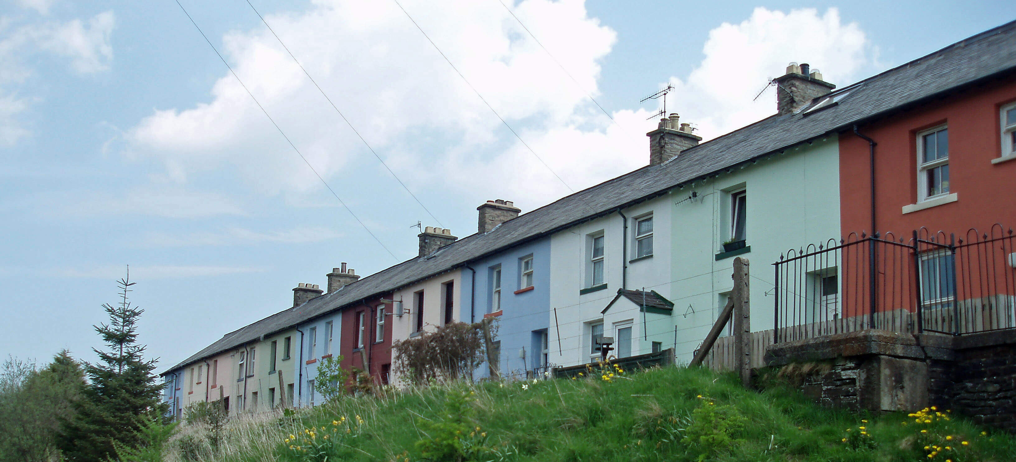
Tebay’s image has not recovered from the reputation
it gained in those times, which is hard to do when guide-writers persist in repeating old opinions, such as this one,
from Clement Jones’s A Tour in Westmorland (1948):
“The traveller … is apt to think - and how rightly - of
Tebay as a grim and grimy railway junction blackened
with the smoke of many locomotives and consisting
mainly of the ugly dwellings of workmen employed on
the railway.”
Today things are different. The Newbiggin branch
line closed in 1962, Tebay station was demolished in
1970, and the Junction Hotel is no longer a hotel. The
terraces are painted in multi-coloured pastel shades and,
below the green hills on a sunny day, present a handsome,
if not pretty, sight. But Tebay cannot fully escape the
impact of its location in a traffic corridor. There is an
ever-present hum or roar, depending which way the
wind is blowing, from the motorway, broken frequently
by the rattle of the London-Glasgow expresses.
Beyond the motorway the Lune passes a mound that
when glimpsed by motorway drivers might be assumed
to be the remains of a slagheap. It is in reality what’s left
of the motte of a Norman motte and bailey castle, now
called Castle Howe. Such castles consisted of an artificial
mound (the motte), with a wooden or stone building on
top, and a larger enclosed yard (the bailey) containing
stables, workshops, kitchens and perhaps a chapel. The
earth from ditches around the motte and bailey was used
to create the motte.
Castle Howe is the first of ten such remains that we
will meet on our journey. The castles were built soon
after the Norman Conquest to provide security against
rebellious northerners. It seems that Loyne’s locals were
not as obstreperous as elsewhere because its castles were
at the smaller end of the scale of over five hundred such
castles built in England. Mottes are typically from 3m to
30m high, with Loyne’s being nearer the lower end of
the range. Also, there are no remains of stone buildings
on any of Loyne’s mottes, indicating that the more
vulnerable wood was considered adequate.
The Loyne castles were probably for the strategic
and administrative use of landlords rather than for
military garrisons. They were built overlooking river
valleys and close to fertile meadows. Castle Howe is
the closest to the river itself and has lost half its motte
to flood erosion. The motorway at least has swerved to
avoid it, if only just. By Castle Howe the Lune, flowing
west, meets Birk Beck, flowing east.
The Previous Chapter (The Introduction)
The Next Chapter (Shap Fells and Birkbeck Fells)
© John Self