
Home
Preamble
Index
Areas
Map
References
Me
Drakkar
Saunterings: Walking in North-West England
Saunterings is a set of reflections based upon walks around the counties of Cumbria, Lancashire and
North Yorkshire in North-West England
(as defined in the Preamble).
Here is a list of all Saunterings so far.
If you'd like to give a comment, correction or update (all are very welcome) or to
be notified by email when a new item is posted - please send an email to johnselfdrakkar@gmail.com.
109. Fair Snape: the Fairest Fell of Bowland
The Forest of Bowland is an Area of Outstanding Natural Beauty (AONB). The map on its Wikipedia page shows twelve
hills in Bowland: Beacon Fell, Clougha Pike, Easington Fell, Fair Snape, Grit Fell,
Hawthornthwaite Fell (99),
Longridge Fell, Parlick,
Pendle (20),
Ward’s Stone (75),
White Hill (96),
and Wolfhole Crag. The only name that seems to bask in this accolade of beauty is Fair Snape. This therefore
seemed a reasonable objective for our last walk before we are restricted to local walks again.
We set off from the Fell Foot parking area walking across fields that were wet but not excessively so considering all the recent
rain, and then over the River Brock, which was running around rather than under the footbridge, and on to the farm of
Higher Fair Snape. Here they have kindly provided a permissive path to the fells. The farmer even held the gate
open for us. Beyond the fields, on the open access area, we zigzagged up a wide, sunken track that took us to the
plateau just east of the Fair Snape trig point, the Paddy’s Pole cairn, and an elaborate wind shelter.
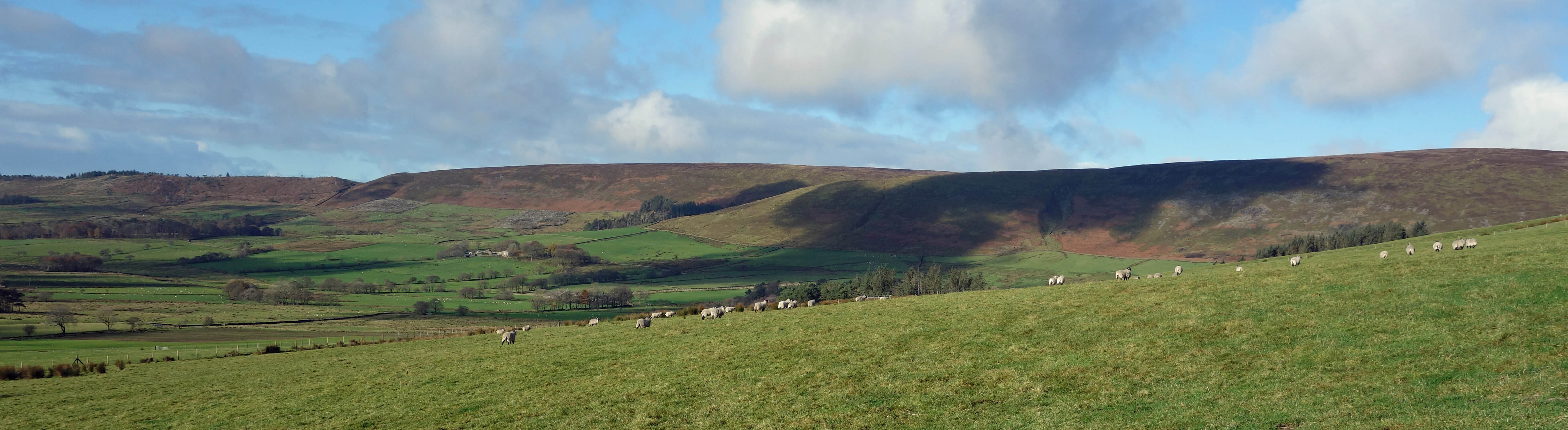
Hazelhurst Fell from the fields above the farm of Higher Fair Snape
We had walked across the green fields in sunshine within the arc of fells, with the rusty red Hazelhurst Fell ahead and
the shaded Parlick behind, with views to the south to Beacon Fell and beyond, a little hazy in the moist air, and, as
we ascended, views to Longridge Fell. By the time we reached the Fair Snape top (510 metres), however, we were mainly
under cloud, and we could see that Ward’s Stone was actually in cloud. Heysham Power Station stood out brightly as
it happened to be within the only patch of sunlight in that direction. Mainly, however, it was the view below, into
Bleasdale, with its scattered farms, green fields, small woodlands, and timeless tranquillity, which held the attention. The
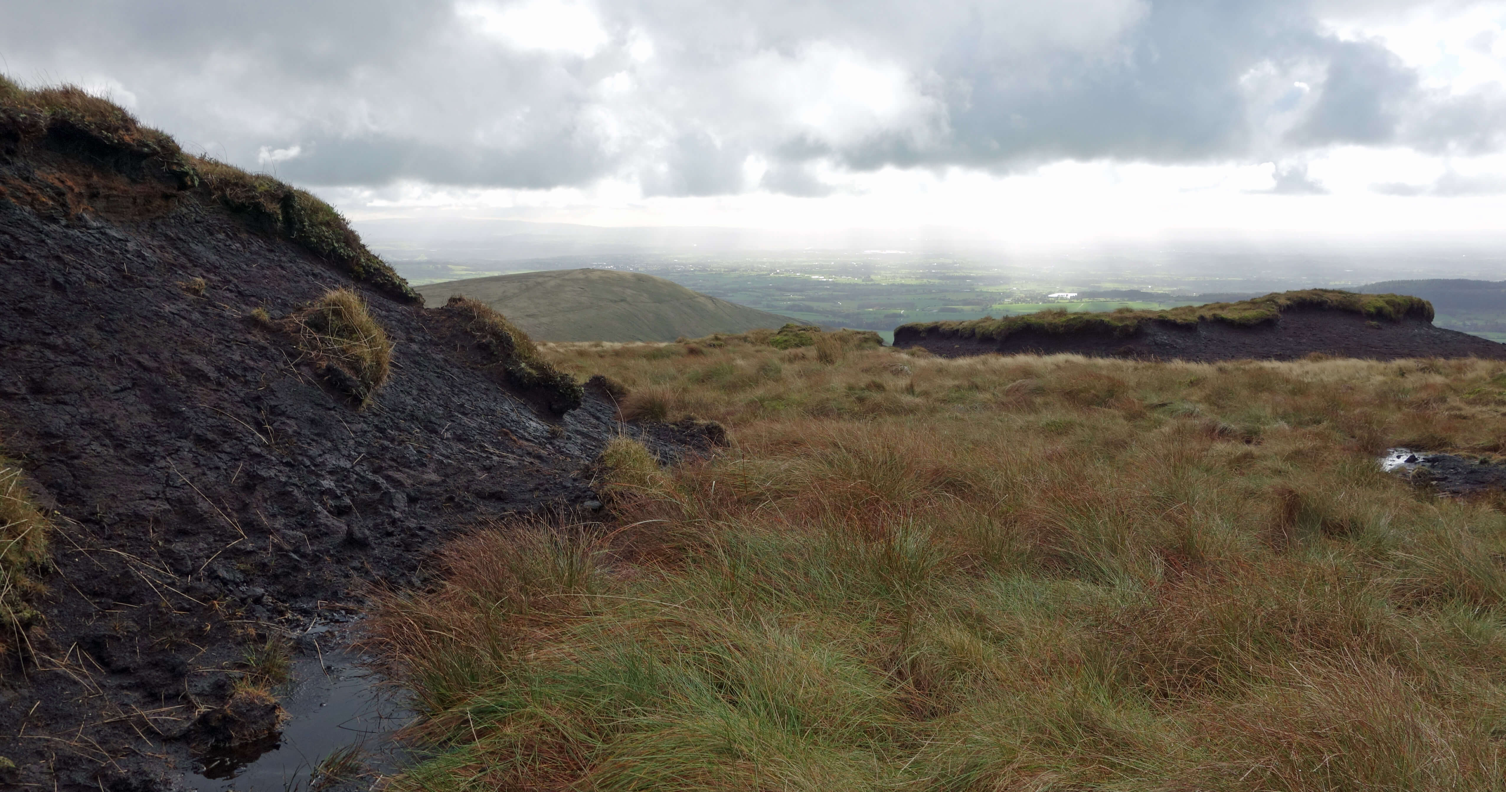
view in the opposite direction, to the north, was of a gaunt gritstone plateau, with stony outcrops, peat hags and bogs.
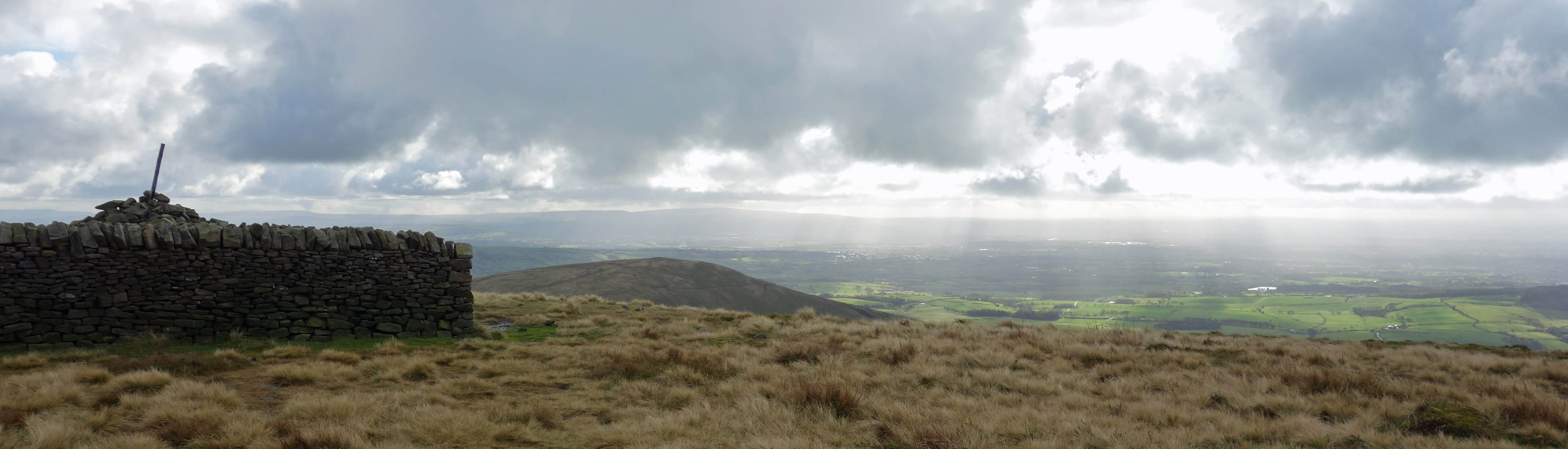
The Paddy's Pole cairn and wind shelter with Parlick ahead
 This contrast prompts reflection on whether Bowland justifies its appellation of ‘natural beauty’. I have already
written (Sauntering 99) about how the severe
management of the moors renders them unnatural but are these
moors beautiful? Mitchell (1977) writes
that “people who slog for miles over cushions of nardus grass, through peat and bog, descending
and climbing out of interminable gills, and being soaked by rain, see the real Bowland.”
This contrast prompts reflection on whether Bowland justifies its appellation of ‘natural beauty’. I have already
written (Sauntering 99) about how the severe
management of the moors renders them unnatural but are these
moors beautiful? Mitchell (1977) writes
that “people who slog for miles over cushions of nardus grass, through peat and bog, descending
and climbing out of interminable gills, and being soaked by rain, see the real Bowland.”
What then does the
typical visitor to Bowland see? A stroll around Dunsop Bridge; an ice-cream by Langden Brook; a meal in the
Hark to Bounty in Slaidburn; a view from Jubilee Tower; a picnic by the stream near Tower Lodge; a walk around
Stocks Reservoir. Are they not ‘the real Bowland’? These visitors see
brooks, fields, woodlands and hills and may well consider them to be of beauty. The fact is,
however, that for most of the year most of Bowland is not a sunny idyll but a bleak, dark, cold, windswept,
barren, boggy wilderness.
What's beauty got to do with it, anyway? Whether or not
I or you consider Bowland to be a region of beauty is neither here nor there.
Emphasising ‘beauty’ puts us and our subjective opinion at the forefront when the key factor in the designation
of regions for protection should not be our aesthetics but its biodiversity and ecology. In this respect
Bowland is sadly lacking. It is not biodiverse. It is managed for grouse and sheep. Raptors and other ‘vermin’ are
routinely exterminated. On the moors nothing
much grows but heather and grass. The heather is regularly
burned, destroying peat and releasing carbon dioxide. Anybody aware of the management practices within
Bowland will walk there with a tinge of sadness, as well as with an appreciation of whatever beauty it has.
Our AONB managers are well aware that the title of ‘Area of Outstanding Natural Beauty’ is a bit odd.
The Forest of Bowland AONB’s
Management Plan
tries to escape by re-defining natural beauty: “‘Natural Beauty’ is
not just an aesthetic concept … The natural beauty of AONBs is partly due to nature, and is partly the product of
many centuries of human modification of ‘natural’ features.” It matters what AONBs are called because if a label
of ‘outstanding natural beauty’ is attached to a place then it comes to be assumed that that place does indeed
epitomise natural beauty, and we obviously must not change anything natural and beautiful. This may be what
the landowners would prefer but may not be what’s best for the region, for the wildlife, or for us.
I am, of course, not implying that Bowland is an Area of Outstanding Unnatural Ugliness. The one mile
walk south from Fair Snape to Parlick (432 metres) is the best mile of upland walking in Bowland. It is over a
smooth, grassy ridge, gently downhill (mainly), with sweeping views into Bleasdale and back to Fair Snape and,
to the east, to Pendle and other Pennine hills. The path rises to the top of Parlick, which forms a distinctive conical shape
when viewed from any direction but from this path towards it. Yes, I could imagine someone sighing ‘beautiful’ as they walked along.
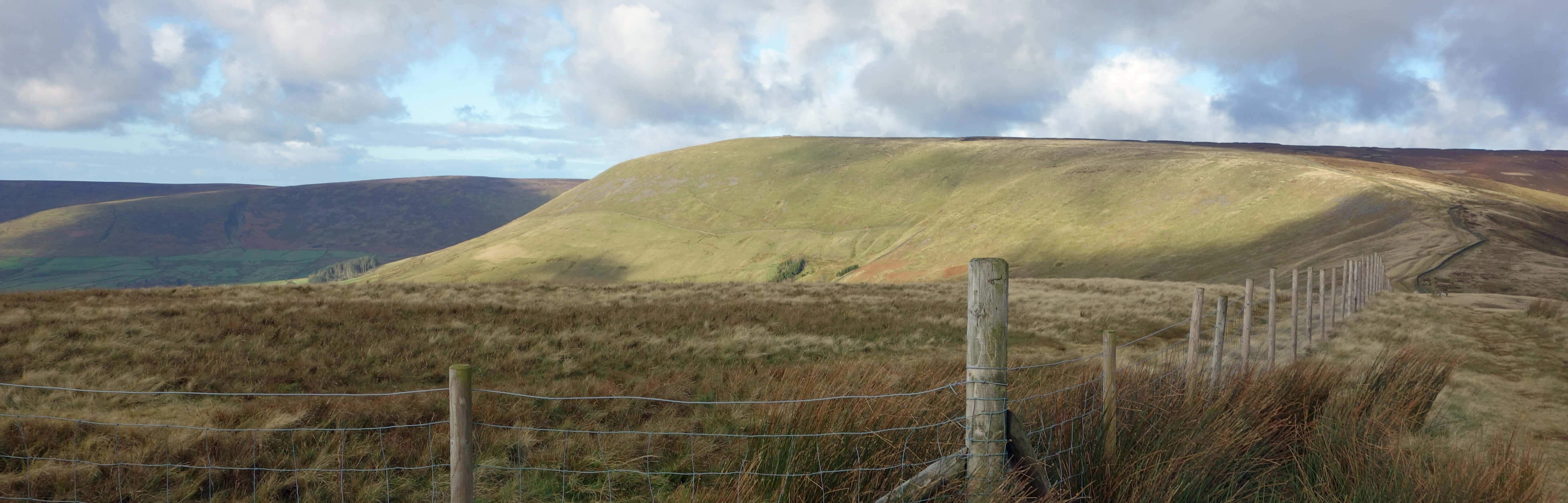
Looking back to Fair Snape from the path to Parlick
Date: November 4th 2020
Start: SD602442, P near Fell Foot (Map: OL41)
Route: W, NW – Higher Fair Snape farm – E, N, E, N – Fair Snape Fell – SE, S – Parlick – SE – Fell Foot, P
Distance: 5 miles; Ascent: 295 metres
November 15th 2020: The government’s 'lockdown 2' restrictions at the moment state that I “must stay at home and avoid travel unless
for work, education or other legally permitted reasons” although I can travel “to spend time or exercise outdoors”
although “this should be done locally wherever possible”. I have carried out a little survey of walking blogs to see
how they have interpreted these restrictions. The majority ignore them and carry on regardless.
Perhaps this reflects the general public’s attitude.
Perhaps these bloggers are so addicted to their walking that they consider that their travel qualifies as essential.
Others, however, accept the restrictions and have curtailed their walking
and blogging. I am with this group. As in April-May, I am only walking from home. I have
been walking under (sometimes self-imposed) restrictions since March, even when the government was urging us to
get out and about. I have not travelled far and have found out-of-the-way places, although I slipped up with
the Three Peakers
(Sauntering 102)!
The two differences from April-May are (1) we don’t have the
fine spring weather and (2) there’s no restriction to short two-hour walks (I think:
was there in April-May?). For short walks from home I refer you to
Sauntering 79 to 94.
For longer walks - well, it remains to be seen if I will
have the energy and enthusiasm to do any.
Home
Preamble
Index
Areas
Map
References
Me
Drakkar
© John Self, Drakkar Press, 2018-

Top photo: The western Howgills from Dillicar;
Bottom photo: Blencathra from Great Mell Fell