Home
  Preamble
  Index
  Areas
  Map
  References
  Top10s
  Me
  Drakkar
Saunterings 101-110
Saunterings is a set of reflections based upon walks around the counties of Cumbria, Lancashire and
North Yorkshire in North-West England
(more details of my ‘North-West England’ are given in the Preamble).
If you'd like to give a comment, correction or update (all are very welcome) or to
receive a two-monthly email update - please send an email to johnselfdrakkar@gmail.com.
Some readers' comments are included in the Preamble.
     Latest (with a list of all Saunterings so far)
     110.   Cloughs and Grit
     109.   Fair Snape: the Fairest Fell of Bowland
     108.   Westward Home!
     107.   Along the Sands from Millom to Silecroft
     106.   Twelve Ponds and a Power Station
               Diversion 4:  You Don't Need a Weatherman ...
     105.   An Autumn Stroll through Beetham Woods
     104.   From Bampton Grange to the Lake District's Highest Hills
     103.   Bogged Down around Rawcliffe Moss
     102.   Upper Ribblesdale: Drumlins, Three Peaks and a Cave
     101.   Passing the Time at Heysham
     1 - 100
110.  Cloughs and Grit
We have been released from ‘lockdown 2’ (when I gave Saunterings a break) into the Lancashire Tier 3. This means
that I can travel from Lancaster (79 cases per 100,000 people) 33 miles south to Blackburn (295 cases per 100,000
people) but not 25 miles north to Tier 2 Kendal (130 cases per 100,000 people). It makes more sense to travel fewer
miles to the Bowland hills (0 cases per 100,000 grouse). As I live just within the Bowland AONB’s northern border
and have no wish to travel far, I suspect that I may be relying upon the Bowland hills in the coming weeks. I hope
that they will forgive me for questioning their ‘natural beauty’ recently
(
99,
109). Now I have a prior question: Why bother to become an AONB anyway – what benefits does it bring?
Of the twelve hills listed in
109 only three – Ward’s Stone, Grit Fell and Clougha Pike – are within my
walking-from-home range (just). The first I tackled in
75, so I set out for the other two. However, I didn’t set out from home since Ruth was able to tip me out at the end of Rigg Lane, so saving me four miles of familiar road-walking. I walked to the car park, from where I headed east up the track to Clougha Pike, after pausing at the information board. Even the most mundane object prompts more questions than are good for me. In this case: Who was involved in the installation of this information board? Was it:
    1.  DEFRA (the Department for Environment, Food and Rural Affairs), since Natural England (see 2) is “sponsored” by it, whatever sponsored means?
    2.  Natural England, the non-departmental public body responsible for AONBs and Sites of Special Scientific Interest (part of Bowland is a SSSI)?
    3.  The EU, the body responsible for Special Areas of Conservation and Special Protection Areas (parts of Bowland are (or were) a SAC or SPA)?
    4.  The Forest of Bowland AONB Joint Advisory Committee?
    5.  The Forest of Bowland AONB ‘Unit Office’ (the group responsible, I think, for
the ‘management plan’ mentioned in
109, the latest version of which is
here)?
    6.  The landowner (the Abbeystead Estate)?
    7.  The local city council (Lancaster City Council)?
    8.  The local county council (Lancashire County Council)?
    9.  The local parish council (Caton Parish Council)?
    10.  Or somebody else?
You may regard it as a multiple-choice question and tick all those who you think were involved.
Halfway up Clougha Pike I passed Windy Clough to the north. This is a narrow gully through which, I suppose, the wind funnels on occasion. My dictionary defines the dialect word ‘clough’ simply as a ravine. My image of a ravine is rather more dramatic and on a larger scale than Bowland’s cloughs. The dictionary also says that clough may be pronounced to rhyme with bluff or plough. I have never heard anything other than Cluffa Pike. Whether anyone in north-west England pronounces clough like plough I haven’t a clue, which is perhaps another possible pronunciation.
As I crossed the stile onto the open fell, the sun at last arose over the Clougha Pike horizon, which was a mixed blessing. It dazzled my eyes, making it very difficult to look ahead to locate the muddy path as it weaved through the grit boulders. The Bowland hills are entirely of millstone grit, which lends a uniform drabness to the surroundings. And yet, if you pause to look at the boulders in sunshine then they can be seen to sparkle in a rather delightful way.
The view from Clougha Pike (413 metres) was not the best. The tops of the hills of the Lake District and the Dales were in cloud and the air was somewhat watery. After complaining about the December sun, I mustn’t appear too curmudgeonly – so I stress that Clougha Pike is one of the best viewpoints in North-West England. Even on a day without clear long-distance views, one can enjoy the view over the green Lune valley to Lancaster and Morecambe Bay, which was full, the tide being in.
From Clougha Pike towards the Caton windmills (Ingleborough in cloud directly behind)
Clougha Pike is not really a top. It is the nose of the ridge from Ward’s Stone over Grit Fell (468 metres), to which
I walked next. From Grit Fell I left the ridge path to walk north across the rough heather and boulders to reach
the shooters’ track. There was no path but it was actually easier walking there than on the ridge path, which
had been beaten into muddy, boggy submission, necessitating much careful detouring. I followed the shooters’ track
all the way down to The Cragg, where in May, so long ago and since when time has stood still, we had listened for
the cuckoos (
91).
We had paused then to admire the long-distance view from Baines Cragg towards the Isle of Man and Skiddaw but I knew that it wouldn’t be so good today. I did, however, pause at another information board.
Down the shooters' track from Grit Fell (Lancaster, Morecambe Bay and Halton ahead)
The boards mention the Abbeystead Estate and the AONB but I don’t know if that constitutes an answer to my multiple-choice question. And that is the point. It is hard to know who is responsible for anything among the mish-mash of organisations that could be looking after Bowland. If you noticed something untoward in the Forest of Bowland to whom could or would you report it? Who would have the authority to address whatever the matter is?
As long as the AONB designation achieves its purpose then perhaps it doesn’t matter. What is its
purpose? The AONB management plan says that it lies in “encouraging activities that conserve and enhance the special qualities of the area and minimising activities that present a threat to the unique character of the landscape.” I live in the Forest of Bowland but that fact has not directly impacted upon me in any way. The AONB managers have never encouraged or discouraged any activities of mine. I am not sure that I would need to take any notice of them if they did. Of course, they are not bothered about people like me: it’s the major landowners that they have to deal with. I suspect that those landowners need take less notice of the AONB’s encouragements than I would. There may be agreement over information boards but what about if the AONB managers consider that excessive numbers of shooters’ tracks are being built on the Bowland moors?
The AONB has a
Joint Advisory Committee
which “comprises the following organisations” and goes on to list twenty of them. No individuals are named. How can a committee be comprised of organisations, some of them rather large? As the name says, the FoBAONBJAC is only advisory and, as its plan says, its delivery “is encouraged through effective partnership working, rather than through enforcement”. Which, I suspect, is not a choice. Does the FoBAONBJAC have powers to enforce anything? How does it deal with ineffective partnerships?
Many years ago I went to a talk by an AONB employee who spoke enthusiastically and knowledgeably about
the Bowland hen harriers. Since then, despite a high profile
Skydancer Project
that won a National Lottery award,
the Bowland hen harriers decreased, year by year, to none in 2017. The recent small increase in hen harrier numbers owes more to the efforts of United Utilities and the RSPB than to the AONB Committee, I think. Never mind, the Forest of Bowland AONB was the first protected area in England to be awarded the European Charter for Sustainable Tourism. What is Bowland for? Us (as tourists or grouse-shooters) or hen harriers?
    Date: December 15th 2020
    Start: SD522596, end of Rigg Lane  (Map: OL41)
    Route: (linear) NE – Rigg Lane car park – SE – Clougha Pike, Grit Fell – N across moor –
shooters’ track – NW on track – Bark Barn – E – The Cragg – NE – New House Farm – NW – Brookhouse
    Distance: 8 miles;   Ascent: 360 metres
    Fraction of 5x5 km squares visited so far: 185/400;
  Percentage of 1x1 km squares visited so far: 12.16
November 15th 2020: The government’s 'lockdown 2' restrictions at the moment state that I “must stay at home and avoid travel unless
for work, education or other legally permitted reasons” although I can travel “to spend time or exercise outdoors”
although “this should be done locally wherever possible”. I have carried out a little survey of walking blogs to see
how they have interpreted these restrictions. The majority ignore them and carry on regardless.
Perhaps this reflects the general public’s attitude.
Perhaps these bloggers are so addicted to their walking that they consider that their travel qualifies as essential.
     Others, however, accept the restrictions and have curtailed their walking
and blogging. I am with this group. As in April-May, I am only walking from home. I have
been walking under (sometimes self-imposed) restrictions since March, even when the government was urging us to
get out and about. I have not travelled far and have found out-of-the-way places, although I slipped up with
the Three Peakers
(102)!
The two differences from April-May are (1) we don’t have the
fine spring weather and (2) there’s no restriction to short two-hour walks (I think:
was there in April-May?). For short walks from home I refer you to
79-94.
For longer walks - well, it remains to be seen if I will
have the energy and enthusiasm to do any.
109.  Fair Snape: the Fairest Fell of Bowland
The Forest of Bowland is an Area of Outstanding Natural Beauty (AONB). The map on its Wikipedia page shows twelve
hills in Bowland: Beacon Fell, Clougha Pike, Easington Fell, Fair Snape, Grit Fell,
Hawthornthwaite Fell (
99),
Longridge Fell, Parlick,
Pendle (
20),
Ward’s Stone (
75),
White Hill (
96),
and Wolfhole Crag. The only name that seems to bask in this accolade of beauty is Fair Snape. This therefore
seemed a reasonable objective for our last walk before we are restricted to local walks again.
We set off from the Fell Foot parking area walking across fields that were wet but not excessively so considering all the recent
rain, and then over the River Brock, which was running around rather than under the footbridge, and on to the farm of
Higher Fair Snape. Here they have kindly provided a permissive path to the fells. The farmer even held the gate
open for us. Beyond the fields, on the open access area, we zigzagged up a wide, sunken track that took us to the
plateau just east of the Fair Snape trig point, the Paddy’s Pole cairn, and an elaborate wind shelter.
Hazelhurst Fell from the fields above the farm of Higher Fair Snape
We had walked across the green fields in sunshine within the arc of fells, from the rusty red Hazelhurst Fell ahead to
the shaded Parlick behind, with views to the south to Beacon Fell and beyond, a little hazy in the moist air, and, as
we ascended, views to Longridge Fell. By the time we reached the Fair Snape top (510 metres), however, we were mainly
under cloud, and we could see that Ward’s Stone was actually in cloud. Heysham Power Station stood out brightly as
it happened to be within the only patch of sunlight in that direction. Mainly, however, it was the view below, into
Bleasdale, with its scattered farms, green fields, small woodlands, and timeless tranquillity, which held the attention. The
view in the opposite direction, to the north, was of a gaunt gritstone plateau, with stony outcrops, peat hags and bogs.
The Paddy's Pole cairn and wind shelter with Parlick ahead

This contrast prompts reflection on whether Bowland justifies its appellation of ‘natural beauty’. I have already
written (
99) about how the severe
management of the moors renders them unnatural but are these moors beautiful?
Mitchell (1977) writes that “people who slog for miles over cushions of nardus grass, through peat and bog, descending
and climbing out of interminable gills, and being soaked by rain, see the real Bowland.” What then does the
typical visitor to Bowland see? A stroll around Dunsop Bridge; an ice-cream by Langden Brook; a meal in the
Hark to Bounty in Slaidburn; a view from Jubilee Tower; a picnic by the stream near Tower Lodge; a walk around
Stocks Reservoir. Are they not ‘the real Bowland’?
These visitors see brooks, fields, woodlands and hills and may well consider them to be of beauty. The fact is,
however, that for most of the year most of Bowland is not a sunny idyll but a bleak, dark, cold, windswept,
barren, boggy wilderness.
What's beauty got to do with it, anyway?
Whether or not I or you consider Bowland to be a region of beauty is neither here nor there.
Emphasising ‘beauty’ puts us and our subjective opinion at the forefront when the key factor in the designation
of regions for protection should not be our aesthetics but its biodiversity and ecology. In this respect
Bowland is sadly lacking. It is not biodiverse. It is managed for grouse and sheep. Raptors and other ‘vermin’ are
routinely exterminated. On the moors nothing
much grows but heather and grass. The heather is regularly
burned, destroying peat and releasing carbon dioxide. Anybody aware of the management practices within
Bowland will walk there with a tinge of sadness, as well as with an appreciation of whatever beauty it has.
Our AONB managers are well aware that the title of ‘Area of Outstanding Natural Beauty’ is a bit odd.
The Forest of Bowland AONB’s
Management Plan
tries to escape by re-defining natural beauty: “‘Natural Beauty’ is
not just an aesthetic concept … The natural beauty of AONBs is partly due to nature, and is partly the product of
many centuries of human modification of ‘natural’ features.” It matters what AONBs are called because if a label
of ‘outstanding natural beauty’ is attached to a place then it comes to be assumed that that place does indeed
epitomise natural beauty, and we obviously must not change anything natural and beautiful. This may be what
the landowners would prefer but may not be what’s best for the region, for the wildlife, or for us.
I am, of course, not implying that Bowland is an Area of Outstanding Unnatural Ugliness. The one mile
walk south from Fair Snape to Parlick (432 metres) is the best mile of upland walking in Bowland. It is over a
smooth, grassy ridge, gently downhill (mainly), with sweeping views into Bleasdale and back to Fair Snape and,
to the east, to Pendle and other Pennine hills. The path rises to the top of Parlick, which forms a distinctive conical shape
when viewed from any direction but from this path towards it. Yes, I could imagine someone sighing ‘beautiful’ as they walked along.
Looking back to Fair Snape from the path to Parlick
    Date: November 4th 2020
    Start: SD602442, P near Fell Foot  (Map: OL41)
    Route: W, NW – Higher Fair Snape farm – E, N, E, N – Fair Snape Fell – SE, S – Parlick – SE – Fell Foot, P
    Distance: 5 miles;   Ascent: 295 metres
    Fraction of 5x5 km squares visited so far: 185/400;
  Percentage of 1x1 km squares visited so far: 12.13
108.  Westward Home!
The imminent presidential election has prompted me to re-read the article
'
Walking'
by the pioneering
American environmentalist and philosopher of pedestrianism, Henry David Thoreau (1817-1862). Halfway through the piece Thoreau commented
on his difficulty in deciding in which direction to walk from the doorstep of his home:
“I turn round and round irresolute sometimes for a quarter of an hour, until I decide, for a thousandth
time, that I will walk into the southwest or west. Eastward I go only by force; but westward I go free.”
Walking westward is, he believed, the
“prevailing tendency”, a natural inclination or instinct,
like being drawn to a magnet of the west.
I am not a ditherer like Thoreau. I know where I'm going before I even get to the doorstep.
You'd think that with this natural attraction to the west Thoreau would be off like a shot.
However, I am walking all wrong. Whenever I walk from home I tend somehow to finish up back at home and although
my geography is ropey I think this means that I have walked as far eastward as westward. To get the most from
the Thoreau Theory that ‘west is best’ I need to walk on a line as straight as possible westward. So, rather than walk
from home to Lancaster (as I did in
72), I asked Ruth to tip me
out at Lowgill so that I could walk westward home. In this way, I would enjoy a walk in harmony with my westward instinct
rather than be befuddled as with my usual circular walks.
The village of Lowgill lies along the line of the Roman road that runs from Ribchester over the Bowland hills.
We (Ruth joined me until I reached the moor) headed west from the corner where the Roman road continued southward,
walking down and up wooded slopes, through the autumn leaves, with a
great deal of brown water in the Hindburn River, the becks and across the lane.
My original intention was to walk across Goodber Common to Roeburndale.
However, the map shows nothing at all on the common apart from
miles of marsh with a worrying number of light blue squiggles that, after all the recent rain, would
be dark and deep. It would be Thoreauly silly to walk due west and disappear into a quagmire.
The moor was in cloud anyway and so was I, more or less.
Under cloud, with the Dales hills to the right and, in the distance, the Lakes hills, in sunshine
So instead I continued on the lofty, lonely, long lane all the way to Wray.
Through the drizzle I could see the hills of the Lake District and Yorkshire Dales, the former in sunshine,
the latter cloud-topped. As I walked along, the Dales clouds lifted and the Lakes sunshine approached across
Morecambe Bay, so I was optimistic that I wouldn't be wet for long, and so it proved.
It was uneventful but pleasant enough, looking over the Hindburn valley to the autumn colours of
this well-treed region, passing deep green fields for sheep and the red-brown grasses of the untamed moor.
In Wray I called in at the garden centre where I found a woman spending gaily (Ruth) and
sat in the sun eating my sandwiches.
Cloud lifting from Barbon Fell, Gragareth, Whernside and Ingleborough
Thoreau proceeded to elaborate his ‘west is best’ Theory over several pages. It doesn’t apply only to walkers -
whole nations are on the march westward:
“That way the nation is moving, and I may say that mankind progress from east to west. We go eastward
to realize history and study the works of art and literature, retracing the steps of the race; we go westward as
into the future, with a spirit of enterprise and adventure.”
The east is the past; the west is the future. He dismissed the contemporary counterexample of Australia
because
“the moral and physical character of the first generation of Australians has not yet proved a successful
experiment”.
Thoreau never felt a need or desire to visit Australia – or anywhere else outside North America.
Anybody walking westward from Wray on the B6480 will be thinking of the future only to the extent of
wondering if they will have one. It is a busy road, scarcely wide enough for two lanes of traffic
and certainly not for a walker as well. The road-side hedges are not welcoming either.
I avoided the first part by walking along the muddy Back Lane but couldn't avoid the rest of the B6480 to the A683.
The A683 was no better: wider but with faster traffic and again nowhere for walkers.
How have we come to accept that roads are not for walkers?
I escaped the A683 for a while by walking through Farleton, a village that, rather oddly, is a
cul-de-sac and therefore has no through traffic.
The partially flooded Lune valley towards Hornby from Farleton
As for the causes of the Thoreau Theory of ‘west is best’, he offered two explanations. First, that it is
the consequence of
“something akin to the migratory instinct in birds and quadrupeds”. Quite why our instinct
should be east-west when most migrations are north-south was not explained. Secondly, that we are inclined to
follow the sun, which he seemed to consider to be a male deity:
“He appears to migrate westward daily, and tempt
us to follow him. He is the Great Western Pioneer whom the nations follow.”

Unfortunately the sun was beginning to hide behind cloud over Claughton Moor but Thoreau may have
a point here. Walkers do prefer to have the sun on their face. However, if we walked towards the sun we
would not walk westward. We would walk in a graceful curve that mathematicians could prove to be
a parabola, or hyperbola, or what?
Having established his ‘west is best’ Theory, Thoreau went on to consider its geopolitical implications. He said that:
“Columbus felt the westward tendency more strongly than any before. He obeyed it, and found a New
World … Where on the globe can there be found an area of equal extent with that occupied by the bulk of our States,
so fertile and so rich and varied in its productions? ... From this western impulse coming in contact with the barrier of the Atlantic sprang the commerce and
enterprise of modern times ... If the heavens of America appear infinitely higher, and the stars brighter, I trust that these facts are
symbolical of the height to which the philosophy and poetry and religion of her inhabitants may one day soar ... Else to
what end does the world go on, and why was America discovered?”
Why indeed? The soaring heights of Americana are everything that make life worth living –
John Dewey, Ezra Pound, Mike Pence, Ernest Hummingbird, Madonna ... But I need to brush up on my history. How do the
civilisations of China, India, Africa, and elsewhere,
including those of the old ‘New World’ (the Aztec, Inca and so on), as well as the Industrial Revolution, fit in?
And why in our inexorable
walk westward should we stop in America? We surely must walk on, westward, westward, across the Bering Strait ...
Having been borne aloft – or westward – on this exhilarating ‘west is best’ Theory, the reader is suddenly
whisked in a different direction by Thoreau:
“The West of which I speak is but another name for the Wild; and what I have been preparing to say is,
that in Wildness is the preservation of the World ... I would have every man so much like a wild antelope, so much a
part and parcel of nature.”
Can the Earth support eight billion antelopes? Perhaps he meant ants.
North America may have the 'Wild West' but it is something of an over-generalisation to equate
'west' and 'wild' everywhere.
Given all this nonsense about the West, why should anyone take
what Thoreau has to say about the Wild seriously?
But some people do, presumably from feeling regret at a perceived loss of wildness rather than from
the wisdom of Thoreau's words.
I had another two or three miles to walk along the A683 and the road through Caton Green.
Overall, my walk did not support the Thoreau Theory of 'west is best' (of course).
I felt no natural westward tendency. It is natural to walk home, but I'd feel
that from whatever direction I approached it. Thoreau may have set off westward a thousand times
but I am certain that I will walk westward home from Lowgill no more than once.
Most readers today will not persevere through Thoreau’s sanctimonious pretentiousness but they may wonder
why a philosopher writing in 1862, ostensibly about walking, felt it appropriate to argue that ‘west is best’ and to
include a paean to American greatness and superiority. Did his American readers at the time lap up this
kind of thing? If so, perhaps it should be no surprise that today the United States follows the enhanced,
sophisticated, 21st century
political doctrine: ‘west is best, stuff the rest’. Will it after November 3rd?
    Date: October 30th 2020
    Start: SD655640, corner above Stairend Bridge  (Map: OL41)
    Route: (linear) W over Stairend Bridge, SW, W, N, W, NW – Wray – NW, W on Back Lane, W on
B6480, SW on A683, S through Farleton, W – Claughton – SW – Caton Green, Brookhouse
    Distance: 10 miles;   Ascent: 80 metres
    Fraction of 5x5 km squares visited so far: 183/400;
  Percentage of 1x1 km squares visited so far: 12.06
107.  Along the Sands from Millom to Silecroft
The Iron Age lasted from about 1850 to 1968 in Millom. The first shafts in the region were sunk in the 1850s and the
last ironworks to close did so in 1968. Before 1850 the Millom area was a pastoral region of a few hundred people
but once rich hematite (iron ore) deposits were discovered the village rapidly grew to over 10,000 people. In the
years immediately after the ironworks closed the population nearly halved but it has recently recovered to about 8,000. I began my walk from the railway station hoping to see how much Millom has changed in the fifty years since the iron industry disappeared.
I walked to the estuary, passing what the poet Norman Nicholson, who lived in Millom all his life, described as “a parallelogram of straight-ruled, tight-packed, slate-built terrace houses” of a “typical northern industrial town” (Nicholson, 1969). However, Millom was not itself a typical northern industrial town. It was hardly part of the industrial north, being isolated at the south-west corner of (what is now) Cumbria. I have seen no similar terraces elsewhere in Cumbria. Today, the terraces seem incongruous without the industrial context. Millom is, in principle, a fine place to live, deserving of suitable housing, basking under Black Combe (600 metres) and on the bracing Duddon estuary.
The Cumbrian fells from the Duddon estuary at Millom
At the estuary I could see what Nicholson meant when he said that despite living in this Millom outpost he always
felt part of the Lake District because he could look towards the “saw-edge sky-line of the fells”. Yes, indeed it
is a marvellous prospect up the Duddon valley towards the Scafells and the Old Man. The tide was in, filling all
the creeks, and, unlike in Nicholson’s day, it was utterly silent apart from the occasional bird-sound. The path that
I walked on was once a railway line running to the various mines on the peninsular. On the landward side was the site
of the Millom Ironworks, now a Nature Reserve, although it seemed to be fenced off from this path. The flat ‘island’ on the bay-side is marked on the 1968 map as also part of ‘Millom Ironworks (disused)’ with ‘mineral railway’ lines and slag heap. The estuary bank had the remains of an old port although I would think that the estuary is too shallow to allow significant vessels to reach it even when the tide was in.
The railway line path ended, leaving a deserted beach to be crossed to reach Hodbarrow Point. Nicholson
described the scene from here in his boyhood: “a desert of slag, with smoking chimneys, roaring furnaces, the
clang and bustle of machinery”. Today, it is a scene of tranquillity. The mile-long, curving outer barrier
now encloses a lake, forming a haven for bird-life. Before the barrier was completed in 1905 the sea came up to a
defensive sea wall from Steel Green to Hodbarrow Point. It clearly wasn’t defensive enough because the
mines were liable to flooding before the barrier was built. Halfway round the barrier is the Haverigg Lighthouse, with a large information board nearby giving the history of the mines and the lighthouse. The latter was renovated in 2003, in a project involving the local primary school, but sadly the lighthouse is now in worse condition than the information board.
The outer barrier from Hodbarrow Point
Near the end of the barrier are the chalets of the Port Haverigg Holiday Village. They do raise the tone from the appearance, typical of isolated coastal villages, of the salty, rusty, weather-beaten houses of Haverigg but I think I’d feel frustrated not to have a clear view of the sea and not to have a way to sail out from the enclosed lake. Beyond Haverigg I anticipated having about four miles of beach walking. However, to begin with I was surprised to find myself walking between high dunes on the landward side and a gravel bank and lower dunes on the seaward side that prevented any view of the sea.
So I pressed on with no view until, after a mile or so, the gravel bank ended. The beach was now wide, and becoming wider as the tide receded, leaving glittering ripples on the sand. Again, it was silent apart from the occasional bird and the distant wavelets. On the sea’s horizon about two hundred wind turbines could be seen, with the outline of the Isle of Man to the north of them. Once I had walked out away from the sand dunes onto the wide beach I could see Black Combe, the overlord of this corner of Cumbria. Needless to say, it was peaceful, soothing walking, alone (apart from one or two distant dog walkers) far out on the sand, making my way around the occasional lagoon left by the tide. It was quite easy walking on the firm sand and I reached Silecroft earlier than expected. At one point I met a group of five riders galloping across the sands. Imagine being able to do that every day, weather and tides permitting! I ended my invigorating beach stroll by walking inland to the village of Silecroft.
The sands at Silecroft
You may be assuming that since I started at Millom railway station I would get the train from Silecroft back – but no. We
have not used public transport since March. Like everybody, we haven’t done a lot of things since March. We haven’t: seen
children or grandchildren (except on Skype/Zoom); seen any other relatives (apart from a few at a funeral); had anybody in
our house (apart from a plumber and a chimney-sweep); been in any pubs or restaurants; been to
any events; slept anywhere other than home. Who knows when this might change?
So our outings, which may become Saunterings reported here, are now a key part in our retaining some
equilibrium, having evolved into our ‘holiday’, distributed over individual days. Ruth has joined me more, now
that her other activities are curtailed. We make a full day of it, feeding ourselves, using our small camper-van.
The walk is only part of the day. On this occasion, for example, we had a challenging diversion over the
moors west of Ulverston to have a coffee break with a fine view of the Duddon estuary and Black Combe, and
on the way home we paused at a reservoir near High Newton to cook our supper while the sun set behind the hills north of Black Combe. Ruth had tipped me out at Millom and driven on to Silecroft where she went for a ride on the beach. She was one of the five.
    Date: October 15th 2020
    Start: SD172802, Millom railway station  (Map: OL6)
    Route: (linear) NE, E, SE, SW around coast – Hodbarrow Point – W, NW – Haverigg – SW – Haverigg
Bent Hills – NW on beach – Silecroft car park – NE – Murthwaite Green Farm
    Distance: 8 miles;   Ascent: 20 metres
    Fraction of 5x5 km squares visited so far: 183/400;
  Percentage of 1x1 km squares visited so far: 11.95
106.  Twelve Ponds and a Power Station
I am stumped. I always try to include in the title an indication of where we’ll be sauntering but this time the
map is no help at all. It marks nothing that anyone will have heard of apart from those who live there, which
is hardly anybody. It shows no villages, no significant buildings (castles, halls, churches,
pubs, and the like), no natural or
unnatural features of any renown, and nothing of interest to a tourist. As far as I am aware, the geology is of
no special interest, no incidents of historical importance have occurred here, and no famous people have been born or lived here.
I walked for about thirteen miles in what was not quite a no man’s land because I passed all of seven buildings
that on the map are given could-be-anywhere names: Hill Farm, Crosslands, Sill Field, West View, Warth, Barkin House
and High Fell House. I did walk around a wind farm as well but few will have heard of that either: Armistead Wind Farm.
Perhaps the wind farm is here because there are so few locals to object and so few features to spoil.
The walk was in fact along lanes and tracks around fields of pasture about six miles north of Kirkby
Lonsdale, just east of the M6. I think I set foot within five parishes: Killington, Old Hutton and Holmescales,
Preston Patrick, Lupton and Mansergh. Two hundred years ago I would have walked over Commons of those names.
Today there are no Commons marked on the map. The land has all, or almost all, been converted to farmland, for
cattle and sheep. That process of conversion seems to have created many bodies of water that weren’t on the
map two hundred years ago. Nobody will have heard of these either but they do, at least, provide a slender
thread by which to hang this narrative.
I walked first to Tarneybank Tarn. I have struggled to decide what to call these various bodies of
water. A ‘lake’ suggests something substantial to me, no doubt influenced by the real lakes to the west. A ‘pond’ I
see as rather small and probably artificial, as with the prototypical village pond. A ‘pool’ emphasises,
I think, the depth of water – and as all these bodies of water lie in hollows in the undulating land I expected
them to be shallow. A ‘tarn’ is, to me, a small mountain lake. I pondered the matter deeply
and opted for ‘pond’. This particular pond I didn't consider to be a tarn,
despite the two 'tarn's in its name, as there are no mountains here.
I couldn’t see it
anyway, since it was well tucked into the folds of the hillocks and hidden by woodland, although I suppose
it must be there as the Westmorland Wildfowlers' Association has recently bought it.
The Howgills from near Tarneybank Tarn
I walked on. A buzzard drifted from its branch. The shadows from the low sun made the Howgills look splendidly
smooth. Then, over a rise, there was a view of the Coniston hills straight ahead, widening out later to the Langdales and
beyond. The terrain throughout this walk was unusual: nowhere flat but nowhere hilly. The land undulated, twisting and
turning, as the lanes and tracks did, revealing views in different directions. There were occasional small conifer
plantations but they did not obscure the open aspect of the landscape. The land itself forms a wide, moderately high ridge, ranging from about 160 metres to 270 metres.

Crossing and re-crossing the M6, I passed Hood Tarn, which I could at least see, just. It was enclosed by
conifers. I then passed a much larger body of water (shown left), unnamed on the map. Since it’s below Bleasegale Hill,
I’ll call it Bleasegale Water. I was puzzled by it. It didn’t seem to have natural banks. It was like a giant puddle that had crept up the fields. A couple of anglers sat around it. Bleasegale Water is not, I think, under the control of Kendal and District Angling Club, unlike Banks Pond, signposted off to the north nearby.
As Crosslands a small pond was becoming less of a pond. Further on, Fall Beck runs in a deep, wooded
gully that has been dammed for some reason to form Gatebeck Reservoir, small, overgrown and of no use to anybody.
The land continued in the form of undulating grassy fields, most with moor grass, indicating that they remain quite
boggy, and also with patches of gorse and bracken. The views swung round towards Arnside Knott and Morecambe Bay
and at West View (with a good view to the west, naturally) there was the only facility that I encountered, in the
form of a small caravan park, that recognised the existence of holiday-makers.

There was also a presentable
little lake (shown right) for them to paddle about in.
Next I passed Warth Fish Pond, according to the map. It could not be seen through thick woodland and
was protected by high fences with ‘trespassers will be prosecuted’ signs. They must have some special fish in
there. I continued along narrow lanes most of which had grass in the middle. On some they hadn’t even tried
to tarmac the middle bit. Apart from two short sections on the B6254, I saw very little traffic, unsurprisingly, since the lanes go nowhere in particular. I saw more bicycles than cars.

The next body of water (shown left) also thinks it’s a tarn – Tarnhouse Tarn. It is in fact a reservoir, with the long dam
clearly seen beside the road. It is nevertheless a pretty setting, although again reserved for private fishing.
I turned north on Green Lane to pass Lupton Reservoir. This, from what I could see of it, is rather smaller than shown
on the map. It is shrouded in trees, with ‘keep out’ signs on the fences.
From Barkin House it was a pleasant walk (off-road for a change), with views to the east across to Middleton Fell and the
Howgills. I reached Wyndhammere, which, I think, deserves to be considered a lake and not just because it sounds
like one. It's about half a kilometre long and is the largest of the ponds visited. It lies in a charming setting below
Middle and High Fell House, but there is no access to its banks. The lake sparkled in the sunlight, a buzzard mewed contentedly somewhere, and a roe deer hopped through the woods.
I assume that it is a reservoir created by a dam across Blea Beck to the south but I couldn't see it.
Wyndhammere and Middle Fell House
I then walked east to the Old Scotch Road, a drove road along which cattle from Scotland were driven south. It now
forms the western border of the Yorkshire Dales National Park. I don’t know what so appealed to the Park authorities
that they wanted to extend the boundary quite so far west. I walked up Talebrigg Hill to gain a view of Kitmere. I
knew from previous experience that it is a challenge to seek a closer view of Kitmere: it is surrounded by dense
rhododendron. It must have seemed a good idea to plant a couple of rhododendron to enhance the boating lake when
Kitmere was created in the 1880s to provide power for Rigmaden Park to the east. Now the rhododendron seems uncontrollable,
although they are trying. Kitmere and Wyndhammere are named after Christopher Wyndham Wilson (1844-1918), known as
Kit, owner of Rigmaden Park. North of Talebrigg Hill is Egholme Peat Moss, an area of rough heathery bog with a few
scrubby trees that seems to have been ignored by man. It is perhaps what most of this region once looked like.
Kitmere from Talebrigg Hill
Walking north, accompanied by a few goldfinch, I came the closest that I had been to the six turbines of the
Armistead Wind Farm. I use ‘wind farm’ because that is its name and it has anyway become the conventional term
for these structures, in a triumph for wind industry PR. The industry can now inherit our goodwill towards farmers,
those ruddy-faced yeopeople of the soil who toil in all weathers to feed us. We might feel less fond of an
Armistead Wind-Power Station. I see that the local parishes receive £12,000 a year from this wind farm. Well why not?
The parish villagers' lives are already blighted by the M6 and few of them can see or hear the wind-power station where they live.
    Date: October 11th 2020
    Start: SD596880, Hills Quarry  (Maps: OL2, OL7)
    Route: N, W past Tarneybank Tarn, W over M6, S under M6 – Crosslands – SW, W – Gatebeck
Reservoir – SW – Sill Field – SE – West View – W, SW – Warth – E past Warth Fish Pond, SE – Tarnhouse Tarn – NE
past Lupton Reservoir – NW – Barkin House – E, NE – High Fell House – E, SE past Wyndhammere, E, N, E, NE – Talebrigg
Hill – N, W, NW, N – Hills Quarry
    Distance: 13 miles;   Ascent: 120 metres
    Fraction of 5x5 km squares visited so far: 180/400;
  Percentage of 1x1 km squares visited so far: 11.76
Diversion 4:  You Don't Need a Weatherman ...
(This is one of the 'Rainy Day Rambles in the Lake District', which are of unknown date and were apparently written for
the Cumberland Courier but never printed there. I can't think why.)
Transcript of Day 127 of the Public Enquiry into the Proposed Flimby Wind Turbines
      Mr Doldrum (chair):   Today, I believe, we have submissions from the Lakes Ramblers Association.
I understand that Mr Breeze will introduce the speakers. Over to you, Mr Breeze.
      Mr Breeze (president, Lakes Ramblers Association):   Thank you. Yes, we would like to
present various points of view on the impact of the proposed Flimby wind turbines on the county of Cumbria. First, I’ll
call on Professor Mistral, an expert on anemometrical engineering.
      Professor Mistral (University of Cumbria):   I am indeed an expert, recognised as such
world-wide, but what I have to say is simplicity itself. Let’s say x ergs of wind energy arrive at the borders of Cumbria.
The 3,659 wind turbines that encircle Cumbria from Carlisle to Sedbergh to Barrow to Workington extract y ergs of this to
contribute to the National Grid. On the leeward side of the wind turbines z ergs of wind energy remain. By the law of
conservation of energy, z equals x minus y ...
      Mr Doldrum:   Is there much more of this algebra?
      Professor Mistral:   No. I’ll get to the point. Modern turbines are so efficient that
y equals x. Therefore z equals zero.
      Mr Doldrum:   Z equals zero?
      Professor Mistral:   In plain English, there is no wind energy in inner Cumbria.
      Mr Breeze:   Thank you, Professor. I’d now like to ask various people about the practical
implications of this profound theoretical result.
First, Ms Zara Zephyr, who is a stalwart member of the Lakes Ramblers.
      Ms Zephyr:   Yes, I do so like to think so, thank you. Yesterday I walked along Striding
Edge and didn’t get blown off once, not like in the good old days. Sharp Edge, Swirral Edge, every other edge - all the same.
Not a whiff. It’s no fun anymore. The wind used to whip the map out of your hand before you’d got up the first hill,
which always added to the challenge. We might as well stroll around the duck-pond now.
      Mr Breeze:   Thank you, Zara. All our members say the same. Many of them, even Ms Zephyr,
are wondering whether to stay as members. But it’s not just fell-walkers who are suffering. I call on Mr Simoom, who
runs the Paragliding Centre in Keswick.
      Mr Simoom:   We haven’t been able to glide for three years now. It’s very frustrating for
all of us. Last week, in desperation, two of our members ran as fast as they could off Blencathra, hoping that their own
velocity would generate enough wind. Sadly, it didn’t.
      [There then followed lengthy submissions from: the head of Bassenthwaite Yachting Club,
complaining that yachting was impossible; the owners of various mountain wear shops, complaining that sales of wind-proof
wear had collapsed; ornithologists, complaining that birds were exhausted through having to flap their wings unceasingly to
generate an updraught; botanists, complaining that many plants were unable to disperse their seeds; and so on.]
      Mr Doldrum:   This is all most distressing. What do you have to say about this, Mr Gale?
      Mr Gale (head of Slipstream Turbines Inc.):   Yes, I agree, most distressing. I agree
with Professor Mistletoe, all those hours ago. Z is indeed zero.
      Mr Doldrum:   But what about the Flimby turbines?
      Mr Gale:   Well, let me put it this way. When Morrisons, Tesco and Sainsburys built
their supermarkets in Keswick they killed off all the corner shops. If, then, Asda proposed to build a supermarket in
Keswick it is no good objecting because of the impact on corner shops. There aren’t any. Asda would hope to do a better
job than Morrisons, Tesco and Sainsburys. And that’s all we want, the chance to do a better job than the others.
      Ms Zephyr:   But what about if Morrisons merge with Safeways?
      Mr Doldrum:   Oh, be quiet. I think I see Mr Gale’s point. Thank you everyone.
An illuminating, if inconclusive, day. Just like the previous 126, in fact.
105.  An Autumn Stroll through Beetham Woods
Autumn has arrived, so we went to see some leaves. The leaves are turning and falling, having had enough of 2020. Haven’t we all?
We walked from Milnthorpe, over the River Bela, and across the Deer Park of Dallam Tower. I can’t immediately think of
another Deer Park in North-West England (at least, not one with deer in it). So we savoured it in case it is the only one. Actually,
we saw only two fallow deer (on the walk south) but many sheep. Between them, they keep the fields trimmer than our garden lawn.
From the Deer Park, there’s a view of Dallam Tower, looking remarkably horizontal for a tower. Presumably, there
was once a proper tower. The present building is of the early 18th century and was remodelled in 1826 by the Kendal-based architect
George Webster (1797-1864).
Webster was involved with a great many of the grand halls and churches that were built or re-built in the north-west in the 1820-1850 period, including, for example, Holker Hall, Conishead Priory and Eshton Hall. Beyond Dallam Tower there are views across the Kent estuary to the Lakeland hills.
Dallam Tower
We walked through Beetham and across fields past the ruins of the 14th century
Beetham Hall,
where there is now a crematorium, as
far as Hale, where we entered the woods that cover the large area of Beetham Fell. Credit where it’s due: whoever is responsible
for signposting the footpaths through these woods has done an excellent job. Without the signposts it would be difficult to
follow woodland paths when there are many leaves on the ground and when walkers’ footsteps cannot establish clear paths
over the limestone. At one point the path crosses sloping limestone grooved with runnels that we can now confidently identify
as rinnenkarren after our expedition on Hutton Roof Crags (
98).

Past Slack Head, we headed for the Fairy Steps, the central feature of these woods. The Fairy Steps form a steep, narrow path
through a limestone outcrop. The
Visit Cumbria website
says that the Steps are on an old corpse road and that coffins were
manhandled up this narrow gap, which, it says, “is hard to believe”. Let me be frank: I don’t believe it. The Steps
can be avoided by following a more manageable path around to the south.

Anyone going to the trouble of bearing a coffin here would have had
more respect for the deceased than to try to lug it up this cleft. Anyway, where was this corpse road supposed to run? Corpse
roads were to transport the dead from isolated places without burial grounds. The regions west and east of Beetham Fell were hardly
isolated. Did they not have their own churches? I am more inclined to believe in the fairies granting me a wish if
I can get through the passage without touching the sides.
We walked on through the woods, with the leaves of the trees displaying colours of all shades within the top half of
the rainbow (reds, oranges, yellows, greens). At Hazelslack we were unable to gain a clear view of the ruinous pele
tower of
Hazelslack Tower.
So we walked on across fields and through woods, past Haverbrack to re-enter the Dallam Tower Deer Park.
This time we saw a large herd of deer browsing under trees. Further on, as we reached the crest of the last rise,
four deer (two with antlers, two without) walked over to thank us for our interest in their deer friends and to wish us
a safe journey home. I couldn’t help wondering if we were safe with them. I assumed so since people are free to wander
among the deer and I have never heard of a walker being attacked by a deer – as is not the case for cattle. Recently,
there have been two incidents where walkers have been killed by cows. Sorry, what with the mention of the crematorium
and the coffins, it seems hard at the moment to put aside thoughts of our mortality, even during a perfectly pleasant,
unchallenging walk through fine scenery.
    Date: October 7th 2020
    Start: SD495814, Milnthorpe car park  (Map: OL7)
    Route: S over River Bela and Deer Park – Beetham – S, SE – Hale – W, N – Slack Head – N, W, SW – Fairy
Steps – W – Hazelslack – N across fields, NE, E – Wray Cottage – NE – Haverbrack – NE across Deer Park - Milnthorpe
    Distance: 8 miles;   Ascent: 110 metres
    Fraction of 5x5 km squares visited so far: 177/400;
  Percentage of 1x1 km squares visited so far: 11.50
104.  From Bampton Grange to the Lake District's Highest Hills
The villages of Bampton Grange and Bampton lie peacefully by the River Lowther (which runs from Wet
Sleddale Reservoir) and Haweswater Beck (which runs from Haweswater Reservoir), tucked between limestone
crags to the east and the slopes up to the High Street ridge to the west.
They are pleasant, rather isolated, villages now but were more important when
the nearby Shap Abbey
was flourishing, that is, between the 12th and 16th centuries. We set off west
from Bampton Grange along quiet lanes and across rolling fields to reach the open moor at Drybarrows.
From there we began a long, steady, gently rising tramp over moorland with occasional views over Haweswater,
the quietness a little spoiled by the regular, distant thump of, we assumed, quarry blasting.
Haweswater from Bampton Common
The standard smart-arse question to ask about the Lake District is:
“How many Lakes are there in the Lake District?”
To which the hoped-for answer is: “15 or 16 or so.”
Which can then be followed by: “No, there’s only one. Bassenthwaite. It’s the only one with Lake in its name. All the others are Meres or Waters”.
It's so standard that most people interested in the Lake District will not fall for it.
So, here’s an alternative:
“How many Hills are there in the Lake District?” (It is important to say this with a capital H.)
To which the answer might be: “214” (assuming that the answerer is a devotee of Wainwright).
And then one can pounce: “No, there’s only two. Wether Hill and Loadpot Hill. All the others don’t have Hill in their name”.
If you do ask this question then be prepared for an argument. Wainwright (1955-66) included Eel Crag in his 214
but the Ordnance Survey and everyone else calls it Crag Hill. Crag Hill (839m) is considerably higher than
Wether Hill (674m) and Loadpot Hill (672m). Birkett (1994) also included Sand Hill (756m), Jenkin Hill (735m)
and seventeen lesser Hills in his 541 tops. So, it could be argued that there are 22 Hills in the Lake
District, and that the highest Hill in England is Crag Hill. However, we strictly followed our dear friend
Wainwright so that our walk took us to not only the Lake District’s highest Hills but also its only Hills. (Perhaps I
should have added “according to Wainwright” to my title.)
Despite the two Hills’ eminence, Wainwright didn’t think much of them. Of Wether Hill, he said “The
top … is quite without interest, while the eastern slopes [the ones we walked up] are little better … There
are many fells more worthy of climbing than Wether Hill, the final slope being very dull.” The summit was
considered “a dreary and uninteresting place.” Loadpot Hill fared little better: “By Lakeland
standards … territory of this type is uninteresting … There is the appearance of desolation.”
Wainwright’s opinion was coloured by the fact that, although he described approaches up the flanks,
he knew that almost all walkers will reach Wether Hill and Loadpot Hill by walking along the High Street
ridge, from the north from Pooley Bridge or from the south from the High Street top itself. For such
walkers, Wether Hill and Loadpot Hill are barely noticeable rises along the long ridge. Walkers
will have had the view to the west – in particular, of the Helvellyn range – all the way and it doesn’t
suddenly change upon reaching Wether Hill or Loadpot Hill. It is different, however, for walkers from
the east, like us. After striding over moorland for some time, as we pass High Kop there is a
revelation through a dip in the High Street ridge of the Helvellyn mountains ahead, to which one can
only respond ‘wow’. As if by design, there is even a sight of Scafell Pike through the Grisedale col.
How can this be considered “very dull”?!
The Helvellyn range as seen approaching the High Street ridge from High Kop
We continued across the High Street ridge to sit on the western slopes in order to absorb the view. The
full extent of the Helvellyn ridge, from Dollywaggon Pike to Clough Head, was immediately ahead of us,
with all the eastern ridges picked out by shadow. Equally finely arrayed were the Fairfield hills to the
south, with the Coniston hills in the distance. To the north were Skiddaw and Blencathra, although we
couldn’t make out the Scottish hills that are, no doubt, visible on a clearer day. Directly below us
were the green fields of Martindale, with the intricate layout of the hills around Hallin Fell and Place
Fell displayed for us. To the northwest, on either side of Hallin Fell, two sections of Ullswater could
be seen.
The Fairfield fells and Helvellyn range, with Martindale's Bannerdale below, from
the western slopes of Wether Hill
To Skiddaw and Blencathra over Ullswater from the western slopes of Wether Hill
Magnificent though the Helvellyn view was, it was only part of what was, for us, in the circumstances, a
perfect day. We will particularly remember – although it will mean little to any reader – the four
splendid spots where we paused for sustenance: First, on a rare pair of rocks on the long, grassy
eastern slope of Wether Hill that provided a comfortable seat from which to survey over Haweswater and
the green Lowther valley towards Shap; Secondly, the afore-mentioned lunch break on the western slope of
Wether Hill, looking towards Helvellyn; Thirdly, a small bank beside the path down from Loadpot Hill, where
we ate an apple while looking across the Eden valley to the Cross Fell set of hills and the Howgills; And fourthly, after
a stroll about the village, by
the bridge at Bampton Grange where we cooked ourselves our evening meal (chilli, sweetcorn, kale, tomatoes,
plus strawberries and Heinichen’s 0.0) which we consumed sat upon a low wall by the river. A local man, out
for an evening jog, paused for a chat, from which we learned that if we had been sitting here in January
then we would have been underwater. The sun lowered over the High Street Hills, and we left.
    Date: September 17th 2020
    Start: NY521179, by the bridge in Bampton Grange  (Map: OL5)
    Route: SW – Hungerhill, Drybarrows – SW, W – Low Kop, High Kop, High Street path – N –
Wether Hill, Loadpot Hill – E, NE past The Pen – Howe – E, SE – Gillhead, Woodfoot, Bampton, Bampton Grange
    Distance: 11 miles;   Ascent: 500 metres
    Fraction of 5x5 km squares visited so far: 175/400;
  Percentage of 1x1 km squares visited so far: 11.40
103.  Bogged Down around Rawcliffe Moss
In 1745 the weather caused an event five miles west of Garstang the like of which will almost certainly never be
seen in Lancashire again. The event itself was not the most spellbinding but the fact that it happened in 1745
and that similar won’t happen again tells us something about the history of the region. On this walk I encircled
the site of the 1745 event.
I began from the eponymous church of Churchtown, that is,
St Helen’s,
which I understand is called ‘the Cathedral of the Fylde’.
This tells me two things. First, that there is no actual Cathedral of the Fylde, and quite right too because the Fylde is
flat and it would be unseemly for a spire to puncture the vast skyscapes, although there is in fact a tiny spire on St Helen’s,
hosting a weather-vane. Secondly, that this church, fine as it may be, is not a cathedral, which is good to know because
I couldn’t define what a cathedral is. Does a cathedral have to have a spire? Does a spire have to be spiral?

I followed the Wyre Way westwards, through the sickly sweet smell of rampant Himalayan balsam, ameliorated somewhat
by the sewage works. After a mile the Way left the River Wyre for the A586, which wasn’t much fun, and passed a sign saying
St Michael’s-on-Wyre, which caused me some angst. When I started these Saunterings I resolved, when in doubt, to
use the Ordnance Survey spelling of place-names. However, not many people spell Haystacks as Hay Stacks or
Scafell as Sca Fell as the OS does, and when it comes to compound names like St Michael’s-on-Wyre the OS is not consistent in
its use of hyphens. In this case, the OS opts for St Michael's on Wyre. But surely the people who put up road signs should know.
Within the village it is invariably St Michaels, with no apostrophe.

So distracted was I that I walked through St Michael’s-on-Wyre without noticing anything of it, although I did pause at
the end of it, at the church,
St Michael’s
(of course), which is, like St Helen’s, a Grade 1 listed building. I continued
by the Wyre, which according to the OS map is at its tidal limit at this point. Since the Wyre still has fifteen
miles to go to reach the estuary at Fleetwood it obviously has a sedate journey from here. The Wyre is now snug
between high banks to prevent flooding, which meant that when I left the Wyre to walk along the quiet Rawcliffe Road I
could no longer see it.
I then passed Horrockses, whose sign said that
it was a “Curiosity Shop, Dress Agency and Hat Hire”, which perhaps is just what the few locals need.
Beyond Ratten Row I walked north away from the Wyre, climbing all of about five metres, to survey the scene. But
there was nothing to see, in all directions. It was flat for miles, like the Australian outback. No, flatter – and
greener – and wetter – and without the kangaroos. I will need to take a Creative Writing course to describe the scene
adequately. In the meantime, I can only say that there were many fields, most green and a few yellow, some with sheep
or cows or horses. I had seen maize by the Wyre but from here on I saw no crops. The first of the farms passed was
the wryly named Belle Vue. At least, that’s what the OS map says. As elsewhere in this region, the names given on the
map often don’t seem to be owned by any particular building.

However, Valiant’s Barn displayed its name in large ornate
letters (I couldn’t work out why).
Passing Wilson House Holiday Park, I turned east on Skitham Lane, which I followed for three miles. It was the
most tedious three miles I have walked since I started these Saunterings. While I think of something interesting to
say about it, here’s a question: Where would you say is the heart of Lancashire? The county of Lancashire is, of course,
much smaller than when it included Manchester, Liverpool and
what is now south Cumbria, but it is still large enough to have a heart. Where?
I passed a place that sold – what? Have a guess (I’ll tell you at the end of the paragraph). And on through
Skitham, a name that probably derives from the old English ‘scitan’, from the proto-Germanic ‘skit’. The ‘k’ has
softened in modern English. Ah, now, I am sure that you are agog to know
what happened in 1745. An analogy may help. Imagine that you made a sponge cake but it was too soggy. You trimmed off
the collapsed edges so that the cake had a neat little wall. Then you accidentally left the cake in the rain.
The sponge continued to absorb the rainwater – until it could absorb no more, at which point the cake ‘burst’ and
flattened itself over a wide area. (Sliding-door wardrobes – did you guess it?)
A ‘bog burst’ occurred on Rawcliffe Moss in 1745. The bog was a raised mire, which is naturally higher in the centre but in this case was unnaturally considerably higher because the surrounding peat had been removed for burning and the land had been drained, causing further shrinkage to lower the land. A similar situation can still be seen today at Winmarleigh Moss to the north, a small bog but the largest remaining in Lancashire, where the bog stands rather weirdly perched a metre or two above surrounding farmland, which is not what you expect of a bog. After heavy rain saturated the Rawcliffe Moss bog it collapsed to spread its contents over a wide area. A witness said that the centre of the bog sank to leave the bed of a river a mile long and half-a-mile wide.
The reason that a similar bog burst will not occur in Lancashire again is that there is little similar bog left. People in Fylde continued to extract peat for burning until the 1950s and the land has been comprehensively drained. The old bogs of the Fylde are now criss-crossed by many ditches, creating rich pasture. The outcome of the peat extraction and the drainage is that the land is now lower than it was and therefore at higher risk of sea-flooding, which is, of course, why the Pilling Embankment was built in 1981.
Rawcliffe Moss (I feel obliged to include a photo of Rawcliffe Moss in order to
show that there is indeed nothing to see)
I had achieved my main ambition of the day – to see the site of a bog burst, although no evidence of it remains today – but
now what? I didn’t think I could cope with any more excitement so I walked on to the village of Nateby. Actually, there
was no alternative. The road went on, above the level of the fields, so that I could be sure that
I wasn't missing anything. I passed Trashy Hill, as anybody would. Hereabouts,
any eminence that it is a couple of metres higher than the fields is called Something Hill. How droll.

So, where is the heart of Lancashire? The Wilson House Holiday Park is in it, according to its sign.
Myself, I’d say that this Park is in the middle of nowhere. The sign says that it was completed in 2018 after EU funding. Oh for the days when we could pay our taxes, have our government send money to Brussels, for a committee there to decide that a Holiday Park here is just what this region needs. I next passed Woodlands Country Park, with an ornamental entrance. Somebody has spent a lot of money here (the sign didn’t mention the EU this time). There must be a bigger market for people who really do want to get away from it all than I thought.
I approached Nateby with some trepidation because the only previous time that I had visited (in 2007) I was suspected
of loitering with intent. At that time, the Nateby region was in a spasm of excitement because someone had thought he’d
found the remains of a Roman road (a side-road from the Lancaster-Ribchester road to the Wyre estuary) and someone else
had thought he’d found, from aerial photographs, a huge circular henge. I hurried then to visit before hordes of tourists
engulfed this would-be Stonehenge of the North. I parked near the school, had a snack and prepared to set off while the
kids ran about the playground. They were ushered indoors and two teachers came out to ask what I was up to. I mentioned
the Roman road and the henge, which reassured them that I was a weirdo but one harmless to their children. There has,
I think, been no more news about the
henge
(which there surely would have been if it were significant) and the news
about the
Roman road
is that it is unlikely to be one.

This time I stayed clear of the school but I wanted to see the church again, or rather the sign on the church. I realise that
this is a touchy topic but I have to say that Christians sure make it hard for someone like me. Love thy neighbour is all
very well as a principle but in practice it seems that Christians hardly love one another. Any slight disagreement over
some sub-clause of the Christian faith leads to another group flouncing off and setting up yet another –ism, with its own
churches and so on. Lutheran, Anabaptist, Waldensian, Catholic, Presbyterian, Congregational, Calvinist, Apostolic,
Mennonite, Pentecostal, Adventist, Coptic, Protestant, Orthodox, Quaker, Christadelphian, Methodist, Hutterite, Moravian, Evangelical,
Anglican, Unitarian, Baptist, Episcopal, Wesleyan, and on and on. I have no interest whatsoever in the precise differences between them.
With Churchtown and St Michael’s-on-Wyre in the parish of Kirkland this is a region that takes its religion
seriously. The Nateby church sign says that it is a “Strict & Particular Baptist Chapel”, whatever that is. The sign
also says “all welcome” so they probably don't have
bouncers at the doors keeping out those who are not particularly strict. Sadly, the
sign no longer says “marriages solemnised” as it did in 2007. I do hope that our Strict & Particular Baptists are not
treating their marriages too frivolously nowadays.
    Date: September 9th 2020
    Start: SD482428, by St Helen’s Church, Churchtown  (Map: 296)
    Route: SW on Wyre Way – St Michael’s-on-Wyre – W on Wyre Way, on Rawcliffe Road – Ratten Row – SW, N – Hoskinshire, Crook Farm – E on Skitham Lane – Nateby – S through Poplar Grove Farm – Sharples Lane – E – Churchtown
    Distance: 10 miles;   Ascent: 10 metres
    Fraction of 5x5 km squares visited so far: 173/400;
  Percentage of 1x1 km squares visited so far: 11.16
102.  Upper Ribblesdale: Drumlins, Three Peaks and a Cave
Cars were jam-packed along the road in Chapel-le-Dale and also at Ribblehead but elsewhere
parking spaces were virtually
empty. We parked alone near Ribble Head House, and set off south over the Thorns Gill packhorse bridge
(shown in
14)
and past the ruins
of the once-substantial Thorns Farm, once a grange for Furness Abbey, according to Hartley and Ingilby (1956). We had come to
see, firstly, the Ribblesdale drumlin field which Waltham (1987) described as “Britain’s finest”. Waltham had been rather
over-the-top about the Hutton Roof Crags karren as well (
98)
but he is not alone in enthusing about the drumlins. Many writers
remark on this aspect of the Yorkshire Dales geology and landscape, often likening the appearance of the
drumlins to (rather large) eggs in a basket.
According to Stephens (1990), “of all the features deposited by the last ice sheets, arguably the drumlin would rank
as the most evocative of the former passage of an ice sheet” since drumlins are “unmistakably the work of the ice”. In the case
of the Ribblesdale drumlins, ice sheets moved west from Langstrothdale into Ribblesdale and then swung south-west and south.
These changes of direction are indicated by the orientations of the long axes of the drumlins. The ‘eggs in a basket’ effect
is, I'm sure, best appreciated from the air – from a hot-air balloon perhaps – with a low sun casting shadows to show the shapes of the
drumlins. On the ground one is aware only of walking up, down and around various smooth humps that are quite unlike the
limestone crags on the valley sides.
After a pleasant hour or so navigating ourselves around the humps, we reached Nether Lodge, where we met a stream of walkers
from the opposite direction. These were Three Peakers, taking the Bank Holiday Saturday opportunity to tackle the classic 24-mile
walk over Pen-y-ghent (694m), Whernside (736m) and Ingleborough (723m). That’s why all the parked cars were there. Many of the walkers were clearly
part of a sponsored group. It is the convention nowadays to do the walk anti-clockwise, starting in Horton-in-Ribblesdale.
So these walkers had completed one of the three peaks (Pen-y-ghent) and had about 18 miles still to go. One of them asked us – since we
were being a nuisance walking the wrong way but clearly
looked exceedingly fit – whether we had already conquered two peaks, which would have meant having walked 18 miles clockwise from
Horton since breakfast.
Ingleborough, from near Ribble Head House
Whernside, from near Nether Lodge, with the Ribblehead Viaduct in the middle
Pen-y-ghent, from Selside Shaw

We paused at God’s Bridge, which is (as God’s Bridges usually are) a natural bridge formed, in this case, by a huge limestone slab
lying across Brow Gill Beck. Of course, almost all the Three Peakers marched straight over the bridge as they didn’t have the time to
pause to look at it. They certainly couldn't
detour a little to see Browgill Cave - they might need every bit of time and energy later. Here the beck emerges from a rather impressive
cave which it is possible to walk some distance
inside, although there was too much water gushing out for us to do so.
We returned to the Three Peaks path to continue against the endless stream of walkers. Sheep looked at them, puzzled,
wondering why they were all following in a line like, well, sheep. Who on earth thinks it’s sensible to take on these regimented
marches, twelve hours of toil, aches and pains, blisters and sore knees, up and down three mountains?
We did – a long time ago, so long ago, in fact, that at the time our friends calculated that our son (who's now a summer
chicken) was conceived
on our Three Peaks walk. It was a more isolated and relaxed walk then, but not that isolated and relaxed. The Wainwright (1970) description
of the Three Peaks walk comments at one point that “a decision must be taken: whether to trespass or not to trespass”. In those
days, you made your own way, as best you could to avoid the quagmires, especially on the long trek between Pen-y-ghent and Whernside.
Today’s walkers don’t need to make any decisions. They hardly need a map. The path is a reinforced thoroughfare most of the way and
in any case all you need to do is follow everybody ahead of you.
We left the Three Peakers at High Birkwith, the residents of which must be mightily relieved that Three Peakers are now
signposted well to the north of them, and dropped down past Low Birkwith, over the River Ribble, under the railway line, through
the hamlet of Selside,
and across the road and Selside Shaw to reach the area around Colt Park, part of the Ingleborough National Nature Reserve.
Here, there are fenced off limestone crags where the native flora is protected to allow it to flourish (and
where you need a permit to enter), fields where experiments are carried out to see how our flower-rich meadows may be restored, and
at an old quarry a reserve where many relatively rare native plants may be seen. However, this was not the time of year to see flowers,
so we resolved to return another time. Instead, we appreciated the play of light and shade on the drumlins across the valley.
Ribblesdale drumlins, from Selside Shaw
    Date: August 29th 2020
    Start: SD771796, on Blea Moor Road, Ribblehead  (Map: OL2)
    Route: NE on road, S over Thorns Gill bridge, E – Ribble Way – SW – Nether Lodge, High Birkwith – SW – Selside – N
on road, NW across Selside Shaw, N – Colt Park – NE, N – road – NW, N – Blea Moor Road
    Distance: 8 miles;   Ascent: 100 metres
    Fraction of 5x5 km squares visited so far: 171/400;
  Percentage of 1x1 km squares visited so far: 10.96
101.  Passing the Time at Heysham

It is necessary to keep track of time when walking about Heysham. The elements of Heysham’s long history should be appreciated within their temporal context. I walked first to Half Moon Bay in order to try to visualise the region before man interfered. The bay is backed by a cliff face with clear sandstone strata to tell us that this bedrock was laid down many millennia ago. When the Ice Age ended some 12,000 years ago this promontory of Heysham Head was left almost as an island, with the Irish Sea to the west and low-lying marshland to the north, east and south.
The cliffs are modest and Heysham Head is only about 40 metres high but even so they must have formed a prominent landmark for travellers up the Lancashire coast at a time when people travelling long distances tended to do so by boat rather than on foot (and when, of course, the artificial promontory of Heysham port and power station wasn’t there). I don’t think that there are any similar cliffs or anywhere higher on the Lancashire coast south of here.
I scrambled up from the bay onto the gorse-scrubby land known as The Barrows. A barrow is an earthen grave mound and therefore it is
no surprise that excavations have found many artefacts that suggest that this was an ancient burial ground. The dating of some of these finds
to the Mesolithic period of about 10,000 years ago shows that the first colonisers of the region after the ice melted considered this to be a
prime location, as no doubt it was since its isolation provided safety and the sea and marshland yielded a plentiful supply of fish and wildfowl,
topped up with the occasional elk or mammoth, perhaps.
For centuries communities lived upon this headland – and died, as shown by the burial ground on The Barrows and more spectacularly by the famous rock graves. These are unique in England and although they are difficult to date they are probably pre-Conquest. Today we can only speculate on their precise use but clearly it took considerable effort to create these eight graves (six together and a further two a little to the north) and they must therefore have been for people revered within the community. A young man sat on the graves, tapping on his mobile.
The Heysham rock graves
With all these graves, and with the views across the bay to the Lake District hills provoking awe and serenity, we can understand that these people would have developed a sense of spirituality. How that manifested itself in the early centuries I don’t know but no doubt more formalised forms of worship gradually developed. Near the rock graves are the ruins of St Patrick’s Chapel, dated to the 8th or 9th century. Excavations around the chapel recovered bone fragments of about sixty individuals, dated to about 1000. Whether the site of the chapel had any direct association with St Patrick (of the 5th century) is a matter of debate but regardless of that the remains are impressive for being a rare example of a pre-Conquest church in England. Families took photos of themselves feigning surprise through the Saxon arched doorway.
The ruins of St Patrick's Chapel
The chapel is rather small and it is assumed that congregations often assembled outside. Even for our hardy predecessors this may not have been ideal, since the location is exposed to the westerly gales. Just a short distance down the hill is St Peter’s Church, a more substantial but still modest structure, dating from the 14th century with a pre-Conquest nave and believed to be on the site of an earlier church. It has, of course, had minor renovations over the years but it retains its peacefulness, as can be appreciated by pausing among the graves on the slope down to the bay to share their view across the water.
St Peter's Church, Heysham
The earliest surviving homes of the church-goers are to be found near the church in Lower Heysham, where some of the cottages bear
17th century dates. The adjective most often applied to Lower Heysham is ‘quaint’, which seems a little patronising to me. It was,
no doubt, a tight-knit, isolated community making a rough living from fishing and cockling around the rocky cove. The cottages
remain, small and higgledy-piggledy, gathered about the Main Street, but there are no boats here now. I sat on the small jetty
watching the tide pulsing in, gradually covering the rocks, until it was within a few metres of the jetty.
The fact that this is called Lower Heysham tells us that there is, or was, a Higher Heysham too. Higher Heysham is half a
mile to the south-east and was, old maps indicate, rather separate from Lower Heysham. There isn’t much left of old Higher Heysham
now apart from the Old Hall whose sign says that it was built in “about 1598”. It is now an inn. The space between and around
Lower and Higher Heysham has been in-filled with suburban housing. In the past Heysham has had a holiday camp, a pleasure park, a
go-kart track, and a bird zoo but today it seems to have given up on explicit tourist attractions. Its attraction now is itself – its
old streets, cottages, chapel and church, and the headland and its views. Tourism here, then, mainly involves grey-haired folk ambling along Main Street, which,
they will be pleased to discover, must be one of the shortest Main Streets in the country.
I walked back to the promenade that continues to Morecambe. There are still green fields with horses but above them the suburban houses that have engulfed Heysham continue beside the A589 to join Heysham with Morecambe. Houses were built alongside the road in the 1930s and in subsequent decades over large areas behind them. I sat for a while looking across the bay, now full to the brim, towards Barrow-in-Furness, Black Combe and the central Lakeland hills, under cloud, and then back towards the Heysham Head promontory.
Heysham has a long history and now seems at ease with itself. But what of the future? I have tried to ignore the power station but Heysham’s future must be partly tied to that of the power station. I believe that the two reactors are due to operate until 2024 and 2030 and although the government said in 2010 that Heysham was one of the sites to be considered for future nuclear power stations there has not been any commitment, as far as I am aware. Maybe Heysham’s future prosperity will depend more on the adjacent port, now that its trade should be boosted by the new dual carriageway linking to the M6. However, I am always surprised that large ships such as the Isle of Man ferry can find a way across the shallow Morecambe Bay, so I’m not sure how much scope for further trade there is.
Time was up. I had whiled away enough time on this amble around Heysham. The car service should be finished.
    Date: August 19th 2020
    Start: SD422626, Woodlands Drive, Heysham  (Map: 296)
    Route: S on Kingsway, W on Heysham Mossgate Road, Smithy Lane – Half Moon Bay – N – Lower Heysham – S on
Barrows Lane, E – Higher Heysham – N on School Lane – promenade – N, E on Oxcliffe Road – Woodlands Drive
    Distance: 4 miles;   Ascent: 40 metres
    Fraction of 5x5 km squares visited so far: 170/400;
  Percentage of 1x1 km squares visited so far: 10.84

     100.  
Crookdale and Horseshoes
     99.  
Heather on Hawthornthwaite Fell
     98.  
Karren and Flora on Hutton Roof Crags
     97.  
Remeandering the Lyvennet
     96.  
Castles and Towers from the Cross of Greet
     95.  
Barbondale and the Dent Fault
     
79-94 are about walks from home during the coronavirus lockdown.
     94.  
Away from It All on Caton Moor
     93.  
The Brookhouse - Claughton Circular
     92.  
The Small-Leaved Limes of Aughton Woods
     91.  
The Littledale Cuckoos are Back!

     90.  
“One Form of Exercise – such as Walking”
     89.  
Tracking the Thirlmere Aqueduct
     88.  
The Lune Millennium Park Artworks
     87.  
Around the Claughton Clay Pit
     86.  
Bluebells and Going Round the Lune Bend
            
Diversion 3:  The Fairy Fell Roundelay (Rainy Day Walk No. 3251)
     85.  
The Tarn Brook Heronry
     84.  
A Loop along Littledale Lanes
     83.  
Gray's Seat and the View from the Crook o'Lune
     82.  
A Peek into Artle Dale
     81.  
The Lost Meander of the Lune

     80.  
The Caton Moor Hares
     79.  
Sand Martins by the Lune
     
79-94 are about walks from home during the coronavirus lockdown.
     78.  
Around Roeburndale
     77.  
Bridging the Lower Little Ribble
     76.  
The Belted Beauties of Sunderland
            
Diversion 2:  These Boots ...
     75.  
To Ward's Stone: A Classic Walk?
     74.  
Blackpool Promenading
     73.  
The Raygill Foraminifers
     72.  
Turner and the Lune Aqueduct
     71.  
Low in Low Barbondale

     70.  
Up the Conder
     69.  
Lakeside, Finsthwaite Heights, Rusland Heights and Tourists
     68.  
Landscape and the Howgills
     67.  
The Consolation of Arant Haw
     66.  
In Search of the Paythorne Salmon
            
Diversion 1:  Save Our Sausage
     65.  
Grisedale and Another Tarn
     64.  
Beyond the Leagram Pale
     63.  
These Are a Few of My Favourite 'Superficial Things': in Crummackdale
     62.  
On and Off the Ingleton Waterfalls Trail
     61.  
Knott Alone

     60.  
The Longsleddale Green Lane
     59.  
The 1 in 5,000 Hen Harriers of Bowland
     58.  
From Hawes, in the Poet Laureate's Footsteps
     57.  
A Blowy Lowsy Point
     56.  
Cross Fell: The Apex of England
     55.  
Butterflying on Whitbarrow
     54.  
Follies around Flusco
     53.  
Why? On the Wyre Way
     52.  
Morecambe Bay - from Cark to Grange-over-Sands
     51.  
On Wild Boar Fell

     50.  
With the Lune from Kirkby Lonsdale
     49.  
Lingmoor Fell - For the Best Medium-High View in Lakeland?
     48.  
With The Grane
     47.  
The 'Wild Desert' of Kingsdale
     46.  
To the Point of Winterburn Reservoir
     45.  
Thoughts from the Towpath (Bilsborrow to Preston)
     44.  
Interlude: We Are Sorry for the Delay ...
     43.  
The Red Screes - Wansfell Question
     42.  
Appreciating Meg and Lucy
     41.  
Safe in Littledale

     40.  
In the Borderlands of Burton-in-Lonsdale and Bentham
     39.  
Halls Galore by the Middle Ribble
     38.  
Reflections from Jeffrey's Mount
     37.  
Whoopers on Thurnham Moss
     36.  
The Flow and Ebb and Flow of Morecambe
     35.  
Dufton Rocks
     34.  
Thieveley Pike and the Singing Ringing Tree
     33.  
Is Nappa Hall Napping - or Dying?
     32.  
Russet Rusland Valley
     31.  
Pink Stones on the Orton Fells

     30.  
Dunsop Bridge, Whitewell and Duchy-land
     29.  
The Quiet End of the Ribble Way
     28.  
Broughton Moor, or What's Left of It
     27.  
The Footpaths of Anglezarke Moor
     26.  
A Booze by Any Other Name
     25.  
Mysterious Harkerside Moor
     24.  
Up Ingleborough with the Holiday Crowds
     23.  
The Kentmere Diatomite
     22.  
In the Lancashire Yorkshire Dales
     21.  
The Fortunes of Fleetwood

     20.  
On the Sunny Side of Pendle
     19.  
Viewpoints around Keswick (part 2)
     18.  
Viewpoints around Keswick (part 1)
     17.  
Sheep-Wrecked Matterdale?
     16.  
The Wildflowers of Sulber
     15.  
On the Hobdale Fence
     14.  
Logging Along the Cam High Road
     13.  
The Cairns of Grisedale Pike
     12.  
Uplifted by High Street
     11.  
The Struggle over Boulsworth Hill

     10.  
The 'Hillfort' of Addlebrough
     9.  
"The Prettiest Mere of All" Lakeland
     8.  
What Price Catrigg Force?
     7.  
Castling in Cumbria: From Brougham to Lowther
     6.  
The Count of Flasby Fell
     5.  
Circumperambulating Stocks Reservoir
     4.  
In a Flap at Bolton-le-Sands
     3.  
Zipping around Thirlmere
     2.  
The Dentdale Diamonds
     1.  
The Taming of Caton Moor
     (and here's some I did earlier)
     
Pre-Saunterings
Home
  Preamble
  Index
  Areas
  Map
  References
  Top10s
  Me
  Drakkar
    © John Self, Drakkar Press, 2018
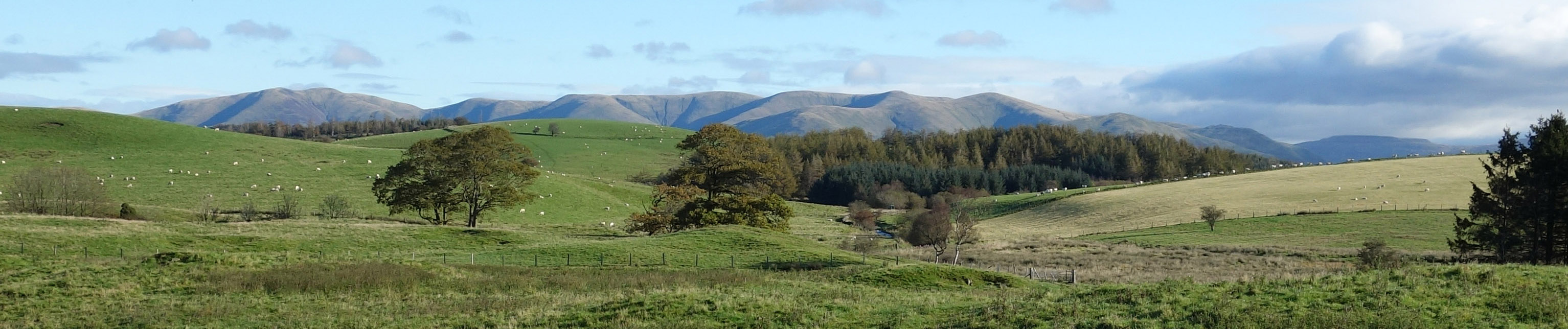
Top photo: The western Howgills from Dillicar;
Bottom photo: Blencathra from Great Mell Fell