
Home
Preamble
Index
Areas
Map
References
Me
Drakkar
Saunterings: Walking in North-West England
Saunterings is a set of reflections based upon walks around the counties of Cumbria, Lancashire and
North Yorkshire in North-West England
(as defined in the Preamble).
Here is a list of all Saunterings so far.
If you'd like to give a comment, correction or update (all are very welcome) or to
be notified by email when a new item is posted - please send an email to johnselfdrakkar@gmail.com.
21. The Fortunes of Fleetwood
I approached Fleetwood on the Knott End ferry. Somebody has to. The ferry is struggling to continue.
I hope my Ł4 helps. At the moment it is the only regular ferry still functioning in North-West England, with the
Windermere one closed for repairs. It has run since 1894 and has, according to a recent
BBC report,
been saved for the next eight
years. At the Knott End end there is a statue to L.S.Lowry, who painted
The Jetty at Knott End,
showing the ferry considerably busier than when I took it. There were only five of us.
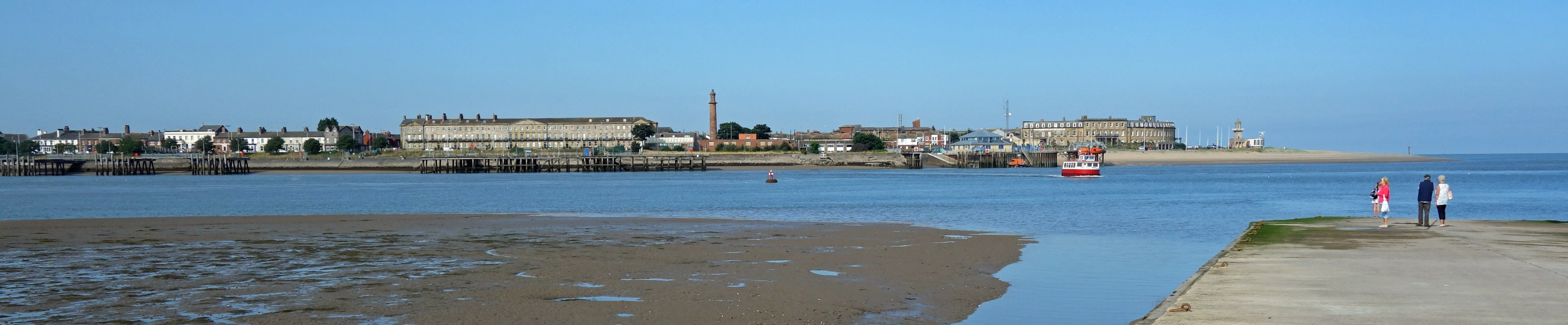
Fleetwood from Knott End, with the North Euston Hotel behind the ferry
Prominent from the ferry is the North Euston Hotel, which played a foundational role in the
history of Fleetwood. In 1830 the peninsula between the River Wyre and Irish Sea was a tract of sand
dunes inhabited by rabbits and sea-birds. It was owned by Peter Hesketh, based at Rossall Hall on the
western coast. An extensive flood in 1833 somehow prompted, or at least did not deter, a vision: he would
build a new town on the peninsula, which he named Fleetwood – and while he was at it he re-named himself
as Peter Hesketh-Fleetwood. This town would flourish as a sea-port through being on the route of travellers
between London and Scotland. They would take the train from Euston, stay at Fleetwood’s North Euston Hotel
(which was completed in 1841), and continue on a steamer to Scotland.
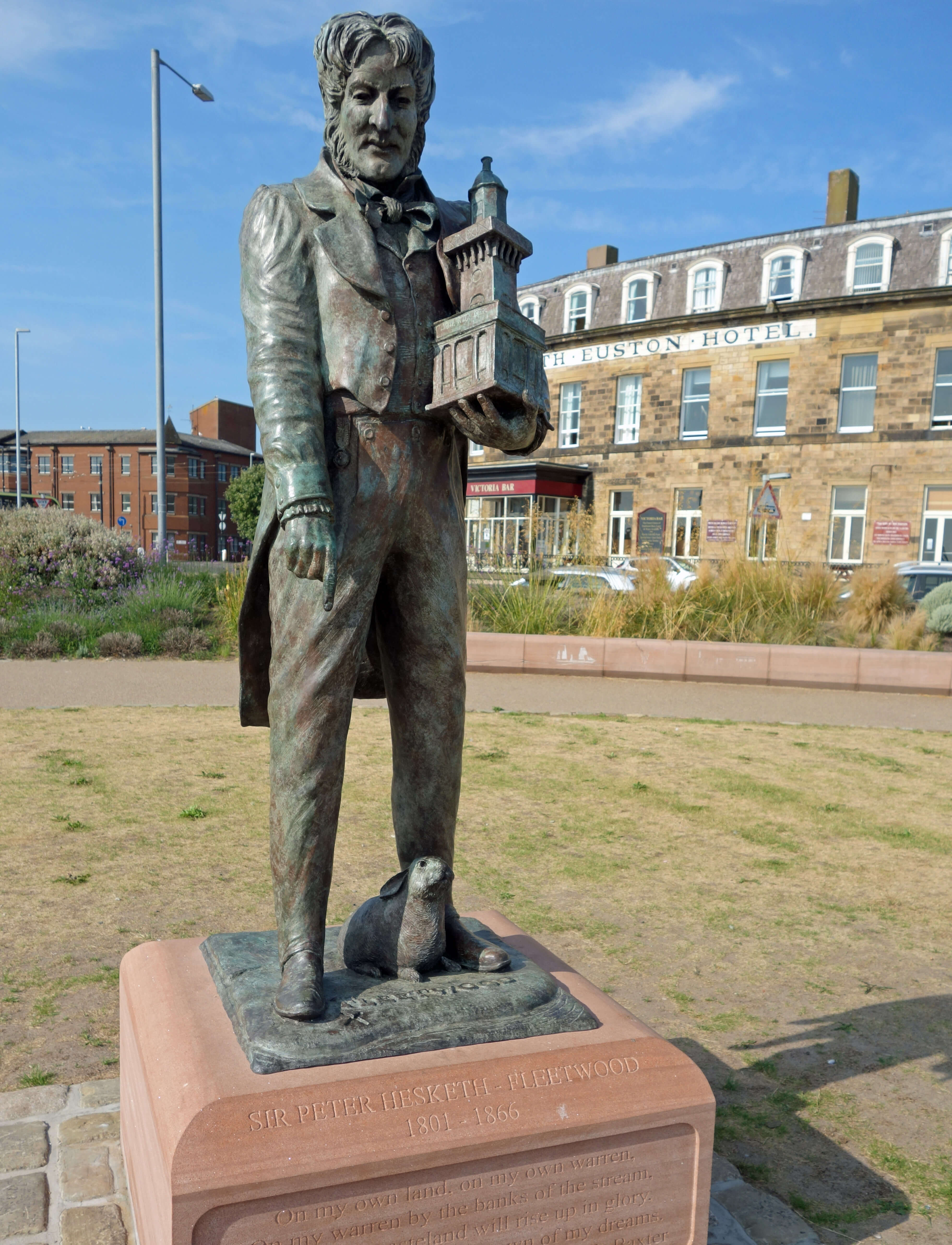 Right: Statue of Peter Hesketh-Fleetwood, unveiled in 2018.
Unfortunately, there was a flaw in this vision. Travellers, having reached as far as Preston, preferred to continue on
the train to Scotland, once it was possible to do so, rather than detour to Fleetwood.
Who could have foreseen that? By the time of the first direct trains from London to Scotland in the 1850s a rather grand Fleetwood had been built, with three lighthouses, a market, a custom house and a port. Hesketh-Fleetwood had retired, virtually bankrupt, to Brighton. The North Euston Hotel closed as a hotel in 1859, becoming a School of Musketry, which sounds exciting. However, it returned to being a hotel in 1898 and seems to have survived as such ever since.
With the travel trade ended, the people of Fleetwood needed to find some other means to live. Well, there
was now a port, so Fleetwood developed as a cargo port. A dock was opened in 1877.
Unfortunately, the growth of
other cargo ports in the north-west and the construction of the Manchester Ship Canal, completed in 1894, largely
put paid to that. The focus switched to fishing. Fleetwood duly developed into one of the largest fishing ports
in the country, employing over 9,000 people at its peak in the 1920s.
Unfortunately, we and in particular Fleetwood,
lost the Cod Wars, which ended in 1976. Today there are few fishermen in Fleetwood, although there is still a
Fisherman’s Friend,
the manufacturer of which is now the town’s largest employer. The dock and port facilities could still be used
by ferries to Ireland and the Isle of Man … for a while.
I went first to have a look at what was left of all this maritime activity. I headed to the Maritime Museum. It was closed until 10.30 (why?), so they will never know if I would have paid the Ł3 to enter. I wandered through the old dock area towards the Wyre estuary. This is not an activity I would recommend, unless you are fond of wire fences. There is a great variety of them to prevent you walking where you oughtn’t.
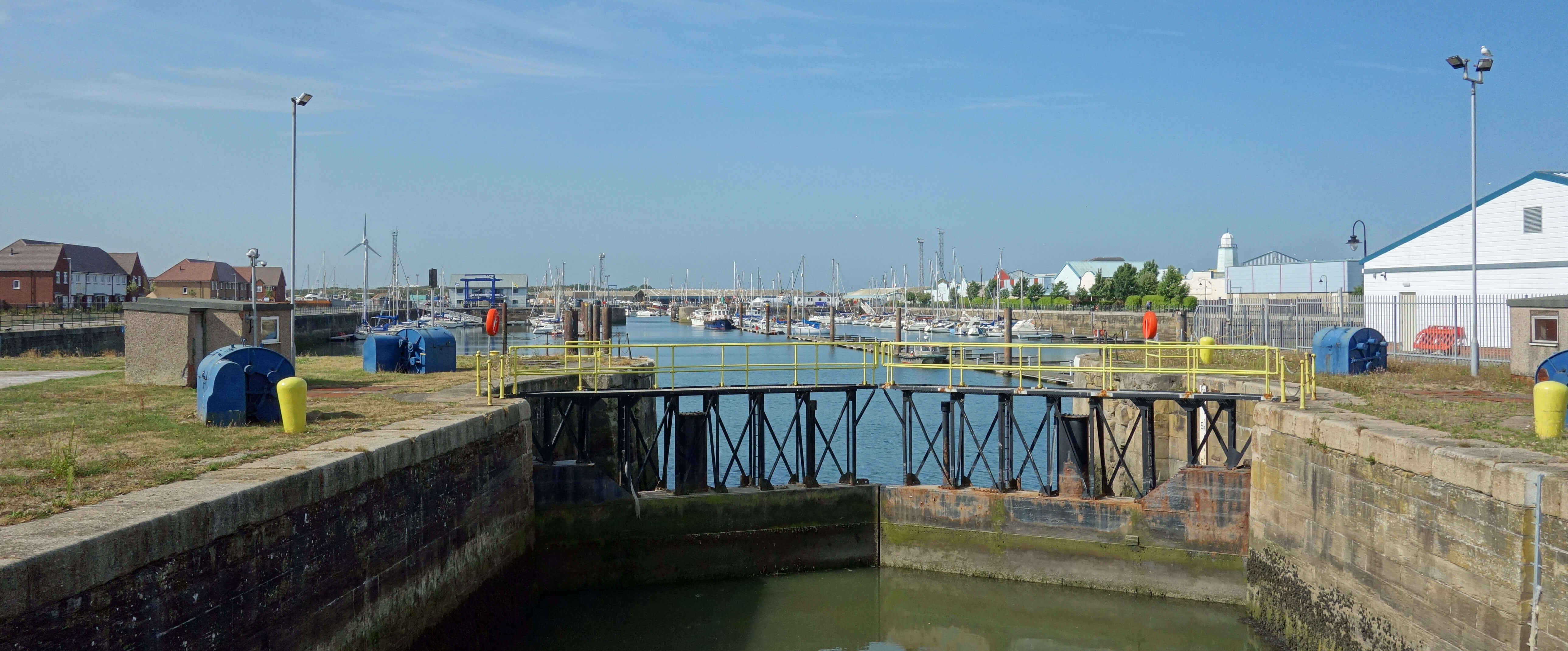 Left: The dock area.
First I passed a large derelict area that was presumably the loading area for the ferries. Perhaps the area is
being left because of a
forlorn hope
that the sea ferries may return to Fleetwood. I crossed the small dock area, which seems to be entirely for recreational boats,
and found a path on the landward side of the salt marshes. I followed it south for some way. The marshes were purple with
sea lavender, with many butterflies, including dark common blues, about. I became aware that the bank to the right had
gained a high wire fence and that the creeks to the left were filling with tidal water. Surely, I thought, the path
must lead somewhere – somewhere away from the salt marshes that is. But it ended at a water-filled creek, so I hurried back.
I came upon the Fleetwood Marsh Nature Park. It’s great to have a nature park but it’s a bit perverse to insist
that people drive to it. The mile-long road to it from the A585 has no footpath, as I found out. There are 25,000 people
in Fleetwood and they could all walk to this park. Instead, people drive to it, with their dog, and, job done, they
collect it and drive home.
I walked past the rubbish tip, sewage works and recycling centre and by several low-lying caravan
parks. I lost the footpath by Rossall School and found myself within its grounds, where I could inspect more wire fences.
I am glad that I accidentally trespassed, as the school has interesting buildings and history. The idea for the school came from the owner of the North Euston Hotel who in 1844 realised that he needed to attract more visitors to the area. It was originally a brother school to Marlborough College and it flourished sufficiently for the Queen to visit to mark its 150th anniversary in 1994. However, it didn’t seem in top-notch order on my passing visit.
I eventually reached the new promenade with its high flood-protection barrier. A flood in 1927 put 90% of the town
under water. A building expansion in the 1960s was, predictably, in the low-lying western part of the town. Consequently,
a flood in 1977 affected more buildings than the 1927 one, even though it was a smaller flood. I expect preparations are
in hand for the 2027 flood. The new high barrier is considerably higher than the low barrier further north, which I assume
the engineers are confident the sea will not sneak behind.
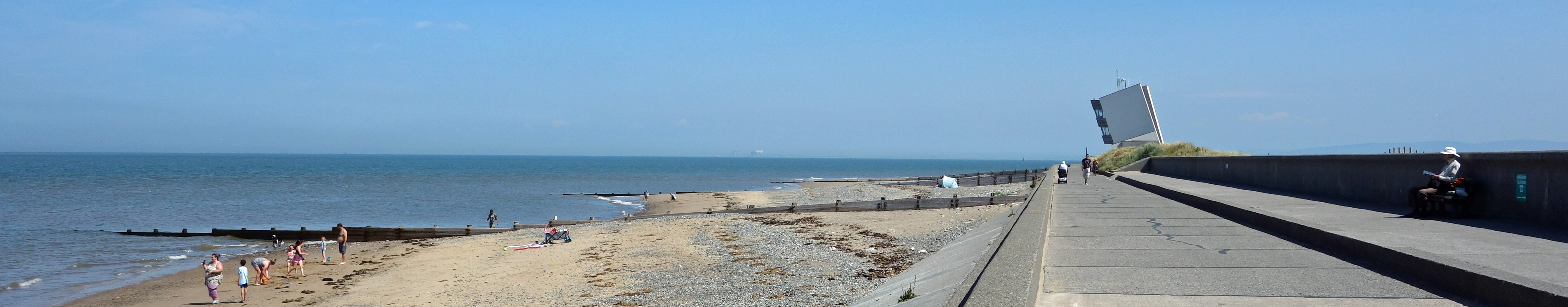
Rossall Point Observation Tower, completed in 2013
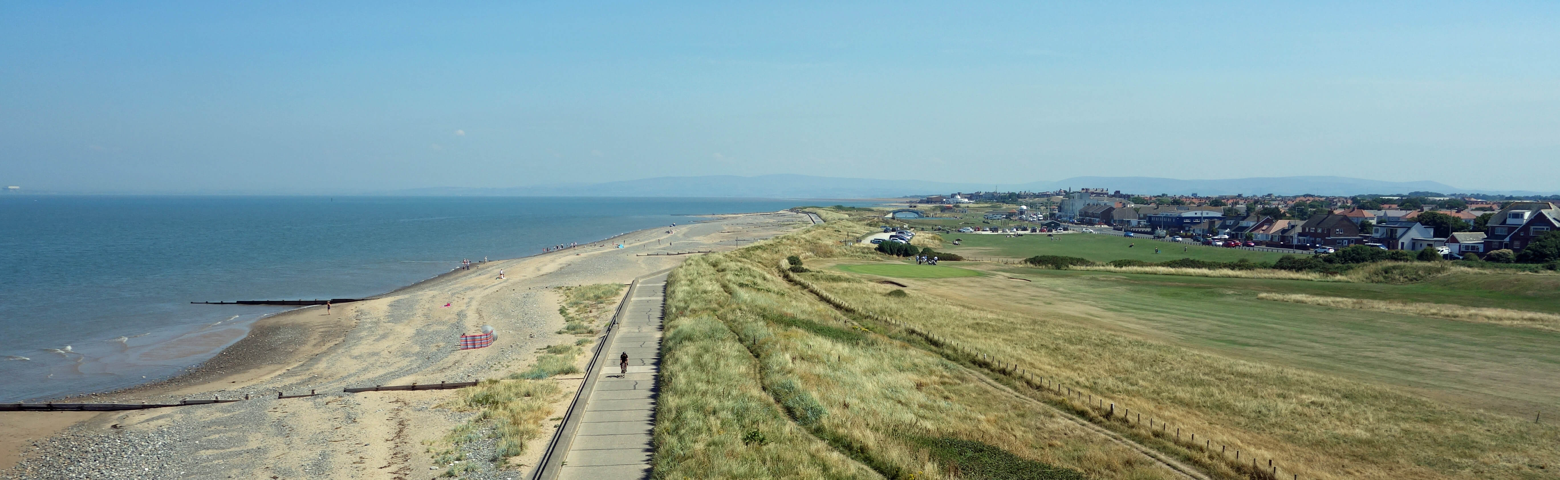
Fleetwood from Rossall Point Observation Tower
Since the 1840s Fleetwood had had an eye on the tourist trade. More recently, it has needed
to fix two eyes upon it. Late in the day – in fact it was the very last seaside resort
to do so – Fleetwood built a new pier in 1910.
Unfortunately, it is hard for Fleetwood to compete with the multifarious
attractions of Blackpool that have developed just down the coast. Those seeking
more dignified relaxation may look wistfully across Morecambe Bay to the mountains of the Lake District – but would probably prefer to be amongst them, not separated from them. Fleetwood has the requisite smattering of tourist attractions – beach (moderately sandy), golf course, bathing pools, and so on – none too gaudy, plus some fine buildings, somewhat spoiled by a large brown shed, of indeterminate function, that occupies a prominent position below the Mount.
I know that I shouldn’t believe everything in Wikipedia but even so I was alarmed to read in its
description of Fleetwood
that Bill Bryson, in his Notes from a Small Island (1995), wrote that the vast bay is “easily one of the most
beautiful in the world, with unforgettable views across to the green and blue Lakeland hills.” I was alarmed because
the words in the book (on page 273) refer to Morecambe, not Fleetwood. Bryson visited Morecambe and Blackpool but
gave Fleetwood a miss. I wonder if the Wikipedia comment is the result
of an act of desperation in the Fleetwood tourist office. If so, things must be bad if they need to steal from Morecambe.
Overall, then, Fleetwood seems an unfortunate town. Whenever it tries to stand on its own two feet circumstances conspire to knock it down. Perhaps it’s not always bad luck. The railway station closed in 1966, the last deep-sea trawler left port in 1982, the ferry to the Isle of Man closed in the 1990s, the pier was demolished after a fire in 2008, and the container service to Northern Ireland ended in 2010. However, there is still the ferry. There were fifteen of us on the return crossing.
Date: July 26th 2018
Start: SD346485, by the Knott End Ferry (Map: 296)
Route: W over ferry, S on road, E past Dock – salt marshes near Kirk Scar –
S for 2 km, N for 1 km – W, SW past caravan park – A585 – S, W
past Fleetwood Farm – Rossall School – W – promenade – N, E along promenade – S up the Mount – N, E on road – Ferry
Distance: 8 miles; Ascent: 30 metres (up the Rossall Point Tower)
Home
Preamble
Index
Areas
Map
References
Me
Drakkar
© John Self, Drakkar Press, 2018-

Top photo: The western Howgills from Dillicar;
Bottom photo: Blencathra from Great Mell Fell